Play allows participants to step outside of themselves and act or think differently than they might normally. One participant remarked that the drama increased their attention to, and retention of, information.
Human impacts on the environment are no joke, and climate change is one of the biggest challenges facing humanity. So, Environmental Education (EE) is serious business. Given the context, it is understandable that EE is usually communicated to adults through serious methods of communication such as lectures, information sessions, and pamphlets. But are these the only tools available? As an Applied Theater practitioner, I see many opportunities for using theatrical tools to create highly engaging experiences that both educate and delight adult participants. While the needs (and impacts) of EE are serious, I argue that bringing fun and play into EE can offer new modes of engaging with the material and potentially reach a wider variety of people.
I was given the opportunity to test out a play-based approach to EE from June 2022 – June 2023, as a resident artist with the Urban Field Station. The residency connected me with several smart and generous scientist collaborators with whom I was to collaborate. At the same time, I was completing my Master’s degree in Applied Theater, a field that lives at the intersection of theater, activism, and education. Applied Theater is used most often in schools, museums, and other institutions, but can be used in any location where people can gather. I hadn’t seen a lot of Applied Theater used to teach EE, and for the residency, I wanted to examine how our techniques could be used to increase ecological knowledge and activate community engagement for adults. After all, theatrical productions have long been used to raise awareness around environmental issues. Why not something more hands-on and education-focused that took theater out of traditional theatrical spaces and into nature?
The Urban Field Station residency is highly collaborative, and as the residency began, I started meeting both online and in-person with my scientist colleagues. I wasn’t sure what I wanted to create, although I thought it would likely be about stewardship and care. Due to the collaborative nature of the residency, I hoped that we could create something that was exciting and interesting to all of us. The first lightbulb moment in our conversations came when I suggested creating something “fun,” and there was an immediate, enthusiastic response (I’m also a clown, so this wasn’t a huge leap for me). We collectively became excited about creating something that inspired a sense of joy, play, and exploration around the theme of stewardship. I was especially inspired by a conversation with one scientist who described the difficulty of recruiting community members to the stewardship program. I decided that I wanted to build something that NYC Parks could use to help activate communities in the stewardship of their local green spaces. The focus would be on exploring the potential for dramatic play to increase awareness of, and engagement with, stewardship of natural areas.
The focus of the project would be on reaching adults. This was partly because adults are most frequently involved in stewardship, and partly because I was interested in creating something for adults that was fun and play-based. After all, how often do you play as an adult? How often do you get to use your imagination, or pretend to be someone else? If you’re like me, the answer is not very often. After all, adults are supposed to be serious, not playful. Play is for children, and we are only allowed to do so within certain parameters: board games, sports, perhaps a role-playing game. This feels especially true for a field like science, with its focus on research and objectivity, but I think that play is undervalued. By doing so, we are ignoring an incredibly potent form of education for all ages.
Although it might be unpopular, from an educational perspective playing can be a wonderful way to learn. Play is fun, which means that engagement tends to be high. Play is effective for different types of learners. People process information in different ways, and play offers many modes of engagement, such as visual, auditory, kinesthetic, and interpersonal. Play also creates the opportunity for debate, decision-making, and action, all within a safe container of make-believe. Moving between these states of action and reflection allows rich space for cognition and learning. By building this project, I hoped to give participants the space to learn and create new meanings.
Drawing from a few different Applied Theater methodologies, my resulting project was an interactive theater piece that took the form of a scavenger hunt. With myself as the facilitator, participants were guided through an exploration of a park while solving a mystery. Upon arriving, they were told that a bag had been left behind in the park and that they needed to help find the owner by examining articles in the bag. Through following clues based on the person’s possessions, participants were led to discover that the owner was a volunteer steward with NYC Parks. After reuniting the “steward” with their bag (played by either another trained facilitator or a real-life steward), they were encouraged to ask them about their stewardship activities, discovering both why someone might choose to be a steward, and how to become involved. The session ended with an art-making activity, inviting participants to create envelopes of seeds for someone in their life that they would like to invite to be their “planting buddy”, a moment for personal reflection. The whole experience aimed to educate participants about how, and why, stewards care for green spaces in New York City. I hoped to raise awareness and encourage volunteer activities, while at the same time providing an enjoyable experience to my adult participants.
Craft supplies for the art making part of the experience. Photo: Ania Upstill
I led three implementations of my project across two different parks. Since NYC Parks and their stewards care for such a huge range of green areas, I felt strongly that I wanted to build something that could be used across multiple parks. I also wanted to test it across a few groups of people. Session One was for the Stewardship team of NYC Parks and took place in Central Park after I accepted the invitation to join them in early March during a scheduled training. The second session was part of a quarterly series of events run by Urban Field Station and attendees included artists, invited guests, and scientists, while the third session was for a group of nine students and their professor from a private university in Brooklyn, New York, who were taking a course exploring socio-ecological practice. The latter two sessions took place in Socrates Sculpture Park in Astoria, Queens. Socrates is my local park, and I was particularly interested in how people engage in stewardship near their homes.
The entrance to Socrates Sculpture Park, one of the sites of the experience. Photo: Ania Upstill
What did this “play” approach achieve? For one, a high level of enjoyment for participants. Across all three sessions, I observed a lot of laughter and enjoyment as we completed the scavenger hunt, including delight at discovering new clues and marked enthusiasm to visit each new location. In the reflection and art-making time at the end of each session, multiple people spoke about how fun the experience was. Some reported feeling a higher level of engagement than in a more conventional, lecture-based approach. There were multiple comments on how childlike (in a good sense) or playful the experience felt, with participants reflecting on how unique it felt to play and make art as an adult. Another remarked that their session felt alive and embraced by both them and by the other participants.
Engaging in dramatic activity changed participants’ perspective on how they took part in the sessions. One participant in session three remarked that the drama increased their attention to, and retention of, information. Other participants described entering a new, observational mode while looking for clues; enjoying the observant aspects of the session; and being continually surprised by the directions the session went in. All these comments pointed to heightened engagement within the drama. One participant described the play-based approach as being more inspiring and interesting than other educational approaches that they had experienced in the past.
Play also allows participants to step outside of themselves and act or think differently than they might normally. These sessions placed participants into an investigative or detective-like role. They became detectives solving a mystery, with some participants noting that they were behaving in ways that they wouldn’t normally, especially around the heightened level of engagement (noted above) and their vested interest in returning a stranger’s bag. It also meant that in the second part of the session, where participants “met” the owner of the bag, they could ask questions not quite as themselves, but rather as a “member of the public” who had found, and returned, the person’s bag. When you’re not yourself and playing a role it can feel easier to ask “stupid” questions or to not know something that you think you might know.
From this first project, and its subsequent analysis, I believe that a play-based approach has many benefits for EE and that Applied Theater, with its long history of creative education and its many techniques and forms, is a field that has many tools to offer. A collaborative approach to creating projects is likely to be particularly effective, drawing upon the knowledge of both scientists and Applied Theater practitioners. Not only were my scientist colleagues instrumental in the development of the idea and its application, but each subsequent session changed and improved as I incorporated their feedback. An interdisciplinary development takes advantage of everyone’s expertise.
As I continue to develop this project and others, I plan to keep play at the center. I’ve seen for myself how satisfying and engaging this approach can be for participants and had positive responses and interest from scientists. While using play might not be common, it is certainly fun, and in a time of crisis, we need all the tools that we have at our disposal. While the environmental issues we face are serious, the approach can be playful. Perhaps it should be.
The world is losing its biological diversity – or biodiversity – at an alarming rate. The primary force driving this is habitat degradation. When the places where animals, plants, fungi, and the myriad other organisms live are converted to other uses, conditions change and the prior residents often move on or die. The two major causes of this habitat degradation, or the extreme of wholesale habitat loss, are agriculture and urbanization. And it is certainly true that converting forests or wetlands to corn fields or apartment buildings changes the land cover, vegetation, soils, hydrology, and other environmental factors in drastic ways. We all expect that many of the kinds of organisms found in those “natural” environments will be missing from the “manmade” environments. And it stands to reason that, as more of the world is converted to “manmade” habitats, the space left for wild organisms diminishes and many are lost from the earth. [I’m using quotation marks around the words “natural” and “manmade” since these are rather gross oversimplifications of the range of human impacts – but that’s a topic for another day.]
While this narrative is true in the broad sense – there is abundant evidence of biodiversity loss resulting from human modification of the environment – it is too simple. It’s not just a case of cities (or farms, but this a blog about cities) replacing other kinds of ecosystems – there are some important nuances to this process. Many elements of nature – the rocks, soils, sunlight and water, but also many organisms – persist even as a city grows up around them. The kinds of species and their abundances will change after urbanization, but some wild life will remain from the previous community. Urban environments also encourage other kinds of organisms by providing habitats that were not present before. And urban environments are sometimes recolonized by species that were originally lost.
Pigeons in midtown Manhattan, New York City. Photo by David Maddox.
The biodiversity among us
When I mention urban biodiversity to my students for the first time, a common reaction is “Are you talking about rats and pigeons?” While rats and pigeons are certainly a part of the system, I think this reaction is shaped by thinking about the largest mobile (and therefore most conspicuous) organisms in the most heavily built-up portions of city. When I press these students, they realize that urban biodiversity also includes the small stuff (like plants in the sidewalk cracks, insects feeding on those plants, and microbes on the surfaces of … well, everything). They also realize that lots of parts of the city aren’t so heavily built-up – the parks and greenways, the low-density neighborhoods, or the outskirts of the city – and that these places are often greener (i.e., have more vegetation) and busier, biologically speaking.
When you consider this whole range – the variety of kinds of organisms and kinds of places in the urban matrix – it’s not hard to image that urban biodiversity can be quite rich.
But we can do more than imagine – increasingly we know. We have data. To list some examples from New York City, where I work:
The Brooklyn Botanic Garden has been documenting plant distributions through their New York Metro Flora Project. This effort involves hundreds of field days per year, collecting and databasing occurrences of plants throughout the metropolitan region.
The New York City Department of Parks and Recreation has a Natural Resources Group, which has been documenting communities of plants and animals throughout the city for over 25 years.
In addition to these formal survey programs, academic researchers throughout New York City are finding all sorts of organisms in various field research projects, from coyotes and small mammals in our parks to unusual insects on green roof meadows.
Similar kinds of programs are happening in cities all around the world.
A coyote with pups in a New York City park. This photo was taken by a stationary camera trap. Photo credit: Mark Weckel
These efforts to document what species are present in cities – along with information about where and when they were observed – allow us to understand changes in distribution over time. Which species’ populations are declining and which are increasing? Which species have disappeared over time, which were lost and have come back, and which species are arriving for the first time in recorded history? These are critical data if we are to make targets for biological conservation or hope to track how invasive species or climate change alter the biota.
These efforts contribute to understanding not only the biodiversity patterns of individual cities, but in the aggregate they allow us to look for generalities about how cities affect biodiversity. How do city centers compare to the urban fringe? How does the age of the city affect biological diversity? Are patterns similar in tropical and temperate cities? Or across continents?
The number and scope of these urban biodiversity inventories has increased dramatically in the past 20 years. It’s a sad fact that cities were generally ignored by most academic ecologists and biodiversity scientists for much of the 20th century. We are finally starting to address that shortcoming – it’s going to be an exciting next decade for understanding how urbanization affects all kinds of organisms.
Urban biodiversity and people
As the previous blog post by Tim Beatley discussed, most urban residents encounter some amount of nature on a daily basis in a casual way – the shade from a street tree, the songbirds overhead or pigeons underfoot, or the calls of crickets on a summer evening. Many of these interactions may not even register consciously, and it’s interesting to think about how they affect the quality of life for city dwellers. There is a growing body of evidence for how contact with nature affects people’s health, attitudes, and behaviors, but I don’t know of research that specifically looks at how exposure to varying levels of biodiversity affects people. Does the satisfaction a visitor gets from a walk in the park increase if there is a greater variety of birdsong? Does a child get more engaged by seeing five kinds of pollinators visit a flower bed than she would if she only saw only three kinds? Would an apartment overlooking a high-diversity forest command a higher rent than an otherwise similar apartment overlooking a low-diversity forest?
Watching Canada Geese and ducks in Central Park, New York City. Photo by David Maddox.
Ecologists have made great progress in understanding the relationship between biodiversity and ecosystem functions like productivity and resistance to invasion (though relatively little of this research has been done in cities), but is there a social dimension to biodiversity-function relationships? And if there is, how will changes in patterns of urban biodiversity affect human well-being and attitudes toward nature?
The answers to these questions will almost certainly be complex. People vary in their perceptions of urban wildlife – a good example here in NYC is diverging opinions about the management of Canada geese. For a vegetation example, what may look like a desirable biodiversity-rich meadow to one person will look like a messy weed lot to another person. The value of nature is at least partly in the eye of the beholder.
What to do about “biodiversity blindness”
One other challenge to understanding the connection between urban biodiversity and human well-being is that much of this biodiversity goes undetected by the vast majority of people. While biodiversity may impact people’s attitudes subconsciously, the sad fact is that most folks – at least in the places where I’ve worked – don’t know much about the other organisms with whom they share their cities. To a lot of eyes, vegetation is an undifferentiated mass of green and all those critters with six legs are just anonymous pests.
Both children and adults are spending less time outdoors and our schools – from grade schools through universities – teach less natural history than in former generations. I’ve seen a fact reported in several places – often attributed to a campaign by Adbusters – that American children can identify hundreds of corporate logos but fewer than a dozen plants and animals native to their home places. If anyone knows the source of this data please let me know in the comments; this is a delicious tidbit, but it may be apocryphal.
As discouraging as this general insensitivity to our natural surroundings can seem, there are some bright spots. Even if one doesn’t get a chance to learn natural history in school, there are many options for motivated people to learn independently. There are natural history groups with regular outings in many cities – NYC has the Torrey Botanical Club, NYC Audubon, the NY Mycological Society, and likely many others that I haven’t come across yet. These outings are often led by local experts and open to novices.
The author leading a field trip in an urban wetland. Photo by Hara Woltz.
For the independent learners, there are excellent field guides for many taxa in much of the world (although admittedly biased towards the charismatic organisms and in the relatively low-diversity temperate regions). There are increasingly good technology options like Leafsnap – a smartphone app that uses automated visual recognition of leaves to identify tree species. There are active online communities that can assist beginners with species identifications – the community at bugguide.net is particularly good. And there are efforts at increasing public awareness of biodiversity like NYC Wildflower Week and several good urban nature blogs.
As a community of professionals, we can also take responsibility for advancing the dialogue about biodiversity education. Offer to go into schools and meet with teachers to see how to get urban biodiversity into the classroom. Many schools have excellent teachers that would be delighted to have local, “real world” materials for their students but they lack the expertise to develop those materials themselves. If you know enough to lead a program, offer yourself to the local nature center or park. Participate in a local natural history group or, if you don’t have one nearby, start one. Support citizen science programs – they educate and empower people and generate useful data. And when you give lectures, media interviews, etc., talk both about why biodiversity is important and why people should get to know their non-human neighbors. It will be hard to motivate the public to care about an issue unless they have a personal connection with it.
Limits to biodiversity knowledge
Although there is a lot one can learn about biodiversity from classes, field trips, field guides, online communities, and careful independent study, there are – of course – limits to our knowledge. All the documentation and analysis of biodiversity data I described earlier is limited to those organisms that are sufficiently well described by science. But there are great bushy sections of the tree of life that are largely undescribed. If you wanted to know something about urban distributions of many kinds of mites or nematodes (to pick two relatively understudied groups), you would be hard-pressed to find information. Not only do we not know much about these organisms in cities – we don’t know much about them at all. Many of the species you would find, even in well-studied parts of the world, haven’t been described, so there’s no reference to consult to find out what lives nearby. The remedy for this is an increased investment in systematics – the branch of biology focused on evolutionary relationships and which classifies and names organisms – but that’s a difficult issue for another time.
Discovery
Urban biodiversity is at several exciting points of discovery. The growing stores of information collected on the distribution of organisms in urban areas around the world will provide the data to address synthetic questions in urban ecology. Better understanding of the ways that biodiversity affects people’s relationship with urban nature will hopefully inform design and stewardship programs. Finally, although the state of biodiversity knowledge in the urban public may be low, there are multiple opportunities for citizens to learn more and discover the life right outside their door.
This essay collection communicates that it will take our collective vision and action to move toward an equitable future for Richmond. It will require both grassroots and advocacy organizations to influence political action. To do this, we need a comprehensive, multi-sector, intergenerational, intersectional approach to our anti-racist work, which links people, communities, and strategies across policy arenas.
The world is indeed a different place than it was when the idea for the Richmond Racial Equity Essays project was conceived in 2019. With the COVID-19 pandemic, the tragic murder of George Floyd and the subsequent protests, activism and increased awareness of racial inequities and injustice, the need for a diversity of voices and solutions are even more timely and necessary as we try to recover and move forward. We, as a nation and city have hopefully sharpened our commitment to live differently, work more purposely and pursue racial justice with even greater fervor. It is our sincere desire that this essay project helps lead Richmond in that direction, that the words of the essayists inspire us all to action.
The inspiration to create this essay collection came from numerous places. As urban planners practicing as a diversity, equity and inclusion consultant and a professor, we often sit in rooms with Richmonders from various sectors who are constantly talking about equity — what it is and how we get there. These conversations too often happen in silos. We wanted Richmond to have a broader and deeper cross-sector conversation about what equity, especially racial equity means for our city, in practice and from practitioners who could offer concrete strategies and solutions. Secondly, The Richmond Racial Equity Essays was inspired by and modeled after The Just City Essays: 26 Visions of Equity, Inclusion and Opportunity, an e-book of 26 Essays edited by Toni L. Griffin, Ariella Cohen and David Maddox and published by J. Max Bond Center on Design for the Just City at the City College of New York, The Nature of Cities and Next City.
The Richmond Racial Equity Essays is a project with a wide scope, from essays and videos to interviews and podcasts.
Using The Just City Essays as a model, we wanted to co-create a similar collection of essays. With the help of Duron Chavis, our vision morphed into a multimedia project to include video interviews and a virtual discussion series, focused on racial equity in Richmond. We ventured to capture voices from all walks of life and sectors in Richmond, representing the diversity of ideas, identities and perspectives in our city. We asked essayists to explore (1) what an equitable Richmond would like, especially as it relates to racial equity; and (2) highlight the strategies that will help us get there. You will find in this collection, a multiplicity of ideas and perspectives. You will also see themes that are both complementary and intersecting on topics such as housing, education, economic inclusion, transportation, language access, the environment and more. Collectively, this anthology creates a platform for understanding racial equity and the different dimensions of racism, gives voice to some of the great work already being done, and highlights ideas and solutions that will help shape our collective future for the better.
This is, however, just a starting point for bringing together a broad array of thinkers and practitioners that are working toward social change. Hopefully this project is a catalyst for engaging other voices and perspectives that might not be represented here; to inspire others to discuss, assess and champion racial equity in their own communities and organizations. But ultimately, we hope this collection provides a framework for advancing racial equity in Richmond that leads to sustained action and the transformation of our beloved city.
Growing up, I was considered “disadvantaged”, because I lived in a single parent household where we struggled to make ends meet and was enrolled in a low performing school district. In order to flip my “disadvantaged” status on its head, I strove to become the epitome of success by graduating at the top of my class and going off to Georgetown University. Now, as a successful Black entrepreneur who “beat the odds,” I am considered an exception. I, however, am not satisfied with being an anomaly. Even under the worst oppression, there were some Black people that were successful. What would be exceptional is if Black and Brown prosperity were the norm. What if we had a system that encouraged Black and Brown prosperity? What if we had a system that valued and invested in it, and removed the greatest barriers to it: systemic racism and economic inequality — both of which feed into each other. What if we had neighborhoods and communities that displayed, supported and celebrated Black and Brown prosperity rooted in property and business ownership and a robust cultural identity?
I went into urban planning because I wanted to create these types of communities, where Black and Brown prosperity was written into the landscape. I wanted to see more Black and Brown communities with renovated buildings, grocery stores with healthy food, quality housing and successful businesses and commercial buildings owned by the people who lived in the neighborhood. Neighborhoods where Black and Brown presence and culture are celebrated, not seen as signs of degradation. This is still my hope; to help create a racially equitable Richmond that is absent of stark visible differences in streets and streetscapes, parks, housing, services, schools and business districts between the mostly Black and Brown communities in Richmond’s East End, Northside and Southside – and those in the West End — wealthier and white.
To do this, we must intentionally acknowledge and address the racial inequities that have become the norm in our community. Data outlined in Richmond 300 (The City’s Master Plan) Insights Report and RVA Green 2050 (The City’s Climate Resilience Planning Process) Equity Index show the wealth, health, school performance, housing and homeownership and environmental disparities are racial, economic and geographic — the neighborhoods that are not thriving are Black and Brown and in certain sections of the city. I would bet there has also been disparities in city capital improvement spending in Richmond, otherwise sidewalks and street repairs and streetscape improvements would be more equitably distributed.
We have to be diligent and vigilant in unmasking and disrupting white supremacy and the ways it has shaped our urban environment. We know the history of redlining, highway construction through Jackson Ward, concentrating public housing and how Black and Brown communities were targeted for subprime lending and experienced the greatest impact on wealth, foreclosures and homeownership from the Great Recession. Black wealth is at an all-time low; we have lost 3,600 Black homeowners in Richmond and our city is gentrifying. We are far from “ONE” Richmond. We are, like most places, a tale of two cities, one prospering and white, the other mostly struggling and Black and Brown. I am not sure what we need is unity. We need to be comfortable with difference, celebrate diversity, make sure those that are marginalized are at the table and have power and work to upend disparities that have been for too long been associated with our differences. My equitable Richmond includes thriving Black and Brown communities centered on and celebrating cultural identity and ownership in intentional neighborhood centric ways. Creating neighborhoods and communities rooted in Black and Brown cultural identity while supporting ownership and entrepreneurship will be keys to advancing racial equity in our city.
From Ideas to Action
This project would not have been possible without the willingness of all 27 of the essayists to offer their personal experience, professional expertise and transformative ideas to create a dynamic vision and concrete strategies to advance racial equity in Richmond. To all of the essayists, thank you for your contribution to thought leadership in our region. These essays have much to teach us about the racial inequities that plague our lives and our city, but also about how we might dismantle racism and reimagine a new future.
Racial equity is both an outcome and a process. As an outcome, racial equity is realized when race no longer determines one’s ability to thrive and be successful. As a process, racial equity is the practice of meaningfully involving marginalized people in the decisions that impact their lives. The overarching themes gleaned from this collection and categorized below can help inform our actions and processes and influence outcomes towards a more racially equitable future. I hope readers reflect on these themes and strategies, perfect them, and put them into action.
Personal Transformation
Advancing racial equity requires a change in personal perspective, and we see that theme throughout many of the essays. Michael reminds us of the important values, such as respect for elders and love of our neighbor that should be the basis for our community engagement and decision making. Lea, Bekah, Damon and Meghan, encourage us to shift the way we relate to those who are most impacted by inequities, recognizing their value, expertise and creating space for those who are most marginalized to step into power. Oscar lets us know that we need to intentionally create space for relational and cultural connection across differences. Angela prompts us to change how we view Black girls, to value their lives and contributions, and to invest in their futures. Dennis invokes white people to work with other white people to address the white backlash that undermines racial equity. Ram gives us Massive Resilience as a tool to heal Black people and communities through arts, culture, education and health. Ashley prompts us to rethink our approach to mass incarceration for violent offences and tells us to move our anti-racist work from our brain to our body to begin to heal our racial trauma.
Institutional Change
The essays make clear that whether business, non-profit or government organizations, changing the policies and practices that create barriers to prosperity for people of color is a must. Lea and Bekah encourage the non-profit sector to change the way they engage communities of color by centering their experience and expertise. They challenge us to fundraise differently and fund Black led non-profits sufficiently. Brian encourages the business community to adopt more equitable practices and remove barriers to Black and brown entrepreneurs. Shantenymakes it clear that greater representation, cultural appreciation and power distribution for Latinos needs to take place, while Gabriella advocates for empathy, empowerment and linguistically and culturally accessible services for the Latino community.
Reallocating Resources
Creating a more just and equitable world will require intentional reallocation of resources and investment into the lives and communities that have been deprived. Ebony believes investing in Black and brown communities that promote property ownership and entrepreneurship is key. Shekinah gives us Brown Circles as a framework for Black collective financial liberation while Taikein, Genevieve, and Ben point us towards transforming the way we approach and fund education. Maritza advocates investing in public infrastructure that reconnects our city and establishing programs that increase generational wealth. Ryan, Jeremy, Danny, Wyatt and Faith clearly communicate that we need to target our health, climate, greenspace and transportation resources and interventions where they are needed most (using data) and to the historically marginalized first.
Changing Policy
History has taught us that policy plays a significant role in creating and perpetuating systemic racism. Heather and Mariah remind us that it was housing policy that helped segregate our communities. Thus, we need to enact new policies and allocate new resources to make sure we have affordable rental and homeownership options available in every neighborhood, such as inclusionary zoning and property tax relief. Likewise, Martiza proposes rewriting the zoning ordinance as a way to facilitate more housing options. We also need policies that provide greater access and alternatives to our existing systems. Tanya exhorts local governments in the region to adopt a comprehensive immigration integration policy that centers language access services. Ashley points us to models like Common Justice than enable alternatives to incarceration.
Multi-Sector Collective Action
Finally, the essays communicate that it will take our collective vision and action to move toward an equitable future for our city. Actions include building awareness of various issues, catalyzing strategies like those presented in this collection, and supporting the work of both grassroots and advocacy organizations to influence political action. To do this, we need a comprehensive, multi-sector, intergenerational, intersectional approach to our anti-racist work, which links people, communities, and strategies across policy arenas.
The work ahead of us is hard, but the time is now. We hope these ideas create conversations and collaborations that lead to innovation and change for Richmond, and perhaps create new models for advancing racial equity in our nation.
Every month we feature a Global Roundtable in which a group of people respond to a specific question in The Nature of Cities.
show/hide list of writers
Hover over a name to see an excerpt of their response…click on the name to see their full response.
Diego Borrero, Cali The Calí green corridor will connect the east and west of the city, and its people. It will act as a catalyst for human interaction, bringing together people and interest groups and enabling ideas to circulate in a boundless and healthy environment.
Kelly Brenner, Seattle Green urban corridors can be hugely successful in connecting people with nature in the city. Seattle’s Pollinator Pathway is a good example.
Lena Chan and Geoffrey Davison, Singapore To be able to objectively assess the effectiveness of these green corridors, the project must be well-planned, giving due consideration not only to the objectives and implementation details but also ensuring that monitoring and evaluation criteria are included in the experimental design.
Susannah Drake, New York Linear parks are all about connection; In this case forming important safe routes for kids to local schools, off-road paths for cyclists to subways for shortened commute times, connection to neighborhood commercial corridors, and access to new planned cultural programming.
Irene Guida, Venice A new idea of open public spaces cannot be understood if we continue to sever design, aesthetics and history, from biology, economy and natural sciences.
Marcus Hedblom, Stockholm Fuzzy edges in green corridors can lead to encroachment on ecological and social function.
Mark Hostetler, Gainesville All corridors are not created equal and below; there a three important factors when considering the utility of a planned green corridor for wildlife.
Chris Ives, Melbourne In many cases, it’s likely that the social benefits of corridors will match or outweigh the their ecological benefits in urban landscapes.
Tori Kjer, Los Angeles Los Angeles is surrounded and interlaced by green corridors that provide a full range of ecological and social functions. These include three mountain ranges encircling the city, a 52-mile river corridor, undeveloped hills, alleys, utility corridors, and parks.
Kathryn Lwin, London Community initiatives are starting to create organic ‘pollination’ corridors or ‘rivers of flowers’ in cities all over the world as people actively engage with one another to grow food, wildflowers or both for the benefit of humans and nature.
Pierre-André Martin, Rio de Janeiro There is a critical need for social uses of green corridors, mixing appropriate solutions of transport and promoting environmental education to change the perception of this natural system within the city.
Colin Meurk, Lincoln Green corridors are sociological phenomena as much as ecological imperatives, designed to reverse fragmentation effects.
Toni PuJol, Barcelona Barcelona is working towards a more connected and structured urban green infrastructure.
Glenn Stewart, Christchurch What evidence is there to support the ecological efficacy of corridors? Well actually there is not much!
Marten Wallberg, Stockholm Green wedges that cross polotical boundaries, such as in Stockholm, will be depend on coordinated planning and political cooperation.
Na Xiu, Beijing Whether green corridor works depends on how we, human beings, design and implement them.
Diego Borrero Magana works to promote social inclusion and create better cities. He has advised governments on regulatory reform and competitiveness in Latin America, Africa and Europe. He is currently an advisor for the Just Cities initiative of the Ford Foundation. @diegoborrerom
Natalia, a cardiologist living in the west of Cali, and Beatriz, a store manager from the east of Cali, share two passions: salsa dancing and biking. When they first heard about the Cali Green Corridor they reacted like most caleños: excited about a project that will change their lives but skeptical about its feasibility. Indeed, the corridor is an ambitious project to be built on 17km of old railway running from north to south (plus a 5km east-center section). This new backbone of the city will add close to 2 million square meters of public space and a clean transport solution for Cali’s mobility challenges. With the Green Corridor, Cali is placing its greatest bet towards sustainable development.
Green can renew life
The “green” of the corridor is not only about the grass and the trees. It is also about the city dwellers seeking an oasis: a safer, cleaner, and happier space for their everyday lives.
But people don’t come spontaneously to a space that has been abandoned and unsafe for decades. Through its design, the corridor must inspire life to thrive in it, with culture, sports and businesses flourishing inside and around it, as engines for its sustainability.
The corridor needs to prove to citizens—with facts—that it can be a landmark for concerts, exhibitions, sports, and other outdoor celebrations in a city blessed by summer weather and coastal breeze all year long.
Photo: SEGC CityLab Universidad de los AndesPhoto: SEGC CityLab Universidad de los Andes
Green can be inclusive
In previous administrations, the space for the Green Corridor was planned to become a toll highway which would increase pollution and social divide; placing higher income households in the west and lower income households to the east. The Green Corridor will do the opposite.
Cali has often prioritized motor vehicles and enclosed recreational facilities, a trend that has eroded social integration. The corridor will now connect the east and west of the city, and its people. The increase of public space—from 2.5m²/habitant to 3.7m²/habitant—with bike lanes, pedestrian paths and cultural facilities will play more than a recreational a role: it will act as a catalyst for human interaction, bringing together people and interest groups and enabling ideas to circulate in a boundless and healthy environment.
However, such social integration can only happen if the corridor is promoted from its very beginning as welcoming all citizens. Business and real estate development in the corridor and alongside it must be for mixed income and usage. It cannot be conceived—and then perceived—as a park “for the rich” or “for the poor”. The Green Corridor must be a space to celebrate Cali’s diversity.
Green can lead to greener
The corridor can become a proxy of a better city within the city. Its ripple effect can demonstrate how public spaces may be put to better use and break negative perceptions about pedestrian streets, bike lanes and public transportation. It will showcase an optimal situation where everyone—citizens, businesses and government—benefit and learn from turning “inactive” places into opportunities.
In addition the project is being developed with strong participation from citizens. A successful experience bringing together government and civil society will have the potential to strengthen both and replicate this symbiotic model.
Green is the future
Cali is experiencing a new wave of optimism, repatriated talent, visionary leadership and civil society engagement. The Green Corridor will demonstrate that Cali has the capacity to put citizens at the top of its priorities. When this new landscape comes to fruition, Natalia and Beatriz will not only share their passion for salsa and biking, but the pride of living in a more inclusive and greener city.
With so many people now living in cities, and with an increasing detachment from nature, any urban nature we design and create should first and foremost be aimed at reconnecting the human population to nature. There are too many ecologically illiterate or ill-informed people living in cities.
Recently I read some comments that illustrated this point. It was a case of developers versus bird habitat; some believed it was very simple case of humans versus animals and humans should always be placed first. Many people see nature as a luxury, something we do in our free time, and fail to recognize that we are dependent on the natural world for survival. Birds aren’t just nice to watch, they perform pollination, pest control, seed dispersal and waste management. Insects are even more essential as our world would collapse without them. This is why we need green spaces in the city—to help increase awareness of the importance of nature.
This project has touched a great many people locally as well, starting with the homeowners whom agree to turn their grass strip between the sidewalk and road into habitat. Seattle University, University of Washington and Cornish College of the Arts have all incorporated the Pollinator Pathway into courses. Many work parties of volunteers have helped install the gardens and there have been several successful fundraisers to help purchase materials. To analyze and provide help with future designs and improvements, an entomologist from the Woodland Park Zoo has been monitoring the gardens since 2010.
Now for a relatively small green corridor in one city, that’s quite a lot of outreach. From my initial statement I believe in this respect it has been a huge success. Many people are now not only aware of this project, but they also know that pollinators need our help, that we rely on them and that we can provide travel corridors for them in the city. It also demonstrates that many people can indeed work together to create corridors in the city. It also shows that enthusiasm is there and can be fairly contagious.
Although the idea of nature in cities is not a new one, it’s far from standard or common among city planners, architects and landscape architects. We have a lot of work to do in this new Anthropocene era. Cities have much potential for adding and improving our green spaces. We have a great deal of existing infrastructure that would work wonderfully with the creation of green corridors such as waterways, power lines, transit corridors; both public transit and streets, and rooftops. We have to start thinking creatively about how to integrate green space and habitat with what is already there. If we had nature built into our infrastructure, we’d encounter it regularly, every day while going about our lives. The more we can bring nature, even if it’s simply the idea of it, to the city, the more we can connect to it and start to care about it as something that’s not simply a luxury item.
Natural habitats areas, whether spontaneous or human-created, exist in fragmented patches in cities. Some of these sites are connected due to human intervention through the creation of green corridors. To be able to objectively assess the effectiveness of these green corridors, the project must be well-planned, giving due consideration not only to the objectives and implementation details but also ensuring that monitoring and evaluation criteria are included in the experimental design. Some thought should be given to the prevention of invasive alien species during the process of creating green corridors.
Green corridors can also evolve spontaneously.
For example, roads can form the infrastructural backbone of green corridors if they are innovatively enriched with plants that serve ecological functions. Some of these ecosystem services include enlarging the effective habitats for birds, small mammals, butterflies, bats, dragonflies, etc. through forming linkages between core biodiversity areas. Increasing the tree canopy cover of roads can also contribute to the reduction of ambient temperatures, reduction of noise, decrease of pollution, and improvement of the aesthetics of the environment.
When planting along roads is synergised with that of the surrounding landscapes, like parks, residential areas, schools, hospitals, etc., the thin linear corridors broaden to form more effective spaces for wildlife in urban settings.
Green corridors as biological systems will inevitably change in structure and form over time. Hence, to be realistic, the ecological functions of these green corridors will also change as the habitats mature.
Dr. Geoffrey Davison is Deputy Director (Terrestrial) at the National Biodiversity Centre, National Parks Board of Singapore. His latest book is “Wild Singapore”.
Susannah is the founding principal of DLANDstudio architecture + landscape architecture pllc. DLANDstudio’s public projects include the QueensWay Greenway, MoMA Rising Currents Exhibit, BQGreen and the Gowanus Canal Sponge Park.
Over the last year my firm DLANDstudio worked for the Trust for Public Land on a feasibility study for a linear park project in New York City called The QueensWay. The QueensWay site is a 3.5-mile, long-abandoned rail corridor that runs from Forest Hills to Ozone Park. The path starts on an embankment and then cuts through the terminal moraine of the Wisconsin glacier in a ravine-like area before transitioning to a structured rail trestle. The new trail will form important connections to Forest Park, a large pastoral park at the heart of the path.
Linear parks are all about connection; In this case forming important safe routes for kids to local schools, off-road paths for cyclists to subways for shortened commute times, connection to neighborhood commercial corridors, and access to new planned cultural programming. A recent United States National Institute of Health study suggests that people living within a half mile of a park are much more likely to engage in vigorous physical activity. The public health potential is tremendous. When completed, the 350,000 people who live within a ten minute walk of the park will comprise the most diverse local demographic catchment areas of any park in the city.
Richard T.T. Forman’s theories of Landscape Ecology suggest that long, linear, continuous landscapes are more environmentally productive, fostering a broader habitat for a diverse range of plants, animals, birds, and butterflies, than disparate patches of park land. The site with its continuous corridor of naturally occurring trees will be augmented with new plantings to create enhanced habitat. Its location along the North American flyway is also an important stopover breeding ground for the Monarch Butterfly on their migration route to Mexico.
Transportation infrastructure has transformed the global landscape. In the case of the Queensway, Highline, Chicago’s 606 Trail, and many others around the world, abandoned rail infrastructure has been replaced by park land. This is a laudable and important effort. However, an opportunity exists to transform working linear transport systems that often bisect and divide neighborhoods into more responsible actors in urban design. Dlandstudio is working on a range of projects that ameliorate the impacts of raised viaducts, highway trenches, and train trestles that adversely impact urban life. As the Under the Elevated Urban Design Fellow for the Design Trust for Public Space, the firm is developing designs that address, acoustic, air quality, public safety, way finding, and storm water management issues. Through a series of prototypical projects that include new program, lighting, sound buffers, green infrastructure and ecological strategies, new systems will be tested as pop-up applications to gage public interest and build support. The designs will then be developed further as pilots for system-wide transformation and, when proven, implemented on a broad scale.
On a more local scale the Brooklyn Queens Expressway is the muse of the firm. From taking water from the raised highway into pilot modular storm water swales we call HOLDS (Highway Outfall Landscape Detentions System) to strategies for capping the trench in the brownstone neighborhoods of Brooklyn, we see tremendous potential in transformation of the linear corridor to make it more environmentally and economically productive. In particular we are focused on creating a new cap over the BQE in South Side Williamsburg.
For the past seven years we worked with the local community to develop a plan to add recreation space over the highway trench. The plan would not only enhance the ecology with new trees and better storm water management, it would unify and strengthen the identity of the local neighborhood. The mostly Latino area is currently plagued by poverty, obesity, gang violence, high childhood asthma rates and traffic fatalities. BQGreen—the name we developed for the park—will eliminate territorial boundaries, clean the air of excess particulate matter, create safe walks for kids to school, provide new active recreation space for all ages and add a new community center with pool.
All of this will be accomplished by leveraging overdue infrastructure replacements. New bridges that cross the highway will expand and connect to create new decked park space. This area wil be ringed by trees and plantings, creating a new ecological corridor. While this is a specific proposal for a particular place, it can be replicated and expanded to have an impact on broader and longer corridors in cities across the country and around the world.
Irene Guida, PhD in Urbanism, is a researcher at IUAV Università di Venezia. Among her publications, L'Acciaio tra gli ulivi, Linkiesta, Milan (January 2012), is an experiment in sharing research to a common public, with high quality content.
As an ecological device, the corridor has been conceptualized according to the island theory in biogeography, expounded by Robert McArthur and Edward Wilson in 1967. These young zoologists, among other things, studied birth rates and population dynamics as they relate to processes of territorialization. Their innovative work consisted of ascertaining a general theory from data, in relating the frequency of rare species to the extension and age of patches they colonized and used to move along their migration. Their findings, in generalizing the data, was that the frequency of rare species was directly proportional to the dimension of islands, and at the same time inversely proportional to the distance between them. This theory was a continuation of Darwinian studies on evolution and the extinction of species. McArthur and Wilson were interested in understanding which factors mitigated extinction in favour of evolution and the adaptation of species. The influence of the theory of biogeography islands became key to landscape ecologists who interpreted the islands as patches of natural habitats in urban conditions.
Among them a contribution that had received a great deal of attention among planners, was given by Richard T. T. Formann. His primary relevance in this dissertation stems from the clear definition he provided, by means of graphic analysis and representational tools. Additionally, pertinent to this study are his description of plant ecotones in human disturbed environments, through his investigation of the mitigation of large-scale infrastructure, such as roads, and large scale human settlements. Formann’s attention toward corridors is mainly driven by its importance in human settlements, and he carefully defines corridors by shape (curvilinear or linear), dimension (coarse or fine), and connectivity (number of connections leading to a node). Conservation experts agree that streams, riparian corridors and agricultural barriers can provide shelter to wildlife, thus increasing biodiversity, as well as being useful for human settlements, providing biomass, wood, etc. Corridors are hence also key in landscape management and design, and this is why they receive such a great deal of attention among planners.
Ecological corridors’ capacity for providing effective connectivity has therefore been greatly discussed by scholars and ecologists.
Skeptics argue that biotic connectivity through corridors cannot be entirely proven. Beier and Noss, on the other side, argue that correctly designing a study to prove corridor connectivity is difficult because of the high number of variables that must be taken into account (as with the selection of a habitat’s fragmentation species, for instance). So they instead provide evidence of what happens if corridors are eliminated. They affirm that cutting corridors, which link habitat patches, does in effect reduce biodiversity.
In response, other scholars argue that experimental studies can instead be effectively designed, and they go on to attempt proving that ecological corridors have a key role in biodiversity protection when the matrix is particularly poor for species using the corridor.
In conceiving (or conceptualizing) the city as an energy’s flow, the territory of flows does not appear as flat. Drawing sections is thus important for a proper description of this phenomenon. This is why, in studying Gwynns Falls, Victoria Marshall, Brian McGrath (urban designers) and Stuart Pickett and Mary Cadenasso (plant ecologists), also drew several sections, relating patch disturbance with changeling sloping land. Both high resolution ortho–imagery and fine 3D models of the land are key in relating patch dynamics to physical environments and the bodily perception of space.
Summarizing the findings that we have investigated until now, it becomes apparent that the conceptualization of something as a “corridor” is not a neutral gesture, for it carries with it many considerable issues. It seems to me that a biotic turn, which helps territorializing social bodies into natural regions, is involved. This biotic turn is what renders landscape ecology not only a specialized feature, but also something that has great social and political meaning.
What I suggest is that a stronger reflection is needed, which involves a genealogical inquiry over the term corridor, reviewing the analogy in the long term, and a new idea of open public spaces, which cannot be understood if we continue to sever design, aesthetics and history, from biology, economy and natural sciences. Landscape Urbanism urges us to learn about breaking through boundaries and finding new reading and writing methods for our small, globalized, urbanized planet.
The fear of actual implementation of a green corridor
In the making of the Uppsala’s strategic master plan 2010 (Uppsala is the 4th largest city in Sweden), a number of green corridors were suggested by the recreational office. Uppsala has a number of larger green corridors leaping from the center to peri-urban area. Those existing green areas are partly left between houses though the history, some are partly left for recreation others are just left by random. Those green areas were never officially named or put on a map prior to the plan. However, it was a small battle internally in the organization about the drawings and purposes of the corridor. The rhetoric was even highlighted in the city newspaper where the “city architects” mentioned that green areas were “dead hands” on the urban development and the “recreation and conservation” planners emphasized importance of recreation and conservation. In the end both “sides” ended with a map that showed the borders of parks and green corridors with very diffuse (intentionally) borders (see figure below).
Although the borders were diffuse, the revision of the master plan in 2014 made an extra case that further emphasized that the map is only visionary. On the other hand, the writing in the master plan still says that “The city’s green wedges…that link the city’s green structure with the surrounding nature and recreation areas should be protected so that the green linkages persists or develops”. Interesting here is that planning is often very precise when it comes to buildings but to make concrete borders for green areas seems harder.
In Stockholm, they have similar corridors and worked a lot with definitions and surveys. I believe that one secret in the success of the work in Stockholm is that they put a minimum width of the corridor: 500 meters. Those 500m makes a distance from disturbing sources as roads and increase social values and also allow habitats in different scales to exist and provide movements for a number of species.
When the society of science has internal discussions about the functions of corridors for humans and species, the planners in cities do not know what to do, or which arguments to use. The city architects in Uppsala fear that 25,000 houses within existing city borders will not fit, or be limited, due to green space. The recreational planners fear that Uppsala will lose attractive recreational and conservational values.
When I worked as a strategic planner in Uppsala, my background as a researcher in ecology put me into difficulties due to the need to generalize. As a scientist, I showed in a study that grassland corridors (resembling road verges) were suitable for movement for butterfly species that were categorized as specialists (not generalists), meaning that they had special preferences for plant species when foraging. However, if a corridor provided very good nectar resources, the specialist butterfly stopped to forage and defend it from other butterflies, making the corridor a potential trap. Thus, telling a planner that they have to make a suboptimal corridor for specialist species is a difficult task.
The distance between the knowledge that a corridor would work, to actual implementation, is difficult.
Back in science again, I believe that it is better to do as they done in Stockholm, to define a minimum width and then work from there with increasing qualities for species and humans. Concretize the borders on a map. As it is now in Uppsala, the diffuse border makes alterations easier and already a road have been built across one part and grasslands for butterflies have decreased.
I am going to focus on the functionality of urban green corridors for wildlife. I do think these corridors could serve as important connectors for significant habitat patches found both within and outside of cities. However, all corridors are not created equal and below, I discuss three important factors when considering the utility of a planned green corridor for wildlife.
1. Which species is the corridor for? This is an important question to answer because corridors for large animals, such as bears, would be much wider than corridors designed for smaller mammals. Also, the mobility of different critters plays a role: butterflies and birds can fly over roads that bisect corridors whereas mammals and reptiles have a relatively difficult time crossing roads. A functional corridor for birds may be viewed more as “stepping stones” compared to a linear corridor with relatively few bisecting barriers for mammals. Often, people think that only large, continuous corridors are noteworthy but I would argue that even small, somewhat disconnected patches of vegetative cover could serve as a functional corridor for smaller species that can traverse built structures. As an example, tree canopy patches that are separated by 45 meters or less (with roads and pavement underneath) can facilitate the movement of forest birds.
2. Management and vegetation structure within a wildlife corridor? Corridors could serve two functions for wildlife—species may be corridor dwellers, where the appropriate habitat structure is available for animals to reside for long periods of time and/or species may be passage users, where animals are in the corridor for a brief period of time and use it primarily to disperse. This has implications for corridor management and vegetation structure. Many urban green corridors are made available for use by citizens and this can raise issues for corridor dwellers and animal passage users. Noise, lights along walking trails, and human activity throughout the interior of the corridor can disrupt corridor dwellers in particular. For example, nesting birds within a corridor where human activity is high would affect reproductive success. It may even affect passage users if the amount of human activity, building structures, and noise is high. In corridors that are heavily used by humans, the presence of passage users (even use as stopover sites by migrating species) is more likely than presence of corridor dwellers.
One way to alleviate the impacts of human activities would be to design paths for humans that go along the very edge of the corridor and occasionally dip into corridor to (for example) see views of a river. This way, there would be areas where corridor dwellers could reside and reduced human activities that may promote passage species as well. Additionally, for both corridor dwellers and passage users, evidence suggests that the amount of native vegetation within a corridor is correlated to use by wildlife. A possible mechanism for this is that native vegetation provides more efficient foraging and functional breeding habitat. Thus, maintain or restoring native vegetation is an important part of retaining corridor functionality. Management actions would include the removal of invasive exotics within the corridor and planting natives.
3. Impacts to corridors from nearby land uses? Pets, noise, lights, motorized vehicles, stormwater runoff, and spread of invasive exotics can negatively impact wildlife use of corridors. These types of impacts typically originate from nearby built areas, especially from densely populated areas. Attention should be focused not only on creating wider corridors (i.e., buffers) in these problematic areas but a management/education plan should be implemented in the built areas. Engaging local citizens about how activities on their property (e.g., planting invasive exotics) and how forays into the corridor (e.g., motorized vehicles) affect wildlife can help mitigate the negative impacts of nearby populated areas.
Chris Ives takes an interdisciplinary approach to studying sustainability and environmental management challenges. He is an Assistant Professor in the School of Geography at the University of Nottingham.
Urban green corridors are a good example of where we jump ahead to solutions before defining the problem. Before calling for the establishment or protection of corridors, it’s important to consider what kinds of ecological and social objectives we want in our cities. I think that green corridors have great potential because they can perform multiple functions. However, exactly what these desired functions are needs to be clearly defined first before guidelines for their design can be set.
The role of corridors as facilitating movement of organisms across a landscape probably has the least amount of scientific evidence—despite the fact it is the function of corridors that most resonates with people. The purpose of movement is also seldom considered. Ecologically, the movement of organisms is not always desirable, particularly when considering invasive species. Facilitating the movement of plants and animals is most valuable when linking two or more otherwise disconnected populations. The ability of corridors to do this is an area that needs more research effort.
We have much more information on the potential for green corridors to function as habitat refuges in urban areas. Streamside riparian zones are particularly valuable as they are positioned at the interface between aquatic and terrestrial environments and are home to many species. They also help buffer the stream from excess nutrients and pollutants in the landscape. Some research I conducted in northern Sydney, Australia demonstrated that urban riparian corridors sustain complex ant and plant communities [1]. However, their ecological health was generally related more to the landscape context and presence of invasive plants than connectivity or corridor width. This study also demonstrated the importance of considering which taxa are being planned for, since ants and plants responded in different ways to environmental variables.
If large habitat areas do not already exist in an urban landscape, protecting or restoring some may be ecologically more beneficial than implementing a corridor network since narrow corridors are likely to experience significant edge effects and be difficult and expensive to manage. Indeed, even if some large habitat reserves already exist in an urban landscape, biodiversity outcomes may be enhanced more greatly by protecting a habitat type that is presently under-represented in the landscape than by linking up existing habitats that are ecologically similar.
In many cases, it’s likely that the social benefits of corridors will match or outweigh the their ecological benefits in urban landscapes. Corridors have an amazing way of galvanising public interest in conservation and can help connect people with nature. Studies have shown that linear green spaces are vital for facilitating recreational activities [2]. Thus, green corridors are an ideal form of green infrastructure for achieving multiple environmental and social objectives simultaneously. However, there may be some conflicts between designing corridors for human use and appreciation and ecological outcomes. We therefore need to consider exactly what we want corridors to do and weigh carefully the tradeoffs between ecological function, management costs and human uses.
1—Ives, C. D., G. C. Hose, D. A. Nipperess, and M. P. Taylor. 2011. Environmental and landscape factors influencing ant and plant diversity in suburban riparian corridors. Landscape and Urban Planning 103: 372–382.
2—Brown, G., M. F. Schebella, and D. Weber. 2014. Using participatory GIS to measure physical activity and urban park benefits. Landscape and Urban Planning 121: 34–44.
Los Angeles is surrounded and interlaced by green corridors that provide a full range of ecological and social functions. These include three mountain ranges encircling the city, a 52-mile river corridor, undeveloped hills, alleys, utility corridors, and parks. Clearly, these green spaces vary tremendously in attributes and uses. But all offer undeveloped space in an otherwise densely populated megalopolis.
Depending on location, green corridors may provide habitat for wildlife and spaces where people can play. Where they connect communities, green corridors may host trails for walking and biking. The San Gabriel and Santa Monica Mountains foothill corridors provide an important green buffer for the city while cleaning the air and providing human habitat and recreation for Angelinos.
Less obviously, the dense neighborhoods in South Los Angeles and the San Fernando Valley are laced with 900 miles of alleyways that could serve as multipurpose greenways that would also filter stormwater and provide safe connections between communities. These largely overlooked linear common areas compose nearly 2,400 acres of potential open space.
Similarly, the corridors of the Los Angeles and San Gabriel rivers, when fully greened, could support regional transportation connections for commuters, tourists, and families. Even now, partially developed for transportation, they provide habitat and empty spaces to escape to.
Urban Mountains
The San Gabriel Mountains and foothills constitute approximately 70 percent of open space in Los Angeles County and work hard for Angelinos, providing approximately 35 percent of the region’s drinking water and recreation for the more than 15 million people that live within 90-minutes of the Angeles National Forest. Indeed, the national forest is Los Angeles’ largest playground for hikers, mountain bikers, backpackers, picnickers, and campers, as well as skiers and snowboarders in the winter months.
The mountains’ ecological importance will only increase in coming decades, when they will help ensure that the region remains habitable in the face of climate change. A recent report by the Los Angeles Regional Collaborative for Climate Action and Sustainability predicts that by mid-century, extreme hot days will triple or quadruple for the vast majority of Southern California residents.
Alleys as Green Corridors
Today, The Trust for Public Land’s Avalon Green Alley Demonstration Project is modeling the greening of Los Angeles alleyways. This project will create the first green alley network in South Los Angeles. It is also the first alley retrofit anywhere in Los Angeles to incorporate greening and the first to demonstrate the potential of green alleys to transform neighborhoods of significant density and poverty.
Retrofitted to green corridors, alleys will help link residents to homes, nearby schools, parks, and businesses. Decorated with community art and planted with native and edible landscaping, alleys will become welcoming community spaces for gathering and recreation. Outfitted with permeable paving, dry wells, and other stormwater-control infrastructure, green alleys also will increase the reliability of local water supplies by reducing runoff, improving water quality, and supplementing the City’s water supply via groundwater recharge. Nuisance flows and small rain events will be captured and percolate underground to be temporarily stored prior to infiltrating into the soil.
Like our the green corridors provided by our mountains, our alleys transformed into green corridors could play an important role in keeping the Los Angeles region livable in the future.
Kathryn Lwin is the Founder Director of the River of Flowers, a nonprofit, eco-social enterprise working with community groups and other organisations to create trails or ‘rivers’ of wildflowers and wild flowering trees as forage and habitat for bees and other pollinators in cities.
‘Human’ and ‘Nature’ are words that go together well. Humans cannot survive without nature; humans have provided nature with the urban environment, one in which it abounds! It’s not cities, which are incompatible with nature but our systems of urbanization and modern agriculture. Such practices have resulted in reduced territory and fragmentation, isolating wild species populations and leaving them vulnerable to loss and extinction. Wild flora and fauna are seen as competitors for space in which to grow food, construct buildings or lay down lines of transport.
If humans were to abandon a city, a green torrent of vegetation would soon rush in to fill in the gaps, facilitating the movement of flora and fauna from one ecosystem to another. Plants would clamber across the built surfaces of the city, swoop over roofs and walls, flow along the linear roadways, railways and waterways, connect up the networks of open spaces designated as city parks, gardens, playgrounds, car parks, cemeteries, urban farms and the non-designated, abandoned areas of vacant lots and brownfield sites with the nature reserves, often girdling the city outskirts. So if humans planted strategically, aiding and abetting this natural flow, we should expect such man-made ‘green corridors’ to work just as well.
Research shows the multiple benefits that plants bring to the urban landscape from cooling and cleaning the air to softening impervious surfaces, lessening flood risk and improving the quality of life by raising health levels. Green spaces have even been shown to reduce crime rates and slow city traffic. City governments could gain even more ‘added value’ from plants by fostering sustainable urban food growing and in the process shrink the miles from ‘farm to fork’ with all attendant implications for carbon emissions, air quality, energy consumption and water use. But to feed itself, a city must first feed its pollinators.
We are already increasing the number of multi-functional green spaces such as rain gardens and pocket parks in a city, but to make these places where pollinators can feed and reside, we need to increase the percentage of diverse, native, insect-friendly forage plants (including wind-pollinated trees for early pollen) as well as nesting and hibernation sites and access to clean water. With more attention to species selection and responsiveness of procurement, a city would add great ‘pollination’ value.
By auditing and mapping the city for availability and distribution of potential and actual growing sites, as the Urban Design Lab has done in New York, we can begin to design ‘pollination’ rather than ‘green’ corridors to criss-cross a city. These would facilitate the ‘flow’ of wild pollinators and plants between the built environment, urban farms and nature reserves.
In London, the Edible Bus Stop has planted fruits and vegetables with the local community along the bus routes in Lambeth while in formal Regents Park, edible crops and beehives now flourish beside stately ornamentals. At the Kings Cross Skip Garden, young people are growing food and wildflowers in building skips, which are simply lifted up and re-sited when the space is scheduled for re-development. Alongside the railway stations and gardens in Hackney, wildflowers and orchards have gained a stronghold, tended by local community gardeners and beekeepers keen to keep their neighbourhood fit for bees. On the River Thames, an urban forest glade and garden, rooted on barges moored beside Tower Bridge, float just a short bee flying distance away from wildflowers blooming on the Queen Elizabeth Hall roof at the Southbank Centre and edible harvests in the housing estates of Bermondsey.
Community initiatives like this are starting to create organic ‘pollination’ corridors or ‘rivers of flowers’ in cities all over the world as people actively engage with one another to grow food, wildflowers or both for the benefit of humans and nature.
Pierre-André has a Landscape architecture degree from École Nationale Supérieure de Paysage de Versailles in France and a MBA in environment from COPPE, Universidade Federal do Rio de Janeiro. He has been a leader over 13 years in urban and environment necessities in France and Brazil, taking care of the integration of urban projects with natural and the urban environment through diagnosis, guidelines and licensing.
In Rio de Janeiro, where biodiversity rates are among the highest on Earth, green corridors ecological function is heroic, but actually their internal structure is not planned or projected and their ecological characteristics are mainly spontaneous and perceived by most of the population as “remaining” areas or waste land. They work as green, blue and faunal struggling for connections, but they are very vulnerable at the same time, receiving huge amount of waste, sewage, slum construction and invasive species. It is a tense situation.
Environmental laws in Brazil restrict from human occupation within 30 meters, at least, from the edges of water bodies. These legal instruments create an extended network of green corridors along natural, rural and urban areas. Actually architects and urban planners see these areas as “environmental” areas and have typically excluded them from their practice in the city.
In my opinion the strongest characteristic of a corridor is their linearity—in their linearity the potential for more social function, especially in Rio de Janeiro situation. The whole city suffers from mobility problems and is mainly connected by an arid and polluted road system focused on car transportation. Low impact mobility like pedestrian areas or cycling lanes can be inserted in this ecological network of environmental corridors with a specific design, using this mobility challenge as an opportunity for focused structural planning and projects. Outside of these areas the road and transportation systems require serious upgrades in their biological and hydrological aspects, as they are also linear systems and must support a wider range of ecological functions be transformed into a support for life systems and not only a “A to B” transportation system.
A key impediment to the useful improvement of these potential corridors is the public’s prejudice—the perception by most of the population that they are useless and meaningless areas, turning them into areas excluded from the mental geography of its inhabitants. This is why I believe in the critical need for social uses of these corridors, mixing appropriate solutions of transport and promoting environmental education to change the perception of this natural system within the city.
Dr Colin Meurk, ONZM, is an Associate at Manaaki Whenua, a NZ government research institute specialising in characterisation, understanding and sustainable use of terrestrial resources. He holds adjunct positions at Canterbury and Lincoln Universities. His interests are applied biogeography, ecological restoration and design, landscape dynamics, urban ecology, conservation biology, and citizen science.
Urban green corridors are a subset of corridors in general, and the same ecological laws will apply, regardless of context. What then is different about ‘urban’ that could change the outcomes? Clearly ‘people’ is the overriding factor (social, cultural, psychological, behavioural, tribal, anti-social). The indirect ecological consequences of stress and disturbance intensity will slow growth and succession, whereas localised nutrient inputs, irrigation and competition control (gardening) will have the opposite effect. The question is whether corridors enhance biodiversity or accelerate pest dispersion. People will control these outcomes by directive behaviours reflecting their aesthetic and cultural perspectives (creating physical barriers, weed control, trapping, opening up closed canopies to light and weed ingress, or actively planting corridors between isolated/fragmented patches). Clearly the concept of ‘corridor’ has a positive ring to it and for this reason a populist ecology has taken over and resulted in these landscape design features being employed by local governments, stream fishing communities, NGOs, planners and landscape architects.
There is voluminous literature on whether they work or not. One statistically persuasive example is by Damschen et al. (2006) which showed, in a carefully orchestrated experiment with open patches in a matrix of closed canopy forest, that ‘corridors increased plant species richness at large scales’ and there was no weed increase. However, the benefits claimed might equally be explained by mere increase in total area of the patch (the corridor itself). There was no evidence that propagules actually migrated along the corridor. This has been observed at small scales (beetles)—and mammals do hug hedgerows, going somewhere!
I cannot get past an old mate Dave Dawson (an expat NZer who worked for the London Ecology Unit) who wrote an unsung review of Green Corridors in 1991. Certainly at that time there was no unequivocal evidence for migratory/conduit function of corridors in cultural landscapes—rather he saw their value as (edge) habitat in their own right. Any value as conduits would be icing on the cake. Clearly they do have socio-cultural value as the idea of connectedness and ‘tidy frames’ (Joan Nassauer) is appealing and resonates with normative human aesthetics and desire for control. They provide visual amenity; when viewed from the side, they are extensive, and were promoted in England along rail corridors as pleasant outlook for commuters.
NZ like other island nations is acutely aware of the role and debates around long distance dispersal. What seemed like impossible barriers of surrounding hostile oceans, or a matrix of intensive farming, could over time be transgressed even at low probability. It seems there is almost no biological event that has zero probability! For this reason, providing a mix of actual corridors as well as virtual corridors, in the form of stepping stones, is a perfectly valid aspiration. Most flighted wildlife or wind-blown propagules are quite capable of hopping from patch to patch with <200m gaps.
Barcelona is working towards a more connected and structured urban green infrastructure
For several years the Mediterranean city of Barcelona (Catalonia) has been committed to preserving and enhancing the natural heritage present in the city. To achieve this in a systematic manner, Barcelona City Council approved a comprehensive strategy in 2012, the Barcelona Green Infrastructure and Biodiversity Plan 2020.
This plan sets out the goals we aim to achieve and the various lines of action and projects we plan to engage in within an 8-year framework, as well as a vision that goes far beyond 2020. Regardless of whether it is the next 10, 20 or 30 years we are looking at, we believe that it is vital, for a real difference to be made, for us to strive towards a city where nature and urbanity converge and enhance one another, where green heritage and green infrastructures lead to connectivity and continuity with the natural surroundings.
What king of green infrastructure and biodiversity do we seek in Barcelona?
We are not aiming for nature to form a map of isolated spots in the city; but rather, a genuine network of green areas or green spaces. We conceive this urban green as a green infrastructure and an inherent part of the city that would provide the maximum possible amount of environmental and social services and thereby increase the quality of life of the city’s residents.
Besides setting out an action plan, the Barcelona Green Infrastructure and Biodiversity Plan 2020 provides for a model of an urban green network and a city where green elements are not ornamental accessories but rather genuine green infrastructures. This model is based on two key concepts, connectivity and renaturalisation, and defined by two instruments:
• Urban green corridors, with the aim of becoming a real, robust and functional network of green infrastructures.
• Opportunity areas, of varying kinds and sizes, ranging from unoccupied plots to green roofs and balconies which can be identified in all neighbourhoods in Barcelona and are likely to undergo renaturalisation and revitalisation.
Urban green corridors, an ambitious approach for a greener Barcelona
We in Barcelona see urban green corridors as city strips with a high concentration of vegetation, to be used exclusively—if not as a priority—by pedestrians and cyclists. These paths crossing the urban fabric are aimed at forming a functional green network to ensure connectivity not just between city’s various green spots but also between the entire metropolitan area of Barcelona, in particular the Collserola Mountain Range and the Llobregat and Besòs rivers.
Proposed urban green-corridors network to be implemented in the city of Barcelona
To succeed in implementing such an ambitious green-corridors programme, such urban planning and design will further need to incorporate both the complexity of nature and the natural elements’ processes if they are to provide more than just an “isolated” concept of urban green. The Barcelona City Council has published a guide for that very purposes, entitled “Urban Green Corridors. Examples and Design Criteria” (link in Catalan). It deals with a set of 12 main criteria that need to be taken into account when designing urban green corridors in a city such as Barcelona.
Source: Urban Green-Corridors. Examples and design criteria. Guide published by Barcelona City CouncilThis stretch of Passeig Sant Joan is part of the urban green corridor connecting Ciutadella Park with the Collserola Mountain Range
We know that it is no mean feat to make more room and connectivity for nature, and provide high-quality public spaces in a compact city such as Barcelona. It would have been demonstrably much easier if green corridors had been planned and created at the same time that other “grey” infrastructures were being developed. However with these goals in mind, we believe that all city makers—not just Barcelona but any other city around the globe—need to speed up such work if they are to reap the benefits as soon as possible of such urban green corridors and other nature-based solutions introduced to urban environments and offer an improved quality of life in our cities while preserving local&global nature.
Glenn Stewart is Professor of Urban Ecology, Lincoln University, NZ. Current research is on Southern Hemisphere urban ecosystems and invasive species, successional processes and predicted changes in global climate.
Corridors have been promoted by conservation biologists to restore connectivity of habitats and to facilitate the movement of plants and animals. The exchange of genetic material between spatially distinct communities has a fundamental impact on ecological processes such as diversity-stability relationships, ecosystem function, and food webs.
But what evidence is there to support the efficacy of corridors? Well actually there is not much! If one looks at the empirical evidence from the published literature that supports (or otherwise) the utilization of corridors as conduits of biotic movement we see little evidence. As part of a graduate students thesis studies we reviewed literature from 11 scientific journals focussed on conservation, ecology, and landscape ecology from 1993-2010 and assessed the scientific evidence for corridor dispersal. Of 28 published experimental studies, 22 provided some evidence of dispersal. However, only 2 studies displayed scientific rigour i.e. they had clear and concise objectives, addressed confounding variables, utilized a “control” experiment, incorporated “replication”, used appropriate statistical analysis, discussed methodological limitations, described environmental conditions, presented data before and after habitat manipulation, included data on life history traits, and used “recorded” not inferred evidence. So although researchers might agree/promote corridors as beneficial there is little conclusive evidence from experimental studies that corridors increase dispersal of individuals between habitat patches.
So if they may or may not promote dispersal why do we promote their establishment?
Because they aesthetically look good, they harbour urban biodiversity and are relaxing to walk and/or cycle thru. We feel “good “about them. So for many social reasons they are great! On the other hand it may well be that they promote the movement of predators and exotic, invasive plants. Especially in many Southern Hemisphere “colonial countries” like New Zealand, Australia and South Africa. That is not good! So we have to achieve a balance between what is good and what is not! Corridors do provide a range of social and ecological services. In our neck of the woods “downunder” we promote “stepping stones” as a viable alternative. Why? Because a large proportion of our native trees and shrubs have fleshy fruits and are therefore bird dispersed and so many of our native (and exotic) birds freely distribute the seeds around the landscape. Which Is great! Although, unfortunately the same birds spread fleshy-fruited exotics! But the advantages probably outweigh the disadvantages. It is a conundrum!
Mårten Wallberg is President of Swedish Society for Nature Conservation the Stockholm Branch and also vice president of the national section of Swedish Society for Nature Conservation.
This is very interesting questions and I will try to put them in the context of the Stockholm metropolitan area.
Stockholm County’s regional green structure constitutes ten green wedges and one of them is the Rösjö green wedge (Rösjökilen). These wedges stretch from the Stockholm city centre out into the surrounding rural landscape. Besides providing refuges for biodiversity in the urban landscape and spaces for a diversity of human activities, these large areas serve as green corridors connecting the green areas to a large-scale network throughout parts of the the region. However, the management of the green wedges are scattered among several municipalities with differing social and economical preconditions and that have monopoly of land use planning, which is a key challenge to their viability in the long-term perspective.
One way to solve the problem of how to make the wedges sustainable is to establish collaboration between the municipalities concerning the wedges. Let me give you an example of this.
The Rösjö green wedge presents a diversity of biotopes providing several ecosystem services, such as supporting urban biodiversity, mitigating climate change through local cooling effects, erosion and flood control, providing space for outdoor exercising and stress recovery, as well as education in ecology. The planning and formal management of the Rösjö green wedge is divided among six municipalities with limited incentives for cooperation, which risks causing fragmentation of the green wedge. In order to sustain the current and future values, collaboration is necessary as a strategy for policy development and institutional innovation. Since 2006 a collaboration of NGOs, municipalities, other authorities and universities has been developed.
The objectives for this initiative are: resilience, climate change adaptation, good living environment, increased accessibility and effective collaboration. A large number of meetings have been, and are, conducted with patience, trust and gaining approval as motto. The collaboration is dependent on sanctions from politicians and is organized around co-ordination groups and project groups. The main communication strategy was from the start outing guides, meetings with politicians and various media contacts. Currently politicians now sanction a platform for 2014-2020 and three more green wedges have joined the process. At the start of the collaborations my organization was the driving force but now the majors in each municipality comprise the steering committees for the collaborations. The collaborations is constantly being refined and analyses of the wedges concerning, among other things, ecosystem services and week ecological links are now being conducted. One of the aims of the analyses is to create a better tool for developing the region in a more sustainable way.
The point of considering these collaborations, as part of my answer to the questions asked, is to show the green corridors very actively can be a part of the urban development. Another point is that the collaboration makes politicians and policy makers in the different municipalities talk to each other, which is not always the case. Thus, the green wedges have not only ecological but also social and democratic functions.
I also want to point out that a close collaboration with Stockholm Resilience Centre at Stockholm University from the start has been a crucial part of the large collaboration.
Na Xiu, landscape architect and PhD student in Swedish University of Agricultural Sciences, Uppsala. Interested in how green and blue spaces in cities can be strongly connected, landscape history and theory in Scandinavia and China.
Whether green corridors work depends on how we, human beings, design and implement them. It is commonly accepted that green corridor should be based on habitat connection and also fulfill recreational, cultural and other social functions. For a corridor’s structure, green corridor is normally designed as linear pattern along the road and river systems. There are two common models in Chinese cities: surrounding and coupling. Both derive from an enclosed pie-shape city development and enclosed ring-road system but coupling pattern combines river or road system out of the city as well.
Two models of green corridor in Chinese cities
In Shanghai, an updated green corridor is still under construction. Based on ring-road system, the green corridor here is categorized as a two-fold meaning. The outer is the forest corridor, 100 meters wide with man-planted trees, which aims to build a stable environment for ecological communities. Besides it, a 400 meter wide greenery belt connects the productive nursery, memorial landscape, agricultural fields, wetland parks and so forth. Here, the green corridor is being implemented as two neighbors in order to provide both ecological and social functions. In terms of forest corridor, a variety of highly valued local trees and shrubs were planted with highly-controlled human management. The intention is to refer the structure of natural habitats and then build an artificial environmental community that lays a foundation for biodiversity and habitat conservation.
It is different from what we traditionally think of as a “Green Corridor”, which should focus on one (or several) species and link its habitats together. Until now, it has been difficult to judge whether it would be a good way or not, but a growing number of animals (birds and insects) were attracted for colonization, migration and interbreeding. At least it would be an available approach for severely interrupted and fragmented cities.
Shanghai and Xi’an green corridor plan, the left is for Shanghai and right is for Xi’an. Source: Shanghai City belt Institution of Construction and Management, and Xi’an Urban Planning and Design Bureau.
In Xi’an, city and regional plan of 2008-2020 emphasizes two parts of green corridor—along the ring-road system especially the loop expressway and along the river system. It is easy to see that the 3-122 meters wide green corridors along the road are still working like a belt because its enclosed ring-road system. The main function is to provide a good vision for traffic drivers. So the plan locates green corridor of road as Greenery.
But green corridor along the river system serves more like a typical “green corridor” that promote biodiversity and habitat connection. For quite a few years, habitat fragmentation of river system had been a city problem in Xi’an. In recent years, master plan started to reestablish the importance function of green corridors. But how to realize them? Restoring vegetation is the first step and the ongoing city plan of 2008-2020 is making efforts on that. Local trees, shrubs and grass are being selected and planted in the fragile river and nearby habitats to give them a chance to breathe.
Breathing city land because of green corridor, current habitat condition in Wei River, Xi’an, June 2014
When I consider how to define “green corridor” and how to implement them into practice, I would say it is difficult, especially in some fragmented Chinese cities. What we can see is that green corridor in Shanghai and Xi’an is still following the linear-shaped pattern along the road, river or any other linear-shaped elements of city areas.
As for how to make sure both ecological and social functions, the two cities give us a new idea—focusing on one aspect first. It means that when we design green corridors at the city scale, it should be based on a whole-city vision and select its main goal accordingly. In many Chinese cities, ring-road traffic is the current condition. So the priority is to recognize this and aim at social or ecological goals but not both. After one of these functions is fulfilled, the other one will be put on the agenda soon. Even as one of the functions is realized, the other may have been achieved already, who knows? The point is to focus success at specific goal first.
This essay is part four in a series. Since 13 March 2020, our team of social science researchers has been keeping a collective journal of our experiences of our New York City neighborhoods, public green spaces, and environmental stewardship during COVID-19. Read the essays from spring, summer, and fall here.
I. Marking time, mourning, and spring rebirth
After hitting the one year mark of the official declaration of the pandemic, we found ourselves both looking ahead with hopeful signs of spring, vaccine distribution, and possibilities for greater openness in our social worlds—while also reflecting backward on just how much has been lost. The first large-scale public memorials occurred this winter, including a national memorial on 19 January held at the Reflecting Pool on the National Mall in Washington, DC as well as the 15 March NYC memorial held at the Brooklyn Bridge in New York City.
It is fascinating to reflect on how drastically use of public lands shifted and consider which of these changes will persist. A common reflection by land managers was the feeling of being both overwhelmed and overjoyed by an explosion in visitation to public parks and forests.
How can we mourn and process what has been lost—including more than half a million dead in the United States alone and millions more lives disrupted—while the crisis is still unfolding? How are we engaging in processes of recovery at multiple scales—from federal relief to local mutual aid? How does environmental stewardship intersect with those recovery processes? What role might our intimate, familial, community, and professional interactions and relations with nature play in processes of healing?
These reflections came through in our personal journals alongside wider conversations that occurred in the media:
Excerpt from Lindsay’s journal on 12 March 2021:
It was an unseasonably warm day—got as high as 69 degrees, so Mia and I went down to Valentino Pier. The neighborhood is coming back to life with kids and dogs everywhere. We saw a group of brave, excited teenagers jumping off the pier into the icy cold water. Their exuberance and pent up energy was palpable! I ran into neighborhood mom friends I haven’t seen in months and am even making a new friend. We spontaneously decided to eat outside at the taco place and Mia was thrilled. We all need a change of pace, to be in public, to see strangers again.
Excerpt from Michelle’s journal on 16 March 2021
This morning I heard a robin singing for the first time when I stepped into the backyard right at dawn. I was immediately thrown back to memories of last spring—lying awake listening to ambulance sirens mingling with robins singing. The past week, the weather has been up and down, teasing us with a promise of an awakening world. I feel like we are in the home stretch, and it is making me more impatient than at any time during the last year—knowing it will be safe to be amidst the world again, and yet not quite there.
The juxtaposition of a pandemic spring, one year on: signage for a sound memorial to COVID-19 victims and appreciating new growth at Brooklyn Botanic Garden. Photo: Lindsay Campbell
Partnerships for Parks, a citywide organization that supports neighborhood stewardship groups, distributed over 50,000 purple crocus bulbs to more than 100 community groups in the fall of 2020 as a memorial to COVID-19 victims. This practice of planting flowers and trees as living memorials is not new, but is a patterned human response, as we engage with and care for nature to mark important events, lives lost, and cycles of birth and death. For example, following September 11, 2001, Congress authorized the USDA Forest Service to create the Living Memorials Project to harness the healing power of trees and support communities in their efforts to remember, respond, and reflect on that tragic event. As researchers, we documented hundreds of these memorials and interviewed community stewards both at the crash sites and in cities and towns across the country. We found that those that create and care for these living memorials are drawn to nature as a catalyst for recovery, caring for both people and place. In this way, these environmental stewards serve as “green responders” who help reknit lives and landscapes and enable recovery from different types of disturbance.
II. Vaccines, economic recovery, and mutual aid
Our team members and our family members began to receive vaccines. New guidance was offered by the CDC that allowed vaccinated people to gather in small groups, and public statements by elected officials gave us hope that summer might even allow for travel and family gatherings.
Excerpt from Michelle’s journal on 25 February 2021
Last night I went to CitiField stadium after work for a vaccine. The energy in line was not an energy of frustration, of waiting—not like at the subway or the bus or Penn Station when you just want to get on that train home. It was an energy of hope—of good times being ahead, together. I waited 4 hours, but I was happy to have gotten my shot with other Queens residents (oh, the translators!!).
City of New York vaccine posters and Citi Field vaccination site. Photos by Michelle Johnson
While vaccines signal a future recovery and reopening, we are aware that many remain in acute need of ongoing support. On 10 March the $1.9 trillion COVID recovery bill passed Congress and was signed into law by President Biden as the American Rescue Plan on 11 March. In addition, alongside and independent of this federal funding, there exists a network of bottom-up, local organizations working to provide direct support to residents. Community organizations and stewardship groups have continued to adapt their programs to meet local needs like food insecurity, such as Brooklyn Grange offering sliding scale Community Supported Agriculture food boxes. At the beginning of the pandemic, mutual aid groups popped up all over the country—with most concentrated in cities—primarily to help community members get groceries, medicine, and other short-term supplies. A year later, many of these groups have evolved to fill ongoing needs by maintaining community fridges, providing mental health care, and even working to expand internet access. These emergent groups are now facing the challenge of how to sustain their efforts as many volunteers return to full time work and major donations slow. Some of our team members have continued to be involved in these mutual aid efforts as a way of being a part of neighbors-helping-neighbors.
Excerpt from Laura’s journal 30 January 2021
It has been inspiring to know that my local mutual aid group is still serving the community by delivering groceries to neighbors in need free of cost. In addition, they have started offering financial assistance of up to $100 per week on an as-needed basis. Most of this money comes from individual donors. I’m not one of the most consistent volunteers, but I agreed to take on 3 dispatch calls a week in the winter. I spoke with one woman who needed help to pay her monthly bills and we were able to send her funds through venmo within about an hour. She called me back to say how thankful she was and also to ask how frequently she is allowed to call the hotline to ask for more money. It was a reminder that despite the sustained effort of Crown Heights Mutual Aid—which has continued for almost an entire year so far—our neighbors are still desperate for more support.
Excerpt from Michelle’s journal 17 March 2021
I have also been thinking about social connections during the pandemic. I ran across this paper a couple of weeks ago, which shows the effects of reduced social connection during the 1918 Spanish flu on social trust for decades to follow. In talking with Kate Peterson of Proud Astorian, I mentioned this outcome from the 1918 pandemic and she noted that it is the opposite now, she felt more connected than before. And I wondered to her whether it is because she has formed this group that meets in person during the pandemic—and whether people in civic groups are having a different experience than people who aren’t part of groups. I went to Socrates Sculpture Park on Sunday, when the Astoria Mutual Aid Network had their picnic—open to all volunteers—and the park was filled with maybe 75-100 people on socially distanced picnic blankets, with booths/tables for Astoria Fridges, Astoria Food Pantry, and other groups that all have formed during the pandemic—and there was live music and a stage and people generally chatting with each other. All of that is a result of people coming together during the pandemic. And they are younger—most people somewhere in their 20s-40s. Are people at higher risk of COVID experiencing the same community? What is it like for essential workers, for the elderly? If they reached out to mutual aid groups, they might also feel this sense of connection, but others might still feel isolated.
III. Digital communities, social worlds, and stewardship practices
In our everyday lives, we remain attuned to our hyper-local surroundings and seasonal rhythms—the first crocuses appearing, the changing of holiday decorations on front doors, the shedding of the heaviest winter jackets—while also connected through the digital world to distant communities of like-minded people. This juxtaposition of staying within the same four walls or the same few blocks, while connecting to people across time zones and geographies through Zoom squares has been both energizing, but also disorienting. The possibilities for meaningful, digitally-enable interaction are greater than ever. How do we now take back these connections fostered at a distance to transform our lived experience of place?
For example, our research team participated in The Nature of Cities Festival on 22-26 February and organized a “virtual stewardship salon” (along with Heather McMillen and Marisa Prefer) as an interactive seed session with a goal of strengthening participants’ sense of reciprocity with nature. While we had been organizing these salons to facilitate conversation, co-learning, and exchange among urban environmental stewardship practitioners, researchers, and artists on an ongoing basis for two years (see McMillen et al. 2020), we had put them completely on hold during the pandemic. This was our first effort to re-constitute this dialogue in a virtual setting. We organized an Indigenous land acknowledgement across our locations, a set of brief presentations and ground rules, and facilitated breakout groups where we shared our own stewardship stories and collectively designed imagined stewardship salons with participants from around the globe.
Screenshot of group brainstorm from virtual stewardship salon at The Nature of Cities festival.
While the festival overall buzzed with creative energy and inspired with ideas across disciplines, geographies, and time zones—and our team members attended plenary sessions from 2am until 7pm EST—we also found ourselves craving in-person exchange. Virtual platforms can lower barriers to enter into conversations and the cost of travel or size of a lecture hall no longer needs a limit who can attend our meetings. But as we seek to learn not only from each other, but from place, we are reminded of the importance of embodied action—of being there, in nature, in community, in the company of strangers—of the need to smell, taste, feel, and do.
Similarly, NYC Open Data Week ran from 6-14 March; this year completely virtual, the reach of the presentations extended beyond the boundaries of NYC, connecting open data efforts with those in other parts of the US and Europe. One event focused on a hackathon for litter cleanup groups, as organizers look for a more sustainable model for their efforts. A central question driving this effort was: who takes care of the streets? For a weekend, litter group organizers and coders/UX/designers hung out on the online platform Discord, talking about how to clean up trash in NYC’s streets. Hearing these groups explain their origin stories, goals, and efforts aligned with other stewardship groups we have surveyed and interviewed in the past. A big difference for the newcomers, operating in a virtual world aimed at supporting embodied practices, was how recruitment and participation occurred. Instagram is where a lot of the organizing is happening—with Instagram handles serving as centralized directories and highlighting emerging coalitions that stretch citywide.
Both of these experiences surfaced more questions for our team. How can we braid the best of both approaches—digitally enabled connections with distant others grounded in our close, direct contacts and experiences? Might COVID-19 be pushing us closer to being able to shape and realize biocultural stewardship practices that are both planetary and local, urban and rural, virtual and physical? What would these cultures of care look like?
IV. Learning from crisis—what will endure?
In addition to our personal observations and reflections, we began to analyze the results from our summer interviews with civic stewardship groups and public land managers about how they were adapting and responding to COVID-19. As researchers, we were interested in the ways groups learned from past crises, and how this learning enabled them to respond to COVID-19. We asked stewards to reflect on their experiences following Superstorm Sandy in 2012, as well as their ongoing learning and response to racial injustice, particularly the context of the BLM protests following the murder of George Floyd in the summer of 2020. While these crises all have vastly different contexts and impacts, many groups drew parallels between them. Some described how the networks they built after Sandy were re-engaged to respond to food insecurity from COVID-19. Others explained how ongoing racial justice initiatives, including DEI trainings for their staff and board, enabled them to think critically about how communities of color were disproportionately impacted by COVID, and led to some creative programming to share resources with poorly served neighboring parks.
NYC Parks sign with Black Lives Matter graffiti. Photo: Erika Svendsen
In our first essay, we posted a series of questions: how does the pandemic change our relationship with the city, nature, and public lands? How might we transform the public realm to better adapt to our new reality, in ways that are equitable, safe, supportive, and welcoming for all? How can our relationship with nature help us restore and strengthen our relations with each other at all scales: individual, group, and societal? Some of the answers to these questions are beginning to be unearthed as we move towards the light at the end of the tunnel, with the knowledge that there will be hard times ahead. The pandemic has strengthened many New Yorker’s relationships with public space as residents spilled out into parks and onto the streets, establishing new personal rituals and habits with their local environment in an effort to escape the confines of their apartments.
While pouring over our interview transcripts from the past summer, it is fascinating to reflect on how drastically use of public lands shifted at height of the pandemic and consider which of these changes will persist. One of the most common reflections by land managers was the feeling of being both overwhelmed and overjoyed by an explosion in visitation to public parks and forests. These sentiments have incited a number of questions for the coming spring and summer season: will this surge in visitation persist? Will patterns of use shift from hyper-local nature to more distant locales? As more people are vaccinated and case numbers fall, will trips to local parks and woodlands be replaced (for some) by vacations to exotic locations or family visits, or have these local parks become some people’s new routine? More urbanites are dispersed or staying in the suburbs and while many workers may return to in-person office work over the summer, there will likely be a “tectonic shift in how and where people work” with many continuing to work from home. Will this change in work and commuting shift the demographics of our city, and how will this impact the public spaces that we share and care for? How do we plan for and equitably serve all residents—including those who cannot travel to distant locales and for whom nearby greenspace is the only nature experience available?
Another prominent theme in these interviews is the burden of maintenance that became a huge focus with this new parks visitation. We’ve already seen numerous adaptations at all scales in response to this increased need for maintenance—ranging from the grassroots, community-organized clean-ups, to advocacy to increase municipal parks budgets, to federal relief and employment programs. For example, in New York City, federal recovery money is being used to hire hundreds of parks maintenance workers for a one-year term . These temporary job programs will help get New Yorkers back to work and provide much-needed maintenance for New York City Parks. The New Deal of the 1930s resulted in an immense investment in New York City parks and playgrounds that lives on today. Will more investment in green space lead to a more permanent transformation of the public realm? The COVID-19 pandemic has shined a brighter light on the way in which parks and open space are critical infrastructures that support public health and well-being; will we emerge from this crisis with broader public support for and engagement with green spaces?
* * *
Overall, we found that all stewards—civic and public—responded to the novel conditions of the pandemic. Some adapted more nimbly than others, but the question remains: whose practices will most fundamentally be transformed and how in order to help enable more resilient and inclusive cities and greenspaces?
We are not yet in the recovery phase from this global pandemic, so time will tell in what ways we can transform our society or return to historical patterns, but holding onto deep memories and trauma that continue to influence us on an individual and societal level.
After a year of journaling, interviewing, and reflecting—the story continues to unfold.
Lindsay Campbell, Michelle Johnson, Sophie Plitt, Laura Landau, Erika Svendsen
New York
Sophie Plitt is National Partnership Manager the the Natural Areas Conservancy. Sophie works to engage national partners in a workshop to improve the management of urban forested natural areas.
Laura is currently pursuing a PhD in geography at Rutgers University. Her research focuses on the civic groups that care for the local environment, and on the potential for urban environmental stewardship to strengthen communities and make them more resilient to disaster and disturbance.
Dr. Erika Svendsen is a social scientist with the U.S. Forest Service, Northern Research Station and is based in New York City. Erika studies environmental stewardship and issues related to hybrid governance, collective resilience and human well-being.
On January 25, 2013, a dolphin swam into Brooklyn, New York’s Gowanus Canal. Poor dolphin! Gowanus canal is a 1.8 mile long Superfund site—a toxic stew of pesticides, heavy metals and PCBs masquerading as “the waters of the United States” (to use the language of the Clean Water Act). A media circus ensued—TV stations set up camp beside the contaminated waters, news choppers hovered over the scene, reporters interviewed children worried about the dolphin’s fate. The dolphin’s struggles were streamed live on the internet. From all sides came the urging—do something! Save the dolphin from this environmental disaster into which it had unwittingly stumbled! Dolphin rescuers demurred, citing the risks to would-be rescuers from entering the toxic waters. A rescue decision was postponed until high tide in the hopes that the dolphin could free itself.
When the dolphin died under the glare of publicity, the polluted Gowanus Canal was suddenly a news story. Yet, the day before the dolphin arrived, the waters were just as polluted. And they remain so today, two months after the dolphin’s death. The cameras have moved on, the choppers hover over new disasters, while the Gowanus Canal remains a perilous trap—a grotesque stew posing a threat not only to marine mammals, but also to communities adjacent to the canal.
This ongoing danger typically gets little attention except from those most directly affected. Perhaps we are so habituated to the idea that economic “progress” demands the sacrifice our waterways that unsafe waters have been normalized. Yet, for a brief moment in January, the Gowanus dolphin pierced that apathy.
The polluted surface of the Gowanus Canal. Photo: William Miller
Even though a later autopsy showed the dolphin to be in such poor health that its death probably had little to do with the canal, the public narrative focused on the dolphin “struggle[ing] in the filthy gray canal.” And, indeed, it was quite an image—a beloved, charismatic marine mammal amidst the fetid sludge, surrounded by the litter and plastic detritus of modern urban life. The very fact of a dolphin in Gowanus Canal, let alone its death, captured the public imagination. I suggest it did so because the dolphin pierced the psychological barriers we use to separate urban places with their contaminated waters and lands from what we think of as “nature.” If the Gowanus dolphin could cross that seemingly stark divide, then perhaps the divide does not actually exist. Moreover, the dolphin’s journey brought home the true meaning of “interconnected waterways” at that term applies to waters regulated under the Clean Water. In addition to the more obvious physical interconnection between the ocean and the Gowanus Canal, the dolphin forced us to appreciate the temporal interconnections between the present Canal and the historical to which it had been put.
Contaminated waterways like the Gowanus canal are all too common in the United States and around the world. Nearly half of the lakes in America are too polluted for fishing or swimming. Of the more than 60,000 chemicals used in the United States, only 91 are regulated by the Safe Water Drinking Act. Toxic pollution spews into rivers, streams and bays, creating a staggering pollution load. As Juana Mariño Drews pointed out in her recent Nature of Cities blog post, “The current development model encourages the location of higher productivity activities in urban areas all over the world.” Polluted urban waterways like the Gowanus Canal and the nearby, similarly-contaminated Newtown Creek are predictable byproducts of that phenomenon.
Indeed, the Gowanus Canal’s history marks the trajectory of a changing relationship between people and their environment in New York. Early Dutch settlers found the Carnarsee Indians living and farming along the Gowanus creek’s rich shores. Indeed, the name Gowanus derives from “Gowanes,” the name of a tribal leader. The Dutch settlers soon forced out the Native inhabitants, and began catching vast quantities of fish and raising beds of oysters for sale to European markets. Overexploitation and pollution from a growing shore-side settlement began to cut into what had been abundant fish populations. Sewage contamination skyrocketed.
In 1849 the New York State Legislature authorized the construction of the Gowanus Canal, a dead-end channel connecting the Port of New York with the Gowanus Bay, and ultimately the Atlantic Ocean. The Canal soon became one of the nation’s busiest industrial waterways. Among the industrial facilities concentrated along its banks were oil refineries, manufactured gas plants, paper mills, tanneries and chemical plants. These facilities discharged large quantities of industrial waste directly into the Canal. Industrial pollutants, combined with storm-water runoff and raw sewage (the Canal served as an open sewer in the 1860s), turned the canal into a fetid, stagnant pool.
By the middle of the 20th century, truck transportation (including along the Gowanus expressway) largely replaced shipping through the canal. The Army Corps stopped dredging and sediment built up in the canal. New York had entered a period of industrial decline, and by the late 1970s, half the properties along the Gowanus were abandoned and derelict. Economic activity may have moved on, but the legacy of prior industrial activity remained. High levels of toxic and hazardous substances turned the Canal into a “Lavender Lake”—an oily, smelly, polluted mess.
Several residential neighborhoods border the Canal, including Gowanus, Park Slope, Cobble Hill, Carroll Gardens and Red Hook. Thousands of people live within one block of the canal. While the waterfront properties directly abutting the canal are primarily commercial and industrial, the City began rezoning these parcels to high density residential use, apparently on the principle that New York can gentrify anything. A major developer recently proposed a 700 unit residential development, and construction of a Whole Foods along the Canal is nearly complete.
Yet, no glossy development brochure can change the reality just living near the Canal puts nearby residents in jeopardy. Recent testing show detected than a dozen contaminants in the Canal. Among the most dangerous were carcinogenic polycyclic aromatic hydrocarbons (PAHs), polychlorinated biphenyls (PCBs) and toxic heavy metals, including mercury, lead and copper. Additional contaminants continue to migrate into the canal from the adjacent abandoned industrial sites.
Rendering of a proposed development by the Lightstone Group,Average Concentrations of Selected Constituents in Surface Sediment in the Upper, Middle, and Lower Canal. Table from EPA Feasibility Study.
During routine storm events, raw sewage flows into the canal from 10 combined sewer overflow (CSO) outlets and three stormwater outfalls dump 355 million gallons of sewage and stormwater into the Canal.
Undoubtedly good advice, these messages to avoid the contaminated floodwaters and sediments were of little use to residents facing flooding (sometimes of well over 6 feet) in their houses.
A neighborhood near the Gowanus Canal during the Hurricane Sandy flood. Photo: Sam Horine
If the poor dolphin had no idea what it was getting into, government officials most assuredly did. Responding to what it identified as “a clear threat to human health and the environment,” the United States Environmental Protection Agency (EPA) added the Gowanus canal to the National Priorities List (NPL) in 2010, calling the canal “one of the nation’s most extensively contaminated water bodies.” The NPL was created by the 1980 Comprehensive Environmental Response, Compensation and Liability Act (CERCLA), popularly known as the Superfund. Once EPA listed the Gowanus Canal, cleaning up the canal became a “national priority” and under 42 U.S.C. §121(b)(1) EPA must devise a remedial plan that will be “protective of human health and the environment.” To that end, EPA conducted more extensive investigations of the contamination at the site. In 2011, EPA confirmed that contamination of the Gowanus Canal “is widespread and may threaten people’s health, particularly if they eat fish or crabs from the canal or have repeated contact with the canal water or sediment.”
This past December, EPA took a first major step toward cleaning up the Gowanus Canal by releasing a Feasibility Plan for the Gowanus Canal. The public comment period on this plan runs until April 27, 2013. Loaded as it is with PCBs, coal tar wastes, heavy metals and volatile organics, EPA estimates that recreational users of the Canal would be exposed to a carcinogenic risk of 1 x 10,-3 meaning that one out of every thousand people using the canal for recreational purposes would develop cancer from those activities. The Agency pegged the overall cancer risk for residents living near the Canal at 3 x 10⁻⁴—meaning three extra cancer cases for every 10,000 residents exposed to the site’s contaminants—a level well about the 1 x 10⁻⁶ (one in a million) level EPA generally considers acceptable. Thus EPA concluded that the Canal posed unacceptable risk levels for surface water/sediment contact and fish consumption.
Testing also shows that fish and shellfish in the canal pose a danger to those who eat it, with Mercury and PCB contamination posing the highest risks. A New York State Department of Health fish advisory covers the entire Gowanus Canal, and signs posted along the canal warn of the dangers of eating fish from the Canal. Yet, subsistence fishing, by environmental justice communities surrounding the canal continues.
Congress passed the 1972 Clean Water Act “to restore and maintain the chemical, physical, and biological integrity of the Nation’s waters.” The Act set a legislative goal of “fishable, swimmable waters” by 1983. For many rivers, lakes and streams, this law has made a difference. Yet, thirty years later, the Gowanus Canal, like Newtown Creek, the Bronx River, the East River and many other urban waterways throughout New York and around the country have been left behind. The Gowanus Canal is neither fishable nor swimmable. Its sediment is toxic to benthic organisms, and its waters pose a risk to a wide range of reptiles, amphibians and waterfowl. Fish from the canal are unsafe for human consumption and just touching the water poses health risks. The Canal thus utterly fails to meet the key goals of Section 101 of the Act.
Multiple community groups have advocated for years to clean up the Canal. Frustrated at the slow pace of clean up, in the late 1990’s citizens began taking matters into their own hands. For more than a decade, the Gowanus Dredgers Canoe Club has run a public education campaign that includes free canoe tours of the Canal and shoreline cleanup initiatives.
The most recent iteration of community action is a citizen science project launched in December 2012 by Brooklyn Atlantis, a collection of scientists associated with the Polytech Institute of New York University. The group developed a solar-powered, remote-controlled aquabot to explore the canal. As part of this project, the aquabot takes readings every few seconds of the Canal’s water quality—including pH, oxygen levels, and other measures of the waterway’s health. That data, along with photos from above and beneath the water, is then uploaded to the project’s website. The public is invited to help tag items captured in the photos in order to develop an aggregate picture of the canal’s conditions across time.
Cleaning up the Gowanus Canal is expected to take more than a decade, and will cost approximately $500 million. A separate NY State-managed cleanup is focusing on contaminated land sites along the canal, including three former manufactured gas plants. EPA clearly stated that it does not expect the cleanup to mean that it will be safe to eat fish from the Canal. Indeed, $500 million and 10 years of effort will not make the Gowanus Canal safe for drinking, fishing or swimming. It will certainly make the Canal less of a health threat for nearby residents, but the Canal will continue to pose a danger for wayward dolphins.
So, perhaps the clearest lesson the Gowanus dolphin taught is that we live (and die) connected to the legacies of past development choices. Our grandchildren, and the marine mammals with whom we hope they still share the earth, will bear the consequences of choices we make today about greenhouse gas emissions, about toxic substances, about pollution more generally. Unless we change things, and soon, it is likely that they will inherit a Gowanus Canal that is still not safe for dolphins (and children).
Spurred on by some students who asked me earlier in the year what sort of personal activism I pursue in relation to my views around the importance of forwarding and preserving functioning urban ecologies, I decided to embark on a bit of guerilla gardening in the form of a seed bombing exercise.
In addition to the interest and enthusiasm of my students, and a personal desire to re-initiate some activism in myself, the exercise takes its inspiration from, and was informed by, two emerging threads in recent landscape, urban ecology and restoration ecology literatures. The first relates to the application of landscape ecology principles in a constructive, futuristic, manner to the urban context and the second to the notion of using ‘charismatic’ species to engage society, emerging in the restoration ecology literature. A third, more personal consideration, relates to the notion of activism, and in how we position ourselves as participants in a relatively young democracy in South Africa (and one that was significantly informed by activism) in response to current causes.
And then of course there is the seed bombing itself, which was the happy culmination of these various musings.
This kind of flush of informed indigenous green would is the kind of pop up ecology sought
Dynamic urban landscapes and ‘popup ecologies’
The landscape and urban ecology literature at the moment notes the importance of not just spatial, but also temporal shifts in the landscape (Ramalho and Hobbs, 2012). What is described brings to mind a dynamic 3D graphic of patches in the landscape changing from occupied, to unoccupied, to variably occupied, and changing in size, shape and purpose, through time. The relief of this is green and brown field sites that are connected, then disconnected, and potentially reconnected in space and time. If these historical shifts are so relevant in understanding contemporary ecological function, then why not take a more active role in manipulating the ecology of those relief spaces in the urban fabric in time? What is presented is often fleeting moments and there might be no long-term potential where every plot is likely to change with the next owner, planning iteration, or political regime. So why not take an opportunistic approach and pursue what David Maddox cleverly termed ‘pop-up ecologies’. We need to view the future urban fabric as an ever-dynamic temporal and spatial matrix where the opportunities for connection and continuity, and pursuit of biodiversity, in space and time are numerous.
Charismatic species to garner public support
A constant point of debate in restoration ecology is ‘restoration to what end?’ We are familiar with at least some of the more obvious answers put forward to this question around functional ecologies, conserving rare and endangered species or systems, and more recently for the delivery of ecosystem services. A fresh answer to that question suggests a more socially-informed response where one of the purposes of restoration should be to engage the interest of the broader public and to use ‘charismatic’ species to this end (Standish, Hobbs and Miller, 2013). Here the suggestion is to avoid the perhaps more ecologically-hardworking, and to aim for the showy, eye-catching species, that might better serve as ambassadors for nature in cities.
A seed bomb
Urban activism
The last point of entry is around activism itself. Having grown up in a relatively politically and socially active community through the apartheid years, I have recently become disturbed by the lack of civic activism in South Africa. Given our heritage where our democracy emerged out of generations of trained and committed activists I feel this spirit should be a positive and healthy legacy of what was a dark and negative era. When I look around now I see very little activism. It’s there of course, but it plays out only really only among the most desperate and there appears to be a significant complacency, especially among the middle classes. So when my students asked me what I actually ‘do’ by way of making my views public and acting on my belief in the importance of an informed urban ecology, I was struck by my own apathy. I have a cause, but was failing to ‘march’ or, as we do in South Africa, to ‘toyi-toyi’.
Note: To ‘toyi-toyi’ is to stamp your feet and chant, generally used in political protest marches in southern Africa. Described by one activist as the weapon of the people where large toyi-toyi-ing masses is an effective intimidation tactic.
Making seed bombs
So the confluence of these various musings saw the organization of a guerilla gardening event to make indigenous seed bombs with a view to shaping the ecology of vacant lots, using ‘charismatic’ species, in my neighbourhood. I ordered seed from our local National Botanical Gardens, Kirstenbosch, and opted for showy annual indigenous species. I purchased seed of 6 species, and a grand total of 25 000 seeds. Putting the word out quickly secured an enthusiastic crowd who spent a jolly Friday evening at my house mixing clay and potting soil into golf-ball sized ‘bombs’, which were then carefully rolled in seed ( a quick internet search will guide you through the what’s and how’s of making seed bombs). After three hours of hard work we had just over 600 seed bombs.
Our seed bomb making event was fortuitously followed by a day of rain and on Sunday morning we targeted vacant lots and road verges. We made sure our sites had limited alien grass cover to reduce overwhelming competitive dynamics and were well positioned for maximum public benefit. Then we bombed these sites hard. We tossed over-arm, we threw under-arm, we chucked them hard at the ground to watch them break apart, we competed to see who could throw the highest, and we jumped on some, and placed some gently in divots in the ground. We had so much fun! The act of hurling a seed bomb was warming to the heart. To throw something is such a physical act and really did galvanize the activist in me giving me all the gorgeous feelings of righteous action.
Local kids throwing seed bombs
Now we wait and see. The rain is promising and we will watch our sites closely. Personally, I am not too anxious. If the seeds germinate and come up and something of a ‘pop up ecology’ is achieved, and there is a showy bloom or two that catches the eye of the public that will all be bonus to me. What I take away from the event is the re-ignition of the activist in me. I do believe we should be more active in our beliefs and that people need to take charge of the ecologies of their cities.
Special thanks to Katrine Claasens, Russell Galt, Georgina Avlonitis, Jackie van Niekerk, Patrick O’Farrell, Quill O’Farrell, Hero O’Farrell, Frances Taylor, Susi-Jo Beyers, Paul Hoekman, Anna James and Rachel Browning for their assistance in making and distributing the seed bombs.
References Standish, R.J., Hobbs, R.J., Miller, J.R. (2013) Improving city life: Options for ecological restoration in urban landscapes and how these might influence interactions between people and nature. Landscape Ecology 28(6):1213-1221. doi:10.1007/s10980-012-9752-1
Ramalho, C.E. & Hobbs, R.J. (2012) Time for a change: dynamic urban ecology. Trends in Ecology and Evolution 27(3):179-188. doi:10.1016/j.tree.2011.10.008
A review of “Liquid City,” The Darkened Mirror,” and “Fragile Waters,” a trio of water-related exhibitions at the San Jose Museum of Art, currently on view together through August 6, 2017.
As the representative contemporary art institution of Silicon Valley, the San Jose Museum of Art might be expected to engage technology a good bit. They do. Yet growing up in this area — and serving shortly as an arts commissioner for the city — I always understood the bigger strength of this museum to be in its responsiveness to the issues facing the diverse denizens of the region. From immigration and borders and local migrant culture, to race and religion and suburban sprawl, SJMA has done an admirable job of serving its community through art.
In these rooms are some of the most powerful and emotive landscapes you might ever come across.
This season, water and urbanism are the featured fare, and it couldn’t have come at a more relevant time. The period from 2011–2014 was the driest on record in California, sending the largely agricultural state into a panic. This year, the drought subsided and the clouds returned in fierce form, dumping enough water onto the region to mark the wettest year on record. The rains triggered a state of emergency complete with collapsed roads, broken dams, and severe flooding.
The floods that ravaged Silicon Valley this winter may have dried up, but there is still plenty of water flowing through the San Jose Museum of Art. Luckily, it’s not the actual wet stuff, but instead comes in the form of silver gelatin prints, etchings, digital films, and sculptures that comprise three complimentary exhibitions currently on view.
Diana Al-Hadid, “Nolli’s Orders,” 2012. Steel, polymer gypsum, fiberglass, wood, foam, plaster, aluminum foil, and pigment. 156 × 264 × 228 inches. Courtesy of the artist and Marianne Boesky Gallery. Installation view, San Jose Museum of Art.
In the central skylight gallery is the Liquid City exhibition. Sparse in content, this exhibition is dominated by Diana Al-Hadid’s massive flowing sculpture, titled Nolli’s Orders. The museum’s curator, Lauren Schell Dickens, raises her eyebrows and gives a sly triumphant grin as she tells me that the piece arrived in 70 some odd boxes on two freight trucks, taking a crew of five the better part of a week to assemble.
Although there are remarkable works throughout the museum right now, it is Nolli’s Orders that provides the gravity here.
Lauren tells me she sees the sculpture functioning as a fountain and community meeting place in the tradition of Bernini’s fountain in the Piazzo Novona and the other great public fountains of Italy. Fountain is a good metaphor for this, a flowing, dripping sculpture that intertwines human form with architectural and natural features. Nolli’s Orders bends, twists, and knocks off kilter our established ideas of social order and the built city.
The ability of my words to convey experience easily finds its limit in trying to talk of this sculpture. But a certain writer, Italo Calvino, does come to mind. A bit sheepishly, I tell Lauren that Nolli’s Orders feels like a physical manifestation of Calvino’s fantastical and expressive writings. Especially, in the book Invisible Cities — a book which was glowingly recommended in a recent TNOC reading list.
“That’s profound,” says Lauren “this very sculpture was originally commissioned for an exhibition based on Invisible Cities.” The relationship to Calvino’s writing only deepens as we continue walking around the piece. Moving toward the half-way point on our 360-degree trip around the sculpture, the perfectly weighted facade begins to give way. Suddenly, figures are awkwardly contorted, space floats. The sculpture seems to “unmoor” itself, in Lauren’s words.
By the time you reach the rear of Nolli’s Orders, you feel as though you’ve ventured into an off-limits underbelly. Here you find that the solid-looking figures that presented themselves to you upon your entrance to the space are, in reality, all hollow shells.
Lauren explains this a purposeful nod by Al-Hadid — who lives in the United States, but was born in the Syrian city of Aleppo — to issues of society and identity. In context of America’s current relationship with places like Syria, the sculpture reads radically differently. Sitting with it for a while, you might discover multiple socially and environmentally relevant references flowing through these sculptural forms, all twisted just as freely as the physical perspectives are.
Or perhaps you’ll just see a warped, ethereal city.
Across the foyer from Liquid City is The Darkened Mirror: Global Perspectives on Water, a collection of mostly video-based works from international artists. Somewhat of a tonic to Al-Hadid’s oracular work, these pieces each focus on very specific issues: water pollution in India, destruction of lakes and water ecosystems during urban development in Cambodia, and hypnotic imagery of industrial agriculture in the United States.
Khvay Samnang, Untitled, 2011. Digital still from video. Image courtesy of the artist and SA SA BASSAC.
Hidden in the back of this part of the exhibition and barely mentioned in the catalog is a film called Llano, a cinematic tour that is at once absurd, humorous, and unflinchingly critical. In it, Danish film-based artist Jesper Just brings us into the abandoned town of Llano del Rio, a utopian commune that launched in 1914 in the desert just northeast of Los Angeles. Not surprisingly, the community, which was home to 1,000 people, failed just four years after its founding, mainly due to lack of water.
Just’s film takes us through scenes of a woman fruitlessly trying to rebuild the structure of the commune, block by block, as the structure relentlessly deteriorates right before our eyes on account of water pouring down on it. A nod to the artist’s cinematic background, the rain comes courtesy of what Lauren calls a “Hollywood style rain machine” that the artist brought in for filming. The work had me laughing. Albeit, at the inevitable destruction of the material-based society which I am so tethered to.
It’s good to be able to laugh at yourself, your country, your aspirations. Isn’t it? Well, an artist named Just apparently thinks so. His work seems often to aim at, and hit, this mark.
Installation view of Amy Balkin et al., “A People’s Archive of Sinking and Melting,” 2012 – ongoing, as installed in “The Darkened Mirror: Global Perspectives on Water” at San Jose Museum of Art.
Attached to this video-based exhibit is also a tactile work, this one by a San Francisco Bay Area artist, Amy Balkin, titled Sinking and Melting. The work invites visitors to contribute items related to climate change, along with stories about the items.
All of this is cataloged and presented as if it were in an old-school history museum, yet Silicon Valley still gets a foot into this one nevertheless; the entire work also exists a digitized version of the exhibition on the artist’s Tumblr.
This side of the museum is full of irony.
Reading room for the “Fragile Waters” exhibition at San Jose Museum of Art. Image courtesy of the museum.
Leaving these works, we walk downstairs to what some might call the blockbuster of the museum’s current offerings. The Fragile Waters exhibition fills the entirety of the main floor gallery spaces with one hundred and seventeen large scale black and white photographic prints by seminal nature photographer Ansel Adams, along with the works of contemporaries Earnest H. Brooks II and Dorothy Kerper Monnelly. The exhibition also includes an extensive reading room.
Whereas the other two exhibitions here approach water and the environment from a wide societal view — making various connections between human habits and the rest of nature — the images on display downstairs are decidedly focused on the beauty of what we humans like to call ‘pristine’ nature.
Stepping in front of these images, you are asked to forget that there is a road just behind Adams’ giant 8×10 view-camera, or that boats carve fluid channels just beyond the reach of Brooks’ lens. The images are here to remind us of what is possible, of what exists outside the walls of our offices, of the grand and unbelievable treasures that nature consistently builds.
Indeed, in these rooms are some of the most powerful and emotive landscapes you might ever come across. In the case of Adams’ work in particular, these are images which literally changed the course of nature conservation and national policy nearly a century ago, popularizing the appreciation of nature for nature’s sake, and inspiring a nation and its leaders to save these treasures for future generations.
Lest we think that the job of these images is over, one only has to take a look at the current precarious situation regarding national parks under the current United States administration. Public knowledge and the building of support for nature is, in the end, what drives public policy. Adams knew that well, and his images still carry a salient message today.
Still, the world has changed much since Ansel Adams took his stand and conveyed his love of nature through images. As a collection, these images can only tell a small piece of the story that desperately needs to be told today.
The success of the work on display here at San Jose Museum of Art, and for that matter its power to change us, lies not in any one work, but rather in this carefully-programmed trio of exhibitions. The curatorial staff deserves much credit here and I suggest, if you do get the chance to see this extraordinary gathering of work, to give yourself ample time to experience it all.
Good thing for you that all of this is on view together in San Jose, California until 6 August 2017. After that point, the photographs come down.
The other two exhibitions mentioned, Darkened Mirror and Liquid City are on display until 27 August, and 24 September, respectively.
To endure in the coming century, cities like Dubai will have to lead the world in innovation for sustainability.
We step off the plane at Dubai International Airport—the third busiest in the world—and the surroundings are familiar: faux granite, glass, stainless steel, arrival/departure screens, duty-free shops, food courts, escalators, the usual. Maybe a bit grander than most, but familiar. We move through customs, hit the duty-free for a few bottles of wine (we’ll want them; it takes about a month to get your alcohol-buying license).
Figure 1. Dubai skyline from the Metro train, looking west. Photo: Peter K. Schoonmaker
Then we step outside with our host, and it hits us. Slams us, really. It’s 7 pm and 45 degrees C (113 degrees F). The concrete is still releasing heat. It’s so ridiculously hot; we laugh because we’ve been told that it will be ridiculously hot. We didn’t believe it. We’ve lived in hot, dry places. We’ve been through the Mohave, Phoenix, the Great Basin. This is different. We were warned.
Figure 2. Outdoors in the UAE, it’s all about the shade. Courtyard of the NYU Abu Dhabi campus looking to the city. Photo: Peter K. Schoonmaker
We’ve heard stories of people coming to live in Dubai fleeing after a few months, or even weeks, as the heat was just too much. Literally leaving all their belongings, driving to the airport, abandoning their car, and getting on a plane. Every place has its apocryphal stories.We push our luggage to our host’s SUV, load up, and notice a late model white Lexus parked next to us. It’s coated with several months of fine ochre desert powder—abandoned. Someone has finger-scrawled on the windshield a single word: “Coward!”
We’ve arrived in Dubai during the hottest month of the year, the middle of August. My wife has taken a job here. I’m along for the ride. I want to learn as much about this place as I can in a few weeks. I’ve heard a lot about Dubai: Instant city. Growing skyscrapers like weeds (I count hundreds of active construction cranes). A stunning skyline. Las Vegas of the Middle East. Winter playground. Huge per capita ecological footprint. And also, few natural resources—little energy, water or arable land. What’s going on here?
Figure 3. Construction and construction cranes are ubiquitous in the United Arab Emirates. Photo: Peter K. Schoonmaker
The contrasts between this desert kingdom/metropolis and my squeaky green hometown of Portland, Oregon, are stark. Hot versus cool. Dry versus wet. Car-focused versus bike-dominant. Fast paced versus laid back. Dishdasha versus flannel. A recent commitment to sustainability versus a half-century of green planning. And some similarities: an excellent food scene, five months of perfect outdoor weather, and tourists flocking to shop and play (Dubai) versus chill and play (Portland).In the next few weeks, I’ll visit the Dubai Design District, the Dubai Desert Conservation Reserve, the Emirates Wildlife Society, NYU Abu Dhabi, and the Masdar Institute for Sustainability. I’ll talk with new acquaintances, and visit a dozen malls (Dubai has 71), souks, and warehouses to help furnish our apartment and learn my way around. What follows are first impressions of a fascinating place. First impressions are important (people and cities alike strive for good ones), sometimes insightful (our eyes are often open widest in novel environments), but also incomplete (we often don’t know to look for).
Figure 4. Dubai is a mall culture, especially during the hot summers, attracting millions of international visitors to its 71 malls. Photo: Peter K. Schoonmaker
I’m coming in with assumptions. Dubai and its oil-rich neighbor, Abu Dhabi are growing at breakneck speed, in one of the hottest, driest environments on earth. How will Dubai’s 2.8 million residents endure in the long run with virtually no natural water or energy resources, and six months of daily high temperatures exceeding 38 degrees C (100 F)? Dubai’s only significant food crop is dates. Despite ambitious public transportation plans, the city is designed for automobiles (as was Portland, ca. 1960), with urban development spread across the desert in patches. The combination of high temperatures and urban patches makes the city un-walkable. Contrast this scene with contemporary Portland: planned growth, ample water, fertile soils, hydropower, bike-able and walkable.
Everyone says you need a car in Dubai. It’s true. For now. Modern Dubai rose from a modest regional port of 40,000 in 1960, centered on Dubai Creek (a lagoon, not a creek), to a sprawling metropolis of 2.8 million today. Unless you live in one of the high rises near the Dubai Metro rail, which runs a mile back and parallel to the coast, you’ll be driving. Even if you live along the Metro, you’ll probably be driving. Public transportation is present, even ample, but waiting for a bus in 45-degree C heat makes an air-conditioned car an attractive option. If you live in one of the dozens of developments southeast of the main strip, you’ll definitely be driving.
Figure 5. Dubai has just recently begun to name roads and assign addresses. Many Emiratis navigate by landmark rather than address. Photo: Peter K. Schoonmaker
Here’s the reason. Dubai’s basic transportation infrastructure—massive freeways, complex cloverleafs, self-contained subdivisions, malls clustered toward the coast—was designed for the automobile. I’m told that Dubai’s leadership is moving to re-engineer transportation systems. But roads are the skeleton of any city. This will take a while. (On the other hand, things happen quickly here: just mix concrete, steel, asphalt, and money, and voila!)
In the meantime, there’s one feature of Dubai’s road system that really stands out to a new driver: U-turns. Whoever designed the road system had an affinity for U-turns. They’re everywhere. You often have to drive a mile or more past your destination, and then U-turn back to your target. I want to know how this pattern emerged.
Here’s another wayfinding challenge: Emiratis don’t use addresses to navigate; they use landmarks. If you give your native Emirati Uber diver an address, they may get lost. But if you say, “go inland, just past the race track, and then turn right at the Spinney’s Market”—they’ll know exactly where to go.
One thing long-term residents tell me repeatedly is, “When I got here, there was nothing west of Old Dubai. We used to drive 15 miles west through the desert to hit the Hard Rock Café.” The 25 kilometers of skyscrapers along the coast that give Dubai its iconic skyline—that was desert 20 years ago.
Dubai’s unique development, wayfinding, and U-turn dependency trip me up the moment I pull away in my rental car on the west end of the city—and lead to an arresting sight. The city ends abruptly in a confusing nest of freeway cloverleaf interchanges—some still under construction—spilling me out onto the road to Abu Dhabi, and to my right, along the coast, the biggest power plant I’ve ever seen. I later learn that the DEWA Jebel Ali a 10-gigawatt natural gas plant powers most of the city and desalinates the equivalent of 200 Olympic pools of water per day. Dubai makes no small plans. Since I missed my U-turn, I’ll be driving past several exits for the largest deep-water port in the Middle East, until I can back-track.
OK so “driving Dubai” is a new experience, kind of like driving Los Angeles if all the freeways had been built since O.J. Simpson’s famous hejira. Time to try public transportation.
Figure 6. View from Dubai’s Metro looking west. Photo: Peter K. Schoonmaker
I leave my car at Emirates Mall in “mid-town” Dubai, which is connected to the elevated Dubai Metro train. It’s efficient and fast and offers commanding views of the linear strip of coast and high rises, suburbs in the middle distance, and finally, desert fading into the morning haze. Twenty minutes later I’m walking along Dubai Creek (lagoon), visiting the historic district, wandering through the textile souk, and stopping at the historic home of Sheikh Saeed Al Maktoum, ruler of Dubai from 1912 until his death in 1958. The home’s courtyard is quiet, modest, and offers cool shade against the morning heat. Traditional Ecological Knowledge is at work here. It feels familiar—the courtyard plan, the shade, the small exterior windows, the cooling wind towers—this Arabic architecture traveled to Spain with the Moors over a thousand years ago giving rise to the haciendas in the arid western Americas.
Figure 7. The restored home of Sheikh Saeed Al Maktoum (1889 – 1958), a cool quite respite on a hot morning in historic Old Dubai. Photo: Peter K. SchoonmakerFigure 8. Dubai Creek divides Old Dubai (right) from Deira (left). Photo: Peter K. Schoonmaker
So this is “Old Dubai” and Deira (on the east side of the lagoon) a modest historic pearling and gold trading port. It’s easy to envision the city 50 years ago: this, and then desert. You can tell where the edge of town was from the jumbo jets just clearing buildings 4 km away. Dubai/Deira rapidly enveloped the airport, built on the edge of town in 1960. Now the edge of town is 20 km past the airport.
Figure 9. Falconry mews 60 km south of Dubai. Photo: Peter K. Schoonmaker
I’ll drive another the 40 km past that to reach the Dubai Desert Conservation Reserve. On the way, I pass an abandoned camel racing track now surrounded by suburbs, and later on, the new Dubai Camel Racing Club. It looks like any high-end luxury horse club, just different animals. I also pass a 5-km line of slow-moving trucks waiting to exit near a large escarpment. I’m puzzled. I thought the Al Hajar Mountains were further to the east. I drive on, turn off on a dirt road toward the research center, and run into an unsupervised herd of camels. They nose up to my car to see what’s up before moving on. Passing date palm plantations and other farming operations, I notice in the distance the largest shade-cloth tents I’ve ever seen: 75 meters high, maybe a hectare in area. What’s growing under those? I soon find out when I arrive at the Conservation Center: nothing.
These huge circular tents recently held hundreds of falcons, until Dubai’s head falconer convinced the emirate’s leadership, avid falconers, that Scotland would make a better mews. Peregrine and gyre falcons and their hybrids like it a bit cooler (ok, a lot cooler). The 25,500 ha Dubai Desert Conservation Reserve originated as an ecotourism site for Emirates Airlines’ Al Maha luxury resort. The initial focus was on larger charismatic wildlife, like the Arabian oryx (Al Maha), but more systemic research and conservation now includes the full biodiversity of the region. As with most arid land, much of the wildlife gathers around water. Oddly, there is abundant water here—some it only three meters below the surface, suitable only for agriculture, and non-renewable. A recent study has estimated that UAE’s groundwater may be depleted by 2030.
Figure 10. Trucks lining up to exit Al Ain Roads and climb the Dubai landfill. Photo: Peter K. Schoonmaker
On my way back into the city I take a closer look at that long line of trucks. They’re all turning off near the escarpment that’s in the hazy distance, and all are climbing up a set of switchbacks on this 200-meter-high feature. Then it dawns on me. This is no escarpment; it is the approach to Dubai’s municipal landfill. As with the natural gas-fired electric/desalination plant, it’s massive. It’s the largest landfill, with the longest line of trucks I’ve ever seen (Dubai plans to shift 75 percent of its waste stream away from landfills). So now I’ve witnessed some of the core input and output sites through which Dubai’s energy and materials flow: a world-class airport, huge deepwater port, massive energy plant, a geologic-scale landfill. More opaque for a first-time visitor are the social and financial systems that drive it all.
Figure 10. Trucks lining up to exit Al Ain Roads and climb the Dubai landfill. Photo: Peter K. Schoonmaker
And the products of these flows? Well, clearly the built environment—the 25-km strip of skyscrapers, the dozens of new and recent developments scattered into the desert, requiring thousands of building cranes, and connecting freeways (and U-turns). And Dubai’s attractions—71 malls, golf courses, theme parks (e.g., Ski Dubai!).
Figure 12. Drip irrigation is standard procedure. Sprinklers are seldom seen. Photo: Peter K. Schoonmaker
Underlying these attractions: green habitat. That is, conspicuous displays of public water opulence—artificial lakes, wetlands, fountains, vegetation. But if you look closely, drip irrigation is the standard technology, and desert-adapted species are standard—neem, acacia, native succulents, etc.
Dubai is essentially an artificial oasis. If you’re looking for wildlife, this is a good thing. The birding is excellent in Dubai’s parks, even in the hot off-season. During the fall and spring migrations, the watering and greening of the UAE desert coast vastly expand habitat for migrating birds. I’m looking forward to returning later for the fall migration.
Figure 13. Dubai Design District, shady and active. Photo: Peter K. Schoonmaker
All these visible stocks and flows of energy and materials supporting this oasis are emergent properties of perhaps a more important characteristic of Dubai: This is a trading city, a crossroads where new ideas and practices are being interwoven into a traditional culture. For the past few decades, those practices have manifested as energy, water, and infrastructure development. Now Dubai and its neighbors appear to be pouring serious money and effort into innovation for sustainability. The city’s building code for sustainability was drafted by one of Portland’s leading green architects in collaboration with Dubai’s urban planning agency.
The Dubai Design District has opened as an innovation hub, and its Institute for Design and Innovation, opening in fall 2018, will enroll 400 young designers when it is fully up and running. Further west in Abu Dhabi, the Masdar Institute for Sustainability has brought in a global faculty to design and prototype sustainable energy, water, and built-environment systems. The Masdar campus is itself a test case for high efficiency, low energy building. The exterior environment is designed to take advantage of shade and cooling winds, much like Sheikh Saeed Al Maktoum’s residence (and many others) in Old Dubai. It’s a synthesis of TEK (Traditional Ecological Knowledge) and tech.
Figure14. Masdar City in Abu Dhabi. Note the shade, vegetation, solar and water facilities. Photo: Peter K. Schoonmaker
Energy may be the easiest fix for Dubai. Solar arrays are everywhere. And massive solar farms are taking shape along the city’s outskirts. Water will be tougher. There simply isn’t any significant regional water resource. Thus, (desalinated) water availability will be energy-driven, first by natural gas, but soon enough by renewables, as gas peaks and declines. Food resources are limited as well. And even with desalinated water, massive food imports will continue. But in some ways, that’s the case for many cities. Los Angeles gets its water at great energy cost. And all cities, including wet, green Portland, have continental scale “food-sheds”. All cities are natural resource sinks by nature. Dubai, for now, is just more so.
Figure 15. Islamic Cultural Center and Mosque, Old Dubai. Photo: Peter K. Schoonmaker
So here’s an observation, a hypothesis, and a proposition: There are no “sustainable” cities (yet); the future of any particular city depends as much on ideas and innovation as on natural resources (unless your entire city lies at or below sea level); if this is true, global crossroads like Dubai may fare as well or better than current “greener” outposts like Portland.
Regardless of how it goes for Dubai and its UAE neighbors, the city’s ambitions may lead to potential paybacks for the rest of us. Dubai has the resources and the intention to pioneer innovative solutions for urban sustainability in arid environments. With much of the world’s population living in hot, dry climates, and with those climates getting hotter and drier, Dubai may end up being a leading sustainability adopter. The most valuable ‘product’ of Dubai may not be shopping or winter recreation or lifestyle—it may very likely be innovation for sustainability. I’m headed back to learn more.
Early childhood—which is generally defined as ages three through eight—is a foundational period when children rapidly move through milestones in physical, cognitive, social, emotional and language development (McCartney and Phillips, 2006). Cities offer unique environments for learning because they present young children with high densities of people from different backgrounds and cultures, buildings and public spaces that may reflect hundreds or even thousands of years of human history, and political systems that regulate environmental behaviors and decision-making.
Early childhood environmental education in cities draws on ideas of John Dewey, Reggio Emilia preschools, environmental education in the built environment, and education for sustainability.
In parks and along riverbanks, in vacant lots and gardens, the natural world weaves its presence. This chapter begins by identifying successive schools of thought in early childhood education that have encouraged the exploration of urban environments with young children. These traditions have pursued similar aims: creative self-expression, democratic decision-making, collaborative learning among peers and multiple generations, communication skills, and a deepening of children’s experiential, place-based learning. This chapter illustrates diverse ways these aims can be achieved in cities, including participatory planning and design, mobile preschools, greening the grounds of schools and childcare centers, gardening, and forest and nature schools in metropolitan areas. It draws examples from both resourced and poorly resourced schools and childcare centers in the global North and South.
In the 1890s, John Dewey’s progressive education sought to prepare children to adapt to an ever changing world through democratic processes of problem solving (Zilversmit, 1993). Central to this philosophy was the ideal of community—that children need opportunities to work with others in a spirit of empathy and service to the world. Dewey’s lab school demonstrated that essential skills like reading, writing, and mathematics could be taught by following children’s own interests in communication, investigation, constructing things, and artistic expression. Dewey’s ideas encouraged project-based learning, which in some schools extended to explorations of local urban and natural environments.
The Reggio Emilia approach to preschool education, which grew out of the ruins of World War II in northern Italy, shared many goals of progressive education. It too sought to replace authoritarian systems of education with more tolerant, communal, equitable, and child-centered values that nurture democracy (Hall and Rudkin, 2011). Adopted by all municipal preschools in the city of Reggio Emilia, its influence has spread worldwide.
Because progressive education and the Reggio Emilia approach encouraged community democratic processes and projects that were motivated by children’s own interests, they opened spaces for investigation of the urban environment. Learning about the city and shaping it through participatory processes of urban design and planning were central aims of the built environment education movement that arose in Great Britain in the 1960s and 1970s. In 1969, the Skeffington Report to government made community consultation an integral part of planning. The Town and Country Planning Association responded by launching the “Bulletin of Environmental Education,” which advocated education to make people more aware, knowledgeable, and responsible for their interactions with the environment “in a manner explicitly constructed to enable them to work with others to take greater control of the shaping and management of their own world” (Bishop, Kean and Adams, 1992, p. 51). In combination with progressive initiatives in British primary schools that included learning through direct experience, team teaching, and field trips into neighborhoods, built environment education led to systematic curricula that brought architects, planners, artists and other experts into classrooms and sent students into the city to investigate and give input on local issues.
Ideals of community and democracy that run through progressive education, the Reggio Emilia approach, and built environment education persist in current expressions of education for sustainability in early childhood education. As Phillips (2014) observed in her discussion of education for sustainability, even very young children want to do “real things” that contribute to solving social and environmental problems. Integration of social and environmental systems, characteristic of education for sustainability, is also evident in the current international movement to naturalize grounds and plant gardens in schools and childcare centers as a means to bring nature into urban children’s lives (Danks, 2010).
Taken together, these pedagogical approaches suggest a set of more specific strategies that can inform early childhood environmental education in cities (Table 1). We illustrate these approaches and strategies using case studies of participatory planning and design and garden education below.
Participatory Planning and Design
Garden Education
Creative Self-Expression
Art-based methods, including murals, nicho boxes, videos, three-dimensional models
Songs, storytelling, cultural exchange
Collaborative Learning
Peer-to-peer and multigenerational learning through dialogue with city leaders and designers
Multigenerational and multicultural exchanges
Experiential, Place-Based Learning
Field trips and research about sites
Native plants and foods, ethnobotanic gardens
Development of Empathy
Recommendations for wildlife habitat in urban spaces including butterfly gardens and creek restoration
Community service, cultural exchange
Sample Recommendation
Tree houses near the library and creek to view and read about nature
Dissipation pond for rain catchment and water play
Participation in planning and design of urban spaces
Growing Up Boulder is a child friendly city initiative that was formed in 2009 and is a formal partnership between the City of Boulder, Boulder Valley School District, and the University of Colorado’s Program in Environmental Design. While the initiative engages children of all ages, its work with young children (ages 3-8) has included participatory design of city parks, playgrounds, large-scale public spaces, neighborhoods, and open space. Growing Up Boulder fosters creative self-expression and collaborative learning through its methods of engagement, from nicho boxes (multimedia boxes inspired from Latin American folk art) and murals to three-dimensional models of recommended redesigns, which allow children to effectively express their ideas (Derr and Tarantini, 2016).
A critical aspect of Growing Up Boulder’s work with young children is developing partnerships in which teachers understand the value of participation in early childhood. One such partnership has been with the Boulder Journey School, a Reggio Emilia school. The school’s philosophies of honoring children’s own modes of expression, instilling a “pedagogy of listening,” and promoting children’s right to active citizenship (Hall and Rudkin, 2011) support participatory design and planning with ages 4-5. For example, Boulder Journey School students contributed to the redesign of Boulder’s Civic Area, a public space in the city’s downtown, through field trips, drawings and photographs, a presentation to city council, and participation as jurors in the city’s design competition (Derr and Tarantini, 2016).
Urban environmental education facilitates children’s contact with and learning about urban nature and the built environment.
Growing Up Boulder has also partnered with third graders (ages 8-9) from an ethnically and economically diverse school that utilizes the International Baccalaureate curriculum. Projects have included neighborhood design for increased density as well as redesign of public space (Derr and Kovács, 2015). The most recent project focused on resilience in partnership with Mexico City, as part of the Rockefeller Foundation’s 100 Resilient Cities network. The project allowed creative self-expression and collaborative learning both within and across schools, through video and mural exchange.
In Growing Up Boulder projects, children consistently consider the rights of others and show empathy toward other people and nature (Chawla and Rivkin, 2014; Derr and Tarantini, 2016). For example, in considering parks and open space, Boulder Journey School students researched physical features of insects and developed simple costumes of antennae and wings (Figure 1), and in the classroom, teachers projected large insect shadows on a wall so that children could experience the scale at which humans appear to insects. In their recommendations, students showed concern that insects might be hurt by visitors on trails and wanted to protect the insects and their homes. Growing Up Boulder has found that desires for nature protection and enhancement emerge across projects and ages, in early childhood and beyond (Chawla and Rivkin, 2014).
Figure 1. Children demonstrate empathy by dressing as insects on a field trip to a city park. Credit: Tina Briggs.
Children’s access to nature in the city
Bringing children to nature
In an effort to increase young children’s access to nature, many Canadian and European cities have established forest schools in which urban children walk to nearby forests or green spaces for some or all of their day (Elliott et al., 2014). Forest schools reach preschool through second grade and are integrated into both private and public school settings. In forest schools, children visit the same place on a regular basis, thus coming to know it and its cycles intimately. Teachers respond to children’s interests by listening to and writing down children’s ideas and then deepening students’ knowledge of nature and place. In Canada, forest schools also provide aboriginal specialists who integrate stories and cultural knowledge into place-based education (Elliott et al., 2014).
In response to shrinking school grounds that lack natural play areas, cities in Scandinavia and Australia have created mobile preschools, in which children ride a bus to natural areas and cultural places in the city. From their research with a mobile preschool in Sweden, Gustafson and van der Burgt (2015) caution that while this model may foster independence and increase children’s access to urban places, such programs face practical limitations from changes in weather conditions, the frequent need for outdoor toilets, and discussion of rules of behavior for different physical settings. This model provides a contrast to forest schools, which provide routine opportunities for learning through repeated visits to the same place.
Bringing nature to children
Naturalized childcare centers in North Carolina, U.S., are similar to forest schools in bringing nature to children where they learn and play. Moore and Cosco (2014) have found that community and ecosystem health fosters physical activity and a diversity of play types. Research comparing behaviors before and after naturalizing school grounds found children spent more time outdoors in all seasons; teachers created more vegetable gardens; children exhibited decreases in negative social behaviors, increases in imaginative play, and increases in play among peers with different abilities; and the community expressed increased pride about school grounds.
Successful models for early childhood environmental education develop citizenship and promote sustainability.
Perhaps the largest movement to increase children’s access to nature within the city is school gardens. As the following examples illustrate, gardens embody a whole systems approach to understanding life’s interconnections and involve children in interacting with plants and animals as they care for them. Tending a garden helps children to develop an ethic of caring, and to connect with themselves, the seasonal cycles, and the creatures that share the garden (Noddings, 2005). Integrating stories about plants, insects and animals into environmental education engages children in life’s wonders on a metaphorical and affective level. Songs tied to natural cycles deepen children’s relationship with what they plant by allowing children to sing, dance, and act as part of their experience.
Gardens at daycare centers: Puebla, Mexico and Rocinha, Rio de Janeiro, Brazil
A small international organization, A Child’s Garden of Peace, partnered with Casa Cuna, the only free daycare in Puebla, Mexico, to create a garden and nature education program on the daycare’s grounds (Figure 2). Secondary schools and universities in Puebla (population 2 million) require several hundred hours of community service from their students. As a service project, about 60 youth prepared the Casa Cuna ground for planting. None had ever held a shovel or planted a garden. They worked with children, aged 2 to 5, to plant herbs, vegetables, flowers and fruit trees. Everyone learned together. The garden also includes a shade structure where children rest and participate in garden-inspired art and music activities. Children’s senses lead their garden explorations. The youth and children water the garden daily, discover what has bloomed or become ripe for picking, and carry the harvest to the school kitchen.
Figure 2. Multigenerational planting at a daycare center in Puebla, Mexico. Credit: Illène Pevec.
When early childhood centers lack land for a garden, large pots filled with soil can provide planting space. In Rocinha, Brazil’s largest favela where over 100,000 people live on a granite hillside, the Associação Social Padre Anchieta Daycare has no land except the building’s footprint. The school’s roof provides a small outdoor play area, and one 10-square-foot area bordered by a 6-inch raised edge became a small garden with the addition of compost donated by a local environmental group. Children used the small plot and large plastic pots to plant garlic, onions, beets, lettuce, collards, herbs and flowers, which in turn enhanced nutrition and flavor of meals, attracted pollinators, and added color and life to the daycare, creating a sanctuary from street dangers.
Educational gardens: Vancouver, British Columbia, Canada
The “Spirit of Nature” garden was initiated by two University of British Columbia students at the Grandview/U’uquinakuh Elementary School and Grandview Daycare Center in 1998. Children, teachers and neighbors engaged in all phases of planning and implementation. Models created by children inspired a landscape architecture student’s one-acre design including a butterfly garden, wild bird habitat, ethnobotanic garden, school vegetable garden, community garden, an outdoor classroom modeled after an indigenous longhouse building, and a dissipation pond. The dissipation pond—in which sand and crushed shells mimic a coastal beachfront and absorb falling rainwater—represents a compromise between children who wanted a pond and the school board who prohibited it for liability reasons (Bell, 2001). The rain catchment system provided a superb play space, affording opportunities for dam building and leaf sailing on rainy days. The Vancouver Coastal Health Authority has funded a garden coordinator/classroom educator since 2001. Lessons for early grades integrate science, culture, and math. For example, students make graphs to measure seedling growth and use an abacus fence to count harvests. The librarian also hosts story times that thematically link garden eating with books about the plants being eaten.
A variety of approaches, including participatory planning, forest kindergartens, mobile preschools, and school gardens, can be integrated into urban early childhood education.
Gardens can facilitate cross-cultural knowledge exchange in diverse urban communities. Elders who live adjacent to the garden in Grandview’s public housing created a book titled “The Web of Life” to share their childhood garden experiences as indigenous peoples of Canada and as immigrants from other countries. The First Nations’ school members also held a community-wide ceremony in which native chiefs, dancers and singers came in full regalia to bless the gardens and longhouse with its totem poles carved on site. As they play in the native maple tree’s shade or under the longhouse roof on a rainy day, children experience wildlife attracted by the native plants and engage in a cultural environment honoring local heritage (Pevec, 2003).
Conclusion
This chapter describes educational approaches that encourage children’s exploration of built and natural settings in cities. These approaches provide opportunities for children to express empathy for other living beings and respect for diverse cultures. Through the participatory design of a playground, a garden space, or a public park, children develop a sense of agency and competence and increase their understanding of the processes that shape a city. Through field trips and gardening, they learn about natural cycles and systems. These experiences lay a foundation for the development of environmental responsibility and stewardship. According to the ideas of John Dewey, Reggio Emilia preschools, and built environment education, social and environmental challenges cannot be solved through authoritarian, technocratic decision-making. Successful problem-solving requires the intelligence, creativity, and collaborative resourcefulness of all sectors of society, including young children. Early childhood is the time to begin teaching these skills. By bringing children out of their childcare centers and classrooms into the built and natural spaces of their cities, and by involving children in naturalizing built surroundings, urban environmental education contributes to cities where human constructions and natural processes can productively co-exist for all ages.
Victoria Derr, Louise Chawla, and Illène Pevec
Boulder, Boulder, and Basalt, CO
This essay will appear as a chapter in Urban Environmental Education Review, edited by Alex Russ and Marianne Krasny, to be published by Cornell University Press in 2017. To see more pre-release chapters from the book, click here.
References
Bell, A. (2001). Grounds for learning: Stories and insights from six Canadian school ground naturalization initiatives. Canada: Evergreen.
Bishop, J., Kean, J. and Adams, E. (1992). Children, environment and education. Children’s Environments9 (1), 49-67.
Chawla, L. and Rivkin, M. (2014). Early childhood education for sustainability in the United States of America. In Davis J. and Elliott, S. (Eds.), Research in early childhood education for sustainability: International perspectives and provocations (pp. 248-265). London: Routledge.
Danks, S. (2010). Asphalt to ecosystems. Oakland, California: New Village Press.
Derr, V. and Kovács, I. (2015). How participatory processes impact children and contribute to planning: A case study of neighborhood design from Boulder, Colorado, USA. Journal of Urbanism: International Research on Placemaking and Urban Sustainability.
Derr, V. and Tarantini, E. (2016). “Because we are all people”: Outcomes and reflections from young people’s participation in the planning and design of child friendly public spaces. Local Environment: The International Journal of Justice and Sustainability.
Elliott, E., Eycke, K., Chan, S. and Müller, U. (2014). Taking kindergarteners outdoors: Documenting their explorations and assessing the impact on environmental awareness. Children, Youth and Environments, 24(2), 102-122.
Hall, E.L. and Rudkin, J.K. (2011). Seen and heard: Children’s rights in early childhood education. New York: Teachers College Press.
Gustafson, K. and van der Burgt, D. (2015). ‘Being on the move’: Time-spatial organization and mobility in a mobile preschool. Transport Geography, 46, 201-209.
McCartney, K. and Phillips, D. (Eds.). (2006). Blackwell Handbook of Early Childhood Development. Malden, Massachusetts: Blackwell Publishing.
Moore, R. and Cosco, N. (2014). Growing up green: Naturalization as a health promotion strategy in early childhood outdoor learning environments. Children, Youth and Environments, 24(2), 168-191.
Noddings, N. (2005). The Challenge to Care in Schools: An alternative approach to education. 2nd edition. New York: Teachers College Press.
Pevec, I. (2003). Ethnobotanical gardens: Celebrating the link between human culture and the natural world. Green Teacher, 70, 25-28.
Phillips, L.G. (2014). I want to do real things: Explorations of children’s active community participation. In Davis, J. and Elliott, S. (Eds.), Research in Early Childhood Education for Sustainability (194-207). London: Routledge.
Zilversmit, A., (1993). Changing schools. Chicago: University of Chicago Press.
Struggles for spatial justice, human rights, and democracy are interconnected and have a long history in Mexico City. As the previous official slogan claimed, this is a “City in Movement”. So let’s get inspired and keep going.
For better or worse, 2017 was a historic year for both Mexico and Mexico City. This can be summed up in two numbers: 100 and 32. The first number celebrates the one hundredth anniversary of Mexico’s Constitution, approved on 5 February 1917, and renowned as the first Constitution in the world to incorporate social rights. The second number, 32, marks the remembrance of the deadly earthquake that killed more than 30,000 people and devastated Mexico City on 19 September 1985. Two very different anniversaries, of course. One, but distant and hardly provoking any popular emotion; the other one random and unforeseen, but still very present in the memories of at least three generations.
Mexico is a country fiercely proud of its history and traditions. Mexico City’s current Mayor (or, more precisely, its Jefe de Gobierno—Head of Government), Miguel Ángel Mancera, enacted and officially presented the first local Constitution on the same day the country commemorated the first century of the national one (although, legally, it goes into effect on 15 September 2018). Later in the year, by a tragic coincidence that challenged all probability statistics, exactly on the same day and just a few hours after the annual “mega-simulacro” (city-wide earthquake drill) had ended, another tragic tremor shook several central and southern states, leaving more than three hundred victims and thousands of buildings affected.
At first glance, it is certainly not evident how these two very different events are related one to another. Yet another anniversary might provide a clue for making a connection, because 2017 also memorializes two decades of the first-ever elected mayor in Mexico City, a milestone that opened the pathway for a significant transformation of the political life in the city and the country. Both the popular imagination and the academic analysis coincide in placing the spontaneous, massive, and outstanding social mobilization that followed the 1985 disaster as one of the key ingredients in the push towards a more democratic state with stronger civic participation.
Progressive movements, the Right to the City, and a new Constitution
Since then, progressive initiatives from social movements and civil society organizations have become the norm in this megacity, and policy changes are being implemented covering a broad range of issues, from housing and neighbourhood betterment programs, relevant improvements in urban mobility and sustainability, childcare and economic support for single mothers, students, and the elderly, to sexual and reproductive rights, Indigenous peoples’ and LGBTQ rights, to mention just a few.
The Mexico Charter for the Right to the City (2010) is certainly a crucial part of that legacy, as it is now the Mexico City Constitution (2017), the first one in the world to incorporate the right to the city at the local level. It is understood as a collective right that implies the “full and equitable use and usufruct of the city, based on principles of social justice, democracy, participation, equality, sustainability, as well as the respect for cultural diversity and the respect for nature and the environment”. The right to the city should guarantee “the full exercise of human rights, the social function of the city and its democratic management, assuring territorial justice, social inclusion and equitable distribution of public goods with citizen participation” (Art. 12).
Besides this definition, the groundbreaking Constitution took several other principles and elements from the Mexico City Charter, a document drafted inside a collective process that included local grassroots organizations, NGOs, activists, academics, and professionals, as well as international civil society networks and the local government—and that also had international repercussion in relevant documents, such as the Global-Charter Agenda for Human Rights in the City (2011) and the New Urban Agenda (2016), both of which explicitly recognized the right to the city.
Promoted as a Charter of Rights, the new Mexico City Constitution includes a long and detailed catalogue of internationally and nationally recognized human rights (civil, political, social, economic, and cultural rights), as well as more “original” ones. Among them, it is worth mentioning:
the right to public space, as collectiveand participatory commons that serve political, social, educational, cultural, and recreational functions (Art. 13.D);
the right to mobility, regarding access to an integrated multimodal and sustainable public transportation system, the protection of pedestrians and the prioritization of the non-motorized options (Art. 13.E);
the right to free time, as a fundamental element for well-being, allowing inhabitants to enjoy rest, leisure, social, and recreational activities, as well as look after their personal care (Art. 13.F).
Most probably taking inspiration from the National Constitutions of Ecuador (2008) and Bolivia (2009), the Mexico City Constitution also incorporates the notion of nature as a collective entity with its own rights—and instructs the subsequent elaboration of an ad hoc regulatory law (Art. 13.A). The recognition of the right to a healthy environment and the right to the natural and cultural heritage for the present and future generations, as well as the rights of Indigenous people and campesinos, are all included in the text, while the capital of the country is recognized as a multilingual, multiethnic, multicultural, and welcoming dynamic territory.
The new Constitution also creates several new and complex institutions for the city, including an Integral Human Rights System and a Democratic and Prospective Planning System (that should be linked to each other and incorporate substantive citizen’s participation), a local Congress, an Economic, Social and Environmental Council and the possibility to determine ‘Municipalities’ (Alcaldías) within its territory.
To get the text ready on time, the process of elaboration was relatively short and, at least for some, a bit rushed. The federal political reform—a necessary step to allow the elaboration of the Mexico City Constitution—was approved by the Senate at the very end of 2015, after intense debate considering the details of the capital city’s new legal status, its attributions and the related institutional arrangements at federal, local and—somehow—metropolitan level.
In February 2016, the Mexico City Mayor appointed a Drafting Committee and an external Advisory Group, both integrated by a wide range of local leaders and experts on human rights, culture, urbanism, and environmental fields. By September 2016, the Constitutional Assembly was installed, and the Mayor officially delivered his draft to the deputies to work on, with the last day of January 2017 as their deadline. Finally, the first-ever Mexico City Constitution was formally enacted on 5 February 2017, marking the one hundredth anniversary of the National Constitution.
Who should pay? Who should benefit? Social contract and urban planning
As expected for any discussion of a new social contract, the process had to first overcome some challenges and heated debates on sensitive topics. Many of them were finally included, such as the medicinal use of cannabis, the option of assisted suicide for the terminally ill, living wills, abortion, recalling of elected officials (revocación de mandato), or the strengthening of direct and participatory democracy mechanisms.
Over the past two decades, the iconic Paseo de la Reforma has been a hot corridor of transnational and national real estate private investments in Mexico City valued in the multimillions.
But some relevant rights were left out. One of those, several observers noted, was the issue of land-value capture (known generically as captación de plusvalías in Spanish), considered by many experts and activists as a fundamental instrument for the advance of urban reform and the right to the city principles. An initial formulation was included as part of the Article 21 of Mexico City’s Draft Constitution, stating that “the increments on the land value as a result of the urbanization process will be considered part of the public wealth of the city. The law will regulate its use for restoring the ecosystems and the degraded areas of the city”.
This was not an original proposition. Similar instruments, under various names, are being used in several countries around the world and even in other Mexican provinces/states. Technically known as a density bonus, or up-zoning in return for community benefits formulas (known in Spanish as transferencia de potencialidad, contribución por mejora, derecho de edificación, etc.), these types of planning tools have been implemented for decades in Brazil, Canada, Colombia, the USA, France, the UK and in cities in many other countries.
While I’m not an urbanist or an academic in this field—nor a lawyer, by the way—in my simple words the explanation is as follows: in exchange for the authorization of new real estate projects, private investors and constructors must make monetary or in-kind contributions to the city for financing infrastructure, social housing, and other crucial needs for some specific neighbourhoods (ideally the most disadvantaged ones) or the city/metropolitan area as a whole.
It took some weeks—until the beginning of December 2016—but the proposal provoked an intense and charged public debate. In just a few days, all major national media (including print, radio, and TV) covered the issue with several dozen news articles and interviews. As a result, by the end of the month, all mention of the topic was totally removed from the proposal, and no reference to it was made in the final Constitution. Additionally, any reference to the term that was already part of the new local Housing Law, approved on those same days, was immediately removed to avoid further debate and controversy.
Does it sound like a coincidence? Of course it wasn’t. But what ignited the fire in the first place? And why did it take only a few days to impact the draft of the Constitution in such a definitive way?
The answers to these questions are, as contradictory as it sounds, both alarming and hopeful. Three elements make the case for it: 1) sincere concern from ordinary citizens regarding unclear and potentially unjust norms that are believed will affect ones personal interests and assets; 2) deliberate manipulation from some major mass media outlets searching for polarizing subjects, ideological indoctrination (presented, of course, as “common sense” and “in the general interest”) and easy popularity gains (with the business/economic benefits related to it, of course); and last but not least, 3) political calculation from the opposition sector to discredit and attack the current administration of Mexico City.
Regarding reflections and lessons learned, an in-depth, detailed review is of value.
Social mobilizations and public debates on sensitive topics
The first element of note was an online petition, initiated by a citizen indignant with the possibility of having the potential increases in the price of his property taken away by the government, as an additional and “anti-constitutional”, “hidden” property tax. Using a clearly provocative title (“Goodbye to Private Property in Mexico City”) and hashtag (#NoSeRobenMiPlusvalía, something that roughly translates into English as “Don’tStealMyLand-ValueIncrease”) the petition, started on 5 December and directly addressing the Mayor and other authorities involved in the constitutional process, sparkled intense mobilization on social media and achieved tens of thousands of signatures in less than forty eight hours. On its last update (13 December), the author claimed as a collective achievement the removal of all references to land-value capture both in the local Constitution and the local Housing Law (for more details see https://www.change.org/p/manceramiguelmx-elimina-el-articulo-165-166-y-167-del-codigo-fiscal-de-la-ciudad-de-m%C3%A9xico-para-las-personas-f%C3%ADsicas-y-el-ciudadano-com%C3%BAn).
An online petition against the inclusion of land-value capture provisions in the new Mexico City Constitution ignited controversies and a charged public debate within few hours. Image: change.org
As expected, national and local media quickly picked up the wave and, with a snowball effect, soon generated public controversy. Within the four days of publication of the petition, most major national newspapers, TV channels, and radio stations had covered the debate and arranged interviews with some of the key actors involved. Although at least sixty media pieces were produced, only a few of them offered deep and balanced analysis of the complex issues at stake (for a full compilation see here). Rather, many were deliberately partial and sensationalistic, presenting a fairly common urban development compensatory mechanism targeting corporate investors as an expropriation and confiscatory measure that would affect homeowners. Some among them went as far as launching editorials referring to “Mexico-Sovietitlán”, perversely playing with the historic Mexico-Tenochtitlán name (lugar de los Mexicas donde abundan las tunas—the place of the Mexicas were the fruit of the nopal abounds—as the Aztecs named this place more than seven hundred years ago), while at the same time openly criticizing “the Mexican Left” for being “still attached to old ideas about income redistribution that have proven their inefficiency in many countries of the world” (which certainly generated strong reactions, including an extensive one by Deliberated Democracy).
Clearly dazzled by the immediate popularity of the petition and the media attention it captured, the conservative party saw an opportunity to gain some traction and rapidly requested the removal of any proposals referring to the land-value capture from both the Constitution and the Housing Law. To the amazement of many, the rest of the political opposition immediately followed them, forcing the constituents into a reversal on this topic with almost no time for debate or to elaborate on the arguments. The Mayor and other actors emphatically denounced the situation as another move to try to harm the current city government.
Of course, many questions arose. Among those, was this occurrence merely a coincidence or an orchestrated campaign? It is hard to know. But this is not the first time controversy surrounds this topic, even if the prior examples come from well in the past. More than forty years ago, when state’s representatives were discussing the Vancouver Declaration and Action Plan as part of the first UN Conference on Human Settlements (known as Habitat I), a Canadian organization claimed that the proposed land management instruments represented “a one hundred percent confiscation of benefits”. And more or less those same terms were seen in the debates in Brazil and Colombia, some years after that. In all those cases, the contents were maintained in the proposed political and legal instruments.
In any case, there are some lessons to be learned from these examples. The confusion over terms, found valid by the majority of the voices in the Mexican case, should be taken as a wakeup call for many of us: community leaders, activists, professionals, academics, public officials, and decision-makers. How do we properly address this linguistic dimension, when the social change we are promoting is strongly linked with terms and concepts that might be totally new to the general public? And how do we react when the meaning is being intentionally manipulated to generate confusion and opposition? At the same time, how can we overcome the hyper-specialized niches in which we are trained and we develop our practice and the specific terminology associated with them, that usually makes wider dialogues—and any associated action—very difficult? What kind of urban pedagogy will be necessary to build a renewed and reloaded civic culture to collectively face current urban challenges and alternatives?
Earthquakes that shake society and politics
Almost exactly one year after the inauguration of the Mexico City Constitutional Assembly, a tragic coincidence shook everybody and everything. On 19 September 2017, just hours after the mega-simulacro, a 7.1 earthquake frightened millions of Mexicans in the central area of the country. With the epicentre only 120 km away from Mexico City, the seismic activity was of such intensity in the capital that, within seconds, several buildings were collapsing; minutes later, the situation was chaotic.
Once again, the immediate social mobilization, with young people as clear protagonists, was remarkable. The emotive and inspiring images traveled the world, with thousands of citizens trying to help as they could, and finding even the tune to sing together “Ay, ay, ay, ay, canta y no llores” (Ay, ay, ay, ay, sing and don’t cry, as part of the chorus of Cielito Lindo, the famous Mexican song) during the initial terrible hours of improvised rescue efforts.
Mexico City, 30 September 2017. With public transportation systems and major roads collapsed for several days, solitary bikers played a crucial role in delivery relief and support to people affected by the quake and volunteers helping them out. Photo: Tercero Díaz/Cuartoscuro.com
As has become the norm, social media and the internet played a fundamental role in the self-organization of aid rapidly producing and distributing very precise maps and lists of places affected; locations of shelters and gathering centres, immediate reports outlining the specific needs at different sites, names of the missing and of volunteers ready to offer support. Bikers played a particularly crucial role, as public transportation systems and several major roads were collapsed for nearly a week after the quake.
Once again, the society was shaken, and the political regime too. Both the national and the local government were accused of being too slow and inefficient in an emergency situation, and then of actually obstructing the more effective and transparent efforts from civil society. But the repercussions of the crisis were even more relevant. The popularity of the federal authorities has since fallen probably to its lowest mark, and the Mayor of Mexico City had to postpone his resignation to be able to run as a presidential candidate in the next national election (scheduled for July 1st, 2018).
Hundreds of organizations, including several Habitat International Coalition members and allies, are involved in the reconstruction of the capital and other Mexican states. Many among them have signed important joint declarations urging the local and national government to take the appropriate measures to guarantee that dignity and human rights are respected, and the affected communities are adequately engaged. A particular call was made to avoid evictions and displacements, as well as to take into account the traditional materials and construction knowledge of the population while facilitating the social production of housing and habitat. At the same time, the public opinion urgently demanded an investigation into the legal status of the affected buildings, their compliance with the regulations and the administrative and judicial actions linked to these issues.
One year on
In this context, at the first anniversary of Mexico City’s Constitution, it is not clear how its implementation will advance. On the one hand, the legal text is a corollary of social change and political innovation of the past two decades; on the other, it represents the collective ambitions that should guide institutional actions over many decades to come. The public controversies around some of its more relevant content revealed that people are alert, ready to claim their rights and demand accountability from their representatives. At the same time, the earthquake reminded us that, as in many other places around the world, society is not sitting around waiting for the government to act.
Struggles for spatial justice, human rights, and democracy are certainly interconnected and have a long history in Mexico’s Capital City. As the previous official slogan claimed, this is a “City in Movement”. So let’s get inspired and keep going.
Most people love some aspect of a city’s nature, but if we can all take some time and observe how everything is interconnected, then there is hope for a just and green world.
The soil is alive and there is a whole ecosystem waiting to be explored, right below our feet. Anywhere in the city, where there are leaves and some cracks in the sidewalk, there is life underneath us! The soil is a living complex of roots, bacteria, fungi, substrate (rocks, sand and clay particles), and animals. Many soil animals are microscopic such as springtails and mites, but there is a whole array of soil megafauna that is waiting to be discovered in urban soil. Of these, earthworms are the most ubiquitous and peculiar to learn about in my rainy city of Portland, Oregon.
Earthworms can be found in many urban settings from gardens, to football fields, to cracks in the sidewalk where there is some moisture and nutrients. They can be enlisted to bring us closer to the life around us and teach us lessons about survival, nutrient cycles, and reproduction. Any wild animal that thrives the harsh conditions of the city should be praised and studied. Children as well as ecologists can gain insights about their importance in food webs with simple techniques.
Worm midden with castings in grandpa’s driveway. The worm has brought in pine needles and rose petals. Photo: Toby Query
Don’t worry. Earthworms don’t have teeth, nor do they transmit disease, so they are entirely safe to handle, if a bit slimy. They are extremely sensitive, able to recognize light, breath through their skin, and feel vibrations. Some earthworms are parthenogenic, meaning they can reproduce without having sex. Others like the nightcrawler (Lumbricus terrestris) are hermaphroditic (have both sexes), and mate by attaching themselves to another worm, impregnate each other, and then have their fertilized egg sacs (the clitellum) migrate from their mid-body over their head where they place it in a good spot for their babes to hatch. One rainy day in the forest I found newly hatched earthworms crawl up to the tip of ferns and watched as they hitched a ride on my pants.
Thank an earthworm
Earthworms are doing a lot of work in the city. They are decomposers and nutrient recyclers. They aerate and mix the soil by creating tunnels and move nutrients and organic matter up and down. They turn leaves and food scraps into soil! Amazingly, they also help process and degrade our toxins. Earthworms have been found to degrade petroleum products, extract heavy metals, and break down PCBs.
Here in Portland once the autumn rains begin and leaves start to drop, worms get to work. The nightcrawler builds small pyramids, called middens, which are a mix of twigs and leaves pulled near their entrance of their underground lair. Their castings (or poop) are easily found nearby between clumps of plants throughout parks and gardens. I sometimes drop leaves around middens in the evening, and in the morning the worms have pulled them closer to their tunnel entrance and often under the surface for a meal.
Grass clippings have been pulled toward the center of the middle. Red circles are the edge of a midden and the green arrow points to the entrance of one. Photo: Toby Query
Children and earthworms
Because earthworms live close by, are creepy, and quite resilient, they are perfect animals for children to learn from. My daughter’s school yard is prime night crawler habitat, as is grandpa’s driveway. Crows know about worms too, as do robins. The crows move in groups slowly and methodically to pull out worms. Other times they turn over leaves on my street harvesting worms. I’ve seen them stash worms on my neighbor’s roof. Robins do a quick short run to find worms in fields.
At school, students can have a pet worm in the classroom by putting one in a jar with soil and leaves, and the kids can watch the worms eat, move, and launder the soil. The mustard extraction method is a crowd pleaser, whereby you mix water with ground mustard seed (found in the spice section) and pour the mixture over the soil. Watch for the next 5 to 10 minutes as worms bubble up out of the ground. It’s like a mild chili bath for the worms, so I usually have some extra water to help wash it off them. This is a great ecology lab or just a fun learning activity.
Night crawler added to a jar with soil, a fern and some florescent coated seeds. Photo: Toby Query
Earthworms are change agents
Along with the first European cargo to Portland arrived the first European earthworms. Early ships used soil for ballast and would unload it at the port and fill it up with goods. Worms crawled out of the ballast and into our forest, including Portland’s Forest Park, which is adjacent to one of the earliest ports in Portland. Forests in the Midwest and east coast of the US and Canada have well documented shifts of plant and animal communities due to the introduction of earthworms. The soil changes from a fungal dominated, slowly decomposing, layered substrate, to soil that is bacteria dominated with an accelerated nutrient cycle. These changes affect tree composition, habitat quality for birds and amphibians, and have been found to increase drought stress in sugar maples.
Since earthworms are master nutrient recyclers, they also release nutrients that can cause nutrient problems (eutrophication) in waterbodies. This presents a challenge for waterways managers that work to control aquatic algae and macrophytes. Besides all the fertilizer and nutrients humans put into our waterways, what part of eutrophication can be accounted for by earthworms? Oregon does have native worms, unlike the recently glaciated northern latitudes of North America. The lily-scented Oregon Giant Earthworm is the most charismatic. It can grow to over a meter long and burrow up to 4.6 meters but is exceedingly rare. One published earthworm survey in forests just outside of Portland in 2002 had a hope of documenting its presence in sites where it had been previously seen. The authors didn’t find the Giant Earthworm, but they did find on average 1,136 kilograms of earthworms per hectare, over 97% of which are of European origin. That’s the weight equivalent of 2 cows per hectare, that are underground and hungry.
That was the only study I could find from my area, but I wanted to know for myself if this is the case in the sites I manage in Portland. I surveyed using the mustard extraction method and repeated plots in my backyard, and in wetlands and forests. I found them in assorted abundances in different areas the city. A few isolated conifer forests remain earthworm-free, but the highest plots translated to over 800,000 worms per hectare. What conditions do earthworms prefer and how do they shape conditions for plants and animals? We did find a clear correlation between an absent duff layer and abundant earthworms. The duff layer (or the humus layer or Organic horizon) acts like a sponge for water and nutrients. It’s also an important habitat for native seedlings, ground fauna (like salamanders), and a hotbed for mycorrhizae. The worms, which can hasten its disappearance, create a driving force that shifts plant and animal communities. Plants that thrive on soil disturbance (you know, weeds), do well with earthworms, and plants that need stable soils with a deep duff layer often disappear. We’ve seen this shift in Portland, much like elsewhere, whereby graminoids (grasses and sedges) and certain weeds (garlic mustard and herb Robert) are favored by earthworm presence. Other understory plants found in nearby old growth forests can’t handle the conditions that worms create. Like other newly arrived species that have a large biomass, earthworms form new connections with resident wildlife. Beyond the birds I mentioned, moles, voles, frogs, salamanders, and even raccoons and turtles eat earthworms.
Urban natural areas have lots of stressors: climate change, urbanization, the urban heat island effect, fragmentation, pollution, and hydrological changes. These stressors, however, are often impalpable. Worms are a living stressor that can be counted and held. You can witness their effects once you train your eyes and hands to them.
The more I study earthworms (and read earthworm studies), the more I realize their silent and continuous labor has deep imprints in the ecology around us. There currently is no field guide or even technical manual to identify earthworms of the west coast of North America. But with this absence of the basic taxonomy of earthworms, there is an opportunity for us to learn about them and observe and document their effects on the world around us. Their ability to thrive in adverse urban conditions generates the need for humans to collaborate with them to create sustainable landscapes. Their ability to degrade human pathogens has been investigated for use in composting facilities and sewage treatment plants.
In this conceptual diagram, the addition of earthworms pushes the system (the ball) to a new location where conditions and processes have transformed and operate under different rules. Credit: Toby Query
Earthworms are just outside your door waiting to be discovered (if you live in a temperate wet climate). If you can’t find worms, there are ants and spiders and millipedes and flies and beetles that can be observed nearby. A few might even be new to science. Children should get in on the discoveries: document creatures on iNaturalist or a nature journal, set up experiments and surveys, and get their hands dirty. Worms have shifted my perspective about the complex nature of cities, underground. With their introduction, our forests here are playing by new rules. Earthworms are a major driving force behind shifts in the plant, animal, fungal, and bacterial communities.
The nightcrawler, anchoring in the crack in the street, accompanied by a small millipede near its head. Photo: Toby Query
How do we learn about changes taking place in our cities? Kneeling and examining the soil and its creatures is a good start. We can learn about the life around us, and how resilient it can be. Worms can be a conduit to noticing the myriad of ways of how other creatures (as strange as they might be) are connected to how we treat our cities. Most people love some aspect of a city’s nature, but if we can all take some time and observe how everything is interconnected, then there is hope for a just and green world.
Are eco-urbanism and urban resilience still relevant? Yes, perhaps now more relevant than ever before. However, their potential needs to be understood from a new perspective.
Russia’s invasion of Ukraine has exacerbated existing problems in global supply chains of two fundamental commodities, namely energy and food, which in turn are leading to soaring inflation. In response, several countries are abandoning their commitments made at the COP26 conference to reduce carbon emissions and instead going back to coal and other forms of polluting energy. The global situation is further exacerbated by the increasingly frequent threats by Russia to use tactical nuclear weapons as an attempt to change the course of its failing invasion of Ukraine. This current situation is superimposed upon an social and political environment that already had all the enabling conditions for the rise of populist right-wing governments across Europe and the Americas, including globalisation, rising inequality, and declining social mobility ― all of which increases climate change skepticism and the belief in the inevitable clash of civilisations.
Against such a background it is legitimate to ask are eco urbanism and urban resilience still relevant? This article will argue that they are perhaps now more relevant than ever before. However, their potential needs to be understood from a new perspective.
Clash of Civilisations or a forward drive of modernity and prosperity on a planet for all?
The theory of the Clash of Civilisations rose to fame with the publication of Huntington’s book with the same title. In it, civilisation may be described by a series of relationships and trade-offs. Civilisation can be defined by different relationships between (1) Humans, Religious Institutions, and their respective god(s); (2) the Individual and the Group; (3) the Citizen and the State; (4) Man and Woman; and (5) Parents and Children. It is further refined and delineated through different views on the trade-offs between (1) Rights and Responsibilities; (2) Liberty and Authority; and (3) Equality and Hierarchy. These differences are the product of centuries of development. For example, western civilizations share the common experience of European history, feudalism, the Renaissance, the Reformation, the Enlightenment, the French Revolution, and the Industrial Revolution. However, particularly in the Era of the Anthropocene, the above traditional definition needs to include the relationship between man and nature, and the trade-offs between the economic growth of human societies and the protection of natural resources and ecosystems. Failing to address these additional relationships and trade-offs may lead to a case of excessive pressures on planetary boundaries that made human settlements and specialization of labour possible in the age of the Holocene.
The theory of the Clash of Civilisations argues that the collapse of communism in the USSR, and the failure of ideas of nationalism and socialism in the Middle East, leads to a wider cultural rift as people in Russia go back to Russianization and people in the Middle East go back towards Islam. Therefore, it is argued that the most important conflicts of the future will occur along the cultural fault lines separating these civilizations from one another. To what extent is this valid today, and what are the chances of increased efforts for eco-urbanism and urban resilience against such a background? Before answering this question, it is useful to see how proponents of this theory responded from a cultural and social science critique perspective.
Said contested the notion that civilizations are monolithic and homogeneous and the unchanging character of the duality between “us” and “them” ― a notion that is prevalent in the establishments of developed first-world countries as well as developing countries. While recognising that differences do exist between Islam, Confucianism, Hindu, Japanese, Slavic, Orthodox, Latin American, and African civilizations; he refused the notion that their differences will inevitably lead to conflict. First, statements about what ‘our’ culture is, what civilization is, or ought to be, necessarily involves a contest over the definition; hence it is more accurate to say we are living in an era of the clash of definitions. To emphasize the differences between cultures is completely to ignore the literally unending debate about defining the culture within civilisations ― particularly important as these debates completely undermine any idea of a fixed identity and hence relationships between fixed identities.
Second, cultures are not the same. There is an official culture, a culture of priests, academics, and the state; that speaks in the name of the whole and provides definitions of patriotism, loyalty, boundaries, and belonging. However, there are also dissenting or alternative, unorthodox, heterodox, strands that contain many antiauthoritarian themes in them that are in competition with the official culture. This “counter-culture”, consists of an ensemble of practices associated with various kinds of outsiders, the poor, immigrants, artistic Bohemians, workers, rebels, and artists.
Third, tradition can be invented, and the idea of a culture and civilization being something that’s stable and fixed is completely disproved by this notion of how traditions can be invented, manufactured for the occasion so the traditions are abstractions that can quite easily be created, destroyed, manipulated, and so on. Fourth, too much focus on the clash of cultures obliterates something else: the fact of a great and often silent exchange and dialogue between them. Indeed, the weakest part of the clash of cultures and civilizations thesis is the rigid separation assumed between them despite the overwhelming evidence that today’s world is, in fact, a world of mixtures, of migrations and of crossings over, of boundaries traversed. There are no insulated cultures or civilizations. Any attempt made to separate them into watertight compartments does damage to their variety, their diversity, their sheer complexity of elements, and their radical hybridity. The more insistent we are on the separation of cultures, the more inaccurate we are about ourselves and about others. The notion of an exclusionary civilization is an impossible one.
The more integrative but more difficult path is to try to see cultures and civilisations as making one vast hole, whose exact contours are impossible for any person to grasp, but whose certain existence can intuit, feel, and study. Such an approach will allow for a new global consciousness that sees the dangers we face from the standpoint of the whole human race including a) climate change, b) threat to biodiversity, c) rising inequality, and d) the emergence of virulent local, national, ethnic, and religious sentiment.
How do eco-urbanism and urban resilience fit in? In every way!
Focusing on the shared experiences and interactions between cultures on how to improve urban resilience and protect eco-diversity, can help the broader objective of enabling a global consciousness that focuses on the dangers we face as a human race.
The relationship between humans, religious institutions, and the associated god(s) varies across countries and religions and is rather complex. Across 800 regions of the World, research shows that people are more religious when living in regions that are more frequently razed by natural disasters. This is in line with psychological theory stressing that religious people tend to cope with adverse life events by seeking comfort in their religion or searching for a reason for the event; for instance, the event was an act of God. It is generally agreed that religious institutions can play a vital role in relief operations and funding in the immediate aftermath of disasters, while also proving to be the space for long-term healing. However, their other role in sometimes promoting disasters as an act of god often benefits authorities, particularly in third-world countries that are characterized by a more religious and less educated population and where religious authorities are under some form of control or influence of the authorities. By portraying disasters as an act of god, which was the rule rather than the exception before the Enlightenment, the discussion shifts away from an examination of the man-made decisions that led to certain development choices which resulted in an unfair and unequal distribution of exposure, vulnerability, risk and losses among different population groups. Sharing and learning from the successful experiences of scrutinizing development choices that lead to disproportionate exposure, risk, vulnerability, and losses would help reduce future disaster losses. It would also help raise awareness of how religion is often maliciously used by authoritarian regimes and greedy investors. This increased awareness, when acted upon in a communal manner, can have a ripple effect on putting an end to the malicious use of religion at large in the long term.
The relationship between the Individual and the Group ― and later on in human development, the relationship between the Citizen and the State ― varies across countries and throughout history. It is affected by trade-offs between liberty and authority, hierarchy and equality, and rights and responsibilities. When the above trade-offs are biased towards elite-captured, despotic, and undemocratic societies; we see marginalized groups being more exposed, more vulnerable, more at risk, and subject to disproportionate disaster losses as a result of decisions taken by the elites. In these circumstances, the process of the use of natural resources (mineral, land, sea, and human) disproportionately benefits the elite, while risks and losses are disproportionately concentrated amongst vulnerable groups (including class, ethnic, sectarian, and cast-vulnerable groups). As a result, social mobility declines, inequality, and marginalization increase, thereby creating the socio-economic conditions for the rise of extremism in all its forms (across the political and religious spectrum). Sharing and learning from the successful experiences of the regulatory role of the state in protecting individuals and groups from the risks associated with the actions of other individuals and groups, would help reduce disaster losses while also reducing inequality and marginalisation. It would also help raise awareness on how the populist “politics-of-fear” is often used by authoritarian regimes who are themselves perpetuating the socio-economic conditions of inequality and declining social mobility.
The relationship between parents and children differs across civilizations and affects and is impacted by DRR practices in several ways. Bronfenbrenner’s ecological systems theory views child development as a complex system of relationships affected by multiple levels of the surrounding environment, from immediate settings of family and school to broad cultural values, laws, and customs. From a DRR context, a culture affects this relationship depending on the degree to which it considers it its duty to pursue policies that (i) will create opportunities for social mobility so children of poorer backgrounds can better their life chances; and (ii) will protect the elderly and provide them with care in case they lack the financial means themselves to do so. Countries that strive to have financial, economic, and social policies that contribute to social mobility have to pay extra attention to ensure that disaster losses do not detrimentally affect social mobility. Furthermore, they need to do so most effectively through the adoption of preventative measures before a disaster strikes. In these countries, parents do support their children; however, the state also provides the conditions for social mobility. Similarly, while children support their parents the state ensures that DRR policies are not ageist.
Image created by Fadi Hamdan
On the other hand, countries characterized by elite capture, while often adopting populist policies, do not invest in long-term policies that can lead to social mobility. In fact, these countries promote and rely on a rentier culture leading to cronyism, where protection against a disaster is a gift from the authorities rather than a citizen’s right. Such countries prefer handing out compensation after a disaster, albeit in a biased manner, rather than invest in more cost-effective and sustainable preventative measures, albeit less politically appealing within a rentier culture. This leads to a culture where, even if parents support their children, social mobility is more difficult, and chronic poverty becomes more prevalent. Lack of social mobility increases the fragility of states, decreases state legitimacy, and increases the drivers of violent extremism.
A way forward for effecting change
The above discussion showed the potential of sharing DRR best practices across cultures and civilizations, while also highlighting their potential impact on reducing violent extremism and promoting multicultural understanding and cooperation. However, effecting change requires Agency to Operationalize Values formed by education, long-life learning, and shared experiences (including on best DRR practices). Furthermore, effecting change requires promoting the notion of Solidarity, in addition to the more traditional top-down concept of protection by the state and bottom-up approach of empowerment.
The notion of Solidarity can be best promoted and built upon by adopting a political economy lens that focuses on the following aspects of the problem under consideration:
Understand the dynamics of the Decision-Making Process: Develop an understanding of the existing dynamics that create certain winners and losers arising from the existing use of resources (human and natural in land, sea, and air), in particular through understanding the vertical and horizontal distribution of benefits, exposure, vulnerabilities, risks and losses arising from the development choices. In doing so, recognise and develop an understanding of governance and decision-making mechanisms encompassing a broad set of political institutions both formal and informal. While doing so, pay special attention to those represented in the decision-making forum, and the main gatekeepers of such forums that allow or prevent certain development choices from being discussed.
Multi-Faceted Role of Advocacy and Awareness Raising: Address the multifaceted role of advocacy, education, and awareness-raising campaigns targeting various stakeholders and national partners, including i) promoting an understanding of roles and responsibilities between the citizen and the state; ii) the interconnectedness of problems; iii) the relationship between rentier states, cronyism, sectarian politics and disproportionate public sector employment; iv) development, employment opportunities and basic services as rights in productive states vs. the favouritism adopted in distributing them in rentier states; and v) need to supplement technical budget solutions with political lobbying and advocacy based on political economy analysis.
Identify Leaders and Build Coalitions: Provide support for local actors to carry out political economy analysis to enhance their understanding and lobbying along the above lines. In addition, identify potential national and local partners from civil society and local development leaders, including the private sector. Employ a definition of leadership as a political process involving the skills of mobilizing people and resources in pursuit of a set of shared and negotiated goals. Support the formation of coalitions for change with leaders and stakeholders as defined above.
While the above may seem like a daunting task, perhaps now more than ever the future of humanity depends on its successful achievement.
This book has an unashamedly strong emphasis on the city of Vancouver as a model—a city that has taken a leadership role. “Hundreds of thousands” of people involved in designing the overall plan, as well as area plans for its inner city, with the city government facilitating “a widely supported vision.” Whilst understandably proud of Vancouver’s achievements, the authors are not blind to its problems and acknowledge that the city “still has big sustainability and livability issues.” This awareness is a strength of the perspective offered in this book.
It is a blind spot in the planning system: it views land as a commodity, rather than as a living system. It’s only made worse by viewing citizens as consumers.
Barnett and Beasley provide a considered and well-articulated description of the problems of modernist zoning that have done so much to destroy the best qualities of urbanism, allied with articulate descriptions of solutions to urban development that are now a well-nigh universal litany (though still observed more in the breach than in substance, thanks to the massive momentum of the motorised modernist miasma).
Six axioms
The book’s six chapters build on four themes:
Adapting to climate change
Balancing transportation modes
Replacing outmoded regulations and incentives
Reshaping the public domain
Although this is not primarily a theoretical tome, the authors begin by considering the basic axioms, philosophy and ethics of ecodesign before concentrating on describing practical measures, where particular regulatory arrangements or design solutions have been shown to be effective.
The six axioms they set out are:
Embrace and manage complexity.
Make population and economic growth sustainable.
Adopt interdisciplinary practice.
Always require public involvement.
Respect natural and built environments.
Draw upon many design methods.
It’s hard to argue with these as intelligent, progressive and realistic propositions, except one: the idea that population and economic growth can be sustainable. It’s the language of the day, but conceptually flawed. On a finite planet, growth cannot be ‘sustained’ without its corollary of degradation and decline. I found this Axiom (#2) curiously at odds with the authors’ own trenchant observations about the sustainability of cities around the world; they state that “no city can be said to be even moderately sustainable,” a statement I find refreshing when the rhetoric of various international city rankings seems to claim otherwise.
Barnett and Beasley say that the suburbs are where the great innovations of the 21st century will have to be made and, in a sense, it’s hard to disagree. But as a universal guide to the ecodesign of cities and suburbs, the book suffers from being focussed on the North American experience in the late 20th and early 21st centuries. Although many would argue that the rise of fossil-fueled sprawl is the quintessential urban (horror) story of our time and deserves to be positioned at the centre of any discussion on designing cities and suburbs, it is still not the primary lived experience for most of the world’s urban populations. A Tokyo ‘suburb’ bears little relationship to the suburbs of Phoenix, and neither of them have a lot in common with the favelas of Brazil.
The authors, and perhaps especially Beasley, who was co-chief planner for the City of Vancouver, are men with considerable experience in the art of convincing civic leaders and planners to make changes in the way they do things so that greater things may be achieved. The tremendous success of the reshaping of Vancouver under Beasley’s influence is testament to that. The writing in this book is consistently clear and to the point. In describing the gradual roll-back of automobile infrastructure in Portland, Oregon, for instance, there are deft turns of phrase as we learn that talk about demolition of more highway viaducts is not “an attack on the car culture,” but is simply removing “excess dedications of land for auto movement.” This is a kind of hypnosis—this is how the planner, the mayor and the highway engineer learn to embrace change and understand that efficiency of movement in an urban environment might be improved by not attacking cars, but by getting rid of roads!
Planners are faced with the challenge of making the transition from the mechanistic framework of 20th century modernism to the profound concern with living systems that our damaged planet and struggling cities demand. The concern is real but, as it is with most of the rest of us, the minds charged with making the changes now needed were trained in the old ways: they lived with the chimera of progress defined by technological advancement, rather than with ecological health.
The book sets out to be something of an omnibus, or at least a kind of primer for the emerging and vitally important practice of ecodesign, and it is comprehensive in its scope. However, it would have benefited from a set of references or a select bibliography that would have enabled readers to follow up on aspects of ecodesign that captured their interests.
The examples are generally well chosen. We learn that Seoul’s Cheonggyechon is “a good example of what we are calling good design, uniting principles of good urban design with restoration of the natural landscape…” Not surprisingly, New York’s High Line Park is included whilst the Promenade Plantée in Paris is granted its due as the “world prototype for adaptive reuse of…nineteenth century rail infrastructure.”
Promenade Plantée – Viaduc des Arts, Paris, from the street. Photo: Paul Downton
Nearly every page of this book has a one-liner or quotable passage that sums up critical ideas or information pertinent to making cities work through better design:
“We need to recognise that housing for everyone is a benefit for everyone.” (p.125)
“The bottom line for shaping cities is that neighbourhoods matter” (p.128)
“Walking is fundamental to our overall experience of a desirable city.” (p.181)
The challenge in implementing ecodesign is to transform ‘isolated successes into general practice.’ (p.209)
“Correcting obsolescence in the current regulatory regime is essential to the achievement of ecodesign.” (p.229)
“Regulations should not just avoid the worst consequences; they should strongly engender the best results.” (p.229)
Climate change and blind spots
The chapter on Adapting to Climate Change and Limiting Global Warming is strong on concern for sea level rise which, given the extent of the world’s cities that are under immediate threat, is understandable. The experience of cities dealing with rising sea levels and storm surges is instructive. Various examples of responses to climate change are noted in this book, from raising the building datum of the Marco Polo Terraces in Hamburg, Germany, to over 8 metres above sea level, to the barrages in London and Singapore and the efforts being made to create sea defences for New York City. Apart from sea level rise, climate change affects food production and ecosystem stability. Ideally, cities should burn no fossil fuels whilst providing excellent accommodation for their citizens. The examples of solar housing in Freiburg, the sustainable new district in Stockholm; Masdar, in the UAE; and Vancouver’s False Creek, all illustrate practical solutions to this kind of aspiration.
Plans for Masdar, a city in the UAE. Photo: Paul Downton
Many Australians, including myself, are concerned about climate change and sea level rise and, increasingly, the frequency and severity of bushfires. There has recently been a particularly severe and unexpected fire in West Australia, just outside Perth, in which almost the entire small town of Yarloop was destroyed by fire. Remarkably, only two residents died. The first reaction of residents afterwards was that the town should be rebuilt in the same place or close by. An excellent point made by Barnett and Beasley is that “Over time, adapting to increasing forest fire danger is comparable to adapting to sea level rise, but at some point the cost of maintaining houses in some locations will become untenable. Some areas will need to be rezoned as too dangerous for permanent habitation.” Denial runs deep in human culture—or is that resilience?
The authors identify three blind spots in the North American planning system:
Land treated as a commodity rather than a living, complex, integrated ecosystem.
Uses and densities separated—“We now know clearly that urban success is about mixing uses and densities in an almost endless variety of ways.”
Zoning systems based on arbitrary categories rather than functional elements, “perpetuating social distinctions from the 1920s.”
Sprawl is hard-wired once built, but it is embedded in regulatory ‘software’ first. Getting rid of regulation that hampers desirable development (in the terms of this book) is not ‘free-market’ deregulation, but sensible pruning of redundant excrescence resulting from planning systems that were born in the early throes of modernism and were too brittle to evolve.
China has its own variants of the kind of prescriptive regulations that have done so much to promote sprawl and damage livability in North America and the anglo-centric ‘New Worlds.’ It would behoove Chinese planners to absorb the lessons of this book—one notes that Beasley has been an advisor to Tianjin in China. There are now many planners and urbanists in China who understand that the business-as-usual of industrial-consumer-capitalism is far from providing best practice outcomes for business, citizens or the environment.
Consumers, or citizens?
Part of the problem of tailoring one’s language to fit the dominant paradigm is that it then reinforces that paradigm. The authors presumably use the word ‘consumer’ because it fits the dominant paradigm of modern discourse, which seems to uncritically define everyone as a ‘consumer,’ but this paradigm is, in many ways, what this book is setting out to challenge.
‘Citizen’ comes from the very root of ‘city’ and denizen, marking someone as living in a place. A consumer is just an end-user, a purchaser of goods. Consumers are inherently powerless, whereas citizens have rights and obligations and roles in the society of which they are part, and which do not depend on whether they buy anything. The homeless and dispossessed are as much citizens as any property owner and, in what’s left of modern liberal democracy, they have a right to vote and engage in the political process that is not defined by how much they own or spend. I take issue when the authors argue that following ecodesign principles requires substantial and sustained involvement of people in the design and management of regulations and so forth, but then proceed to argue that the political process is for citizens, whereas the design process is for consumers. Why the separation? Using ‘consumers’ as a general term for people who live in cities is the same kind of newspeak that calls a corporation a person.
It is dangerous to diminish the concept of citizenship in any way, and particularly dangerous to define people as consumers. If there is a blind spot in the planning system because it views land as a commodity, rather than as a living system, then that can only be confounded by viewing citizens as consumers. The distinctions here are critical. Consumers are defined in relation to commodities, in a variant of the capitalist system that is recent in human history and has reduced the richness of life to little more than a kind of marketplace.
The authors’ agenda is fundamentally radical, but they are writing for the mainstream. Writing about the challenges of mixed-use development, for example, they note that “Looking out at a balcony filled with bicycles, barbeque equipment and storage boxes can upset office workers because they say it diminishes the business feel that they prefer.” Solutions to this aesthetic conundrum, apparently, include things like opaque railings. I’d like to have seen an argument for some cultural change, especially as Vancouver does provide an excellent example of a city that has made an enormous and successful change to both its planning culture and regulatory environment to favour mixed-use, density, social diversity and family-friendly environments in the city’s downtown. Importantly, it also stresses the role of landscaping and the use of trees, vegetation and convivial outdoor spaces to make the city work the way cities should.
The observations in this book are all cogent and to the point. For example, regulations for Compact Mixed-Use Urban Centres “should allow a richly compatible combination of activities, directed toward the totality of the place that is being created rather than just the integrity of any one use.” But whereas there is attention to detail for the ‘hard’ infrastructure associated with such things as the management of stormwater—down to the level of illustrating a rain barrel—there is no equivalent attention paid to any detailed means by which natural systems might be nurtured and integrated with human demands. Clearly, nature is to be respected and accommodated in the ecodesign ‘vision,’ but I was left with the sense of it being tolerated rather than embraced. There are no examples of wildflower meadows or wildlife corridors in the book, for instance, that might have provided solid examples of natural systems solutions.
The book is, overall, supportive of the basic tenets of New Urbanism and the authors acknowledge that New Urbanism projects in North America are important exemplars. But they point out that New Urbanism developments have all been ‘one-off,’ special case, up-market, single developer creations that are hermetically sealed from the regulatory framework (and often the transit system) of the cities that have allowed their development.
Design with nature?
In the index of this quite comprehensive volume, you won’t find the word ‘resilience.’ Most TNOC readers would probably consider ‘urban ecology’ and ‘wildlife’ to be important considerations in any discussion of ecological futures for cities, but none of these features in the index. Neither will you find ‘citizens,’ ‘natural systems’ or ‘ecosystem.’ It’s not that these topics aren’t covered (e.g., Anne Whiston Spirn and natural systems are mentioned, and their importance recognised), but they are key words that I expect to find when interrogating a book about ecodesign, and I was surprised that they weren’t there. ‘Animals’ don’t feature in the index either. The role of animals in the city, whether wild or companion, is neglected, or, at least, not dealt with specifically.
One shouldn’t expect any single book to be encyclopedic, but when the topic is inherently about systemic thinking, design and the integration of cities with nature, it raises certain expectations. Whereas there is strong material and many concrete examples throughout the book, the role of ecology is not presented with the same degree of specificity. This book is very much about the human part of the urban system. To provide the missing balance, I’d recommend reading it in conjunction with Michael Hough’s classic Cities and Natural Process (he’s not in the index either).
A thoroughly sound discussion of the public realm is a real strength of this book—sufficient to grant its entry into the library of any urbanist—but its value as a key text for ecodesign would have been enhanced by an equivalent emphasis on the realm of all the non-human species on which, ultimately, the public realm depends for its existence. The authors acknowledge these, noting that the public realm has been “exploited without reference to natural systems, and their potential to facilitate a connected web of ecosystems has been ignored.”
As the authors put it, “Ian McHarg’s well-known injunction to design with, not against, nature will have to become a basic principle of development regulation. It is certainly a fundamental tenet of ecodesign.” When McHarg made the case that architects, planners and engineers should work with natural systems and not try to construct against them in his 1969 book, Design With Nature, he was developing ideas going back through the lineage of Mumford, and Geddes, and the Tao. But the point is well made by Barnett and Beasley that McHarg’s experience of the evolution of natural systems was “so slow that for practical purposes nature could be considered to have a stable structure.” Now, under the influence of global warming, nature is changing rapidly and, as a consequence, “the issues he identified (are) even more urgent.”
Nearly half a century after Ian McHarg put forward the basic concept of what we now know as GIS, using tracing paper overlays and hand drafting, we have computer systems that enable sophisticated mapping of this kind to be done swiftly and accurately, and to be readily distributed in a way far beyond the reach of pre-computer copying techniques. This makes Barnett and Beasley’s call for the use of GIS maps as the legal basis of development decision-making, so that ecosystems can be properly integrated into planning, an entirely reasonable proposition.
It is because the authors clearly speak from experience that one can read and believe a statement like, “The agenda of a discretionary regulatory system and transactional development management process can embrace anything relevant in the modern city; nothing is too complex to be incorporated.” But nature doesn’t engage in negotiation, it provides the fundamental environment within which human transactions take place, so it’s difficult to accept that this process “…can broker neighbourhood conflicts and reconcile settlement and ecology in fine variations that represent the reality of the natural environment and human expectations.” (p.228)
Promenade Plantée – Viaduc des Arts, Paris: the garden. Photo: Paul Downton
Dancing with nature
The prospective readership for this book would obviously include students of the subject, but it should find a wider readership. Many will be familiar with the basics of ‘ecodesign,’ but may not have access to such a succinct description of what has been achieved in practical terms to introduce ecocdesign initiatives to cities. As such, the book is a valuable reference for policy planners and elected representatives. Active citizens stand to be informed and empowered by this book; I would imagine that almost all TNOC readers would find it of interest.
Yes, I did want this book to make more of a song and dance about nature, but it is a very good book, packed with information and quotable material, and it left me pondering, yet again, the question of how we can transfer from the careful world of not saying the wrong things to a world in which we can be forthright about the absolute needs of nature as part of how we make cities.
“Human use, population, and technology have reached that certain stage where mother Earth no longer accepts our presence with silence.”
― Dalai Lama XIV
I am writing this blog as I am deeply disturbed by the colossal tragedy that happened in Kedarnath and Rambada region of Uttarakhand State on 15 June 2013 due to cloud burst as per few reports or disturbance in the glaciers in Kedarnath as per some others, whatever the reason be. This is one of the important pilgrimage centres in India and is considered as one of the Char Dhams (four must-visit pilgrimage centres).
There is still a debate over the number of people killed. Some estimates put the death toll between 5,000 to 10,000, and many people are still missing. In India, this is not the first incidence of flashfloods and cloudbursts. In 1908 one cloud burst was reported. After a span of 62 years, another cloud burst occurred in July 1970 in Uttarakhand. Since 1990s, 17 cloudbursts have happened to cause massive damage to lives and property, of which at least 11 cloudbursts occurred only in the hilly states of Uttarakhand, Himachal Pradesh and Jammu and Kashmir. In fact, now this phenomenon seems to be highly frequent: 11 out of the 17 cloud bursts occurred only during 2010-2013. Experts say that the increase in frequency of such incidence is because of climate change.
While we can easily categorize this as a natural disaster, I attribute this as a human-made disaster. Ecological disasters are a result of disturbance in the natural rhythm due to adopting lifestyles and technology practices that change the basic constitution of nature. Uttarakhand, the place where the disaster happened in June, is located at the foothills of the Himalayan mountain region and is abundantly rich in forests, mountains and water and is an ideal place of hydropower generation.
We clearly know the real culprits in this case. It is not the nature but we human beings. I see this tragedy directly arising from destabilizing ecosystem services provided in Uttarakhand. There is massive deforestation in the region. Especially the hill regions due to their topography are extremely fragile, and deforestation along the mountain tracts would mean inviting the peril. Similarly, there has been a lot of sand mining along the river banks which change the natural course of the river, rampant and illegal construction to absorb the growing tourists, lack of proper urban and town planning along the hills, ridges and river beds, and building of hydroelectric dams to satiate the demand for electricity mostly from urban population. The last factor seems to be a key trigger in influencing the disaster and dams involve massive destruction of fragile mountain ecosystem through extracting resources from the riverbeds for construction, drilling tunnels, blasting rocks, laying transmission lines, running of giant turbines, along with altering the hydrology of the region.
Statistics do not lie. We can see that the average annual growth rate in Gross Domestic Product of the state has been 18.6% between 2004 and 2012. The state could achieve such a growth rate due to the wide-range of benefits it offers to industries in the form of interest incentives, financial assistance, subsidies and concessions. The state has also undertaken several initiatives to attract tourists. Tourism has both direct and indirect impacts on the economy. The quality of the forest cover has declined and it varied among the districts. The decadal growth in urban population in the State has been 42% during 2001-2011 while the district Rudraprayag, where the disaster struck, has registered a growth rate of 263%. The number of hydroelectric projects in the hill states of Uttarakhand, Himachal and Jammu has increased and they generate 148,701 MW of energy and several projects worth 98,242 MW are in the pipeline. There are around 680 dams reportedly in various stages of planning or construction in Uttarakhand, in addition to the 70 existing ones.
We know that most of this demand for hydroelectric power and better infrastructure comes from the urban dwellers, who do not even understand the relevance of ecosystem services to their everyday life. The problem lies in the mindset of most of the urbanized people and policy makers who think that a magic wand called technology is the key to all problems in India. Our technologies have proved to be regressive in terms of increasing the size of our ecological footprints. My last last blog addressed this issue on ecological footprints and addressed why we need to reduce our footprint.
What does this mean?
There is a multiple organ failure in the form of institutional, governance and policy failures. In my last blog, I discussed that our policies are so short sighted that we cannot move beyond our narrow plans that concentrate on growth. This is like curing the disease even if the disease has multiple side effects. The disease here is curing the problem of unemployment and stagnation in production and consumption. However, there are multiple side effects in the form of ecological degradation, which will ultimately kill us one day. Is there a remedy now? We need to provide a quick fix to the technical snag in the system by addressing institutional, governance and policy failure by adopting integrated system approaches, rather than continuing a component approach.
It is not easy.
First of all we need to ease the pressure of human settlements and promote more balanced development models. We should respect the ecologically fragile zones and protect them from exploitation. This requires creating the ecologically sensitive zones in the states. The regions need (1) strict building and infrastructure codes, (2) undertake massive reforestation in the hilly regions, (3) avoid degradation along the slopes and (4) adopt a more cautious development model.
The growth should allow nature to breathe, regenerate and recuperate. We need to come out of the illusion called growth rate of GDP as the real sign of progress and focus more towards new indicators, which recognize the value of nature. If not, growth rate in Uttarakhand in a year from now would be much higher as a result of asset reconstruction, and we will suffer from an illusion that the economy is truly growing.
The Indian government convened an ‘expert group’ under the chairmanship of Sir Prof. Parth Dasgupta and under the directive of the Prime Minister. The report, a “framework for greening India’s national accounts”, was released on 6 April 2013. The report emphasized the necessity of recognizing all forms of capital as wealth—produced, natural, human and social—for measuring sustainability of the country’s growth. If the recommendations and road map prepared by the report are accepted, the country may seriously think differently about the way they make future assessments of their economic performance. And as a result we would think of different and improved planning strategies for eco-sensitive states.
We have been designing school gardens, river banks, urban forests and city parks over the last 12 years. I’ve written about school garden and city park design project in former articles. The aim of these projects are to create areas for children’s play, ecological education, and biodiversity preservation that can simultaneously form part of an ecological network in an urban area. In this blog, a nature restoration project at a riverbank has been planned in the northern part of Kyushu, Japan. The ministry of Ministry on Land, Infrastructure, Transport and Tourism asked us (Keitaro ITO Lab., Kyushu Institute of Technology, Japan) to design a new fishway and river mouth surrounding area as an ecology park. In this blog, I would like to focus on river landscape design process and nature restoration and discuss urban ecology.
Changes in five years at the project site. Credit: Keitaro Ito.The dam in the river mouth at Onga-river, north part of Kyushu, Japan. Photo: Keitaro ITO
The Planning and design site
The River Onga in Fukuoka Prefecture, Kyushu, Japan, has a total length of 61 km and a catchment area of 1,026 km2. The urbanised areas have dramatically expanded at the surrounding area of the river. The population at the surrounding area of the river is around 670,000 people, and the population density is around 650 per square km. The surrounding area of the river is composed of mountains (80%), agriculture area (14%) and residential area (6%). The river has contributed to local society, economics and culture over the centuries, thus there have been many linkages between local people’s life and the river.
Before planning and design, 2008. Photo: Keitaro ITO
Planning and Design process
We conducted our basic design process during October 2008 through March. As in our previous projects in school gardens and city park, we used “process planning”. The fundamental principles of our landscape design are as follows: (1) using local materials; (2) avoiding artificial shapes; (3) creating play spaces for children; and (4) enhancing native biodiversity. According to the above principles, we stated “Restoration of a waterfront space linking between people and living nature” as the design concept. The figures below show the informal design sketches by Keitaro ITO. And the 1/100 model was made by the students in Keitaro Ito Lab.
Practical planning was held April 2009 through September 2010 with MLIT staff, university students, local government staff, residents, children and consultants. Collaborative work was conducted in 12 workshops.
First sketch of the project, 2009. Credit: Keitaro ITOConcept sketch of the project, 2009. Credit: Keitaro ITOFig. 5 The 1/100 model, 2009. Credit: Keitaro ITO Lab
Construction and use process
The construction process occupied one and half years, October 2010 to March 2012. At first, we got rid of the concrete structure and recycled them for fixing the underground structure at this site. Finally, the site was gradually covered with grasses and trees; areas children could occupy. Also, the site at the end of the lower fishway was designed for a tidal flat which could attract both water creatures and birds. Although tidal flats used to exist everywhere at river mouth areas in Japan, it has currently become rare due to concrete embankment construction. Consequenctly, very significant ecosystems at tidal flat areas are threatened. The can be a special place for an an environmental education opportunity for local children to observe ecosystems .
Getting rid of concrete structure, 2010. Photo: Keitaro ITORecycled concrete pieces for underground structure. 2011. Photo: Takayuki FukauraChildren came into the fishway and thinking how to use the stones for the ecosystem near the river mouth, 2012. Photo: Keitaro ITOThe site is gradually covered with grasses and challenging for more biodiversity; Lower part, 2013. Photo: Keitaro ITOThe site is gradually covered with grasses and challenging for more biodiversity. Upper part, 2013. Photo: Keitaro ITO
Local people’s participation
Four workshops took place in order to share this design concept and process with local people, So, it was expected that they would become close to this ecology park before completion of the renovation work. The local government and people must manage the park in the future. It should be noted that the local people knew that a core reason for the park was ecological restoration and education, and that these elements must be incorporated into the maintenance. The attendees were the students from our university, the Ashiya-town government, Ashiya-Higashi primary school, and local nature protection members.
Now (July 2014) we are in next stage of the project and challenging ourselves on how to manage the fishway and grassland for urban biodiversity. The detailed design process and ecological monitoring data will be coming soon in a book and papers.
Keitaro Ito
Kyushu
Univ. Students, primary school children and local people have collaborated for surveys and environmental management. Photo: Keitaro ITO
The park was designed & formed as a space for nature restoration at the weir across the mouth of River Onga in Fukuoka which used to be covered by concrete.
Producer: Ongagawa river office, MLIT. Keitaro ITO, Kyushu Inst. of Tech. Suguru TATSUMOTO, Ongagawa river office. Yuichi ONO, Kyushu University.
Director: Keitaro ITO, Kyushu Inst. of Tech. Takayuki FUKAURA, Ongagawa river office. Matsuura Shiraishi JV. Matsumasa Fukuyama JV. Mishima Construction CO.,Ltd.
Designer: Keitaro ITO, Kyushu Inst. of Tech. Lab. of Env. Design (Keitaro Ito Lab.) , Kyushu Inst. of Tech. Yachiyo engineering CO.,Ltd. CTI engineering CO.,Ltd. Civil eng. & eco-tech. consultants CO.,Ltd.
References
1) Ito, K., Fjortoft, I., Manabe, T., Masuda, K., Kamada, M. and Fujuwara, K. (2010).
Landscape design and children’s participation in a Japanese primary school – Planning
process of school biotope for 5 years. Urban Biodiversity and Design.Consrevation Science and Practice Series. Eds. N. Muller, P.Werner, J.G. Kelcey Blackwell Academic Publishing. Oxford.
2) Fjørtoft, I. and Ito K. (2010) How green Environments afford play habitats and promote healthy child development. A mutual approach from two different cultures: Norway and Japan , Science without Borders., Transactions of the International Academy of Science H&E, 46-61, 2010
On a path of accelerated urbanization, India is going through substantial changes in its land cover and land use. In 1950, shortly after Indian independence, only 17 percent of the country’s population lived in cities. Today, India’s urban population stands at 33 percent. India contains three of the world’s ten largest cities—Delhi, Mumbai, and Kolkata—as well as three of the world’s ten fastest growing cities: Ghaziabad, Surat, and Faridabad. In the past two decades, the area covered by Indian cities has expanded by a staggering 250 percent, occupying an additional 5,000 km2 of India’s surface with concrete, asphalt and glass (Nagendra et al., 2013). Projections indicate that more than 50 percent of India’s people will be living in cities by 2050 (United Nations, 2014). This massive urbanization will pose large scale challenges for urban resilience and sustainability, especially for the poorest and most vulnerable: the urban poor, migrant workers, traditional village residents.
“Smart cities,” a program of focus of the Indian government, are considered to hold promise to resolve major challenges of urban sustainability. This approach is driven by a belief in the supremacy of technology for the efficient management of urban growth. Yet other equally, if not more, significant issues of the importance of nature and the restoration of thriving ecosystems for the wellbeing and health of people in cities demand attention. A systematic focus on urban ecosystems, via the protection of urban commons, is essential to provide a robust, adaptive, and resilient pathway towards greater urban sustainability.
The environmental consequences of the rapid growth of cities are starkly apparent. Urban expansion has degraded and destroyed natural habitats across most Indian cities and small towns, transforming urban forests, lakes, and wetlands into polluted travesties of their former ecological vigor, and converting them into vast expanses of concrete construction. Why should we care about the impacts of urbanization on ecosystems? In part, of course, because of their intrinsic value. In addition, though, urban ecosystems are essential for human health and wellbeing and, ultimately, for urban resilience.
Trees provide shade for all, including vulnerable groups such as street vendors in Bangalore.
Urban ecosystems provide a range of important ecosystem services that are critical for the sustainability of cities. Wetlands clean up water contaminated with industrial pollutants and sewage, while trees strip the air of pollutants. For instance, coastal wetlands provide protection against flooding to parts of Navi Mumbai, an extension of the city of Mumbai (Nagendra et al., 2013), while inland wetlands buffer the city of Chennai from flooding during heavy rains (Nambi et al., 2014).
Trees in Bengaluru clean polluted air and provide shade for street vendors and pedestrians, reducing the levels of harmful pollutants such as suspended particulate matter and sulphur dioxide (Vailshery et al., 2013). Services such as these are termed “regulating” services because they regulate the environment. Important “supporting” ecosystem services, such as the provision of habitat for migratory birds and bats, are provided by urban ecosystems such as the coastal wetlands of Mumbai and parks in Bangalore (Nagendra et al., 2013).
A park in Bangalore provides a refuge for large colonies of the fruit bat.
Urban ecosystems also provide important cultural and recreational ecosystem services. Ecosystems hold an important place in the cultural landscape of urban India through their sacrality and worship (Nagendra et al., 2014). Exposure to green spaces provides wellbeing and psychological relief from urban stress. Parks, lakes and coastal beaches act as important social nodes of congregation, strengthening social bonds between disparate, anonymous urban residents.
In the heart of the city, children engage in a time honored favorite activity—climbing trees!Children from wealthy residential areas and local slums working side by side, painting leaves and stones at an urban lake festival in Bangalore.
The importance of urban regulatory, supporting and recreational services are widely recognized by the public, as well as by policy makers and planners. Yet there has been a systematic decline in the availability of urban ecosystems for provisioning ecosystem services across Indian cities. In almost all Indian cities, lakes, tree cover, grasslands and wetlands once provided food, fodder, fuelwood and other important resources. These ecosystem products are still consumed by many, from cattle owners and fishers to migrant workers and the poor. For instance, the mangroves of Mumbai are used by thousands of local residents for collecting fodder, fuelwood, and food, while lakes in many parts of Bangalore continue to provide fodder for cattle, and supply milk and fish to city residents. These areas historically functioned as urban commons, providing collective resources for the entire community in times of scarcity and need.
Goats grazing at a lake in Bangalore.
However, local planners and governments have permitted the large scale conversion of these areas for urban development. It is only in recent years, in particular after large scale flooding in 2005, that the utility of maintaining mangrove habitats for flood protection and lakes for ground water recharge became recognized, prompting the protection of these habitats (Parthasarathy, 2011). The motivation for such protection has been the urgent need to maintain regulatory ecosystem services, while the importance of production services for the resilience of the poorest and most vulnerable has been largely ignored in official planning discourse. For example, many lakes across Bengaluru are now being restored in response to ground water depletion, following citizen protests by affected local communities.
Community protests to save a polluted lake in Bangalore.
Yet the protection of lakes has an often ignored, yet important social consequence: while lake ecological condition improves, restored lakes are typically fenced and gated to keep out grazers, washermen (dhobies), fishers and other traditional users.
A sign in Kannada announces that fish are available at a local lake in Bangalore.
Urbanization thus not only leads to specific patterns of change in ecosystem use: it also leads to specific types of change in the perceived value of specific types of ecosystem services, shaping wide ranging policies that regulate access to and management of these former urban commons.
Regulatory and recreational ecosystem services have systematically taken precedence over productive uses of ecosystems in the minds of the urban public, the media, and city administration. In turn, urban ecosystems have transformed from commons or common pool resources used by communities for shade, water, grazing, fishing, and fuelwood collection, to protected lakes, parks, and mangrove forests that belong to the state, valued for public ecosystem services such as ground water recharge, recreation, and flood protection.
A tree branch provides shade and shelter for a makeshift cradle, holding the sleeping child of a street vendor in a Bangalore park.Water collected from a depression in a dry lake bed is an important resource, used by the inhabitants of a tented slum.
In this process, many of the urban poor—whose livelihood resilience, health, and nutritional levels depended on access to provisioning ecosystem services—have been the worst affected, losing access to the services provided by natural ecosystems due to the dual processes of privatization for urban land use and public protection for conservation (Mundoli et al., 2014).
An advertisement for a private butterfly park in a new residential complex in Bangalore.
The massive scale of urbanization in India will undoubtedly pose challenges for the country’s environment, ecology, society, and sustainability. Responding to these challenges will require sustained attention to devising and implementing appropriate policies for ecologically sustainable urban growth. The current focus on smart cities in India is driven by a search for technological fixes. Yet the restoration of thriving ecosystems as urban commons, which can ensure the wellbeing and health of a wide strata of people in Indian cities, requires equal attention. A systematic focus on urban ecosystems is essential and can provide a relatively inexpensive, adaptive, robust, and resilient approach for enhancing urban sustainability. Better protection, management, and use of urban ecosystems will be essential for urban sustainability in the era of the Anthropocene.
An ecologically smart city may be the smartest city one can envisage! Such an approach would increase the resilience of cities by providing low-cost, adaptive, and efficient ways to deal with the challenges of providing safe food, pure water, and clean air for unprecedented and growing numbers of people. To create ecologically smart cities, a systematic focus on urban ecosystems is required, restoring their original function as urban commons that provide important provisioning, regulatory, recreational, and supporting ecosystem services. Such ecologically smart cities would be low-cost, adaptive, and resilient to a whole host of local and global environmental challenges, from pollution and food insecurity to climate change.
Mundoli, S., Manjunatha, B., Nagendra, H. 2014. Effects of urbanization on the use of lakes as commons in the peri-urban interface of Bengaluru, India. International Journal of Sustainable Urban Development DOI: 10.1080/19463138.2014.982124.
Nagendra, H., Sudhira, H.S., Katti, M., Schewenius, M. 2013. Sub-regional assessment of India: Effects of urbanization on land use, biodiversity and ecosystem services. In Urbanization, Biodiversity, and Ecosystem Services: Challenges and Opportunities, ed. Thomas Elmqvist et al., Chapter 6, pp. 65-74
Nagendra, H., Unnikrishnan, H., Sen, S. 2014. Villages in the city: spatial and temporal heterogeneity in rurality and urbanity in Bangalore, India. LAND 3: 1-18.
Nambi, A.A., Rengalakshmi, R., Madhavan, M., Venkatachalam, L. 2014. Building urban resilience: assessing urban and peri-urban agriculture in Chennai, India. United Nations Environment Programme (UNEP), Nairobi, Kenya.
Parthasarathy, D. 2011. Hunters, gatherers and foragers in a metropolis: commonising the private and public in Mumbai. Economic and Political Weekly XLVI: 54-63.
United Nations. 2014. World Urbanization Prospects: The 2014 Revision. United Nations Department of Economic and Social Affairs, New York.
Vailshery, L.S., Jaganmohan, M., Nagendra, H. 2013. Effect of street trees on microclimate and air pollution in a tropical city. Urban Forestry and Urban Greening 12: 408-415.
New modes of engaging with the urban landscape will not be based on superficial aesthetic concerns or sentimental rear-view thinking, but a celebration of the messy complexities and nuances of novel ecosystems, and the active role they will continue to play in the nature (and future) of our cities.
Volunteers. Exotics. Aliens. Weeds. Whatever happens to be your preferred nomenclature when describing the existence and behavior of spontaneous vegetation, it’s clear that many biases abound. We pluck, poison and mulch our landscapes to keep these decidedly untidy forces at bay. Yet have we also effectively mulched our mindsets? Have we blunted our ability to see these ubiquitous features of our everyday lives as anything other than botanical garbage? Might we benefit from taking a second, or a third glance at these novel ecosystems, perhaps even include them into our expanding definitions of “urban resilience”? A growing body of discourse and practice says yes.
First glances can be deceiving
When famed Italian artist and cartographer Giovanni Battista Piranesi decided to depict the dereliction of 18th century Rome in his Vedute series, it was not by accident that he reserved amplified poetic license in expressing the ways weeds had taken over. Looking into the margins of these highly detailed etchings, one can’t help but ponder the role of common European weeds such as burdock (Arctium lappa) and common reed (Phragmites australis) emerging as central subjects, actively ravaging the skeleton of a once great city.
Giovanni Battista Piranesi’s Vedute Di Roma #9, ca. 1760. Source: http://www.let.leidenuniv.nl/
As they were in 18th century Rome, scenes like this have become commonplace at many scales within our human altered environments today, nibbling at the forgotten fringes of our yards and neighborhoods, teasing our ingrained notions of the natural. This is not Nature with a capital N, but rather “nature” in its more mischievous and subliminal form. The kind of nature that expresses itself in moments of self-willed ecological poetry: emerging from the shadows and cracks of the sidewalk, or in tangled masses along transportation corridors, or peeking defiantly through the tattered remains of post-industrial ruins.
The author at the edge of a Novel Ecosystem in contemporary Rome. Photo: Kim Karlsrud
It’s no wonder then that these messy “novel ecosystems” aren’t just seen as symptomatic of decline, but also symbolic of it, even contributive to it. But it’s precisely their special status as botanical boogie men that makes weeds so fascinating. At every turn, they seem to defy our instruments of control, and remind us of the chaos which lurks just beyond the veil of order.
Whether through the process of romantic imitation, clever marketing strategy, or scientific consensus, weeds have always signified the untamed, unwanted or feral aspects of our world—untidy nuisances to be disregarded, slowed, or even killed. One only needs to observe the campy television commercials for Roundup®, which typically feature an otherwise average domestic father figure temporarily transformed into a vigilante cowboy of the old west, battling a formidable band of vegetable outlaws. In place of a pistol is a spray wand containing Monsanto’s powerful glyphosate herbicide, armed and ready to chemically restore law and order to the untamed backyard frontier. Weeds in this context are often presented as anthropomorphized versions of themselves, an obvious attempt to exaggerate the pathology of their sinister intentions: thuggish thistles, dastardly dandelions and pick-pocket plantains.
Clips from Roundup Commercials. Via YoutubeClips from Roundup Commercials. Via Youtube
But it’s not just suburban dads who vilify these common constituents of the urban ecosystem. Many professional ecologists and conservation biologists, with a longstanding disciplinary bias towards the study of native ecosystems and pristine wilderness conditions, have tended to study alien species exclusively through the lens of invasiveness. This lens has proven to be effective and arguably appropriate to understand the ways in which some botanical newcomers behave badly when introduced to a new territory—gobbling up resources, altering habitats, displacing native species, and generally wreaking havoc on the ecosystems they invade. The fact that the vast majority non-natives appear to integrate smoothly with their new neighbors is rarely emphasized.
In its third Global Biodiversity Outlook (CBO-3), the internationally funded Convention on Biological Diversity still lists the spread of exotic species as one of the biggest threats to planetary health and sustainability, citing a familiar shortlist of culprits which are laying waste to agriculture, spreading infectious disease, and so on (“Global Biodiversity Outlook 3” 2017). Emerging from this demoralizing narrative of loss and degradation is an elevated sense of threat with regard to all non-native species, and a range of land management practices that are based the continuing assumption that native is always good, and exotic is always bad.
This “green xenophobia” is powerful and pervasive, and impacts the ways we think and talk about urbanized landscapes too. Even the relatively nascent field of urban ecology to date has tended to direct much of it’s focus on more charismatic urban megaflora and “restorative” design solutions rather than fostering a deeper understanding of the feral and the funky. Driven by the desire to reconcile the (false) binary of “City” and “Nature”, these management and design strategies tend to disregard or supplant that which may already be thriving as an impediment to the establishment of “healthier” seeming ecosystems.
This phenomenon was recently reflected upon by Emma Marris in an apt critique she referred to as the “The Highline Problem”—in reference to New York City’s now iconic landscape darling designed by James Corner’s Field Operations. In its former condition as a spontaneous urban meadow on a defunct elevated railway in Chelsea, The Highline likely boasted a range of common weedy species such as tree-of-heaven (Ailanthus altissima), fleabane (Erigeron canadensis), and mugwort (Artemisia vulgaris)—all of which are conspicuously absent from the plant palette in its formalized condition today. While noting the project as a gorgeous piece of green infrastructure, Marris questions the costs of this new arrangement in both biological and financial terms, noting the irony that a space which started as a self-willed cosmopolitan urban meadow with an effective operating cost of zero, now boasts the highest maintenance bill of any park in the city (“The Last Word On Nothing | Urban Wilderness and the ‘High Line Problem’ ” 2017).
New York City’s Highline Park, Before and After. Source: http://www.telegraph.co.uk
Second glances as a call to arms
Because they’re less charming than their ornamental counterparts, and seemingly less trustworthy than their native counterparts, the odds are overwhelmingly stacked against the acceptance of weeds as a welcome expression of nature in our cities and in our everyday lives. Yet a growing body of contemporary creative practice and emerging research suggests that despite their unseemly appearance and dubious provenance, spontaneous urban vegetation may actually represent an unlikely expression of urban resilience, worthy of at least a second glance.
New nature writers such as the previously mentioned Emma Marris, Richard Mabey, and Fred Pierce, examine the deep and complex lives of these plants through lenses as far flung as history and folklore, to invasion biology and climate change (Pearce 2014; Marris 2010; Mabey 2010). In the space of academic ecology, researchers such as Peter Del Tredici, Ingo Kowarik, and Norbert Kuhn have dedicated their careers to understanding the dynamics of urban vegetation in all its forms. Del Tredici’s Wild Urban Plants of the Northeast: A Field Guide has been a staple reference for landscape and ecology students since it’s original publication in 2010.
A unifying theme in the work of these contemporary thinkers is the suspension of disbelief and judgment about non-native species to consider their potential merits as much as their potential risks. Their diverse modes of inquiry are not informed by typical knee-jerk presumptions of guilt, or mythologies of good vs. evil, but by observation and curiosity. Instead of judging species by their origins or aesthetics, they challenge us to consider their actual behavior and contextualize their role in the ecosystems they’ve become a part of.
Take, for example recent phytoremediation research suggesting that many ruderal species are highly effective “bioaccumulators”, capable of drawing up heavy metals like nickel and cadmium from post-industrial brownfield sites at prodigious rates (Kennen and Kirkwood, n.d.). Common plantains (Plantago major) seem particularly adept at plucking particulate pollution right from the air in the roadside environments they tend to inhabit (Weber, Kowarik, and Säumel 2014). Even dandelions (perhaps the most iconic among the uncharismatic urban microflora) have been studied as a vital early source of spring nectar to thirsty urban pollinators (“Urban Pollinators: Dandelion, Taraxacum officinale agg., 2017). In his groundbreaking book on the subject, Richard Mabey observes that weeds exhibit an uncanny ability to thrive in even the most disturbed, contaminated, and abused landscapes we create, noting that “What we ignore, more perilously, is the fact that many of them may be holding the bruised parts of the planet from falling apart” (Mabey 2010).
Many creative practitioners have also taken notice. Landscape architects such as Margie Ruddick, and David Seiter are among the forerunners of innovative new approaches to urban planting design and landscape management. Ruddick’s Wild By Design: Strategies for Creating Life-Enhancing Landscapes, and Seiter’s SUP (Spontaneous Urban Plants) have recently emerged as essential compendia for exploring the cosmopolitan wilderness conditions and potentials in cities like Philadelphia, and New York City. Itinerant Artist and writer Ellie Irons evokes weeds as both artistic muse as well as powerful political metaphor, and even paints with pigments derived from wild urban plants she’s collected. The so called No-Mow Movement in the United States and elsewhere has set its sights on understanding what happens when we intentionally forego the weed-whacker in certain areas of the city and rebrand these sites in a positive light. A growing contingent of amateur urban botanists have even emerged on Instagram (Plants of Babylon, The COMMONStudio, and LocalEcologist as just a few examples) all using 21st century tools to spot, identify and share their casual encounters with common urban weeds.
Sign marking the territory of an experimental long-term “No-Mow” site. Source: www.smartcitiesdive.com
Perhaps one of the most exciting examples of formally “collaborating with chaos” can be found in Berlin’s Natur-Park Südgelände, a public park and urban nature reserve that is decades in the making. Originally used a freight rail yard, Südgelände was subsequently abandoned in 1952 and remained virtually untouched and forgotten for nearly four decades amid the economic, political and territorial disputes between East and West Berlin. When curious citizens and urban ecologists visited this territory just after the city’s re-unification in 1989, they were amazed to encounter the active processes of ecological succession playing out right under their noses in the heart of the city. In the spaces of unused railway tracks and open fields of sterile gravel, a novel and eclectic mode of nature had taken hold: Robinia trees, and extensive meadows containing ragtag mixtures of native and exotic wildflowers, dry grasslands, and shrubs (Kowarik and Langer, n.d.). Rather than erase the novel ecosystems that had emerged there, the design team conceived a plan that embraced them. Since it’s opening in 2000, this 18 hectare (44 acre) park has served as a thriving ecological sanctuary and community amenity, home to over 350 plant species, 47 fungi, 30 species of bird, 57 species of spider, as well as numerous wild bees and insects (“Natur-Park Suedgelaende, Berlin” 2017).
The Natu-Park Suedgelaende Plan. Source: wasistlandschaft.dePedestrian Pathway within the Natur-Park Südgelände. Source: wikiwand.com/de
These second glances offer a way out of the limited conceptual traps of upholding “nativism at all costs”, and unlocks new narratives of vindication for plants and ecosystems that have been historically marginalized as “guilty by association.” In so doing, these important precedents are helping redefine what it means to live in a “post-wild” world, and challenging us to expand our outdated notions of what counts as nature—especially in our increasingly urbanized habitats.
Closer glances of the third kind
Novel urban ecosystems—and the exotic biota that inhabit them—are an unavoidable part of our ecological inheritance in the Anthropocene. Despite our best efforts to eradicate or control them, they are here to stay. And they will continue to move, colonize, spread and change. Alien species and “weeds” seem to occupy a distinct niche in our collective consciousness, marked by extreme prejudice, and narratives of loss. But might this be a by-product of our limited purview? Our first glances? A range of contemporary voices (writers, artists, scientists, and designers) are moving the needle on novel urban ecosystems, challenging us to give them at least a second glance. Yet there’s still a long road ahead to foster broader acceptance, and deeper understanding of how these messy systems work, and why they matter.
Casual observations of urban botany via Instagram. Source: From Left to Right: @thecommonstudio @plantsofbabylon, @digitaljalanjalan
The cases and thinkers cited here should surely stand as a compelling challenge to designers, ecologists, and policy-makers to follow suit. Third glances, then, are those that are still yet to come. Imagine the stories that are yet to be told, the scientific insights yet to be made, the landscape conditions and experiences that have yet to be nurtured. Is it possible that there are latent virtues in these messy ecosystems that are still awaiting discovery? How might we better incorporate the feral aspects of urban nature into our worldview, our research, our creative practice? How might we continue to work toward better understanding, measuring and incorporating the benefits of novel ecosystems, while minimizing the risks?
It’s time to allow these seeds of possibility into our collective discourse about urban resilience, and give them time and space to grow, un-mulched. What’s at stake in these new mindsets is not just the fate and perception of “weeds” in our world, but the emergence of new modes of urban environmentalism. These new modes of engaging with the urban landscape will not be based on superficial aesthetic concerns or sentimental rear-view thinking, but a celebration of the messy complexities and nuances of these systems, and the active role they will continue to play in the nature (and future) of our cities.
“Global Biodiversity Outlook 3.” 2017. September 3. https://www.cbd.int/gbo3/?pub=6667§ion=6700.
Kennen, K., and N. Kirkwood. n.d. “Phyto: Principles and Resources for Site Remediation and Landscape Design.” https://www.google.com/books?hl=en&lr=&id=0b_lCAAAQBAJ&oi=fnd&pg=PP1&dq=Phyto+kirkwood&ots=rZzkKQtkPy&sig=u4ZYErg_QmbDistsWjr8P5AxqvM.
Kowarik, I., and A. Langer. n.d. “Natur-Park Südgelände: Linking Conservation and Recreation in an Abandoned Railyard in Berlin.” http://link.springer.com/content/pdf/10.1007/3-540-26859-6_18.pdf.
Mabey, Richard. 2010. “Weeds: In Defense of Nature’s Most Unloved Plants.” https://scholar.google.hu/scholar.ris?q=info:Zdqe_Hi2tuMJ:scholar.google.com&output=cite&scirp=0&hl=en.
Marris, E. 2010. Rambunctious Garden: Saving Nature in a Post-Wild World. https://www.google.com/books?hl=en&lr=&id=NXF4AAAAQBAJ&oi=fnd&pg=PA173&dq=rambunctious+garden&ots=SabNFPBg7U&sig=gh0nsHkvNNv910FJyUYS5zOPON0.
“Natur-Park Suedgelaende, Berlin.” 2017. September 3. https://www.gardenvisit.com/gardens/sudgelande_nature_park.
Pearce, Fred. 2014. The New Wild: Why Invasive Species Will Be Nature’s Salvation. https://scholar.google.hu/scholar.ris?q=info:dg0ljllhCV8J:scholar.google.com&output=cite&scirp=0&hl=en.
“The Last Word On Nothing | Urban Wilderness and the ‘High Line Problem.’” 2017. September 3. http://www.lastwordonnothing.com/2017/05/01/urban-wilderness-and-the-high-line-problem/.
“Urban Pollinators: Dandelion (Taraxacum Agg.) – a Valuable Food Source Not Only for Pollinators.” 2017. September 3. http://urbanpollinators.blogspot.com/2013/12/dandelion-taraxacum-agg-valuable-food.html.
Weber, Frauke, Ingo Kowarik, and Ina Säumel. 2014. “Herbaceous Plants as Filters: Immobilization of Particulates along Urban Street Corridors.” Environmental Pollution 186 (March): 234–40. http://www.sciencedirect.com/science/article/pii/S0269749113006441.
Mumbai’s development plan is revised every twenty years. The revision process of the current plan is underway for preparation of a new plan for 2014-2034, to be launched some time later this year. Amongst many issues that active citizens and environmental groups have flagged is that of ecology and environment. Sadly, ecology and environmental causes are considered by authorities as huge burdens on the “development” agenda, particularly so in “land starved” cities, as is Mumbai. This is true for many city governments around the world. Such a mindset has to be challenged. Sustainable Ecology & Environment has to be the central aspect of city development plans and prepared with peoples’ participation. For this to be successful, ecology rights movements have to be popularized worldwide.
Interestingly, participation in the preparation of the new development plan for Mumbai has been bigger than anytime before. Under pressure from people’s movements and active citizenry, the Municipal Corporation has launched public consultations before finalizing the new plan. Individuals, organisations and institutions engaged in wide ranging subjects are today actively contributing. As for the environmental cause, several groups have come together to jointly submit their views and demands during public hearings to the corporation’s officials. This is probably the first time when such collective and concerted effort has been witnessed.
Background
City building efforts have led to unprecedented abuse and destruction of natural assets and ecosystems. Also their relationship with built environment has been severed in most instances. As a matter of fact, development plans and programs have dealt with natural conditions with hostility. Their exclusion from city maps or their inadequate documentation, as in the case of Mumbai, is an example of such apathy and indifference. Instead, our challenge is their integration, towards building a sustainable urban ecology.
City development anarchy in Mumbai.
Today, cities are seen as opportunities to build more, achieving higher and even higher construction turnover for mere financial gains at the cost of social and environmental interests. This build-more syndrome and the development anarchy across cities has led to the decimation of natural environmental conditions and turned these areas into city’s backyards: both physically and metaphorically.
In Mumbai’s case, the vast and diverse extent of the city’s natural assets covering an area of over 180 square kilometers (area for construction & other development works being 260 sq.kms), has been damaged and in many instances totally destroyed by indiscriminate construction. These eco-sensitive areas have been considered as dumping grounds for waste disposal and illegal land filling. Such acts of arrogant violence against natural environment are increasingly witnessed under growing urbanization and city expansion programs.
Mumbai’s seafronts as dumping grounds. Photos: PK Das
Open Mapping
Due to rapid expansion plans and programs in cities, it has become necessary to define boundaries and areas of various natural aspects. This proposal is not meant for a permanent division or separation of the natural areas from the city building process, but to ensure their protection in the intermediate phases towards the achievement of an informed integrated urban ecology. Also determining and demarcating buffer areas for every natural element has become an absolute necessity during this period. Such buffer areas will help in the establishment of open space between various built developments and core ecological areas.
While undertaking both these exercises we will experience critical differences with our governments and bitter conflicts with private builders and developers who forever want to extend their property boundaries onto these areas for further construction and real estate benefit. In Mumbai, based on ‘Open Mumbai’ plans, we have jointly proposed to the authorities to designate the buffer areas as reserved public open spaces for walking and cycling without any form of construction and for regeneration of natural ecosystems. Further, we have proposed to develop a contiguous network of these buffer areas connected with other open spaces of the city parks, gardens, playground etc., and various public places: market areas, community buildings, transportation hubs, etc. We believe that free public access to spaces in this network will facilitate effective vigilance by community groups against abuse and misuse of the natural assets. Such collective engagement in open spaces will facilitate social networking and the democratization of public spaces and vital ecological resources.
Mapping is not merely a physical exercise but has to be understood as a socio-political action engaging people across neighborhoods and the city. Through the mapping process individuals would not only be able to contribute but will learn to work together with others in building public knowledge about ecology and the importance of conservation of fragile environmental conditions. People’s survey data, generated through collective engagements will challenge government’s skewed and insufficient information manufactured to suit certain vested interests that are contrary to larger sustainable environmental cause.
Popularizing ecology & the environmental cause
Collective engagement along with wide public dialogue is a necessary democratic process for the achievement of such an objective. Organizing public meetings and campaigns for awareness towards building public opinion can achieve this process. Significantly, public engagement would be possible only when they realize the necessity of the importance of environmental issues in their daily life experience.
Citizen’s action will inevitably include legal interventions and public interest litigations (PIL) in the courts. Many significant orders in favor of environmental cause have been achieved through this effort. In Mumbai’s case, due to PILs, the Courts have ordered that mangrove areas be reserved as protected forests. Similar orders have prohibited land filling in wetlands. Strangely, the State Government of Maharashtra that includes the city of Mumbai has been pursuing an idea of building low-cost housing on saltpan lands and other wetlands for short-term political gains. These court orders are big victories in the battle towards conservation and protection of natural assets. But, filing PILs are neither simple nor easy for citizen’s movements. They involve massive expenditure, time and sustained effort to cope with slow legal procedures. Moreover the opponents are powerful people with enormous resources at their disposal to fight these legal challenges.
For long-term gain, it is important to achieve necessary legislative changes for the protection, conservation and enrichment of various natural conditions. Governments deciding unilaterally or taking decisions in collaboration with highly influential private developers, land sharks and business houses, as is the practice today, leads to the downsizing of natural areas and depletion of these vital public assets. In spite of protracted struggles for environmental cause, governments have undermined such critical decisions and thereby allowed the continuing destruction of natural areas. In Mumbai for example, we witness large-scale illegal land filling, dumping of garbage and rubble generated from building repairs and construction sites onto areas of mangroves, wetlands, rivers and creeks. Even the city government, has over the years, used wetlands and mangrove areas as solid waste dumping sites. Hence, concerted democratic movements and protracted struggles will have to continue in order to influence decisions in favour of environmental protection and their conservation.
Integrated City Development Plans
Amongst many steps that have to be undertaken and battles waged, the formalization of boundaries and areas of the natural and eco-sensitive areas in the development plans of cities is of utmost importance. Only then we would achieve legal teeth for pursuing our ecology rights battles for the achievement of sustainable ecology and environmental justice.
Preparation of development plans of cities with such ideas and objectives creates new challenges. Integration of the natural areas with other social infrastructure and human development demands are complex, when basic human rights related to housing, amenities, access to healthcare and education are pressing demands. In spite of public suggestions backed by surveys and elaborate data — as also carried out by Mumbai waterfronts Center and this author — the authorities in Mumbai have not committed as yet to define the boundaries and areas in the forthcoming development plan of the rich and varied natural elements that this city uniquely possesses.
With continuing pressure from movements and sustained public action, hopefully the authorities will ultimately concede to the demand for surveying all the natural areas and carry-out their integration in the forthcoming development plan for Mumbai.
Continuing participation and active citizen’s movements have been able to influence government decisions in many other planning issues and related areas of concern. As demanded, the idea of participatory neighbourhood planning forming the basis of city planning, is one such example which the authorities have adopted. In the new draft plan, the city has been divided into 151 planning units.
Local area or neighbourhood plans facilitates maximum participation as people relate best to their neighbourhood. In any case, Mumbai has evolved by itself and every area has typical challenges. Each neighbourhood has its own unique set of strengths, weaknesses and opportunities, best understood by the people who live and have an interest in it. Also every neighbourhood has distinct geographic and environmental conditions. Allowing citizens to utilize this awareness of their nighbourhood will result in a vision best suited to them and to the city. ‘Neighbourhood Planning’ keeping larger, city issues in mind is the way ahead. It will empower local residents and make them responsible for their area development. This will truly be our Vision, our desired future for our surroundings, our city and the environment.
In India, as in many other countries, destruction of natural areas continues to exceed efforts towards arresting them. Simultaneously, pretentious and counter-productive plans are mooted on many fronts. For example, to reduce erosion of the coastline including beaches, governments are dumping concrete tetra pods and building sea walls. Similarly, enormous concrete walls are being built on both sides of rivers and other watercourses to contain their spread. These big contract turnover projects permanently severe the water courses from the natural ecosystems.
Integration of the natural assets with other urban development goals is not easy; particularly when the city is being systematically fragmented into disparate and conflicting parts, best reflected in the physical form of cities. Land and resources, including natural areas are divided and barricaded and considered individually and separately for various construction and development works. How then can the integration of natural and built environments happen for the achievement of a sustainable urban ecology under the present nature of city development?
This integration is indeed one of our biggest challenges in our thrust towards urbanization and city building. For this purpose people’s movements for environmental cause would necessarily have to join forces with other democratic rights movements for the achievement of integrated and inclusive cities world over. This has to be a simultaneous effort in all cities of the world.
Few people thought that the Don River could ever be brought back to life. Education, cooperative learning, capacity building, co-production of knowledge, and co-innovation of solutions have all been essential to make better use of an ecosystem approach in achieving urban ecosystem sustainability.
Historically, North American urban environmental and natural resource management was operationalized in a top-down, command-and-control fashion. In general, governments prepared plans and made decisions with some limited input from other stakeholders. Over time, this shifted to a more bottom-up, collaborative approach ― an ecosystem approach. The ecosystem approach is not new but needs to be re-energized, particularly in urban areas, to realize greater benefits for more stakeholders and to foster cooperative learning and sustainability.
Ecosystem approach
An ecosystem approach accounts for the interrelationships among air, water, land, and all living things, including humans, and involves all user groups in comprehensive management. It uses systems thinking to better understand and manage ecosystems. Ecosystem approaches are frequently designed for a particular place and a particular set of stakeholders. As such, they are frequently referred to as locally designed ecosystem approaches.
An ecosystem approach is both a way of thinking and a way of acting. For example, the difference between the environment and the ecosystem is like the difference between a house and a home. House is something that is viewed as external and detached and home is something we see ourselves in even when not there. What we do to our ecosystem we do to ourselves.
Fostering an ecosystem approach can be challenging because of the transactional costs (the amount of time and meetings required), scientific uncertainty, limited predictive capability, and complexity of spanning political, disciplinary, and institutional boundaries. In the Great Lakes Basin, the use of an ecosystem approach has helped focus on integrated resource assessment and management and helped transcend jurisdictional boundaries and focus on watersheds. Commitment to involving all user groups in management has led to participatory governance and thinking beyond boundaries. Key elements of an ecosystem approach include: bringing stakeholders together; defining a desired future state or vision that can be carried in the hearts and minds of all stakeholders; building capacity through fostering cooperative learning, strengthening science-policy-management linkages, and ensuring human and financial resource support; co-producing knowledge; co-innovating solutions; and practicing adaptive management where assessments are made, priorities established, and actions taken in an iterative fashion for continuous improvement.
An ecosystem approach and ecosystem-based management now have a 50-year history of understanding ecosystems and managing relationships between humans and their ecosystems. Three good Great Lakes urban examples of where an ecosystem approach has been successfully applied are presented below.
Don River naturalization in Toronto, Ontario, Canada
The Don River is located in the heart of the six-million-person Toronto metropolitan area. It is a 24-mile river that stretches from its headwaters on the Oak Ridges Moraine to the Keating Channel where it empties into Lake Ontario. As the city region grew and became more urbanized in order to provide for its expanding population, environmental pollution increased, with no better example than the Don River.
Over time the Don River (also called the Don) was straightened for convenience, channelized, paved, and built over, and polluted with substantial municipal and industrial waste and land runoff to the point that it twice caught on fire. A 1958 Toronto Globe and Mail editorial noted that the Don had “waters heavily polluted and laden with scum, its banks littered with all varieties of filth, and the whole sending up foul odors”.
Few people thought that the Don could ever be brought back to life. But after years of planning, the federal, provincial, and municipal governments announced in 2017 a $1.25 billion CAN project, called the Don Mouth Naturalization and Port Lands Flood Protection Project, to bring back the Don and restore the east waterfront.
This project is literally constructing a new naturalized river mouth through the Port Lands and creating a new urban island neighborhood called Villiers Island. In addition, it will provide critical flood protection to 593 acres of Toronto’s eastern waterfront. It must be recognized that much of this area along Lower Don was filled during the 1800s, and as a result, many of the historical ecosystem services or benefits were lost, including buffering against flooding, providing habitats for fish and wildlife, filtering stormwater, protecting shorelines from erosion, and supporting recreation.
Restoration of the Don River mouth on Toronto’s eastern waterfront. Credit: Don Ford, Toronto and Region Conservation Authority
The river valley will also add 40 acres (16 ha) of new parkland, promenades, and riverfront open space. It will create 36 acres (14.5 ha) of new aquatic habitat and wetlands to improve biodiversity and water quality and naturally moderate the effects of flooding and erosion. It also addresses legacy pollution by remediating contaminated soils and sediments through a combination of removal of some contaminated sediments, capping others, and bioremediation ― using microorganisms to degrade organic contaminants and make some less toxic. In addition to the above environmental benefits, construction will generate approximately $1.1 billion CAD in value to the Canadian economy, 10,829 person-years of employment, and $373 million CAD in tax revenues to all levels of government.
This project is projected to be completed in 2024. It is a strategic move to restore ecosystem health to the Don, help reconnect people with it, and help make nature part of everyday urban life. It has already won many awards, including the Best Overall Project at the 2021 Canadian Brownfield Network Brownie Awards.
Key strengths of the process include stakeholder engagement and 30 years of citizen advocacy to bring back the Don, co-production of knowledge, co-innovation of solutions, and provision of social, economic, and environmental benefits.
Detroit RiverWalk in Detroit, Michigan, USA
Detroit was widely recognized as the “Arsenal of Democracy” during World War II, is the automobile capital of the United States, and is often considered part of the Rust Belt. During the 1960s, the Detroit River was considered one of the most polluted rivers in the United States. Oil pollution was causing winter waterfowl kills, phosphorus pollution was causing accelerated eutrophication, municipalities and industries were causing violations of water quality standards, toxic substances in fish were a major threat to human health, and land use practices had destroyed wetlands.
Like many other large North American cities, the Motor City made the river its back door, with businesses facing inland and away from the river. Compounding the problem, Detroit became indifferent to the water pollution that was perceived as just part of the cost of doing business. As a result, Detroit residents lost connection to their river.
Cleanup of the Detroit River over the last more than 40 years has resulted in measurable improvement in water quality and surprising ecological revival, with a return of bald eagles, peregrine falcons, osprey, lake sturgeon, lake whitefish, walleye, beaver, and even river otter. Although much has been accomplished, much remains to be done to restore the physical, chemical, and biological integrity of this ecosystem.
Out of the growing public interest to improve public access to the Detroit River and improve non-motorized transportation options like bicycling, and strong public and private support to revitalize Detroit, the Detroit Riverfront Conservancy was created in 2003 to transform Detroit’s international riverfront ― the face of the city ― into a beautiful, exciting, safe, accessible world-class gathering place for all called the Detroit RiverWalk. Today, it has been identified by USA Today as the No. 1 riverwalk in the United States. Economic benefits of the Riverwalk totaled over $US 1 billion for the first ten years alone and more than three million annual visitors are using it.
The Detroit RiverWalk, voted the No. 1 riverwalk in the United States three years in a row. Credit: Detroit Riverfront Conservancy
The Conservancy is a public-private partnership that has functioned as a boundary-spanning organization, bringing stakeholders together, co-producing knowledge, co-innovating solutions, practicing adaptive management, and realizing benefits to all. Its community engagement has been exemplary, reaching down to block clubs, churches, and community groups through listening sessions and design charettes. It has worked through partnerships to clean up industrial brownfields, restore shoreline habitats in eight locations, and clean up contaminated sediments in two locations while building a world-class gathering place for all.
Hamilton Harbour’s Randle Reef in Hamilton, Ontario, Canada
Hamilton Harbour is a 5,313-acre (2,150 ha) embayment located at the western end of Lake Ontario. Hamilton, Ontario is a port city located on the banks of the harbor. It has over a 100-year history of steel making, resulting in it being named the “Steel Capital of Canada”. This long history of industrial and urban development resulted in substantial pollution of the harbor.
Stakeholders in the greater Hamilton region have a long history of advocacy for cleaning up harbor pollution. The major coordinated effort started in 1985 when the Hamilton Harbour Stakeholder Group came together to develop and implement the Hamilton Harbour Remedial Action Plan. Over time, the governance structure evolved into a Bay Area Implementation Team (that includes all the agencies and organizations responsible for the implementation of cleanup and restoration) and the Bay Area Restoration Council (an independent incorporated citizens group responsible for monitoring remedial progress and charged with education and advocacy). Together, these two organizations are equal partners in restoring Hamilton Harbour as a thriving, healthy, and accessible Great Lakes ecosystem.
One of the legacies of over 100 years of industrial production was considerable contamination of harbor sediments, the most significant being near Randle Reef. The Randle Reef is approximately 148 acres in size and contains more than 90,700 cubic yards of contaminated sediment at the bottom of the harbor, a volume that would fill a major hockey arena three times over.
Local stakeholders took this issue on, and today Randle Reef is the largest contaminated sediment remediation project in the Canadian Great Lakes. Its cost is $139 million CAN. The Government of Canada and the Province of Ontario have each committed $46.3 million CAN, with the final third coming from the City of Hamilton, City of Burlington, Regional Municipality of Halton, Hamilton-Oshawa Port Authority, and Stelco (formerly U.S. Steel Canada).
This project involves constructing an engineered containment facility that is specially designed as a 15.3-acre double steel-walled and sealed “box” to contain the most heavily contaminated sediment. Environment and Climate Change Canada is leading this effort.
The engineered containment facility being filled with contaminated sediments from Randle Reef, Hamilton Harbour. Credit: Riggs Engineering, Ltd.
This entails constructing the containment facility in the harbor, filling it with the contaminated sediment, placing an impermeable cap on the sediments, and then turning it over to the port authority to expand its operations. This project began in 2015 and is now projected to be completed in 2025, due to delays resulting from the covid pandemic.
The final uses of the facility will provide social and economic benefits to the local community and project stakeholders. Economic benefits are projected to be $96 million CAN to local property owners, $38 million CAN to local businesses, and $29 million CAN to municipal governments. The project will also provide short-term employment opportunities in the local area during the construction and long-term operation of the facility.
The cleanup of Hamilton Harbour is an integral and essential part of the region’s revitalization strategy. The vision is for Hamilton Harbour to be a vibrant centerpiece in the community by improving the potential for recreational uses while maintaining its essential economic function.
The Hamilton Harbor cleanup effort and its Randle Reef contaminated sediment remediation project are considered exemplars of the use of an ecosystem approach. Bay Area Restoration Council and Bay Area Implementation Team have functioned as boundary-spanners, bringing stakeholders together, co-producing knowledge, co-innovating solutions, practicing adaptive management, and realizing social and economic benefits.
Education, cooperative learning, capacity building, co-production of knowledge, and co-innovation of solutions have all been essential to make better use of an ecosystem approach in achieving urban ecosystem sustainability. Based on experience from the Great Lakes Basin, it would be prudent to prioritize the development of boundary spanners ― individuals who establish “bridges” within and outside an organization who can help serve as facilitators, knowledge brokers, and champions of strengthening science-policy-management linkages.


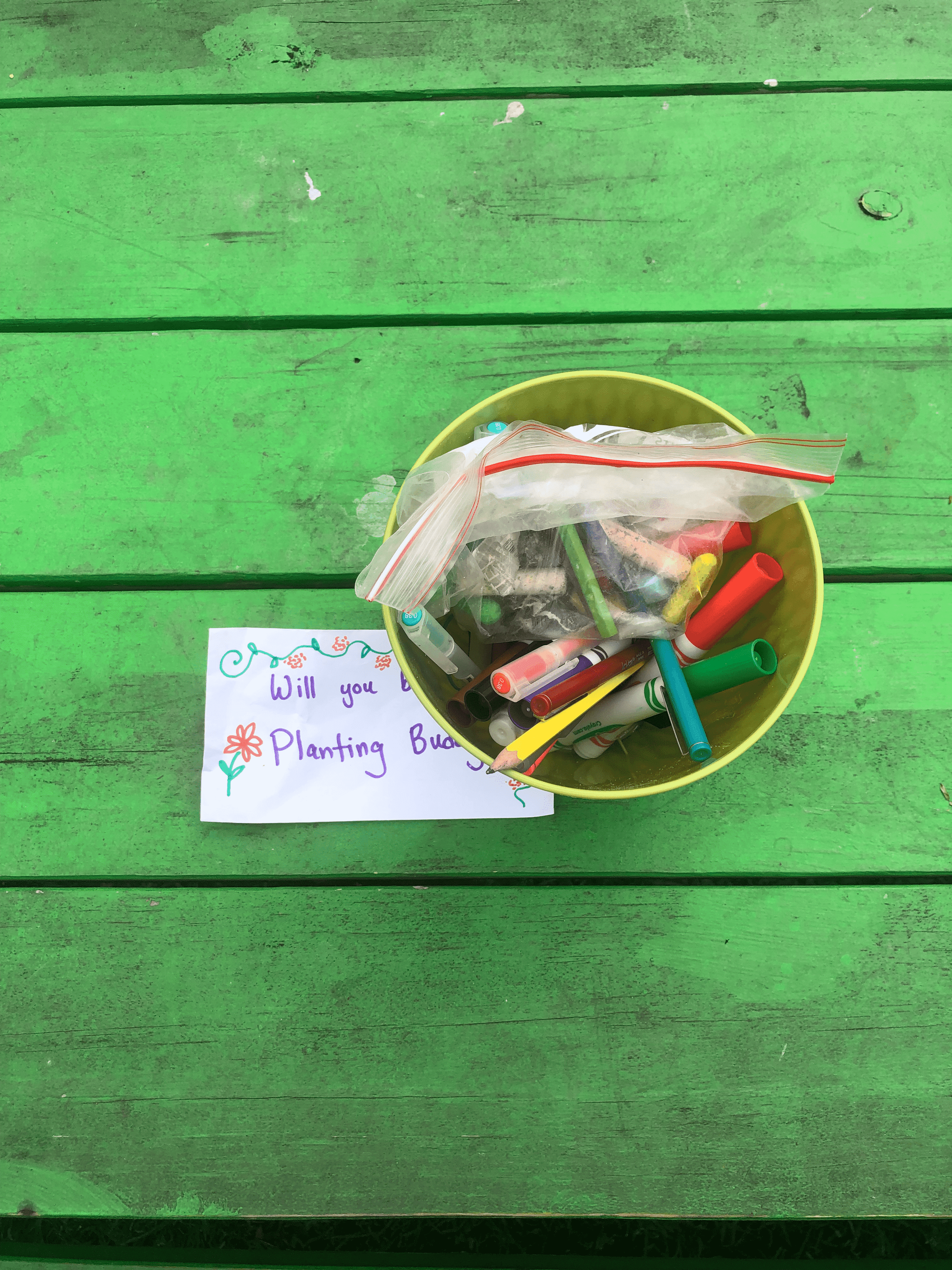
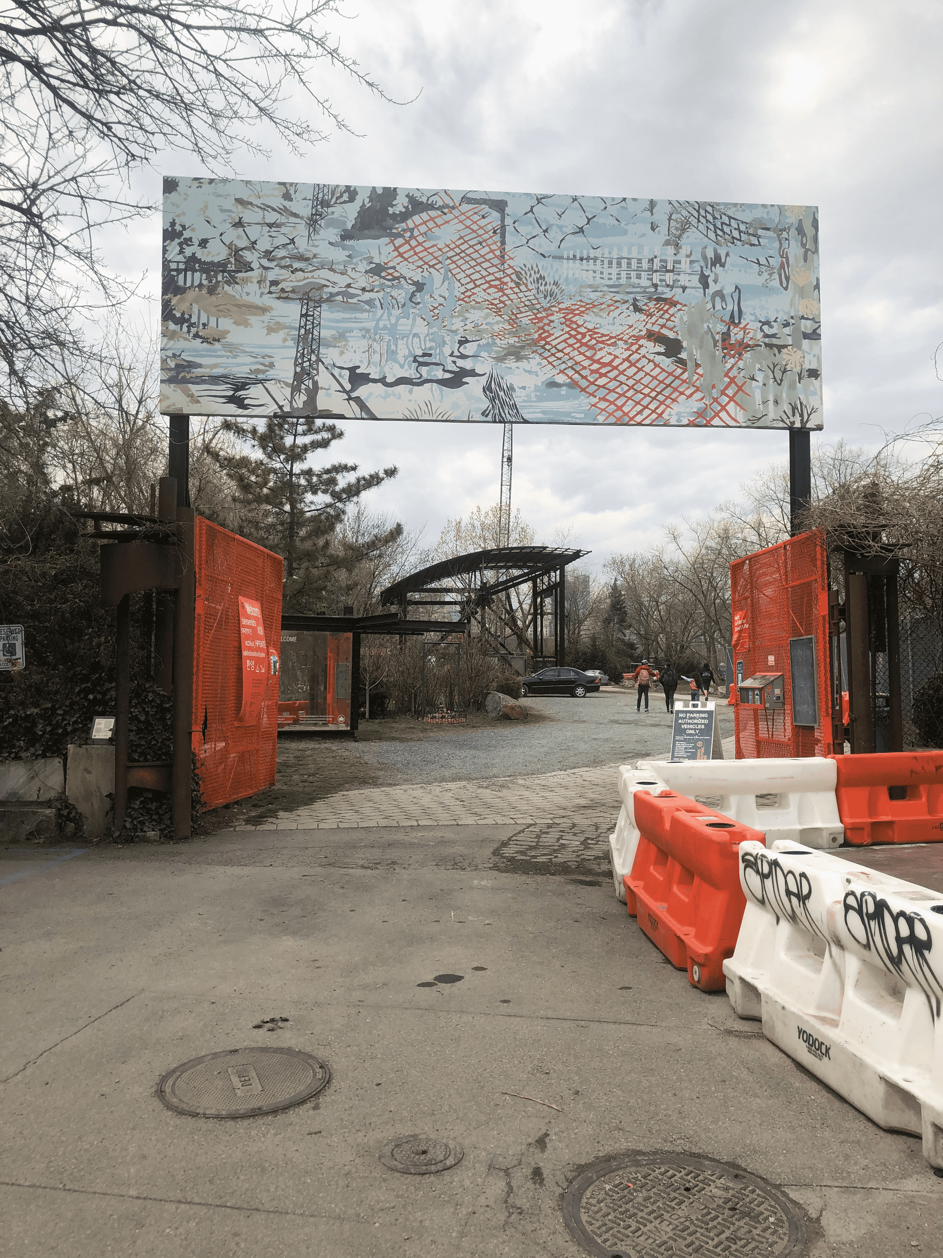

")

")
")

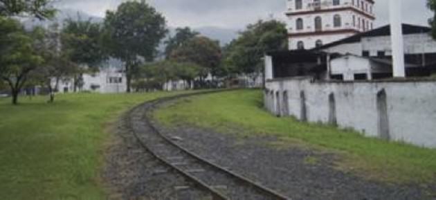
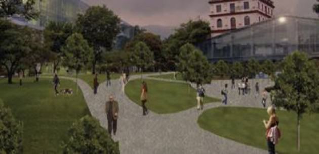

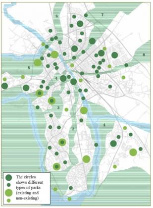 Although the borders were diffuse, the revision of the master plan in 2014 made an extra case that further emphasized that the map is only visionary. On the other hand, the writing in the master plan still says that “The city’s green wedges…that link the city’s green structure with the surrounding nature and recreation areas should be protected so that the green linkages persists or develops”. Interesting here is that planning is often very precise when it comes to buildings but to make concrete borders for green areas seems harder.
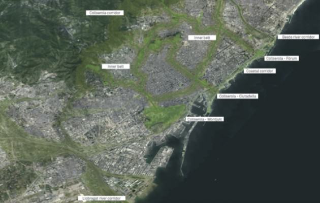
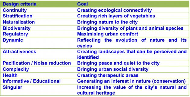
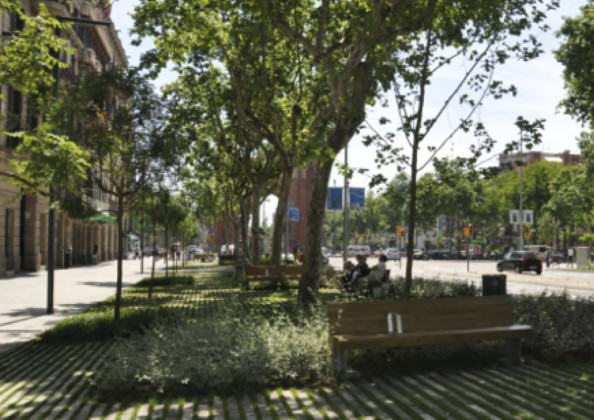
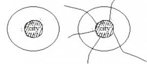
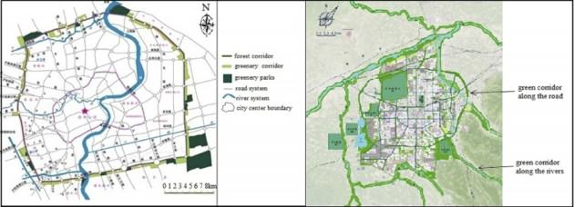
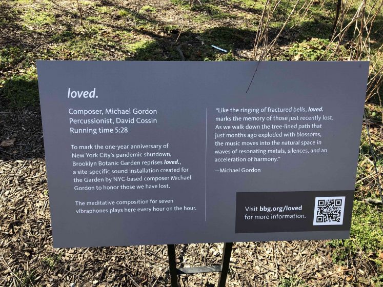
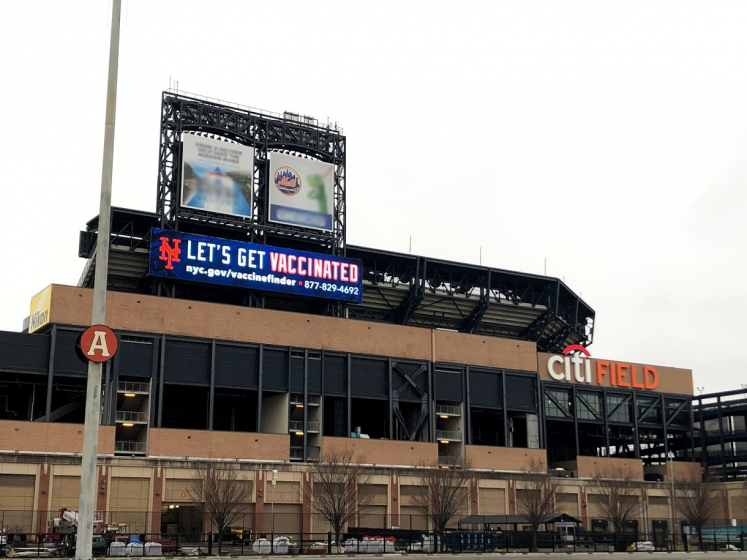
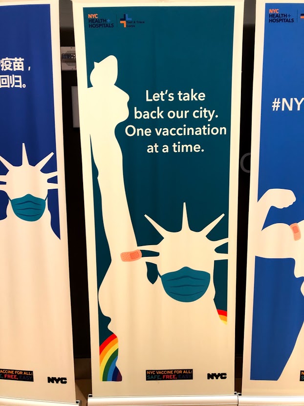
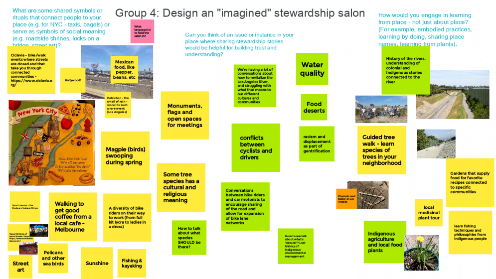
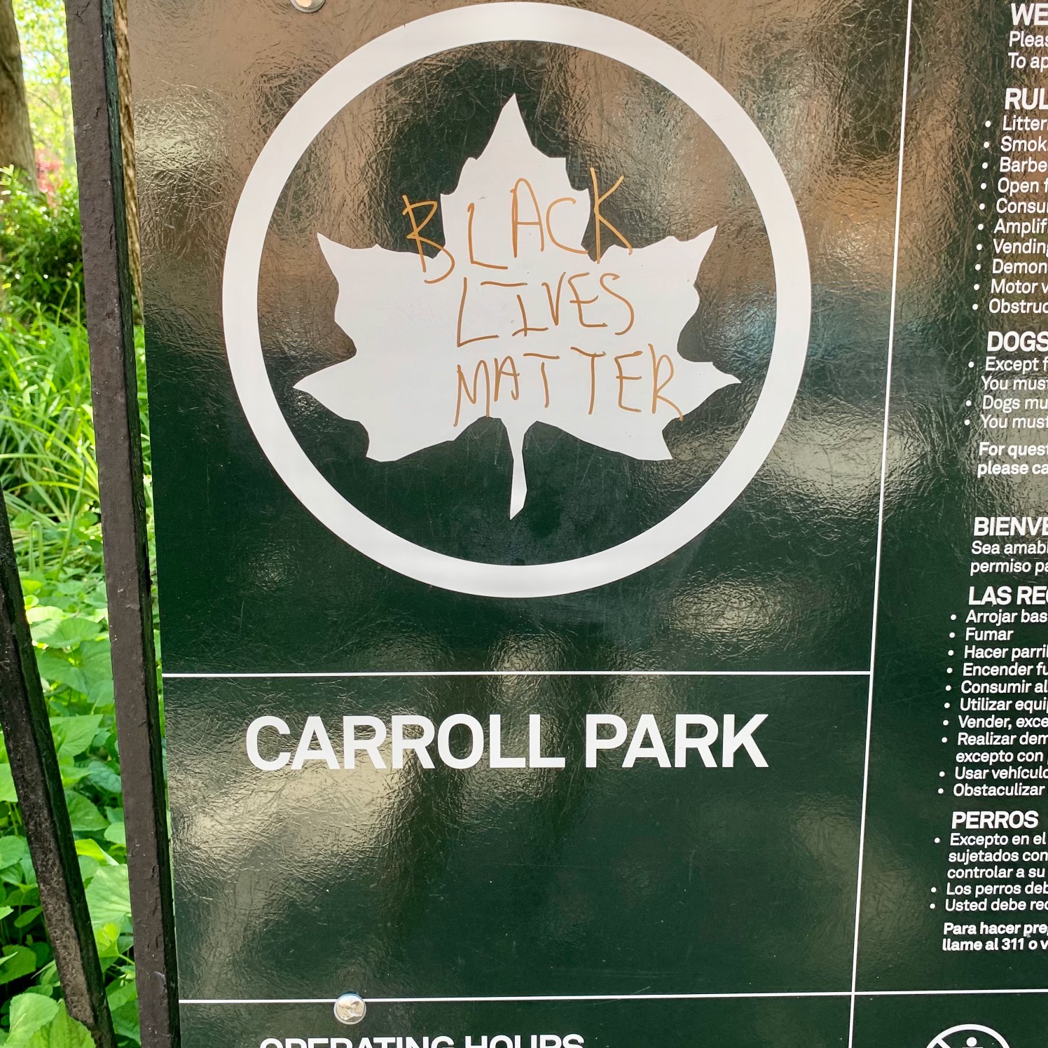


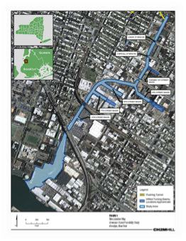
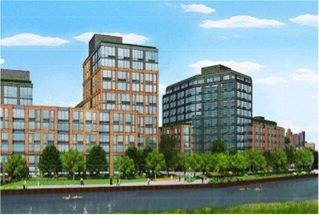
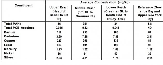
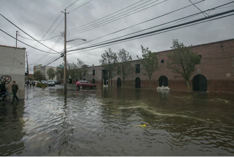


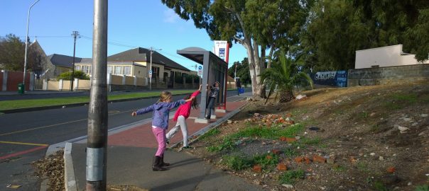
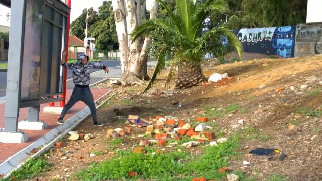 In addition to the interest and enthusiasm of my students, and a personal desire to re-initiate some activism in myself, the exercise takes its inspiration from, and was informed by, two emerging threads in recent landscape, urban ecology and restoration ecology literatures. The first relates to the application of landscape ecology principles in a constructive, futuristic, manner to the urban context and the second to the notion of using ‘charismatic’ species to engage society, emerging in the restoration ecology literature. A third, more personal consideration, relates to the notion of activism, and in how we position ourselves as participants in a relatively young democracy in South Africa (and one that was significantly informed by activism) in response to current causes.
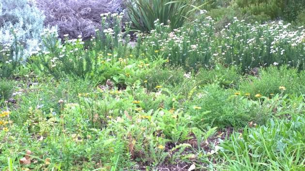
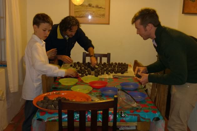
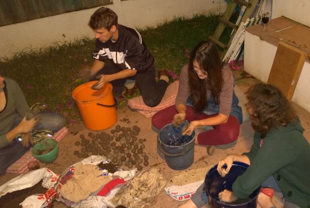
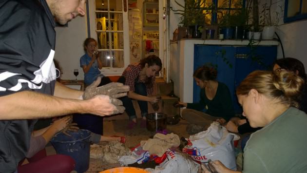
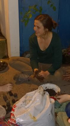 Our seed bomb making event was fortuitously followed by a day of rain and on Sunday morning we targeted vacant lots and road verges. We made sure our sites had limited alien grass cover to reduce overwhelming competitive dynamics and were well positioned for maximum public benefit. Then we bombed these sites hard. We tossed over-arm, we threw under-arm, we chucked them hard at the ground to watch them break apart, we competed to see who could throw the highest, and we jumped on some, and placed some gently in divots in the ground. We had so much fun! The act of hurling a seed bomb was warming to the heart. To throw something is such a physical act and really did galvanize the activist in me giving me all the gorgeous feelings of righteous action.
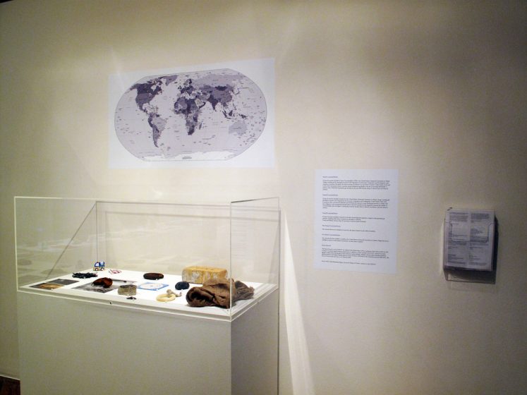
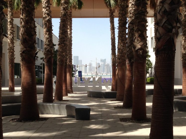
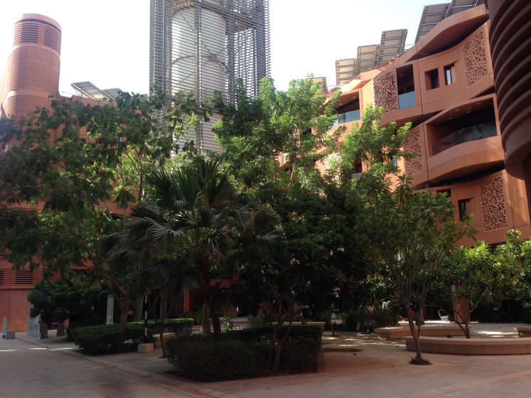

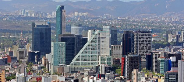
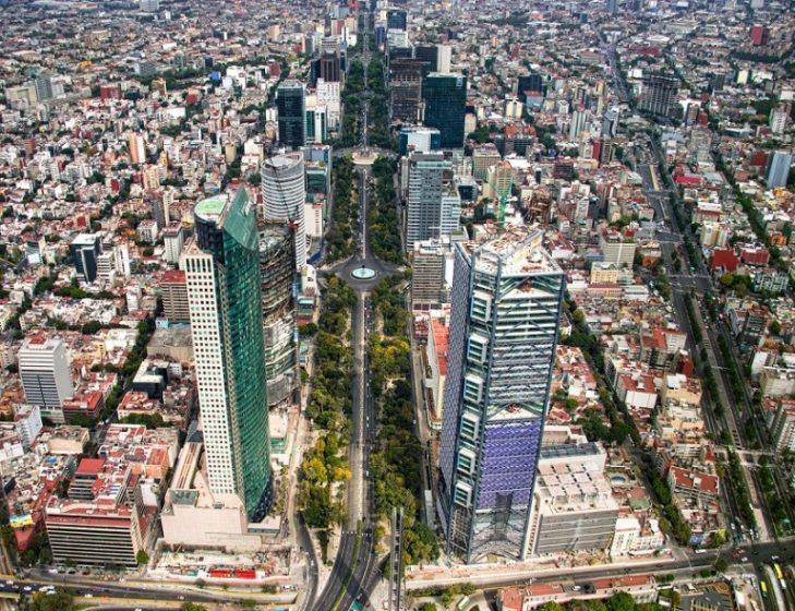


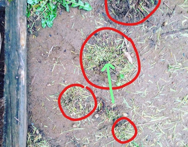
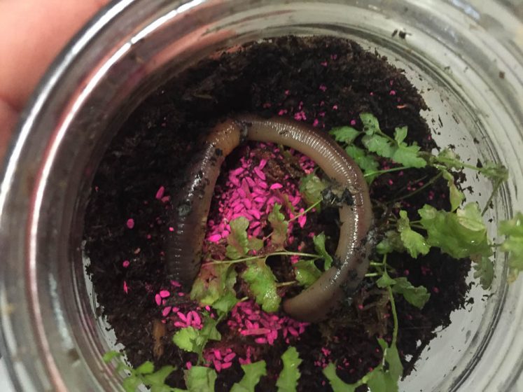
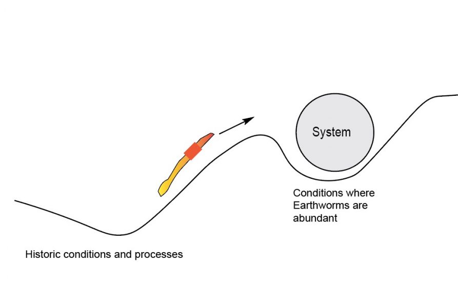

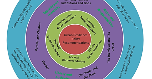
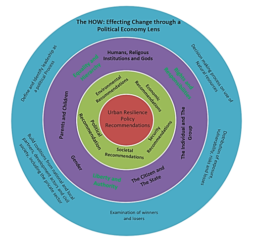
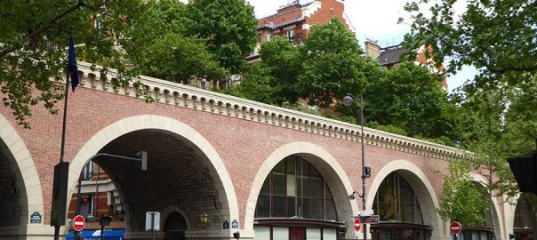

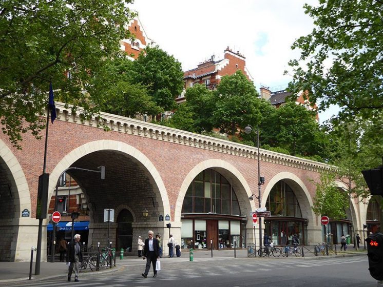
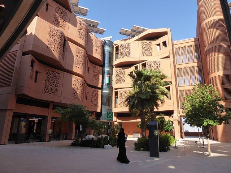
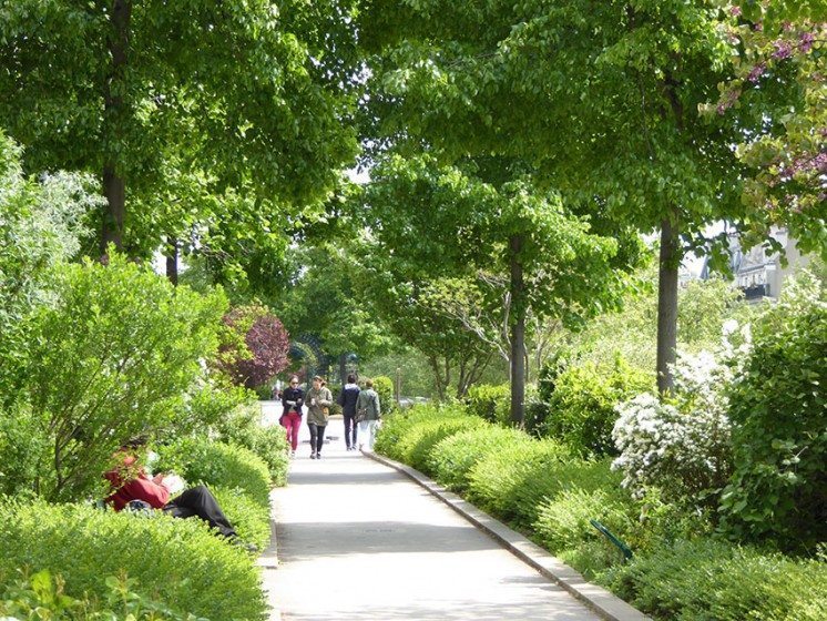
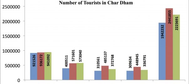
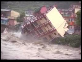
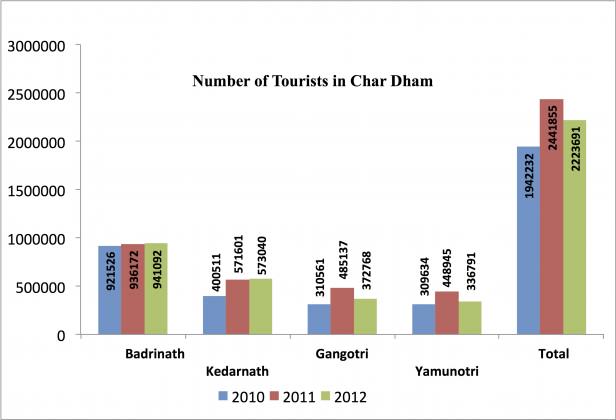 While we can easily categorize this as a natural disaster, I attribute this as a human-made disaster. Ecological disasters are a result of disturbance in the natural rhythm due to adopting lifestyles and technology practices that change the basic constitution of nature. Uttarakhand, the place where the disaster happened in June, is located at the foothills of the Himalayan mountain region and is abundantly rich in forests, mountains and water and is an ideal place of hydropower generation.
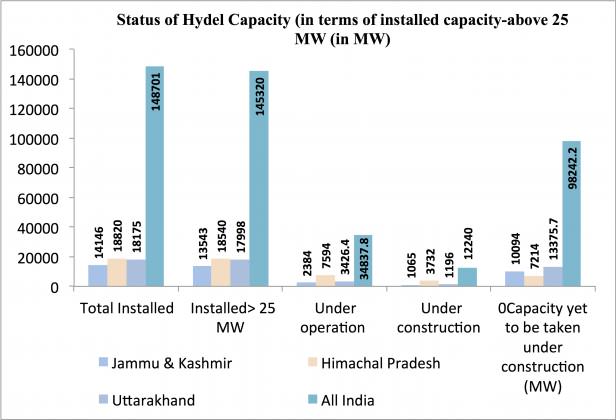 Statistics do not lie. We can see that the average annual growth rate in Gross Domestic Product of the state has been 18.6% between 2004 and 2012. The state could achieve such a growth rate due to the wide-range of benefits it offers to industries in the form of interest incentives, financial assistance, subsidies and concessions. The state has also undertaken several initiatives to attract tourists. Tourism has both direct and indirect impacts on the economy. The quality of the forest cover has declined and it varied among the districts. The decadal growth in urban population in the State has been 42% during 2001-2011 while the district Rudraprayag, where the disaster struck, has registered a growth rate of 263%. The number of hydroelectric projects in the hill states of Uttarakhand, Himachal and Jammu has increased and they generate 148,701 MW of energy and several projects worth 98,242 MW are in the pipeline. There are around 680 dams reportedly in various stages of planning or construction in Uttarakhand, in addition to the 70 existing ones.
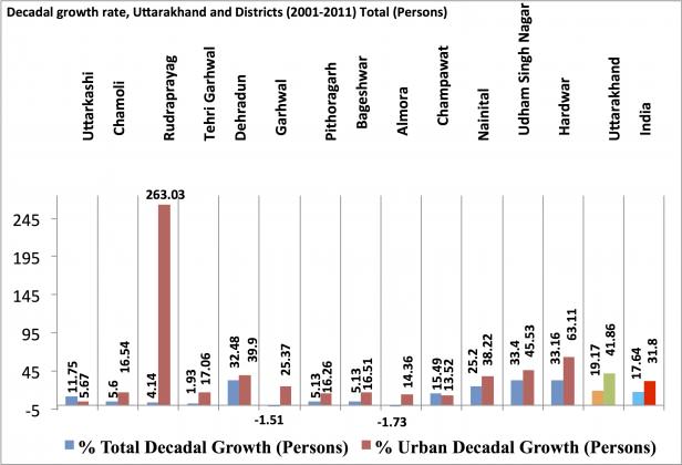 We know that most of this demand for hydroelectric power and better infrastructure comes from the urban dwellers, who do not even understand the relevance of ecosystem services to their everyday life. The problem lies in the mindset of most of the urbanized people and policy makers who think that a magic wand called technology is the key to all problems in India. Our technologies have proved to be regressive in terms of increasing the size of our ecological footprints.
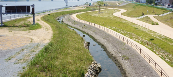
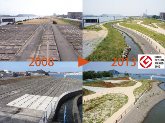
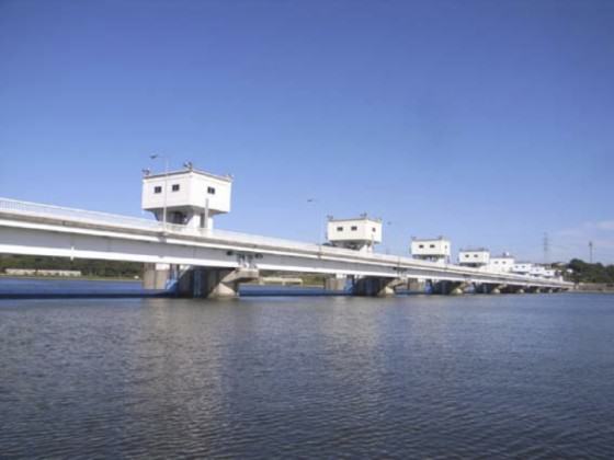
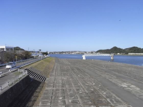
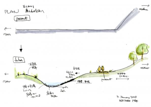
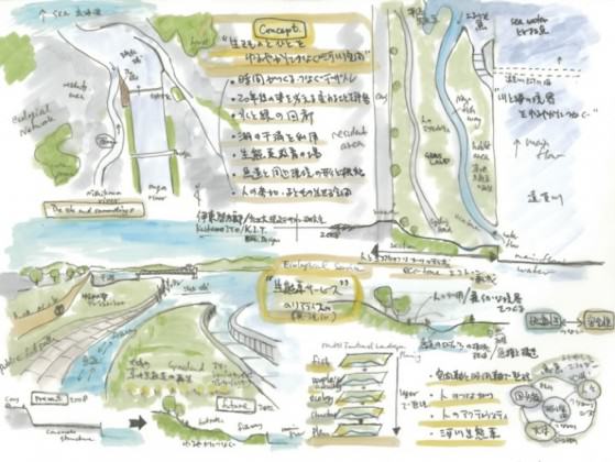
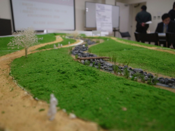
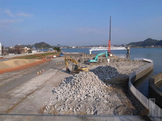
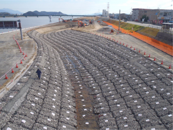
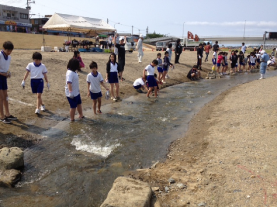
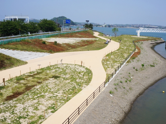
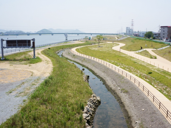
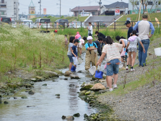
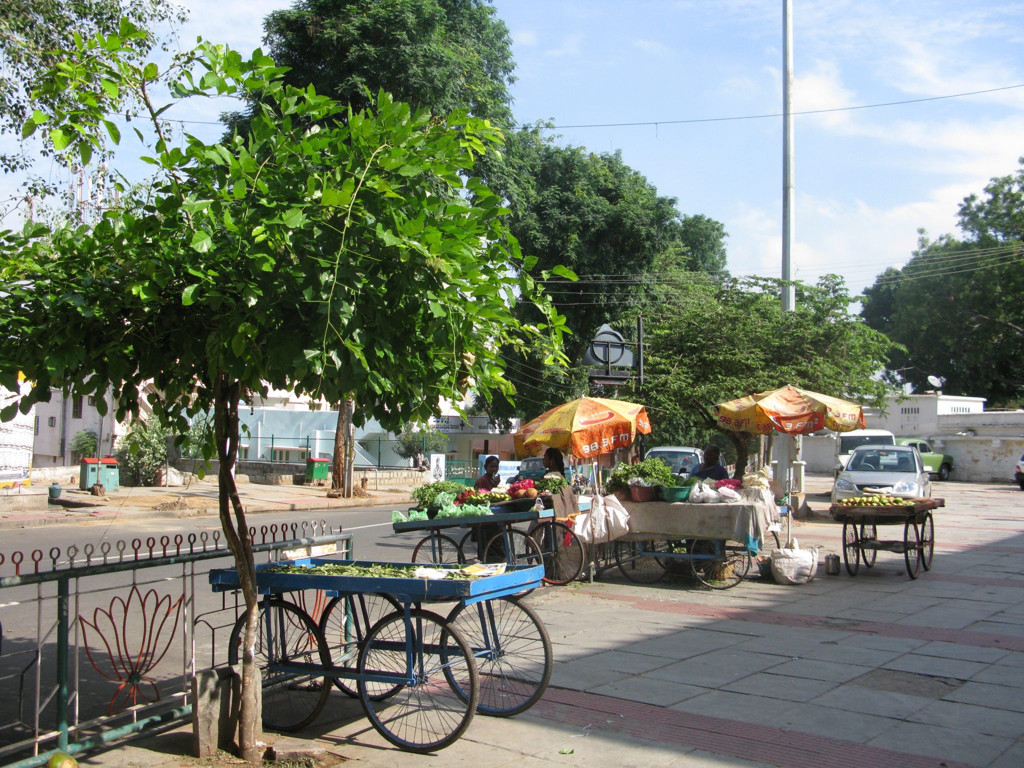
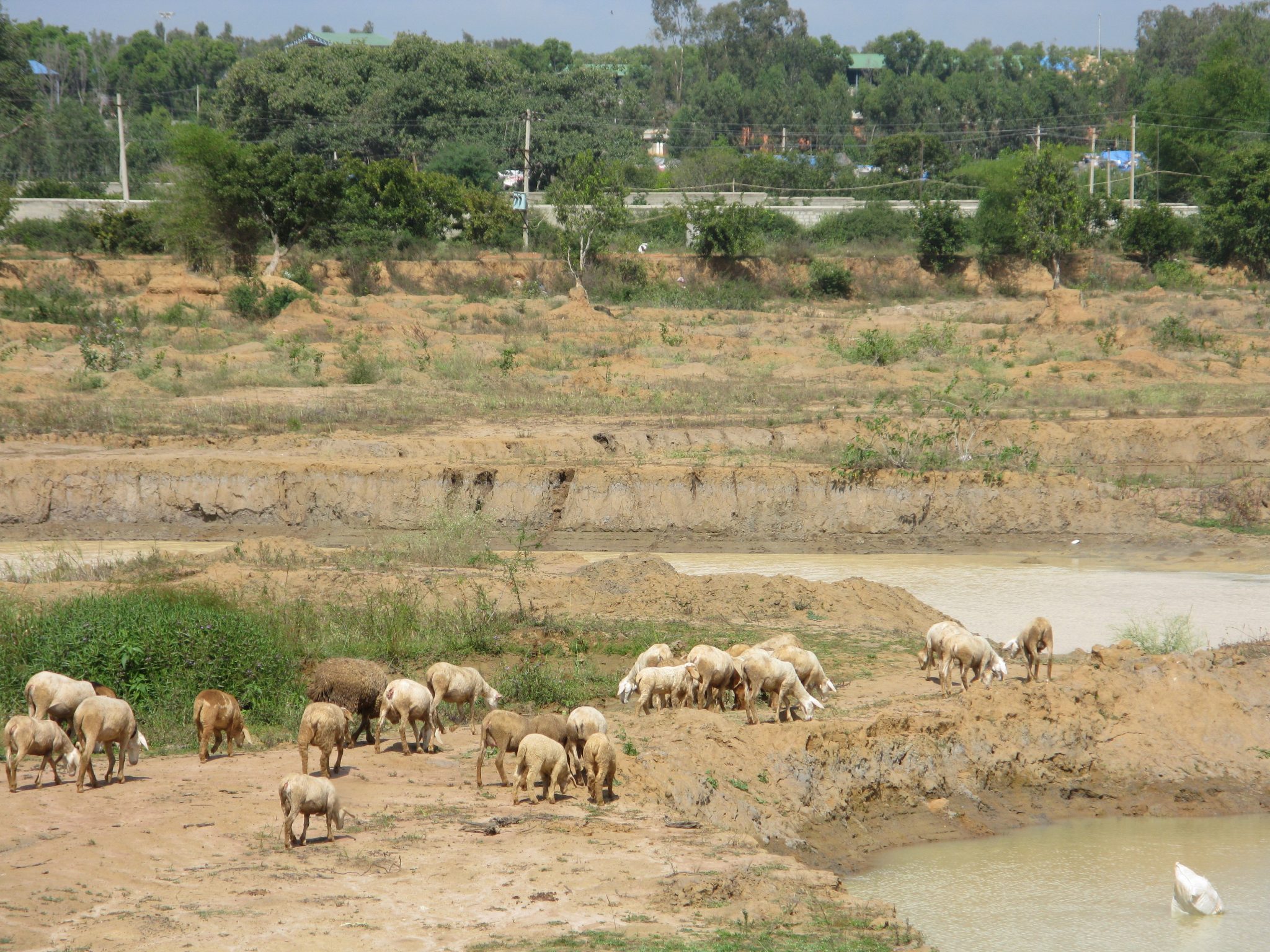
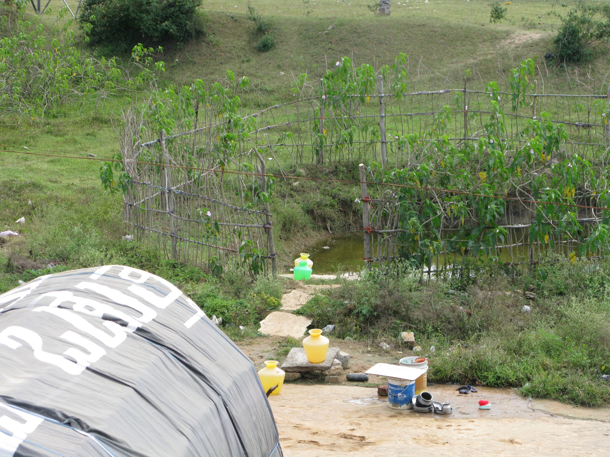
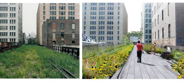

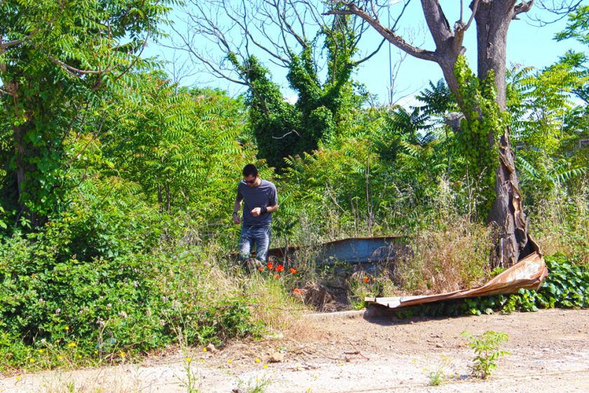


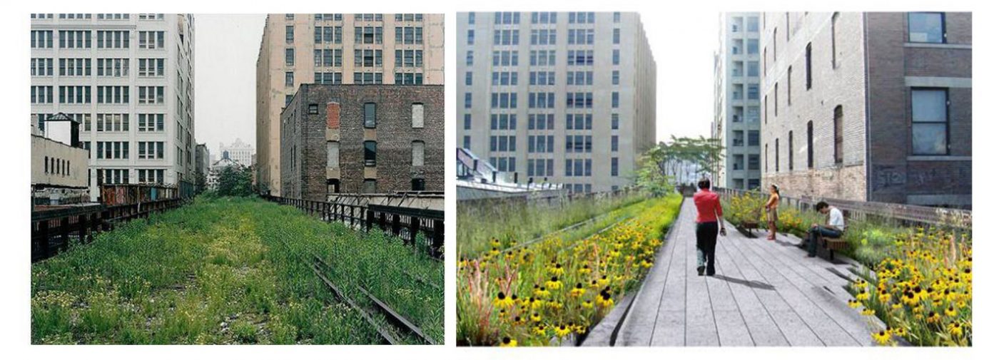
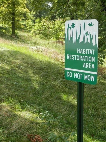
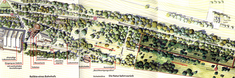
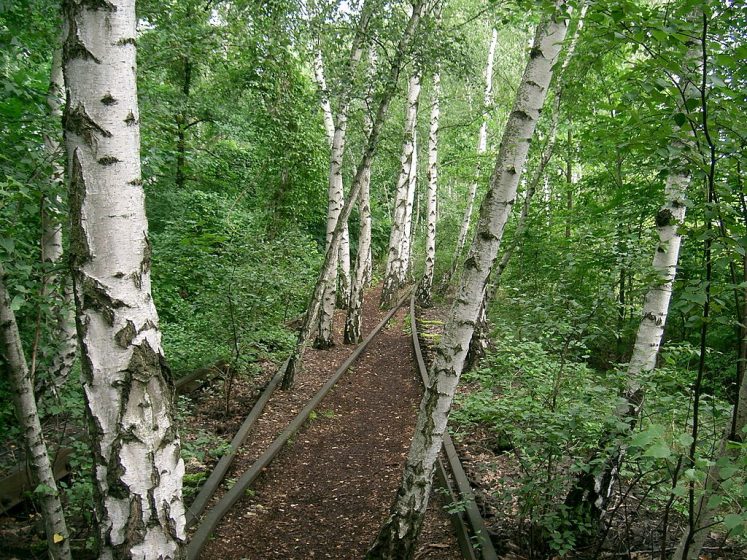
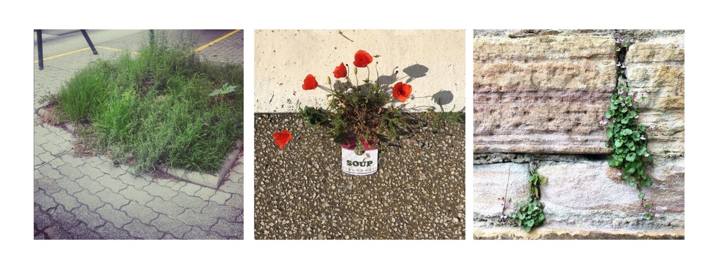
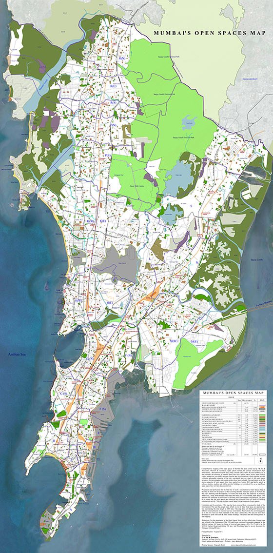
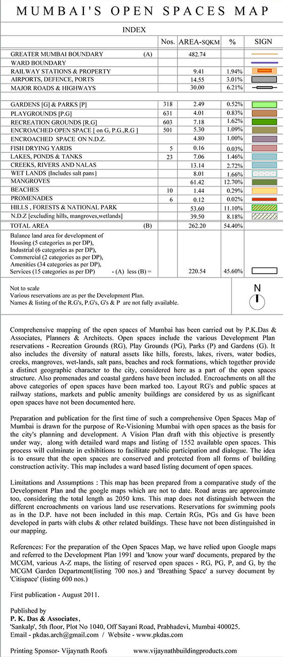
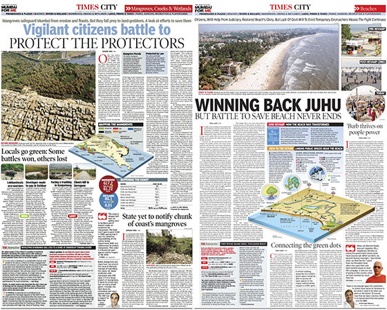
 For long-term gain, it is important to achieve necessary legislative changes for the protection, conservation and enrichment of various natural conditions. Governments deciding unilaterally or taking decisions in collaboration with highly influential private developers, land sharks and business houses, as is the practice today, leads to the downsizing of natural areas and depletion of these vital public assets. In spite of protracted struggles for environmental cause, governments have undermined such critical decisions and thereby allowed the continuing destruction of natural areas. In Mumbai for example, we witness large-scale illegal land filling, dumping of garbage and rubble generated from building repairs and construction sites onto areas of mangroves, wetlands, rivers and creeks. Even the city government, has over the years, used wetlands and mangrove areas as solid waste dumping sites. Hence, concerted democratic movements and protracted struggles will have to continue in order to influence decisions in favour of environmental protection and their conservation.
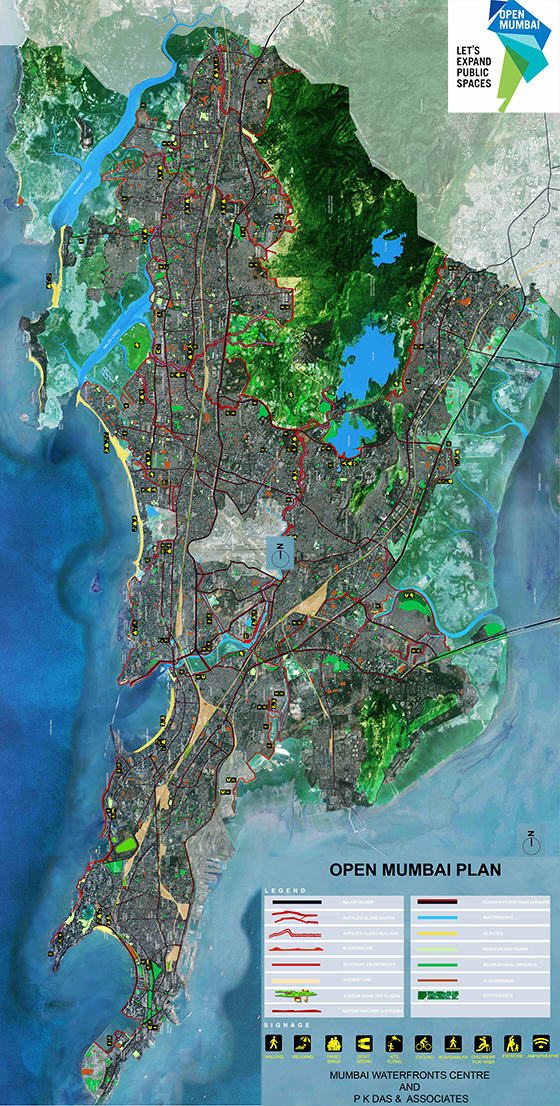
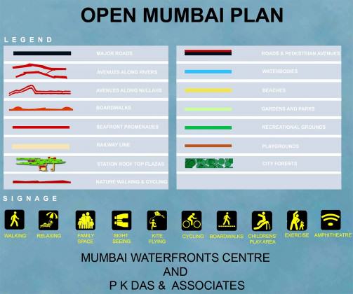
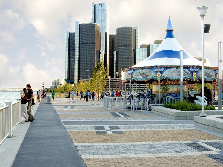
Add a Comment
Join our conversation