Collectively, researchers over the past 60 years (or more) have collected a good deal of data on urban biodiversity and impacts on urban plants and animals. From urban gradient studies to patch dynamic studies, we have a plethora of empirical data that suggests how various urban designs would impact various species. However, these studies have not affected actual planning decisions in most cities (there are exceptions of course).
Often, to address biodiversity, urban decision makers do not use empirical studies because they are too detailed and/or they target particular taxa (i.e., urban bird studies dominate the scientific literature). Most planners and other urban decision makers rely on broad ecological theories to shape planning.
Planners can manipulate three things that affect urban biodiversity: 1) the quality, amount, and patch size of conserved open space; 2) how open space and nearby built areas are managed; and 3) the degree of open space connectivity. Currently, to guide green infrastructure conservation, planners and landscape architects use island biogeography theory (MacArthur and Wilson 1967), using species-area curves and distance to source calculations, which translates into conserving large remnant patches (Linehan et al. 1995). They also create wildlife corridors and improve landscape connectivity, which stems from meta-population theory (Keymer et al. 2000). Overall, these ecological theories translate into clustering built areas, conserving some percentage of open space, and protecting lands for corridors (Arendt 1996). While conserving some connected patches is a good step, in reality, it is much more complicated to determine which species gain and/or lose from one design versus another.
In reality, suites of flora and fauna respond differently to sizes of connected patches, nearby land use impacts, and fragmentation/edge effects. A given corridor and patch arrangement has different effects on mammals, butterflies, herpetofauna, birds and the associated vegetation community. For example, scattered patches of habitat are more connected for birds and butterflies than for mammals and herpetofauna, because the built matrix impedes the movement of ground-dwelling animals (Hourdequin 2000). Size of the animals also matters as very small species, e.g., small beetles, hummingbirds, small lizards, and mice, operate at different scales than larger animals, e.g., large butterflies, raptors, alligators, and bears. Also, edge effects impact different species within a taxonomic group; for example, specialists are more vulnerable to fragmentation than generalists (Hilty et al. 2006). People may believe that only large patches are worth conserving but even fragmented landscapes, if done correctly, are capable of benefiting a whole suite of species (Dupre and Ehrlen, 2002; Bastin and Thomas 1999). Typically, we do not have the opportunity to evaluate the impacts on different species, and we just go with general principles in urban design.
Design is important, but both the conserved areas and the landscape matrix surrounding the conserved areas must be managed appropriately. Any green infrastructure can dramatically lose its biological integrity over time due to lack of appropriate management for both built and conserved lands (Hostetler 2012). For instance, invasive plants and animals may spread into conservation areas, requiring invasive exotic control within conserved habitat (Reichard 2004). Additionally, most urban natural areas are missing certain ecological processes and need some type of habitat management; examples include prescribed burns, roller chopping, restoration through native plantings, and other activities used to improve or maintain the habitat for native plants and animals. Even day-to-day human behaviors can impact green infrastructure (Hostetler 2010; Hostetler and Drake 2009): ATV vehicles running through conserved areas, infiltration of feral cats and dogs and other exotic pets, nutrient and chemical intrusion caused by improper use of fertilizer/herbicides/pesticides, and increased impacts from light and sound pollution (Longcore and Rich 2004). Thus, even with green infrastructure design, funded management plans are needed and residents in nearby built areas must be engaged so that their homes, yards, and neighborhoods enhance and rather than damage local biodiversity efforts.
With all these nuances, it is no wonder that planners and conservationists rely on broad theories to make decisions. Also, many of the urban studies are not understood (or heard about) in the planning world, and they are not incorporated into urban planning. To date, urban decision makers state that they do not have sufficient information to holistically address how alternative design and management practices can improve the biological integrity of cities (Ahern 2013). Tools have not been created that synthesize urban ecological data into a format that can be used by most city planners.
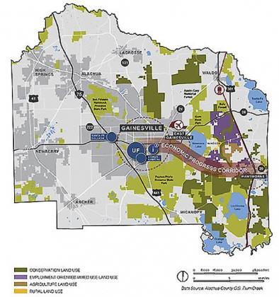
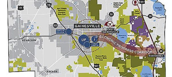
What to do? I suggest that we (ecologists) explore (more often) what urban planners actually use in the “real world” to make decisions. Typically, most city and county planning rely on land use maps and evaluate different designs by utilizing GIS software, such as ArcGIS Desktop software. One robust decision-support tool, called CommunityViz®, is an extension of the ArcGIS Desktop software that enables formula-driven alternative future scenarios, as well as, front-end web-based and digital presentation-driven information sharing. The software is flexible and facilitates, land use scenario planning, sketch building, time scale interval visualization, social-ecological impact assessment, urban growth modeling, and similar GIS related functions. CommunityViz® has been in use for over a decade with an extensive, and growing, track record of application to public and private sector urban land use planning processes (http://www.orton.org/tools/communityviz). By the way, this is not an endorsement as there are other similar tools out there, it is just one that I am familiar with.
In other words, if we had flora and fauna biometric equations that would plug into CommunityViz®, planners would have a tool to evaluate different design and management options and their impacts on a suite of species, simultaneously. This planning tool permits biometric equations that run in the background and display various impacts from alternative planning design and management decisions. For example, planners can manipulate patch sizes and management practices for a 100 ha site, and the outputs would display impacts on birds, mammals, and insects simultaneously.
Of course, we are currently missing these biometric equations. I propose getting a group of ecologists, planners, landscape architects, and other interested built environment professionals and tackle this problem. I have ideas about how to do this (e.g., meta-analyses) but we need various expertise involved to create usable and realistic equations for taxa big and small. Conserving green infrastructure and implementing management practices takes effort and money, and the use of these biometric fauna and flora equations will help cities to develop better planning strategies and be more confident that they are getting “bang for their buck!” Perhaps through a workshop, we will map out a strategy to generate biometric equations, ultimately helping urban decision makers to evaluate which species and groups lose or gain from different urban designs and management strategies.
Mark Hostetler
Gainesville
References
Ahern, J. 2013. Urban landscape sustainability and resilience: the promise and challenges of integrating ecology with urban planning and design. Landscape Ecology 28: 1203-1212.
Arendt, R. 1996. Conservation design for subdivisions: a practical guide to creating open space networks. Island Press, Washington, D.C.Bastin, L., and C.D. Thomas. 1999. The distribution of plant species in urban vegetation fragments. Landscape Ecology 14: 493-507.
Bastin, L., and C.D. Thomas. 1999. The distribution of plant species in urban vegetation fragments. Landscape Ecology 14: 493-507.
Dupre, C. and J. Ehrlen. 2002. Habitat configuration, species traits and plant distributions. Journal of Ecology. 90: 796-805.
Hilty, J.A., Lidicker Jr., W.Z., Merenlender, A., and A.P. Dobson (Eds). 2006. Corridor Ecology: The Science and Practice of Linking Landscapes for Biodiversity Conservation. Island Press, Washington, DC, USA.
Hostetler, M.E. and D. Drake. 2009. Conservation subdivisions: a wildlife perspective. Landscape and Urban Planning 90: 95-101.
Hostetler, M.E. 2010. Beyond design: the importance of construction and post-construction phases in green developments. Sustainability 2: 1128-1137.
Hostetler, M. 2012. The Green Leap: A Primer for Conserving Biodiversity in Subdivision Development. University of California Press, Berkeley, CA, USA.
Hourdequin, M.(ed). 2000. The ecological effects of roads. Special issue of Conservation Biology 14(1): 16-94.
Keymer J.E, Marquet, P.A., Velasco‐Hernández, J.X., and S.A. Levin. 2000. Extinction thresholds and metapopulation persistence in dynamic landscapes. The American Naturalist 156: 478–4945.
Linehan, J., Gross, M., and J. Finn. 1995. Greenway planning: Developing a landscape ecological network approach. Landscape and Urban Planning 33(1-3); 179-193.
Longcore, T. and C. Rich. 2004. Ecological light pollution. Frontiers in Ecology and the Env.. 2(4): 191-198.
MacArthur, R. H. and E.O. Wilson. 1967. The Theory of Island Biogeography. Princeton University Press, Princeton, NJ, USA.
Reichard, S. 2004. Invasive plants in the wildland-urban interface. In S.W., Vince, V.W., Duryea, M.L., Macie, E.A. and L.A. Hermansen (Eds.)



Leave a Reply