

On our way, we came across a very interesting monument, the artesian well of the Butte Aux Cailles. Only three such wells exist in Paris, and they connect us to very profound waters, those of the aquifer that lies beneath the urban landscape. One can drink spring water in the middle of the city.
On the occasion of The Nature of Cities Summit, which happened in Paris in early June 2019, I had the opportunity to organize a creative walk along the ancient path of this mythical and often forgotten river. We were to uncover the history of this river, the lost sister of the Seine, and softly dive into Parisians relationships to water in its various ways: river, spring, aquifer, fountain, rain… With a group of about fifteen Summit participants, we met up on a Friday afternoon at Jussieu University where the Summit was happening. From this meeting point, we headed south with the subway, to the “doors” of Paris, where the Bièvre used to enter the capital city and to where we were to begin our walk.
What we first saw while looking at the southeastern part of the Paris subway map is that many stop names referred to the times where the Bièvre river flowed through those neighborhoods. One stop named “Les Gobelins”, directly cites the ancient name of the river: “rivière des Gobelins”. A name that doesn’t refer to the fantastic creatures we call goblins but to the name of a famous manufacturer—Jehan Gobelin—who had established his dye shop along the river Bièvre in the 15th century. This factory was famous for its red colors soon created the reputation that the Bièvre was a bloody river. But that’s another story.
Still looking at the subway map, I pointed out the stop called “Glacière”, or icehouse. There the waters from the river Bièvre created wetlands that froze in winter and became an ice reservoir for the city (and an ice skating attraction). Examining the map we could also see a stop called “Poterne des Peupliers” (poplar postern, or « side entrance » through poplars) just at the very limit of the peripheral highway that encircles the old Paris. That’s where we were heading and the poplar trees, longtime companions of waterways, were showing us the way! Interestingly enough, Lindsay Campbell noticed on the new interactive subway map we were navigating on for this introduction, that the whole path of Bièvre was marked, even when flowing under Paris! Perhaps a preview of its future revitalization in the Parisian landscape.
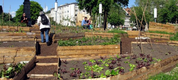
The walk started at the Parc Kellerman, literally located inside the ancient Bièvre river bed, where it once entered the city. The park had been designed as a celebration of water. With its narrow channels, iconic waterfall, and small wetland. For the first time of my life as a native Parisian, I saw a heron inside the city. He flew in front of our group to catch a fish in the water. It was a good sign for the beginning of our day. Guided by the wonderful choreographer Nadia Vadori-Gauthier, we embodied the fluid energy of the lost river and of the park’s ecosystem that is softly calling it back. A video of our dance as part of the One minute of dance everyday project by Nadia Vadori-Gauthier.
https://vimeo.com/340912313
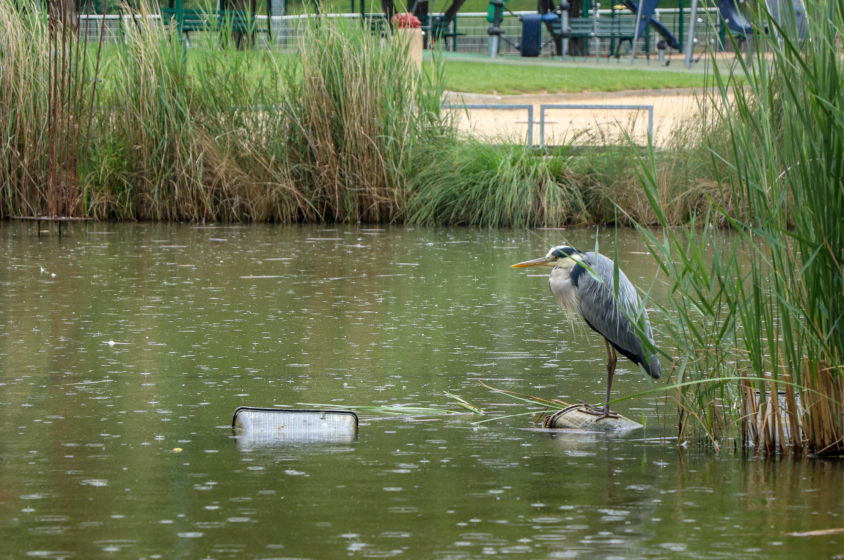
The rain started and suddenly water was everywhere. We crossed the small streams running through the park. Local water hens and ducks started to show up among the cord grasses. The heron was still there, proudly standing in the middle of the pond. Soon we could read, engraved on the ground “Parcours symbolique de la Bièvre” (« the symbolic course of the Bièvre »). We were on the right path. Leaving the garden, heading north into the city, we took a large street framed by tall poplar trees singing in the wind. We were to enter a neighborhood where the names of those riverside giants were to be found everywhere, in the name of the hospital “des peupliers”, of the coffee shop, the pharmacy, and of the street we were walking on. We started to cross streets with names referring to water mills: Moulin des Prés”, “Moulin de la Pointe”. Designed to grind grain, they once flourished along the active branch of the river Bièvre. Heavily industrialized with mills, but also tanneries, butcher shops, and dye-makers, the river got more and more channelized over time. Home to those many local industries, each using its waters and flow for their own purpose, it became dramatically polluted and gradually was forced underground.
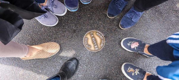
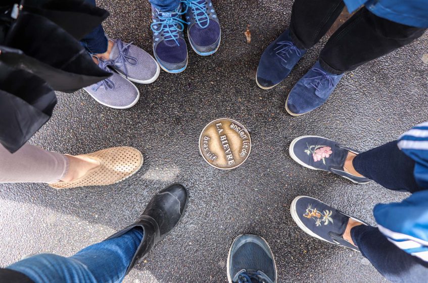
As we kept walking the rain stopped. We started noticing the many medallions placed on the sidewalk by the urban architect Benoît Jullien, each marking where the Bièvre used to flow. Those marked paths would separate into two routes, the active branch (“bras vif”) of the Bièvre that was artificialized stay active at all times, and the inactive branch (“bras mort”) of the Bièvre, its natural path, that would dry up for parts of the year.
On our way, we came across a very interesting monument, the artesian well of the Butte Aux Cailles. Only three such wells exist in Paris, and they connect us to very profound waters, those of the aquifer that lies beneath the urban landscape. These are precious places for people wishing to drink spring water in the middle of the city. Indeed, as we tasted this water collected at a depth of about 600 meters, we could see neighborhood inhabitants coming on bikes with jerry cans to stock up water for their homes. After drinking this water, we stopped at a nearby park. We took a break to read out loud some of the poems and texts that were written about the Bièvre river. Many of those texts were extracts from the collection of poems Teint: for the Bièvre / Pour la Bièvre, written by the British poet Zoë Skoulding in 2014, to mourn and pay homage to the lost river.
Not a river but its
shadow harmonics hidden
level in the glass note
glissando between a
movement and a sound
half in the performance
where I ran to you I
an as tainted water
while tarmac shines in rain
the channels you don’t touch
well up on tomorrow’s
tongue to flower there don’t
leave or was it this way
that now I’ll run from you
— Excerpt from Zoë Skoulding’s Teint
As she researched its history, she made it into a symbol of the domination over nature and destruction caused by industrial culture, and even by patriarchy. “The Bièvre is today the most perfect symbol of female misery exploited by a great city,” wrote Huysmans a century earlier in 1914. A feminist symbol claimed by some, the Bièvre comes to represent the rawness of Paris’ nature that has been tamed by violent exploitation but hopes to reclaim its rights to live in its full power. As we walked the streets, graffiti and collages caught our eyes, some representing a Super Woman, others a crying teenage girl. More thought-provoking graffitis appear on our path, many made signed by the famous local street artists collective called Lézarts de la Bièvre (the arts of the Bièvre). Through poetic urban art, they help passers-by remember the vanished river and tying its memory to the social justice issues of today.
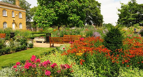
The group stopped for lunch in a strange park, the square René-Le Gall, which used to be a very small island on the Bièvre. At the time when the river was flowing, this place was called l’île aux singes (the monkeys’ island). Some say this name comes from boatmen who came accompanied by their monkeys that they left free on the islet, and others say it was a slang name given by its workers to the owners of the nearing tannery. Indeed the island was the former kitchen garden of the upholsterers of the famous Manufacture des Gobelins. As we walked up the curvy street leaving the garden we could soon see its luxurious buildings, the only lasting factory from the time of the river’s industrial bloom. Still famous today for its tapestries, this institution has survived and flourished through the centuries. In this place, famous artists like Louise Bourgeois, Jean Arp, Fernand Léger, Alexandre Calder, Sonia Delaunay, and many more have collaborated with artisans perpetuating four hundred years of knowledge. On the facade of the building bas-reliefs representing the different steps necessary to make and prepare the wool for the textile artisans, illustrating for us the practices one could have seen happening by the river for centuries.
But the tragic reality of the Bièvre surfaces again as we walk through an area near Censier, described in Victor Hugo’s famous novel and call for social justice Les Miserables (literally « the wretched people »). Indeed, in the 19th century, the waters and banks of the Bièvre had been so extremely polluted by various industries that putrid smells would escape from the river and make entire neighborhoods unliveable and home to misery. This reality slowly led in 1912 to the covering of the river for sanitary and social reasons. Today, the advocates for the revitalization of the river argue that we have now mastered those sources of pollution and it is time to bring the river back to life.
Now walking downhill, we could slowly sense the Seine river approaching and imagine the past reunion of the two rivers. The medaillons on the ground kept guiding us and assured us that we were following the right path. At times, we saw again names of streets referring to mills or even sculptures of millers and bread bakers at work.
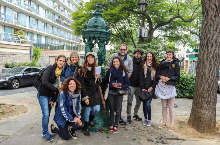
Our last stop was by a typical Parisian fountain, called “Fontaine Wallace”. Now iconic of the city, those green fountains were introduced at the end of the 19th century by a British philanthropist who believed Parisians (who had just suffered the siege de Paris by Prussian forces and civil war) should all have access to free water. Those “fountains for the people” were designed in the style of the time, with four caryatids adorning them, each representing qualities associated with the four seasons: Simplicity for Spring, Charity for Summer, Sobriety for Autumn, and Kindness for Winter. An interesting detail that can be found on each of those fountains is a small metal plate indicating from where this specific fountain water comes from. And it can change from one street to the next. In our case, the plate said that the water was coming from the filtered waters of the Seine and the springs of the Vanne river. With the water, we cleaned delicious cherries that we shared and replenished our bottles. It was time for a group photo.
Softly, with water in our backpacks, we finally arrived by the Seine at the spot were the Bièvre would have reached this larger stream. At the Pont d’Austerlitz, looking at the strong flow of the Seine, we smiled and decided that we would each write a few sentences for the Bièvre river in a Dadaist style, meaning however we want.
As we invite you to recall that river, here is a collective collage of our words:
Not forgotten but recalled / a lost body found
The river laps
across generations
across geographies
cutting new ground,
the river laps.
River of the depths, I honor you wherever you go. Vine path, path of hearts. Sister of the Seine.
Dappled drops as light reflects where water was. Step step splash puddle muddled river mort. Follow the live arm.
We start dreaming about the past, about what these banks were, we look for the signs of the presence of water, we find them.
We connect to this underground flow that passes south of Paris, at Gentilly, and runs to the Seine.
We look at photographs of a Paris of the past that we had no idea about, we dream of a future where water would reappear from the walls where it is enclosed. We tell ourselves that this world is crazy.
Searching for traces, memories in the landscape – a word, a puddle, a slope, a sign – les peupliers.
Many thanks to all those who participated in the walk and to The Nature of Cities who connected us across disciplines and ways of life in our love for urban nature. I am looking forward to many more.
Carmen Bouyer
Paris
Leave a Reply