Lessons from a small city
Much of the urban ecology literature focuses on the world’s largest cities, and many of the Nature of Cities bloggers have written about these places. Blog posts have discussed the challenges of conserving biodiversity and ecosystem services in London and New York City, planning for greenspace and social justice issues in Rio de Janeiro, Johannesburg and Cape Town. So what can be learned from a smaller city in the midwest United States — an average city?
Columbia, Missouri is very different from those places, but it is also a city shaped by a legacy of racial segregation that continues to influence its neighborhoods and it is a city that is faced with equally important planning and development questions. A focus on biodiversity associated with these day-to-day settings is useful in illustrating some of the challenges in making biodiversity meaningful and accessible to all urban residents.
Nearby nature
In the 1980’s Rachel Kaplan and Stephen Kaplan introduced the concept of nearby nature, the nature that is within 1 km of where people live and work. The Kaplan’s argued that these nearby places are where people encounter nature on a day-to-day basis, are places that are valued by urban residents, and have a strong influence on residents’ perceptions and values.
Nearby nature has become an important concept in landscape architecture and urban planning but the concept is often ignored by people who study biodiversity in cities. The common, the ordinary, and the everyday are often described as examples of degraded or homogenized biodiversity. existence. My work as an urban wildlife ecologist considers the biodiversity associated with day-to-day environments, and the role focuses on these areas and in this blog I will describe some of the work that my students, colleagues, and I have done in these places in the city where I live and work, Columbia, Missouri.
Shaping nearby nature: race matters
Urban form and morphology shape patterns of nearby nature and form and morphology are shaped by laws, policies, and decision making. Columbia developed during a time when the civil rights of black Americans were limited by law and practice. Segregation was a social driver shaping the form of neighborhoods in central parts of Columbia, and to some extent shaping nearby nature. Before 1954 Columbia’s black residents attended a single school and lived in four neighborhoods in the center of the Flat Branch Creek Watershed. Residential segregation was not required under Missouri law but it Columbia it was enforced by custom and local planning policy. The 1935 City Plan for Columbia, Missouri states,
“The negroes are an important and useful element in the city’s life, and provision should be made for their welfare, including suitable locations for living and recreation. It is not to the best interest of either race to encroach upon the other. Control by zoning, while instituted in certain southern cities, is not entirely satisfactory, and it is believed that mutual agreements between the races offer a better method of procedure. With little possibility of material increase in negro population, and with considerable vacant property within the principal sections now occupied by them, effort should be made to concentrate future population within these principal sections and avoid scattering into other sections of the city.”
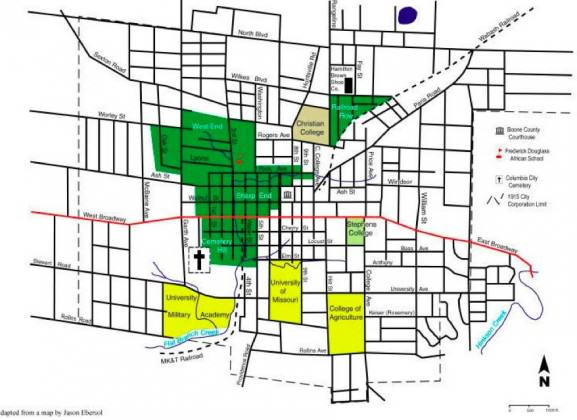
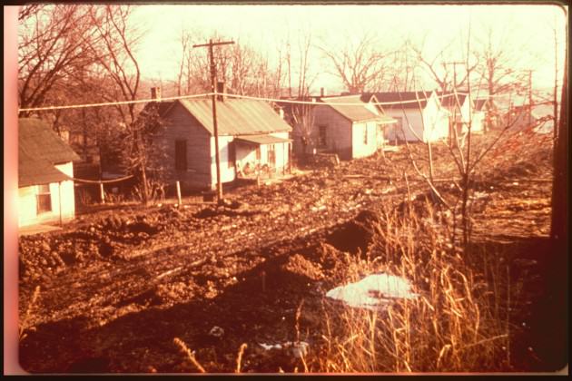
Pictures of the “principal sections occupied by Negroes” show a mix of traditional streetscapes and small greenspaces along with unpaved streets and open sewers. In 1956 the city developed the Douglass School Urban Renewal Area to initiate a process that resulted in tearing down 222 houses, additional small business, and burying portions of Flat Branch Creek. The urban renewal project moved relocated much of Columbia’s black community to the west and northwest portions of the watershed, away from Flat Branch Creek.

Shaping nearby nature: planning policy matters
Columbia is a growing city with development focused on infill of greenspaces within older parts of the city and sprawl on the fringe of the city. I have mentioned the role of planning as part of a broader pattern of residential segregation in Columbia, but planning plays an additional role is shaping nearby nature in that it provides guidance on development. Planning and zoning authority in the city does not address wildlife habitat. Environmental planning is limited to a floodplain overlay zone protecting streams and riparian areas in the city and a land protection ordinance protecting forested parcels in the city.
To support this ordinance the city has uses a natural resource inventory that maps contiguous forest and tree cover. This has led to a planning approach that focuses on protecting large blocks of open space and riparian corridors around the city, a process that often ignores nearby nature. This lack of focus has resulted in small-scale controversies over proposed developments throughout the city.
The look of nearby nature: big differences along the same street
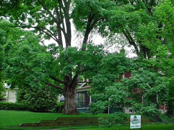
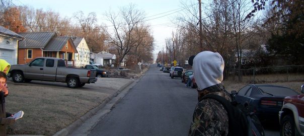
Our work focuses on describing and assessing nearby nature in the city’s neighborhoods. George Middendorf and I developed a crosstown walk as a teaching tool for a qualitative look at environmental changes along single streets that track a socioeconomic gradient. We’ve used the crosstown walk to describe differences in nearby nature along a 1.8 km stretch of a Columbia street. Edgewood Ave., Aldeah Ave., and Alexander Street are a single street west of downtown Columbia. The southern end of the street (Edgewood Ave.) is part of one of the wealthiest and mostly white census tract block groups in the city with large houses, brick streets and mature street trees. The northern end of the street (Alexander Ave.) has a median family income almost $50,000 lower, a relative small number of white residents, has smaller houses and fewer trees on streets and in yards.
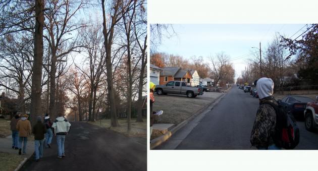
With support from USDA Forest Service’s Midwest Center for Urban and Community Forestry, we asked groups of residents from different Columbia neighborhoods to describe the places in their neighborhoods that were important to them and to explain why they were important. Representatives from the Westmount NA that includes the southern end of Edgewood / Aldeah / Alexander, described the large street trees in their neighborhood, mentioning the beauty of the fall colors and the trees framed houses along the streets. They also valued the wooded hillsides and small streams near some of the houses and these features provide a unique feel to the street. They voiced concern about the city’s management of street trees in their neighborhood.
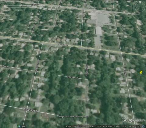
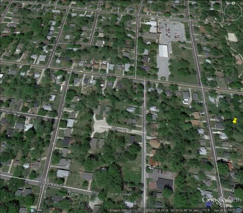
Residents of the Smithon Valley Neighborhood Association, that included the central and northern blocks of Edgewood / Aldeah / Alexander, valued the deep 50 m lots behind their houses and the spontaneous vegetation associated with old fence rows that was growing up in the back of many of the lots. The residents also valued relative large patches of forest that were formed behind houses. They were concerned about the potential development of some of the larger patches, mentioning the recent purchase of some of these interior lots and proposed development for homes.
Biodiversity and nearby nature
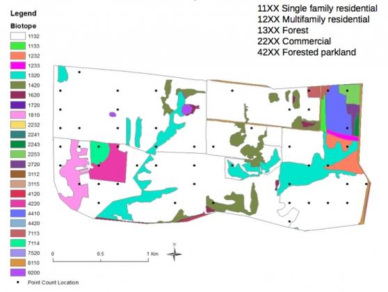
Since 2008 we have worked on a project to document the animal species that occur that are associated with nearby nature. We’ve developed a biotope map for the city, a process that has identified more than 60 types of habitats associated with different land use types in Columbia. We have used this as a tool for looking at habitats and species associated with neighborhoods in the city. We have started to assess some of the places identified by our discussions with local residents. Places that form unique biotope types, such as the spontaneous vegetation associated with alleys in the city’s older neighborhoods.
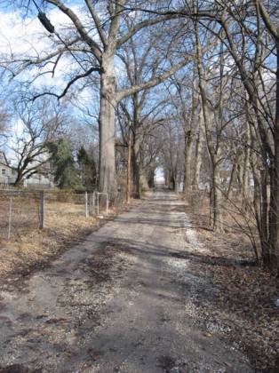
Our studies of birds, small mammals, and butterflies are designed to document the species occurring in habitats in residential neighborhoods. For example, we are studying breeding and winter birds in one central Columbia neighborhood as a pilot study for a larger study looking at birds and management of habitats in residential neighborhoods.
By documenting the species associated with the nature that Columbia resident’s encounter near where they live we will be able provide information to residents and planners about the contributions these places make to local and regional biodiversity.
Our emphasis on nearby nature points to the importance of understanding the local context that shapes biodiversity and ecosystem services in cities. The approach we use in Columbia is relevant to all cities because it combines understanding what residents see and value in the nature around them, and assessing and recognize the contributions of these important places.
Charles Nilon
Columbia, Missouri
References
A City Plan for Columbia, Missouri. 1935. Report to the City Planning and Zoning Commission. Hare and Hare City Planners, Kansas City, Missouri.
Cady C. Finding Flat Brach. City of Columbia Department of Parks and Recreation.
Middendorf, G. and C. Nilon. 2005. A Crosstown Walk to Assess Environmental Changes Along an Urban Socioeconomic Gradient. Teaching Issues and Experiments in Ecology 3: Experiment #3 [online].
Pierce, R.A. II, C. Nilon, and H. Stelzer. 2013. Assessing wildlife habitats and natural resources in neighborhoods and urban environments. MP927 University of Missouri Extension.
Sullivan, J. 2003 Ridgeway neighbors oppose Habitat’s housing proposal. Columbia Daily Tribune



Leave a Reply