Neighborhoods and Urban Fractals—The Building Blocks of Sustainable Cities

Many voices. Greener cities. Better cities.

Urbanisation is spreading across the face of the planet at an unprecedented rate. Most of it is opportunistic; ad hoc development and shanty towns rather than master plans. Virtually none of it, planned or otherwise, incorporates the elements of natural capital that are needed to create sustainable cities. Every time a new piece of urban fabric is created, or an existing piece is patched up and reworked, it may add to the value of the real estate but subtracts from the ecological health of the urban area. As each conurbation grows it diminishes the biological wealth of its region. Globally, the entire urban system trends towards becoming increasingly dysfunctional.

But what if it were different? What if, every time we added to the weave of this great human construct, we constructed pieces of urbanism that not only provided good shelter for people but also increased biodiversity and enhanced the value of natural capital?

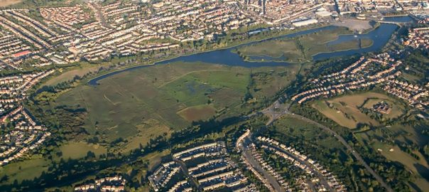
Urban systems are largely unplanned with only incidental (though crucial) relationships to the bioregions on which they are ultimately dependent. Credit: Creative Commons license

For some time I have been intrigued by the idea that one might be able to identify patterns in urban systems that could provide a systematic model for developing cities that can always and simultaneously incorporate the essential characteristics of ecologically sustainable urbanism – and that this might be applicable across the spectrum from eco-village to metropolis.

Dongtan, China – centrally planned but not yet realized. Situated adjacent to RAMSAR wetlands, would it have incorporated the essential characteristics of sustainable urbanism that would protect natural capital? Credit: Arup

Cultural fractals

Around the start of the century I proposed that a living system of human relationships that displays the essential characteristics of the larger culture of which it is a part can be thought of as a “cultural fractal”. In my book Ecopolis – Architecture and cities for a changing climate (Springer 2009) I formally set out a number of propositions, including that:

  • Cultural change can be catalysed by the creation of cultural fractals that display essential characteristics of the preferred cultural condition.
  • An “urban fractal” is a network that contains the essential characteristics of the larger network of the city. Each fractal will possess nodes, or centres, and patterns of connectivity that define its structure and organisation, and it will exhibit characteristics of community associated with living processes. It is a particular type of cultural fractal.

Culture is a living system of human relationships that expresses itself in language, arts, tool-making and social organisation, including politics and economics. Characteristic and distinctive elements weave together in a pattern that we recognise as a particular culture. If there is an identifiable smaller pattern that displays the essential characteristics of the larger culture – if it is self-similar to the cultural whole – it can be considered a “cultural fractal”. For a cultural fractal to be meaningful it should contain all the essential characteristics of its culture. Cities weave together the strands of cultural activity and are the most complete expressions of a society. They include, express and are a consequence of relationships between the rural and urban, the domestic and the wild. The most complete fractal representation of a civilisation is urban. The concept of a sustainable city includes the essential characteristics of a sustainable culture – the concept of ecopolis includes the essential characteristics of an “ecological culture” – in its physical and organisational structure, its ethos, and its process of realisation.

An urban fractal is a kind of cultural fractal.

Fractals catalyse more fractals Credit: Paul Downton.

An urban fractal is any part of the urban system that contains sufficient characteristics of that system to represent the essence of that system in microcosm. It is a conceptual tool (what Patrick Geddes might have called a “thinking machine”) that, I believe, has scope and potential as both an analytical device for understanding exactly what is the essence of sustainable cities and societies, and as a synthesising device for creating replicable models of sustainable design.

The pioneering ecocity advocate and theorist Richard Register found that the urban fractal idea “describes very well” his own “integral neighborhoods” and “ecological demonstration projects” (Register 2006). His nicely succinct summary of the urban fractal is that it is “a fraction of the whole city with all essential components present and arranged for good interrelationship with one another and with the natural world and its biology and resources for human activity”.

Urban fractals should include ecology: Design guidelines for non-human species

Each neighbourhood and precinct scale piece of the city should be what I have called an “urban fractal”, containing the essential characteristics that we want to see in the whole urban system, including nature, ecosystem services, and urban agriculture. The dimensions of an urban fractal are defined in terms of performance, rather than its spatial dimensions. Thus, a required dimension for an urban fractal that supports nature in the city might be a set of Design Guidelines for Non-Human Species that required it to provide support for wildlife indigenous to the place and be able to provide, for example, sufficient viable habitat that it can support at least one key indicator species of fauna and a majority of the species of birds indigenous to the place.

Because urban fractals are not physically the size of a whole town or city they are more achievable than whole new cities, particularly in developed countries. It is possible to identify potential (and partial) urban fractals in existing projects and cities, but an ideal urban fractal of a sustainable city or ecopolis would be an integral neighbourhood with human diversity that reflects the city, shops, jobs, education, housing, biodiversity, gardens, renewable energy systems, water capture and conservation, good transit and pedestrian oriented planning all configured in such a way as to nurture and restore the natural processes of the bioregion to which it belongs. One would expect to see creek and watershed protection or restoration and green roofs. Parks, gardens, public spaces and waterways would form life-supporting arteries of green and blue and there would be a mutually enhancing relationship of built form with the needs of both social exchange and ecosystem function.

Each one of these in every fractal.

The reader may enjoy speculating on what elements should be in place to ensure that an urban fractal for a sustainable city or ecopolis included essential requirements for the functional relationship and integration between natural and anthropogenic systems.

Green roofs to provide both human amenity and other species habitat might be a required dimension for an urban fractal. This one is at Christie Walk in downtown Adelaide, South Australia. Credit: Paul Downton, architecture & photography.

Making complete fractals may appear to be relatively difficult to achieve but developments that are physically large enough to contain a functioning neighbourhood are not unusual, for instance, when an entire city block is redeveloped. However, it is rare for even the largest of conventional developments to contain sufficient characteristics and services for it to function as a neighbourhood. By including those services it would facilitate the activities of a socially functional neighbourhood and by then adding key characteristics that would connect that neighbourhood to natural systems and ecosystem services it can be transformed into a fractal of a sustainable city with the potential to become an ecopolis – that is, a city comprised of ecologically, socially, and architecturally complete fractals.

The urban fractal concept fits well with ideas of the “distributed city”, for instance, where power, water and resource management systems are less centralised, with the technologies under more local control, assisting in the reduction of a city’s ecological footprint.

Pocket neighbourhoods

The task of creating fractals can be broken down further into bite-size chunks of urban development at the smaller scale of what Ross Chapin calls “pocket neighbourhoods”. These are essentially a few dwellings, typically 6 to 20, that are gathered around a commons. Chapin claims that with this simple concept he is giving name to a pattern innate to human nature, which he sees as having the potential power to shift the thinking of everyone involved in building, from home-dwellers to city officials and architects.

Considering that every dwelling in a pocket neighbourhood looks onto the green heart of a central commons of social and green space, it is easy to see how this might be extrapolated to the larger scale of the neighbourhood, and how that neighbourhood might constitute an urban fractal. One can envisage that with each “pocket” within the neighbourhood containing both social and biologically productive or viable space the total socio-biological performance of the fractal would be enhanced.

Socially and biologically viable – part of the common space in the Christie Walk pocket neighbourhood, Adelaide. Credit: Paul Downton, architecture & photography.

As the various fractals developed, linked and interacted, the synergies of their relationships would form the emergent order of the larger anthropogenic biome of the city.

Using this concept of an urban fractal it is possible to imagine the evolution of a city model that can always and simultaneously incorporate the essential requirements for urban nature across the spectrum of urban scale, beginning at the level of the precinct and neighbourhood. In this model, urban fractals would need to exhibit characteristics of healthy ecosystems, such as circular (non-waste) resource flows. Although these characteristics could not all be displayed completely (eg. resource flows might only be circular for some materials, not all) this parallels local ecosystem behaviour in that although all resources are metabolised in ecosystems when viewed globally, the process is only partial when viewed locally.

This, in turn, reinforces the need for effective connectivity between ecological neighbourhoods and the crucial role of boundaries and edge conditions.

Our cities need to be “greener”, incorporating and being incorporated by nature and ideally, operating within the framework and limitation of pre-industrial ecological systems. They need to greatly reduce (and ultimately help to heal) damage from global warming. We’ve got an impressive tool kit of strategies and devices to green our cities and combat climate change, but they won’t work if we don’t use them well. In the context of the larger urban system, green buildings are simply part of the tool kit, they cannot, by themselves, make a green city. For all their individual merits, the tools in this kit work best when they are applied as a set and attention is paid to their interrelationships. The concept of the urban fractal offers a way to frame a thorough consideration of those interrelationships.

Christie Walk is a 27 dwelling, high density ‘pocket neighbourhood’ development on a 2,000sq.m. (half-an-acre) block in the centre of Adelaide that demonstrates how careful design that creates pedestrian pathways rather than bitumen roads can provide corridors of green habitat as well as human amenity even in dense urban development. Credit: Paul Downton, architecture & photography.

Think fractal, act local

At the local level of the neighbourhood and precinct it is much easier to gather, process and act upon information. Rather than seeking top-down control what I’m proposing is a kind of biomimicry in which planning and city governance facilitate the emergence of natural patterns and processes within the artificial ecology of urban systems. Working from a decentralist model, this could also be seen as mapping and embedding desired tendencies for development into the DNA of the city.

In his TNOC post (3 October 2012) Thomas Elmqvist identified opportunities that lie in greening the urban expansion and cited a checklist of “key messages” including that “Ecosystem services must be integrated in urban policy and planning.” If one imagines every development of neighbourhood scale or larger (of whatever density) being required to support and enhance ecosystem services (eg. by replacing lost habitat with green roofs) then the progress of a city’s development will continually move towards greater ecosystem health and associated resilience for humans reliant on that system.

Overall, what’s needed is an approach that allows for individual initiative, creativity and diversity but ensures that all the individual initiatives are related to each other in ways that are practical and effective. So let a thousand fractal flowers bloom – and include all the bugs that make an ecosystem work.

Paul Downton
Adelaide, Australia

Just as nature grows individual organisms that reflect their circumstances whilst developing according to the same set of rules, so individual pieces of the city can grow and develop to reflect their place and circumstance whilst fitting their defining characteristics as urban fractals. Credit: Paul Downton.
http://books.google.com/books/about/Ecopolis.html?id=iDhbMM5ms6QC

Neighborhoods that Change in Non-linear Ways—Urban Planning for Succession

Many voices. Greener cities. Better cities.
Can we shift the fundamental question of planning from “should our neighborhoods change?” to “how should our neighborhoods change?”
For most of urban history, urbanization was a nonlinear process. Lots filled in as needed over time, in a process some call incremental growth, or organic growth, seemingly randomly and chaotically. It was iterative, driven by acute feedback and extreme scarcity. Even the shape of lots was refined over time, leaving no corner unused and a cadastral plan looking like cellular tissue.

After World War I, just as the petrochemical industry was hitting its golden age, the world embarked on a new experiment of linear urbanization. The need to support motorization meant buildings, streets and lots had to be designed, financed and constructed simultaneously. Modern urban planning was invented along with this process. Every part of a new neighborhood was standardized and codified to meet transportation and financing requirements. 

The transition from nonlinear to linear urbanization started with streetcar-oriented suburbs but finished when the automobile was fully democratized. The last living examples of nonlinear urbanization are hence found just before, and they are dramatic to witness.

In this article I will explore the phenomenon of ecological succession and how it realizes itself in the context of nonlinear urbanization. With succession understood I then provide a critique of transect-based planning as a continuation of linear urbanization and propose a new way of drafting city plans based on random lifecycles.

This is São Paulo’s Paulista Avenue on the day of its inauguration, 1891. Many people showed up to visit a whole lot of nothing. Within a few years the place had been settled with spacious mansions surrounded by elaborate gardens as the city’s wealthy elites escaped the overcrowded city center.  Source: https://commons.wikimedia.org/wiki/File:Jules_Victor_AndréMartin-_Avenida_Paulista_no_Dia_de_Sua_Inauguração,_1891.jpg
Yet business kept moving southward, and by the 1950s the central business district was relocating to Paulista, particularly the cultural and media industries which took advantage of its high altitude to set up their transmission towers on their already towering buildings. Source: https://commons.wikimedia.org/wiki/File:Avenida_Paulista_1902.jpg
Source: http://netleland.net/hsampa/mansoesPaulista/mansoes.htm
In the 1970’s Paulista was the undisputed economic heart of the city, and the country with it. That meant the street had to be re-designed to accommodate more cars and more traffic, which would eventually reach apocalyptic levels and stay there. Source: http://www.sorimoveis.com.br/index.php/fotos-de-sao-paulo/sao-paulo-antiga
Then growth kind of peaked. The business district moved on further south. The few remaining mansions became a protected artifact of what had once been the street’s main land use, which sometimes involves weird marriages. Source: https://acervo.estadao.com.br/noticias/acervo,avenida-paulista-completa-125-anos,12597,0.htm
The dramatic transformation of the Paulista neighborhood from idyllic suburb to central business district is an extreme example of the phenomenon called succession. Source: http://netleland.net/hsampa/mansoesPaulista/mansoes.htm

Defining succession

The main concept behind ecological succession is that an ecosystem complexifies when simple organisms complete their lifecycles and establish the conditions for higher-order organisms to thrive. One community thus follows another. 

The successional economy is the entrepreneurial analog to a successional ecology. Small businesses in “emerging economies” create the capital and networks upon which larger companies form. It can also go the other way. For instance, there are businesses that can only emerge on the remains of larger defunct predecessors. The Belgo building was once a luxury department store, then a garment manufacture, and now is filled with art galleries, independent restaurants, a yoga studio, and various small offices. This was what Jane Jacobs meant when she wrote that neighborhoods need a mix of new and old buildings to be alive. Some businesses cannot survive in expensive new buildings, and some can only exist by recycling business failures.

The “retail apocalypse” currently shuttering malls and big box stores is the successional economy analogue to forest fires—extreme fragility linked together in catastrophic failures triggering an ecosystem “disturbance”, sending the ecology backwards in lifecycles.

A cycle of disturbance that sends an ecology backwards in successional communities ultimately ends with its return to a its climax community. Gentrification is tragically the end steady-state of disturbance-triggered economic succession, the trees slowly taking back the regenerating land, suffocating uncompetitive economic activities. Being strategically situated on Montreal’s downtown shopping artery, the Belgo building is being renovated for higher-tier retail such as bank branches. Gentrification is a natural and unavoidable process caused by the disturbance that precedes it, thus fighting it necessitates chaotic intentional disturbances (controlled burns) to maintain the status quo. Since new fires will get triggered in other economic sectors naturally, a city’s regenerative force should focus there first.

Against linear planning: the New Urbanism

Linear urbanization was intensely criticized just as it achieved increasing rates of growth and efficiency and came to dominate the landscape. It eventually standardized on a few widely-denounced but dominant typologies: housing subdivisions (whether of detached single-family houses or condominium towers), shopping centres, and business parks connected by arterial roads. What makes them financially successful is also what makes them so controversial: the larger the quantity of identical buildings sold, the more economical they are. This is the dominant pattern of the world’s fastest growing cities in China and the Middle East today.

New subdivisions being developed in Dubai. Source: https://commons.m.wikimedia.org/wiki/File:Dubai_Marina_on_1_May_2007_Pict_5.jpg

Unfortunately, the mass production efficiencies of these developments also make them extremely vulnerable to disturbances, as we are seeing happen to the retail zones.

Some people perceived this threat long before the fires began. New Urbanism arose from this question: what would be better than a subdivision or a mall? New Urbanists carefully observed how traditional towns of America functioned and concluded that the improvement on a subdivision should be a more complex subdivision/mall hybrid, based on traditional building codes instead of modern zoning. 

Hybridizing the subdivision into a mixed-used development meant an increased financial and legal burden for the developer, required a much longer commitment and exposure to economic cycles, and saw limited adoption. It also changed nothing about the fundamental relationship between developer and community—the developer financed the initial infrastructure to meet local codes and then transferred maintenance liabilities, and the effective lifecycle of the development, onto local taxpayers.

To its credit, the New Urbanism’s ideal was modeled as a “transect”, a concept borrowed from ecology. It models transitions from one community to another as a sequence of distinct geographical “zones”.

Source: https://transect.org/transect.html

What is missing from the new urbanist transect is its “geological” dimension—how does one layer arise out of the previous one? We move across zones in space, but never in time. Without removing the structure of the previous zone and starting over, we cannot “upgrade” a zone. We must assume that a zone comes into existence fully-realized and functional. 

Suburban development (T3 zones) proceeds as such—level the rural structure, subdivide it and sell it back as lots for houses, offices, malls or warehouses, in a process made maximally efficient using economies of scale and linear repetition. 

The New Urbanists thought the same could be done for the urban zones, but the financial risks are an order of magnitude higher. This means besides some limited success making planned towns (“T4 General Urban Zone”) with committed landlords, New Urbanism has failed at its stated objective of ending suburban sprawl. Linear urbanization spreads much faster.


That we can show T5 and T6 zones exist geographically, from a historic trajectory that was pre-capitalist and could not take on large-scale risks, means they had to appear through a successional process. What needs to be added to the transect is the vertical axis of time.

A trip back in time

If we were to roll back the clock and model, for instance, lower Manhattan “devolving” back to its suburban and rural origins, we would see that the T5 and T6 patterns are rooted in a suburban pattern of garden houses and townhouses that has nothing in common with today’s suburb.

Lower Manhattan (New York), circa 1851 . Source: http://www.old-maps.com/NY/NY-BirdsEyeViews_NYC.htm
New York City in 1989. Source: http://stevenwarranresearch.blogspot.com/2014/06/1898-history-of-real-estate-building.html
African Burial Ground in what is now lower Manhattan, New York. Source: https://commons.wikimedia.org/wiki/File:African_Burial_Ground_Manhattan.jpg

What this implies is that, much like today’s existing T6 zone has a past that is nothing like today’s T3 zone, today’s T3 zone has a future that is nothing like today’s T6 zone. This future needs to be invented to scale to the existing morphology of subdivisions, shopping centres, and business parks, before they experience their own version of a forest fire.

The successional infrastructure of nature

Source: https://radicalmycology.com/educational-tools/other-fungi/mycorrhizal-fungi-101/

What triggers succession in natural systems? For a long time succession was seen as phenomenological, we witnessed it happening but didn’t understand how or why. There is recently emerging a theory around fungal networks that promises to integrate ecology and network science to explain the phenomenon.

Forest topsoils have been shown to consist of extensive networks of “mycorrhizal” fungi that colonize roots and communicate nutrients and threats from tree to tree, mushrooms being the “fruits” of these underground systems. A single individual fungi can span many square kilometres.

Compost scientists such as Dr Elaine Ingham are teaching that the successional habitat of plants is related to their mycorrhizal relationships. Weeds bloom in the absence of fungi, when bacteria outweigh fungi 10:1. Trees prosper when fungi outweighs bacteria 5:1, up to 1000:1, where this balance of nutrients in the soil stresses plant species that arrive earlier in ecological succession.

The ecological role of weeds is to grow roots that provide an anchor for fungal networks to bootstrap, while increasingly interdependent plant species colonize those networks and grow the land into an underground of increasingly dense and complex communication networks, which then makes weed growth more difficult and longer-lifecycle plant growth more successful. 

This fact eluded us until now because human civilization evolved in a context where we needed to go backwards in plant lifecycles, by clearing forests to plant orchards, row crops and vegetables. Fire was the first technology employed at large scale to achieve this, tillage the second. Both technologies sever fungal threads in the topsoil and allow bacteria to proliferate, which makes agriculture of edible plants possible.

Tragically, our abuse of these two technologies have produced extreme disturbance leading to soil desertification, caused by an endless war on weeds and pests using an increasingly burdenful mix of petrochemicals and unsustainable land management practices, and ultimately becoming a major factor in global climate change. The theory of soil ecology is the reaction that this crisis demanded, and it can be applied beyond soils and plants to the human urban ecology.

What comes first, fungus or plant?

Humanity’s ecological history begins in old-growth forests and ends with the threat of desertification because of our need to disturb ecologies, but its urban history celebrates the achievement of its most dense and complex systems. 

The urban equivalent of an old-growth conifer forest is the skyscraper district. The extreme concentration of daytime residents needed for them to emerge requires multiple overlapping mass transit lines. Manhattan famously has two such districts of overlap, downtown and midtown. Which came first, transit density or building density? There is no agreement, which suggests a successional relationship.

The Japanese model of railway operation, where railway companies operate commercial real estate around stations and thereby extract the most valuable rents created by their networks, approximates the behavior of a mycorrhizal network even more closely. The network both conducts energy from distant parts and creates energy at its connections. It is both self-sustaining and interdependent.

These examples highlight the chicken-or-egg-first problem of building transit for districts or districts for transit, which is at the core of urban sustainability objectives. We need energy-efficient transit, but we’re stuck with urban growth that can’t sustain it.

Nature solves the problem thusly: short lifecycle plants are less dependent on networks than long lifecycle plants. Long lifecycle plants feed network growth more, until the climax ecology is achieved.

When that symbiosis failed to take hold or was harmed by politics, some American cities, confronted with the extreme disturbance of their neighborhoods by decades of policies expecting immutability, suffered a never-before-seen phenomenon of urban desertification. The solution they are now embracing is “weedy” urbanisation, figuring that even temporary container shops with portable toilets are preferable to a cratered block. They bring life and support for neighboring growth.

Lifecycles replace transects

Modern urban planning has no concept of lifecycle, it assumes all change to be permanent. As we see with the New Urbanist transect, even the best-intentioned urban planning also struggles with the confusion of time processes with spatial processes. New Urbanism sought to imitate the outcome of traditional cities while shortcutting the process they were built from, as if trying to plant a forest in a desert. This paradoxically succeeded best in a context that had no traditional precedent: resort towns.

What does planning that integrates lifecycle look like? It begins from the assumption that everything must eventually be replaced, either to: 

  • an equivalent lifecycle from the natural end of its purpose or material structure, or to 
  • a lower lifecycle from economic disturbance due to recession, bad policies or war damage, or to 
  • a higher lifecycle from economic pressure created by the neighboring ecology and increasing network density.

Successional planning is non-linear because it does not assume order in the rate of replacement. We do not know precisely when each part must be replaced, but we know the half-life of groups of parts. The most accurate plan thus plans for a random half of the system to be replaced. 

Randomness is part of the plan. To not do this is to invite randomness as a pretext to prevent change. When faced with an inevitable maintenance crisis, an easy argument is to claim we must rebuild this block, street or bridge exactly as before because it has become too urgent. If a plan already exists to upgrade it when its lifecycle ends, it becomes a maintenance opportunity instead.

Planning for a half-life has interesting implications. For central business districts, it means facing the fact that large-scale, noisy reconstruction of towers becomes a permanent feature, to be mitigated for life to function normally on a day-to-day basis. At the other end of the scale, it means approaching new neighborhoods with the assumption that some lots may never be built on, or some blocks never filled in, if demand or financing evaporates. New neighborhoods can be planned with the option for half of their space to remain unbuilt, making their contribution to the city as green space. This cannot be financed under conventional planning systems, because a development’s construction is intended to be paid for with land sales, and its maintenance with land taxes.

Finally, lifecycle means the rate of growth of the city expresses itself through planned or unplanned changes. What if the end of a house’s lifespan means city-sponsored demolition, as happens in the “rust belt”, following a severe socio-economic disturbance? Or growth pressure is pulling it up a level or two of transect due to booming capital flows, as California is seeing? Coming full circle, it means cities need a plan for each neighborhood to go up, down, or the same in their transect zone, instead of the assumption that the transect zone itself is the plan and must be encoded and enforced.

Neighborhoods are destined to change

Behind the two fracture points of modern planning, NIMBYs and gentrification, is one fundamental question: should neighborhoods change? NIMBYs and anti-gentrification activists agree that they should not. The modern planning system was invented to enforce that agreement.

Introducing change into such a system is to work against its nature. Whether the rules are coming from the national government, the municipal bylaws or property owners’ associations does not matter. What matters is the intent of the rule, to keep things ordered as they are. This is where “accessory dwelling units” get their significance.

We have witnessed a massive conflict emerge over the euphemistic accessory dwelling unit (studio apartment). In jurisdiction after jurisdiction, the pressure of real-estate demand is splitting the constituents: is this what we want in our backyard to keep rents from rising?

If you wonder whether a struggle to add a few permissions allowing property owners to build studio rentals on their properties is worth the pain, realize what this change implies; it shifts the fundamental question of planning from should our neighborhood changeto how should our neighborhood change.

This is not a simple addition of studio rentals but a generational shift in neighborhood planning. When the next generation finds itself occupying a neighborhood filled with studio apartments, there won’t be a need to shift question again, only to provide new answers. Since accessory dwelling units have some of the shortest lifecycles of any dwelling, this change will bear its fruits soon enough to lead to more extensive succession.

Mathiew Hélie
Montreal

On The Nature of Cities

Neither Above Nor Below

Many voices. Greener cities. Better cities.

Jakarta Is Sinking So Fast, It Could End Up Underwater
—New York Times headline, 12/21/17

 A flash of silver-green in the water. That is all Hasan sees, but it is enough. He runs after, alongside, his small legs propelling him across the planks and platforms that crisscross the city. The wood once scratched underfoot, but it has gone smooth with time and wear, just as the soles of Hasan’s feet have grown thick and hearty, able to withstand all but the sharpest of splinters.

He hasn’t seen a turtle for days. He promised Ricardo he would get one for him. He said it braggingly, hands on hips, in the way of eight-year-olds who still believe they are unstoppable, that the world holds no match for them. Now, days later, he is beginning to feel twinges of chagrin, a new emotion. But then, there it is: the flash of silver-green. Redemption.

See a video of a reading of the story at TNOC Summit below.
Hasan hears his feet thunk-thunk on the wooden platforms. The planks whisper softly below his pounding weight. He has no fear that they will break. They will hold; they have always held. He has run this way and that across the city since he was able to walk. He hears the swish of the turtle, gliding through the water alongside, the lap of the water’s edge against the planks. The waterways cut through the city like a maze for which Hasan knows every turn and curve and dead end.

The turtle, too, knows its way. The turtle, too, has been here before. The turtle watched the ingress of water into the city, but unlike the humans, it watched without fear, without alarm. It watched, instead, with patience. It waited to retake the land the humans had taken from it.

The turtle makes a sharp right. From where Hasan stands, the turtle’s logic is unclear, but no matter. Hasan has only to follow, to trust that the turtle knows where it is going and why. Hasan jumps from board to board, keeping the turtle always in sight. He runs past the fishermen, past the dry goods shop, past the seamstresses, heads bent over their work. Past the school where he spends six hours a day learning to read and write, learning his arithmetic, so that one day he can go to University like Ricardo. Ricardo is a doctor, Hasan knows, but not the kind of doctor who can fix a body. He’s a doctor of turtles is what Hasan thinks, a doctor of the sea.

Ricardo came to study their city. That’s what he told Hasan. That their city was the only place in the world that lived so close to the water, the only city in the world that had found a way to coexist with the rising tides. Hasan nods his head when Ricardo tells him this, but it does not totally make sense to Hasan. Of course they live close to the water. Where else would they live?

Hasan’s grandparents tell him the city was not always like this, but he has known nothing but. To him, it is beautiful, a never-ending playground of mangroves and sea hibiscus, long-tailed monkeys and heron. His grandparents tell him the city sank, not just because of the rising waters of the sea but because of human greed, human corruption, humans digging under the surface of the city, lowering it inch by inch. That, even, was before their time. Eighty years earlier, an era unknown.

Many fled to higher ground, but those who stayed welcomed the water. It was the corrupt ones who fled, that’s what Hasan’s grandparents say. Those who remained adapted, rebuilt. They raised their houses on stilts; they grew accustomed to moving about the city on makeshift rafts. They built the platforms that Hasan runs across now. The government offered to resettle them, to move them to solid ground. But why should they move? Hasan’s family has lived in the city for centuries. His ancestors walked its roadways back when it was known only as the port of Sunda Kelapa, a valuable stop on European trade routes. His ancestors fought for Sunan Gunungjati, driving out the first colonizers. Sunan Gunungjati, who named the city Jayakarta. Victorious City. These are the lessons Hasan learns in school. Impossible to understand the present, his teacher says, without understanding the past.

The turtle has reached a dead end. But it does not fret. It glides to a stop and floats, contemplating its next move. It is patient. It feels the warmth of the sun above, the cool water below. It has time.

Hasan pulls the equipment Ricardo gave him from the pouch that hangs across his back. He lies on his stomach and reaches his hands into the water. Slowly, slowly. He inches his hands toward the turtle’s body until he holds its ancient mass between his fingers. He lifts it out of the water and into the humid air, gentle, gentle. It flaps its flippers, but it does not fight. He holds the turtle by the body, careful, careful, just like Ricardo showed him. He takes its flipper between his thumb and index finger. It trembles in his hand. Hasan runs the disinfectant swab over the flipper and clips on the metal tag, quick, quick, the flipper tough like leather. He eases the turtle back into the water and feels the splash of drops on his face. He wonders if he will ever see this turtle again. The tags will help him know.

Hasan watches it swim away, untroubled by his brief intervention, the feel of human hands already forgotten.

Hasan, too, will one day be a doctor of the sea.

The turtles, Ricardo says, are coming back.

Jayakarta. Victorious.

This story is also published in the book A Flash of Silver Green, and on line at ArtsEverywhere.ca, which, along with The Nature of Cities and others, was a lead sponsor of this collection.


Neural Networks—A New Model for “The Kind of Problem a City Is”

Many voices. Greener cities. Better cities.

The non-linearity of neural networks provides a useful illustration of how details can matter in complex systems, but also of the importance of iteration for adaptation. Is it possible for our cities to learn and adapt as neural networks do?

Jane Jacobs’ final chapter of Death and Life of Great American Cities, titled “The Kind of Problem a City Is”, remains its most misunderstood. The principal ideas of the book have become the mainstream of urban know-how and helped the triumphant turnarounds in the fortunes of American cities, most notably for New York City. But the last idea in the book—that the scientific foundation that is the basis of the planning profession is founded in error—has not had the same impact. The debate over the scientific basis of urban planning was set aside.

To explain why, I could refer to Thomas Kuhn’s theory of paradigm shifts, which states that a discredited paradigm, even though no one believes its conclusions any longer, cannot disappear until a new, more effective paradigm appears. But Jane Jacobs already had a proposed paradigm for a science of cities. She described it as a problem of “organised complexity”, much like biology, contrasted with problems of “disorganised complexity” that are tractable with linear statistical modeling, and problems of simplicity, or constant relationships between variables (Jacobs p. 429).

A likely explanation for the remaining mystery is that the tools of organized complexity science had not become mature enough to be relatable to urban planners, while statistical science was a hundred years old.

We struggled for decades to express problems of organized complexity in formal mathematics, but recent breakthroughs in computer science have provided models that successfully replicate the behavior of biological neural systems. The artificial neural network is now a workhorse technology for some of the world’s biggest enterprises and should be considered an inspiration from which a science of cities can be built. Before we can explain how let’s first provide an illustration of artificial neural networks and how they are constructed from systems that solve for disorganized complexity and simplicity.

Problems of simplicity

These are the classic two, or three, variable problems that began the scientific revolution. Since Newton was hit on the head by an apple, we have known, among other problems, how to measure precisely how much work needs to go into a device to lift a specific weight, as long as we can measure the weight. That is a linear law between two variables. Another classic expression of a problem of simplicity is e=mc2—once we know the mass of an object, we can derive its potential energy by plugging it into the equation.

What distinguishes problems of simplicity from those more complex are their use of constants—we know precisely how the gravity of Earth affects motion, at the rate 9.807 m/s², and that doesn’t fluctuate over time, though it’s different on the Moon.

Problems of disorganized complexity

These are problems that appear to present random relationships, but that can be tackled statistically and described as an average relationship. For example, when conducting studies on the efficacy of new medicine, the measurements of the results are not precise enough that a single observation can confirm or refute its efficacy. We need to measure a whole population against a control group, and different statistical measures are used to establish whether or not the medicine worked. The most widespread technique for tackling the solution to such problems is called a linear regression. It has successful applications in both science and business.

A linear regression starts from a table of known data points, such as the prices of multiple apartments on the market combined with their area, and whether or not they are in a particular neighborhood. Is it possible to devise a “law” that predicts whether or not an apartment will be in this particular neighborhood if we know only its price and area? Using linear regression, we can estimate the relationship, on average, between these variables, by plugging in different multipliers for the input variables and finding the two multipliers that are the least-wrong over the whole table of known values, meaning they produce the real answer as closely as possible as often as possible. (Different algorithms and techniques exist to produce this kind of result.)

Linear regression, and other such statistical estimation techniques, are the foundations of modern 20th-century science, and are used throughout scientific experiments to verify whether or not results are statistically significant. They are not as reliable as simple linear models, which will never present a significant statistical error in predicting the position of a planet, as one example. Thus, using these techniques implies a tolerance for error and confidence in the value of an average.

Nonetheless, this is what modernist planners thought gave them authority. They knew the numbers and could determine precisely, if not exactly, how much sunlight the average human needed. They believed that if they gathered enough data points, they could solve all the averages in the system, and their policies would be beyond debate, a matter of scientific fact alone.

Of course, people build and live in cities for more than average reasons. There are no average households and businesses, just average measurements. This idea is what Jane Jacobs spent most of her words attacking in her chapter on complexity. Around that same time, the US Air Force conducted a statistical study that proved that there was no average pilot in their service after many pilots crashed because the cockpit, having been designed to average dimensions, obstructed them. The problem was resolved by developing an adjustable seat for the fighter jet, but the ideology of the average has been slow to fade away.

Problems of organized complexity

How can we arrive at a statistical model that accounts for all relevant details, without averaging them over? After Jane Jacobs published her book, computer scientists began exploring a system that they believed functioned much like neurons from a biological organism: the neural network.

To understand neural networks, it is surprisingly easier to start from linear regression than it is to start from the biology of neurons. Recall that a linear regression model relates multiple input variables to a single output variable through error-minimizing coefficients, which we can picture as inputs (circles) combining to form an output (a circle) through multipliers (lines).

Illustration by author.

One of the characteristic flaws of linear regressions is their namesake linearity. They only work if the input always affects the output in the same proportion. In the neighborhood apartment example before, if the apartments in our neighborhood are either large and expensive or small and cheap, with no middle ground, a linear regression will not be able to draw any conclusions. What we need instead is a model that can keep track of details. In the complex world, some details matter sometimes but are irrelevant other times. The easy way to model these conditions is to connect many linear regressions using a middle “layer” of activations.

An activation is an intermediate prediction—instead of predicting whether an input corresponds to an apartment in our neighborhood, we predict how strongly this input activates another set of predictions. Only when a particular combination of inputs is “strong” does the middle layer provide its part of the output. Thus, when an apartment is small and cheap, an intermediate neuron activates, if it is large and expensive, a different intermediate neuron activates, and the linear sum of those two neurons tells us whether or not a specific apartment is in our neighborhood.

Illustration by author.

Neural networks had limited success for decades after their invention, being applied mainly by the postal services to read the handwritten addresses on letters, until scientists began assembling them with very large numbers of activation layers, in so-called “deep learning” models. They could do this because computational power and speed increased dramatically and they now can afford to run exponentially increasing iterations. The result is an explosion of applications in advanced pattern detection, from identifying fraudulent financial transactions, to filtering spam email, to suggesting movies you might enjoy watching right now, or identifying which of your friends appears in a picture someone took at your birthday party.

The success of deep learning on large data sets had two interesting outcomes. First, there is no longer any clean mathematical description of the solution to such a network. The state-of-the-art algorithm to train them is called stochastic gradient descent, which is a fancy way of saying that the coefficients are iterated by a random amount of error correction until they fall into place (or like shaking a box until it stops rattling).

The second outcome is that it becomes practically impossible to understand how the model makes its predictions. We can look at them and be amazed or amused only.

The focus on building up predictions using combinations of small details can produce results that seem to us absurd. For instance, here are many pictures of dogs and muffins that are highly similar. The world’s most complex neural networks struggle to tell them apart.

Powerful cloud computers are in intense competition to see who can best tell apart a chihuahua from muffins. Source: Chihuahua or muffin? My search for the best computer vision API.

This shows that an enormous gap remains between machine intelligence and human intelligence. We know so much about context that it is obvious to us when a chihuahua differs from a muffin, but the machine knows only pixels and how they combine into activation patterns.

The interesting fact, however, is how efficient this machine is at combining its ability to identify muffins with its ability to identify dogs. Its first layers activate almost identically for both kinds of pictures because at that level of detail they are nearly the same. This means that the more layers of complexity a neural network is built from, the more it is able to retrain to answer wildly different, or never yet encountered questions, so long as the basic patterns of those questions match patterns that were encountered before.

The kind of system a city is

How does this help us understand cities and problems of organized complexity in general? I am not suggesting that cities are neural networks, but that they both belong to the category of complex adaptive systems, and show similarities in behavior. The non-linearity of neural networks provides a useful illustration of how details can matter in complex systems, but also of the importance of iteration for adaptation. Many problems can share details yet resemble nothing at the large scale, such as the problems of identifying muffins or dogs in pictures. It turns out that a system trained in one area can quickly adapt to the other. It also turns out that we can’t really plan for these outcomes.

As an example of how this works for cities, the decades following the publication of Death and Life of Great American Cities saw the end of a particular kind of harbor-industrial economy, notably along the harbor of New York. The city was left with warehouse after empty warehouse, an emblem of the decline of cities until some adventurous citizens began repurposing them as workshops and condominiums. The industrial city, while preserving some of its details, completely shed its industrial function and soared back to life as a new form of urban living.

It turns out that the city is not a machine for living or a machine for production, but it is a learning machine, exactly like an artificial neural network learns. A few cycles after the activations for industry stopped, the system found a new path to iterate on while preserving the bulk of its structure.

There is another field where the distinction between linear models and complex models matters greatly: agriculture. Linear agriculture was championed by the United States government in the 20th century for its simplicity and the abundance it produced. All a farmer needed to know was that combining specific land, machinery, fertilizers and pesticides (the inputs) could greatly increase the yield of a crop (the output). The agronomist Norman Borlaug was even given a Nobel prize for inventing a particular combination of inputs that led to wheat being practically free to purchase for the average family. Linear agriculture was driven to its absurd extremes in the Soviet Union, where large state-owned farms could specialise in such narrow crops as beet seeds, under the theory that ever larger and more specialized farms would produce even better yields.

Organic farmers rebelled against this model because they considered it unsustainable, meaning it could not be retrained to adapt to changing conditions. Organic farming’s product is not a commodity crop but the vitality of the soil itself and its ability to produce again, the equivalent of training the middle layers of the neural network or improving the streets of a city to invite buildings of an unspecified type. Organic farmers thus produce what is best to improve the soil, and their main challenge is finding markets for those products, instead of optimizing for existing commodity markets by refining the inputs.

The urgency of thinking of cities in terms of complex or organic models has now moved from industrial cities, which have completely transformed and reinvented themselves and in essence are learning how to learn or become organic, to the suburban sprawl cities that are now finishing their first lifecycle and have never had to endure loss of purpose. Becoming a complex system is learning how to change, and when the next unexpected cycle occurs those cities that have already been through major change start with a strong advantage over those that have always followed the same path.


The current panic over a retail “apocalypse”, the collapse in demand for simple suburban stores while the online retailers whose headquarters are anchored in cities soar in value, shows just how far we have come in the transformation of the industrial city. The end of suburban retail should be seen as both a crisis and an opportunity. What new purpose can be devised for the shuttered buildings and parking lots? They typically occupy the most central areas (in fractal terms) of many automobile-oriented cities and should be apt to fulfill any number of purposes. The one thing standing in the way of their re-adaptation are laws stating that their sole purpose is retail, now and forever. Such laws could be repealed overnight. Can these areas produce learning and iteration instead?

After the retail apocalypse is the office park apocalypse and the housing subdivision apocalypse, as they both reach the end of their initial lifecycle. The lessons learned by the retail zones will be crucial to the adaptation of the other two, and may even prevent an apocalyptic outcome by encouraging local inhabitants to welcome change in their environment. Urban planners increasingly must rely on complexity science to inform the decisions that these communities will make, since those decisions make no sense under any other scientific paradigm.

Mathieu Héile
Montréal

On The Nature of Cities

New Integrated and Actionable Urban Knowledge for the Cities We Want and Need

Many voices. Greener cities. Better cities.

A preview of the book, Urban Planet: Knowledge Towards Sustainable Cities. 2018. Editors: Thomas Elmqvist, Xuemei Bai, Niki Frantzeskaki, Corrie Griffith, David Maddox, Timon McPhearson, Susan Parnell, Patricia Romero-Lankao, David Simon, Mark Watkins. Cambridge University Press. Available as an open source download here, or purchase as a physical book.

To secure a better urban future, we must strive to produce an integrated and actionable urban knowledge.
We are living on an urban planet. In the coming decades, about 2.6 billion more people will be added to world cities in various locations. Asia now has half of the world’s urban population, while Africa’s urban population is larger than that of North America. Rapid urbanization in countries like China is thought to be one of the biggest human settlement challenges in human history, accompanied by profound social, economic, and environmental transformations (Bai et al. 2014).

But broad recognition that we now live in a majority urban world—and that cities will surely determine our future—does not mean we agree on why nor how the urban era is important. More importantly, neither does it suggest how to design cities that will serve people and nature so that urban spaces are sustainable, resilient, livable, and just. It is clear that progress toward the goal of such cities will require a more open and reflective dialogue that span divides separating points of view, ways of knowing, and modes of action.

But how? This is the spirit of collaborative and diverse dialogue that nurtured the new book, Urban Planet.

Urban Planet draws from diverse intellectual and practice traditions to grapple with the conceptual and operational challenges of urban development for sustainable, resilient, livable, and just cities. The aim is to foster a community of global urban leaders through engaging the emerging science and practice of cities, including critiques of urbanism’s tropes. We hope that ideas about global urbanism that situate the city at the core of the planet’s future will provide pathways for evidence-based interventions to propel ambitious, positive change in policy and practice.

Most of what will actually happen across the global urban system will be down to citizens, political decision-makers, and the actions of people institutions (including governments and civil society). For us, adaptive urban knowledge and practice is imperative: a new way of thinking and acting about cities and with cities. This will require an excitement and curiosity about cities that fuels a massive scaling up and sharing of our collective wisdom about the urban world we inhabit. Good urban ideas cannot remain isolated in academia: they must be invented and re-invented on the ground, both useful and responsive to the needs of city-builders.

With this at heart and in mind, over 100 contributors, from both practice and academia, make this a book that is both idea-driven and grounded in reality. The sections below provide a glimpse into the key ideas in the primary sections of the book.

We inhabit a dynamic urban planet

Urbanization follows diverse patterns and pathways, each presenting unique policy challenges. Some urban regions are growing rapidly but others are shrinking. While mega-cities often receive more attention in global urbanization debates, many smaller urban centres are growing more rapidly. Cities do not exist in isolation: they are open systems, with various processes linking cities and their global resource/environmental hinterlands. These facts have immense implications for global sustainability.

We need to continue to develop and advance thought on urban typologies and complex systems, and understanding of the different dimensions of urbanization at regional and global scales, both at medium and long-term (beyond 2050) perspectives. However, at the same time, there is also the need for knowledge underpinning very local, place-based solutions. We’ve come a long way with more holistic approaches and frameworks, but knowledge gaps still remain when it comes to understanding politics and underlying power structures, political economy, urban macroeconomics, cultural traditions, and preferences/behavior that influence urbanization.

How do we bridge the gap between the demand for local, placed-based solutions and regional, global, and temporal insights on urbanization?

Urban systems are complex, with many interacting parts, and therefore we need to avoid simplistic indicators—hence the need for increasingly sophisticated indicators and efforts to ensure global relevance. Successive generations of indicators and multi-criteria aggregation tools have improved our ability to capture urban complexity and dynamism, though there is often a trade-off between the increased sophistication of more holistic and composite indicators and the availability of the requisite data. More integration with international agencies and governments can help develop indicators that are useful for both science and policy.

For the development of useful knowledge, we can view cities as living laboratories: Big Data, citizen science, co-production, and the data potential of social media have great potential to be of service in creating knowledge for better cities. For instance, citizen science is an umbrella term for numerous ways in which ordinary urban dwellers and community groups can engage in knowledge creation as active data collectors using everyday devices, such as mobile phones, while undertaking their normal daily activities, or carrying out specific surveys and reconnaissance activities to complement conventional research.

A persistent threat to knowledge-based city making persists. We must work to overcome inertia and entrenched interests. Greater inclusivity and multi-stakeholder engagement do not, in and of themselves, overcome these barriers, although they might help to challenge them by engaging and perhaps empowering previously voiceless and underserved groups.

Reconciling the fundamental “disconnects” of global urban sustainability

In fact, urbanization is an opportunity to increase global sustainability. But, what does it mean to create sustainability on the ground? To do this we must connect to local issues, behavior, and politics, not only global patterns since no masterplan will be locally appropriate and legitimate.

One way to focus the idea of “sustainable cities” is to prioritise the areas of greatest need, for example, the urban poor and the areas they inhabit. This addresses the most urgent and often severe aspects of unsustainability and has the potential to make a clear difference. Success will require complex tools and patience to work with the communities through inclusive and participatory or co-productive approaches.

However, it is also clear that urban sustainability cannot be achieved if current levels of consumption persist in the Global North. It is perhaps the greatest geopolitical challenge of our time: how to reconcile, in terms of global sustainability, the need for increased prosperity in growing cities of the Global South with persistently high consumption (and the related production systems) in the developed world.

To engage multiple points of view is to create more robust solutions

There are many and diverse stakeholders and actors that play a role in urban transformations to sustainability, from city officials and private and civil-society actors, to the people who live in cities. We must actively engage them. A key revelation lies in acknowledging that because a diverse agency is active in cities, we must create solutions that have wide currency, and are born of multiple streams of thought and care. Such a rich solution base can be the stepping stone for positive trajectories to sustainable, resilient, livable, and just cities.

Recognising the diverse agency and the richness of solutions they bring forward, we need multi-actor knowledge building and governance that invites new and unusual partners to play a role in urban transitions, and proposes to deepen research about relations between these urban change agents for new approaches and new collaborative and empowering means to facilitate urban transformations to sustainability. One common thread—and perhaps at the core of such challenges—is the need for merging work across disciplines, integrating other forms of knowledge, opening to multiple forms of knowledge, and embedding urban research into global policy processes.

Views from practice

For many writing from the street view, there is a great distance between academic knowledge and effective practice and city and neighbourhood scales. While the provocations from 38 designers, artists, activists, and other practitioners focus on an array of topics, they tend to hover around a set of key ideas or themes. Central to many of the chapters is the idea that the political reality of local sustainability is often ignored by academic treatments of the subject. For Mahim Maher of Karachi, this means that the concept of sustainability as it stands in New York and London is attractive but meaningless for her hometown, where there have been long periods without a mayor, there is little organized city planning and water has been sold by organized crime.

Good ideas must not remain solely in the academic realm—untranslated in common language, unreported outside of academic journals, not matched with workable solutions, and not addressing the needs of decision-makers in cities. Policy needs a human scale, and so does knowledge. The academic knowledge will mean nothing if the lives of people are not improved. For some of our provocateurs, the core Western economic model is fundamentally flawed or even broken. For example, Guillerma Ramirez, an indigenous leader from the Mapuche region of South America, believes that technical sustainability solutions without fundamental social reform are bound to fail.

Other essays point to the fact that cities around the world increasingly benefit from greater participation and activism by civil society, practitioners, and regular citizens. This activism has two key benefits. First, it facilitates the grounded practice of making better cities through not just knowledge, but action: the design of neighborhoods, infrastructure, and open spaces that better serve the needs of both people and nature. Second, participation by urban citizens in decision making and urban creation should be the driver in any connection between academic knowledge and policy. Indeed, what knowledge do cities themselves feel they need?

Persistent fault lines

First, there is lack of academic knowledge on and voices from cities of the Global South compared to the Global North, which is an apparent and common knowledge gap demonstrated across all the academic chapters (but less so the contributions from practitioners). Indeed, even in cases in which knowledge and experience from the Global South are well-developed, it often does not find its way into traditional academic forums. Even when they do, they tend to receive less attention and less prominence in the traditional academic ecosystem of ideas.

While cities in the Global South are and will be the home for most of the current and future urban populations, and they are confronted by very complex urban challenges, the reality is that more influential and dominant voices in academia are from the Global North. Books such as this one, while still imperfect in this respect, are an important advance, in which ideas and experience from the Global South are integrated into a book with global reach.

Second, there are drastic differences between the perspectives of practitioners and academics. Here it is critical to note that there are many styles, sources, and uses of knowledge that typically exist in isolation from each other. In an attempt to pursue more universal and scalable patterns and processes, academic knowledge can sometimes be agnostic on the idea of social values. It cannot remain so, as we are deeply fragmented, from Global North to South, and from rich to poor.

As demonstrated by the diverse perspectives represented in the section called Provocations from Practice, many urban stakeholders other than researchers hold deep insight into urban issues. Urban practitioners’ knowledge of what works and what does not, based on long-term experience of practice and context-specific knowledge, can be key, and an invaluable complement to scientific knowledge. But, in traditional urban literature,these distinctions only receive peripheral acknowledgment, at best. This is, in part, due to the formalities of academic publishing, which discourage the “informality” of practice. But in general, there is a paucity of forums for sharing practice-based solutions among city and communities. This is starting to change (for example, The Nature of Cities).

 Visions of the cities we want

Building better and sustainable cities requires knowledge from multiple sources. It also requires visions of the cities we want that are grounded in values. High-level policy goals for cities will require science (or, at least, a new integrated urban knowledge), imagination(formulating and utilizing collective visions of the future), and open minds (understanding and embracing deep uncertainties and risks into the future).

The lack of connection of policy and science to the attachment to place by people (a lived experience) is repeatedly highlighted in the practitioner chapters in this volume. Visions need to be co-created in inclusive, experimental settings, varying from demonstrators, to civil society initiatives, to seed-projects and urban living labs across cities around the globe. Uniform across all types of cities is the need to create conditions for inclusive, just cities in which voices and aspirations across social groups are heard and considered and city-wide visions like smart cities are democratic and open for debate.

Conceptualization of the inter-linkages between factors and dynamic processes shaping urban futures. Visions are represented as societal goals influenced by worldviews, value systems, politics and power, culture and choices, and play an important role in intervention, innovations, and transformation that can lead to alternative and more desirable urban futures (McPhearson et al. 2017, modified from Bai 2016 ).

Visions, in particular, shared positive visions, can play a critical role in shaping desirable futures. Of course, visions alone are not enough. There is urgent need for action-oriented research and practice that links positive visions to on the ground transitions and transformations. While we acknowledge that the formal attribution of transformational change as a causal result of visioning is entangled with a myriad of social, political, cultural, ecological, and technological factors, examples of successful implementation of positive visions offer the optimism and empirical basis we need for replication and scaling up to the cities we want.

A way forward

Some of the tensions revealed in this book, especially between the academic and practitioner worlds, present opportunities for synergies, while others represent fundamental frictions and clashes of worldviews, ways of knowing, and modes of action. The reasons for such disparities vary across geography and communities of practice. It is not the intention of the book to present an analysis of the underlying factors (although this would be a worthy direction of research). Rather, by presenting them side by side, we wish to showcase the diverse perspectives, contrast the state of research insight with lived realities in communities of practice, and present different forms of knowledge and ways of knowing.

By doing so, we point to the need to resolve the gaps and produce new types of knowledge that integrate knowledge from applied, practical, and academic sources. There are many more bridges to cross in order to connect knowledge with lived reality. For example, does research-based knowledge truly reflect reality or does it cater to policy and practical needs? To what extent academic knowledge is translated into practice, or, more importantly, correctly translated with all appropriate constraints and caveats? In which areas do practitioners even need research? How can practice-based knowledge be better shared?

These are just a few of the important questions suggested by discussing research and practice in a single volume. Bringing these into one volume in itself is a pioneering attempt, and we hope the creative tensions presented can serve as a springboard to futher discussions.

One thing is clear: To secure a better urban future, we must strive to produce an integrated and actionable urban knowledge.

Thomas Elmqvist, Stockholm
Xuemei Bai, Canberra
Niki Frantzeskaki, Rodderdam
Corrie Griffith, Phoenix
David Maddox, New York
Timon McPhearson, New York
Susan Parnell, Cape Town
Patricia Romero-Lankao, Boulder
David Simon, Gotthnberg
Mark Watkins, Phoenix

On The Nature of Cities

References
Bai, X., Shi, P., & Liu, Y. (2014). Society: Realizing China’s urban dream. Nature, 509(7499), 158–60.

Bai, X. et al. 2016. Defining and advancing a systems approach for sustainable cities. Current Opinion in Environmental Sustainability. Volume: 23  Pages: 69-78  Part: 1 DOI: 10.1016/j.cosust.2016.11.010

McPhearson, T., D. Iwaniec, and X. Bai. 2017. “Positives visions for guiding transformations toward desirable urban futures.”  Current Opinion in Environmental Sustainability (Special Issue), 22:33–40 DOI: 10.1016/j.cosust.2017.04.004

Xuemei Bai

About the Writer:
Xuemei Bai

Professor Bai is a professor in Urban Environment and Human Ecology at Australian National University.

Niki Frantzeskaki

About the Writer:
Niki Frantzeskaki

Niki Frantzeskaki is a Chair Professor in Regional and Metropolitan Governance and Planning at Utrecht University the Netherlands. Her research is centered on the planning and governance of urban nature, urban biodiversity and climate adaptation in cities, focusing on novel approaches such as experimentation, co-creation and collaborative governance.

Corrie Griffith

About the Writer:
Corrie Griffith

Corrie is Program Manager for the Global Consortium for Sustainability Outcomes (GCSO), based at Arizona State University.

David Maddox

About the Writer:
David Maddox

David loves urban spaces and nature. He loves creativity and collaboration. He loves theatre and music. In his life and work he has practiced in all of these as, in various moments, a scientist, a climate change researcher, a land steward, an ecological practitioner, composer, a playwright, a musician, an actor, and a theatre director.

Timon McPhearson

About the Writer:
Timon McPhearson

Dr. Timon McPhearson works with designers, planners, and local government to foster sustainable, resilient and just cities. He is Associate Professor of Urban Ecology and Director of the Urban Systems Lab at The New School and Research Fellow at the Cary Institute of Ecosystem Studies and Stockholm Resilience Centre.

Sue Parnell

About the Writer:
Sue Parnell

Professor Sue Parnell is an urban geographer in the Department of Environmental and Geographical Sciences at the University of Cape Town and is a founding member of the African Centre for Cities there.

Paty Romero-Lankao

About the Writer:
Paty Romero-Lankao

Paty Romero-Lankao’s research focuses on the intersection between urbanization, cities, and risk. She has strived to understand the factors shaping people's capacity to adapt and mitigate risks, while pursuing life goals. She cares deeply about her family and friends and is passionately engaged in finding options to move humankind toward more sustainable and fair futures.

David Simon

About the Writer:
David Simon

David Simon is Professor of Development Geography at Royal Holloway, University of London and until December 2019 was also Director of Mistra Urban Futures, an international research centre on sustainable cities based at Chalmers University of Technology, Gothenburg, Sweden.

Mark Watkins

About the Writer:
Mark Watkins

Mark Watkins is Program Manager for the Central Arizona-Phoenix Long Term Ecological Research Program, part of the US LTER Network.

New York’s Central Park as Muse, as Imagination, as Home

Many voices. Greener cities. Better cities.

A review of: Painting Central Park, by Roger Pasquier. 2015. ISBN: 0-86565-314-3. Vendome Press, New York. 197 pages. Buy the Book.

For the past two years, I’ve invited people to pick free food on Swale, an edible public park built on a barge in New York City. Creating something unexpected is a technique that I’ve utilized on Swale to frame an engaging experience where visitors feel like they are on land and on water at once. Such an experience helps to connect visitors with common spaces in unusual ways. Reading Painting Central Park convinced me that, although a term usually reserved for ornamental architecture that is out of place, parks in cities are all follies to an extent. Through being out of place they insist we confront difference. Artists who paint the landscape inside of the city are drawn to these differences.

For over a century New York’s Central Park has been a muse for artists.

Throughout the book, artists’ interpretations of Central Park range from abstract to diaristic and photorealistic. The selection of artwork propels the reader into the book, and acknowledges how some of these images may inform our own cultural imaginations of the park, a park that has been a site of modern pilgrimage, a subject of many films, novels, and photographs that have circulated near and far.

With a preface by Amanda Burden, who asserts that it’s a human necessity to be able to engage with flora amidst urban street life, Roger Pasquier writes an homage to Central Park. He traces the history of the park through the original Greensward Plan, created by Frederick Law Olmsted and Calvert Vaux. He describes the landmarks, buildings, and landscapes that were designed to be intentionally anomalous. Olmsted and Vaux’s plan utilized strategies from English landscape design, such as incorporating follies and other architectural structures for visual interest, while also embracing the grandness of the Catskills to the north. In 1858, 3,800 workers were employed to recreate what Olmsted and Vaux perceived were the better qualities of the less-colonized Catskills nearby.

Pasquier shares documents and accounts that evidence the architects’ obsessions with creating tension in a park visitor’s experience. They did this by framing Central Park’s multiple access points as a series of idealized viewsheds into the park, based on what catches peoples’ eyes, and what a painter may choose to paint.

With admiration, he takes us on a journey through some of the many artistic representations of Central Park via visual artists who made the 843 acres of hills, lakes, vegetation, and visitors their muse. We move from Jervis McEntee’s View In Central Park, 1858 (a stark meadow with scattered boulders) quickly to the more active paintings of Julius Bien. As Central Park grows into itself, the paintings and literary references describe a more communal place. That transition is described by two quotes from Henry James who witnessed the park shift over time. His first visit to the park was translated for his novel The Bostonians (1886) with “lakes too big for the landscape and bridges too big for the lakes”. Later in 1905, James observed:

The variety of accents with which the air swarmed seemed to make it a question whether the Park itself or its visitors were most polyglot. The condensed geographical range, the number of kinds of scenery in a given space, competed with the number of languages heard, and the whole impression was of one’s having but to turn in from the Plaza to make, in the most agreeable manner possible, the tour of the little globe.

From paintings of major landmarks like the Bethesda Terrace, to crowds ice-skating, and people in solitary contemplation, Pasquier helps us see a variety of different perspectives of the park. Reproductions are organized thematically, into sections with titles such as “The Park’s First Artists”, “Celebrations and Quiet Times”, and more. The selection of artwork propels the reader into the book.

Marc Chagall Vue de la Fenêtre sur Central Park, 1958.

From painters difficult to categorize such as Rackstraw Downes to the abstractions of Milton Avery and Helen Frankenthaler, or the photorealism of Richard Estes, Pasquier curates a voyage through time, power, beauty, and imagination. Pairing David Hockney’s View from the Mayflower Hotel, New York (Evening), 2002, next to Marc Chagall’s Vue de la Fenêtre sur Central Park, 1958 show artists as voyeurs and subjects; both chose to paint Central Park from windows inside of their rooms looking down on it.

The last chapter highlights the idea of the frame again, but this time it’s not the frame around the canvas or the perspectival views outlined by the park’s planners. Pasquier wants us to see the entire park as a painting, to picture Central Park from above, to imagine its vistas flattened and abstracted like a satellite image of the park, until we are indeed seeing a work of art meant for the wall. Perhaps my favorite chapter, because Pasquier asks us to suspend our belief in Central Park as Central Park, but rather to understand it as a painting too. We can imagine zooming upwards from the Metropolitan Museum of Art for a satellite view of the entire panorama, and then imagine that the Art Deco, Beaux-Arts, and Neoclassical buildings that immediately line the park are the first indentation of a Baroque frame. For blocks, we witness the wealth of this frame, every square foot ascribed extraordinary economic value, but then we are brought back to its focal point, Central Park, whose value can never truly be quantified.

New York’s Central Park. South is to the left. Image: Google Earth

In 1862, Harper’s Monthly said of Central Park, “the finest work of art ever executed in this country”, and the park draws admirers worldwide. Roger Pasquier grew up with Central Park. The idea for Painting Central Park came to him when he was working with environmental organizations in Washington, DC. He writes, “[t]here, nothing made me more homesick than looking at George Bellows’s Bethesda Fountain at the Hirshhorn Museum”.

Guy Wiggins “Central Park Skyline” 1936

In the summer heat, I hold my breath while looking at a representation of Guy Wiggins “Central Park Skyline” in wintertime, and realize it could encapsulate my own love for New York: the brilliant warmth and camaraderie from within the cold. I find myself yearning to be transported to Central Park, too.

Multiple cultural imaginations exist of Central Park, and this book is a gateway into some of them. As a good book tends to do, it leaves me wanting more. I look forward to a follow-up, part two of Painting Central Park, when Pasquier may take Jean Claude and Christo’s “The Gates” as an entry point to investigate some of the expanded fields of art. These could include both representation and active art, moving images and performances that are site-specific, or that Central Park is the main protagonist of. In a crowded city, a park is a landscape of difference. For over a century Central Park has been a muse for artists. These artists inform a growing cultural imagination about it.

Mary Mattingly
New York

On The Nature of Cities

To buy the book, click on the image below. Part of the proceeds return to TNOC.

New Zealand’s Ecological Identity: Should We All Kill Exotic Species to Protect our Natural Heritage?

Many voices. Greener cities. Better cities.

This emphasis on killing introduced species to protect native ones makes me wonder how much people involved in these activities think about why they are willing to kill some to protect others. Why do they value native species above others?
The image of a child triumphantly brandishing a dead rat on national TV news in New Zealand, trapped in her backyard as part of a community’s bid to try to bring native birds and lizards back into her neighbourhood, reminded me of the extent to which local people in New Zealand’s urban areas have committed to protecting and enhancing urban native biodiversity. TV1 News had delicately pixelated the rat’s head, to spare the queasy members of their audience the sight of a crushed skull. Predation by ship rats, also known as black rats, has been linked to local extinctions of many forest birds, reptiles and large invertebrates in New Zealand, and their habit of chewing on seeds has adverse impacts on forest regeneration.

But rats are only one of a suite of introduced mammals that have decimated New Zealand’s flora and fauna. Becoming “predator-free” to protect native wildlife through wide-scale and intensive eradication of predators has become a major national preoccupation in New Zealand, especially since the launch by the previous government of “Predator-Free 2050”, a nation-wide initiative that has the ambitious goal of eradicating three introduced predators (rats, possums, stoats) from across New Zealand, by 2050. While some debate over how and whether this goal can be achieved, large sections of the public of all ages are enthusiastically behind it, particularly in some neighbourhoods in some urban areas, where backyard trapping of rats and possums has become the norm.

Some may ask, is it right to support community initiatives that have the goal of killing as many animals as possible? After all, these species didn’t ask to be brought to New Zealand and in following their own natural instincts, don’t deserve to be demonised. Does this community offensive against introduced predators reflect a lack of compassion for animals that are merely victims of historic human decisions, and are they being used as scapegoats for the consequences of wider environmental degradation? As an urban ecologist and conservation biologist I see the involvement of people in towns and cities in trapping predators as a very positive force, and completely necessary if we are to restore populations of native species in urban areas and foster a sense of stewardship among urban human residents. Although the battle to reverse declines in populations of our native species occurs across all habitats, the urban one is noteworthy in the level of community participation. In fact the community is the biggest resource in this battle, with urban human populations enabling a level of predator control that is difficult to achieve in rural areas without the application of aerial toxins.

From the Department of Conservation’s blog which provides step-by-step instructions on how to trap in your backyard: https://blog.doc.govt.nz/2017/10/15/how-to-trap-in-your-backyard/

The willingness of New Zealand’s urban public to trap rats and brushtail possums is likely to be at least partly explained by New Zealand’s relatively recent history of colonisation and loss. Unlike the UK, Europe or the USA, NZ’s history of settlement by humans is relatively recent, perhaps only about 800 years, and we are still witnessing the ongoing loss of our natural heritage. While wide-scale habitat loss, degradation and modification are undoubtedly important causal factors in the decline of many ancient endemics, mammalian predators introduced for various reasons — to establish a fur trade (brushtail possums), by accident (ship rats and Norway rats), and to control introduced rabbit populations that were out of control in the nineteenth century (stoats) — have wreaked devastation on our native species. This, in combination with large-scale introductions of species, mainly from the UK, mean that only about half of bird species encountered in urban areas are native to New Zealand, and numerically they are very much in the minority: in areas of higher density housing only 10% of the birds seen are likely to be native, but even in well-vegetated suburbs that proportion increases to only 35% (van Heezik et al. 2008). Both rats and possums can be abundant across urban landscapes, and of course there are cats and hedgehogs too. Social support to control cats and hedgehogs is still contentious, but most communities have no problem supporting and participating in the control of rats and possums. People from countries that don’t have the same history of colonisation and level of endemism as New Zealand might not understand our national obsession with trapping predators.

Endemic faunas and floras make a country unique, and it is that uniqueness that engenders among its human inhabitants a sense of place or identity. Those species with populations that respond best to predator control are the most deeply endemic ones; in New Zealand they are species that have evolved for millions of years in an environment with no mammalian predators. The only terrestrial mammalian species native to New Zealand are a couple of species of rather small, insectivorous bats. When urban residents band together to trap rats or possums, it is to protect these vulnerable, endemic, native species — they want to be able to share their living spaces with them and encounter them as part of their day-to-day lives, rather than having to travel to special predator-free areas such as offshore islands to see them. NZ’s Department of Conservation’s Threatened Species Ambassador, Nicola Toki, argues that native species and introduced predators in New Zealand cannot co-exist, and that it is the indigenous subset of our biodiversity that fundamentally defines us as a nation.

Some cities also contain or are situated adjacent to eco-sanctuaries, which are areas fenced with predator-proof fencing — no mean achievement — and from which almost all predators have been removed: mice are always the hardest to eradicate entirely. For example, Wellington, our capital city, has in its core the Zealandia Ecosanctuary, which has been the site of several translocations of species that used to be resident in the area, but which had disappeared with the ongoing process of urbanisation. If these populations of birds thrive in the eco-sanctuary in the absence of predators they inevitably reach their carrying capacity and spill out into the city. One of New Zealand’s native parrot species which was translocated into Zealandia, the kaka, is very mobile and now roams widely across the city. The saddleback, or tieke, a species that has been rescued from extinction through translocations from its one remaining island population to predator-free islands and eco-sanctuaries, was also translocated into Zealandia, and has attempted to nest in suburbs surrounding the sanctuary. It was this event that prompted a group of locals to band together to protect these individuals, by reducing predators as much as they could. Since then a groundswell of support for the predator-free initiative has built in Wellington, with groups working towards entire suburbs being possum and rat-free, and a trap in every 5th resident’s backyard. It is an exciting concept for people living in cities; to now be able to see species that have previously been restricted to ‘safe’ islands inaccessible to most people.

This emphasis on killing introduced species to protect native ones makes me wonder how much people involved in these activities actually think about why they are willing to kill some to protect others, i.e., why they value native species above others? There has been long-standing, ongoing debate in the scientific literature on how introduced species should be managed, with some scientists arguing that the paradigm of native/non-native is no longer relevant in highly modified environments, such as urban landscapes (Davis 2011). Instead, proponents of this school of thought assert that environmental management should involve acceptance of alien species and novel ecosystems. Conciliation ecology is thought by some to be the morally acceptable course of action (references in Russell & Blackburn 2017), but is soundly rejected by others.

While there is no doubt in New Zealand that the introduction of predatory mammals into a fauna that evolved without any mammalian predator has had a disastrous impact on many of NZ’s native species, not everyone in NZ agrees with Nicola Toki’s sentiments or the concept of valuing native species above others. For example, one opponent to the “predator-free” concept asserts that “we can’t keep erasing the fact that the species that we introduced, whether managed or not, are ‘ours’ too — even the ones we later decided were a mistake. They’re our responsibility as well. And a future where people learn to accept the presence of our introduced species is not so horrifying.”

This view is being echoed more frequently in the media; in a recent opinion piece in The Press, columnist Joe Bennett writes:

“We like our birds here. They’re our signature fauna. No-one else has got them and we haven’t got much else. But among birds we practise apartheid. We distinguish between birds that are — and here’s an adjective that chinks like a gold coin — native, and those that are not. Native birds are first-class citizens who can do no wrong. The rest are the rest and the magpie is among them. It’s an Australian import, loud, boorish, a bird to deride.”

In his article defending the magpie, which was introduced from Australia, he goes on to say:

“Reproducing annually they’ve now been here for 150 generations, which in evolutionary terms is more than twice as long as human beings. What do they have to do to become native? How do they get to be tangata whenua (‘people of the land’)? And how fair is it to trap, shoot, bludgeon or poison a bird because its 150-times-great grandfather drank Foster’s, pronounced school skewl and had a penchant for cheating at cricket? We are all of us mongrels from somewhere or other and none of us responsible for our forebears.”

Those who support this view believe that nature connection in people will ensue from our contact with all species, native and introduced, that they see day-to-day outside their windows. Indeed, it is a fact that there is no evidence that the well-being benefits associated with exposure to nature are greater if that nature is native; although this question hasn’t yet been tested explicitly.

Annie Potts (2009) expands on the concept of responsibility for all species, irrespective of their origin. She presents the brushtail possum as a species that was forcibly transported from their native Australia to New Zealand to establish a fur industry, but which in the last 80 years or so has become “blamed and despised” for their unanticipated negative impact on the native environment and wildlife, becoming the subject of “revenge and punishment”, and unworthy of compassion. She neglects to mention that possums also transmit bovine tuberculosis to cattle and by doing so threaten a sector of our economy as well. She argues that the “demonization of possums in New Zealand is overdetermined, extreme, and unhelpfully entangled in notions of patriotism and nationalism”.

Kaka – translocated into Zealandia eco-sanctuary and now roaming widely over Wellington city. Photo: © Jean-Claude Stahl by Jean-Claude Stahl

At a more general level, in other countries, criticism has been leveled by social scientists at those advocating for native species, labelling it as a form of anti-immigrant nativism. They claim that the removal of non-natives reflects an anti-immigrant, racist, political discourse (Mastnak et al. 2014). They draw our attention to the Nazi policy of removing non-native plants, and by doing so implicitly associate the protection of native species with Nazism. An alternative perspective is that many current ecological problems are a legacy of colonialism, a process of settlement of plants, animals and people that resulted in the uprooting of native plants and indigenous peoples (Mastnak et al. 2014). This was certainly the case in New Zealand, where we even had an “Acclimatization Society” whose role was to introduce many species from the UK, where most settlers originated from, and create landscapes populated by familiar species. After early waves of extinctions this process was thought to be a means of restoring biodiversity to a depleted environment. Advocating for native plantings then becomes a process of decolonisation, which is ethically appropriate.

Others advocate for the middle-ground; they both question the dichotomy between native and non-native, but at the same time acknowledge that low-impact, non-native species should be tolerated, and that control methods to remove alien pest species can also be contentious if they involve the use of toxins (Shackelford et al. 2011). Some critics have raised the issue of involving children in the process of systematically killing predators, but also the militaristic dimensions of the entire exercise, which uses terminology such as “war on predators”, or “under siege”, and what some consider to be xenophobic expressions (Schlaepfer et al. 2010 ). Simberloff (2003) discusses the claims and suggests that it is impossible to prove that aesthetic preferences for native species are infected by nativism or xenophobia. He points out that those who criticise efforts to control non-native pest species often ignore their ecological and economic impacts, which alone comprise a valid, ethical rationale for managing introduced species.

Do the families involved in trapping introduced predators in their gardens ever realise the political dimensions of their actions? I suspect not. Given the large body of evidence pointing to the damaging impacts both brushtail possums and rats have on New Zealand’s native fauna and flora, I believe urban community groups are well justified in going into battle to remove these pest species from their neighbourhoods. In doing so they not only provide safe refuges for native species, but they also foster a sense of national identity, and through united community effort, enjoy the social benefits of being engaged in a community undertaking.

Recently our Prime Minister, Jacinda Ardern, explained her feelings about Te Reo Maori, i.e., the Maori language: she said she felt proud to hear Te Reo being spoken when outside New Zealand, knowing that it was something that was unique and special to New Zealand. The same sentiments apply to our natural heritage. While the conciliation ecologists are willing to accept novel ecosystems, in cities in particular, the process of biotic homogenisation means that these novel ecosystems will hardly differ from one city in one country to the next. In this case novel, or new, isn’t better: let the citizens unite and fight to save the unique identity of their cities and country!

Yolanda van Heezik
Dunedin

On The Nature of Cities

References

Davis, M. 2011. Do native birds care whether their berries are native or exotic? No. Bioscience 61(7): 501-502.

Mastnak, T., Elyachar, J., Boellstorff, T. 2014. Botanical decolonisation: rethinking native plants. Environment and Planning D: Society and Space 32:363 – 380.

Potts, A. (2009). Kiwis Against Possums: A Critical Analysis of Anti-Possum Rhetoric in Aotearoa New Zealand. Society and Animals 17: 1-20.

Russell, J.C., Blackburn, T.M. 2017. The rise of invasive species denialism. Trends in Ecology and Evolution 32(1): 3-5.

Schlaepfer, M.A., Dax, D.F., Olden, J.D. 2010. The potential conservation value of non-native species. Conservation Biology 25(3): 428-437.

Shackelford, N., Hobbs, R.J., Heller, N.E., Hallett, L.M., Seastedt, T.R. 2013. Finding a middle ground: the native/non-native debate. Biological Conservation 158:55-62.

Simberloff, D. 2003. Confronting introduced species: a form of xenophobia? Biological invasions 5: 179-192.

van Heezik, Y., Smyth, A., Mathieu, R. 2008. Diversity of native and exotic birds across an urban gradient in a New Zealand city. Landscape and Urban Planning 87: 223-232.


From the Department of Conservation’s blog which provides step-by-step instructions on how to trap in your backyard: https://blog.doc.govt.nz/2017/10/15/how-to-trap-in-your-backyard/


Kaka – translocated into Zealandia eco-sanctuary and now roaming widely over Wellington city.

No More Elsewheres

Many voices. Greener cities. Better cities.

The fern-shaded, monkey-proofed fish pond at my Nairobi home. ©Mimi Huang.

The frogs of suburban Nairobi

Four years ago I moved to Nairobi and repaired the concrete-lined fish pond on my property. Soon thereafter the frogs appeared unbidden. Their performance generally begins with a single peep or croak and rapidly crescendos into something so dramatic and deafening that it feels more like the opening refrain of Carmina Burana than a mundane event in an expatriate Nairobi garden. But, halfway across the world from New York, it is these frogs that remind me where I am. However, their presence, both nocturnally and seasonally, is fleeting. No doubt they are there to breed and lay their eggs. But as the effects of climate change intensify and the distinctions between seasons are blurred, they are less signifiers of seasonal shifts than some obscure evidence of a micro-opportunism I have not yet discerned.

A zebra within the fenced confines of Nairobi National Park. Photo ©Lotte MD

The relationship between human and non-human nature in Nairobi usually raises the issue of exploitation, particularly wildlife poaching. It is true that Nairobi National Park and the Karura Forest – the only protected area in the world adjacent to a capital city and one of the largest urban gazetted forests in the world, respectively — represent relative successes, however isolated. Still, industrial effluent from nearby factories has contaminated the ground water of the Park and the construction of a highway bypass has threatened a wetland connected to the Forest. In the main, biodiversity in Nairobi is considered vulnerable, where it is considered at all. It is easy to think of the frogs in my pond as mere victims. That we as humans impose our own narrative on nature is hardly surprising.

The gardener on my property, James, says that it is the belief of his ethnic group, the Luhya, that frogs cease their calls only when a “bad man” happens to be walking by. This raises the scintillating possibility that the frogs impose their own judgmental narrative on us…and, moreover, the possibility that we may, in turn, use them as a kind of security alarm. (Jane, another Luya, dismisses this with a laugh as sheer superstition. Like many other Luhya, both are effectively long-term commuters who have come to Nairobi for the work opportunities yet continue to identify with and return seasonally to their home in western Kenya).

At some point during the night the frogs in my garden pond conclude their song and suburban Nairobi returns to the hum of generators and bore hole pumps and distant hooting of matatus. Whatever their reasons or our uses for them, the fact remains that the frogs are there.  And then, at a certain point, they are not. They arrive when the conditions suit them and disappear, it would seem, once things turn unfavourable. Once again my sense of being  on a suburban plot in Nairobi, Central Province Kenya supersedes that of being within the Tana, Athi & Coastal Drainages Freshwater Ecoregion of East Africa (whose description, curiously, on the Freshwater Ecosystems of the World website does not even mention Nairobi).

New York’s Staten Island Ferry, which links Manhattan Island with the suburbs in Staten Island. ©Dave Huth

A new species for New York

In February 2012 biologists in the United States published an astonishing discovery.  A theretofore unknown species had been discovered in one of the most built-up and ecologically studied areas in the world.  According to Jeremy Feinberg of Rutgers University, who first discovered the new species on Staten Island, one of New York City’s five boroughs, an entirely distinct leopard frog exists exclusively within the typical commuting range of midtown Manhattan, effectively New York City’s central business district. Its epicentre, amazingly, is estimated to be Yankee Stadium in the Bronx.  However, so far the new species has only been found in parts of the commuter belt surrounding the core of New York City: Staten Island (New York City), in Orange and Rockland Counties (New York State) and in Great Swamp, New Jersey. In other words, its range is relatively low density – i.e. relative to Manhattan — but still very built up with highly fragmented green patches.  The area lies entirely within the Northeast United States and Southeast Canada Atlantic Freshwater Ecoregion.

Rana pipiens, whose widespread range helped mask discovery of the new frog species. ©dvpfagan

How could an entirely new species have been missed for so long? Feinberg admits that the New York City metropolitan area had long been dismissed as lacking biodiversity. In appearance, the new species closely resembles the northern and southern leopard frogs (Rana pipiens and Rana sphenocephala, respectively) whose own natural ranges — which extend over areas of North America thousands of times larger — intersect here in metropolitan New York City. However, the new species’s mating call is completely different. Unlike the “repetitive chuckle” of the other two widespread North American species, the new species emits a terse single cluck.

The New York Times immediately commenced a name-the-frog initiative, highlighting its unique croak. Readers suggested enshrining its commuting habits as well as the New Yorkness of its terse mating call. Some marvelled at its exclusive existence within the urban metropolitan area; others clarified that, strictly speaking, much of the frog lived in upstate New York and the adjacent state of New Jersey, outside of New York City proper. Still others, citing the relatively high (human) incomes of much of the commuter belt that the new leopard frog species inhabits, called it out for its snobbery (admittedly, the original publication does cite “high levels of divergence [that] strongly suggest a lack of gene flow between R. sp. Nov. populations and other leopard frog species, and cluster analysis indicated that none of the samples were of admixed ancestry”).

I myself wondered whether it was being ironical. Was its limitation to metropolitan commuting New York out of solidarity for public transportation? Or had it been riding the Staten Island Ferry, New York Water Taxi and MetroNorth trains out of sheer convenience? Or was this the latest wave of hipster frogs recolonizing the periurban wastelands? Then an unnerving possibility came to my urbanistic mind: perhaps it really is a suburban frog.

The metropolitan settlement patterns of human New Yorkers have long been studied and theorized.  For E B White, in Here Is New York, there were “roughly three New Yorks. There is, first, the New York of the man or woman who was born there, who takes the city for granted and accepts its size, its turbulence as natural and inevitable. Second, there is the New York of the commuter—the city that is devoured by locusts each day and spat out each night. Third, there is New York of the person who was born somewhere else and came to New York in quest of something. Of these trembling cities the greatest is the–the city of final destination, the city that is a goal.”

Had this new species first appeared inevitably in New York and stayed effectively invisible all this time? Or had it come from somewhere else in quest of something new? Had it tried the City itself and, like White’s much-maligned “locusts”, fled for the peri-urban edge? Or had it really discovered a peri-urban niche all along? Mr. Feinberg has hypothesized that the new frog may have once existed in the rest of New York City – Manhattan, Brooklyn, Queens and yes, the Bronx of the Yankee Stadium – but only further studies will tell. Mr Feinberg will be publishing a related manuscript later this year.

Commuter train station on New York’s Hudson Line, along which Cheever’s ‘The Five Forty Eight: passed. ©Jay Skilling

The frontier within

White’s literary contemporary, John Cheever, chronicled the relationship between New York City’s core and periphery.  His suburbanites north of the city (near where the new frog species has been found) had also sought access to livelihoods, maximization of opportunities and space — real and perceived – in which to thrive. Many thought they had found the best of both worlds at the metropolitan edge. However, dysfunction and disillusionment was beginning to creep into many of their lives. In The Five-Forty-Eight a corporate commuter abuses and abandons his office assistant, then hopes to escape the consequences by leaving the city. For him, atonement lay in the suburbs beyond the urban periphery. But when his disgruntled ex-assistant follows him home on the commuter train, he realizes that the frontier of consequences has been breached and he is forced to reckon with his earlier indecencies. We learn that there is no protected area that consequences cannot surpass.

Regular readers of this site will already know that the heterogeneous mosaic that comprises the urban built environment – in short, “the city” – hosts a high amount of biodiversity, especially in terms of richness. Whether in the core or at the periphery, cities and their concentrated interchanges of resources, money, ideas, innovation and genes draw all creatures in search of opportunity. Urbanites and suburbanites; humans and nonhumans; and the New York as-yet-unnamed leopard frog have all come to the New York metropolitan region to secure a place in their respective niches. Evolution favours the resourceful. Some may revel and steep in the midst of constant surprise and exposure; others may go about their business, oblivious to the diversity around them; still others may dash in, acquire what they need and return to the privacy of their homes to enjoy their spoils.

For those who may still think that biodiversity has at best a marginal role in cities – or vice versa – I would ask what becomes of the protected areas once the frontier of development has passed them?  As in Nairobi, the key is not so much the continued existence of its protected areas – important as they are – as it is what we do with the built-up spaces that remain in between them.  With so many spaces already fragmented, the key is to link the patches into a functional mosaic, leveraging the heterogeneity of urban and suburban green spaces and the varied, unexpected opportunities they provide.  But unless we can make our suburbs more sustainable, those opportunities may no longer be there.  The problems of the city cannot be displaced by pushing the edge/frontier further.
Wily as they may be, these new frogs’ exceptional niche existence remains threatened as long as wetlands – particularly those in peri-urban areas – are continually drained, degraded and fragmented. The biologists of this discovery remind us that “urban environments such as the northeastern US have been shown to be detrimental to anuran populations, primarily due to habitat fragmentation and isolation, road mortality, and contamination”.  That is why the passage of the Ramsar Convention Resolution XI.11, Principles for the planning and management of urban and peri-urban wetlands, is so important. And the stakes are even higher for cities like Nairobi and thousands of others in the developing world whose low-density, peri-urban fringe – often where land is cheapest and environmental and zoning regulations weakest – is expanding faster than its population.  How to allow these cities to grow without increased environmental impact in a time of climactic uncertainty and an impending resource wall?

Unless we take urgent measures now to make our cities more compact, less resource intensive and less disruptive of natural processes (often one and the same thing) there will remain no edge beyond which there is no consequence. The key is to assess how advantageous our configuration is now, its implications for urban metabolism – materially, what is flowing through our cities – and adjust them accordingly.  This is critical to halting sprawl, preserving existing large green patches on the periphery and improving environmental interface within existing built-up areas.

In this International Decade for Biodiversity, it is clear that there are no more deferrals, write-offs or “elsewheres”.  We cannot any longer sacrifice our metropolitan edges to the caprices of unplanned, underzoned development in the hopes that our indecencies can later be atoned for by compensating with “untouched” protected areas. Instead, the solutions lie within rather than without. The Convention for Biodiversity’s Global Biodiversity Outlook 3, from 2010, showed that amphibians – including frogs – were the most endangered of all classes, with 42 per cent of all amphibian species declining in population.

The time and place for urban wetlands is now and here, in the places we have already created. Biodiversity in urban areas continues to be opportunistic, but we must ensure that urban opportunities remain viable for all.

Ocean Cities: The Power of Documentary Filmmaking to Tell Stories About the Nature Around Us

Many voices. Greener cities. Better cities.

The potential to make wonderful (low-cost) documentary films about urban nature, that tell compelling stories, that captivate, fascinate, and motivate, is great indeed.
At a recent film screening of our new documentary film Ocean Cities, about connecting cities and marine environments, the panel discussion and questions that followed demonstrated clearly the value of these kinds of films. Some of the comments reflected a sense of being inspired by what other cities were doing (“that’s a great idea, we can do that here also”), others seemed surprised that remarkable ideas had already taken hold locally (“I didn’t know we did that here in Baltimore”), and still for others the film ignited a host of questions about whether any of these cities were doing enough or committing enough to address the serious ocean conservation and climate adaptation work that we need to be doing. But whatever the sort of reaction it started conversations, it stimulated thinking, offered a measure of hope and direction, it spurred imagination and strengthened resolve to do more and to see (depending on the role of the viewer) how they might engage in some way in the changes that are needed. There are many venues and avenues to inform and engage: there are books and newspaper articles, op-ed and blog posts (like this one), power point presentations of many flavors, but there are few media that are able to engage in the ways that a film can.

This newest film, recently finished and now making its way to film festivals and screenings, is an hour-long documentary about the innovative ways in which coastal and port cities, mostly in the US, are managing the marine and aquatic habitats around them. The resulting film is at once informative and inspirational, telling some of the emerging stories of actions taken by local governments and NGOs to connect with marine nature, to understand it as an asset, but also to manage and prepare for the dangers associated with proximity to water. I often find myself speaking of the “dangers and delights” of coastal urban settings, and we’ve tried in this film to present the good work of cities to address both issues (two sides of the same coin really).

This is the second major film collaboration with Colorado filmmaker Chuck Davis. It began with an earlier film called The Nature of Cities (pre-dating and unrelated to the creation of the TNOC blog; the entirely of which can now we watched online here: https://vimeo.com/98080426). It was a serendipitous collaboration: we met by chance at a green building conference in Utah. Chuck was screening his latest film, Transforming Energy, and I was giving a talk about work around Green Urbanism. Chuck approached me after this talk and suggested we think about a film that would document and present in compelling visual ways the innovative green cities I was studying. With just a little funding, Chuck and I (and usually one camera man) travelled and filmed in a number of American and European cities, including San Diego, Austin, New York, Copenhagen, Stockholm, Amsterdam, Freiburg, and Paris. It was a dizzying array of stories and voices and to Chuck’s credit he was able to brilliantly weave these strands together to produce an informative and entertaining film, one seen by PBS viewers around the country.

I highly recommend such collaborations, though in the Urban Planning world they seem unusual. It has been an especially potent joining of a filmmaker’s / director’s (Chuck) technical and creative skills with my professional and scholarly knowledge and contacts. It was an epiphany to me as mostly a researcher and academic to begin to understand the power of film in vividly showing what cities could be and what they were striving to accomplish. I had written (and continue to write) books about these leading cities, but have become convinced that telling their stories in this more sensorially rich way has tremendous value.

Our film shoots have been largely low-budget. Mostly it is the cost of travel that is required. At every point we have found creative ways to capture memorable scenes on a low budget. In Copenhagen we filmed on-bicycle interview with the head of the city’s bicycle planning efforts. It was a bit a coordination test for me, the interviewer, and creative equipment solution was found with the use of one of that city’s famous cargo bikes: the cameraman was crouched in the front, with the director frantically pedaling to keep up.

Ocean Cities is similar in strategy and format. Largely unscripted, with interactions on-site, designers, local official, and citizens talk about what we are seeing and share their opinions and perspectives. We’ve been able, I think, to capture the remarkable vitality and beauty of these waterfronts and to embed within specific cities compelling stories of what is possible. The film builds on my own earlier work around the concept of Blue Urbanism[i] (see also this.) The main premise is that we live on the blue planet (more than 70 percent of the surface of the Earth is water) and increasingly the urban planet—yet these two spheres seem rarely connected.

The Trailer for our 50 minute documentary film Ocean Cities. Click to Watch!

While we need to appreciate and plan for the danger, delight is everywhere in such ocean cities. We film opens with a walk along the beach at Carmel with J. Nichols, author of the book Blue Mind, talking about the psychological and stress-reducing benefits of water. The backdrop here makes the point wonderfully, a key premise of our filmmaking approach. This was true at many points in the filming: interviewing kids from an underserved neighborhood in Baltimore as they learned to kayak (and doing the interviews while sitting in a kayak); sampling sustainable seafood dishes and visiting a restaurant’s “white board”, where they keep track of what they are serving and where it comes from; or, following a group of fifth-graders with nets as they scoop up marine life from the bottom of the sea (more about that later). Capturing these kinds of active scenes, involving actual people actively learning, engaging, doing, we have found is a more effectively animates the story in way that a sit-down interview cannot (though we have our share of these kinds of interviews as well).

A key theme of the film is how we must begin to see the watery realms around us in  cities in new ways. Too often our collective view is that these are empty or barren areas without nature—they are often depicted as grey or black or otherwise uninteresting and featureless in the conventional maps we prepare and use for city planning. This is changing, and we share the voices of people like landscape architect Kate Orff, who has been working on projects like the Living Breakwaters, along the southern shore of Staten Island, New York. It is an unusual example of civic ecology, creating natural reefs seeded with oysters that moderate flooding but that also engage the public in learning about and caring for the harbor ecosystem. She spoke eloquently about her own journey in re-discovering water, and her design work that increasingly involves “putting water at the center and the land at the edges”.[ii]

The City of Baltimore Parks Department sponsors programs like this one to expose inner city kids to what it’s like to be on a kayak on the Inner Harbor. Photo: Tim Beatley

The medium of film allows the telling of stories visually and also often in impressive real time. You hope for, but are never sure you will find, unplanned spontaneous stories, people, voices along the way. We filmed one day at a neighborhood of floating homes in the IJBurg district of Amsterdam. Walking along with the developer of these homes we encountered a new residents, having just moved in. What was it like to live in a home that was floating, we asked? We were able to capture the interplay and conversation between an appreciative homeowner and the developer (who he did not know or recognize) who made it possible.

While filming in Miami Beach, a city already experiencing the impacts of sea level rise, we had a similar encounter. Filming in Sunset Harbor we sought to capture a sense of how the city’s efforts at elevating roads and investing in new pumping stations looked and felt like in this very sea-vulnerable location. We just happened to encounter a worker at one of the restaurants most affected. It was a personal moment of sharing about the uncertainty of the future of the city, the need to more aggressively tackle climate change for the sake of his kids and family, all at the doorway of a business that was oddly two-feet below the street. It was a striking juxtaposition of the engineered and the human, and something we did not and probably could not have planned. It was another advantage of celebrating the unscripted and being on the lookout for serendipitous encounters that make the film ever more interesting and personal.

Some of the most interesting stories we tell in the film have to do with creative ways to make the often invisible marine world visible to those living in cities. With this in mind we filmed one evening in Gig Harbor, Washington (about an hour’s drive south of Seattle), where a nonprofit called Harbor WildWatch had been organizing a series of monthly events called “Pier Into the Night”. It was a clever, low-tech way to engage the community in appreciating and learning about the underwater life all around them. Volunteer divers are sent underwater with a GoPro camera and lights to see what marine life can be discovered. These images are then displayed in real time on a screen on the town’s public pier. It was a magical evening and impressive that families with small kids were willing to endure a cold evening to watch what the divers were finding (all interpreted in real time by a Harbor WildWatch naturalist). To those who have heard about this it is an “AHA” moment—with a few volunteers and some inexpensive equipment, the underwater world of Puget Sound can be delivered in a compelling way to those (most of us) more terrestrial-bound human beings. But then, disappointingly, none of this footage made it into final film, highlighting a difficult reality: often it is too dark or the images too shaky to use. This might be corrected through acquiring file footage, but many shoots end up this way.

Pier Into the Night in Gig Harbor, Washington: Families with kids watch in rapt fascination to what the volunteer divers are finding on in the nearby waters. Photo: Tim Beatley

Perhaps my favorite shoot occurred in Miami (one that does end up in the film!), with a similar theme of uncovering the wondrous marine world. Just a few weeks after we had visited Gig Harbor we found ourselves wading into the Atlantic Ocean, with a group of highly charged fifth-graders. These kids were participating in a popular program called Seagrass Adventure, organized through the Marjory Stoneman Douglas Biscayne Nature Center.

Here the power of film shines especially. To see the rapt fascination of these young kids, most of whom though they lived only miles away, many from underserved neighborhoods, many had never experienced the ocean before. They tackled their assignment with ferocious courage, dipping and moving their nets along the bottom of the ocean and pulling to the surface a variety of marine organisms. The audible reactions at what they were seeing were remarkable. We came away from that day with the feeling that we had seen human transformation take place.

After about an hour in the water, and with each group’s floating bucket full of unusual and exotic (to us) creatures, the kids headed back to shore. There, the Center’s naturalists continued their work. The kids formed circles and the staff sent around in plastic containers some of what they had discovered. The kids learned more about the biology of these creatures and got an even closer longer look at what they had collected. These in-water activities are supplemented by extensive classroom talks and lab exercises, some of which we also filmed.

Kids participating in the Seagrass Adventure, at the Marjory Stoneman Douglas Biscayne Nature Center, near Miami, Florida. Photo: Tim Beatley

In our films we have also given a priority to voices of young people. In one of our New York City shoots we visited the Harbor School on Governors Island. We learned from several very enthusiastic students about the process for raising and growing young oysters, as they showed us around the aquaculture lab. The New York Harbor School–essentially a public high school specialized in developing maritime skills and careers–is a wonderful story itself, and its founder Murray Fisher spoke eloquently of its origins and value. As Fisher told us, New Yorkers are still “shockingly disconnected” from the harbor and the School has sought in some significant ways to address this. One of the most impressive is the Billion Oyster Project, which engages schools around the city in learning about, raising and deploying oysters in the Harbor. So far they have put a remarkable 20 million in the Harbor. There is a long way still to reach a billion, but progress have been great in engaging schools and others (including local restaurants in who donate badly needed oyster shells used in making new oyster beds).

Students at the Harbor School on Governors Island, explaining how the aquaculture lab works. Photo: Tim Beatley

One of the key themes in the film is rethinking our approach to seafood. It is easy to muster experts and sometimes overly dry statistics (we need them of course), but film can tell the story in a more concrete, contextualized way. To this end we  spent the day with a small scale fisher, Calder Deyerley, based in Moss Landing, on the Monterey Bay. It was about the merits of fishing quotas, and new mechanisms such as Community Supported Fisheries or CSFs (we profiled one of these in the film, Real Good Fish, also based at Moss Landing, through which of his harvest is sold), and other ways to support more sustainable local fishing practices, but it was more than that.

We stood on his small boat and listened to him talk about the meaning of fishing, his commitment to place and community, his pride in fishing and hopes that his five year old son (who was also there when we filmed) will be able to follow in his footsteps. It was a compelling visual and a compelling (and hopeful) story of an alternative fishing future, one that you wanted to root for.

Calder Deyerley, a passionate sustainable fisher on his boat in Moss Harbor, California. Photo: Tim Beatley

These onsite shoots are also educational opportunities for me, and I have found that I learn much from seeing, experiencing and conversing directly with those in the trenches. I also sometimes discover things that would be difficult to grasp or absorb in any other way. That day in Moss Landing I had a reaction that surprised me a bit, and one that caused some pondering for days afterwards. Towards the end of the day we waited for Calder to return and to bring his day’s harvest into port. He arrived and after waiting his turn to offload the catch it appeared in several crates full of writhing fish.

Despite my strong feelings of support for what this principled fisher was doing I was still impacted by what I had not thought about before—the pain and suffering of these fish. Later I had the opportunity to speak by phone with Australia ethicist Peter Singer (for a column I was writing for Planning Magazine). With these reactions still percolating our conversation veered to the topic of ethics of food. Singer had been tracking for years the emerging research about the sentience and psychological complexity of fish (and thus their pain  and suffering). There are clear ethical advantages, Singer says, to growing oysters and other bivalves (they lack, for instance, a central nervous system) as well as for kelp and seaweed harvesting (already on the rise). These are topics given scant attention in our film but that would be more prominent if we were to start over today (and perhaps will be included in the next film).[iii]

There are limitations to our particular style of filmmaking. to be sure. One is that we often sample so many stories and places that there is little room for in-depth or detailed treatment. Experiencing visually, and perhaps experiencing vicariously (through my eyes) a project such as the immense Maeslant Barrier in Rotterdam, an immense floodgate longer than the Eiffel Tower is tall, is a conscious trade off: A full discussion of the merits and operation of this flood gate would require an hour-long film, but to see it, to get a sense visually of its size and magnitude nevertheless has some power.

One of my own strategies has been to take the extensive taped interviews and to use them to, in part, produce parallel books. In the case of Ocean Cities, more detail about many of the people, projects and organizations highlighted in the film can be found in a 2018 book (called Blue Biophilic Cities, published by Palgrave MacMillian[iv]). In this case, it is a slim volume, but a demonstration of the idea that academics who dabble in filmmaking can often apply (some of) this material in more scholarly ways. There is an efficiency (and a synergy) between writing and documentary filmmaking that serve to extend the value of both.

There are other limitations of our method of filmmaking. One involves the choice of shoot locations. Ocean Cities has a heavy American orientation, and a decided Northern Hemisphere outlook about what is possible in response to sea level rise. It has been rightly observed that climate adaptation in the less-affluent cities of the Global South are more constrained and often raise more serious issues of equity and social justice (I especially recommend Lizzie Yarina’s insightful essay “Your Seawall WIll Not Save You”[v]).

And it is a legitimate question whether the experiences of Rotterdam, highly touted around the world, and given yet more visibility in our film, are relevant in other cities. Indeed there is a risk in generalizing such ideas such as “water plazas,” and failing to appreciate the important ways in which sea level rise adaptation ideas and strategies must be locally indigenous. Nevertheless, we are already seeing how the Rotterdam story stimulates thinking about what can be designed and built in other cities, with a necessary dose of local or regional adaptation.

Despite these limitations the potential to make wonderful (low-cost) documentary films, that tell compelling stories, and that captivate and fascinate, and hopefully to motivate, is great indeed. In the case of Ocean Cities we hope the film helps in a small way to shift our terrestrial biases, to see the watery nature around us in new and more appreciative ways. There is both delight and danger in coastal cities and we must continue to press for creative approaches (especially in city planning) that deftly navigate between these two realities.

Tim Beatley
Charlottesville

On The Nature of Cities

Notes:

[i] Timothy Beatley, Blue Urbanism: Exploring Connections Between Cities and Oceans, Washington, DC: Island Press, 2014.

[ii] For more about the Living Breakwaters project see Orff’s excellent new book Toward an Urban Ecology, Monacelli Press , 2016; This book was recently reviewed in TNOC here:

[iii] Singer has done some writing on this topic, for instance: “Fish: the forgotten victims on our plate,” The Guardian, September 14, 2010, found at: https://www.theguardian.com/commentisfree/cif-green/2010/sep/14/fish-forgotten-victims

[iv] Timothy Beatley, Blue Biophilic Cities: Nature and Resilience Along the Urban Coast, Palgrave-MacMillian, 2018.

[v] Lizzie Yarina, “Your Seawall Will Not Save You, Places Journal, March, 2018, found at: https://placesjournal.org/article/your-sea-wall-wont-save-you/

Of Flash Floods and a Lost Indian Waterscape

Many voices. Greener cities. Better cities.

The story of the Dharmambudhi lake serves as a reminder of the fact that disrupting the connectivity of a waterscape can have serious implications.

In the weeks prior to the writing of this article, the city of Bengaluru was reeling under the onslaught of torrential rainfall, the likes of which it had not witnessed in decades. Effects of this downpour were felt in many ways—flash floods in several parts of the city, trees uprooted, lives lost, and gnarly traffic standstills. Viral visuals also surfaced showing the city’s main bus station, its prominent indoor stadium, and several other parts of the city knee deep in water. Several lakes breached their banks, while minor rivers like the Vrishabhavati, which have not held water within city limits for decades, came back to life.

It was also this rain that made people realize the faulty infrastructural planning of the city. Images of flyovers draining floodwaters into roads below like mini waterfalls, further contributing to floods, went viral in several circles (Image 1). Reports surfaced of citizens unable to go about their daily lives owing to rising water levels inside homes, and forced to explore outside the box ideas to combat these issues. One woman invested in a rowboat to navigate floodwaters (in land locked Bengaluru!) and ferry her children and those of her neighbours to their after-school tutoring.

Image 1. Mini waterfall created by a flooded flyover – Bengaluru, 2017. Photo: Hita Unnikrishnan

In addition to human suffering and infrastructural challenges, these events have another common thread running through them—that of a vanished waterscape brought to life in unexpected ways when nature decided to pay a call. The city’s present struggles with water are linked to its past, when the intimate relationship between the urban landscape and the waterscape was manipulated over several centuries, leading to its eventual loss. Flash floods, such as Bengaluru recently witnessed, jog memories and nostalgia surrounding Bengaluru’s lost lakes, channels, and streams. Several areas that were flooded in these rains were—for obvious reasons—locations of former lakebeds, storm water channels, and lake wetlands. The Kanteerava Stadium (formerly Sampangi lake), Majestic bus terminus (formerly Dharmambudhi lake), National Games Village (formerly Koramangala tank) and several others were recalled by popular media and cited as examples of bad urban planning by civic bodies.

Why did flooding at such a scale occur in a land locked city that is geographically prone to aridity and does not have a major river flowing through it? The answer to these questions requires one to revisit the city’s past. Early settlers and rulers, recognizing the geophysical constraints imposed by Bengaluru’s topography, exploited natural depressions in the land to engineer a series of networked, cascading water bodies connected by numerous channels. Filled seasonally by monsoon rainfall, water from one lake would overflow into the next across gradients of elevation, creating a flowing waterscape that met the water requirements of its early inhabitants. Water thus harvested and stored was supplemented through massive open wells that tapped into shallow aquifers recharged by lakes, thus ensuring further water security. Why and how did this all-important waterscape disappear across the centuries? Moreover, what does this mean for contemporary urban planning?

Any visitor to Bengaluru city traveling either by train or by bus cannot miss the sprawling Kempegowda bus station, the city’s central bus terminus. The area welcomes visitors and residents with a strong flavour of old Bengaluru—narrow streets, with colourful shops selling all manners of clothes, cheap plastic toys, bangles, vegetables, fruits, and flowers; traditional musical instruments, and old-style homes, juxtaposed to create a cacophony of noise and colour in this space. This is what remains of the Pete: the agricultural and industrial hub of colonial Bengaluru, which was separated from the anglicized cantonment, complete with parks, boulevards, and bungalows. Dharmambudhi lake in the eighteenth and nineteenth centuries, together with three other minor water bodies in the vicinity served to meet the water requirements of the Pete through the diversion of lake water into strategically placed stone troughs that enabled the collection of water. Sluice gates around the lake also enabled the provision of water for agriculture. The banks of storm water channels were used for a variety of domestic activities including washing clothes, swimming, and bathing. Access to pasturage was, however, regulated through tenders and public auctions. A lake deity on the banks of the lake provided the cultural and spiritual connection to the water body and was worshipped through an annual boat festival.

Dharmambudhi was further connected by means of several manmade channels to several other lakes in the vicinity—the Millers tanks, Sankey tank, and the Sampangi tank being the most prominent. Of these many tanks, today, only the Sankey tank survives in a shrunken form. The channels connecting the Dharmambudhi to these other lakes proved to be a source of conflict and were instrumental in catalysing large-scale change to the lake system. Several channels from this lake were diverted into other water bodies or were closed up and built over for several decades before the effects of these activities were perceptible. The lake was considered to be in decline as far back as 1877, and this decline exacerbated conditions of famine in Bengaluru between the autumn of 1876 and March 1877. The main channels connecting this lake with the Sampangi lake (Image 2) were diverted to a newer lake up north (presumably the Sankey), thereby reducing the water flow to the Dharmambudhi. This diversion was meant to clear the way for new railway lines connecting the city. By the October of 1882, the lake had dried up completely, an event linked to a loss of water for farming, and inflation in the prices of food grain.

Image 2. Lakes connected by the Dharmambudhi lake around the year 1885. Map: Hita Unnikrishnan. Click on the image to expand.

The effects of a disrupted channel system began to be felt in other lakes of this network by 1883, causing communities dependent on water for livelihoods such as horticulturists to rise up in revolt. Restoring the channel became an issue of contention between the Mysore kings and the British administrators. A number of technological solutions were proposed, ranging from restoration of the channel to digging a tunnel under the railway line to channel water. None of these proposals were however taken up. All this while, other channels connecting the lake were also disrupted for various purposes, further reducing the inflow of water into this lake and rendering it completely dry by 1892. The city started receiving piped water from distant sources by this time, rendering activities to restore the Dharmambudhi redundant. By 1935, most of the lake was completely dry (Image 3) and the land began to be utilized for a playground. One swampy marsh, where little water was left, was considered too dangerous to negotiate. As with other lakes in the city, the attention of planners was focused on making “use” of this land, by converting it into a playground or a school. Rallies for Indian independence, cattle fairs, exhibitions, and circuses were held on this land, transforming its identity.

Image 3. Urban sprawl and loss of lakes in the same landscape by the year 1973. Map: Hita Unnikrishnan. Click on the image to expand.

Together with a strategic renaming of the landscape into Subhashnagar (in honour of an Indian freedom fighter) after Indian independence, the former waterscape was relegated to the realm of hazy memories, soon to die out and be replaced by others.

Image 4. A view of the present day Kempegowda bus terminus. Photo: Hita Unnikrishnan

The present-day bus station (Image 4) was conceptualized and built on the land by the late 1980s—a brainchild of the then Chief Minister, who was inspired by bus terminals during his tour of New York. Today’s generation of inhabitants around the area, have few memories of its former existence as Dharmambudhi lake. Remnants of the past remain however: a portion of the sluice gate overwhelmed by roads and debris, a single storm water channel today transporting sewage (permeating the air with its unique stench) and flooding the landscape periodically, and temple of the former lake deity, who now occupies a rather privileged position in the middle of a busy road (Images 5 & 6). Otherwise, it is only during rains such as the one Bengaluru witnessed this autumn, when the bus terminal fills up with water that memories are jogged and one remembers the past.

Image 5. The former lake deity stranded in the middle of the road. Photo: Hita Unnikrishnan

Image 6. Remnants of the sluice gate situated amidst construction debris. Photo: Hita Unnikrishnan

The loss of connectivity in this waterscape resulted in the destruction of not just one but several lakes along the chain, which then began to be built over with malls, residential layouts, sports arenas, and other structures. The city expanded phenomenally, began to attract immigrants, and sourced water from a river (the Cauvery) almost 100 km away. Ecological memory persisted, however: the floodplains recalled their original functions despite being unrecognizable from the past, and water continued to flow along the elevation gradient and filled up naturally occurring depressions of the landscape in accordance with the engineering design of long ago.

The floods of 2017 serve as a stark reminder of this lost waterscape, occurring predominantly in converted beds of former lakes, or along channels converted long ago and the serious implications of destroying floodplain connectivity. Effects of such disruption are not limited to the famines and drought resulting from immediate disruption, but can manifest themselves centuries later, such as through the floods in Bengaluru. This ecological history provides potential lessons to upcoming cities of the global south that follow similar trajectories of urbanization, to be aware of the complexities of their waterscapes and plan cities accordingly. Cities need to focus efforts on not encroaching or otherwise destroying the floodplains, while at the same time investing efforts to sustain their existing water infrastructure. This even while sourcing water from elsewhere for meeting rising demands. This will ensure better urban flood mitigation strategies while also creating a secondary dependable water source for the city to fall back on, in case of adverse conditions. Planning strategies of this nature therefore necessarily needs looking to the past in order to create a more resilient and sustainable urban future.

Hita Unnikrishnan and Harini Nagendra
Bangalore

On The Nature of Cities


Harini Nagendra

About the Writer:
Harini Nagendra

Harini Nagendra is a Professor of Sustainability at Azim Premji University, Bangalore, India. She uses social and ecological approaches to examine the factors shaping the sustainability of forests and cities in the south Asian context. Her books include “Cities and Canopies: Trees of Indian Cities” and "Shades of Blue: Connecting the Drops in India's Cities" (Penguin India, 2023) (with Seema Mundoli), and “The Bangalore Detectives Club” historical mystery series set in 1920s colonial India.


Of Wilderness, Wild-ness, and Wild Things

Many voices. Greener cities. Better cities.

And I think in this empty world there was room for me and a
mountain lion.
And I think in the world beyond, how easily we might spare a
million or two humans
And never miss them.
Yet what a gap in the world, the missing white-frost face of
that slim yellow mountain lion!
—D.H. Lawrence, Mountain Lion

Humans are an urban species. For the first time in our history, more than half the world’s 7.4 billion humans now live in urban settlements. We have become the single dominant species shaping the planet, from its surface lands and waters to its climate, and, by extension, to the future of all other species on earth. The Anthropocene age is upon us, and we are its defining creature. But what of the others—the other 2.5 million-so-far (by the most conservative estimate) known species on Earth? Who in the Anthropocene will speak for these creatures and their wild places? Where will be these wild things and, through their fading reflection, what will become of the wild within the human?

The old wilderness is now but fragments, and the wild (and its qualities) will be found in the refuges and connective tissue in-between.

In the last 20 years, landscape architecture has risen to prominence—and, in some cases, to dominance—within the applied professions of city building and urban place-making. In North America, the most urgent challenges posed by the environmental crises of the mid-twentieth century (some of which are referred to in the 1966 landmark Declaration of Landscape Architecture) have been, to a large extent recognized, managed, remediated, and in a rare few cases, solved. Indeed, the rise of 1970s and 1980s Third Wave Environmentalism was activated in large part through landscape architecture and supported by allied disciplines of ecology, environmental planning, environmental studies, and associated sciences. Together with landscape architects, these allies advocated, planned, and designed for environmentally responsible solutions, reducing and cleaning up toxic waste, controlling pollution, improving waste management, and initiating environmental conservation.

Central Park Island. Image: Sergei Semonov

These and other strategies were effective reactions as crisis management, but have now given way to more proactive strategies for longer-term, larger-scale, complex challenges related to climate change and sustainability. Landscape architecture has been at the centre of this shift, from new urbanism, to landscape urbanism, to ecological urbanism, landing squarely in the rhetoric of resilience and the practice of green infrastructure. Some might conclude that the landscape architect has arrived, centre stage, in the Anthropocene as urban saviour. But on this urbanising planet, what remains of the wild? More urgently, what will become of the wild things and their places, and of the quality of being that defines them and, by contrast, us?

On the relentless trajectory of global urbanisation, we continue to lose millions of acres each year of earth’s natural and agricultural cover through land conversion. The loss of natural habitats, whether by swift condemnation and conversion, or by the cumulative paper cuts of habitat fragmentation and degradation, ultimately leads to irretrievable loss of biodiversity. The Anthropocene is the planet’s sixth great extinction epoch: from almost daily extirpation to mass extinction, the wealth of the world’s biodiversity is bleeding away. While we may lament the loss of the wild, we also exacerbate it by failing to validate and value what it is to be wild. Honouring the condition of wild-ness is fundamental to valuing the wild things and caring for their places—central tenets in activating their protection.

Elk in Yellowstone National Park in 2016. Photo courtesy of Nina-Marie Lister.

Wolf kill of elk in Yellowstone National Park. Photo: Nina-Marie Lister

The wild and its essence will not persist if we retreat passively. We cannot simply do nothing, for neglect is not benign. A different wild will inevitably emerge from the void left behind: from invasive species to barren fields and hostile environments, an evolving new nature—an unintended consequence of our own design—will simply select humans out, replacing us with plague and pest alike. Our role must be as active agents in reaffirming, re-establishing, and re-valuing the place and role of the wild. Policies and targets for wilderness protection vary widely, from the United Nations’ Convention on Biological Diversity goal of 17 percent by 2020 to ecologist E.O. Wilson’s ambitious “Half-Nature” movement to protect from development 50 percent of the world’s natural landscapes. In the abstract, these targets are blunt instruments; they need design interventions to engage the imagination and empower action. From restoration sites to rewilding initiatives, from greenways to green infrastructure, we must engage in nothing less than a planetary strategy of landscape connectivity. Large wilderness is now rare, but its interstitial spaces will be the practice of the everyday. Designing and re-making connections between remnant wild fragments will be paramount, from the “mongrel places” [1] of the in-between, to novel and hybrid ecosystems, to agricultural working lands, to reserves for hunting and harvesting, and even derelict places of urban decay: together these landscapes will form a wild mosaic for the next wave of conservation. In the Anthropocene, there is no away to which we retreat, no pristine place unaffected by human hands. Rather, we need design tactics for the full spectrum of landscapes from urban to sub-urban to rural to wilderness. The old wilderness is now but fragments, and the wild (and its qualities) will be found in the refuges and connective tissue in-between. The local work of the landscape architect will be humble, to stitch together the fragments, but the cumulative design is planetary: we must (re)weave the tapestry of the wild back into the landscape of the future.

Grizzly and cub on a road in Montana. Photo: CLLC

To lose the wild is to lose that which makes us most human. The sad irony is that in wasting the wild, we lose a vital, visceral, and primal part of ourselves. Yet landscape architecture has the tools to integrate these stories through the medium of design, reflecting the relationship between wild places and the emotional responses they provoke—and the very human qualities they evoke. Reflected in art, anchored in master plans and policies, implemented in design, landscape architecture has the power and the authority to make legible the story of the wild, to re-centre its place within the landscapes we make, and by extension, to wake the wild within the human. So I urge us, as landscape architects and allies: reaffirm the primordial place of the wild, reactivate the vital role of wild things, and reconnect the landscapes that sustain us all. In so doing, we must design with awareness, humility, intention, direction, and conviction. To honour the voice of the wild, we must listen for it; to reveal the sublime of wild places, we must see them, and to assert the wild-ness that makes us human, we must value it. For without the wild, we are condemned to the endless monochrome, lost to a monoculture of our making.

Nina-Marie Lister
Toronto

On The Nature of Cities

This short essay is part of the Landscape Architecture Foundation’s New Landscape Declaration. It was read by the author at the Summit on Landscape Architecture and the Future, held in Philadelphia on June 10-11, 2016 to honour the 50th anniversary of the 1966 Declaration of Concern.

Endnotes

[1] Richard Weller’s term, elaborated in “World Park”, LA+ WILD Vol. 1(1:10-19).


Oh, For the Love of Bicycles! A Walking Reflection about Moving on Two Wheels through Urban and Rural Areas

Many voices. Greener cities. Better cities.
There’s something intrinsically delightful about watching a 70-something-year-old grandmother riding free and easily in a wide, dedicated bike lane on her old-fashioned, big-wheeled bicycle, her woven basket spilling over with fresh baked bread.
Walking may be my main form of transportation these days, but I often daydream about wheels…bicycle wheels…and the way they move people through urban and rural spaces.

Most of our 14,000-kilometer journey to date is speckled with memories of two-wheeled riders, and my longing to join them in their pedaling outings.

I have frequent flashbacks of the group of smiling Burmese school girls with crisply ironed white shirts and long green skirts cycling unperturbed in the narrow shoulder of a busy truck road. I wince when I remember the Bangladesh and Indian men laboriously squeezing their heavy-loaded bicycles and tuk-tuks through small gaps between the throngs of people, cars, buses and cows. I imagine future adventures when I talk with long-distance cyclists about the gear in their panniers and the ups and downs (both on the physical terrain and their emotional state of mind) of riding on the barren stretches of the old Silk Road in Central Asia. Along Turkey’s Black Sea coast, I sigh with relief when we finally find sidewalks and bike lanes, and we can step off the asphalt into safer, more human-friendly zones.

Big cycle statue with animated-type of figure looking out to the Caspian Sea, Iran (Maybe this could be the feature photo?): Where will the next bicycle lane take us? Photo: Bangkok to Barcelona on Foot
Street chaos: Finding a gap in the street chaos is an everyday challenge for cyclists and tuk-tuk drivers in Bangladesh. Photo: Bangkok to Barcelona on Foot
Bicycles as cargo trucks: It’s a constant surprise to see how bicycles are used in different parts of the world. Anything with wheels helps locals transport all sorts of the things in India. Photo: Bangkok to Barcelona on Foot
But, it’s in northeastern Italy, the country our walking route has most recently led us to, where I’m charmed into a stupor by the retro-style, touring bike culture. There’s something intrinsically delightful about watching a 70-something-year-old grandmother with whitish-gray hair riding free and easily in a wide, dedicated bike lane on her old-fashioned, big-wheeled bicycle, her woven basket, secured to the handlebars, spilling over with fresh baked bread. 

Like in other places, the Italian scene of a happy, waving cyclists and senior citizens doing things they have done their whole lives, like riding to the market, sparks a chain of walking reflections that loop around each other.

Older man on a bike, with two older women walking: Italy’s cycling culture and the country’s numerous bike and walking lanes invite people of all ages to move around their cities and towns by foot. Photo: Bangkok to Barcelona on Foot

“How fun is it to ride a bike to the market! These people are so lucky to have such a nice network of bike lanes through their town. It’s such a joy to walk in a place that makes room for walkers, runners and cyclists! Oh, the bike lane ends here, at the edge of town. Uf! That’s too bad. Now we have to go back to the almost non-existent shoulder with cars nearly touching our elbows,” I think. “It’s too bad the local governments don’t link their cycling routes, and create more inter-town bicycle lanes. What if I want to go to the other town’s market? I would have to brave the road without a shoulder and with trucks and vans. Really, life doesn’t stop at your own city’s border. It’s great that these small towns have invested in these bike lanes (some of which look pretty new judging by the painted white lines and smooth surfaces), but why don’t town officials think this all the way through and work with surrounding communities to share the costs and rewards of expanding their bike networks? What if every town everywhere in the world set aside some money every year to develop and increase walking and cycling lanes so people everywhere can enjoy seeing their slice of the globe by the power of their own feet? Now, that would be a movement I could support! It won’t happen. People will say there is not enough money to do it. But, if it happened little by little…”

Bicing station: Bike-sharing has become so popular in Barcelona that some days it’s hard to find a bike at some docking stations. Photo: Bangkok to Barcelona on Foot
Street light with parking sign: As city cycling gains popularity as a fitness sport and mode of transportation, city officials worldwide will have to reconsider their bicycle parking, safety and overall traffic strategies. Photo: Bangkok to Barcelona on Foot

I drop my head, shut down my string of thoughts, and focus on the oncoming traffic. Italian drivers, like drivers in other countries, give me strange looks. They sort of expect cyclists to be there; Italy has a large cycling community, and it’s common to see cycling groups out for morning or late-day rides. Long-distance walkers, however, are an uncommon lot. 

Reflecting on other cycling moments

In the quieter walking moments, my thoughts return to the luxury of having wheels…bicycle wheels… and other cities where bicycles are now part of the fabric of everyday life, and part of my view of urban life.

I’ve been lucky enough to call places like San Francisco, Munich and Barcelona home for a while. For better or worse, by experiential default, they are the cities I use to compare and measure every other cities’ effort to do anything, including developing sustainable alternatives to car traffic while also promoting citizen well-being. 

When I lived in San Francisco in the late 1990s and early 2000s, I was surprised by the Critical Mass rides in which hundreds of cyclists would pedal around the city on the last Friday of every month. I remember (not always fondly) having to sometimes change my car route to skirt around the blockages the cyclists would cause in the downtown area. Today, wiser to world’s ways, I regret not having joined them when I lived there. The Critical Mass folks caused a shift in the way San Francisco and the Bay Area, hubs for all sorts of athletic endeavors, had to think about bicycle usage, rider and driver safety, and traffic on city blocks.

In 2008, Munich blew me away with its volume of day-to-day bicycle commuting. I used to stand on a corner on Ludwigstraße, one of the city’s main streets, and marvel at the polite order in which cyclists queued up at the streetlight. My jaw dropped when I saw bicycle police give tickets to cyclists going in the opposite way of the designated flow of bicycle traffic. Munich people take their cycling habits and rules pretty seriously, so seriously that I felt I couldn’t possibly learn or understand proper bicycle etiquette in the short year I had an address there.

As I was remembering Munich, an email popped into my inbox, and the link pointed to a report about an increase in global bicycle and run activity and commuting. Strava, a social fitness network primarily used to track cycling and running via GPS data, reported in November 2018 that “Cyclists covered more than 5.2 billion miles in 2018 — far enough to get from Earth to Pluto. Runners covered 944.8 million total miles with an average distance of 5.1 miles per run.”  Additionally, compared to 2017 levels around the world, run commuting grew 70% and bike commuting grew 42%; in the United States, Strava’s users uploaded more than 11 million bike commutes (a year-over-year increase of 30.8%), and 3.6 million run commutes (a 56.8% increase from the previous year), according to the company.

These kinds of data points give me pause. How are cities managing this increased bicycle and foot traffic? Putting in bike lanes and allotting safe places where people can pedal and go by foot are obvious first steps. But, to create something sustainable, long-lasting, and accessible-to-all, city officials need to have a bigger vision. They also need to willing to make important economic, political and popular tradeoffs, such as foregoing building an extra car lane or eliminating auto parking spots in favor of widening the existing bike lane in a crowded neighborhood.

Back home, I’ve seen first-hand how Barcelona’s overall bike demand and, specifically, its bike-sharing program, Bicing, have evolved in about a decade. 

Although it started with a meager 15 stations, 200 bicycles and a few bike lanes, Bicing got 30,000 subscribers in its first two months, according to a Treehugger article. When I checked the Bicing website recently, the numbers, as of September 2018, have climbed to 105,545 users, 420 stations and 6,000 bikes in circulation. What’s interesting, too, is the perception of the many more bicycle shops that have popped up in different neighborhoods the last decade; they obviously are catering to the increasing number of people who prefer to have their own bicycles and to the many tourists who now use rented bicycles to visit the city.

To their credit, Barcelona’s city government noticed this pent-up demand, and in 2015, launched the “Bicycle Strategy for Barcelona”, a measure aimed at “encouraging more bicycle use as a habitual mode of urban transport.” The strategy’s core mission is a noble one: Expand and improve the cycling infrastructure; improve signage to guarantee safer journeys, and take actions to ensure harmonious co-existence with other people using the public highway, both pedestrians and other road vehicles, according to the website.

But it’s not just words on paper. There appears to be a commitment to make this happen. “Barcelona City Council aims to provide 308 kilometers of cycle lanes by 2018, which would mean an increase of 165% on the figure quoted in the 2015 Strategic Bicycle Measure (a network of 116 kilometers). This means that by 2018, 95% of the city’s population would have a cycle lane within 300 meters of their home,” I read on the city’s website.

Think about that­–95% of Barcelona’s estimated 1.7 million residents will be within 300 meters of a bike lane! That’s, basically, a bike lane within one Manhattan city block from nearly everyone’s front door.

I can’t help but to be curious about how many new bike lanes will crisscross my old neighborhood when I get back to Barcelona. And, I’m already thinking about the bike I’m going to a buy and use to rediscover my own city…it will probably be a foldable one that fits under my desk.

For now, though, we’ll press on without wheels (sigh!). Hopefully, cyclists won’t mind if we share their lanes. They are gems we are always grateful to find. I would love to hear about other cities’ bicycle strategies and their plans to expand and manage bike usage within their cities and surrounding areas. Tell me what you’ve heard or know in the comments’ section.

Jennifer Baljko
Bangkok to Barcelona

On The Nature of Cities

On Paschal Mysteries, Primates and Conflagration: Notre Dame and the Ecological Disenfranchisement of Western Civilization

Many voices. Greener cities. Better cities.
While I mourn the damage to Notre Dame, I can’t help notice that I don’t see this level of concern for our forests, our oceans, our water and air.
I was vacationing in Florida, taking advantage of Spring Break, and Easter week, writing and reading and escaping the administrivia that accompanies the end of the spring semester when I saw a short report on the television behind the bar at the local pub. It was Notre Dame. It was burning.

I never miss a chance to visit this cathedral when I travel to Paris. It is like an old book. It is like a family history. It is an arc floating beyond our own memories, containing aspirations and ambitions, as well as the sacred. It was shelter from the plague. It is a symbol of what we, as a society, are losing, made more flesh and bones by the smoke emanating from its spires.

My last visit there was an extended one. I spent the day in and on the cathedral grounds, and then the evening in its shadow writing and pondering at the venerable Shakespeare and Company books. I had been thinking about the crusades, about the various templar organizations, about their fervor. Their sacred and dutiful pilgrimages and vows. What must have been the conviction of their faith, of their certainty in the sheer necessity, for their survival, of the perseverance of Jerusalem, of the Church? The magnitude of effort and resources expended is astounding, even by today’s standards…

A cathedral full of worshippers at Notre Dame, Paris, France, 2014. Photo: Keith G. Tidball

I marveled at the gargoyles, peering out over the City of Light. Like others before me, I wondered at their grotesqueness — “What are these fantastic monsters doing in the cloisters before the eyes of the brothers as they read? What is the meaning of these unclean monkeys, these strange savage lions, and monsters?[1]”  I marveled at the wood, in the paneling, in the pews, in the finely carved ornate filigree. In the timbers above, the flying buttresses and vaults, bringing life to the mathematical fancy that was, nearly 800 years ago, experimental architecture. How many trees, I wondered then?

The fire has sparked interest in the structure, in the materials. “The roof was made of beechwood beams over 800 years ago. There are no longer trees of that size in France,” Bertrand de Feydeau, vice president of the French Heritage Foundation (Fondation du Patrimoine), told CNN on 16 April 2019. Beyond the roof, the frame required many trees. The Cathedrale Notre Dame de Paris is said to be affectionately referred to as The Forest because of the large number of wooden beams used in its construction. Each of the beams came from a different tree, many of which were around 300 to 400 years old.  The building is structured upon 1,300 oak trees that represents approximately 21 hectares (ca. 50 acres) of forest.

The morning after I heard the news, I read the papers while watching the sun come up over the Gulf of Mexico. I read social media and joined in the posting of my own memories of the Cathedral. My friend Georgina Avlonitis, who works at UN Environment and is living on the other side of the planet from me, was awake, and posting about the fire on her social media feeds. She and I, and a host of commentators, began hashing through something I had been mulling in the daybreak half-light. Wasn’t it interesting that so many of our friends and associates were posting their memories, their photographs, of Notre Dame? Their vacation there 10 years ago, their well-meaning Quasimodo references, their home videos…  Catholics, Protestants, Jews, Muslims, even atheists… feeling loss and tying themselves to that loss via nostalgia, via social media, via broadcasted place attachment.  There’s status in being seen to be attached, it seems. Status in being connected.

My thoughts drift to the here and now: to refreshing my cup of coffee as the sun peaks over the Florida scrub lands of Cedar Key and bathes the Gulf of Mexico in golden light. Brown pelicans arrive to perch on the piers and inspect the smorgasbord as the tide goes out. The abandoned piers in row after row, pointing up, look strikingly like the frame of a burned building. Absentmindedly I read the packaging of the coffee I am preparing. Rainforest. Conservation. I look back at the flights of Ibis patrolling the beach edges. I am reminded of the Amazon, of the meeting of the waters, of the Rio Negro and the pink birds, the pink dolphins. The monkeys. My mind fixates on the monkeys momentarily and I recall waking up to the uncanny sound of howler monkeys from my tent, in a tree, north of the Amazon, in Costa Rica. I follow my stream-of-consciousness reverie with coffee to the macaque monkeys loitering at the Ellora Caves in India, the Vervet Monkeys pilfering picnics in the bushveld, the snub-nosed monkeys interrupting my meditation in Yunnan province, or the Snow Monkeys joining my hot springs soak in Japan. The baboon warrior that attempted to strong-arm my colleague in order to free her of her sandwich in Zambia, or was it Zimbabwe? These primates, these cousins of ours—where did they worship? What do they hold sacred? Foolish anthropomorphism. I watch the steam rising from my coffee, and the steam rising from the exposed rich and acrid smelling salt marsh. But their temple is their home, their forest, their hearth. Their Cathedral is their habitat.

Gray Langur monkeys at Ellora Caves, India, 2003. Photo: Keith G. Tidball
Vervet Monkey in Eastern Cape, South Africa, 2017. Photo: Keith G. Tidball

Current information shows the existence of 504 species of primates in 79 genera. According to a recent report[2], alarmingly, ~60% of primate species are now threatened with extinction and ~75% have declining populations. This situation is thought to be the result of escalating anthropogenic pressures on primates and their habitats—mainly global and local market demands, leading to extensive habitat loss through the expansion of industrial agriculture, large-scale cattle ranching, logging, oil and gas drilling, mining, dam building, and the construction of new road networks in primate range regions. Other important drivers are increased bushmeat hunting and the illegal trade of primates as pets and primate body parts, along with emerging threats, such as climate change and anthroponotic disease.  In other words, primates are being driven from their burning cathedrals. We cut them down. Burn them. Farm them. Pave them. My social media notifier chimes, and I read more Notre Dame sentiment – “it took over 800 years to build and now it’s gone.” I am moved to tears by the juxtaposition of film footage of the Cathedral burning and mourning French citizens singing Ave Maria in vigil in the firelit darkness. And I can’t help recall the burning rainforest in the Amazon.

Baboon in Kruger National Park, South Africa 2005. Photo: Keith G. Tidball
Snow Monkey (Japanese macaque) at Joshinestu Kogen National Park, Nagano, Japan, 2011. Photo: Keith G. Tidball

Would that we mourned as deeply the loss of our more ancient cathedrals. Would that we punched through the ecological amnesia that we demonstrate, especially we Westerners, so that we could see the conflagration before our eyes. While I mourn the damage to Notre Dame, I can’t help notice that I don’t see this level of concern for our forests, our oceans, our water and air. While I internalize the loss of stained glass and wooden artifice steeped in centuries of genuine piety, I can’t help recall the lack of crisis that surrounded the likely extinction of the northern white rhino, or the addition of more and more animals to the red list[3], or the continuing loss of the Amazon rainforest[4], casualties of our ecological disenfranchisement.

This affliction, this disenfranchisement, this prodigal parsing of ourselves—we mourn the loss of the great Notre Dame, built to contain our adulation for the great One in Three: Creator, Created, and the Life that binds us. And we should mourn, and allow the loss to settle in to our secular calendars still organized around Pashcal and Easter. And we should raise our eyes above the smoke, to the very trusses of our earthly home, those blue arches and white and gray frescoes. 

We must rebuild Notre Dame, but we must also contemplate the reconciliation that must occur for a rebuilding, a reconnection, a restoration of the temples, cathedrals, mosques and synagogues that are the home of our fellows in Creation. Perhaps we must make new pilgrimages and visit these natural sacred spaces. And like the original builders of Notre Dame, we must simply have faith and immerse ourselves in the labors, knowing that, though we may not live to see it, perhaps our children will worship here in a restored Oikos, a restored cathedral, a restored spiritual, and physical home.

Keith Tidbll
Ithaca

On The Nature of Cities

Notes

[1] Leclercq, Jean; Rochais, H.M., eds. (1963). “Apologia ad Guillelmum abbatem”. Tractatus et opuscula. S. Bernardi Opera (in Latin). 3. Rome: Editiones Cistercienses.

 https://advances.sciencemag.org/content/3/1/e1600946.full

http://cmsdocs.s3.amazonaws.com/summarystats/2016-1_Summary_Stats_Page_Documents/2016_1_RL_Stats_Table_9.pdf

4 https://www.sciencedaily.com/releases/2017/10/171018090212.htm

On Privilege as Choice

Many voices. Greener cities. Better cities.

By denying the existence of inequities within our beloved cities, we set the stage to create even more of them.

Two incidents stand out particularly from my memories as a young child. In the first one, I was perhaps 5 or 6 years old—at that age when we ran out of the housing colony and into the streets to play a game of hopscotch or whatever else took our fancy. I remember playing with a child my age when another child’s parent came up to me and scolded me. “Why are you playing with her? Don’t you know she is of a lower caste?” I had no idea what caste was, but to pacify the irate woman in front of me, I, to my everlasting shame, agreed that I would not play with that child. The reason the incident has stayed on in my memory is that, in recounting it to my parents, I earned one of the biggest spankings I have ever received. My parents were upset that I was exposed to the one thing they tried to keep me away from. I had just treated someone differently, not to mention badly, simply because of the family she was born into. Worse, they found it difficult to explain this to someone as young as I was then, and I was left to ponder the incident over the years until I could finally make sense of it.

The second incident was also equally bewildering to me at the time. I was eight, it was the 14th of April and, here in India, the date is celebrated for a number of reasons. It signals the start of a new harvest year for many people across the country. It is also the birthday of Dr. B.R. Ambedkar, the architect of India’s constitution, a member of the country’s famous untouchable or Dalit community, and someone who went against the social limitations imposed by his birth to shape the direction of the country post-independence. For me, a little school-going child, the day was simply another holiday in which to have fun. Coming from a privileged background, and belonging to the so-called “upper caste”, while I knew that Dr. Ambedkar was an important person, I was oblivious of the struggles and lived inequities of his community, which he worked to address through drafting the Indian constitution. On this particular occasion, I had to run an errand for my parents at a small shop, an “upper caste” family-run business. At the shop, the conversation went something like this:

Shopkeeper: No school?

Me: No, it is a holiday.

Shopkeeper: Why?

Me: Well, it’s Ambedkar Jayanti (the birthday of Dr. Ambedkar) and Vishu (the harvest festival as it is known in the southern state of Kerala, where I come from)

Shopkeeper (with a snicker): Oh, you celebrate Ambedkar Jayanti then?

Me: Yeah, doesn’t everybody?

Shopkeeper (with another snicker, this one louder than the other, and addressing another group of customers): Oho! She celebrates Ambedkar Jayanti; (to me) You celebrate Ambedkar Jayanti—do your parents know about it?

The group found it deeply hilarious and went on to have a huge laugh at my expense. I was unsettled, and, in a bid to escape from the situation I found myself in, denied celebrating the said holiday and ran back to the safety of my home.

These two incidents were my induction into the world of social privilege and, in recent months, I have found myself repeatedly going back to those memories and realizing that my social privilege did not just come about because of the family I was born into; rather it was further enabled and amplified because I could choose to walk away unscathed from both those events. I find myself thinking of that other young child, who in my ignorance I had snubbed, and who might have grown up with deep scars as a result of that and other experiences she would undoubtedly have been subjected to. I think what if it had not been me, but an actual Dalit child who was laughed at because he or she belonged to a community that celebrated Ambedkar Jayanti? And then I realize, while there may have been many such children who bear deep scars that cut into their very being because of events such as this, I was privileged because I was able to simply file them away as unpleasant memories. I had the choice to either remember them or forget them, and I had the choice to decide how much those events would influence me.

I was privileged. I had choice.

During my fieldwork as a Ph.D. student in Bangalore, I spent a lot of time documenting the traditional institutions that existed around lakes, the people who live there, and social changes in the area. One such institution was that of the neerganti or the village waterman—his job was to manually operate the sluice gates of the waterbody and let out required quantities of water to individual farms that were irrigated by the lake. He was compensated for his efforts through a share in the total produce from the area. He was also a member of the scheduled castes and tribes—a dalit, an untouchable—someone whose social status was far beneath those of the farmers and other upper societal echelons, and because of which they were subject to many societal restrictions including their choice of water source. Today his profession is rendered obsolete because agriculture is no longer widely practiced, and, where it is still present, people use electric pumps for irrigation. In several interviews I have conducted with members of this community, I would often hear of how they did not wish to be associated with their former identity:

In the older days, we were untouchables, yes, but we were self-sufficient. We got our food and grain because of what we did. Today, we have to pay for our food, but people still look down upon us. Why should we call ourselves neergantis anymore?”

“We have seen how it affected our parents—how they drank themselves to ruin because of society’s taunts. It is why we choose not to be associated with the community and an occupation that we were once very proud of.”

That young child whom I had once snubbed was now grown up and she did not have a choice.

An old sluice gate, once manually operated by neergantis to allow precise amounts of water into surrounding farms. Photo: Hita Unnikrishnan

The ongoing COVID pandemic has only brought out the worst in us like never before. Each day brings with it a fresh wave of distressing visuals—thousands of people walking thousands of miles to reach their villages amidst a lockdown announced in the dead of the night, with about four hours of notice. A young child, asleep at the end of a trolley, being dragged along by his parents. A pregnant woman giving birth to her child on the roadside with no medical attention and plodding on with just a couple of hours of rest. Another toddler attempting to wake its dead mother, a woman who perished from hunger and thirst. Several people being sprayed with hazardous chemicals in the name of sanitization and disinfection. Muslims across the country being blamed for spreading the disease thanks to one particular congregation and conveniently forgetting a number of events across other religions also flouting rules of social distancing. A state callously oblivious to their plight, going so far as to treat all of these people like second class citizens in their own homeland. We have seen it all —from denying the hunger and thirst of the migrants, to actively stopping them from travelling back because that would adversely impact the construction industry.

As tragic as these events were, another set of voices were conspicuously absent – of those who depend upon natural resources for their lives and livelihoods—farmers, fishermen, commercial washer folk (dhobhies), urban foragers, livestock owners. Each of these groups of people would have found it exceedingly difficult to eke out their livelihoods, given that the country’s many parks, lakes, and other urban green spaces were closed during the period of lockdown. This undoubtedly would have caused shortfalls in many resources —for instance pasturage for the livestock owners, water for the farmers, or forage for the urban foragers. Given ongoing limitations to social interactions placed by the pandemic, we are still unaware of strategies that these groups of people have evolved in order to continue to sustain themselves and their families.

There is something else that continues to stand out amidst all these events—the deep fault lines existing within urban spaces brought about by privilege—or rather the choice that is enabled by urban privilege. On one hand, the vulnerable migrants were trekking across the country from the cities which once gave them hope and from which they now had to escape in order to reach their distant loved ones. On the other, urban middle to upper-class residents were worried that their supply of fruits and vegetables, which would once reach their homes in less than thirty minutes, would now take over four hours to be delivered. And all the while, in the background, was the ubiquitous television which continued to stream endless visuals of masses of people thronging railway stations, or walking long distances, sometimes with very limited food or water to sustain them. Against such stark contrasts were conversations I had with people around me—people fortunate enough to be able to continue calling the city their home. There were two distinct conversational tones that I found deeply interesting. First, and most prominent were the group of people who while expressing sympathy for the plight of these vulnerable populations, also laid blame at their feet for the aggressive spread of the pandemic. “We are very sorry that some people have to go through this misery—but think about it Hita, if these people would only maintain social distancing and not trouble the government when it is doing so much for our protection.” The head of the country also apologized to “his poor brothers and sisters… but there was no other way to wage war against the corona virus.” On the other hand, there were people who chose to help—volunteering and setting up helplines so these communities could have somewhere to seek help from, setting up neighbourhood task forces in order to provide domestic help, daily wage workers, and other vulnerable populations with support, food, and shelter.

This is, however, not the first time that these fault lines in urban planning have been exposed. Urban planning has historically been iniquitous and geared towards improving the lifestyles of the already privileged. During our long term research conducted into the socio-political and ecological changes driving the loss of lakes within Bengaluru—capital of the south Indian state of Karnataka—we found that certain groups of people have been historically marginalized and continue to remain vulnerable to pressures posed by ongoing urban change. Take the story of a central lake within the city, the Dharmambudhi converted into the city’s central bus station. Driven by colonial concerns of the sanitary city, and the belief that western technologies of managing water and sanitation were superior to native ones, this story is one of how existing forms of infrastructure were superseded by other forms—in this case, local water supply systems (lakes) by networked closed pipes enabling long-distance water transfer. Piped water supply systems were provided into the homes of urban middle to upper-class members of the community who began to dissociate themselves from the water body that formerly sustained them. This dissociation fed into other forms of urban development—it rendered the resource open to being repurposed in other forms, for example, stormwater channels connecting this lake to others within the network began to be built over into other forms of public infrastructure—railways and public utility structures among other things. As a result of this, the lakes themselves began to fall short of meeting the water requirements of those people, mostly those of marginalized urban residents and resource-dependent livelihoods who had continued to depend upon it for meeting their needs. Drought and famine ensued, causing widespread chaos, migration, and death, each event further spelling a death knell upon the already vulnerable water body. Today, memories of the former water body are evoked all around the landscape, for instance, through the names of roads (Tank Bund road, etc) or a solitary temple that still proudly proclaims its association with the former lake. The lake, meanwhile, has given way to another form of public infrastructure: a bus station evocative once again of the processes of change that drove the transformation of this urban space.

The city’s iconic Majestic bus station, and formerly the Dharmambudhi lake.
Photo: Hita Unnikrishnan

These inequities are not confined to the past either. Even today, urban transformations tend to prioritize the needs of the privileged over the marginalized. Waterscapes are seen as spaces of entertainment, recreation, and aesthetics. The result is widespread commercialization of water bodies, increasing efforts to landscape them with fountains, gardens, and night lights, as well as the widespread hoardings advertising real estate that promise spectacular lake views to its buyers.

Missing in each of these narratives about the urban space are the people who live in the fringes. Cities, especially those that have grown by engulfing their peri-urban boundaries, have a substantial population of resource-dependent people—migrants who depend upon urban blue and green spaces to meet their domestic needs of food, shelter, and water, urban foragers who supplement their diet or income through harvesting local greens, farmers who cultivate on the banks of water bodies (even polluted as they are), livestock owners who make use of pasturage, and water supplies from these spaces, and so on.

One of the many luxuries offered by an enclosed privatized lake in Bangalore.
Photo: Hita Unnikrishnan

Equally visible are voices of other privileged urban populations who either choose to draw attention to these urban fault lines or turn away while still acknowledging and sympathizing with those who may be affected by such changes. It brings home an important thought: yes, privilege is about power, about possessing sufficient bargaining power within communities, neighbourhoods, and bureaucracies, but privilege also confers upon people the ability to choose. That young girl whom I had snubbed long ago did not have that choice. Instead, I had choice and the ability to decide whether or not I wanted to continue playing with her. That I chose not to is a reflection of how societal conditioning allowed, or rather disallowed, me to exercise my own privilege.

Likewise, privilege gives people the ability to sympathize with others while yet staying distant, it gives people the choice to deny that systemic inequality has always been a part of the urban fabric, be it with respect to social or ecological interactions. For example, I have been told several times: “You know issues of gender and caste are not part of a city like Bangalore at all. I am not denying that inequality in India exists, but it exists in backward towns and villages, not in a global cosmopolitan city such as ours.”

At the same, privilege also gives people the choice to fundamentally rethink what “urban” means, what “urban inequality” represents and who urban spaces actually support. It gives us a huge opportunity to rethink the fundamental inequities of our society and drive transformative change towards addressing them. In many cases, however, we choose to leave our privilege undisturbed because it allows us to exist within our own comfortable bubbles. The choice we make may not always be morally or ethically sound—we simply make them because they either represent the path of least resistance or a cop out. This is not to say that individuals who make these choices are inherently bad—in most cases we are simply unaware that we are choosing the easy way out. Perhaps what is needed is more introspection into the privilege we consciously or unconsciously exercise. It’s probably important to remember that in singling out and denigrating an entire religion, we also affect individuals practicing that religion and who may also be part of our own inner circles—people we consider to be close friends for instance. That by denying the existence of inequities within our beloved cities, we set the stage to create even more of them. We also need to reflect on the choices we make, its influence on the collective good of societies we live in, and the broader moral and ethical implications of what we choose. We may need to recognize that in choosing to be comfortable, we may unconsciously be enabling the opposite, not just for the countless faceless people that make up the population of a city, but also for those we deeply care about, can identify in a crowd, and can recognize as individuals in their own right.  Because, in the end, it is always a choice down to governments, communities, and individuals—we choose the kind of urban neighbourhood we live in and privilege plays an important role in deciding how, what, and who become part of that cityscape.

Hita Unnikrishnan
Bangalore

On The Nature of Cities


ONE LANDSCAPE: A MINI Treatise on the Suburban MEGA City and Tactics to Design Within It

Many voices. Greener cities. Better cities.

Different schools of professional and academic thought have recently emerged to address the unprecedented problems of the sprawling megacity. One particular group believes that solutions will emerge from the cultivation of data and vast amounts of statistical research. This activity, which is sometimes referred to a “datascaping”, reduces the complex problems of megacities to verbal logic that has the capacity to inform other verbal systems, such as the regulatory statutes, zoning, by-laws, comprehensive plans, and public policy of a city.

The suburban megacity feathers through endless gradations, from city patterns and built systems to nature and bio-morphic systems, forming ONE LANDSCAPE.

Another group, comprising architects, landscape architects, and urban planners, see the megacity as a design problem. Born out of a long and time-honored history of urban design, this notion extends from a conviction that the spatial arrangements of a city and the uses they contain can be designed, altered, or permuted to foster the social and economic relationships of a society and its goals. In contrast to the datascapers, this group largely sees the city as visual and spatial logic—in other words, Architecture.

OL 1
Datascape Diagram[s] from the Endless City. Image courtesy of Kevin Sloan
Another group that is neither interested in datascaping or Architectural conventions passionately argues that megacities are unprecedented constructs that deserve, if not demand, new and unprecedented methods. The recent developments of Landscape Urbanism and Ecological Urbanism invent new verbal ideas and terminology that are in concert with the new and unfamiliar design solutions they produce.

Rather than debate the legitimacy of which one is right or better, that a unified theory and nomenclature of megacities do not yet to exist is perhaps a clue that they are not yet accurately understood or characterized. For example, to refer to Rome as a “city” and Los Angeles as a megacity implies that LA is simply a gigantic version of the Roman pattern, which, of course, it isn’t.

Perhaps a productive step would be to characterize the megacity more accurately by its attributes rather than by using nomenclature that is inaccurate or insufficient.

ONE LANDSCAPE

OL 2
View of Park Cities from Downtown. Image courtesy Kevin Sloan

Pulitzer Prize winning architectural critic, Robert Campbell, offers a useful potential assessment of the megacity and its relationship with nature in “Still Steel” for Landscape Architecture Magazine.

“For the first time in human history, the entire world both built and un-built is being considered as one continuous landscape. It is a profound way of re-conceiving architecture (landscape) and cities.”

This article will explore and discuss the suburban megacity and/or mega-region as a landscape that feathers through endless gradations of city patterns and built systems on the one hand, to nature and bio-morphic systems on the other—i.e., ONE LANDSCAPE.

The article begins with a diagnostic of the suburban megacity that maps out a supportive framework for the notion of One Landscape. Density analyses of various cities and urban geographies will be used to reveal pattern characteristics.

Two potential techniques that can intervene in landscape-like patterns follow the diagnostic. The first is based on the notion of “reciprocity between buildings and landscape”, a conceptual device that was loosely utilized by planners and designers in the mid- to late- 20th century. The second is a particular kind of drawing technique that exploits the formal vagueness of megacities and the potential to introduce new qualities within them that unify urban design, landscape, and ecological impulses.

OL 3
Photo courtesy of Kevin Sloan

WHICH DENSITY OFFERS HOPE?

Experts on urbanism extol “density”—the ratio of humans to an area of measurement—as an attribute that “offers hope for the future” as a potential strategy that can restructure a suburban pattern. However, simple questions quickly arise. For example, what is the density goal? At what density does urbanity ignite—i.e., what is a target density? And then, by logical extension, would the same density that produces a social and economic network also be sufficient to make energy consumption efficient and economical? Or are these different density thresholds?

And, conversely, at what concentration of building forms and density is the potential for nature and ecologies to exist within a city driven out and replaced by an entirely constructed environment? Simply put, does “density” mean Hong Kong, or is the density of Boulder, Colorado or Savannah, Georgia sufficient, and for what?

An inventory of the density of key world cities is revealing. The density comparisons that follow take into account only the residential population of a city or region and the area it encompasses. For purposes of this analysis, this limitation avoids potential density distortions that are created by surging commuter populations that originate from outside a geography, and which can heighten the urban performance of an area with pulse concentrations.

OL 4
Density of San Francisco. Image courtesy of Kevin Sloan

OL 5
Density of Paris. Image courtesy of Kevin Sloan

OL 6
Density of New York. Image courtesy of Kevin Sloan

When considering only its residential population, San Francisco’s density is 27 people to an acre. Given that San Francisco is generally seen as a highly urbane world city, its surprisingly low resident-density, which stabilizes the urban performance of the city, is also evidence of the commuter surge delivered by BART (Bay Area Rapid Transit) into the financial and governmental quarters of San Francisco.

The resident-density of Paris is 103 people per acre. At over four times the resident-density of San Francisco, what comes quickly into focus by comparing the two cities is that Paris is an extraordinarily efficient urban pattern, with an abundance of avenues and public spaces. We can infer that it isn’t as reliant on a commuter surge and/or that the weaving of residences with shops and small officing must be exceptionally integrated and fine-grained to sustain a resident-density of over 100 people per acre.

The resident-density of New York City is even higher than Paris at 111 people per acre. According to Professor Kenneth Frampton, the daily commuter surge into Manhattan can drive the resident-density even higher, with guesstimates falling somewhere between 500 and 1000 people per acre.

Comparing the density of these world cities—which originated around a historical core or a colonial center, or were hyper-densified by unusual geographical restrictions such as those posed by Manhattan island—with the 20th-century suburban megacities of the North American Sunbelt reveals a shocking if not an alarming, reality.

OL 7
Density of Dallas. Image courtesy of Kevin Sloan

OL 8
Density of Atlanta. Image courtesy of Kevin Sloan

OL 9
Density of Phoenix. Image courtesy of Kevin Sloan

The average human density of Dallas-Fort Worth (or DFW) is 1 person per acre. Unaffected during its rapid expansion by any natural boundaries that might interfere and generate density, what has materialized in DFW instead is a pattern that undergoes a machine migration every day: residents abandon vast tracts of purely residential geographies to commute to purely “officing” or shopping geographies. Taken together with the public easements established for intercity highway and infrastructure, multiple airports (including the colossal DFW International Airport), and its system of water-harvesting reservoirs, every person living in DFW currently requires one acre of civilization to exist.

While the astonishment of such a land and resource consumption pattern settles in, keep in mind that Atlanta is virtually the same, with 0.97 persons per acre. Indeed, the same analysis applied to virtually all Sunbelt cities—Houston, Austin, Las Vegas, and others—yields a resident-density of approximately one person per acre.. Since all these cities were largely constructed with the same kind of engineered pattern—designed to the same parameters of traffic, safety, and turning radii—they essentially are one in the same place. Little wonder when critics and writers wax about the “lack of place” that typifies these kind “Generica” environments, they are stating facts that can be supported quantitatively. Whether it was offered as a critique or simply a statistical fact, architect Rem Koolhaas, during his 2008 lecture for the opening of the Wylie Multi-form Theater in the Dallas Arts District, called Dallas (DFW) the, “Epicenter of the generic.”

Only Phoenix, with 0.30 humans per acre—essentially one third the density of all the others—distinguishes itself from the monotonous hyper-pattern of the North American suburban megacity, which has produced one landscape built at an average resident-density of one person per acre.

ONE LANDSCAPE AT ONE PERSON PER ACRE

By comparison with hyper-dense cities, the strikingly thin density of the suburban megacity raises a broad spectrum of questions and potential speculations. It provides evidence for why attempts to create nodes of urban concentration and density struggle to succeed. Urban formations are inherently more complex and expensive to design and construct. Costs to achieve them are transferred into the lease and purchasing rates for officing, retail, condos, and apartments. The spike in price point is theoretically offset by the advantages offered by urbanism that include culture, convenience, walkability, safety, and a generally vibrant and satisfying urban environment.

What can be observed with almost documentary evidence is how the thinly densified suburban area around a dense node tends to exert a dissipating effect on the benefit of urbanization by diffusing the amenities of concentrated land uses: cheaper rents and real estate are supported by an endless array of alternative land uses that are equally accessible by motorcar.

OL 10
Photo of a denser “attempt.” Image courtesy of Kevin Sloan

OL 11
Four density ratios. Image courtesy of Kevin Sloan

OL 12
Canadian population density math. Image courtesy of Kevin Sloan

The cause and effect relationship between density and urbanity may be more complicated than the simple notion that attaining higher and higher densities should always be the objective. For example, several U.S. cities, such as Portland, Oregon; Madison, Wisconsin; Boulder, Colorado; and Savannah Georgia frequently top rankings of urban places that are highly desirable to live in. The same density analysis approach in these cities reveals the following:

However, it is the counterintuitiveness of the analysis that brings into focus a more poignant revelation about the suburban megacity that may be its most urgent and irreversible characteristic.

Using North Texas as a typical case study region, we see that 11 separate counties comprise DFW and they incorporate approximately 7 million acres of civilization for approximately 7 million residents. As a simple thought experiment, consider what would happen if the entire DFW metropolis attempted to universally densify to equal the charming and town-like density of Madison, Wisconsin, with 4.7 people per acre. Simple arithmetic reveals that the entire population of Canada would have to move to DFW to inhabit the new and denser city of 36 million people.

Does this potentially mean that any attempt to urbanize the suburban megacity is fundamentally doomed, an exercise in futility or romance for a town-like history that cannot be achieved? Has the unbridled growth and horizontal expansion of the North American city made the suburban megacity statistically impossible to retro-densify? Obviously, nodes of concentration can exist within the pattern, but even the most modest density objectives of, say, a Savannah Georgia-like density project, quickly produce a statistical reality that cannot be achieved. Even if the denser formations were built, there simply wouldn’t be enough people to occupy the buildings.

This documentary evidence could lead us to conclude that the future will, in fact, be One Landscape where nature, either cultivated or “wild,” co-exists with diffuse patterns of civilization that feather across density and nature layers. To meaningfully design new places, design strategies that interchangeably consider nature as architecture and buildings as site elements are needed. A strategy that considered such a hypothesis throughout the history of cities and gardens, as well as in the modern age, that could be useful to the contemporary problem of the suburban megacity, is known as “Reciprocity.”

RECIPROCITY IN HISTORY, LANDSCAPE, ARCHITECTURE & ECOLOGICAL DESIGN

 Webster’s definition of reciprocity is “a situation or relationship in which ‘two people or groups’ agree to ‘do something similar’ for each other.” When reciprocity is applied as a design tool for architecture and planning, the phrase “something similar,” means the definition of spaces and places of most types and at most scales for human use. In extending the metaphor and application of reciprocity to urban planning and landscape design, the preceding phrase, “two groups,” that Webster mentions, can refer to architectural elements such as columns, walls, volumes and planes that can “reciprocate” by design with biomorphic and/or landscape elements such as trees, hedges, bosques, and orchards.

The key to reciprocity is that the mutual design of buildings and landscape elements should be a perceivable characteristic to individuals who inhabit environments or spaces that have been reciprocally conceived. Reciprocity is the result of deliberate and composed relationships that put buildings and landscapes into the “reciprocal” role of defining, mending, correcting, making a space or place that is a shared objective. The product of reciprocity is a continuous landscape where buildings and nature are spatially woven into a seamless fabric.

Image courtesy of Kevin Sloan

OL 14
One Landscape is formed in this exploratory project by applying the point grid of an orchard of trees to the interior column grid of houses. Image courtesy of Kevin Sloan

A simple and basic example of reciprocity between buildings and landscape, can be observed in how two repetitive lines of dots can signify the columns of a trellis or colonnade, or the trees of an alley or tree-lined path. If two such conditions were combined, the cadence of the trellis columns could continue into the cadence of the tree trunks and vice-versa.

The same thinking would apply to how a thickened line, drawn in plan view, can signify a building or landscape wall and/or a plant hedge. By further logical extension, a rectangle or volume in plan view, can signify a building footprint—a house—or it could signify a Bosque of trees, or even a biofilter that is planted and filled with dense underbrush.

These basic examples demonstrate how reciprocity can produce environments that are accomplished with the spatial integration of built and biomorphic materials of landscape. Creative extrapolations can rapidly multiply from the basic examples, into a playful and disciplined activity that is rich in possibilities, and thus “The game,” as Shakespeare wrote, “is afoot.”

Traces and built incidents of reciprocity occur throughout history as well as in contemporary buildings and landscapes. While reciprocity has existed as an infrequent occasion for making architecture, gardens, and cities, it could be used more often as a tool to make places and spaces in the diffuse pattern of the suburban megacity.

Two case studies follow that are intended to explain and highlight how reciprocity existed in the Renaissance garden of the Villa Gamberaia, as well as in The Nasher Sculpture Center, a 21st century accomplishment by architect Renzo Piano and landscape architect, Peter Walker FASLA.

Reciprocity in History: The Villa Gamberaia, Settignano Italy 

Situated on a Tuscan ridge near Settignano, Italy, and in the hills above Florence, the Renaissance Villa Gamberaia is a textbook demonstration of how garden spaces can be reciprocally conceived with building and landscape elements. Along with the shifted formal relationships of buildings and plant materials, meanings and perceptions produced by the reciprocal operations also shift, adding richness that is an inspiration for how conceptual and perceptual intentions can co-exist in a place of unprecedented beauty and delight.

OL 15
Villa Gamberaia. Image courtesy of Kevin Sloan

In the same way that the overture of an opera proclaims the essential themes of the musical production, the arrival sequence at the Villa Gamberaia announces to the observer that the entire garden will unfold as an interplay between landscape elements that are rendered as building elements, and building elements that are realized with landscape materials.

The foreshadowing role of the arrival sequence begins on the country road that extends a short distance from the town center in Settignano to the villa entrance, and proceeds through a concavely shaped gate and into a narrow garden corridor that is defined by two monumental bay laurel hedges that terminate on the door-less side of the main house. (Image One) The metaphorical meaning of the hall-like garden corridor is eventually revealed in the sequential presentation of the main space of the V. Gamberaia, which historians often refer to as the “bowling green.” (Image Two)

When examined in plan view, a long and axial bowling green is the dominant spatial figure of the space and the principal element that organizes the entire garden into subsets of other street-like spaces. The main building of the villa, two double arched arcades, a retaining wall that is articulated like a building façade, the edge of an equestrian stable, a banister railing and another bay laurel hedge, are arranged to reciprocally form and define the edges of the bowling green.

A freestanding grotto fountain caps one end and gives the alley-like space of the Bowling Green a kind of metaphorical beginning and origin point. (Image Three) The other end is left open as a belvedere overlook that propels a spectacular view into the Arno valley below.

A third clue is the interaction of the main house with the other dominant object of the garden, which is a monumental bay laurel hedge that was planted and trimmed to appear like a fragment of a Roman amphitheater. (Image Four) A plan view of the garden helps to reinforce the reciprocal reversal of meaning, because the hedge amphitheater looks more like an architecture element than the actual main house, which is a simple rectangular block. Returning for a moment to Webster’s definition of reciprocity, what the two different elements are “agreeing to do for each other,” is to frame and define a formal water garden between them. It is a space made in one part by a building that is simulating a hedge and on the other side by a hedge that is simulating a historical building fragment—an amphitheater. And this pattern of reciprocal operations and reversals in meaning repeats throughout the garden.

When all of these elements are taken together, one realizes that the Villa Gamberaia is a city fragment, where the narrow garden alleys and the bowling green are metaphorical streets and avenues with plants shaped into living facades and building facades that stand in for urban palaces.

OL 16
Gamberaia. Photo courtesy of Kevin Sloan

Essentially, two places are produced in the same garden. One, in and of the city. The other, outside the city and in a pleasure garden. By traveling outside of Florence to enter a hillside garden, the observer discovers they have been conceptually re-inserted into a city. The concepts and ideals that shift the observer’s interpretation of the environment unfold within a garden that is also exquisitely beautiful and flawlessly integrated into the surrounding landscape.

Contemporary Reciprocity: The Nasher Sculpture Center, Dallas, Texas

Renzo Piano, architect for the Nasher Sculpture Center (Nasher), referred to the design as a contemporary “ruin” that nature has reclaimed as a garden. Where the Villa Gamberaia demonstrates reciprocity using a classical nomenclature of Roman Amphitheaters and axial alignments, the Nasher utilizes a modern and repeating system of parallel alignments of lines and dots that are reciprocally realized as walls, hedges, columns, and trees.

OL 17
View of the Sculpture Garden. Photo courtesy of Kevin Sloan

OL 18
Plan of the Nasher Sculpture Center. Image courtesy of Kevin Sloan

When viewed in a plan, the dominant quality of the overall arrangement is parallel lines that are the walls of the interior, the exterior perimeter walls of the sculpture garden, or freestanding hedges in the garden that act as spatial dividers and partitions within the overall garden room. Rows of live oak trees (Quercus virginiana) stand parallel with the walls and hedges. These point-lines reciprocally extend the building walls from inside the museum building into the sculpture garden, even as they are simultaneously transformed into landscape points that become the live oak rows and a cedar elm orchard.

To heighten interest, some of the line-points are shifted out of alignment with the building walls in order to adjust for pathways and also allow the imagination of the observer to become involved by correcting the misalignment with their minds-eye. Lines of street trees that lie outside the containment walls of the garden seem typical when viewed as a streetscape. However, when seen from within the garden and in comparison with other garden elements, they read like more rows of the parallels trees and hedges within the garden, that have been multiplied onto the street edges.

In addition to being a place that was exquisitely conceived and impeccably maintained, the Nasher is a textbook case illustrating that the elements of a building can be seen as reciprocally continuous with the elements of a garden landscape.

The net effect of reciprocal design is the work of the mind: inside can become outside, building turns into landscape, and a wall becomes hedge or a line of trees. Taken along with the splashing fountains, shadow patterns on the flawless turf, and the unparalleled quality of the sculpture collection, the reciprocal operations heighten curiosity and enlarge any visit to the center.

Reciprocity isn’t the only device that is available to mend and restructure the diffuse pattern of the suburban megacity. Urban applications of landscape and building reciprocity as an “architecture of trees” and potential mending fabric for the fragmentary and misshapen spaces of the contemporary city represent another tool that was advanced in late 20th– century writings of Colin Rowe.

“ARCHITECTURE OF TREES”

Colin Rowe (1920 -1999) was an architectural historian, theoretician, and professor of architecture at Cornell University, who exerted a significant intellectual influence on world architecture and urbanism in the second half of the twentieth century. His writings and influence revivified the urban design tactics and lessons of the great canonical cities of western civilization such as Rome, Florence, Paris and London.

As a graphic tool to convey and explore patterns of urban space and form, Rowe and his colleagues and followers frequently relied on a particular kind of drawing convention known as figure / ground, that was both a graphic device as well as an intellectual summary of an architectural worldview. The highly reductive, black and white abstractions were useful and consistent to their theoretical interests, considering how the black and white contrast intensified the edge and boundary condition between buildings and the voids that are formed between. The conclusion and summary effect of Rowe’s hypothesis is that cities are essentially building solids and the voids between them. In the same way that architectural space is the reality of a building, to paraphrase Frank Lloyd Wright, cities can also be reduced to the same essential condition. Cities are essentially voids that are deliberately shaped by buildings.

OL 19
Wiesbaden figure / ground. Image courtesy of Kevin Sloan

While Rowe’s erudite speculations and the figure / ground drawings that represented them influenced world-renowned architects such as James Stirling, Michael Graves, Leon Krier, Rob Krier (Leon’s brother), Alan Chimacoff, Michael Dennis, Fred Koetter and others, as well as exerting a revolutionary influence on the curriculum of architecture, planning, and landscape programs at Cornell, Syracuse, the University of Virginia, the University of Maryland and individuals within the Harvard GSD, the drawing technique also carried with it the effect of editing out consideration of any role for nature, landscape, and/or the circumstantial interference of topography and/or geography to city form. All cities can be reduced to black and white diagrams of solids and voids. Cities that cannot be mapped by figure / ground, were edited in Rowe’s hypothesis as irrelevant or as anti-cities.

While an entire school of thought formed around the figure / ground-driven view of the “city of (architectural) space,” the same group of academics and practitioners may have overlooked another important lesson that also originated from Rowe’s writing—one that may be an even more provocative offering that could benefit the crisis of the suburban megacity.

While his interests were principally aligned with the European planning models, doubt about their relevance and/or applicability to the diffuse patterns of the suburban metropolis were already unfolding in the American city of the mid-twentieth century. Skepticism about the universal relevance of European cities may have been a by-product of his early teaching years at UT-Austin and the expansive Texas landscape he encountered. He offered the following speculation in an essay he wrote for “The Present Urban Predicament.”

“I would simply like to suggest that the garden may be regarded as both a model of the city; and that the architecture of trees either articulating as parterres as one of the these cases or, amplifying a particular condition as in the other, might well provide some kind of palliative for the contemporary predicament and even some kind of paradigm for the future.”

In the same way that Rowe revivified principles of the European city which are applicable for dense nodes, downtown centers, or dense American cities that have grown, densely, around the originating colonial center, the notion of an “architecture of trees,” and also the idea of the garden as a “palliative” and/or mending fabric for the sprawling and diffuse contemporary city, is an invitation for current generations to potentially extend Rowe’s line of design inquiry and research.

Two projects by Kevin Sloan Studio (of which I am principle and founder), one built and the other unrealized, are case studies that explored “Architecture of Trees” and the potential cohesion it could develop for a diffuse building and landscape formations. 

OL 20
A tree farm in Florida. Photos courtesy of Kevin Sloan

OL 21
Before and after of St. Cyril, Detroit Michigan. Images courtesy of Kevin Sloan

Case Study One: An Architecture of Trees at the Sprint World Headquarters Campus

The Sprint World Headquarters Campus in Overland Park (suburban) Kansas City is an essay on Colin Rowe’s hypothesis for “an architecture of trees.” Situated on 212-acres that were formerly agricultural land, the Kansas City-based Sprint telecommunications company co-located some 13,000 employees within a new campus formation of 21 buildings. While the building design favored a historicist notion of an academic campus in retro-brick, the planning idea for the mixed-use corporate center, produced seven garden quadrangles that were intended to be a spatial, social, and organizational armature for the entire project.

During the master planning process, the physical size of the quadrangles and the building arrangements that formed them was heavily influenced by an interior space-planning strategy that was driven by the area needed for a mid-level executive at Sprint to supervise their particular group on one continuous floor. Consequentially, the typical floor sizes for the office buildings at the Sprint Campus are unusually large—typically 50,000 square feet per floor, and up to 100,000 square feet for exceptionally large corporate divisions.

As a result, the spaces between the buildings were also unusually large and unwieldy for fostering the kind of social interaction between employees that was imagined by the co-location strategy and master plan. The idea to insert an architecture of trees into the seven voids of the quadrangles arose both as a theoretical exploration and one that would also be useful in re-scaling the quadrangles into multiple spaces that would individually be more humane in proportion.

Once within the network of quadrangles, the architecture of trees creates an enveloping effect that rescales the open areas of the quadrangles in some areas, and in others, completely removes the buildings from any perception. Much like the reciprocal metaphors at the Villa Gamberaia, after entering the quads and the highly densified building formations, one is suddenly presented with a landscape world that is without any visual perception of a building. In addition to abstracting notions from the V. Gamberaia, in other situations, we used modern notions of transforming arcade and column formations into tree groves and fountain structures.

In reversing the perceptual reality of the Sprint Campus from the buildings to the landscape in the seven quads, one is invited to imagine removing the buildings to leave only the trees, earth forms, and fountains as the architectural reality of the campus.

OL 22
View from the wetland at the Spring World Headquarters Campus. Photo courtesy of Kevin Sloan

OL 23
The quad. Photos courtesy of Kevin Sloan

OL 24
Rain fountain courtyard at Spring World Headquarters Campus. Images courtesy of Kevin Sloan

OL 25
Mosaic of landscape devices. Images courtesy of Kevin Sloan

 Case Study Two: A Pecan Farm becomes a City of Trees

 This project began as an assignment to lay out the orchards of a pecan farm and support buildings on four square miles of river bottomland along the Neosho River in southeast Kansas. In lieu of only an agriculturally established layout, the expansive fabric of trees was re-imagined as a “City of Trees,” to extend Rowe’s hypothesis for an ”Architecture of Trees.”

To originate the abstracted city form in pecan trees, the pattern of an ideal city that was conceived by 1st-century Roman architecture, we used Vitruvius and multiplied it into an array. The scale of the pattern was determined by two conditions: 1) the ideal spacing of pecan trees for agricultural production, which was 2) multiplied vis-à-vis the Vitruvian pattern across the area of the entire site.

The insertion of the pattern onto the site forced the ideal pattern and the circumstantial form of the river and its attendant cottonwoods to interfere and modify the design. The project remains unrealized as the landowner reconsidered the economical potential of hydraulic fracking over pecans.

OL 26
Aerial photo of the pecan assignment. Photo courtesy of Kevin Sloan

OL 27
Vitruvius: City of Trees. Image courtesy of Kevin Sloan

OL 28
The pecan orchard as a City of Trees. Image courtesy of Kevin Sloan

Reciprocity in Drawing as a Design Tool

Michael Graves (1934 – 2015) was an American architect who revolutionized modern architecture by repositioning history into contemporary building designs. In addition to his prodigious architectural production and household product designs that included teapots, silverware, and other household items, Graves was an accomplished painter and artist. Drawing assumed an essential role in his architectural production and a particular kind of drawing he referred to as “referential” exploited ambiguities of drawn notations that could be reciprocally interpreted as either a building or a landscape element.

Each of the drawing examples shown above represents different themes, organizational ideas, sets of principles, or even conversations between pieces and fragments that suggest a possible completion or interpretation. The key to the drawing is that the ambiguities remain deliberate, allowing the broadest potential for interpreting what part of the drawing might be the building element and what part the landscape element.

OL 29

OL 30

OL 31
Examples of Graves drawings. Images courtesy of Kevin Sloan

As a demonstration of applying reciprocity as an active part of a landscape or urban design process, Graves’ use of this particular kind of drawing convention may have no equal.

While Graves’ sketches are entirely from his hand, one can easily imagine extending the idea by taking the fragmentary characteristics of an existing site or suburban building arrangement and filling the spaces between with drawn notations that knit, organize, permute and/or transform. By making the drawing insertions similarly ambiguous, the endless speculation that the elements, which knit and transform a fragmentation into a composition, could be additional buildings or landscape devices, is possible.

While Graves may have been definitive in his use of this particular drawing convention for design, much more can be done with it, especially in application towards the vast problems and occasions of the suburban megacity.

 SUMMARY

OL 32
Photo courtesy of Kevin Sloan

In “Landscape & Memory,” author Simon Schama says, “landscape is the work of the mind.” This elegant and accurate remark clarifies that for landscape to be “landscape,” it must distinctly bear the imprint of the hand of man, distinct from nature. In returning to Robert Campbell’s statement that the entire surface of the earth is now being considered as “one continuous landscape”, by logical extension, we can move to viewing the entire surface of the earth as touched directly or indirectly by the actions of people.

At the poetic level, this notion is compelling and opens up exciting new possibilities for planning, design, and the nature of cities. And at a prosaic level, the statement is less poetry than potential fact, given the threats to the environment that are accumulating from the unmanaged actions of humans.

What is hopeful is not density, but rather how design as a productive and beneficial human could make incremental progress in reversing and transforming the malevolent nature of current building and planning paradigms into a synthesis of building with nature. Indeed, as Campbell concludes, it is potentially a profound new territory for landscape architecture to explore.

Kevin Sloan
Dallas-Fort Worth

On The Nature of Cities

One Minute of Dance a Day, at TNOC Summit

Many voices. Greener cities. Better cities.

One of the One Minute of Dance a Day project. This dance was performed on the Sorbonne campus during the TNOC Summit, outside the main auditorium venue. Beats by 3’z. There are over 700 dances, and you can search them by Paris neighborhood, site type, nature element, and more.

12h03, Sorbonne Université, Paris 5e. Une danse avec 3’z lors du colloque international « Nature of Cities », pour des villes vertes et colaboratives.
12:03 p.m., Sorbonne University, Paris 5th. Dancing with 3’z at the « Nature of Cities » summit, to propel a movement for collaborative green cities.

Open Mumbai: Re-envisioning the City and Its Open Spaces

Many voices. Greener cities. Better cities.

41% of the total land area in the densely built city of Mumbai must be reserved as open spaces. A change in the mindset, along with not so radical changes in the development plan, can make this city very eco sensitive and a sustainable urbanized centre to live in.

We feel the need to prepare development plans with open spaces expansion being the basis of planning for Indian cities and towns because of worsening conditions of our urban life. Deteriorating quality of life, growth of informal sector, degradation and deprivation of open spaces, destruction of the environment and the abuse of the ecological assets including water bodies have rendered our cities into a regrettable state. Also the high cost of urban transportation, lack of housing for a majority of the people, inadequate and costly amenities, fragile services, overwhelming real estate thrust, colonization of land and arbitrary decisions in urban development make our cities an arduous place to live in. Our attempts at city development are tragically fragmented, disparate, contradictory and almost always reactionary. Anarchic growth marks the character of most Indian towns and cities.

In response to crises and adversities, the government and development agencies have only looked at ways to exploit the real estate potential of the city. Real estate turnover, in fact has been the single largest thrust of our cities’ development even at the cost of social amenities, basic infrastructure appraisal and loss of open spaces. Our cities are controlled by a real estate agenda and arbitrary changes in land use and development control regulations which work against public good.

As towns expand, their open spaces are shrinking. The democratic ‘space’ that ensures accountability and enables dissent is also shrinking. Over the years, open spaces become ‘leftovers’ or residual spaces after construction potential has been exploited. Hence we need plans that redefine the ‘notion’ of open spaces to go beyond gardens and recreational grounds –– to include the vast, diverse natural assets of our cities, including rivers, creeks, lakes, ponds, exhausted quarries, mangroves, wetlands, beaches and the seafronts. Plans that aim to create non-barricaded, non-exclusive, non-elitist spaces that provide access to all citizens. Plans that ensure open spaces are not only available but are geographically and culturally integral to neighbourhoods and a participatory community life. Plans that redefine land use and development, placing people and community life at the centre of planning — not merely real estate and construction potential.

The objectives for any city should be to expand its open spaces by identifying its natural assets, preserving them and designing them to turn into public spaces for recreation. The aim should be to expand and network public open spaces, conserve natural assets & protect eco-sensitive borders, prepare a comprehensive waterfronts/natural assets plan, establish walking and cycling tracks to induce health enhancing behavior while promoting energy efficient transport and promote social, cultural and recreational opportunities.

Also, interaction in public spaces is an old tradition and needs to be policy of contemporary cities. A good city should have a good community life. Urbanized centers world over have a tendency to create individual spaces and gated communities which result in aloofness, loneliness and depressed lifestyles. Sense of community fades and individualism takes over. According to urbanologist Jan Gehl when the city whole heartedly invites to walk, stand and sit in the city’s common space a new urban pattern emerges: more people walk and stay in the city. We need to design cities as meeting places — for small events and larger perspectives. City designers need to set the stage for necessary activities like walking, optional activities like enjoying a view and social activities like tempting public interaction. Public institutions tempt public interaction and greatly enhance and consolidate social, cultural and community aspirations. Historically public institutions like libraries, cultural centers, theatres, planned squares and chowks, etc have led to significant movements, demonstrations and alternate thinking. For now and for the future it is necessary to establish public institutions to contribute and enrich the life of all the people in the city and facilitate growth of public engagement and knowledge for human development. By building public spaces we weave psychological and intellectual growth into a comprehensive physical plan while bringing substance to the notion of public realm.

Open Mumbai

The ‘Open Mumbai’ plan takes into consideration the various reservations in the existing development plan of the city. The recreation grounds, playgrounds, gardens, parks, rivers, nullahs, hills are already marked in the development plan; we are recognizing them and linking them with marginal open spaces and pavements along roads. No radical land use changes are proposed, except to limit further conversion of natural assets to buildable land. Such measures would make implementation simpler and successful.The various reservations are most often segregated and individual and so we are bringing them together to create a larger network of public spaces.

For example, we are maintaining the land along the mangroves as eco sensitive border but integrating it in the urbanized area with the concept of promenades and cycling tracks and thus merging it with the idea of open spaces, to experience them as a part of the public realm. This will also contribute to enormous recreational activity as citizens can walk, cycle along the marshy bushes and also learn about the ecosystem. Children too will get a chance to play in natural, open to sky surroundings instead of just visiting artificial atriums created in malls — the notion of contemporary public spaces today. Thus the idea of creating green spaces is not just designated to the building of cute and fancy parks and gardens but creating a network of open spaces, open and clear forever for all the citizens equally.

‘Open Mumbai’ Plan objectives and elements (Open Mumbai Map)

Maps are an insight into a nation’s progress. Not maps that define national boundaries, but maps that define cities and neighbourhoods. Maps that reveal the resources we have and how we share them. And the resources we may have lost. Open spaces, water bodies, vegetation, wildlife. Maps that make us vigilant and protective. Ours is a voluntary effort that has helped create a basis for the ‘Open Mumbai’ vision plan. An even more concerted effort by government is needed to continually map the city in extensive detail…if we are to build a more equitable city for its citizens.

Objectives:       

  • Expand and network public open spaces
  • Conserve natural assets & protect eco-sensitive borders
  • Prepare a comprehensive waterfronts plan
  • Establish walking and cycling tracks
  • Promote social, cultural and recreational opportunities
  • Evolve and facilitate participatory governance practices
  • Democratise public spaces
  • Undertake necessary amendments in the DP and DCR

‘Open Mumbai’ Plan Elements:

  • Vast Seafronts
  • Beaches
  • From Rivers To Nullah’s To Rivers Again
  • Creeks and Mangroves
  • Wetlands Conservation
  • Lakes Ponds and Tanks
  • Integration Of Nullah’s
  • Parks and Gardens
  • Plots and layout RG’s
  • Historic forts and Precincts
  • Hills and forests
  • City Forests
  • ‘Open’ people-friendly Railway Stations
  • Area Networking

© Open Mumbai PK DasThe Way Forward: Summary

  • Reserve open space around or adjoining the various natural assets and define boundaries of various elements like seafronts, beaches, rivers, creeks and mangroves, wetlands, lakes, ponds, tanks, nullahs, parks and gardens, plots and layout recreational grounds, historic forts and precincts, hills and forests, city forests which will help in creating buffer zones in order to arrest the continuing abuse of these assets.
  • Earmark spaces that would enable the networking of the various categories of open spaces. These networks may take the form of avenues, ‘squares’, plaza’s, walking and cycling tracks, landscapes, reserved as ‘Open Networks’.
  • Reserve spaces adjoining markets and public buildings as ‘Open Spaces’.
  • Reserve spaces adjoining railway stations and other public transportation hubs as ‘Open Spaces’ and reserve the precincts as special planning areas.
  • Reserve all waterfronts as open spaces.
  • Demarcate the various beaches as reserved ‘Open and Conservation Precincts’.
  • Demarcate and reserve 6m open space on both sides of the nullahs and develop them as public open space while also providing access for the maintenance of the nullah.
  • Identification and demarcation of NDZ land to be reserved as compulsory open spaces, marked as ‘Open NDZ’
  • Distinguish hills and forests from all other open spaces reservation.
  • Limit building/civil construction to public conveniences like toilets, drinking water fountains & assistance booths in all accessible spaces.
  • Permit landscape development to only include promenades, plantations, paving, walkways, seating, lighting, signage, drainage, boardwalks, cantilever decks, railings, steps, plaza’s, open-air performing spaces and edge retaining walls along the natural assets.
  •  Make necessary modifications to ensure that Recreational Grounds (RGs) are effective open spaces for recreation and not fragmented, misused and built upon at anytime. Also, layout RGs be notified as Designated Protected reservations.
  • It is the State government and the Municipal Corporation who have to initiate the planning and development of public open spaces. Therefore, public participation and dialogue on issues relating to public open spaces becomes necessary.

Vast seafronts: 0.95 sq km

With 149 kms of coastline and seven interconnected islands, Mumbai is a city on the sea. A city with few parallels in the world. Yet how much of this coastline is respected, preserved and used as planned public space? The promenades at Carter Road and Bandstand in Bandra demonstrate how neighbourhood initiatives, ‘inclusive’ non-elitist planning and government and private support can transform our seafronts meaningfully.

Mumbai has a whole series of once iconic waterfronts that have the potential of becoming vibrant, open public spaces, providing access to all sections of society.

© Open Mumbai PK Das© Open Mumbai PK DasBeach conservation and nourishment: 16 km in length

With 16 kilometers of beaches, Mumbai should have an abundance of public open spaces and opportunities to enjoy the Arabian Sea. Unfortunately, our beaches are shrinking due to unbridled construction along the coast and consequent ecological damage. Some of the damage can be reversed by a beach conservation and nourishment programme similar to the one undertaken in Tel Aviv, Israel. On a modest scale, this is being attempted at Dadar Prabhadevi with encouraging results that can be replicated at other beaches in the city. As the beach ‘regenerates’, an inevitable corollary is neighbourhood pride that ensures ongoing conservation.

© Open Mumbai PK Das © Open Mumbai PK DasFrom rivers to ‘Nullahs’ to rivers again: 81.4 kms in length — both banks

Did you know that Mumbai has four rivers? Mithi, Oshiwara, Dahisar and Poisar, together 40.7 kms long? Almost invisible to the city’s population, these rivers are waiting to be ‘discovered’, protected and their shores revitalised as open public spaces. Mumbai’s riverfronts can yield 81.4 km of walking and cycling pathways. They are the ‘veins’ that can be networked with other public spaces, creating a veritable ‘tree of life’ for the city.

© Open Mumbai PK Das © Open Mumbai PK DasCreeks and mangroves: 34 km

Mumbai is one of the few cities in the world where over 70 sq km of creeks and mangroves coexist with the city’s land mass. A proven natural barrier against high tides, cyclonic winds and coastal erosion, their environs also represent unused potential for the development of ecologically-sensitive public open spaces. The city stands to gain approximately 33 km of boardwalks and promenades in the process. By creating these spaces alongside ecologically rich creeks and mangroves, we open them to public vigilance and therefore greater protection too.

© Open Mumbai PK Das © Open Mumbai PK DasWetland conservation: 10 km

Every year, hundreds of flamingoes temporarily migrate to Mumbai, drawn to our urban wetlands. A part of nature’s bio-engineering, wetlands protect our coastlines, check soil erosion, keep floods at bay and breed precious marine life. We can integrate our wetlands by creating boardwalks, promenades and gardens along their edges. Let us protect and enjoy our rich natural treasures, instead of building upon them.

© Open Mumbai PK Das © Open Mumbai PK DasLakes, ponds and tanks: 2.4 km

Compared with our attitude to other natural resources, Mumbai has recognised the importance of its lakes, be it Vihar, Tulsi or even Powai. Our ponds and tanks, however, are an altogether different matter. Instead of losing our once-pristine ponds and tanks to pollution, waste disposal and development, we need to work towards their conservation, so that we can enjoy them. Instead of barricading them, let us network our lakes, along with our ponds and tanks, with other neighborhood open spaces so they become an organic part of the city.

© Open Mumbai PK Das © Open Mumbai PK DasIntegration of ‘Nullahs’: 96 kms

Mumbai has 16 planned nullahs covering a length of 48 kms. Designed to be storm water drains meant to protect the city from flooding, these nullahs are misused as dumping grounds for sewage. Let us protect these vital lifelines from abuse and keep them clean. Let us integrate these spaces into our neighborhoods, create walking and cycling tracks and plantations along their sides.

© Open Mumbai PK Das © Open Mumbai PK DasPlaygrounds, parks and gardens: 13.37 sq km

London has 31.68 square meters of open space per person. New York has 26.4 square meters. In comparison, Mumbai has just 1.58 square meters of open space per person. Under current development policies, this will further reduce to 0.87 square meters per person. Mumbai’s Development Plan (DP) provides 2053 playgrounds and gardens covering 18.98 square km. Of this, 5.3 square km have already been encroached upon.

The city urgently needs to safeguard and expand its green space through gardens and parks that provide opportunities for enriching community life and expand open spaces. We need to turn all the marginal open spaces along nullahs, roads, transportation links, public buildings and our vast natural assets into welcoming gardens and parks.

© Open Mumbai PK Das © Open Mumbai PK DasPlots and layout Recreational Grounds: 23.15 sq km

In an effort to maintain our green cover, development regulations stipulate that a certain portion of all plot and layout development have to be reserved for Recreational Grounds (RGs). Despite these guidelines, there are no official records or audits that ensure compliance by builders with these regulations. This invariably leaves these spaces open for misuse through further construction, which further depletes our open spaces.

Let us ensure that the roughly 23.15 sq km of open spaces earmarked for Recreational Grounds, which constitute 10.49% of Mumbai’s ‘developable’ land area, is opened up for public use, instead of being misused.

Historic forts and precincts: 0.083 sq km

Mumbai has a rich martial heritage that includes six forts, designated as ‘protected’ areas but in practice entirely neglected. The transformation of the once derelict Bandra Fort into a cultural hub that dominates the urban landscape, proves that all it takes to restore our imposing forts is determined, concerted effort. Mumbai’s ancient forts represent important landmarks in the city’s history. Developing them into meaningful public open spaces as neighbourhood initiatives, supported by government, can ensure greater vigilance and protection of these sites.

© Open Mumbai PK Das
Bandra Fort

In a city where land costs are among the highest on earth, there actually exists something even more precious — small urban ‘forests’. The verdant BPT Gardens in Colaba, the green cover around Juhu’s Irla nullah (created by an enlightened former-municipal commissioner), and the hidden gem that was born on a dumping ground, the Mahim Nature Park, are only a fraction of the potential that exists.

Instead of cutting down trees and small urban ‘forests’ in the name of development, let us create new ‘forests’ as part of developmental projects, by adding buffer zones along and around creeks,water bodies and coastline edges. Let us create landscapes that are contiguous, enabling networking of open spaces and inter-weaving of neighbourhoods.

© Open Mumbai PK Das © Open Mumbai PK Das © Open Mumbai PK DasDevelopment control regulations for hills: 64.31 sq km

  • Restoration of the hills damaged by quarrying and re-forestation.
  • Protect the National park by defining its borders with walking and cycling tracks, along with necessary resting places.
  • These hills and forests should further be declared as ‘Conservation Areas’ to ensure their safekeeping.

Name, Location, Total Area (square meters)

  • Mandala Hill, Chembur 6,333,524.54
  • Gilbert Hill, Andheri 6,195.11
  • Sanjay Gandhi National Park, Borivali 46,685,597.10
  • Aarey Milk Colony, Goregaon 11,230,000.00
  • Total: 64.31 square km

Open peopl-friendly railway stations: 0.06 sq km

Trains are the lifeline of Mumbai. Almost 7 million Mumbaikars use them every day to travel to work. Our city has 51 stations, covering 155 acres. Yet, crowds, congestion and chaos are the words that come to mind when we think about the hubs that link our trains — the railway stations.

A simple act of building ‘Roof Plazas’ at railway stations, with multiple connectivity to neighbourhoods and their surrounding streets, could ease some of this congestion, and greatly improve the quality of travel. With extensive landscaping and public facilities, these Roof Plazas would not only provide substantial open space, but also enable easy access to and from platforms, help commuter dispersal and contribute substantially

© Open Mumbai PK Das © Open Mumbai PK DasRoads and pedestrian avenues

In our Open Mumbai Plan, we propose comprehensive planning of roads having dedicated and segregated steady lanes to allow the flow of traffic and efficient mobility by various modes of transport including walking and cycling. These roads would then form an integral part of the open space networks throughout the city.

In this plan, many of the arterial roads are redesigned as one-way roads with additional lanes along with adequate space for walking and dedicated cycling tracks. Wider one-way roads will facilitate faster movement of traffic thereby de-congesting the roads. Arterial roads that are parallel with each other would be interconnected laterally to form rings for easy access and dispersal. This road pattern is illustrated in the case of DN Road in the fort area. In our plan certain other roads are re-oriented largely for pedestrian movement and cycling along with motorable service lanes in cases where the buildings have no other access road. The road from Churchgate to Flora Fountain and Horniman Circle is an example of such conversion. Many neighborhood roads throughout the city can be similarly altered.

© Open Mumbai PK Das
DN road after designing

Mumbai, like any other global city, is an amalgamation of a diverse set of neighborhoods, each with distinct identities, opportunities, strengths and weaknesses. Neighborhood planning which focuses on individual neighborhoods, without losing sight of the city at a macro level, empowers local residents and leads to quicker development, as seen in the case of ‘Vision Juhu’.

The aim? To develop contiguous open spaces by interconnecting various areas open to the public. A ‘Green Spine’ that nourishes community life, neighbourhood engagement and public participation.

© Open Mumbai PK Das © Open Mumbai PK DasConclusion

These plans and proposals are essentially rooted in ideas of conservation, restoration, recycling, re-planning and re-structuring existing realities and their spatial transformation. Rather than mega projects with large-scale displacements and enormous revenue burdens, this approach is based on more pragmatic and people-oriented alternatives.

Firstly, we believe that all re-developments should recognise and respect existing realities as part of the planning and urban development process. Public open spaces as the basis of planning are an effective means to achieve these objectives. Such an approach engages citizens, leads to better quality life and ensures a more ‘democratic’, more equitable city.

By achieving intensive levels of citizens’ participation we wish to engage and influence governments to devise comprehensive plans for public spaces and re-envisioning the city with open spaces being the basis for planning including the vast natural assets of the city.

P.K. Das
Mumbai

On The Nature of Cities

All images are © Open Mumbai and P.K. Das

Open Wells and Urban Resilience

Many voices. Greener cities. Better cities.

What happens to a city’s traditional foundations of service delivery when it expands boundaries and enhances its infrastructure? Does the city still concern itself with the maintenance of the supply structures that were once essential for the city? The case of the disappearing wells and polluted lakes in the south Indian megalopolis of Bengaluru gives us some interesting answers to these questions.

Image 1
The well (in the foreground) of the old Begur Fort with its lone temple surrounded by apartments and children playing in the fields where history was once created. Photo: Hita Unnikrishnan

Earlier this week, we wrote a series of articles in a leading Indian newspaper about the importance of lakes and wells for urban social-ecological resilience in Bengaluru. One article described the disappearance of the thousands of private and public wells that once provided Bengaluru with water. In this piece, we called for a city-wide concerted effort to revive existing open wells, increasing the water security of the city.

As has become common, we received a number of comments on social networking sites. One particularly telling response revealed a viewpoint in stark contrast to ours: perhaps one held by several in the city. A friend commented that she’s glad to see wells disappearing because big open wells posed a danger to inquisitive children. While this is an acknowledged danger—and there are ways to work around this—the comment exemplified the mind-set of an urban population that has become reliant on piped water supply. The availability of piped water 24/7 often leads to the perception of traditional water storage, supply, and recharge structures, such as open wells, as useless, a waste of space that could be more usefully utilized for construction, or even as an environmental and physical hazard.

Image 2
A dhobhies well in the heart of the city, with water very close to the surface. Photo: Hita Unnikrishnan

Both of us live in upmarket urban neighbourhoods where piped water supply is available, but with intermittent supply. When water is supplied, houses across Bengaluru proceed with filling up household water storage tanks. When water does not come for a few days, the city depends on water tankers filled by borewells that are depleting the city’s ground water table at an alarming rate. Yet while most will complain bitterly when piped water is not provided for a few days in a row, rarely do people spare a thought to consider where the water comes from, from whom water has been taken to provide the city with water, and whether it is sustainable to depend upon piped water from distant sources, or whether alternative arrangements for enhanced water security have to be made. What happens to a city’s innate resilience when basic supplies such as water are brought into it from great distances—in this case, from a river over a hundred kilometres away? Which brings us to our original question: are old and once essential traditional supply mechanisms still maintained? Or, like its residents, does the city ignore its past and disregard those very structures that could guarantee its water resilience?

Image 3
A well (padlocked) visible on the compound wall of a temple. Photo: Hita Unnikrishnan

The modern day city of Bengaluru is built on the foundations of the medieval sixteenth century city founded by a local war chieftain, Kempe Gowda. Water supply in Bengaluru was always uncertain, with the city located in the rain shadow of the Deccan Hills. To provide the city with water, an intricate system of networked lakes was created in local topographic depressions. These lakes stored water, and replenished the shallow ground water table, functioning in association with smaller reservoirs called kalyanis, and with numerous open wells distributed across the landscape. Surface water was retained by the lakes, while recharge was performed by the wells.

The use of open wells as a source of water goes back much earlier than the sixteenth century; in fact, it goes all the way back to the dawn of civilization in India. Wells have been found in almost every site belonging to the Indus Valley Civilization, attesting to their persistence as well as their social importance.

Image 4
A well that is used by communities in the more impoverished parts of the city. Photo: Hita Unnikrishnan

One of the oldest forts in Bengaluru is the mud fort of Begur. The fort lies within a larger temple complex, where an inscription from the 9th century AD provides the first mention of the word Bengaluru. This fort, with its mud embankments, encloses a large open ground with a small temple. Behind the fort, an array of high rise apartments can be observed. Within this open ground, where inscriptions record stories of battles fought, lands recaptured, and tales of martyrs and saints, is a magnificent open well: a strong reminder that the availability of water can make or break a civilization. Embedded at ground level, disused, and with stone steps leading to the bottom and stone walls lining it, the inside of the well is dark. Yet, when we knelt down and peered into the well, we could still see the glimmer of water deep within.

Image 5
A community well under the shade of a banyan tree. Photo: Hita Unnikrishnan

We don’t know much about this well—perhaps its waters were drawn to worship and bathe the idol in the temple nearby; possibly laughing women with flowers in their hair whose anklets chimed in time to their footsteps came here to draw water for their households; or the well may have provided water to the weary soldier, trudging into his home after a long day of battle. Yet, there it stands, surrounded by a changing world with apartments in the background replacing agricultural fields and battlegrounds, still a reservoir of groundwater.

Each well of the city has its own story to tell—of a king who built the well for his people, of a well whose waters never went dry, of a well that was an indispensable resource for the poor, and of the thought and pride that went into its construction. While many people who live around the wells have recently migrated to the city, other elderly residents freely share the stories of these water reservoirs, speaking of them with pride, affection, and nostalgia.

Other information about the location and maintenance of wells in the past comes from maps and archives from the colonial period—crumbling, dusty, yellowing files with elegant, curved penmanship. These documents are evidence of the importance of wells to the social and environmental life of the past. There were different kinds of wells—public wells on roadsides, wells used for livestock living in the courtyards of houses, private wells within homes used to provide drinking water, wells inside temples used for worship, and wells belonging to specific communities like the washer folk (dhobhies) who used it for laundering. The links between lakes and wells were well recognized; some lakes were specifically retained without use, for recharging the open wells in their vicinity.

Image 6
This is a massive open well that provides water to the community and into which fish have been introduced. The movement of the fish within the water of this covered open well provide local school children with entertainment. Photo: Hita Unnikrishnan

As early as 1865, contaminated wells were recognized to be a source of major epidemics of the time such as cholera, typhoid, and malaria. Steps were taken—not to destroy the wells as is wont in today’s world—but to remove the sources of contamination. The creation of a new position of a Water Inspector, whose job it was to monitor the two thousand or wells in the city, helped to keep the wells clean. Wells were stocked with larvicidal fish to prevent malarial outbreaks, and monthly reports were provided on the condition of wells in the city. When Bengaluru experienced a severe drought in 1891, it was to the wells that people turned to meet their water requirements. During periods of intense drought, such as that experienced by the city in 1905, agriculture was halted to restock wells with water, compensating the affected farmers.

Yet, for all their importance, wells also came with their fair share of problems. Perhaps the most disturbing accounts from the archives are those that describe a time when, in the throes of an epidemic of plague, the city grappled with corpses of affected individuals by throwing them into wells. It must have been quite a harrowing experience for municipal authorities who had to maintain the wells and prevent their contamination in such situations.

Image 7
Another community well which provides water for domestic purposes. Photo: Hita Unnikrishnan

Wells often stood in the way of sewage channels and became contaminated with their contents. This, too, had to be taken care of. Sir Ronald Ross, the Nobel Laureate who was an officer on special sanitary duty in Bangalore during the cholera outbreaks in 1895, traced the transmission of cholera to wells contaminated with sewage and refuse which percolated through the soil, from which water was drawn for cooking and drinking. He coordinated a program to map all the public wells in the city, and to have them disinfected, or closed down in irreparable cases.

By 1898, lakes and wells ceased to be an important source of water in the city following the construction of reservoirs outside, with piped water supply to urban homes. For a few decades, despite the provision of water from distant rivers, the wells of Bengaluru continued to be maintained and used as important water sources. While many of the city’s lakes were converted for other forms of land use such as sports stadiums and malls, wells were valuable supplements of water for local residents and communities.

Over time, with the decline of the dependence of the city on its lakes, the use of kalyanis and wells also decreased. In the past couple of decades, there has been a steady loss in the number of functional open wells in the city. Using old maps from the 1880s, we find that there were about 1500 mapped wells (presumably public wells) in the old native city and cantonment; by 2014, that number had gone down to a handful: 49. Over time, some of these structures have become decrepit ruins that led to some fatalities, mostly of children who fell into them.

Yet, wells continue to be used by some communities. The dhobhies have never really given up their dependency on wells. Some of the best-maintained wells in the city are those that are used by dhobies. In many low-income areas, wells provide water security in conditions where the municipal water supply is erratic or contaminated. Other wells that are preserved are centuries old wells within temple complexes, used for worship and domestic consumption. Some wells that have been preserved within the homes of people are used both to recharge groundwater and as an alternate source of water to these families.

Image 8
A well that is a reflection of the most rudimentary type of drawing water—the yatam—with its stem, drawing rod, fulcrum and water very close to the surface. Photo: Hita Unnikrishnan

Many of the old wells in the city are a visual delight. Ornate stone structures, some have lovely spiralling stone steps right down to the bottom. One open well hosts another well within its depths, while several bear beautifully crafted pulleys. Some wells retain the form and structure of the wells of old—a simple fulcrum stem, a base stem, and a drawing rod taking the place of the pulley, with specially handcrafted buckets. Other wells also exist, their structures intact, the glimmer of water captured in sunlight, despite their state of disuse. They provide hope for the city, if only they could be revived and utilized.

The advent of piped water supply did reduce the perceived necessity for wells and lakes: but why, then, do some wells persist? Our field studies clearly indicate that wells have survived only where people see a value for the water they provide. Contamination with sewage, lowering of the water table, and a lack of access to wells are factors that lead to the disuse of many wells now.

For a city to be resilient, it has to harness its innate resources to withstand change. Bengaluru is an example of a city that has provided infrastructure for its residents from afar, while neglecting to build capacity within itself. As a result, Bengaluru has wells that could and do hold water, but they also hold a whole lot of other things: leaf litter, plastic wastes, flower garlands, dead animals, and other garbage. Some magnificent wells are hemmed in on all four sides, so that the only way one can get to them is by climbing onto nearby residents’ rooftops. But once one climbs up, on a lucky sunny day, one could be greeted with a magnificent view of an old stone well with spiralling steps, through which the sparkle of water is still visible.

Structures such as these provide hope—that someday, this sparkle of clear water may be recognized for what it is—the strength and resilience of the city against adversity. The communities of dhobies, temple priests and other groups who still maintain their wells, and use them with reverence and pride, instil hope that more of these structures may be revived (and many of them can with little effort) and used. Then, just maybe, we can progress further down a path of cultivating an ecologically smart, resilient urban scape in water-hungry cities. Such a path is not only relevant for Bengaluru: it holds importance for cities across the world that are facing problems of water shortage, from California to Sao Paulo.

Hita Unnikrishnan and Harini Nagendra
Bangalore

On The Nature of Cities

Harini Nagendra

About the Writer:
Harini Nagendra

Harini Nagendra is a Professor of Sustainability at Azim Premji University, Bangalore, India. She uses social and ecological approaches to examine the factors shaping the sustainability of forests and cities in the south Asian context. Her books include “Cities and Canopies: Trees of Indian Cities” and "Shades of Blue: Connecting the Drops in India's Cities" (Penguin India, 2023) (with Seema Mundoli), and “The Bangalore Detectives Club” historical mystery series set in 1920s colonial India.

Opportunities and Challenges in Working with Volunteers in Local Parks

Many voices. Greener cities. Better cities.

The urge to contribute one’s time, without compensation, to benefit a closely held cause or purpose appears to be a deeply rooted human need because volunteerism is found everywhere, in various forms and for every conceivable reason. For instance, every year, more than 13 million people volunteer in Canada, 63 million people volunteer in the U.S., 20 million people volunteer in England, 6 million people volunteer in Australia and 24 million people volunteer in Germany. These figures work out to between 36 and 39 percent of these nation’s populations. It is difficult to accurately estimate how many people volunteer globally, but a recent Gallup World Poll found that 16 percent of adults worldwide volunteered their time to an organization annually.

#1

Although it is not the number one volunteer choice, many people want to volunteer their time in local parks. This can present both opportunities and challenges for park departments trying to respond to such committed public interest.

Today’s volunteers

A growing body of research about volunteers and volunteering helps to document the social and economic value of volunteers, personal motivations for volunteering, and the changing nature of the volunteer landscape. The field of volunteer management is also well developed, with a number of professional organizations working to advance volunteer management and education.

#2

Despite widespread recognition of the value of engaging with volunteers to help organizations achieve their goals and the availability of guidelines and best practices for effectively doing so, there can still be challenges in utilizing volunteers in an effective way. These challenges may surface as differing expectations about the volunteer experience.

#3

For instance, Paula Sladowski et al. (2013) found that today’s volunteers “lead more structured lives; are more mobile, tech-savvy, results-oriented, autonomous; and have multiple roles and interests,” which requires organizations to be “more structured and more flexible at the same time, and to be well prepared for volunteers and provide the space for volunteers to bring what they have to offer.” This can create gaps between what people want from their volunteer experience and what organizations are offering to them.

 Even with significant organizational constraints, local park departments can offer meaningful opportunities for volunteers.

For example, Sladowski identified the following gaps between volunteers and organizations:

  • Many people are looking for group activities, but few organizations have the capacity to offer them
  • Many people come with professional skills, but many professionals are looking for volunteer tasks that involve something different from their work life
  • Organizations are expected to clearly define the roles and boundaries of volunteers, but many volunteers want the flexibility to initiate what they have to offer (i.e., to create their own volunteer opportunity)
  • Many organizations still want long-term commitments, but many more volunteers are looking for shorter-term opportunities
  • Many organizations focus on what they need, but, besides helping others, many volunteers come with their own goals to be met

Sladowski says that of the gaps identified above, the most important are for volunteers to be able to fulfill their own goals and to contribute through shorter-term opportunities.

#4

As noted, volunteers can face significant barriers to contributing their time and talents to an organization. For instance, Karen Bell lists some of the limitations to volunteering in conservation activities in Australia:

  • Lack of resources for volunteer projects
  • The need for more supervisors for volunteer projects
  • The need for greater coordination and technical support for volunteer programs
  • The perceived lack of support for the volunteer program amongst senior staff
  • Insufficient sense of achievement by volunteers
  • Having non-interesting, menial or pointless work
  • Unfriendly or unwelcoming treatment by staff
  • Poor quality of organization and management
  • Insufficient recognition of volunteer’s contributions
  • Failure of training or educational opportunities to match participants’ expectations
  • A lack of fun

Susan Ellis says that salaried staff may feel threatened by volunteers and this can create tension between staff and volunteers. Some of the perceived threats identified by Ellis include:

  • Volunteers will take paid jobs….maybe my job
  • Volunteers will do a bad job and I’ll be left with the blame, or the responsibility to clean it up
  • Volunteers will do a great job and I’ll look less effective
  • Volunteers are amateurs; they don’t know much and I’ll have to train them, which takes time
  • Volunteers are highly trained and they can’t be controlled
  • Volunteers are different from me
  • Volunteers are spies, gossips, undependable, can’t be criticized, interrupt my day, bring about unwanted change, etc.
  • Volunteers will take the fun parts of my job away from me
  • Volunteers require me to break my work down into smaller tasks, and I’m not sure how to do this
  • Volunteers require supervision and I have never received any training and I don’t want to ask for help
  • Volunteers require me to share my work space and I don’t want to do this
  • Volunteers make me jealous because they get all of the attention and can say “no” to work assignments

Although these challenges may exist across a broad spectrum of volunteer opportunities, they can be particularly problematic for land management agencies, where the public desire to assist with conservation activities can conflict with the ability of such agencies to meet these needs.

This can be the case in local park departments, which may have limited capacity to engage with volunteers in ways that the public desires, even though local park departments have the ability to offer exciting and interesting volunteer opportunities. These opportunities span the spectrum of activities that park departments engage in, including park management, stewardship, interpretation, operations, development, education, monitoring, policy development, special events, research and more. Because park departments manage land, a majority of the volunteer opportunities are usually directly involved with outdoor activities in a park setting. This can present challenges by the very nature of the setting, where many activities involve some degree of risk and may require active supervision.

#5

Often, especially in smaller park departments with limited staff, the capacity of staff to manage volunteers may present a challenge. If a municipality or regional government is unionized, there may be difficulties in determining how volunteer help can be utilized without contravening the union contract. Another challenge can emerge with the political and executive leadership of the organization—if the politicians and top administrators don’t recognize and champion the role of volunteers within the organization, it can send a message to staff that it isn’t really that important for them to work with volunteers.

Following from the need for strong executive leadership, the need also exists for a well developed volunteer program within an organization, including policies, procedures and dedicated resources for managing volunteers once they are in place. This requires qualified staff to recruit, train and supervise volunteers. The presence of policies and procedures for managing risk is also essential for reducing the chance of personal injury and resulting liability of the organization.

#6

While many local park departments utilize volunteers in various capacities to augment the work they do, these challenges can present problems for fully engaging with volunteers in ways that work well for the organization and for the volunteers. Organizations such as local park departments need to keep in mind that volunteering is shifting away from more traditional long-term commitments to short-term or one-off assignments that accommodate people’s busy lives and the growing need to fit volunteerism in with many other commitments.

With today’s volunteers being generally better educated and with more skills to offer than in the past, these volunteers also want to know that their efforts are useful, meaningful and rewarding. This puts pressure on local park departments to accommodate volunteers in ways they may not be equipped to do, which requires adaptability and flexibility on the part of the organization in creating meaningful volunteer opportunities that benefit local parks and natural areas.

The Canadian Code for Volunteer Involvement

#7

Fortunately, a set of organizational standards for volunteer involvement exists which can benefit parks agencies looking for ways to effectively engage with volunteers.

In 2012, Volunteer Canada developed a model Canadian Code for Volunteer Management, which includes statements on the value of volunteer involvement, guiding principles for volunteer involvement and organizational standards for volunteer involvement. Many organizations have developed volunteer programs based on the Canadian Code for Volunteer Management. When such a model program is adopted, a foundation is set for meeting organizational and volunteer needs.

The Volunteer Canada organizational standards for volunteer involvement are:

  1. Mission-based Approach: The Board of Directors and senior staff acknowledge, articulate, and support the vital role of volunteers in achieving the organization’s purpose or mission. Volunteer roles are clearly linked to the organization’s mission.
  2. Human Resources: Volunteers are welcomed and treated as valued and integral members of the organization’s human resources team. The organization has a planned and integrated approach for volunteer involvement that includes providing adequate resources and support.
  3. Policies and Procedures: A policy framework that defines and supports the involvement of volunteers is adopted by the organization.
  4. Volunteer Administration: The organization has a clearly designated individual(s) with appropriate qualifications responsible for supporting volunteer involvement.
  5. Risk Management and Quality Assurance: Risk management procedures are in place to assess, manage, or mitigate potential risks that may result from a volunteer-led program or service. Each volunteer role is assessed for level of risk as part of the screening process.
  6. Volunteer Roles: Volunteer roles contribute to the mission or purpose of the organization and clearly identify the abilities needed. Volunteer roles involve volunteers in meaningful ways that reflect their skills, needs, interests, and backgrounds.
  7. Recruitment: Volunteer recruitment incorporates a broad range of internal and external strategies to reach out to diverse sources of volunteers.
  8. Screening: A clearly communicated and transparent screening process, which is aligned with the risk management approach, is adopted and consistently applied across the organization.
  9. Orientation and Training: Volunteers receive an orientation to the organization, its policies, and practices, appropriate to each role. Each volunteer receives training specific to the volunteer role and the needs of the individual volunteer.
  10. Support and Supervision: Volunteers receive the level of support and supervision required for the role and are provided with regular opportunities to give and receive feedback.
  11. Records Management: Standardized documentation and records management practices and procedures are followed and are in line with current relevant legislation.
  12. Technology: Volunteers are engaged and supported within the organization through the integration and intentional use of current technology. New opportunities are continually evaluated.
  13. Recognition: The contributions of volunteers are acknowledged by the organization with ongoing formal and informal methods of recognition, applicable to the volunteer role.
  14. Evaluation: An evaluation framework is in place to assess the performance of volunteers and gauge volunteer satisfaction. The effectiveness of the volunteer engagement strategy in meeting the organization’s mandate is also evaluated.

#8

Development of a volunteer program based on these 14 principles can help local park departments strengthen and improve their volunteer engagement strategy while meeting their mandates and contributing to a stronger community.

As the next section illustrates, some of the most successful parks volunteer programs incorporate these principles into their organizational culture.

Four model volunteer programs serving local natural area parks

#9

To accommodate the organizational and public interest in volunteering, many local park agencies have developed volunteer programs. These volunteer programs range in scale, scope, focus and opportunities depending on the nature of the organization and its strategic objectives. Often volunteer programs have clearly defined roles for volunteers, such as park warden, nature house interpreter, guide, trail ambassador or park watch volunteer.

Many programs incorporate opportunities to contribute volunteer time in more flexible ways, such as with a group or as a family, and in short-term or single sessions. Park departments with the best programs make it very clear that they value volunteers and consider them essential components of their organization.

What follows are a few examples of outstanding volunteer programs developed by metropolitan area park departments that are worth a closer look. This list represents only a very small sample of the many high-quality volunteer park programs that exist; may they provide inspiration for what can be accomplished.

Forest preserves of Cook County, Chicago, Illinois

#10

The Forest Preserves of Cook County were first created in 1914 to acquire, restore and manage public open space for education, enjoyment and public recreation. The Forest Preserves are the largest in the U.S. at more than 69,000 acres; they receive more than 40 million visits each year at the 22 dedicated nature preserves, 40 managed lakes and ponds, seven major waterways and 300 miles of marked recreational trails.

The Forest Preserves showcase outstanding examples of native oak woodlands and savannas, tall-grass prairies and native wetlands. The Forest Preserves place a great emphasis on engaging volunteers to help with land management activities, providing many types of volunteer opportunities.

#11

The volunteer program webpage provides links to the wide array of volunteer opportunities offered at the various nature preserves. Volunteers are involved as citizen scientists and monitors, in ecological restoration activities, and in other nature based positions. The programs reach out to all ages and abilities and provide opportunities for people wanting to connect with nature in a volunteer capacity.

City of Surrey, British Columbia, Canada

#12

The City of Surrey has an exceptional park, nature, and environment volunteer program. Surrey is the second largest city in B.C., with a population of over 468,000 people. The population is young and diverse, with families coming to the city from all over the world. With over 6,000 acres of parkland and green space, Surrey is known as the City of Parks.

Surrey offers a wide range of volunteer programs that focus on improving conditions in local parks, creeks and streams. The Surrey volunteer website makes it easy to find out about available opportunities. These opportunities range from drop-in volunteer projects, to nature guides trained in local ecology and interpretive skills, to group projects designed to enhance local parks, to volunteers working on the urban forest, to the Surrey Youth Stewardship Squad, and to the Coho Crew charged with protecting salmon and trout in local streams.

#13

City of New York, U.S.

The City of New York, with a population of 8.4 million people living in five boroughs, is the largest U.S. city. However, this densely-populated city is also home to numerous parks and nature preserves, enabling residents and visitors to enjoy nature experiences close by. The city also has an excellent parks volunteer program.

#14

For instance, the Forever Wild Program is an initiative of the New York City Department of Parks & Recreation to protect and preserve the most ecologically valuable lands in the five boroughs by incorporating the work of volunteers. The 51 nature preserves include over 8,700 acres of forests, wetlands and meadows. New York also has a variety of green spaces tucked into neighborhoods that provide opportunities for volunteers to work on projects where they live.

#15

NYC Parks offers a wide range of volunteer opportunities in its city parks and green spaces, including park stewards who restore natural areas and monitor wildlife, volunteers who count and map street trees on every city block, and individuals and groups who participate in hundreds of volunteer events throughout the year to improve city parks. The NYC Parks volunteer website is easy to navigate and clearly organized, with easy to follow links for information on how to get involved.

Parks Victoria, Australia

#16

Parks Victoria, the home of the Healthy Parks, Healthy People movement, offers an amazing diversity of volunteer opportunities, ranging from campground hosts to park stewards. Volunteers engage in activities including seed collection and plant propagation, research and survey work, restoration, data collection, invasive species removal, habitat restoration, and park maintenance. Volunteers work in and around the city of Melbourne and in parks located within the State of Victoria. Opportunities range from one day in length to a week or longer.

The Parks Victoria volunteer website is accessible and provides enough information about different volunteer opportunities that potential volunteers can easily connect with opportunities that interest them.

#17

Summary

Local parks departments have a wide range of duties and responsibilities in managing their public lands and facilities. This is typically coupled with budgets that may be stretched thin in accomplishing all the work that needs to be done. One of the ways that parks departments can increase their effectiveness is in utilizing volunteer help. Members of the public also have a great interest in their local parks and often see them as the type of places they would like to contribute their time and energy to improving. While it can be challenging for an organization such as a local parks department to offer meaningful opportunities to volunteers, it can be done, even with significant organizational constraints.

Guidelines and standards exist for developing robust volunteer programs and many examples of exemplary volunteer programs are out there to discover and to learn from. Volunteerism done right is powerful, both for people and for our local parks. I encourage you to get out there and experience this feeling for yourself!

#18

Lynn Wilson
Vancouver

On The Nature of Cities

References

Sladowski, Paula Speevak, Hientz, Melanie, & MacKenzie, Ruth. (2013). Volunteering: a catalyst for citizen engagement, social inclusion, and resilient communities. The Philanthropist, 25(1), 37-44.

Opportunity in Crisis: Ecojustice Education for Pandemic Resilience 

Many voices. Greener cities. Better cities.

While much of the nation reacted to coronavirus by enacting either strict lockdown procedures or reckless reopening, we sought to demonstrate that it was possible to carry out in-person experiential education that was designed around strict health protocol and productivity.
At the beginning of the pandemic, there was widespread concern and uncertainty. How many people would get sick? How long would this last? Will I lose my home, my job? Will there be food shortages? There were also widespread shutdowns—schools, offices, restaurants, libraries, even the police were only responding to “non-emergency calls”. One thing that was not closed however—deemed “essential” along with supermarkets and hospitals—were farms. This included urban farms. Municipal governments had the foresight to realize the potential for food shortages in cities, and the more-than-ever need for good nutrition when people’s health would be stressed. It was because of our “essential” determination that the Radix Ecological Sustainability Center, an urban environmental education center and one-acre farm based in Albany New York, was able to continue operating though the pandemic, pivoting to meet the challenges and the uncertainties of the coronavirus head-on.

Photo: Scott Kellogg

Disasters, from hurricanes to wars to plagues, disproportionately impact the poor. The coronavirus pandemic, combined with this summer’s worldwide protests against police brutality and systemic racism, has laid bare and shone light upon multiple persistent societal inequalities. These inequities are notably visible and pronounced in inner city environments. Poverty, along with other social and environmental determinants of health, have left low-income and communities of color particularly vulnerable to the effects of the virus. Widespread unemployment and economic uncertainty have compounded these stresses, while access to nutritious food and healthcare has only grown more limited. In the meantime, environmental, climate, and food justice issues plaguing inner-city communities continue unchecked.

In response to these challenges, Radix put out the call for and began organizing the creation of “pandemic resilience gardens”—food production centers built to not only give residents some sense of control over their futures, but to seize the opportunity in the crisis to address long-standing issues of food access and sovereignty. Similar to the victory gardens of the world wars, pandemic resilience gardens provided a sense of stability and reliability during frightening times, while simultaneously encouraging people to go outside, eat nourishing food, breather fresh air and feel sunlight—all essential for immune support. The several pallets worth of seeds we had been donated the previous fall proved enormously useful as widespread panic buying resulted in national seed shortages. This allowed us to get numerous trays of vegetable starts going in our greenhouse to be distributed to Albany residents and to neighborhood gardens. Our biggest limiting factor in planting more was a labor shortage. Working within the confines of a greenhouse, it was difficult to maintain social distancing among volunteers. Furthermore, our year-round afterschool youth program was forced largely online after schools closed. As the weather warmed, however, it was possible to move more of the planting work outside where distancing was easier and air exchanges increased.

Photo: Scott Kellogg

It is in this context that the Radix Center ran its “Pandemic Resilience and Climate Justice” summer program. It consisted of a ten-week in-person experiential education offering involving fifteen AmeriCorps employees (recruited through Siena College’s SPIN program) and twenty high-school age youth employed through the city’s summer youth employment program. As a team, we planted multiple garden sites, keeping them weeded and watered throughout the summer, composted significant amounts of food waste, and distributed food and vegetable starts to neighbors in need. Going beyond gardening work, students worked as teams to engage in community-based participatory research throughout the South End neighborhood, investigating socio-environmental issues including food access, evictions, lead-based soil contamination, and “innovation blocks” a door-to-door neighborhood outreach program of our partner organization, AVillage…Inc. For intellectual growth, collectively we read and studied a number of articles on topics ranging from environmental justice, food access, gender studies, prison abolition, climate change, redlining, urban commons, and more. This focused study was necessary for understanding the big picture issues and theories that informed our work in its particular context.

As their opportunities for education, employment, and entertainment have been drastically curtailed by the shutdown, urban youth have been notably impacted by the coronavirus. When schools closed in March, many of them were left in precarious positions with tenuous access to computers and reliable internet connections. At-risk youth were in danger of slipping through the cracks, cut off from meals, guidance, and other essential services provided by schools. Some youth found themselves in dangerous situations, forced into lockdown isolation with abusive family members. Far more students were simply bored, weary from zoom calls, frustrated by the lack of sports, camps, or extra-curricular opportunities of any sort. In this sense, we hoped to provide an enriching employment opportunity that gave youth the chance to be outdoors, learn, and engage with one another, albeit wearing masks and from six feet away.

Safety was of utmost importance to us in the pandemic resilience program. While much of the nation reacted to coronavirus by enacting either strict lockdown procedures or reckless reopening, we sought to demonstrate that it was possible to carry out in-person experiential education that was designed around strict health protocol. Employing program participants of co-designers of these pre-cautions, we enforced a strict stay-home-if-sick policy, mandatory mask wearing, and social distancing, all while being outdoors nearly all the time (we were blessed with remarkably good weather—on only one or two occasions was it necessary to take shelter in the neighboring warehouse, itself a well-ventilated and spacious structure). We are happy to report that to our knowledge, there were no transmissions of coronavirus within the group. In stark contrast to much of the rest of the country, infection rates in upstate New York remained relatively low throughout the summer.

Photo: Scott Kellogg

The rise of Black Lives Matters and the racial justice movement over the summer of 2020 created an intense synergy with the conditions of the pandemic, and for the focus of our program. The South End of Albany is itself a prime example of what happens to a neighborhood after decades of racist policies—federal redlining practices creating zones of disinvestment where basic services are absent, substandard housing is prevalent, and opportunities for advancement are few. Just one week before its start, the South End was engulfed in protests, tear gas flooding every corner of the neighborhood. The South End precinct station, less than a block away from the Radix Center, was the epicenter for much of the protest activity, with community members demanding accountability from the local police. In response, giant concrete barricades were placed in the road by the station, blocking any vehicular access to the street. Their presence was a constant reminder of the intensity of the moment as we each day navigated wheelbarrows loaded with soil, food, and tools between their confines. The eventual removal of the blockades was a moment of jubilant celebration for the group, their symbolic shadow of oppressive securitized control lifted. While the problems facing the South End will require generations worth of work to remedy, the events of the summer created a sense of urgency and timeliness to the work of challenging degenerative structures and regenerating enviro-social equity and health.

The Black Lives Matters movement timed well with the beginning of the South End Night Market, a weekly outdoor market organized by AVillage…Inc. that featured local, predominantly black vendors selling a variety of products to the local community in an effort to build local black wealth and prosperity. After the initial shutdown, the future of the market was cast in doubt as there was a ban on gatherings of almost any sort. Fortunately, Radix’s agricultural “essential” designation came in useful once again as it permitted farmers markets to continue. By selling our locally grown produce at the Night Market, it could be regarded as a farmers market and be allowed to continue. Vendors were carefully spaced on the sidewalk outside of Radix with tape marking the safe setbacks for shoppers to stand behind. The Night Market drew progressively larger crowds over the summer, creating a community event where local wares and affordable produce could be bought. We were fortunate to involve Pandemic Resilience participants in the market, having them help with tasks ranging from set up, produce sales, vendor questionnaires and promotions.

As the summer ends, autumn brings cooler temperatures and continuing uncertainty. How long will this state of emergency continue for? Will in-person education ever resume? Are further waves of disease and political violence on the horizon? While there are no clear answers, we know that we must increase our adaptive capacity to effectively respond to future events with the needed urgency. It may be entirely possible that summer 2021 is a replay of summer 2020, but if it is, we at least have some blueprint of success to work from.

Scott Kellogg
Albany

On The Nature of Cities