In this tale of three urban wetlands across three continents, I’m struck by the importance of balancing access and ecological integrity. Surely the promise of these reserves can only be maximized by providing the public the opportunity to experience the riches they hold, while maintaining their integrity.
Madagascar is well known for its incredible biodiversity; the lemurs, chameleons, and the baobabs are, for good reason, recognized as the environmental rock stars of the island. In July 2019 I landed in the capital of Antananarivo to participate in the 56th meeting of the Association for Tropical Biology and Conservation. I arrived a couple of days early but didn’t have time to truly explore the country. Instead, when I got to the hotel I looked at Google Maps and searched for green spaces nearby to explore. A 20 minute walk would take me to a green spot called Parc de Tsarasaotra.
Parc de Tsarasaotra
I searched on Google for details of Tsarasaotra and didn’t find a whole lot. It was clear to me that it was a restricted access site and had open hours. Wasn’t sure where to buy a ticket though. I discovered it was a Ramsar Convention site and thus of international importance. Surprising given its small size and location right in the middle of the city! In fact it is one of the smallest Ramsar sites in the world. The wetland is home to endangered and endemic waterfowl that make use of the habitat for roosting and feeding.
The next morning I got up at a reasonable hour and walked to the park following the map on my phone. When I arrived to the point where Google Maps pointed me to I came to a large wall. Dozens of ducks and herons were flying overhead into and out of the park. But without wings I would need to find an entrance. I darted in and out of the crowds as I followed the wall around the park.
Finally, having circled nearly the entire park (actually, it only took about 10 minutes) I found a gate with a clear view of the wetland. I walked up and was met by a low-key guard who said “20000 Ariary” (about $US5). I gave him the cash and walked in. The small wetland was empty but for myself and thousands of ducks and herons. As I walked around the quiet park I found a Malagasy Kingfisher and some cool orbweaver spiders.
Photos of Parc Tsarasaotra in July 2019. Photos: TC Bonebrake
After about half an hour I left the park and was struck by how loud the city was as I exited the gate back into the city. With the tall walls it was easy to forget the dense city outside. And once back into the city, the presence of the wetland was not apparent other than the ducks flying overhead.
Mai Po
The experience reminded me of the Ramsar wetland located only an hour drive away from where I work in central Hong Kong: Mai Po Nature Reserve. (Disclaimer of sorts, I’m currently a member of the management committee of Mai Po.) Mai Po is considerably larger than Tsarasaotra and is surrounded by a relatively rural landscape. But urban encroachment in the landscape is rapidly advancing in both Hong Kong and in Shenzhen just across the bay (Deep Bay).
Mai Po is well known regionally and internationally as a birding hot spot. Rare and endangered shorebirds and, of course, the black-faced spoonbill make their homes in Mai Po. Visiting Mai Po requires more than walking up and paying someone as I did at Tsarasaotra. But with a little forethought and planning you can indeed arrange (and pay a small fee) to book a visit. World Wildlife Fund Hong Kong manages the reserve and is at present enhancing visitor facilities to improve access and visitor experience as well.
Wildlife at Mai Po as captured on camera traps between 2017 and 2019. Photos: Shane McMillan)
One of the more elusive creatures living in Mai Po is the Eurasian otter. Sharne McMillan, a PhD student at the University of Hong Kong, has been tracking and studying otter in Mai Po for a few years now. And though she’s personally never seen one, she’s found a lot of evidence of the species in the reserve in the form of camera traps and spraints (otter poop). She’s also spent considerable time interviewing fish farmers that live in the areas surrounding Mai Po. Interestingly, based on these interviews, it appears that otter are more widespread than previously appreciated… but still the species seems to be in decline and rare in Hong Kong.
Displaying and protecting urban wetland wildlife
Most urban greenspaces, as conventionally conceptualized, have open access (or something close to it). The idea is that the public can use these spaces, interact with biodiversity, get exercise, or otherwise make use of open space near where they live. Urban wetlands seem to be a bit different. Even if there were open public access there are few people interested in diving into a wetland or tromping through thick mud to get a close look at some ducks (who would fly away in such cases anyway). And if there were such people the damage to the wetland would be severe.
There’s a balance then in urban wetland management that seems especially delicate. Access tends to be restricted to protect the habitat and the species that live there. But in such cases, the case for conservation is made more difficult, or at least the direct benefit to people living closest to urban wetlands may not be so obvious.
Mai Po and Tsarasaotra are both spectacular sights, full of colorful birds and contrasting horizons of water and reeds plus skyscrapers in the distance (in Mai Po) or short two story buildings just outside the walls covered in drying laundry (in Tsarasaotra). These urban Ramsar wetlands hold important pockets of biodiversity and high-value conservation habitats. But the access is also valuable and visits to the sites could likely have considerable indirect benefits as well. So maybe these urban wetlands should be more open to the public?
Sepulveda Basin
As a kid growing up in the San Fernando Valley in Southern California, the Sepulveda Basin Wildlife Reserve was a special place for me. My dad and I would drive there early on Saturday mornings and count geese, look for loggerhead shrikes (wonderful little vicious bird predators), and watch raptors above. The reserve was key for my development into the environmentally minded person I am today. I honed my skills and grew a sense of awareness for ecological interactions.
It’s very easy to get to the Sepulveda Basin and access is basically free. You can go whenever you want and there’s no quota or visitor restrictions. As a consequence the Sepulveda Basin is very popular for birders in the San Fernando Valley and a lot of people visit the site daily.
Photos of the Sepulveda Basin, dates not certain, likely late 1990s. Photos: TC Bonebrake
This has not come without problems of its own, however. There are considerable public safety concerns at Sepulveda Basin and at times key wildlife habitat has been removed—for example a large vegetation clearing occurred in 2012 to manage the problem of “sex-for-drugs encampments” and other criminal concerns. In the Los Angeles area the homeless population has surged in recent years (~60,000 in LA County in 2019) and this has caused problems for Sepulveda Basin. Homeless encampments have taken over parts of the reserve. In addition to habitat loss, such pressure also leads to considerable pollution problems and other disturbance impacts. So maybe this urban wetland should have a large wall or restricted access to it?
Pitfalls and promise
In this tale of three urban wetlands across three continents, I’m struck by the importance of balancing access and reserve integrity. I don’t have specific recommendations on this issue for any of the urban wetlands. But surely the promise of these reserves can only be maximized by providing the public the opportunity to seethe riches they hold while not causing any deterioration of the habitat as a consequence of such access. Perhaps more so than other more purely terrestrial, or even marine urban green/blue spaces, urban wetlands have considerable challenges in meeting both goals of space for biodiversity per se and space for people (e.g. for recreation or environmental education). How to balance habitat and open space needs properly will depend on the context (the city, environment and population) surrounding the wetland of interest. On the other hand, when these challenges are met then the value of urban wetlands is exceptional, for biodiversity and humanity alike.
At Suparichit, there is a sense that although this site could be easily dismissed from a distance as a vacant wasteland, it is perhaps the closest thing this community has to a central park—one being intensely utilized every day by a multi-species range of local stakeholders. How can we help it evolve?
To begin to grasp Bangalore’s frenetic patterns of urbanization, Google Earth offers an interesting place to start. Yet despite its much lauded reputation as India’s “Silicon Valley”, the “street view” function is still unavailable here. It appears to be the case that in a city which boasts among the worst traffic congestion in the world, the task of braving the dazzling fray of bikes, motorcycles, rickshaws, potholes, and street cows may be too daunting or dangerous for the “street view subarus” to even attempt. Until your next visit, a low resolution aerial perspective will have to suffice.
Scrolling through the polycentric expanse from above, one can easily trace the broad strokes of a megacity still caught up in the rapid process of becoming ever more “Mega.” Look closely and you might barely manage to trace the serpentine shadows cast by double-stacked urban flyovers (UFO’s). Or the zigzag of dusty urban streets, forming a dense jumble of discontinuities and dead-ends. Look closer still, and you might make out the bright clusters of tarpaulin tent communities, which crystallize like blue ice at the fringes of burgeoning shopping malls, high rise apartment blocks, and expansive corporate tech parks.
Bangalore, India, 2017, Near Dasarahalli Station. Photo: Daniel Phillips
Landscape Anomaly near Rachenahalli Lake. Image: Google Earth
Continuing this process of low resolution aerial wandering, you might eventually find yourself hovering in the approximate location of 13.058199 latitude, and 77.617179 longitude, at which point you would encounter an unmistakable landscape anomaly.
Within this oddly dappled territory at the southern edge of Rachenahalli lake, Google curiously identifies a landmark—The “Dreamz Suparichit Appartment”, yet no such development (as of yet) actually exists. Could this be a digital specter of a developer’s speculation? A promise of what’s to come?
One can only assume that this site dreams of becoming one of the many towering residential complexes which are commonplace throughout the city—offering luxurious three bedroom flats, promising escape from the ills of the seething urban core, fresh air and unobstructed lakeside views. The perfect setting for an up and coming family of urban professionals.
For now, what actually exists within this space of roughly 10 acres is a captivating expanse of piles. These heaps of earth could be loosely defined as the detritus of development—dug up from nearby construction sites and illicitly dumped here in an ongoing process that is slowly subsuming the former agricultural landscape below them. It’s a refugee camp of sorts, for displaced dirt. They aggregate, creep forward, and spread out to form a vast territory with many strange and beautiful juxtapositions—vertical strata of soil once suspended in invisible layers beneath the earth’s crust have been recast as a rich horizontal mosaic which ranges from Bangalore’s distinctive terracotta-colored topsoil, to piles of sand and rock which appear as bleached as the dunes of the Sahara.
Material conditions of piles found at the Suparichit site. Photos/Layout: Daniel Phillips
These curious features of the landscape appear both intentional and naive. They arise not as product, but as byproduct. This expansive landscape produced at the “Suparichit” site reflects a range of frenzied and unfolding processes that remain barely hidden from view and comprehension: the centrifugal forces of real estate speculation, the mechanical maneuvering of deep excavation, and the machinations of India’s informal labor market, all converging to deposit the detritus of development to the fringes of the city in thousands of clandestine after-hours truckloads.
Nearby construction site near Bellary Road. Photos/Layout: Daniel Phillips
A park by any other name
How do we even begin—as ecologists, urbanists, landscape practitioners—to make sense of such sites? Should they be written off and maligned as just another “Tragedy of the Commons”, a wasteland, an unfolding ecological disaster? Or do they represent an inevitable process of transition to a new condition, a disturbed pixel in an ever changing mosaic of urbanization? Or might it be something else entirely? Seen from the elevated, godlike perspectives of GIS or Google Earth, it would be easy to categorize such sites as merely one of the “Remnant”, “Ruderal”, or “Managed” landscape conditions which are typically used as reference points in the analysis and classification of urban land-cover and land-use.
Yet to encounter this place from ground level—as an embedded human subject—tells a much more nuanced and interesting story.
Intrigued as we were by the complexities implied by remote sensing, we first paid a visit to this site “in the flesh” on a cloudy day in the spring of 2017. Our aim wasn’t to judge, blame, or diagnose, but to observe. Rather than producing a clear or singular reading, we soon realized its capacity to contain a symphony of opposite and parallel identities. Wasteland. Wetland. Place. Non-place. Each of these monikers is equally valid, and simultaneous.
Shepherd and flock near the southwestern edge of the site. Photo: Daniel Phillips
The stories told in the spaces on top of, and between the piles are as numerous as the piles themselves: Of traditional agricultural communities contemplating the return of the monsoons, of contemporary developers crunching their returns on investment, of mothers carrying the day’s laundry back and forth. The sounds of human laughter mix with the stern thunder of cattle calls, the constant metallic clamour of nearby construction, the guttural cries of migratory cormorants, and the howling of feral urban dogs, all mixing together, yet never quite in harmony.
These identities are reflected in the in the daily life of the territory, where cows can still be seen grazing and swimming in the margins of the wetlands, overseen by local Cowboys (“Hasu Kayuva”) who now use the elevated promontory of the piles to keep prospect on their animals. Seeds dispersed by wind and birds and foot traffic are giving rise to spontaneous trees shrubs and creepers, emerging in the rich substrates of discarded soil and rubble. To be on the lookout for cobras is a common warning.
In the trenches of Suparichit, one impression began to emerge: a sense that although this site could be easily dismissed as a vacant wasteland from above, it is perhaps the closest thing this community has to a central park. Though its formation is entirely informal and undesigned, it is a vibrant urban commons nonetheless—one that is being intensely utilized every day by a multi-species range of local stakeholders.
Landscape intervention as catalyzing gesture
As urban ecologists and creative practitioners, we are often trying to create a critical feedback loop between studying urban ecosystems, and shaping them. Many of the previous interventions staged under the auspices of The Commonstudio have been unsanctioned yet intentional—social-ecological gestures that catalyze new landscape perceptions and processes. These tactical interventions are all about intervening in small ways, but creating ripples that extend, unfold, and evolve over time.
Yet the question of intention in this case proved to be a slippery one. What can we introduce here that could never happen otherwise? How might we catalyze new processes that point not to the past, but to the present and future? What would it look like to imagine new modes of participation and ecological engagement that invite and nudge rather than prescribe and control? How do we reconcile our own status as outsiders? And perhaps most importantly in this case, when enormous budgets and timeframes necessary for formal modes of remediation or placemaking are simply unavailable, what can you do with 20 dollars (1200 Rupees) and some human sweat in the early hours of a Sunday morning?
Pile Study #1 offers a radically simple, singular gesture aimed at inviting new narratives of value for this liminal place, which is largely referred to as a wasteland by local residents. The tactic of introducing charismatic micro-flora into highly disturbed or maligned urban ecosystems has been explored elsewhere in our work and in the work of many others before us. Whereas seed-based interventions often offer a delayed promise of profusion, we were seeking something with more immediate gratification.
Conceptual diagram of intervention tactic. Image: The Commonstudio
When we arrived on-site on a still morning in August of 2017, the sun was just starting to rise, and the smell of damp dirt and hot algae filled the air. After an early morning trip to Bangalore’s famously frantic KR Flower Market for supplies, and a ragged rickshaw ride to the periphery with 25 kilos of blooms in tow, we were ready to roll. Targeting a single pile along a common path of pedestrian travel, we began methodically inserting a blanket of Marigold flower heads to a state of stark relief from its surroundings. This had originally been intended to appear anonymously, like a mysterious form of environmental “Banksyism”. Yet as it unfolded, we were surprised and delighted to see this initial gesture instead created a magnetic visual spectacle which invited immediate engagement with local communities, who were compelled to actively participate in its construction.
As the morning grew warmer and brighter, we noticed a group of onlookers in the distance. They slowly crept closer, tentative but curious. Within 20 minutes we were joined by the nine young men—local laborers from the surrounding informal encampment. They laughed and commented to each other in Hindi and Kannada, and seemed perplexed by the fact that we didn’t speak a word of either. Yet they stayed, digging small pits in the piles and placing flowers until the bags were empty, snapping photos of the outcome.
Marigolds (Tagetes erecta) in Indian life, and intervention in process. Photos/Layout: Daniel Phillips
Perhaps this act of consecration speaks to the powerful role that the Marigold (Tagetes erecta) holds in Indian cultures. The flower is used widely in rituals marking thresholds, attracting auspicious energy, and paying homage to the sacred aspects of daily life. With its hearty green vertical vegetation, vibrant orange flowers, and prolific re-seeding habit as an annual plant, the Marigolds’ aesthetic and ecological properties also provide a means of visually mapping the afterlife of the intervention in both space and time as the site continues to evolve. When we returned to the site two months later in November, each flowerhead had indeed acted as a seedbank, sprouting life into a new generation with the help of the recent monsoon rains.
Post-intervention vegetation after six weeks. Photo: Daniel Phillips
[Post-intervention vegetation after six weeks. Photo: Daniel Phillips]
The Pile Study is part of an ongoing body of social-ecological experimentation that we hope can contribute to the widening discourse on marginalized urban ecosystems—not just as places worthy of looking at through new eyes, but worth caring for in new ways. Implied in a growing body of action and research are exciting new horizons for creative and civic engagement that reframe these territories as assets rather than liabilities in the fight for more just, more vibrant, and more resilient cities.
Those within the urban landscape practice are particularly well-positioned to conceive of new modes of co-evolutionary bargaining which respect the existing ecologies and informal cultural heritage produced within these marginalized landscapes. Under new paradigms of understanding and collective action, highly disturbed territories regarded as functionally and ecologically useless today may ultimately be recognized and utilized as key contributors to the health of the urban ecosystem in the near future. It’s time we develop more coherent ways to work with and alongside these conditions, however messy they may be.
Walking in Bangkok is a messy experience. It is impossible to predict a change of grade or width of sidewalk under your feet. That is if there is a sidewalk. Similarly it is impossible to predict if the next building you walk past will be a shop house, condominium, bungalow, abandoned orchard, construction site, shopping mall or factory. Never mind the vendors, carts or motorcycle taxis. Or the many little pots filled with water, fish and lotus, or soil and flowering plants. It feels as if the whole city could be classified as mixed-use or just perfectly heterogeneous. Viewing the city from a car on one of the elevated highways, or from the skytrain it appears as a dense mix of tall and short buildings, sometimes in clusters, or almost a row but most often scattered. I find the assortment intellectually interesting, as when I walk I feel alert and engaged. From close up and afar, it is a beautiful mess. And my Thai students agree.
Last month I taught a workshop in Bangkok titled “Bangkok: Beautiful Mess” [See image 1]. It was pitched as follows: “This workshop engages the messiness of cities, in particular Bangkok. Students in this workshop love messiness, they enjoy its strange beauty and challenge those who want to tidy things up.” At the launch of the workshop I asked the students, why did you choose this workshop amongst the many they were offered? They said they were attracted to the word mess. So we spent eight days together, amidst the Bangkok Shutdown, exploring the nature of the mess. The students are third year undergraduate architecture from the International Program in Design and Architecture (INDA) program at Chulalongkorn University. The workshop is part of a yearly event called Design Experimentation Exchange (DEX). This blog post is a workshop report, which builds on two earlier posts, Patch Reflection that shared some new tools, and Urban Practice that was a seminar report. Together these are part of an ongoing project to explore ecological urban design practice, learning from the Baltimore School of Ecology.
Bangkok is changing fastest on the periphery — at the edge of the Bangkok Municipal Area and in the surrounding provinces such as Samut Prakan, Nonthanburi and Pathum Thani — all connected by the new ring road and an expanding skytrain and highway network. This is where the private-luxury-fast-car-air-conditioned life and all its urban forms is shared with the multimodal-shared-slow-car-boat-motorcycle-walking life of the village, farm, and temple. And so it was here that I focused our attention.
I also focused on the periphery because I observed an emerging pattern: megablocks form in the periphery in ways that were different than what I had observed in China and India. I also learnt from two bodies of research that I titled Bangkok Solid and Bangkok Liquid, as well as Grahame Shanes short history of the megablock [See references at the bottom].
Image 2: Khlongs and Skytrain. Credit: Victoria Marshall
The historical development of Siamese urbanism evolved from a tributary political system and a distributary water system and it has followed the Chao Phraya River from upstream to downstream. For example, Bangkok — a delta city — is the third capital, and is located downstream of the previous upstream capitals Sukhothai — a fan terrace city — and Ayutthaya — an island city (McGrath et al 2013). The Chao Phraya River as it forms the delta, meanders [See image 2: brown wiggly line]. Various khlong (canals) construction projects created north south shortcuts to enhance trade, shortening the distance for boats travelling from the gulf of Thailand to Ayutthaya, and later to Bangkok [See image 2: curved blue lines]. Other khlongs were built as east west shortcuts for defense — to allow the movement or troops [See image 2: straight blue lines]. The megablock for our workshop [See image 2+3: yellow square] is bisected by a busy waterway, Bangkok Noi Canal, an historical course of the Cho Phraya River. On the southern boundary of our megablock is an east west khlong, which is the site of a proposed fast boat dock that exits directly into the Bang Wa skytrain interchange. This is a brand new urban condition, where the elevated skytrain network and the khlong network are formally integrated [See image 2: orange line and See image 3: The image on the left shows the location and character of a proposed skywalk that connects the skytrain station to the boat dock. The image on the right shows the expanded BTS network for Bangkok that includes new growth areas (big green circles — Bang Wa is the one on the left), and the new fast boat (blue boat icon and small wavy blue line].
Image 3: Transit maps on display at Bang Wa BTS station. Credit: Victoria Marshall
The future skytrain and fast boat city is embedded within a bigger and much longer historical transition from the slow water-based city to the car-based city. This is described as the shift from fluid khlongs to clogged roads (Sintusingha 2010). This is also a shift from the tributary political system of the Kingdom to the nation-state, and marks the subsequent decline of the water-body, an imagined national geo-body (McGrath et al 2013). It also marks the transformation from the distributary water system of the urban-agricultural delta from the cultivation of rice to a global network for exporting electronics and automobiles (McGrath et al 2013).
Bangkok grew historically along its khlongs, these long corridors formed a type of linear urbanism because canals were often filled in to create roads, or roads were built parallel to the canals. In addition thanons (roads) that ignored pre-existing land patterns were built to link distant provinces. Since the 1950s and today, rural land adjacent to new roads is developed as part of the car-based city. Soi (alleys or local feeders) are built to connect to old water-based temples, and villages. Soi are also built to create land development estates or housing development estates. The landowners build soi that follow agrarian land ownership patterns, therefore each landowner individually and varyingly participates in the piecemeal development of the their rice paddies into Bangkoks suburb (Sintusingha 2006). With the recent construction of the ring roadand the new airport [See image 4: pink lines and pink zone] these radial corridors with their maze like soi are being increasingly interconnected at the periphery. Today a finer grain of connector roads that link old linear corridors have been built, and many more are proposed in the future [See image 4: red lines].
Image 4: Thanon, Ring Road and Connector Roads. Credit: Victoria Marshall
In Thailand megablocks form where these three different types of roads intersect in varying combinations: thanon, ring road and connector road. In India and China megablocks are formed by new city (Shanghai, China) or new town (Kolkata, India) development where each road is built at the same time, and rapidly (China) or incrementally infilled (India). In both cases land is no longer farmed as before. In Shaoxing I observed many piles of recently excavated soil located adjacent to farmer resettlement houses being temporarily farmed as kitchen and vegetable gardens. In Kolkata I observed former fish farms that are now grass-covered low lying lands used as foraging fields for villagers, and their roaming herds of cows and buffalos. In both cases existing residents leave, often under duress. Some stay under certain conditions, such as resettlement, as a urban village with varying upgrades, or as a type of non-urban area — a condition with less services, rights and privileges than adjacent urban areas.
These two linked methods for addressing rapid urban growth on the periphery of cities aim to solve congestion through decentralization in different ways. Thinking about city models is useful here [For an expanded description of city models for theory and practice see the McGrath and Shane 2012 reference listed below]. One way is to network existing and new cities (megalopolis city model is dominant in the Yangtze River Megadelta), another is to create a new legal entity, conduct a massive land grab on the periphery, and build a new town that includes all of the new big things that don’t fit in the old city: for example city governance, education, health, military or religious campuses, special zones for IT or industry, eco-parks, shopping malls, big box retail, and elite housing estates (fragmented metropolis is an emerging condition in the Ganges River Megadelta which is dominated by the megacity model). In Bangkok megablocks are not master-planned, and form overtime in a way that combines the big infrastructure moves of the megalopolis, and the big urban fragments of the metropolis with the water, plant, soil and micro-economy based livelihoods of the megacity. This is creating a messy but fertile urban form for thinking about inclusive and sustainable cities (might the Metacity become a dominant model for the Chao Phraya River Megadelta?)
For the long time residents of Bang Wa the new connector road is a boundary as it is ten lanes wide with no opportunities for pedestrian crossing, other than skywalks. It is this road, that formed a megablock in this area, enfolding and bringing diverse communities and places together. There is often a gradient of increasing privacy as you get deeper into a megablock. Typically the intersection where a connector, radial or ring road meets a long branching little soi forms a type of gateway that supports micro-economies. When congested, this street life with its many generations of street vendors makes for a difficult place to drive or walk if you are in a hurry. However the slow speed affords many types of transactions that support diverse livelihoods — one of many local systems of order which are deeply loved [See image 5]. In India and China the roads within the megablock are shaped in a different way. In the newest new town in Kolkata it remains to be seen how much of Kolkatas famous street life — maybe more messy than Bangkok — will be cultivated by everyone involved. Of note here are local syndicates which tend to exclude those that aren’t part of their patronage system, however they also create a powerful Occupancy Urbanism which bogs down mega politics while reconstituting real estate (Solly Benjamin 2007). In Shanghai state-led strategic planning protocols direct the design of inner block street life. Typically developers build an inner loop road to service each gated development, therefore creating an even more exhausting pedestrian situation than what Bang Wa residents are dealing with.
Image 5: When a long branching soi meets a big road with a sky train. Credit: Khim Pisessith and Grape Nalintragoon
In the mebablocks of the periphery of Bangkok large land or housing development parcels are assembled from adjacent plots of farmland, which are typically found in the middle of the block. Grand gates, and long private roads service these middle-class residential enclaves which are often shaped like Thailand itself — with a narrow ‘neck’ and awkwardly shaped ‘body.’ New big roads are increasingly lined with suburban car-based attractions such as: nightclubs and restaurants with big outdoor terraces illuminated brightly at night, big box home furniture stores such as IKEA, and the newest urban form — a ‘community’ mall which consist of various air-conditioned pavilions in landscaped grounds rather than a big spectacular multi-level box. Sky train stations attract much high-rise condominium development increasingly connected by elevated walkways directly to the BTS or to adjacent shopping malls. At Bang Wa the riverside urban villages have become a nostalgic floating city backdrop for tourists as they speed by in colorful longtail boats for hire. Self-built pathways and boardwalk trails that connect houses within tightly built villages, and villages to farm land, khlongs, soi, schools and temples are being reorganized with changing ownership of land.
And so It is in this context that students designed urban design practices that might shape one megablock differently, and allow them to rethink the periphery of Bangkok. Below are six edited examples of the work and a conclusion to this workshop report.
Soi-Soi: shaping the messiness of our megablock street life in inclusive ways Jom Praj Kongthongluck and Woody Sethavudh Siddhisariputra
Our idea is to minimize the soi (alleys) in order to provide more space for people to use. One reason for the famous traffic of Bangkok is because there are a variety of routes that drivers can choose to go. This diversity does not dilute the flow, but rather it causes congestion, as there are too many routes that lead to the same destination. So we dug into the typology of the soi of our megablock. We categorized them into three types that overlay each other: block (brown), ladder (red), and spiral (orange). We then highlighted all of the soi that lead to the same big street and to the temples — which are important community centers (green) [See image 6]. Soi in Thai means cutting off. So our project is called Soi-Soi or cut-cut.
Our proposal is to interrupt the soi with movable gates. This is not a shut down like a protest or the creation of a private enclave, but a break in the street system. We want to rearrange its mechanics. The result could be increased privacy for the local people, more plants and water gardens in pots, trellises for shade or food, and an increase in micro-economies such as motorcycle taxis, roaming cart shops, food vendors and expanded areas to accommodate temple festivals [See image 7].
Image 6: Analysis of soi types and soi cuts. Credit: Jom Praj Kongthongluck and Woody Sethavudh Siddhisariputra
Image 7: Exploring how to cut and which urban elements to rearrange. Credit: Jom Praj Kongthongluck and Woody Sethavudh Siddhisariputra
Drift: shaping canals so local, express and excess water life can co-exist Peachy Pitchanee Sae tung and Sarar Punnarungsi Temswaenglert
In Siam urbanization water was very meaningful to our lives. People used water for transportation, drinking, washing clothes and dishes, and cooking. Today the rivers and canals are gradually disappearing. Not physically disappearing, as they still exist, but visually as they become invisible in the shift from water-based to land-based urbanization [See image 8]. In our megablock we observed that Khlong Bangkok — the main canal — is only used by tourists in speedboats or for people who use it as a water expressway. These boats create many waves as they speed by. The smaller canals that are perpendicular to this turbulent water space have been ignored for some time.
Our idea is to support small groups of adjacent property owners to collaborate and build new connections between these smaller canals: to create a local economy from a secondary and less dangerous water movement network. These new canals could have water gates and weirs that connect to orchards revaluing their corrugated landform as productive monkey cheeks (micro water retention systems). Some orchards might form a shady canopy for floating markets. Drift is a spatial strategy but it is also a perceptual image, one that brings forward the smell of romance during dinner while enjoying sunset reflections. Old teak houses and new elevated buildings are home stay or apartments. These new neighbors who commute to the city on the fast boat, now live with slow local water too [See image 9].
Image 8: Analysis of water-based to land-based urbanism. Credit: Peachy Pitchanee Sae tung and Sarar Punnarungsi Temswaenglert
Image 9: Example of fast khlongs and slow khlongs. Credit: Peachy Pitchanee Sae tung and Sarar Punnarungsi Temswaenglert
Seasonal tung: forming parks within the heterogeneity of the inner block
Gun Donrawat Jantarumporn and Punch Nattan Limpanyakul
We are the plant group and we don’t want to destroy the mess of the Thai culture but be adaptive to it. Our idea is that fruit plants can act as the catalyst for parks, a spatial type that is lacking in our megablock. Learning from our fieldwork we studied the many different types of land cover mixes within our megablock. We then created an animated drawing to help us imagine how different vegetation systems might be engaged among the existing communities, as a living way to organize area [See image 10]. There is a trend in the periphery of Bangkok where agricultural land in the middle of the megablock is the last to be in-filled with new buildings, such as gated middle-class housing developments. Typically those areas closer to the fast roads get built first. Seasonal Tung (field) is an idea where the owner opens up the remnant farmland as well as front yards and backyards for public use.
Our idea follows a coffee shop model. You are expected to buy a cup of coffee, or a bowl of noodles for example, and then you can hang out all day. This is something that happens all over the city. During the fruit harvest, or whenever the owner wants, the park is closed. People then explore their neighborhood further, moving with the seasons and becoming closer to plants [See image 11].
Image 9: Tungs (field) are parks with open and close according with fruit harvests and other yearly rhythms. Credit: Gun Donrawat Jantarumporn and Punch Nattan Limpanyakul
Shared privacy: dead ends as gates that sustain existing communities Kanoon Prechaya Punyakham, Imm Pawika Thienwongpetch and Jean Rudiampai Kuonsongtham
Our group focused on dead ends, which are located throughout our megablock. We observed two types. First are shared, and often self-built alleys, which provide access to private homes in tightly built villages. Second are new, and gated developments, which have one fancy entry gate with roads and sidewalks that again lead to private homes. In this case the homes are often large villas, or townhouses surrounded by walls. Both societies desire privacy. Moreover, we noticed that abandoned farmland — an indicator of future gated developments — lay in between many of these two dead ends [See image 12].
We saw this as potential. For an expanded private space that supports peace between people from each side. Shared Privacy is an idea that transforms horizontal sprawl into vertical living to create new model of urban form: a vertical suburban condominium in a monkey cheek. This is an idea that acknowledges flooding as a part of urban life. It is also an idea that supports existing communities, offering an expanded environment for living within the urban periphery a place where increasing congestion and enclosure is imminent [See image 13].
Image 12: Understanding the spatial arrangement of dead end patches. Credit: Kanoon Prechaya Punyakham, Imm Pawika Thienwongpetch and Jean Rudiampai Kuonsongtham
Image 13: Section through vertical suburban condominium in a monkey cheek. Credit: Kanoon Prechaya Punyakham, Imm Pawika Thienwongpetch and Jean Rudiampai Kuonsongtham
Bangkok on top: expanding the multi-level city Khim Pisessith and Grape Nalintragoon
Our project is a system of multiplying messy street life activities that occur on the ground vertically. In our fieldwork we investigated the elevated BTS and MRT train lines with their skywalks, and new ferry pier inclusively. We stumbled upon several types of urban actors that had influenced and were being influenced by prominent places: such as a university, a hospital, and most distinctively, the under-construction condominiums. We also noticed that shophouses — a flexible and resilient urban form — were being demolished removed in blocks in order to provide spaces for condominiums or to widen the roadways. [See image 14]. Bangkok on Top offers a way for the “old settlements” as in the shophouses and the “new settlements” being the condominiums and other expanded institutions to coexist.
We asked what if the condominiums are built one block back? That is one block away from the main road, and is connected to the skytrain via a walkway, which links to the rooftops of the shophouses? [See image 15]. This keeps a vibrant street life on the ground level, as the shophouses have a mix of retail and residential and the condos only have parking. It also makes for a lively roofscape, multiplying and distributing the retail across the neighborhood, rather than in one big shopping mall, a trend at the other BTS stations. Our project aims to scatter perception in the multilevel city, and to create a complication of method, which supports inclusive messiness to the messy city that we all adore [See image 16].
Image 14: Analysis of multi-level city under construction. Credit: Khim Pisessith and Grape Nalintragoon
Image 15: Section of shophouse streetscape with new skytrain, walkways and shady recreation. Credit: Khim Pisessith and Grape Nalintragoon
Image 16: Collage of shophouse streetscape with new skytrain, walkways and shady recreation. Credit: Khim Pisessith and Grape Nalintragoon
Non-place some-place: forming mid-block communities Tarn Chanaporn Sutharoj and Fon Thanwarat Petchote
We analyzed two roads, which are Jaransanidwong Road and Ratchaphruek Road. Both roads have their own characteristics: the Jaransanidwong area is a dense, slow, congested and friendly mess but Ratchaphruek is loose, fast, and alienating [See image 17]. It is a Non-Place that we wanted to make into Some-Place. Our project therefore explores sharing activities to create a community within this new, and wide suburban road. We observed three new activities that come with this road: car sales and service, fancy sport clubs, outdoor pubs and restaurants which are brightly illuminated at night. We mixed these with existing activities such as shopping for vegetables, waiting for the bus, and crossing the street — it is long hike to cross the 10-lanes road by walking. The long distance between the people in terms of feeling and physical space us to our proposal to expand three existing pedestrian bridges into skywalk community spaces. These are an urban form produced through a negotiation with the new landowners. These new crossing and intersection spaces will benefit their business, and activate their parking lots while providing pleasurable mid-megablock pedestrian destinations, something that is lacking [See image 18].
Image 17: Megablock boundary comparison. Credit : Tarn Chanaporn Sutharoj and Fon Thanwarat Petchote
Image 18: Crossing interactions around the megablock. Credit : Tarn Chanaporn Sutharoj and Fon Thanwarat Petchote
Conclusion
Reflecting on the workshop, which was the first urban design experience for all of the students, I can imagine two shared directions that this research might be advanced. First is to further understand the nature of the people that are rooted to this mess. What is their realistic agency within the city? As seen in many projects, their superadaptiveness can create amazing mutant kinds of physical and social spaces which are valuable in many ways. How might urban design practice support these types of public realms so as not to create a completely new city, but not to be nostalgic or romantic either? Rational modern strategic planning had a bias, it was assumed that cleaning things up was important because cities without order were characterized by ignorance and confusion, lethargy on the part of the people, which would be represented in their surroundings with crime, accidents, disease, juvenile delinquency, racial tension, waste and excessive cost, and potential political corruption, therefore planning of a type created in the 1960s was needed. Today this sounds plain silly, but still the nature of the mess could be supported and shaped much better.
A second direction is to draw more, to learn to see the dynamics of all of the periphery megablocks in relation to other changes occurring in the delta. Our workshop has found ways that one megablock might be valued as a basic urban element that keeps its messiness in patchy, reflective, playful, and inclusive ways. Every urban condition here is seen as having potential: the maze-like nature of the soi, latent water infrastructure, multi-layered sky-train spaces, shophouse street life, and the abandoned orchards with their fertile soil and little pathways that connect to small urban villages. The resorting of the delta by the state, particularly after the 2011 flood is occurring in ways that continue to ignore the water-body, privileging a solid imagination over a liquid one, and ignoring important cultural knowledge (Thaitakoo and Mcgrath 2008). Many megblocks are connected to canals and the expanding skytrain network. Might it be possible to open up a discussion with the irrigation department about opening flood gates during the dry season, rather than pumping? This would allow the fast boat network to expand. Might a water-body be created anew, moving downstream, but this time connecting to the ocean-body, a geo-body which disappeared in the sixteenth century but one that is also being created anew.
Victoria Marshall with Yanisa Chumpolphaisal Newark and Bangkok
References:
Bangkok – Solid
Sidh Sintusingha, “Sustainability and urban sprawl: Alternative scenarios for a Bangkok superblock,” Urban Design International, 00 (2006) 1–22.
Sidh Sintusingha, “Bangkok’s Urban Evolution: Challenges and Opportunities for Urban Sustainability,” in Megacities: Urban Form, Governance, and Sustainability, eds. A. Sorensen and J. Okata (Tokyo: Springer, 2010).
Bangkok – Liquid
Brian McGrath, Terdsak Tachakitkachorn and Danai Thaitakoo, “Bangkok’s Distributary Waterscape Urbanism,” in Village in the City: Asian Variations of Urbanisms of Inclusion, Eds. Kelly Shannon, Bruno De Meulder, and Yanliu Lin, (Chicago: Park Books – UFO: Explorations of Urbanism, 2013) in press.
Danai Thaitakoo and Brian McGrath, “Mitigation, Adaptation, Uncertainty –Changing Landscape, Changing Climate: Bangkok and the Chao Phraya River Delta,” Places, 20.2 (2008), 30-35.
Urban Design Theory
D.G. Shane, “Block, Superblock, Megablock: A Short Global History,” in press
Brian McGrath, Grahame Shane, “Metropolis, Megalopolis and Metacity,” C. Greig Crysler, Stephen Cairns, Hilde Heynen, The Sage Handbook of Architectural Theory, (London: Sage, 2012).
I am currently typing away at a hairdresser in Tarragona, in Spain, while my wife receives a pre-wedding facial. That is the reason for our presence in Spain. Our families will soon descend on a tiny village in the mountains of Catalonia, from South Africa and Japan. This background information is my partial justification for writing about that iconic city located nearby my current location, and likely well known to you the reader, at least in name: Barcelona.
Leaf-like undulations of Sagrada Familia annex building. Photo: André Mader
Through my work on local governments and biodiversity through ICLEI’s Local Action for Biodiversity (LAB) Programme, I have had a long history of contact with Barcelona biodiversity officials. Due to my sister’s residence in nearby Tarragona I have also had the fortunate occasion to visit several times. More recently, through the Global Partnership on Local and Subnational Action for Biodiversity, I have also been able to glimpse the workings of the Autonomous Region of Catalonia, the subnational government that contains both cities. Despite having travelled fairly extensively over the past few years, I have been unusually impressed by the way Barcelona works in terms of biodiversity management. That’s the other justification for writing about this city.
Barcelona is an example of a city that blossomed as a result of a major event—the 1992 Summer Olympic Games, which it was selected to host after losing out to Berlin back in 1936. An Indian colleague of mine remembers visiting it as a little city on the Mediterranean when he attended the Games, and was astonished at its growth when he visited again in 2013. Indeed it is one of Europe’s few cities with a population of over 1 million people. The size and the rate of growth of Barcelona place unique challenges on it, comparable in some ways to those of developing countries. Nevertheless, biodiversity management seems to have grown in status rather than shrunken. Biodiversity colleagues of mine from the City have received pay cuts as a result of the financial crisis that has hit this country so much harder than others, but they remain optimistic, proactive and innovative.
Sea-floor-like ceiling detail at La Pedrera. Photo: André Mader
What I find fascinating about Barcelona is the way in which its history seems to have affected its present. It is the capital of the quite fiercely independent Catalonia and that must define it to some extent. But it is its spirit of creativity that sets Barcelona apart from almost any other city I know. That spirit is virtually synonymous with the name of artist/architect Antoni Gaudi, although his contemporaries, such as Montaner, probably deserve more than the mention I am able to afford them here.
Gaudi is best known for his design of the phenomenal Sagrada Familia, a structure still under construction a hundred years after the first brick was laid and paid for entirely through donations, and various other sites around this city. It is fairly well known that Gaudi drew much of his inspiration from nature, which was one of his great passions in life, and this is clearly evident in his works. The spiral of a snail’s shell, the undulations of a leaf, the distinctive shape of tree trunks, these and many other natural phenomena were used to great effect in his work for the purposes of aesthetics, function, and, as he put it, “joy”. Some of his greatest inspirations, apparently, came from the great outdoors such as visits to the caves of Mallorca and Collbató, and the Prades Mountains. He used to say that there is no better structure than the trunk of a tree or a human skeleton. These forms are at the same time functional and aesthetic, and Gaudí discovered how to adapt the language of nature to the structural forms of architecture.
Tree-like columns at Sagrada Familia. Photo: André Mader
Snail-shell-like spiral staircase at Sagrada Familia. Photo: André Mader
Gaudi is responsible for a plethora of Barcelona’s major tourist attractions and local pride. It puzzles me, therefore, that his work has not been more widely and thoroughly emulated because it is so wonderfully elegant; so practical. Not only his emulations of nature in design, but the aesthetic effects he achieved by, for example, darkening the color of the tiles on the upper walls of Casa Batllo to balance the dimmer light low down; the many ventilation systems that he built into his works.
This history blends into, and complements, Barcelona’s modern biodiversity efforts. Park Güell is one conspicuous example—visited for Gaudi’s architectural spectacles but a park nevertheless, with more greenery than concrete. Another is the Sagrada Familia itself which, when last I spoke to Barcelona colleagues about it, was home to one of the few pairs of peregrine falcons that the city’s biodiversity staff are trying to preserve. In another sense, Gaudi’s creative spirit may have contributed to some of the many biodiversity initiatives that the City continues to implement, despite hard financial times and a change in local government’s ruling party.
Roof turret and chimney at Casa Batllo. Photo: André Mader
Most recently, Barcelona has produced a “Green Infrastructure and Biodiversity Plan”, which strategically focuses on the ways in which biodiversity and development can coexist. What might sound insignificant, but what I consider the most important part of this plan, is the way it is presented—more illustrations than text, and with artists’ and architects’ impressions of what certain parts of the city could be like if they were greener. It is one of the few documents of its type that I know, which draws the reader in asks for the page to be turned.
The term “green infrastructure” is used in the document to refer to a life support system that carries out the vital role of enhancing the operation of a city and that of other infrastructure. “The network”, as explained in the Plan, “of public and private areas with natural, agricultural and landscaped vegetation provides a host of ecological, environmental, social and even economic services.” As with an increasing number of other such plans in other forward-thinking cities, there is a strong focus on how these services benefit the City and its citizens. Considerable attention was paid to the benefits provided by different sites, depending on their characteristics (for example, a private garden or a forested area).
View of Sagrada Familia from La Pedrera. Photo: André Mader
Although City biodiversity staff admit there is room for improvement, as demonstrated by the lack of green in many of the plazas that dot the city, and indeed others in Catalonia and Andalusia (the only two parts of Spain that I have visited), a major focus of the green infrastructure idea is to complement existing infrastructure with green elements such as the tree-lined streets that connect these plazas. That itself is a product of cultural heritage but one that biodiversity staff in the city are seeking to re-direct. It is an inspiring read, even if one does not go through the text.
It is not certain to what extent the Gaudi legacy affects the biodiversity planning of Barcelona. But biodiversity planners in the city certainly seem proud to be associated with him through their mutual home. It would also be wrong to credit a city’s uniqueness and importance to one person, but Gaudi was one of those special individuals who set a shining example for others to follow. It is often said that case studies are an important way of guiding best practice.
I agree, but I also think there is much that can be done to improve the way in which these case studies can be shared—beginning with design of the way they are presented. This is one of the focuses of my work—and that of many other contributors to this form: to enable examples to be set internationally and locally. Barcelona is an eye-opening showcase of design innovation, and a model both for how a person can influence a city, and the potential that a city has to influence other cities.
The bat is the only flying mammal that is present in most cities over the world. But unknown makes for undesired. Due to COVID-19, the reputation of bats is even worse than before, but bats have a lot to offer to keep our cities green and liveable. Let us increase positive and spontaneous encounters of the bat-kind.
Bats — “they live in the dark, they eat your blood, they fly in your hair, and they spread diseases like Ebola”. At least that is what stereotypes have painted them to be Most people do not know much about bats. Since COVID-19, the reputation of bats is even worse than before. But bats have a lot to offer to keep our cities green and livable. Insect-eating bats help in preventing plagues in our urban parks and near our houses. A common pipistrelle bat eats over 300 small insects like mosquitos (which helps me sleep better at night). Fruit-eating bats help pollinate flowers and they assist in dispersing seeds for forest regeneration. And my personal favorite; they are spectacular aerial acrobats and always spark the curiosity of kids. Bats are a great way to get people in contact with local nature. How can we turn this bat reputation into a good reputation?
The bat is the only flying mammal that is present in most cities over the world, I presume. But unknown makes for undesired. I would like to share some examples of raising awareness on bats in cities to help urban ecologists and other conservationists to turn the tide on the bat reputation. I wish to open up opportunities to tell the true story of how bats help our cities stay livable. This will raise stewardship for bats and also for other urban animals.
So, let us increase positive and spontaneous encounters of the bat-kind.
Photo by: Gitty Korsuize
Raising awareness: Some examples
Bathopping in backyards and balconies in Utrecht(Europe). For this project, we asked participants to lay batloggers (devices that record all bat sounds throughout the night) for three nights in their backyard. Afterwards, experts analyzed the bat sounds to see which species could be heard. We found that bats are ever-present in the gardens of Utrecht: mostly with two species, in some backyards even with eighth species. Most of the participants were not aware of bats so close to their homes, and most were surprised that it was more than one species. The strength of this project is that it brings knowledge of unexpected nature near to the homes of people.
Bats in trees in Frankfurt am Main (Europe). Relic fragments of woodlands are important for bat survival in Frankfurt (Dietz, 2020). Bats living in tree cavities are frequently endangered by trees being cut down for reasons of public safety. The city of Frankfurt did a city-wide survey of the holes in their trees and species that depend on them (birds, bats, and other mammals). In Riederwald park, safety and conservation of an endangered bat — the park contains trees with a nursery colony of the endangered Bechstein’s bat (Myotis bechsteinii) — were colliding. The public was given a choice. During an excursion, experts explained the dilemma to the public. They could choose to close some walking paths or cut down the trees. The public chose to close some of the walking paths and thereby reducing the area where trees needed to be cut down because of road safety. This segregation resulted in a larger area for bats with trees that are less secure for people but better suitable for bats.
Fruiting bats in trees near a Military hospital in Accra (Africa). Military personnel were shooting fruiting bats out of the trees because they assumed they would spread disease. In Ghana, the land tenure system is under the primary care of the traditional authorities, who are the custodians of the land and its traditions. This traditional space provided an opportunity for an indigenous conservation measures to preserve these bat species. Ibrahim Wallee, an environmental activist, consulted the traditional authorities on this situation and they stated the bats were a Totem-species. This means that killing the bats without serving the purpose of food is forbidden. The next threat to these bat species is the new city infrastructure development for which part of the old trees need to be cleared.
The Save Lucy Campaign in Virginia (America). A volunteer named Leslie Sturges visits schools and shows the children a live bat named Lucy and other bat species with various names. Lucy the bat cannot fly anymore so she cannot be returned to the wild. The children learn about bats during this visit. For a lot of them, it is probably the first time they see a live bat up close. Lucy is a mascot for an imperiled species and all bats in general. It is important that children come into contact with nature. This can positively change their attitude towards nature, and enhance their stewardship of nature later on in their lives. Increased interaction with wild animals and plants is therefore essential for the willingness of city dwellers to coexist with urban nature.
International Bat Night. Excursions are always a good way to show and tell all there is to know about nature or, in this case, bats. In Europe, a lot of excursions are held at the International Bat Night (the night of 28 – 29 August 2021). Maybe we can make this a more global event with digital bat-excursion from all over the world? It will help open up the eyes of the public to this flying acrobat. Bats help make visible the (unexpected) nature that still lives near our homes.
As I learned at the TNOC summit in Paris, appreciating nature starts with emotion. Bats evoke the emotion of fear, because they can only be seen at night. This mystery of an animal rarely seen creates an extra interest in people. I know from my own experience that kids love to be outdoors at night. This adds the extra emotion of adventure and finding bats makes this even more exciting.
If we look at the examples above, we discover these emotions:
Surprise of nature on your doorstep (which you never discovered before) or in your local park.
The need to take care of animals/your environment (being stewards, or custodians).
Excitement of meeting a live bat (probably mixed with a bit of fear) in school or during an excursion.
I hope these examples inspire you to put some effort into helping turn the bat reputation into a good one. I look forward to any other examples.
Acknowledgments: I would like to thank Ibrahim Wallee, Markus Dietz, Leslie Sturgis for their inspirational projects and their help in checking if I correctly captured their project. I would like to thank Karin Theophile for her energy in bringing bat workers together.
Relevant articles and links:
Simon J. Ghanem, Christian C. Voigt, Chapter 7 – Increasing Awareness of Ecosystem Services Provided by Bats, Editor(s): H. Jane Brockmann, Timothy J. Roper, Marc Naguib, John C. Mitani, Leigh W. Simmons, Advances in the Study of Behavior, Academic Press, Volume 44, 2012, Pages 279-302, ISSN 0065-3454, ISBN 9780123942883, https://doi.org/10.1016/B978-0-12-394288-3.00007-1.
Dietz, M., Bögelsack, K., Krannich, A. et al. Woodland fragments in urban landscapes are important bat areas: an example of the endangered Bechstein’s bat Myotis bechsteinii. Urban Ecosyst 23, 1359–1370 (2020). https://doi.org/10.1007/s11252-020-01008-z
Cavity Trees in Urban Areas – Development of a guideline for preserving a valuable habitat in parks and urban forests, taking into account road safety. City of Frankfurt am Main, Environmental Agency
Ecologists suggest that insect-eating bats help in controlling disease vectors, while fruit-eating bats help in fertilising soils with their guano and in dispersing seeds for flower pollination and forest regeneration.
The maneuverability of a bat in flight makes even Harry Potter’s quidditch performance look downright clumsy. While many people may be content to simply watch these aerial acrobats in wonder, Kenneth Breuer and Sharon Swartz are determined to understand the detailed aerodynamics of bat flight – and ultimately the evolutionary path that created it.
Kim Behrens and I are driving slowly through my Turnagain neighborhood on a snowy mid-December afternoon, when a legion of songbirds prompts us to pull over to the curb, grab binoculars, and scramble out of her truck. In deepening grayness, we stand in open-mouthed amazement among yards that have been ornamented with mountain ash and other fruit trees. In those trees and the sky overhead are dozens of robins and more than a thousand bohemian waxwings.
Only minutes before, Kim and I had finished walking a section of Anchorage’s Coastal Trail. We covered 4½ miles in 3½ hours, while shuffling through the snow at an intentionally slow pace. Participants in Anchorage’s annual Christmas Bird Count (CBC), we stopped frequently to look and listen for birds. During the first hour of our walk we counted nearly 20 black-capped chickadees, several magpies and ravens, a few mallards, a red-breasted nuthatch and hairy woodpecker, and hundreds of waxwings, seven species in all. But what began as a light snow became heavy by mid-day and the birds seemed to disappear. By hike’s end we remained stuck on seven species, with nothing unusual to report.
Now, passing through another CBC team’s area, we don’t concern ourselves with counting birds, only enjoying their presence and wondering if we’ll spot a local rarity, a dusky thrush that’s been reported hanging out with the robins, which in recent years have overwintered in Anchorage in steadily growing numbers.
We don’t see the rare thrush, but that’s okay. I’m simply delighted to be in the company of so many robins; we’re surrounded by several dozen of them, the most I’ve ever encountered at one time, by far. Later I’ll learn that one group of CBC participants counted a flock of 90 robins—ninety!—a number that seems remarkable to me. Hunkered down among clusters of mountain ash berries, the robins are spectacle enough. But the waxwings add to our pleasure. Well over a thousand of them swoop and circle through the neighborhood, landing on trees and then lifting off again with a great and startling whoomph.
Eventually more Christmas Bird Counters arrive and put binoculars to eyes, still hoping to see that dusky thrush among the many robins. Residents shoveling their driveways seem as curious about us as the swirling, berry gobbling birds we’re watching and a group leader takes the opportunity to explain why we’re out here, what we’re doing.
The evening of Dec. 14, a few dozen birding enthusiasts gather for the local CBC tally, feasting on the chili, corn bread, and desserts that are part of the ritual. The crowd is smaller than usual because of the storm, but there’s plenty of enthusiasm and laughter as the day’s results are reported and stories are shared.
The final count: only thirty species, a low number attributed at least in part to the weather. Most years around 40 species are observed and in 1984 an Anchorage record 52 species were counted. No group saw more than fourteen species and most counters observed ten species or less.
Among the surprises: only one owl (a boreal) was seen or heard and only 64 pine grosbeaks and 72 common redpolls were counted, way below average. The redpoll number was especially surprising; last winter, legions of them invaded Anchorage and the local CBC record is 7,917 birds. But redpolls are known for their great swings in numbers from year to year as flocks of them search the northern landscape for food. On the high side of things, nearly 19,000 waxwings (below the record of 22,245, but certainly impressive) and a record 304 robins were counted.
The final human tally was 51 feeder watchers and only 82 field observers. That too is low, organizers tell me. Again, weather likely kept numbers down in this, Anchorage’s 53rd holiday count.
* * *
There are any number of ways that urban residents can become more engaged with their surroundings and wild neighbors, and citizen science—which has been described as “public participation in scientific research”—can be an especially effective way of doing so. Perhaps because birds are so ubiquitous, many of the largest, longest lasting, and most popular citizen science efforts are tied to our winged neighbors. And there’s no better example than the Christmas Bird Count. Organized by the National Audubon Society in coordination with its regional and local chapters, the CBC is reported to be the world’s longest-running citizen science survey. Now 114 years old, in recent years it has attracted tens of thousands of participants, who gather information that is added to an ever-expanding database. That data then helps ornithologists and other scientists to track long-term population trends.
As the Audubon Society recounts on its website, the CBC’s origins can be traced to an earlier holiday tradition known as the Christmas “side hunt.” Participants would choose sides and then go hunting for birds; whichever team brought in the biggest pile of feathered (and apparently furred) bodies, won the competition. In 1900, ornithologist Frank Chapman of the fledgling Audubon Society proposed a new holiday ritual: a Christmas Bird Census that would encourage people to count birds during the holiday season, rather than kill them. Chapman and 27 others participated in that initial census, which included 25 count areas spread from Toronto, Ontario to Pacific Grove, California (though most were in the northeast United States). Together they tallied 90 species.
By the 2012-2013 count (the most recent for which complete data is available), the number of count areas had increased to a record 2,369 locales while the number of individual observers reached 71,231 people, also a record. The great majority of those count areas are in the U.S., but hundreds more are spread through Canada, Latin America, the Caribbean, and several Pacific islands. (Anchorage’s first-ever Christmas count occurred in 1941, when a single resident went looking for birds, but then two decades passed before a second count was organized, that time with eighteen participants. It has been staged every year since then but once.)
The Audubon Society and other Christmas Bird Count advocates emphasize that data collected by participants over the past 114 years has helped “researchers, conservation biologists, and other interested observers to study the long-term health and status of bird populations across North America [and now other areas]” while providing “a picture of how the continent’s bird populations have changed in time and space over the past hundred years.”
But the CBC and other citizen-science efforts also help to make people more aware of the creatures with which we share the landscape, including and especially urban residents who might normally ignore their presence. Besides the scores of people who participate in Anchorage’s count, for example, thousands more residents are made aware of which birds share our city through the Anchorage Audubon’s website and emails to its members, and also through local media coverage of the event. This is no small thing, especially in winter, when people tend to spend most of their time indoors and give less thought to the animals that share our cities and the habitat that they depend upon. What better way to remind the general public that we human residents of Anchorage share the winter landscape with more than ravens, chickadees, waxwings, and rock doves (the latter better known as pigeons)?
* * *
While the Christmas Bird Count is the longest running bird-oriented citizen science project, in recent decades other events and programs have greatly expanded people’s awareness of the wild birds that live among us, even in the most urban of locales. Later this month, tens of thousands of people around the world will participate in the seventeenth annual Great Backyard Bird Count. Organized by the National Audubon Society and the Cornell Lab of Ornithology, the GBBC is a four-day happening that this year begins on Friday Feb. 14 and runs through Monday, Feb. 17.
As explained on the website, this event is intended to engage “bird watchers of all ages in counting birds to create a real-time snapshot of bird populations. Participants are asked to count birds for as little as 15 minutes (or as long as they wish) . . . Anyone can take part in the Great Backyard Bird Count, from beginning bird watchers to experts, and you can now participate from anywhere in the world.”
What makes the GBBC especially effective is this sense of inclusiveness (no special expertise required); the fact that participants don’t have to invest a great deal of time or effort (you can watch bird feeders from the comfort of your home for as little as 15 minutes a day); and the ease of reporting data (at least for those with access to a computer and basic Internet skills). Also appealing in our “instant gratification” times and culture is the fact that participants can check out “real-time maps and charts that show what others are reporting during and after the count.” If that isn’t enough, all participants are entered in a drawing, with the chance of winning prizes that range from bird feeders and books to binoculars. Such a deal!
There’s also the sense of joining a grand event in which people scattered around the world are increasing our knowledge of birds, while helping researchers “learn more about how birds are doing, and how to protect them and the environment we share.”
In short, the organizing partners explain, “It’s free, fun, and easy.” That’s true no matter where you live, including the innermost parts of cities.
This approach has proved highly successful. In 2013, GBBC participants turned in more than 134,000 checklists (many submitted daily reports for each of the four days) with some 34.5 million individual bird observations, representing 4,004 species, including a record 638 species in the United States. Event organizers received checklists from 111 countries and territories, representing all seven continents. In total, the 2013 GBBC provided “the most detailed four-day snapshot of global bird populations ever undertaken.”
Aside from all the data and whatever help it provides to researchers and managers, the GBBC, like the Christmas Bird Count, also engages significant numbers of people—many of them urban residents—in a citizen science effort that invites people to pay increased attention to their wild neighbors and the landscapes we share with birds.
Complimenting the Christmas Bird Count and Great Backyard Bird Count are two other popular programs that present great opportunities for both urban and rural bird enthusiasts throughout the United States and beyond. One of them is seasonal, the other year-round.
Another “fun and easy” citizen-science program of the Cornell Lab of Ornithology, Project FeederWatch is, like the GBBC, intended for people of “all skill levels.” Now in its 27th season, FeederWatch enlists the help of birding enthusiasts throughout the winter season (from early November into April). Participants keep track of the birds that come into their feeders two days per week and report their observations. Again, it’s an ideal opportunity for people to connect with birds—and the larger world of nature—wherever they live.
The year-round program is ebird. Another cooperative Audubon-Cornell Lab effort, ebird was started in 2002 and its primary goal is to utilize the “vast number of bird observations made each year by recreational and professional bird watchers.”
At various times, I have participated in all of the programs mentioned here while living in Alaska’s urban center. I know firsthand that each citizen science effort, in its own way, provides opportunities for people to pay increased attention to the birds with which we share our home landscapes and to learn more about them.
Because many species adapt to urban environments and they’re often more easily noticed than other forms of wildlife, birds—and programs like those described here—can be ideal portals into a greater appreciation and increased awareness of the wild nature that exists in cities. They’re most valuable during the winter season, especially in northern climes, where darkness and cold make it easy to stay indoors and be less attentive to the wildness and natural wonders that enliven our cities throughout the year.
A review of Good Urbanism: Six Steps to Creating Prosperous Places by Nan Ellin. 2012. Island Press. ISBN 13: 978-1-61091-374-4. 141 pages. Buy the book.
Many people have a desire to improve spaces in their cities and neighborhoods, but most don’t know where to begin or what steps to take to see a community project through to fruition. Most who have been successful at creating “livable and lovable spaces” succeed through tedious determination of trial and error.
Nan Ellin’s strong desire for environments that “inspire, uplift and sustain us” shines throughout Good Urbanism.
During the recovery stage after the Joplin, Missouri EF5 tornado of 2011, students at Drury University designed and built a 12,000 ft2 memorial garden, the Volunteer Tribute in honor of the over 170,000 registered volunteers that went to Joplin’s aid in their great time of need. As students with no prior experience in creating “prosperous places” they relied on the experience of their professors to guide them through the steps of designing and building this community space. In this case, as it was response to a traumatic disturbance, a trial and error approach to the steps of place making would have been too slow. There was immediate need of relief from the brownness in the city caused by the scrapping of the earth during the demolition and clean up. Greening this Red Zone (Tidball, Krasny 2013) through the construction of the Volunteer Tribute and other projects within the park, set the stage for the park to become a sacred place in Joplin.
In Good Urbanism, Nan Ellin offers her “positive call to arms to connect us to place” mapping out the process in a clear, cohesive manner that shows the reader how successful interventions have applied these steps through eleven easy-to-follow case studies. Ellin draws on and applies insights from organizational learning, psychology, and the philosophy of pragmatism-grounded theory and wisdom traditions, to create a straightforward, step-by-step approach to a “Path toward Prosperity” in urban spaces.
She quickly and succinctly defines six steps that become the road map for grassroots community members or students to follow toward successful acquisition of resources and execution of what she calls livable and lovable spaces. Icons representing each step reinforce the process and clearly tie the storyline of the case study with each step. The diverse projects and the variety locations of the case studies reinforce the idea that the proposed steps can be effective in any U.S. urban area.
Six steps to prosperous spaces, according to Ellin:
Present
Promote
Prototype
Propose
Polish
Prospect
Dissecting the case studies and clearly defining how each case used the steps she has identified makes the book a good resource for activists as well as professors and students. This short read has no self-indulgent filler. Instead, it is feels like the writer wants to uplift and inspire the reader to take action. A humble, collaborative approach to community action is suggested throughout, which is always good advice. As resources are the make or break of any project, Ellin guides the reader toward “cultivating good ideas” but makes clear the importance of “rallying the resources to realize them”.
In Good Urbanism, Ellin uses icons to illustrate the six steps to prosperous places.
Generating desire and enthusiasm to support improvement of places within a community is typically easy. Identifying and acquiring funding to make projects happen is almost always the harder task. Though she calls for a “rally for resources”, a deeper description of successful funding acquisitions or a step-by-step guide for successfully finding funding would be of great assistance to the reader.
While this book could be a reference for urban designers, universities with a strong and engaged learning culture could turn to Good Urbanism as the go-to guide for any civic engagement project, regardless of the discipline the project is housed within.
The book’s optimistic approach is undeniable and refreshing—Ellin’s strong desire for environments that “inspire, uplift and sustain us” shines throughout the read. As to its merits as a guide book to community action, Ellin’s straightforward approach to telling the story and organization of case studies, combined with the overlay of six step icon, makes it a friendly resource for first-time grassroots activists and students.
As urban practitioners, it’s important to understand the significance of these city rankings and indices, how they may or may not be useful, and be clear and mindful of their limitations.
So, what happens when a city reaches the top ranks? Have you ever noticed the kind of media attention the city gets? City rankings are indeed very popular and attract a lot of media attention across the globe.
Each year, there are more than 40 city indices published globally. In fact, since 2007, more than 500 different urban indices and rankings have been published worldwide to rank cities from across the globe according to the Business of Cities. These indices show how cities perform when compared with each other in their region or globally based on various indicators including livability, quality of life, competitiveness, sustainability, prosperity, resilience, and others. As urban practitioners, it’s important to understand the significance of these city rankings and indices, how they may or may not be useful, and be clear and mindful of their limitations.
In addition, there are not many rankings that specifically focus on the environment, despite the clear role that cities play amidst the current climate and biodiversity crises. In a recent post on the ecological performance of cities, IUCN and NParks Singapore address this shortcoming by presenting two indices that intend to measure urban nature in cities and set targets towards a nature-positive future. While the City Biodiversity Index has been around for a while, it has recently been revised to improve its robustness and applicability. The other index, IUCN Urban Nature index, which measures the ecological performance of cities, has recently launched its draft and the ongoing pilots in 5 cities will soon provide important insights on its application. Yet, how does one define usability? Or usefulness? And for whom?
In this post, we present the preliminary findings from our research on city rankings and indices, exploring who are the users of city rankings, and how they use rankings in practice. We also identify the limitations of city rankings and propose future prospects and recommendations. Our findings are based on multiple sources of information, including desktop research, literature review, and interviews conducted with the index publishers, urban practitioners, and academic experts.
Who are the users of city rankings and how is it useful for them?
Based on our research, we have considered three main categories of users for city rankings, i.e., a) city ranking producers (including real estate, consulting firms) b) city policymakers and urban planners, and c) researchers and students. Each of them uses city rankings in a different manner and we do acknowledge that there may be other users existing as well.
Similarly, global consultancy firms, such as ARUP and Arcadis, use city rankings as a useful resource for branding and marketing for their own firms. One such example is the ARUP’s City Resilience Index and the framework which is often used by the firm for other projects. On the other hand, Grosvenor, which is one of the largest privately-owned international property companies, produces information that can be used directly for the corporate’s own real estate investments and market visibility.
b) City policymakers, urban planners, and local authorities
City rankings are also used by policymakers for city planning and benchmarking. For example, some cities use their city ranking to benchmark against the best, or at least higher ranked cities and set goals, and Key Performance Indicators (KPIs). One such example is the Global Power City Index used by Tokyo city to set goals and annual KPIs, based on the performance of different indicators each year.
Similarly, there are also various theme-based rankings, for example, transport-related rankings which assess the transport infrastructure in cities and rank them according to public transportation availability, accessibility, and infrastructure provisions for sustainable transport. These rankings help make comparisons on various parameters and inspire other cities to learn from. One such example is the Walking Cities ranking by Institute for Transportation and Development Policy (ITDP) which inspires cities to promote active mobility in cities, thus promoting a healthy air quality environment and cutting transport emissions.
Some cities also use it for domestic comparison, i.e., to assess how different cities are performing at the national or regional level. This is the case for the Global Power City Index used in the United Kingdom or the smart city rankings/ Swachh Bharat Mission (Clean India Initiative) used by the Ministry of Housing and Urban Affairs in India.
City rankings provide access to datasets for researchers. Recently, there has been a steep rise in interest in research on the role and performance of cities in addressing resilience and sustainability issues. City rankings potentially allow researchers to access new data for an individual city, collected and processed by third-party producers. These new data can be used to learn about urbanization trends, including theme-based indicators to understand best practices, e.g., for transport, water, or the environmental and social performance of cities. One such example is the UESI index that offers an interactive tool to compute environmental and social indicators for various cities.
What are some of the limitations to city rankings?
Despite their potential benefits, city rankings do have quite a few limitations. It is important for policymakers, local authorities, and researchers to be mindful of such limitations and consider them whenever necessary.
Limitations to city rankings
Lack of available, accessible, and quality data for assessment. One of the main limitations to city rankings is the lack of quality data available to calculate the index or ranking. Often, city rankings are based on open data sources, and not based on datasets which are officially disclosed or recognized by the city authorities. This lack of data seriously limits the scope of the analyses. For most of the cities, the city-level data are not consistently available and differs drastically. Even if data is publicly available, we usually don’t have information on the way these data are collected, and it may differ from country and city. For example, while making a city-to-city comparison, data may be available for the London city area but, for Tokyo, data might be available only for the metropolitan area.
In addition, in some cities from developing countries, city-level data may be outdated, and the only available data might be from national-level authorities, but updated years ago. Due to financial constraints, most of the cities from the Global South are often unable to update their city-level data annually or make it public, thus missing out on being assessed for city rankings. Conversely, cities from the developed nations of Europe and North America ensure that there is publicly available data, and therefore data accessibility is much easier in these cities. This leads to a clear bias towards the Global North in the majority of city rankings. Therefore, it is important for policymakers to be aware of the potential biases due to data availability when deciding to make use of a city ranking for their own city.
Lack of representation of secondary cities. Relatedly, the method of city selection is rarely explained by the producer of rankings. Most of the cities selected are primarily based on openly available data for cities, a determining factor to include any city in the indices. Some producers also use other available resources to select the city e.g., the Global Power City Index includes cities based on the top 20 major city rankings from Global Cities Index (GCI),Cities of Opportunity, and the Global Financial Centers Index (GFCI). It is more often observed that city rankings focus only on global cities, leading to repetition of the usual suspects at the top and secondary cities not making to the index, thus more often ignoring them.
Disaggregating city-level data. Spatial aspects of a city are important to understand the urban form (sprawl, green space), the geographical situation of the city (natural assets, isolation, connectivity), and others. Hence, spatial datasets are important to determine livability in cities. It is observed that more often the detailed spatial data for cities from the global south is unavailable. As a result, city indices publishers are unable to incorporate spatial data sets in their indicators. It is understood that this could be due to limited resources or publicly available data sets for the producers of these rankings.
Similarly, the neighborhood-level data is more often ignored or not publicly available and captured in these rankings. In cities, neighborhoods are the real essence of city-making, but the producers of city rankings rarely use such nuanced, sub-city-level data. This clearly limits the use of such rankings for urban design and livability purposes.
Lack of (representative) public engagement. Another limitation of city rankings is that they are rarely engaging with the local public. Ideally, publishers of city rankings would understand how an individual city is perceived and lived by the residents, but it is also important to engage them at some point during the city assessment. Even though some of them claim to engage with the city residents, few indices disclose how the public opinion is accounted. Those that do, even suggest a lack of representativity, e.g., EIU the Global Livability Index which is constructed based on subjectively measured data (i.e., data based on the opinion of someone else and relies on the opinion of those creating/capturing the data which are essentially the EIU employees in a particular city). Similarly, IMD-SUTD Smart City Index (SCI) assesses 118 cities worldwide by capturing the perceptions of only 120 residents in each city, which is quite small as a sample size. Almost all the city indices that we came across are based on publicly available secondary data and only a few of them consult the residents, local city authorities, or academia to have their views.
Lack of involvement of academia. Other than a few city rankings which are peer-reviewed by experts from academia, most of the rankings miss out on this expertise. It is often observed that there is an oversimplification of indicators included in the indices and collaborations with academic experts could indeed provide a more integral view of city rankings to guide the index results and suggest improvements.
Lack of transparent methodology. Often, the methodology of city indices is not disclosed publicly or available free of cost. It usually comes with a paid subscription service that policymakers, researchers, or the general public may not be willing to pay for. This leads to misinterpretation of the methodology or the city ranking and interest only on the final ranking instead of fully understanding the detailed methodology or indicators used by the indices.
Lack of learning for other cities. It is also observed that city rankings typically attract attention for winning or losing cities, meaning cities that are ranked at the top or at the bottom. This could be because of the way producers showcase best to worst performing cities, rather than listing them in a way that could trigger learning for cities.
What are the prospects for city rankings in the future?
Overall, we find that, while city rankings are potentially useful for different users, they also come with limitations and constraints which need to be addressed for better outcomes.
First, city ranking publishers need to make sure that there is transparency and a clear indication of the methodology used in city rankings. As mentioned earlier, if the methodology is available publicly without any paid subscription, there could be a better understanding and response to the rankings.
Secondly, city rankings should not just focus on ranking the cities but, in fact, should also indicate ways of improvement or learning for other cities. This could help in having city collaborations and engagements to improve different themes or indicators lacking in respective cities.
Thirdly, in general, the visual appeal of these rankings can be more informative, visually enticing, and insightful with the possibility to change some of the user preferences while exploring these rankings.
In addition, we identify some of the prospects for city rankings and where they could particularly be useful.
Prospects for city rankings in the future
Stimulating Public interest for the city residents: Generally, extreme rankings tend to stimulate public interest in urban policymaking. Once a city ranking is published, the individual performance of that city generates media attention and recognition (or shame!) in the regional and local media. With the rise in public participatory planning approaches in cities, these rankings may be starting points for city-wide discussions between the experts, residents, and local authorities, to how their city can be improved in specific indicators.
Addressing the demand for Environmental Indicators in Global Indices: With the rise in climate change and biodiversity issues, there is a renewed interest in indices and rankings that include environmental indicators. To our knowledge, no existing city ranking covers all the important environmental or nature-related aspects, including the use of nature-based solutions for biodiversity and climate change. However, the recently launched Urban Nature Index by IUCN Urban Alliance promises to be a new knowledge product helping cities measure and track their ecological performance and sets a benchmark in measuring the environmental performance of cities. Increasing the amount of easily accessible environmental indicators and testing their robustness will help guide cities towards better environmental practices.
Developing theme-based vs Overall city indices: More generally, we note that cities are made of complex urban systems, and it is important to understand them individually and in-depth while ranking the cities. Therefore, we recommend city rankings to be more targeted and meaningful by focusing on theme-based city benchmarking rather than trying to cover all the aspects and losing the fine ingredients present in these themes.
For example, the Walking Cities Index by ITDP is an extremely specific index focused on walkability whereas the Best Cities ranking by Resonance considers transportation as a whole (Fig 4. below), but misses out on an important form of transportation in the city, i.e., walkability. In fact, it only considers ease of getting around using public transportation in the city which is just one part of overall transportation in the city. City ranking producers must be transparent in the themes or sub-themes they assess.
Guidance for these themes can be obtained from the Sustainable Development Goals, which represent a useful guideline for cities: not only Sustainable Development Goal #11, which provides specific targets for cities, but also all other goals that are, in one way or another, related to urban governance.
Best Cities Ranking by Resonance (Source: Resonance)
Incorporating retrospective and prospective dimensions: Given the importance of scenario exploration in urban and environmental governance, indices could also consider future scenarios to consider city trajectories. Based on the city action plans, climate change commitments, and future plans for cities, projections can be made, and they can be ranked for the next 10, 20 years. This could generate greater interest, learning, and invite policymakers from other cities to make better commitments or plans in their cities.
Learning for other cities: It is important for city rankings to initiate learning for other cities. Some good examples that city rankings could take inspiration from are, the Urban Environment and Social Inclusion Index (UESI), or the CDP climate scores who don’t focus on showcasing the top and the bottom cities, but are arranged in a format that promotes comparison of cities as well as allows for improvements or learning for other cities.
Our exploration of city indices is still at the beginning, but our preliminary findings agree with other scholars that, in fact, city rankings should be Taken more Seriously. They have the potential to promote healthy competition and guide cities to nature-positive futures, and it’s up to us urban practitioners, to design or interpret them in the most useful way possible.
For the interviews conducted during this research, we would like to thank the team of Global Power City Index, led by Hiromi Jimbo, Norio Yamato, and Peter Dustan from the Mori M Foundation. We would also like to thank the authors of essay – Taking City Rankings Seriously – Daniel Pejic and Michele Acuto from the University of Melbourne. We also appreciate the time for the short discussion with Angel Hsu (author of Urban Environment and Social Inclusion Index) and Agnieszka Ptak-Wojciechowska, Anna Januchta-Szostak (author of publication – ‘The Importance of Water and Climate-Related Aspects in the Quality of Urban Life Assessment’) for taking out time to answer my questions about city rankings.
To read more on this topic, here are some of the reference papers if you are interested to know more about city rankings.
Perrine is an Assistant Professor at NTU’s Asian School of the Environment. Her research group examines how green infrastructure can contribute to creating resilient and inclusive cities in Southeast Asia. Prior to joining NTU, Perrine was a senior scientist at Stanford University with the Natural Capital Project.
Every month we feature a Global Roundtable in which a group of people respond to a specific question in The Nature of Cities.
show/hide list of writers
Hover over a name to see an excerpt of their response…click on the name to see their full response.
Julian Agyeman, MedfordTwo fundamental “recognitions” before we can move forward: (1) we must recognize and acknowledge, openly, that in the U.S., we are on stolen land; (2) Second, we must recognize and acknowledge, openly, that in the U.S., urban planning is the spatial toolkit for articulating, implementing, and maintaining White Supremacy.
Isabelle Anguelovski, BarcelonaDecolonizing green city planning would involve prioritizing land recognition, redistribution, control, and reparations and developing new land arrangements as necessary to an environmentally just landscape.
Anna Livia Brand, BerkeleyDecolonizing green city planning would involve prioritizing land recognition, redistribution, control, and reparations and developing new land arrangements as necessary to an environmentally just landscape.
Jean-Marie Cishahayo, OttawaLes dimensions spatiales, sociales et économiques de l’inclusion urbaine sont étroitement liées et ont tendance à se renforcer mutuellement. Sur un chemin négatif, ces facteurs interagissent pour piéger les gens dans la pauvreté et la marginalisation. En sens inverse, ils peuvent sortir les gens de l’exclusion et améliorer leur vie.
Jean-Marie Cishahayo, OttawaThe spatial, social, and economic dimensions of urban inclusion are tightly intertwined and tend to reinforce each other. On a negative path, these factors interact to trap people into poverty and marginalization. Working in the opposite direction, they can lift people out of exclusion and improve lives.
CJ Goulding, TeaneckWhile we recognize what needs to be done, it will not be easy, and we will face pushback and resistance from those who would like to see things remain as they have been.
Morgan Grove, BaltimoreAn “anti-” urban ecology is more than social interactions and ecological thinking. An “anti-“ urban ecology is to understand and act upon how these institutionalized systems alter the ecologies and interactions of species, populations, communities, landscapes, and ecosystems at local, regional, and global scales.
Derek Hyra, WashingtonDecolonizing green city planning would involve prioritizing land recognition, redistribution, control, and reparations and developing new land arrangements as necessary to an environmentally just landscape.
Laura Landau, New YorkReal transformation only happens when we examine issues of ownership and control in order to radically redistribute power. The good news is that many environmental groups are already showing us how to take these steps.
María Mejía, BogotáCali’s urban natures mirror deep wounds of racism and colonialism. Its urban development in the 20th Century was embedded in historical dynamics of labor exploitation and the trade of goods and commodities. The historical concentration of land by elites made of Cali a highly segregated city: it was a radicalization of space.
Polly Moseley, LiverpoolSolidarity and justice are meaningful to the struggles which the people of Liverpool have felt as a city. Where we have sown wildflowers on public land threatened with building projects the wildflowers have been particularly welcomed by local activist groups and residents; we find more homegrown social innovation and receptiveness to change in these spaces.
Amanda K. Phillips de Lucas, BaltimoreAs we plot out the path towards the anti-racist city, we must simultaneously amend the practices and procedures that have burdened others. We must begin to see the tools of our professions as enmeshed within multiple systems and structures. What we understand as a best practice may also result in the worst possible outcome for a community.
Steward T.A. Pickett, PoughkeepsieCritical race theory has suggested sequential steps that urban ecology must use to contribute to just and equitable cities, towns, and regions: (1) Awareness of how racism shapes places; (2) Acknowledgement that racism evolves; (3) Inclusion of marginalized communities in research; (4) Embedding of anti-racist praxis in core philosophies.
Charles Pompeh, AccraThere is a complex inter-mesh of racism, socio-political, and economic injustice that accounts for environmental degradation in Africa, all with colonial origins. Lands in Africa became the property of Europeans, with Africans enduring all forms of brutality. It must now be de-colonized.
Malini Ranganathan, WashingtonDecolonizing green city planning would involve prioritizing land recognition, redistribution, control, and reparations and developing new land arrangements as necessary to an environmentally just landscape.
Baixo Ribeiro, São PauloA história da resistência das populações indígenas no Brasil é uma história de luta para manter as suas terraspermanentemente assediadas por um capitalismo desmedido e financiado pela indústria global. Minérios, madeira, petróleo são os nossos piores inimigos e os consumidores do mundo todo são responsáveis.
Baixo Ribeiro, São PauloThe history of resistance of indigenous peoples in Brazil is a history of struggle to keep their lands, which are permanently besieged by rampant capitalism. Minerals, timber, and oil are our worst enemies. Consumers worldwide are directly responsible.
Amrita Sen, BangaloreEnvironmental organizations have to bear larger accountabilities towards protection of marginal urban communities, not only during incidences of risk but also when environmental management and its related implementation at all levels appear discriminatory and/or racist.
Suné Stassen, Cape TownWe at Open Design Afrika believe that collaborative Creative Intelligence is a SUPER POWER! We also believe that every child and citizen should have the right to develop it and be empowered to confidently contribute to the future-making of a world we can ALL feel proud to live, work and play in.
Abdallah Tawfic, CairoWomen’s experiences and perceptions of public spaces differ to men and it is important to take these differences into account when planning and designing spaces. By applying an intersectional gender lens, women’s specific experiences, needs, and concerns can inform the development of safe and inclusive public spaces.
Cindy Thomashow, SeattleNatural systems are putty in the hands of city planners and the wealthy. Intentional inequities, more frequently than not, shape cities. UEE builds the leadership skills that support change-making focused on fairness, equity and justice.
Hita Unnikrishnan, BangaloreEnvironmental organizations have to bear larger accountabilities towards protection of marginal urban communities, not only during incidences of risk but also when environmental management and its related implementation at all levels appear discriminatory and/or racist.[/
Ebony Walden, RichmondWe need more planners, environmentalists, institutional and civic leaders, across races and with a broad intersection of identities committed to confronting racism in urban ecology in an ongoing, diligent, and vigilant fashion to disrupt the status quo of white supremacy.
Ibrahim Wallee, AccraThere is a complex inter-mesh of racism, socio-political, and economic injustice that accounts for environmental degradation in Africa, all with colonial origins. Lands in Africa became the property of Europeans, with Africans enduring all forms of brutality. It must now be de-colonized.
Diane Wiesner, BogotáNos preguntamos dónde y en cuántas calles de las urbes colombianas rendimos tributo a nuestros paisajes, a los pueblos originarios o a los indígenas? Nuestras plazas están repletas de monumentos de una España que arrasó con poblaciones y ecosistemas.
Diane Wiesner, BogotáLet us ask: where, and in how many streets of Colombian cities do we pay tribute to our landscapes, native peoples, or indigenous people? Our plazas are full of monuments to a Spain that razed populations and ecosystems.
David loves urban spaces and nature. He loves creativity and collaboration. He loves theatre and music. In his life and work he has practiced in all of these as, in various moments, a scientist, a climate change researcher, a land steward, an ecological practitioner, composer, a playwright, a musician, an actor, and a theatre director.
There has been a growing belief in the need for “equity” in how we build urban environments. The inequities have long been clear, but remain largely unsolved in environmental justice: both environmental “bads” (e.g. pollution) and “goods” (parks, food, ecosystem services of various kinds, livability) tend to be inequitably distributed. Such problems exist around the world, from New York to Mumbai, from Brussels to Rio de Janeiro to Lagos. Indeed, among many there is a sense that “equity” is not enough. Perhaps we need a more active expression of the social and environmental struggles that that underlie issues of equity and inequity in environmental justice and urban ecologies: one that is explicitly “anti-racist”, and which recognizes and tries to dismantle the systemic foundations of the inequities.
There is a logical resonance of this idea to a wide variety of identities, histories, prejudices, and processes that systematically exclude and discriminate among people, including (but sadly not limited to) colonialism, social caste, gender, sexual orientation, religion, ethnicity, and indigeneity.
So, let us try to imagine approaches beyond the mere basics of equity. What would an anti-racist (or de-colonial or anti-caste, and so on) approach to “urban ecologies” be? How would it be accomplished? Is it an approach that would create progress? How would it integrate social and ecological pattern and process? How would we as professionals and concerned urban residents engage with it?
These conversations must be about social issues as much as ecological ones. Light needs be shined in all directions.
We must be fiercely honest with ourselves by shining lights into the patterns and limitations — yes, the stubborn prejudices — of our own professions. What can we do as individuals? How can we nudge our disciplines — ecology, or planning, or architecture, or policymaking, or educations, or civil society, or whatever — in better directions?
And we must also move towards articulating what we are for and activate ourselves and our professions towards change that supports these things; not be satisfied with merely railing at what we are against.
What actions we will take to make cities that are truly better for everyone?
Julian Agyeman Ph.D. FRSA FRGS is a Professor of Urban and Environmental Policy and Planning at Tufts University in Medford, Massachusetts, USA. He is the originator of the concept of "just sustainabilities," which explores the intersecting goals of social justice and environmental sustainability.
Recognition, reconciliation, reparations? Just sustainabilities as an anti-racist, anti-colonial approach to urban ecologies
Two fundamental “recognitions” before we can move forward: (1) we must recognize and acknowledge, openly, that in the U.S., we are on stolen land; (2) Second, we must recognize and acknowledge, openly, that in the U.S., urban planning is the spatial toolkit for articulating, implementing, and maintaining White Supremacy.
What our cities can become (sustainable, green, smart, sharing, resilient) and who is allowed to belong in them (recognition of indigeneity, difference, diversity, and a Right to the City) are fundamentally and inextricably interlinked. Yet we in the urban planning, urban ecology, and placemaking arena have focused almost exclusively on the becoming city, the city of “our” dreams. But exactly whose dreams are these? These are not the dreams of those increasing numbers of people who are denied the right to belong through homelessness, racism, xenophobia, or being displaced by gentrification. We must build a broad coalition of politicians, city building professionals, non-profits, activists to weave a narrative around both urban belonging and urban becoming, together, using the concept of just sustainabilities as the anchor, or face deepening segregation, spatial and social inequities and injustices in our cities.
For the past 20 years, just sustainabilities has been used to explore the intersecting goals of social justice and environmental sustainability, defined as: the need to ensure a better quality of life for all, now, and into the future, in a just and equitable manner, whilst living within the limits of supporting ecosystems.
But achieving just sustainabilities requires two fundamental “recognitions” before we can move forward.
First, we must recognize and acknowledge, openly, that in the United States, we are on stolen land. Urban Indigenous cultures have been rendered largely invisible in most U.S. cities. Yet 78% of Native Americans live off-reservation, and 72% live in urban or suburban environments. Non-Indigenous planning and placemaking practitioners, urban ecologists, activists, and scholars alike must better support ongoing and emerging efforts to disrupt the erasure and displacement of Indigenous peoples, their histories and geographies, from the urban environment.
Second, we must recognize and acknowledge, openly, that in the U.S., urban planning is the spatial toolkit for articulating, implementing, and maintaining White Supremacy. Racial segregation today is the result of historic (and in many cases ongoing) practices such as the issuing of racialized real estate covenants, exclusionary zoning, redlining, racist housing and infrastructure policies such as building freeways through Black neighborhoods. While many of these practices have changed, their collective imprint lives on, proscribing the spatial practices of Black and Brown bodies, where they are, and aren’t allowed to go; where they can, and can’t live in cities.
Recognizing our cities as being on stolen land, our cities as being intentionally segregated, has to be the starting point for any emerging theory (and practice) of change. In re-narrating our cities in this way, we must acknowledge at all levels, the need for anti-colonial and anti-racist policies and practices. From there, we can begin to talk about reconciliation, restorative justice and reparations, as the examples below are beginning to do. Critical race theory and settler-colonial theory, despite what their political detractors say, have much to contribute to such discussions in terms of power asymmetries, rights, recognition, and cultural pluralism in how we imagine and design the built environment.
In June 2020, the City of Seattle announced it would transfer the Fire Station 6property at 23rd Ave and Yesler to community ownership (Community Land Trust), clearing the way for an Africatown-led redevelopment plan.
In July 2020, the city council of Asheville, NC, unanimously passed a resolutioncalling for reparations for the Black community, recognizing, acknowledging, and apologizing for both historical and contemporary systemic enslavement, racism, discrimination, and incarceration.
In October 2020, Boston mayoral candidate Michelle Wu’s Food Justice Agenda notes that “Food justice means racial justice, demanding a clear-eyed understanding of how white supremacy has shaped our food systems” and that “nutritious, affordable, and culturally relevant food is a universal human right.” It includes provisions such as a formal process in which private developers would have to work with the community to ensure there is space for diverse food retailers and commercial kitchens, and licensing restrictions to discourage the proliferation of fast-food outlets in poorer neighborhoods.
In spring 2021, Participatory City Canada began working in K’jipuktuk/Halifax, NS. It is working with the Mi’kmaw Nation on developing social infrastructure for reconciliation.
The good news is that conversations around anti-racist, anti-colonial policies and practices are increasingly widespread. The phrase White Supremacy, once the hushed subject of leftist discussions, is now a commonly used, if contested phrase. Now, we need to turn these phrases and conversations into a workable politics that recognizes rights, reconciles difference and restores human dignity.
Isabelle Anguelovski is a Senior Researcher at the Institute for Environmental Science and Technology at the Universitat Autònoma de Barcelona. She is a social scientist trained in urban and environmental planning and coordinator of the research line Cities and Environmental Justice.
Isabelle Anguelovski, Anna Livia Brand, Malini Ranganathan, Derek Hyra
Decolonizing urban greening: From white supremacy to emancipatory planning for public green spaces
Decolonizing green city planning would involve prioritizing land recognition, redistribution, control, and reparations and developing new land arrangements as necessary to an environmentally just landscape.
Recent conversations around (in) justice in urban greening and public green space planning highlight the multiple dimensions of displacement, including housing loss (Dooling 2009, Gould and Lewis 2017) and social-cultural erasure that can affect socially marginalized groups. In addition to displacement linked to new real estate developments and increased housing prices, research in the field of green gentrification shows that municipal and private greening interventions can undermine residents’ sense of belonging in nature and their neighborhood and (re)produce erasure and trauma through socio-cultural and emotional loss (Anguelovski et al. 2020, Brand 2015).
As we argue in a recent article (Anguelovski et al. 2021), exclusion and dispossession can also materialize when urban greening overlooks racialized minorities’ experiences in what have been and are violent, discriminatory, and segregationist landscapes (Brown 2021, Finney 2014) and leave aside the ways in which racialized residents have been surveilled, criminalized, or coerced in public space (Ranganathan 2017). The murder of Armaud Arbery while jogging in 2020 in Georgia (USA) is only one illustration of this control and criminalization of Black bodies, as the Black Lives Matter movement and others call attention to.
Some scholars even go as far as arguing that urban greening is increasingly representative of the socio-spatial practices of white supremacism (Bonds and Inwood 2016, Pulido 2017) and settler colonialism, including land grabbing and frontier-driven value capture (Safransky 2014, 2016, Dillon 2014). In the United States, for example, previously forgotten Black landscapes in Dallas (West Dallas), New Orleans (Tremé), San Francisco (Hunters Point) and Washington, DC (Anacostia) have been shown to suddenly acquire value for planners and developers aiming to create new green ventures and build luxury homes in the vicinity of restored waterfronts, greenways, multi-purpose parks, and so-called resilient shorelines (Anguelovski et al. 2021).
Anacostia, in the Southeast section of Washington, DC, has long been African American community. It was also a thriving business community before being impacted by urban renewal and public in the 1950s. Sixty years later, it is a new gentrification avenue, like much of Washington DC (Hyra and Prince 2015), much of it linked to new urban greening plans. In 2014, Anacostia received new attention when the New York City-based architecture firm OMA proposed its “avant-garde” plan for a $50-60 million green bridge – the 11th Street Bridge Park – which is expected to improve physical and social connections between the two sides of the Anacostia River while improving recreational and green spaces.
The 11th Street Bridge Park’s is certainly envisioned with social equity at the center. Anchored around the 2018 Equitable Development Plan (EDP) led by the nonprofit Building Bridges across the River, the project does include resident-centered workforce training and development and support to revive local business on the local Martin Luther King Jr. Avenue. Those efforts reflect the fact that new green assets can be strongly associated with resident-centered economic development and income generating ventures in order to achieve environmental justice for racialized minorities. The EDP also includes a Douglass Community Land Trust (CLT) and community-controlled housing and business development. The CLT uses, among others, the provisions of the city’s TOPA (Tenant Opportunity to Purchase Act) and DOPA (District Opportunity to Purchase Act), legislations and builds partnerships with local lenders and nonprofit developers (i.e., MANNA and LISC) for down payment assistance.
However, in our views, the project overlooks the deep segregationist and exclusionary legacies of racial settlement, their ongoing manifestations, and risks of new white privilege. The broader developments and transformation that the project contributes to accelerate vulnerability to green gentrification and displacement, with new large scale, high-end redevelopment projects such as Poplar Point and Reunion Square already banking on the value of the bridge park for future investments. As a developer told us, the bridge park project is a “first entry point. […] Our “goal [is to] go in early to emerging neighborhoods […] ready for redevelopment and to buy property and redevelop it and re-tenant it.” Furthermore, while the CLT model is planned to secure permanent affordable housing, its pace and implementation structure is unlikely to address the deep and growing intergenerational and interracial wealth gap, nor secure permanent affordable rental housing to enough working-class residents living in a fast-gentrifying neighborhood.
Much of the CLT is also financed by international finance groups such as Chase Bank likely attracted by the prospects of redevelopment and rebranding in Anacostia. In contrast, Black and workers-owned businesses and commercial ventures remain limited, thus further anchoring what some plantation economies in Anacostia. Last, even though the project uses cultural activities and artistic renderings to highlight the racial past of the neighborhood, it also illustrates how enduring racialized economic inequalities allow a certain type of greening and sustainability to be deployed, activating “cool” and “fun spaces, while risking invisibilizing and excluding dissonant or informal greening and land uses, as a resident shared with us: ““I will be good enough to serve you slurpies and hotdogs at the river festival, but not to live there.” In that greening, more emancipatory proposals such as land reparations to address a legacy of extraction and loss also remain under-discussed.
Our research thus illustrates is that the current development of 11th Street Bridge Park reinforces the false binary of urban greening (and eventual displacement) versus historic (and current) underinvestment while leaving green reparative justice limited. In contrast, decolonizing Green City planning would involve prioritizing land recognition, redistribution, control, and reparations and developing new land arrangements as necessary to an environmentally just landscape. It would also first mean to engage with the history of a multi-layered geography of dispossession and exclusion and include new cultural and symbolic recognitions of networks of resilience and care. It would allow for new institutional arrangements and the construction of alternative political power inspired in Black radical traditions. All in all, an anti-racist greening practice in the US and beyond would enact justice in newly amplified and life-affirming, emancipatory geographies for racialized groups.
References:
Anguelovski, I., A. L. Brand, J. JT Connolly, E. Corbera, P. Kotsila, J. Steil, M. Garcia Lamarca, M. Triguero-Mas, H. Cole, F. Baró, Langemeyer J., C. Perez del Pulgar, G. Shokry, F. Sekulova, and L. Arguelles. 2020. “Expanding the boundaries of justice in urban greening scholarship: Towards an emancipatory, anti-subordination, intersectional, and relational approach.” Annals of the American Association of Geographers.
Anguelovski, I., A. L. Brand, M. Ranganathan, and D. Hyra. 2021. “Decolonizing the Green City: From environmental privilege to emancipatory green justice ” Environmental Justice.
Bonds, Anne, and Joshua Inwood. 2016. “Beyond white privilege: Geographies of white supremacy and settler colonialism.” Progress in Human Geography 40 (6):715-733.
Brand, Anna Livia. 2015. “The most Complete Street in the world: A dream deferred and coopted.” In Incomplete Streets: Processes, practices, and possibilities, edited by J. Agyeman and S. Zavetoski, 245-266. Routledge.
Brown, Lawrence T. 2021. The Black Butterfly: The Harmful Politics of Race and Space in America: JHU Press.
Checker, Melissa. 2011. “Wiped Out by the “Greenwave”: Environmental Gentrification and the Paradoxical Politics of Urban Sustainability.” City & Society 23 (2):210-229. doi: 10.1111/j.1548-744X.2011.01063.x.
Dillon, Lindsey. 2014. “Race, Waste, and Space: Brownfield Redevelopment and Environmental Justice at the Hunters Point Shipyard.” Antipode 46 (5):1205-1221. doi: 10.1111/anti.12009.
Dooling, Sarah. 2009. “Ecological Gentrification: A Research Agenda Exploring Justice in the City.” International Journal of Urban and Regional Research 33 (3):621-639.
Finney, Carolyn. 2014. Black faces, white spaces: Reimagining the relationship of African Americans to the great outdoors: UNC Press Books.
Gould, Kenneth A, and Tammy L Lewis. 2017. Green Gentrification: Urban Sustainability and the Struggle for Environmental Justice: Routledge.
Hyra, Derek, and Sabiyha Prince. 2015. Capital Dilemma: Growth and Inequality in Washington: Routledge.
Immergluck, Dan, and Tharunya Balan. 2018. “Sustainable for whom? Green urban development, environmental gentrification, and the Atlanta Beltline.” Urban Geography 39 (4):546-562.
Pearsall, Hamil. 2010. “From brown to green? Assessing social vulnerability to environmental gentrification in New York City.” Environment and Planning C 28 (5):872-886.
Pulido, Laura. 2017. “Geographies of race and ethnicity II: Environmental racism, racial capitalism and state-sanctioned violence.” Progress in Human Geography 41 (4):524-533.
Ranganathan, Malini. 2017. “The environment as freedom: A decolonial reimagining.” Social Science Research Council Items 13.
Safransky, Sara. 2014. “Greening the urban frontier: Race, property, and resettlement in Detroit.” Geoforum 56:237-248.
Safransky, Sara. 2016. “Rethinking Land Struggle in the Postindustrial City.” Antipode.
Anna Livia Brand iis Assistant Professor of Landscape Architecture & Environmental Planning in the College of Environmental Design at UC Berkeley. Her research focuses on the historical development and contemporary planning and landscape design challenges in Black mecca neighborhoods in the American North and South.
Malini Ranganathan is Associate Professor in the School of International Service at American University, An urban geographer by training, Dr. Ranganathan focuses on environmental injustices, what she calls "environmental unfreedoms," in India and the U.S, and their structuring by caste, race, and class.
Derek Hyra is Professor in the Department of Public Administration and Policy within the School of Public Affairs and Founding Director of the Metropolitan Policy Center at American University.
Jean-Marie Cishahayo has around 20 years of studies and professional work in International development and lived in 4 continents: Asia, Europe, Africa, and North America. He has passion in capacity building in sustainable development, climate change, smart and green cities, local economic development, Resilient Monitoring and evaluation, Climate change. He is fluent in French, English, Chinese and Swahili.
Repenser “le droit à la ville” : le futur défi de la gestion de l’équité et de l’inclusion dans la matrice des systèmes naturels urbains
Les dimensions spatiales, sociales et économiques de l’inclusion urbaine sont étroitement liées et ont tendance à se renforcer mutuellement. Sur un chemin négatif, ces facteurs interagissent pour piéger les gens dans la pauvreté et la marginalisation. En sens inverse, ils peuvent sortir les gens de l’exclusion et améliorer leur vie.
Au-delà de l’équité urbaine, il est possible de construire l’antiracisme dans la gestion des systèmes naturels dans la matrice urbaine. C’est une approche qui pourrait créer des progrès, à mon avis. Voici quelques concepts et approches pour développer quelques réflexions.
Je voudrais commencer par recommander de faire revivre et de repenser l’idée originale du droit à la ville. Le “droit à la ville” est une idée et un slogan qui a été initialement proposé par Henri Lefevre dans son livre de 1968 : Le Droit à la Ville. Il a été acclamé plus récemment par des mouvements sociaux, des penseurs et plusieurs autorités locales progressistes comme un appel à l’action pour récupérer la ville et créer un espace de vie en contraste avec les effets croissants que la marchandisation et le capitalisme ont eu sur l’interaction sociale et l’augmentation des inégalités particulières dans les villes du monde entier au cours des derniers siècles (chapitres 2-17 de Writings on cities, sélectionnés, traduits et introduits par Eleonore Kofman et Elizabeth Lebas).
Le concept du droit à la ville de Lefevre ressemble à une combinaison de meilleures pratiques en matière de planification des environnements urbains avec pour objectif préliminaire de construire une communauté harmonieuse, de droits aux ressources urbaines, de l’équité en matière de justice environnementale, d’écologie urbaine, de l’antiracisme, de la haute qualité des services urbains tels que l’éducation, le logement, le transport, la sécurité, les services de santé, du partage des ressources environnementales naturelles et de la liberté de vivre dans une communauté d’écosystèmes humains. Ces droits sont appréciés passivement ; nous devons les préserver, les sécuriser, les maintenir et nous battre pour eux tout en respectant l’identité et les aspirations des autres. Cela nous rappelle aussi le concept d'”écologie urbaine”, une itération de l’approche de l’écologie humaine de l’École de Chicago, qui emprunte des concepts écologiques comme l’invasion et la succession pour tenter d’expliquer l’organisation de la société dans les villes (Andrew E.G.Jonas, Eugene Mc Cann et Mary Thomas, “Urban Geography”, 2015, Will Blackwell).
Au cours des siècles, je pense que ce concept a été un échec, ou un test fort pour les décideurs politiques, les urbanistes, les communautés et les individus. L’exclusion sociale, le racisme et la ségrégation ont commencé en l’absence manifeste d’un droit à la ville dans toutes les formes de vie et dans de nombreux pays du monde. Aujourd’hui encore, cela est politisé et institutionnalisé dans certains pays. Bien plus, il est préférable de comprendre comment ce concept de droit à la ville joue aujourd’hui dans les institutions, les pays et les communautés modernes. Voici des visions et des conclusions équilibrées de la Banque mondiale sur la création de communautés durables, inclusives et résilientes.
Aujourd’hui, plus de la moitié de la population mondiale vit dans des villes et cette proportion atteindra 70 % d’ici 2050. Pour s’assurer que les villes de demain offrent des opportunités et de meilleures conditions de vie à tous, il est essentiel de comprendre que le concept de ville inclusive implique un réseau complexe de multiples facteurs spatiaux, sociaux et économiques :
Inclusion spatiale : l’inclusion urbaine exige de fournir des produits de première nécessité abordables tels que le logement, l’eau et l’assainissement. Le manque d’accès aux infrastructures et services essentiels est un combat quotidien pour de nombreux ménages défavorisés.
Inclusion sociale : une ville inclusive doit garantir l’égalité des droits et la participation de tous, y compris des plus marginalisés. Récemment, le manque d’opportunités pour les pauvres urbains et la demande accrue de voix des exclus ont exacerbé les incidents de troubles sociaux dans les villes.
Inclusion économique : créer des emplois et donner aux habitants des villes la possibilité de profiter des avantages de la croissance économique est une composante essentielle de l’inclusion urbaine globale.
Les dimensions spatiale, sociale et économique de l’inclusion urbaine sont étroitement liées et ont tendance à se renforcer mutuellement. Sur un chemin négatif, ces facteurs interagissent pour piéger les gens dans la pauvreté et la marginalisation. Dans le sens inverse, ils peuvent sortir les gens de l’exclusion et améliorer leur vie. Cela nous ramène à réfléchir à l’objectif des nouveaux Objectifs de développement durable. Personne ne doit être laissé de côté ; tout le monde compte. C’est un concept fondamental des droits de l’homme et de l’équité en milieu urbain. Parce que certaines de nos communautés ne sont pas plus inclusives, les mouvements de colère et d’antiracisme gagnent du terrain.
De millions de personnes souffrent de discrimination dans le monde du travail. Non seulement cela viole un droit humain des plus fondamentaux, mais cela a des conséquences sociales et économiques plus larges. La discrimination étouffe les opportunités, gaspille le talent humain nécessaire au progrès économique et accentue les tensions et les inégalités sociales. La lutte contre la discrimination est un élément essentiel de la promotion du travail décent, et le succès sur ce front se ressent bien au-delà du lieu de travail (ILO sur l’équité et la discrimination).
Il est possible de construire l’équité dans la matrice urbaine, mais cela nécessitera de repenser totalement notre politique urbaine, notre planification spéciale et nos systèmes éducatifs dans les écoles et dans les familles. Il faut se concentrer davantage sur des approches innovantes en vue de construire des communautés multiculturelles et inclusives dans un environnement équitable basé sur la nature. Personne ne doit être laissé de côté, si je peux emprunter ce slogan aux Objectifs de développement durable des Nations Unies.
Personne n’est née, raciste, extremiste, violente, exclusive, radicale. C’est dorénavent son type de famille, son type d’éducation, son type de compagnons, son type de communauté et son type d’environement politique qui ont transformé sa personalité et sa manière de penser. Alors quoi faire pour notre équité environemental? Et pourquoi nous sommes impuissants pour changer la done?
* * *
Rethinking “the right to city”: the future challenge in managing equity and inclusion in urban natural systems matrix
The spatial, social, and economic dimensions of urban inclusion are tightly intertwined and tend to reinforce each other. On a negative path, these factors interact to trap people into poverty and marginalization. Working in the opposite direction, they can lift people out of exclusion and improve lives.
Beyond urban equity, it is possible to build antiracism in managing natural systems in the urban matrix. This is an approach that could create progress in my view. Here, are some concepts and approached to develop some reflections.
I would like to start by recommending that we first revive and rethink the original idea of right to city. The “right to the city” is an idea and slogan that was originally proposed by Henri Lefevre in his 1968 book: Le Droit à la Ville. It has been aclaimed more recently by social movements, thinkers, and several progressive local authorities alike as a call to action to reclaim the city as to create a space for life detached from the growing effects that commodification and capitalism have had over social interaction and the rise of special inequalities in worldwide cities through the last centuries. (Chapters 2-17 from Writings on cities, selected, translated and introduced by Eleonore Kofman and Elizabeth Lebas)
Lefevre’s concept of the right to the city sounds like a combination of the best practices in urban settings planning with a preliminary aim to build harmonious community, rights to urban resources, equity in environment justice and urban ecology, antiracism, high quality of urban services such education, housing, transportation, safety, health services, sharing a natural based environment resources and freedom to live in a human ecosystem community. These rights are not granted; we need to preserve, secure, maintain, and fight for them while respecting other’s identity and aspirations. This reminds us also the concept of “Urban ecology”, an iteration of the Chicago School’s human ecology approach, borrows ecological concepts like invasion and succession in attempts to explain the organization of the society in cities. (Andrew E.G.Jonas, Eugene Mc Cann, and Mary Thomas, “Urban Geography”, 2015, Will Blackwell)
Over centuries, I think, this concept had been a failure or strong test to both policy makers, urban planners, communities, and individuals. Social exclusion, racism, and segregation started in the clear absence to right to city in all form of life in many countries of the world. Even today this is politicized and institutionalized in some countries.
Much more, it is better to understand how this concept of right to the city plays today in modern institutions, countries, and communities. The following are well-balanced visions and findings by the World Bank in order to build sustainable inclusive and resilient communities.
Today more than a half of the world population lives in cities and this proportion will reach 70% by 2050. To make sure that tomorrow’s cities provide opportunities and better living conditions for all, it is essential to understand that the concept of inclusive cities involves a complex web of multiple spatial, social, and economic factors:
Spatial inclusion: urban inclusion requires providing affordable necessities such as housing, water, and sanitation. Lack of access to essential infrastructure and services is a daily struggle for many disadvantaged households.
Social inclusion: an inclusive city needs to guarantee equal rights and participation of all, including the most marginalized. Recently, the lack of opportunities for the urban poor, and greater demand for voice from the socially excluded have exacerbated incidents of social upheaval in cities.
Economic inclusion: creating jobs and giving urban residents the opportunity to enjoy the benefits of economic growth is a critical component of overall urban inclusion.
The spatial, social, and economic dimensions of urban inclusion are tightly intertwined and tend to reinforce each other. On a negative path, these factors interact to trap people into poverty and marginalization. Working in the opposite direction, they can lift people out of exclusion and improve lives.
This brings us back to reflect the purpose of the new Sustainable Development Goals. No one should be left behind, everyone counts. This is a fundamental concept of human rights and equity in urban settings. Because some of our communities are not more inclusive, anger and antiracism movements are gaining grounds.
It is possible to build equity in urban matrix, but it will require a total rethinking of our urban policy, special planning, and education systems in schools and families. It should focus more on innovative approaches to building a multicultural and inclusive communities in a nature-based environment. No one should be left behind, if I can borrow this slogan from the United Nations Sustainable development goals.
No one was born, racist, extremist, violent, exclusive, radical. It is indeed his type of family, his type of education, his type of companions, his type of community and his type of political environment that transformed his personality and his way of thinking. So, what can we do for our environmental equity? And why are we powerless to change the situation?
CJ Goulding (he/him) (@goulding_jr) is a weaver, a facilitator, a community builder, an organizer, and a storyteller who invests in the growth of people, the growth of connection between people, and the growth of communities. In his career, he has trained, mentored and supported national networks of over 450 leaders who are changing systems and creating equitable access to nature in their communities. He believes in liberation for people of color that is not based on the context of White supremacy, and is committed to organizing and redistributing power and resources in order to achieve equity and justice.
Changing Urban Ecology Through Radical Imagination and Community Gardens
While we recognize what needs to be done, it will not be easy, and we will face pushback and resistance from those who would like to see things remain as they have been.
Imagine with me that we are building an urban community garden. Can you see the empty lot? Can you hear the sounds of the city and community around you? As you create that mental picture, hold the idea that this garden is synonymous with the environmental, outdoor, and urban ecology movements.
Our world and our society are built on our beliefs and imaginations. In the United States, there is a blind faith, an inherent trust in our policies/laws, our society, our representatives, our systems, that they are built to support the idea, built into the U.S. Constitution, of “all men being created equal”. When we examine the history of the empty lot, this garden, it tells us a different story, one where our country and movements have been planted in exclusionary soil.
The mainstream outdoor and environmental movements have roots in ideas that imagined the wilderness and nature to be pristine, serene, untouched and untrammeled by human contamination. Some environmental leaders and ideas around those times also include an imagination that like wilderness and urban areas, people held different value and could be separated when considering the impacts of policies, resources, and living conditions.
In the past, the plants sprouting in this empty lot from those imaginary roots are the weeds of the removal of the Miwuk and Paiute people from Yosemite Valley, the mistreatment of farmworkers during the 1950s (which led Dolores Huerta to start the National Farmworkers Association), and events like a toxic smokestack being demolished in Little Village, Chicago in 2020 despite the blatant concerns for the health of the Black and Brown people in the surrounding community.
All this is rooted and planted in the imagination, the belief and mindset that the mistreatment of people, specifically communities of color, for the benefit of “wilderness” and for a privileged group of people is justified, that certain people are expendable. These are the sewage sludge, industrial residue, the pesticides in our garden. These are the factors we will have to acknowledge and overcome in order to grow life in this plot.
So, what is the solution? How do we grow a garden in contaminated soil?
First, we get specific in our awareness of the contaminants. Knowledge of soil health and potential contamination are keys to helping communities identify and correct problems so that a garden is safe and productive. The same applies to our movement.
To plant this community garden, to lead the movement forward in an anti-racist and equitable way, we have to lay bare the mental models that harm people and land. We have to call those contaminants in the soil out specifically to treat it and grow moving forward.
FSG’s Water of Systems Change refers to six implicit and explicit conditions of systems change that we must investigate in order to be able to change. They are: Structural (policies, practices, resource flows), relational (relationships and connections, power dynamics), and transformative at the core (mental models).
Once we understand the contaminants in our movement’s racist soil, we have to employ what adrienne maree brown calls a “radical imagination” that thinks generations ahead, outside of the habits that brought us to our current predicament. The colonial leaders who brought us here are not going to be the leaders who bring us forward. Instead, our imagination for this garden has to be based in what has worked before and what we imagine is possible. In that way, although we have started with contaminated soil, our future is positive, informed, inclusive, and hopeful.
This community garden will bring life to land that was poisoned. These relationships we build are raised beds, the community centered practices are soil amendments to stabilize the contaminants. We will address those contaminants (exclusionary and racist mindsets), remove and unlearn those habits, and replace them with clean soil. We will follow knowledge from Indigenous communities and communities of color like the use of phytotechnologies (plants that extract, degrade, contain or immobilize contaminants in soil) in order to lead us forward.
While we recognize what needs to be done, it will not be easy, and we will face pushback and resistance from those who would like to see things remain as they have been. Keep making progress.
I asked you to imagine us building an urban community garden. Our radical imagination has given us the context to ground us and the awareness of how we can move forward equitably. Now let’s open our eyes and get to work.
Morgan Grove is a social scientist and Team Leader for the USDA Forest Service's Baltimore Urban Field Station and is a lecturer at Yale University. He joined the USDA Forest Service in 1996 and has been a Co-Principal Investigator in the Baltimore Ecosystem Study (BES) since its beginning in 1997.
[The findings and conclusions in this essay are those of the author and should not be construed to represent any official USDA or U.S. Government determination or policy.]
An “anti-” urban ecology is more than social interactions and ecological thinking. An “anti-“ urban ecology is to understand and act upon how these institutionalized systems alter the ecologies and interactions of species, populations, communities, landscapes, and ecosystems at local, regional, and global scales.
Here in the United States, institutionalized racism has been adaptive and resilient since before the founding of the country. It has persisted despite a civil war, amendments to the U.S. Constitution, and changes in the country’s laws and programs.
And while progress has been made, institutionalized racism persists with very deep and widespread roots. The same is likely to be true in other societies based upon caste, colonization, or religion and manifest in their urban ecological systems.
An “anti-” approach in urban ecology depends upon tackling institutionalized systems of race, caste, colonialism, or religion as resilient systems. There is a profound and deep seriousness and meaning to this statement that is neither academic nor intellectual. It is an adaptive and resilient system and requires a wide variety of adaptive, systemic responses. Again, it is an adaptive system. It is also a complex system. While complicated and complex systems may have many parts, the interactions among the parts in complex systems are interdependent and involve feedbacks, non-linearities, thresholds, and uncertainties that are missing from a complicated system.
Many of these interactions may appear prima facie to be objective and unbiased. But that is how the prejudices of banal bureaucracies of governance can often work. When scrutinized further, the racist intent or at least racist outcomes of “objective” rationales become manifest. For instance, the City of Baltimore had a history from the 1930s to 1970s of approving environmental zoning variances in “deteriorated” neighborhoods and denying zoning variances in “well-kept” neighborhoods. The rationale was that the value of deteriorated neighborhoods had already been reduced. Thus, the marginal harm was small. In contrast, the value of well-kept neighborhoods was high and the marginal harm would be great. The net result of this practice was the longterm concentration of polluting businesses in Black neighborhoods and protection of white neighborhoods in the city.
An “anti-” urban ecology is more than social interactions and ecological thinking. An “anti-“ urban ecology is to understand and act upon how these institutionalized systems alter the ecologies and interactions of species, populations, communities, landscapes, and ecosystems at local, regional, and global scales. Further, it is more than “impacts on” ecological phenomena. An “anti-“ urban ecology is to conceive of and understand these types of ecologies and their interactions as active agents and narratives in social-ecological systems of institutionalized racism.
Institutionalized systems of race, caste, colonialism, or religion will be a major challenge to climate change adaptation. Climate change creates societal disruptions, displacements, and migrations of human populations to new countries and from rural to urban areas. Resettlement to urban areas is often concentrated and segregated. In the United States, we have seen major migrations before from Scandinavia, Ireland, Italy, Eastern Europe, and from the South. All of those migrations resulted in fundamental, longterm restructuring of urban ecological systems. Over the next 30 years, it is unknown whether climate-driven migrations to urban areas will reinforce or reckon with institutionalized systems of prejudice.
When one envisions success, how is it done and what does it look like? First, in order to create resilient systems that are good, we will need to learn from and disassemble resilient systems that are bad: race, caste, colonialism, or religion. Second, success for an “anti-“ urban ecology may need to be recast as a progressive urban ecology that supports universal human rights and self-determination. Recast from what one is against into declarations of what one is for. But does it look like assimilation into the existing, normative goals, processes, and appearances of the existing privileged peoples and places? Would that be success? Is this the reference for goal-setting and evaluation? Or, is there a different future that simultaneously dismantles the resilient parts, feedbacks, and adaptive capacities of institutionalized racism on one hand and builds new visions and systems of society that are resilient socially and economically and in the face of climate change? These types of questions will be fundamental to a progressive and universalist urban ecology.
Laura is currently pursuing a PhD in geography at Rutgers University. Her research focuses on the civic groups that care for the local environment, and on the potential for urban environmental stewardship to strengthen communities and make them more resilient to disaster and disturbance.
Real transformation only happens when we examine issues of ownership and control in order to radically redistribute power. The good news is that many environmental groups are already showing us how to take these steps.
Thanks to the work of environmental justice scholars and activists, we have long understood that the placement, quality, and safety of environmental resources are shaped by structural racism. This is often discussed in terms of distributional justice, or the equal distribution and maintenance of green and blue spaces. During COVID-19 in the United States, we saw first-hand how access to open space, the safest place to spend time in public during the pandemic, is inequitably distributed. Further, the events of summer 2020—from the racialized police call on Christian Cooper to George Floyd’s murder—reminded us that even in public spaces, non-white bodies are not granted equal safety and freedom. These instances go beyond distributional justice to issues of procedural justice and interactional justice, which get at the inequitable decision-making processes and inclusivity within green and blue spaces.
In order to work against the injustices that are so deeply embedded in our society, we have to acknowledge the ways in which our histories of colonization and slavery continue to shape our urban environments. This work begins with being explicitly anti-racist in our missions and actions. This includes speaking up and sharing statements in response to racist violence, conducting anti-bias trainings for staff, board members, and volunteers, taking a look at who is represented (and who is absent) in each of these roles and at all levels of the organization, and initiating dialogues to gather input on what needs to change.
But the work does not end there. Real transformation only happens when we examine issues of ownership and control in order to radically redistribute power. The good news is that many environmental groups are already showing us how to take these steps.
In summer 2020, along with my colleagues at the USDA Forest Service and the NYC Urban Field Station, I interviewed representatives from 34 civic environmental stewardship groups in New York City. These groups range from small informal neighborhood groups to citywide organizations, yet they share an intention to steward the local environment through land management, conservation, scientific monitoring, systems transformation, education, or advocacy. I found that stewards are already participating in anti-racism work in a wide variety of ways—some just beginning to examine their relationships to environmental justice, but others thinking deeply and creatively about how to use their power and resources. For example, one steward shared her vision to connect and partner with an Indigenous community group and offer them ownership of a garden plot as a gesture to the LANDBACK movement. In addition to allowing Indigenous stewardship of the land, this partnership could become a powerful education tool for the many school groups that come through the garden. Imagine if all of our conversations about environmental equity started from a place of acknowledging that the land we manage is stolen land. How might that change the way we think about environmental justice?
Another group that stewards a neighborhood park was able to leverage their power to support protesters following the police murder of George Floyd. When they noticed that NYPD vehicles were surrounding the park during peaceful protests, they stepped in to communicate on behalf of the organizers and requested that no more police vans be sent. This seemingly simple step limited potentially violent action by police against protesters, and affirmed to the community that the park is a place where they should feel safe and protected.
Finally, a number of stewardship groups led by women of color discussed the steps they are taking to gain ownership of their local food systems. They shared that food sovereignty and control of the food chain are essential to promoting the health and economic wellbeing of their communities. Efforts such as starting locally owned food co-ops and sliding scaled produce boxes have the potential to become long-term and sustainable interventions to address chronic issues like food apartheid. These shifts do not happen overnight, but they are nonetheless crucial seeds of change. If we learn from and support the efforts of groups like these, I trust that we will begin to see more new and creative projects that deepen the possibilities for anti-racist natural systems management.
My heart is scattered across Colombia, Germany, the United States. and the Philippines. I have worked with incredible teams (Asian Development Bank, German Cooperation Agency, PIK Institute, etc.). Now back home, I'm currently leading the BiodiverCities by 2030 Initiative at the Humboldt Institute of Colombia. Editor of Urban Nature: Platform of Experiences (2016) and Transforming Cities with Biodiversity (2022). Volunteer at Fundación Cerros de Bogotá. Friend of TNOC since 2013.
Live now! Claiming back the right to the city: A tale from Colombia’s streets
Cali’s urban natures mirror deep wounds of racism and colonialism. Its urban development in the 20th Century was embedded in historical dynamics of labor exploitation and the trade of goods and commodities. The historical concentration of land by elites made of Cali a highly segregated city: it was a radicalization of space.
I’m writing this short article with a heavy heart. I received this invitation from TNOC in the midst of social unrest in our country. Unexpectedly, the tax reform presented to Congress on 15 April 2021, was the straw that broke the camel’s back. The national strike on April 28th in opposition to this tax reform revived a social mobilization from November 21st of 2019, known as N21. Back then, the massive general strike was a response to shortages in public education expenses, but it was soon fueled by structural issues dealing with inequality, violence, oppression, poverty, and unemployment, especially youth unemployment.
LEFT: With signs and barricades, people re-signified Puerto Resistencia’s public space, formerly known as Puerto Relleno, a low income neighborhood in Eastern Calí. Photo: @InvisiblesMuros. RIGHT: Call, the resistance capital. Photo: @Keos36
This time the epicenter is the city of Cali, referred to these days as the Resistance Capital or Capital de la resistencia. A few public spaces in the city were even renamed by urban dwellers in light of the dynamics of rallies and meeting points, for instance, The Hill of Dignity (Loma de la Dignidad) or Port Resistance[i](Puerto Resistencia).
Monday, 5 May 2021: Independent press[ii] and human rights NGOs report 19 people shot to death in Cali, presumably by police and military forces. The victims were not performing life-threatening acts, some were singing harangues, and some were just walking back home or strolling along the grass. These violent and difficult circumstances in Cali but also those reported in the cities of Pereira, Barranquilla, Neiva, Popayán, Pasto, Gachanzipá, Madrid and Bogotá[iii] explain my heavy heart.
The Police’s Comandos de Atención Inmediata (CAI, mini police stations) now turned into pubic libraries. The walls display the names of people presumably shot to death by police officers. Puerto Resistencia, Calí. Photo: @InvisiblesMuros
A low heat situation soon to turn into fire
But why Cali? Why this green and blue heaven, blessed by the majesty of the Andes mountain range to the west and the Cauca River[iv] to the east? In 2019, Cali was better off than the national average in terms of unemployment, so what made this happen? The impact of COVID-19 in livelihoods? Young people looking for opportunities who are neither studying nor working (“ninis” from the Spanish phrase “ni estudia ni trabaja”)? A struggle for the right to the city? A historical segregation pattern? All of the above?
Cali holds the largest afro-descendant population nationwide and it probably holds the second place in Latin America, after Salvador de Bahia in Brazil. By the mid-60s Cali became a receptor city of displaced communities forced to flee their villages due to our armed conflict, both afro and indigenous communities.
There is no doubt that Cali’s urban natures mirror deep wounds of racism and colonialism. Cali’s urban development in the 20th Century was embedded in historical dynamics of labor exploitation and the trade of goods and commodities. The historical concentration of land by elites undoubtedly made of Cali a highly segregated city in the 21st Century. This is what Professor Luis Carlos Castillo called the “Racialization” (racialización) of the space, the localization of poor classes in high-risk areas in the periphery of Cali[v].
The threat of mass movements in the slopes of Cali to the west are classified as “High risk (not mitigable)”, “Medium risk (mitigable)” and “Low risk (mitigable)”. On the other hand, the threat of river flood is significant along the plains to the east of Cali).
Protests in Bogotá, Colombia, May 2021. Photos: @laorejaroja
Beyond equity: Power relations and urban natures
How are we—as sustainability practitioners or urban ecologists—engaging with notions of equity and social-environmental justice? Are we understanding equity as the fair access to markets with restrictive rights and access or (more complex notions related to) the devolution of rights and empowerment? In other words, are we understanding equity and social-environmental justice as the fair access to green areas or as the need of reshaping power relations in cities and political revindication of the powerless?
I’d say “distributing” nature on equal basis may be the last film of the “Just and Green Cities” Trilogy. In line with notions of equity and social-environmental justice, the first movie will probably need to make explicit the idea that cities are highly contested spaces, where social groups strive to conquer the portion of land which can render the highest profit on capital investment[vi]. The second film could then reflect on Who is to decide what and how in cities? Whose voices are listened when it comes to protect urban natures? Whether an urban wetland should be kept as an ecological and social spot or transformed to give way to transport infrastructure expansion? Who is waving each of these narratives? Which groups are enjoying the right to the city? How race, class and gender play a role in this political participation? Finally, the closing film could touch upon distribution of and access to urban natures by exploring the role of urban design or the so-called Nature-Based Solutions to tackle access-related challenges.
Closing thoughts from my own limitations and aspirations
Maybe any post addressing the relationship between racism, colonialism, and the city may start by acknowledging one’s limitations and inherited comfort. More than pinning down a reason to explain why Cali is the epicenter these days, in what follows I share my closing thoughts as a mestizo woman born in Bogota, in a privilege circle and with a sincere will of decentralizing my ways of knowing. What is happening in Cali makes me draw these preliminary ideas:
A social crisis I grew up watching on the news in rural areas is now taking a new form, adding up new layers and more evidently, taking a whole urban dimension.
The situation in Cali mirrors decades of segregation above and beyond the city itself.
A vibrant and creative youth claiming back the right to the city. A new social force is shaping the city i.e., Puerto Resistencia.
An invitation to listen and bond together. An invite to overcome polarization.
The above poses the question on the role of urban natures to heal (or to reinforce) social inequalities in Colombian cities. What will be the role of urban natures in Cali in pursuing a new citizenship? To what extend do we need to rethink the research we conduct, or the methods we choose so that power relations can be unpacked?
Finally, as Augusto Angel Maya would say, loving nature entails loving humans. We need to commit in respecting and protecting life in all its forms. “Life is sacred”[vii].
The author speaking in the hills outside of Bogotá
[iii] See “Geography of police violence” in https://cerosetenta.uniandes.edu.co/la-geografia-de-la-violencia-policial/).
[iv] The Cauca River is Colombia’s second largest river.
[v] Doctoral Thesis by Prof. Luis Carlos Castillo: El Estado-nación pluriétnico y multicultural colombiano: la lucha por el territorio en la reimaginación de la nación y la reivindicación de la identidad étnica de negros e indígenas. Retrieved from http://webs.ucm.es/BUCM/tesis/cps/ucm-t28946.pdf
[vi] The social production of ecosystem services: A framework for studying environmental justice and ecological complexity in urbanized landscapes. (Ernstson, 2013)
Amanda K. Phillips de Lucas is a Postdoctoral Research Associate at the Cary Institute of Ecosystem Studies. She received her Ph.D. in Science and Technology Studies from Virginia Tech in 2018. She is interested in how social understandings of space shape the production of infrastructure systems. Her research interests include the History of Technology, Infrastructure Studies, Political Theory, and Urban Environmental History.
If I Had a Hammer… Crafting the Right Tools for the Anti-Racist City
As we plot out the path towards the anti-racist city, we must simultaneously amend the practices and procedures that have burdened others. We must begin to see the tools of our professions as enmeshed within multiple systems and structures. What we understand as a best practice may also result in the worst possible outcome for a community.
A reckoning is emerging as scholars advance the projects of justice and equity within ecology and environmental studies. Academics and activists are naming the complex legacies of harm perpetrated by discriminatory policies, resource extraction in the name of economic growth, and racialized disinvestment. Alongside documenting these legacies, it is necessary to explore how the tools used within the environmental disciplines are implicated in this history.
To quote Audre Lorde, “the master’s tools will never dismantle the master’s house.” These words weigh heavy as we consider strategies that address the environmental, economic, and social inequities built into cities. Positioning Lorde’s invocation in the spirit of this roundtable – what if building the anti-racist city requires the abolition of environmental management as we know it?
An example from Baltimore’s history illustrates how the tools that support environmental management can simultaneously be used to curtail the project of social justice.
During the “freeway revolts” of the 1970s, lawsuits were a frequently utilized tactic to stop or delay the construction of urban interstates. The most successful cases challenged highway development through established parkland. These lawsuits followed the precedent set by the Supreme Court in Citizens to Preserve Overton Park v. Volpein 1971. This decision stated that “protection of parkland was to be given paramount importance” in road placement.
The privileged status of parkland simultaneously devalued residential land in highway routing decisions. In the case of Baltimore, the decision in Overton Park pitted activists concerned with preserving their homes, businesses, and local communities against the Sierra Club-sponsored VOLPE (Volunteers Opposing the Leakin Park Expressway). This division hindered the already tenuous attempts to develop a cross-neighborhood—and thereby a multi-racial—coalition opposed to the whole highway project.
Lawyers for VOLPE were successful in getting a temporary injunction against the route through Leakin Park. The lawsuit relied on the new tools afforded to them through the Overton Park case and coincident policy changes. These tools, including the National Environmental Policy Act (NEPA), required public hearings, and environmental impact statements (EIS), were not useful to groups looking to preserve their homes and continue to live within the city.
Judges hearing a lawsuit brought by the larger coalition of Baltimore highway activists—a group called MAD—ruled against the case on all counts. While MAD’s lawyer used arguments successful in the Overton Park and Leakin Park cases, the judges found that the public hearings and impact statement for the majority-Black and impoverished Franklin-Mulberry corridor in west Baltimore were adequate and did not necessitate additional environmental study. Since demolition in the corridor took place prior to any environmental study, the judges found that the site was already determined to be suitable for route placement. This ruling was made in spite of the long history of racialized dispossession and disinvestment that occurred in the corridor prior to the emergence of strengthened environmental protections.
While MAD’s case lost on procedural grounds, the tools afforded through environmental policy were an ill-fit definitionally as well. As the judges noted, injunctions should only be issued when projects are “to prevent continuing work in areas that have already been changed in an environmental sense.” They cite clear cutting forests or dam building activities as examples of environmental alteration — signaling a clear distinction between what we might now refer to as natural and built environments.
The consequences of these inequitable legal and political tools are visible in Baltimore’s landscape. The “highway to nowhere” divides west Baltimore while vacant row homes overlook the sunken, partially constructed interstate. Leakin Park sits just a few miles away, relatively undisturbed.
As we plot out the path towards the anti-racist city, we must simultaneously amend the practices and procedures that have burdened others. Importantly, we must begin to see the tools of our professions as enmeshed within multiple systems and structures. What we understand as a best practice to achieve environmental preservation may also result in the worst possible outcome for a neighborhood, a resident, or a community.
Change requires not only peeking outside of our disciplinary silos, but also challenging our notions of what natures, environments, and beings ought to be preserved, nurtured, and maintained.
The project of the anti-racist city requires a heterogeneous set of tools. We must design these tools to serve and address the environmental problems communities deem most pressing. Developing this new toolkit necessitates the end of universal and top-down approaches to environmental management. Our task is one of humility. In this relinquishment is the kernel of liberation, an opportunity to remake our practices to address the problems and desires of those most in need.
Steward Pickett is a Distinguished Senior Scientist at the Cary Institute of Ecosystem Studies in Millbrook, New York. His research focuses on the ecological structure of urban areas and the temporal dynamics of vegetation.
Critical race theory has suggested sequential steps that urban ecology must use to contribute to just and equitable cities, towns, and regions: (1) Awareness of how racism shapes places; (2) Acknowledgement that racism evolves; (3) Inclusion of marginalized communities in research; (4) Embedding of anti-racist praxis in core philosophies.
Social, economic, and political research has exposed the ideological drivers behind colonialism. Racism is one of the prime tools of colonialism and industrial capitalism. The roots of ecology, along with those of other disciplines born in the last two centuries, are entwined with colonialism, racism, colorism, classism, sexism, and other tools of empire. However, the fact that urban ecology shares this tainted history does not excuse it from seeking an anti-colonialist, anti-racist future (Baker, 2021). Ecology, like many other disciplines, must first address and then work to dismantle the systemic racism in which it is embedded (Pickett & Grove, 2020; Schell et al., 2020).
Ford and Airhihenbuwa (2010) laid out a strategy for applying critical race theory to public health, which I believe ecology can also employ. Critical race theory offers ecology a way to acknowledge the role of structural racism in its history and practice, while at the same time suggesting how the discipline can expunge the influence of this systemic racism from its ongoing research and application. All urban ecology work, not just that focused on the green spaces in the urban mosaic, should follow Ford and Airhihenbuwa through these steps:
Adopt Race Consciousness. Ecologists must become aware of the role racism has played—and continues to play—in shaping the discipline and its work. Being conscious of race is not the same as being racist.Nor is “colorblindness” the same as being anti-racist (Bonilla-Silva, 2018; Kendi, 2019). Instead, colorblindness encourages people to ignore the substantial and continued role of structural racism in the human-ecological systems that ecology must study to promote sustainability or even just to work in the Anthropocene.
Understand that Racism Evolves. Racism, which emerged from colonialism and the ideology of white supremacy, adjusts to political, economic, and cultural changes. Those adjustments are often subtle or couched in non-racial terms. They become ordinary or banal—“naturalized”—and hence may be hard to detect by those who are not the targets of racism. Indeed, even those who are afforded lower racialized status may not be aware of all the ways in which racism constrains their lives. Those on the top of the heap are even less likely to see racism at work on their behalf.
Center Work in the Margins. The margin refers to communities that have been deprived of power or resources. It is in such marginalized situations where anti-racist research questions, institutions, and projects must be grounded. The realities and worldviews of racialized groups that are oppressed and disempowered must be reflected in research. This move prevents the questions, methods, and interactions by which research is conducted to privilege the realities and worldviews of those at the top of the racialized and class hierarchy. Such awareness of center-margin dynamics is also relevant to research conducted by Global North institutions and scholars in the Global South.
Employ a Critical Race “Praxis”. According to Ford and Airhihenbuwa (2021:S32), “critical race theory is an iterative methodology for helping investigators remain attentive to equity while carrying out research, scholarship, and practice” (emphasis added). Thus, critical race theory invites ecology to be reflexive in all steps of its work in systems where past and present colonialism, evolving structural racism, and the obfuscation of “post-racial” rhetoric are in play. It requires ecologists to recognize that intentional racist behaviors are not required for racism to be an ecological factor.
Critical race theory has suggested four sequential steps that urban ecology must use to contribute to just and equitable cities, towns, and regions. First and foremost, ecologists must become aware of the role that racism and classism continue to play in constructing and enforcing inequity in urban places. Second, we must understand and investigate how the manifestations of racism continue to change in urban places, and how racism continues to generate novel forms of oppression and exclusion. These manifestations of racism can drive social and ecological processes in urban systems. Third, urban ecological research must stop neglecting marginalized communities, and indeed, focus at least some of its efforts in those places. Ethics requires the constant, engaged involvement of residents in marginalized communities. Finally, if the first three steps become habitual, the fourth step will signify the achievment of an anti-racist ecology as an intellectual, practical, and ethical instrument in urban ecology’s normal toolkit. It is urgent that we begin the journey along the four steps identified by critical race theory. That journey can help ecology take up its responsibility toward equitable urban futures.
References
Baker, B. (2021). Race and Biology. BioScience, biaa157. https://doi.org/10.1093/biosci/biaa157
Bonilla-Silva, E. (2018). Racism Without Racists: Color-blind Racism and the Persistence of Racial Inequality in America (5th ed.). Roman and Littlefield.
Ford, C. L., & Airhihenbuwa, C. O. (2010). Critical Race Theory, Race Equity, and Public Health: Toward Antiracism Praxis. American Journal of Public Health, 100(S1), S30–S35. https://doi.org/10.2105/AJPH.2009.171058
Kendi, I. X. (2019). How to be an Anti-racist. One World.
Pickett, S. T., & Grove, J. M. (2020). An ecology of segregation. Frontiers in Ecology and the Environment, 18(10), 535–535. https://doi.org/10.1002/fee.2279
Schell, C. J., et al. (2020). The ecological and evolutionary consequences of systemic racism in urban environments. Science. https://doi.org/10.1126/science.aay4497
A história da resistência das populações indígenas no Brasil é uma história de luta para manter as suas terraspermanentemente assediadas por um capitalismo desmedido e financiado pela indústria global. Minérios, madeira, petróleo são os nossos piores inimigos e os consumidores do mundo todo são responsáveis.
Eu e minha mulher somos netos de indígenas, porém não sabemos muita coisa sobre esse passado. Conseguimos facilmente identificar muitas gerações dos nossos antepassados brancos, mas sobre os indígenas não temos informação nenhuma. Isso é causa do histórico de racismo muito agressivo contra os povos originários no Brasil. Nossos avós e seus antepassados sofreram verdadeiros extermínios e, no começo do Século XX era muito perigoso demonstrar a sua própria cultura. Os pais não queriam que os filhos sofressem como eles e passaram a mimetizar a cultura branca, mudaram seus nomes e apagaram seu passado. Isso aconteceu com uma grande parcela da população brasileira, mas eu não consigo precisar a porcentagem dos 200 milhões de habitantes que dividiram essa mesma história, até porque muitos brasileiros não se identificam com a culturas indígenas.
Os povos originários são autênticos e verdadeiros protetores das florestas, além de possuidores de tecnologias muito especiais para cuidar da natureza e curar muitos de seus males. Então, a proteção desses povos é, ao mesmo tempo, a proteção da natureza. A promoção da cultura dos povos indígenas é ao mesmo tempo a promoção de soluções para o planeta.
A história da resistência das populações indígenas no Brasil é uma história de luta para manter as suas terras permanentemente assediadas por um capitalismo desmedido e financiado pela indústria global. Minérios, madeira, petróleo são os nossos piores inimigos e os consumidores do mundo todo são responsáveis pelo sistema que gera o desequilíbrio que está levando Terra ao seu fim e da qual as terras protegidas pelos povos indígenas são as últimas fronteiras de florestas ainda inexploradas.
Além da terra, os povos indígenas lutam também pela manutenção das suas culturas e das suas línguas. Segundo a UNESCO, são 256 povos e culturas diferentes no Brasil e cerca de 180 línguas muitas em processo de extinção. Na América do Sul são 45 milhões de indígenas, 642 povos e 500 línguas. Segundo a CEPAL, o Brasil com apenas 900 mil indígenas, possui o maior número de comunidades (305), seguido por Colômbia (102), Peru (85), México (78) e Bolívia (39). Apesar dos números conterem alguma imprecisão, Nota-se claramente a vulnerabilidade dos povos indígenas brasileiros.
Em relação às terras indígenas, a atitude do Estado brasileiro tem sido a de lenta demarcação, mais oumenos respeitada dependendo dos governos do momento. No entanto, a força do capital é muito maior do que a do Estado e consegue enfrentar e envolver todos os governos em seus lobbies, o que resulta numapermanente ameaça de retrocessos apesar de alguns avanços. A situação atual é muito preocupante no Brasil, pela soma de fatores: um governo bastante agressivo em relação às terras indígenas e o agravamento da pandemia com a consequente mortalidade da população indígena, sabidamente mais suscetível aos vírus gripais.
Em relação à promoção das culturas indígenas, a população não-indígena tem se interessado mais ao longo das últimas décadas pelo conhecimento de algumas culturas dos povos originários, bem como tem-se pautado com mais frequência as culturas ancestrais. Mas é uma tímida tomada de consciência em relação à gravidade da situação em que essas culturas estão inseridas no Brasil. Por exemplo, inexiste ainda um projeto estratégico de engajamento da população no aprendizado das línguas indígenas pelos não-indígenas.
Enfim, apesar dessas considerações um pouco superficiais, pretendi com a minha participação nesse fórum, chamar atenção para a questão do racismo contra os povos originários no Brasil e sua ligação direta com modos de vida que destroem a natureza do nosso planeta.
* * *
The history of the resistance of the indigenous populations in Brazil is a history of struggle to protect their lands from being permanently besieged by aggressive capitalism and financed by global industry. Extraction of ores, wood, and oil are our worst enemies. Consumers around the world are directly responsible.
My wife and I are grandsons of indigenous Brazilians, but we don’t know much about this past. We can easily identify many generations of our white ancestors, but we have no information about our indigenous progenitors. This is because of the history of very aggressive racism against the original people in Brazil. Our grandparents and their relatives suffered real exterminations and, therefore, at the beginning of the 20th century it was very dangerous to demonstrate their own culture. Parents did not want their children to suffer like them and started to mimic white people’s culture, changed names, and deleted their past. This happens to a large portion of the Brazilian population, but I cannot specify the percentage of the 200 million inhabitants who share this same history, not least because many do not identify themselves with indigenous cultures.
The indigenous people are authentic and true protectors of the forests, in addition to possessing very special methods to take care of nature and cure many challenges. So, the protection of the indigenous peoples is, at the same time, the protection of nature. The promotion of indigenous people’s cultures is at the same time the promotion of solutions for the nature of the planet. The history of the resistance of the indigenous populations in Brazil is a history of struggle to protect their lands from being permanently besieged by aggressive capitalism and financed by global industry. Extraction of ores, wood, and oil are our worst enemies and consumers around the world are responsible for the system that generates the imbalance that is taking Earth to its end and of which the lands protected by the indigenous peoples are the last frontiers of unexplored forests.
In addition to the land, indigenous people also fight for the maintenance of their cultures and their languages. According to ONU (2014), there are 256 different indigenous groups in Brazil and about 180 languages, many of which are close to extinction. Only to compare, in South America there are 45 million indigenous people, 642 indigenous groups, and 500 languages. According to CEPAL (2010), Brazil has only 900,000 indigenous, but has the largest number of indigenous communities (305), followed by Colombia (102), Peru (85), Mexico (78) and Bolivia (39). Although the numbers contain some inaccuracy, the vulnerability of Brazilian indigenous peoples is clearly noted.
In relation to indigenous lands, the attitude of the Brazilian State has been one of slow demarcation, more or less respected depending on the governments of the moment. However, the strength of capital is much greater than that of the state and is able to face and involve all governments in their lobbies, which results in a permanent threat of setbacks despite some advances. The current situation is very worrying in Brazil, due to the sum of factors: a very aggressive government in relation to indigenous lands and the worsening of the pandemic with the consequent mortality of the indigenous population, known to be more susceptible to influenza viruses.
In relation to the promotion of indigenous cultures, the non-indigenous population (the majority of the Brazilian population is mixed between white, black, and indigenous peoples) has been more interested over the last decades in the knowledge of some cultures of the original native peoples, as well as the ancestral cultures. But it is a timid awareness of the seriousness of the situation to which these cultures are subjected in Brazil. For example, there is still no strategic project to engage the population in the learning of indigenous languages by non-indigenous.
These are just brief observations, but with my participation in this forum I intended to draw attention to the issue of racism against the indigenous peoples in Brazil and their direct connection with ways of life that destroy the nature of our planet.
Suné is the co-founder, custodian and CEO of Open Design Afrika, a social enterprise and not for profit company. She is a designer, impact entrepreneur, design activist and educator who strongly believes in the power of creativity as a change agent and catalyst to drive and scale systemic change, and to develop a future-making culture who can confidently add value to the greater good, drive the UN SDG’s agenda and contribute to the design of regenerative economies, thriving communities and flourishing environments.
Designing thriving urban ecologies for 10 000 generations and more
We at Open Design Afrika believe that collaborative Creative Intelligence is a SUPER POWER! We also believe that every child and citizen should have the right to develop it and be empowered to confidently contribute to the future-making of a world we can ALL feel proud to live, work and play in.
As a designer I always look at our manmade world through a design lens with the human race at the helm as the chief designer. For generations we have successfully engineered a very destructive and unjust world for living in.
The current Global Pandemic sharply heightened our awareness of thriving inequalities and how everything in this world is connected “from the sunflower to the sunfish”, as boldly expressed by Richard Williams also known as Prince EA”, a spoken word artist and civil rights activist, in his epic video titled “Man vs Earth”, a highly recommended video that cuts to the bone, puts things into perspective and breaks down complexities into basic building blocks, vital to ignite, escalate and sustain real systemic change.
Humanity’s inability to systemically approach the design of our manmade world, has captured and disabled global populations from prospering and confidently contributing as future makers.
The triple bottom line— People, Planet, and the Economy—forms the foundation of this design process. Disregarding people and planet had a devastating ripple effect felt by generations. This resulted into a serious disconnect across all levels of society, in business, government and in our environments. History has proven that without a holistic and systemic approach it is not possible to create a conducive environment where ecologies can flourish and a prosperous value chain can be developed that is beneficial to all. At best, the legacy of the human race has been a world that is in constant survival mode,
Today far too many show the scars of the unjust global culture we have engineered, but as an intelligent species I strongly believe that we are equally capable of designing the exact opposite if change is driven through wisdom instead.
Observations
Why do we continue to reinvent the wheel with solutions less impactful and sustainable? As the top designer of ecologies, Nature boasts with the most impressive portfolio of successful models, processes and systems that stretch across 3,8 billion years which allows all living organisms no matter their size, to flourish. It will be very wise to learn from Nature and implement these learnings across education, in society and across all other sectors. We must learn from nature how to approach our manmade world as a holistic design challenge and aim to develop strategies that will impact and allow humanity to thrive for 10 000 generations and more – THE SAME WAY NATURE DOES. This I believe is the greatest legacy worth aspiring too.
Education shapes the fabric of society and to date it has been a significant contributor to inequalities. The education we have experienced across generations did not optimize participation and the opportunity for ALL children to develop their full potential. It certainly did not enable society with FUTURE-MAKING LIFE SKILLS. Developing Creative Intelligence through creativity, phenomenon base learning, play AND STEAM education democratises participation and optimise the learning experience and the development of crucial future-making skills in ALL CHILDREN and across all levels of society. This I believe will be a great start to address the skill shortage of the past, and shape the foundation to start transforming society into a more prosperous world that’s beneficial to all.
The Fourth Industrial Revolution suggests unique and exciting opportunities for large scale transformation to achieve and uphold the UN SDG’s. Yet a symbiotic relationship between man and machine is crucial to succeed. Priority investment in technology and tech skills without EQUAL investment in Creative Intelligence, is not driving and serving this agenda. This includes future-making skills like empathy, creativity, emotional intelligence, critical thinking, complex problem solving, judgement, decision making and collaboration that defines and differentiate us from the machine – it’s our ONLY competitive advantage. Other investments will proof to be short-lived without investing in appropriate social and human capital that can uphold, maintain and drive future prosperity.
Albert Einstein once said: “Imagination is more important than knowledge. Knowledge is limited but Imagination encircles the world” and I could not agree more.
Imagine the immense added value and ripple effect on our future economies, environments and communities if Empathy and Emotional Intelligence guided all our decisions, in government, as leaders and in civil society. Creative Intelligence will develop the human qualities and social capital that’s needed to drive and build the just and equitable society we should strive to design.
At Open Design Afrika we believe that collaborative Creative Intelligence is a SUPER POWER! We also believe that every child and citizen should have the right to develop it and be empowered to confidently contribute to the future-making of a world we can ALL feel proud to live, work and play in.
Abdallah is an architect, environmentalist and urban farmer. He works at the German International Cooperation (GIZ) and he is also the cofounder of Urban Greens Egypt, a startup aiming to promote the concept of Urban Agriculture in Cairo.
Women’s experiences and perceptions of public spaces differ from men’s and it is important to take these differences into account when planning and designing spaces. By applying an intersectional gender lens, women’s specific experiences, needs, and concerns can inform the development of safe and inclusive public spaces.
Public spaces play a significant role in community life. They provide a space for people to foster social connections, engage in physical activity and provide access to green spaces. Being able to occupy public space can positively impact social, mental and physical health. However, in many countries around the world — and more in the developing world — there is inequality in who can access and use these spaces comfortably and safely.
Evidence shows that women are more likely than men to feel unsafe in public spaces, and can also feel that the space is not designed with them in mind and consideration. This is particularly true for women who experience other intersecting forms of marginalization, such as those women from migrant backgrounds, older women, or religious orientation.
“Cities have the capability of providing something for everybody, only because, and only when, they are created by everybody.” This was the way the writer and activist Jane Jacobs described how spaces of our cities can be thought of in her book Death and Life of American Cities (1961). A recent UN report stated that 99.3% of women are being harassed in public (see Note). This phenomenon has been explained in many researches as the natural result of the gender segregation within the society. A society with a culture of males perceiving public space as their own territory while females perceive it as a daily ambush.
Experiencing the public space as a safe space that encourages equal social interaction among users with diverse interests, opinions, and perspectives is a luxury that has not existed before in Egypt, and the society and different movements are exerting efforts nowadays to change it. When the revolution sparked in Cairo in 2011, women marched to Tahrir square with the hope of freedom, change in the political regime, and the rights for safe means of speaking their minds in public spaces.
The social classes of Egyptian women in the early 20th century were divided with different shares of the public sphere. This has somehow improved during time, however, although today there are still some unexplained stigmas around male dominant public space activities, especially in informal areas. Coffee shops in informal settlements or “Ahwa” (short for coffee shop in Arabic) today remains a male dominant space. There are no rules that prevent women from enjoying a cup of tea and chat with friends in any “Ahwa” in Egypt. However, the Egyptian society was raised with the idea that this space is not a place for women, and Ahwas are considered marked zones for men only to enjoy their drinks and play cards.
Women’s experiences and perceptions of public spaces differ to men and it is important to take these differences into account when planning and designing spaces. By applying an intersectional gender lens, women’s specific experiences, needs, and concerns can inform the development of safe and inclusive public spaces.
Good design is always the key to creating public spaces that are inclusive, accessible and safe for everyone in the community. In order to create these spaces effectively, design must acknowledge and accommodate the specific needs and experiences of all groups within the community, taking into consideration the cultural traditions and activities that differs from a country to another, and break down retroactive activities that has turned into old fashioned rooted traditions that doesn’t make sense in our modern world.
Women protesters in Tahrir square in Cairo, Egypt, 22 November 2011. Photo: Mohamed Omar/ EPA
Note:
Braker, Bedour. (2018). Women in Egypt The myth of a safe public space. Retrieved from: https://www.researchgate.net/publication/327285947_Women_in_Egypt_The_myth_of_a_safe_public_space/citation/download
Natural systems are putty in the hands of city planners and the wealthy. Intentional inequities, more frequently than not, shape cities. UEE builds the leadership skills that support change-making focused on fairness, equity and justice.
Antiracist thinking applied to the urban matrix means that we commit to making unbiased, equitable choices about the ways that water and air, roads and buildings, plants and animals, as well as humans, are considered in city planning. It is not as simple as it may sound. The equitable management of natural systems in Seattle, for example, deeply intersects with its politics, cultural and class matrix, racial and ethnic make-up, economics, and entrepreneurial dreams.
Power belongs mostly to people who have money. Most often, those who are impacted the most, have little say in the matter. Unless you understand how the policies that govern growth are created, it is easy to become a victim of someone else’s desire. The disenfranchised are often not involved in decision-making unless advocates make it so. The graduate program I designed (Urban Environmental Education M.A.Ed. at Antioch University Seattle) prepares our students to understand and respond to these issues. Who benefits and who doesn’t from the impact of growth on natural systems? What species gain or lose a survival advantage? What humans benefit or are deprived of health and well-being? How do we learn to navigate the rights of all in fair and just ways?
Natural systems are as complex as they are necessary, which we forget sometimes in our hurry to develop places for the comfort of humans. It is amazing how natural systems and their inhabitants continue to adapt amid the chaos and change. Coyotes wandering the streets of cities at night. Racoons are in trashcans. Rats find new homes when buildings are razed. Plants taking refuge in the cracks of sidewalks. Water runs wherever a track can be found. So how do we to apply antiracist thinking to natural systems in the urban matrix?
I tried something different in my graduate class 10 years ago to better understand this complex dynamic. Students were challenged to think about the conservation of natural systems in urban places by radically shifting their perspective. I’ve used it since with great success. First, we walk the streets or the land with observational intention, making notes and maps and taking the time to know all of a place. We use a technique from On Looking by Horowitz, taking multiple routes through a neighborhood as an insect or animal, a young child or disabled adult. Students step aside from their human identity and represent another life-form or aspect of place: topography, air, water, soil. Students research how and why different species, habitats, people would be impacted by development. In the end, a trial is held. Each student testifies from the adopted perspective: trees, animals, water, soil, humans. The resulting designs for development are unique and inclusive. Taking the time to consider equitably how each vested interest will fare from the new structural development stimulates creative thinking and a unique plan for the future of each place.
If we listen carefully to community members about how the city manages natural systems, we often find that residents know clearly and deeply about the impact that policies have on the natural systems impacting their health and wellbeing as well as their access. They know from experience how natural systems have been altered, destroyed or improved. The impact of policies are revealed through their stories, their concerns and their perspectives. Green spaces in cities supposedly benefit everyone. Except that, green spaces often raise property values and become expensive, more exclusive and less accessible to “everyone”. Following one of our ‘walks’ through the city, a student of mine noticed a subtle divide between public and private use of the garden space.
“I was here today with my Urbanizing Environmental Education class to examine the natural and social forces that shape contemporary Seattle. This walk around Belltown sparked a reading from the Urban Ecology class on the history of Seattle and the tensions between public and private that have plagued the city since its beginnings. Using this block as an example, known as the Cistern Steps, we walked a series of terraced plantings designed to clean rainwater as it travels through the city. These green terraced plantings echo the emerald rice fields of SE Asia. The steps are a haven of food and shelter for local wildlife. I was taken by the beauty and function until I noticed that they are “steps”. Meaning that anyone not able to walk or using wheels are banned. Here is a community-based project built on a public city block, that is not accessible to everyone. Plus, the sharp features embedded in the walkway by the expensive apartment dwellers abutting, made it impossible to sit or lay down. What is the line between public and private and who benefits in the end?” (Melani Baker, UEE 2016)
The Urban Environmental Education M.A.Ed. focuses on urban ecology through the lens of equity and inclusion, justice and leadership. We are out on the streets asking questions: Where and how is water directed through neighborhoods and why? What is the line between public space and private control…and who does each serve? Which neighborhoods are most impacted by air quality? How is stormwater runoff managed? Who benefits from tree canopy? How is wildlife managed? Where do the homeless find safe harbor?
The UEE approach deliberately integrates the study of systemic racism and the resulting policies and practices that govern the growth of cities. When the truth emerges, it becomes pretty clear who is in charge and who benefits from the decisions. Natural systems are putty in the hands of city planners and the wealthy. Intentional inequities, more frequently than not, shape cities. UEE builds the leadership skills that support change-making focused on fairness, equity and justice. This means getting out into communities that are experiencing inequity and listening. It also means advocating for changes in the process of creating policies so that they are more inclusive. It means learning to use participatory action research so that everyone has a say and widely diverse perspectives are gathered. As Alicia Garza says in The Purpose of Power:
“Our wildly varying perspectives are not just a matter of aesthetic or philosophical or technological concern. They also influence our understanding of how change happens, for whom change is needed, acceptable methods of making change, and what kind of change is possible.”
— Alicia Garza, The Purpose of Power, One World, 2020, page 5
A Newton International Fellow at the Urban Institute, The University of Sheffield, Hita studies histories of lost urban commons among the networked lakes of Bengaluru, India.
The when, why and how of systemic racism within and across urban social-ecological systems: stories from India
Environmental organizations have to bear larger accountabilities towards protection of marginal urban communities, not only during incidences of risk but also when environmental management and its related implementation at all levels appear discriminatory and/or racist.
Back in 2009, one of us (Hita) was leading the life of a climate activist, and implementing projects aimed at reducing individual emission footprints. One of these projects involved replacing incandescent bulbs used by residents of slums in Bangalore with the then feasible gold standard of sustainability – CFLs or compact fluorescent lamps, and sending the collected incandescent bulbs for recycling.
Hita recalls: “I was very excited about what we were doing, and that we would enable at least one aspect of green living at no cost to marginalized communities. It was a small village on the outskirts of south Bengaluru. I remember doing the job with a sort of mechanical precision – enter a house, ask if we could replace bulbs, tell them why we were doing so, plug in the new bulb, collect the old one, thank people for their kindness and hospitality, and repeat the process in the next house. Until we reached this little hut with a thatched roof, set much lower into the ground than the road, and so you had to climb down a couple of steps to enter it. It was pitch dark inside the hut, and the only person inside was a very elderly woman resting on a bed. Not registering the fact that the house was in darkness, I asked her if she would allow me to replace the bulb for her. She replied saying that there was no bulb in the house, and the only source of light came from candles. Upon inquiring further with other people in the village I found out that this woman was a widow and belonged to a lower caste (social order in India), and thus she was kept away from even the illegal wire taps of local electrical poles that slum dwellers frequently use to meet their infrastructural needs. It was the first time I had come across systemic racism within communities and which extended into my own work as an activist, and needless to say, it has stayed with me since.”
Hita proudly displaying her haul of incandescent bulbs. Photo: Gunajit Brahma
Reliving childhood while replacing incandescent bulbs with CFLs in a marginalized community of Bengaluru. Photo: Hita Unnikrishnan
City environments are complex. They require a deeper understanding of the complexities of communal relationships existing in a place, before deciding on management interventions to address key urban social-ecological challenges. This is essential so that urban environments may be successfully managed through designing socially inclusive and equitable management methods that also address concerns of imparting ecological resilience through forging stronger community engagements and accountability with nature. Because they typically consume very little, marginal urban communities contribute least to unsustainable patterns of development, yet are most disproportionately exposed to environmental crisis in cities. It is also important to understand that unequal power relations between community members manifest through racial discrimination within and across communities, affecting who actually receives the benefit of urban interventions.
Environmental racism is structural and has historical roots. It can be largely explained through an inquiry on how structural biases shape common beliefs and practices. For example, the view that urban poor are justifiably fit to bear huge environmental costs and that it doesn’t really matter if they are affected, more so in a city where they are unauthentic settlers without a legitimate space. Slums and informal settlements in the global South suffer most from the erosion of natural ecosystems in cities, since a large number of urban commons support human subsistence.[1] In India, villages in city neighbourhood areas are largely impacted by pollution that the cities emit and garbage that cities produce- a study reports how residents of Mavallipura, a village near Bangalore city, are affected by landfill and waste, leading to groundwater contamination and health hazards. In another instance, a recent paper speaking directly to environmental racism, points out how hazardous environments in specific racially segregated Black American neighbourhoods of USA rendered residents disproportionately vulnerable to Coronavirus- these residents were forced to settle in these neighbourhoods being subjected to redlining, a practice denying people of colour loans and resources while purchasing housing.
Quite similarly, in Indian cities, socio-political structures driving urban inequalities and stratification deeply account for a systemic failure in addressing both ecological as well as social needs. No wonder then that urban poor is mostly found around low-lying areas, or near storm water and sewage channels, and worse, they are blamed for their “unhygienic and unaesthetic” practices. These are the people who bear the biggest brunt of adverse environmental conditions – from flash flooding to vector borne and life-threatening diseases, they have seen it all.
Recent studies suggest how commons such as lakes in Bangalore, which were earlier critical urban infrastructures for communities, have morphed into fenced and recreational spaces, where people come to jog, meditate, and breathe fresh air. These new residents largely prefer that the fences keeping out native, marginal communities of the cities, who now must reside in neighbourhood squatters. Most often, cities reveal a version of environmentalism entrenched in an elite narrative where poor are a “menace” to the city ecology—they cause pollution, stink, dirt, waste, and make surrounding landscapes filthy. At the same time, in the work both of us do with marginalized communities, we often hear stories of how certain castes within communities are kept away from “hygienic” water sources such as open wells, instead having to walk longer distances to a lake to fetch water. Racism thus is entrenched both at the level of urban planning discourses, as well as within communities who are affected by those discourses.
A dwelling used by some of Bengaluru’s most vulnerable populations. Photo: Amrita Sen
Justice is therefore a critical imperative of urban environmental planning. We have elsewhere pointed out that inclusive ecological restoration practices in cities can comprehensively benefit communities and ecosystems, if they go beyond rhetoric to practice (Sen, Unnikrishnan and Nagendra forthcoming.[2] Environmental organizations have to bear larger accountabilities towards protection of marginal urban communities, not only during incidences of risk but also when environmental management and its related implementation at all levels appear discriminatory and/or racist. We have critical challenges in our struggle to restore environmental resilience in larger cities. It is imperative that we locate environmental justice as center-stage while designing sustainable cities. Doing so would fundamentally ensure stronger environmental commitments within and across heterogeneous urban communities.
Notes:
[1] Adegun OB. 2021. Green Infrastructure Can Improve the Lives of Slum Dwellers in African Cities. Front. Sustain. Cities 3:621051. doi: 10.3389/frsc.2021.621051
[2] Amrita Sen, Hita Unnikrishnan and Harini Nagendra. 2021. ‘Reviving Urban Water Commons: Navigating Social-Ecological Fault Lines and Inequities’. Special issue on ‘Restoration For Whom, By Whom’ (Edited by Marlène Elias, Deepa Joshi, Ruth Meinzen-Dick), Ecological Restoration, 39 (1&2), 120-129
Amrita Sen is an Assistant Professor of Sociology at the Indian Institute of Technology Kharagpur and a Visiting Faculty with Azim Premji University. Her research interests include cultural and political ecology, politics of forest conservation, urban environmental conflicts and Anthropocene studies. She is currently writing her book manuscript entitled “A Political Ecology of Forest Conservation in India: Communities, Wildlife and the State”.
Ebony Walden is an urban planner, consultant and facilitator with over a decade of experience working to transform communities. Ebony is the Founder and Principal Consultant at Ebony Walden Consulting (EWC), an urban strategy firm based in Richmond, Virginia. At EWC, she works with organizations to design and facilitate meetings, training and community engagement processes that explore race, equity and the creation of more just and inclusive communities. Ebony is also an adjunct professor at Virginia Commonwealth University where she teaches Diversity, Equity and Inclusion in the City.
We need more planners, environmentalists, institutional and civic leaders, across races and with a broad intersection of identities committed to confronting racism in urban ecology in an ongoing, diligent, and vigilant fashion to disrupt the status quo of white supremacy.
The notion that everyone deserves access to nourishing built and natural environments regardless of their race (or any identity) should be built into the fundamentals of placemaking, but we know that in reality, it is quite the opposite. Racism in the United States has created a tale of two cities in most places, one white and thriving, the other black and brown and struggling. In Richmond Virginia, for example, there is a 20-year difference in life expectancy between one predominantly black neighborhood and another predominantly white neighborhood. Likewise, communities of color have less access to green space, are more exposed to pollution, and are more likely to be impacted by extreme weather events due to climate change. If we are to move toward an urban environmental ecology where everyone has access to resources and opportunities, and there is equity in outcomes and participation, we need to be explicit about upending racism. Whether you call that advancing racial equity or anti-racism, what is necessary is that we are overt, action-oriented, and disruptive in thought, word, and deed.
An anti-racist is actively conscious about race and racism and takes action to end racial inequities, not only in outcomes and processes but in our own biased perceptions and behaviors. If the goal of urban ecology is balance between people and our built and natural environments, then an anti-racist approach to urban ecology would be paying attention to and disrupting the ways racism has produced inequities in that balance, burdening people of color in the process.
Examining the historical roots and contemporary manifestations of racial prejudice and discrimination in cities and how those have and continue to manifest in our natural and built environments.
Exploring the influence of race and culture in our own personal and professional attitudes and behavior.
Identifying and counteracting bias and stereotyping in our communities and the organizations and institutions responsible for our environmental and brick and mortar placemaking.
Dealing with racial tensions and conflicts that arise in our communities — around use, access to, and regulation of space. We need safe, inclusive, and culturally responsive spaces.
Identifying appropriate anti-racist resources to incorporate into our urban and environmental planning education and practices.
Developing new approaches to placemaking that take a diversity of ethnic and racial groups into consideration — using a targeted universalist approach that centers BIPOC voices, leadership, and decision making.
Developing equity assessments of new and existing policies, programs, procedures, and practices that shape the built and natural environments.
Assessing the hidden narratives evident in environmental and placemaking efforts and institutions, making them more inclusive and reflective of a broad range of people and experiences.
Ensuring that government and institutional policies, practices, and processes are consistent with equity goals and provide practitioners with the knowledge and skills to implement equity initiatives.
An anti-racism approach to urban ecology must be proactive in uprooting racism in the structure and nature of our cities — in its people, places, processes, institutions, and our urban and environmental planning efforts. To do that, we need more planners, environmentalists, institutional and civic leaders, across races and with a broad intersection of identities committed to confronting racism in urban ecology in an ongoing, diligent, and vigilant fashion to disrupt the status quo of white supremacy.
Charles Prempeh, PhD, is the Director of Research for African Christian-Muslim Interfaith International Council and holds a teaching appointment at the African University College of Communications, Accra, Ghana. He researches on religions, chieftaincy, politics, indigenous cosmological knowledge systems, and youth culture.
Decolonizing African ecology to promote sound ecosystems
There is a complex inter-mesh of racism, socio-political, and economic injustice that accounts for environmental degradation in Africa, all with colonial origins. Lands in Africa became the property of Europeans, with Africans enduring all forms of brutality. It must now be de-colonized.
Historically, different philosophical dispositions have influenced how human beings have interacted with the environment. Until the birth of modern science, human beings in the pre-industrial world had been at the mercy of the natural environment. They subsisted based on the natural orientation of the environment. So, either through hunting or gathering, the environment was the determining factor in human existence where the so-called primitive human being had little knowledge about progress—in the sense of humans dominating the environment. The idea of progress is a modern concept that followed a long historical trajectory of the invention of modern agriculture and science.
With the invention of agriculture in 9000 BC, humans learned how to rule over the environment. But things came to a head when modern science was born in the seventeenth century, with humans gathering momentum in controlling the environment. This crystallised the era of the industrial revolution, beginning in the 1730s.
Since the eighteenth century, human beings entered the Anthropocene phase—as human activities began exerting a negative influence on the environment. But more central to the industrial revolution was the quest for material resources to feed growing industries in Europe. Prior to that, the need for human beings to work the large tracts of land in the Americas had resulted in the mass enslavement of Africans for about four centuries. The end of the slave trade was primarily a result of the industrial revolution—even though there were other secondary reasons, such as the advocates from humanitarian groups.
So, with the rise of the industrial revolution in the eighteenth century and the increasing need for raw materials, Europeans had to develop their own philosophical traditions to rationalise the wanton exploitation of distant lands, especially in Africa. Just as Europeans had used socially constructed theories—such as the Hamitic hypothesis—to justify the enslavement of Africans, alternative theories were developed to justify the destruction of the ecological system of countries in Africa. We are particularly interested in the Hamitic hypothesis because of two mutually inclusive reasons: First; it denies Africa’s contribution to human civilization, and which leads to the west questioning Africa’s contribution to solving contemporary challenges, particularly ecological injustice. We, therefore, argue that critiquing this theory would help us chart new pathways in ensuring that Africa shares an equal table with the rest of the world to stem the tide against ecological injustice.
Framed as “legitimate” trade, European colonising powers, including the British, French, Dutch, Spanish, Portuguese, and Germans had to integrate the philosophy of property into the arena of colonisation in the late eighteenth century. Indeed, prior to this century, the notion of a property had been hotly debated among early English philosophers, including Thomas Locke. Thomas Locke had argued that whatever nature offers is free and that it becomes an individual’s property if an individual applies his or her labour to it. This led to the idea of terra nullius—where nature was considered “no-man’s-land”. Terra nullius was philosophical ammunition that inspired Europeans to set off destroying distant lands to benefit the metropolitan countries.
The above elaborations point to the historical origin of racism and inequality in using the natural environment. Lands in Africa became the property of Europeans, with Africans enduring all forms of brutality, including German acts of genocide, against the Herero people in Tanzania in 1904. More recently, Africa continues to be the dumping ground for electronic toxic waste from western countries, including Germany. For example, Agbogbloshie, a neighbourhood of Accra, is one of the dumping sites of electronic waste from the West. Similarly, the Chinese since the 1980s have also been complicit in working with their Ghanaian counterparts to destroy the country’s water bodies through illegal mining, called Galamsey.
The above points to a complex inter-mesh of racism, socio-political, and economic injustice that accounts for environmental degradation in Africa. To address these issues, our paper explores how Africa and the world can work together to relieve the continent and the world from ecological injustice. Africa’s ecology needs to be decolonised. We argue that ecological decolonisation would be possible if Africans undertake the following steps: First, take pragmatic and strategic measures to minimise corruption within the environmental sector. Second, with Ghana, the country should engage all stakeholders, especially chiefs who are custodians of about 90% percent of land, to explore ways of overcoming ecological injustice. Third, countries in Africa should appeal to the international court to compel foreign countries and companies to stop destroying the ecology of Africa. Recently, in January 2021, Nigerian farmers in the Niger Delta won a court case against the Royal Dutch Shell company who were found culpable in oil polluting in Nigeria.
Ibrahim Wallee; is a development communicator, peacebuilding specialist, and environmental activist. He is the Executive Director of Center for Sustainable Livelihood and Development (CENSLiD), based in Accra, Ghana. He is a Co-Curator for Africa and Middle East Regions for The Nature of Cities Festivals.
Nos preguntamos dónde y en cuántas calles de las urbes colombianas rendimos tributo a nuestros paisajes, a los pueblos originarios o a los indígenas? Nuestras plazas están repletas de monumentos de una España que arrasó con poblaciones y ecosistemas.
Sobre identidad y dualidad
Entender las realidades de la desigualdad de cada rincón de Colombia es difícil, desde la vida campesina del páramo de Sumapaz hasta las vivencias de los indígenas urbanos. Su comprensión se suscribe únicamente a lo poco que conocemos o a aquello que nos cuentan, en sus términos, los medios de comunicación. Hay una gran cantidad de matices para interpretarlas.
Un grupo de indígenas Misak, usando cuerdas, derriban una estatua del español Sebastián de Belalcázar, que estaba ubicada en el Morro de Tulcán. Imagen tomada de: Casa Fractal Cali. Abril 2021
Lo que está sucediendo actualmente en Colombia representa un país encendido de dolores. Por una parte, indígenas y ciudadanos derriban monumentos como el de los fundadores de Bogotá y de Cali, que para ellos son símbolos del colonialismo. «Reivindican la memoria de sus ancestros asesinados y esclavizados por las élites. También [los desmontan] en señal de protesta por las amenazas que han recibido», dicen los medios. Lo que para los indígenas es un acto de dignidad, para otros es un hecho vandálico y violento. La estatua de Sebastián de Belalcázar, fundador de Cali, fue construida en el morro de Tulcán, sobre un cementerio precolombino.
Los expertos en la conservación del patrimonio cuestionan estas acciones pues este tiene que ver con una historia común, no con un momento reciente sino con uno precedente. Pero, a la vez, también lo reconocen como vehículo de narrativas incompletas que deben debatirse. Su representación no refleja la pluralidad de la vida y de la diversidad. Esto explica porqué la violencia contra símbolos culturales, ejercida por distintos sectores de la sociedad, ha sido recurrente en la historia de la humanidad.
Para algunos, derrumbar monumentos significa borrar huellas y argumentos que sirven para reinterpretar la historia. Estamos viviendo una nueva relación con estos elementos que llegan a reflejar ciertas identidades incompletas.
Nos preguntamos dónde y en cuántas calles de las urbes colombianas rendimos tributo a nuestros paisajes, a los pueblos originarios o a los indígenas. Nuestras plazas están repletas de monumentos de una España que arrasó con poblaciones y ecosistemas. Muchas personas proponen que la mayoría de estos monumentos deberían exhibirse en los museos, como parte de la historia. El debate está abierto.
Gonzalo Fuenmayor. The Unexpected Guest – Special Edition Faena Collection, 2017. Tomado de la exposición «Mitologías Tropicales del artista colombiano Gonzalo Fuenmayor», llevada a cabo en el Museum of Fine Arts de Boston.
En esta ruptura interpretativa de símbolos colonialistas nos cuestionamos también el hecho de haber borrado muchos de los trazados de asentamientos palatíficos y agrícolas de nuestros ancestros, posiblemente más ligados a la naturaleza. Un buen ejemplo de ello son los de la sociedad muisca en los camellones del río Bogotá.
¿Cuál es, entonces, la legítima representatividad? Si en lugar de las ordenanzas de las Indias —en las que el damero pasaba por encima de las geografías onduladas— las ciudades se hubieran estructurado desde las cuencas y desde la naturaleza, tal vez el resultado hubiesen sido trazados y ciudades orgánicas, con otras jerarquías y otros «desórdenes». ¿Acaso ese orden-desordenado o el nuevo orden que reclamamos —basado en soluciones que tienen como eje la naturaleza— será reflejo de sociedades más democráticas y equitativas o que quieren llegar a serlo?
Colombia es, en efecto, un conjunto superpuesto de estas dualidades: españoles-indígenas, naturaleza-no naturaleza, entre otras; sin embargo, lo más probable es que nos reconozcamos en una sola de esas miradas.
Decía Fernando Patiño, líder de la Fundación Ríos y Ciudades, que habría que «soñar con nuevos símbolos para este país tan golpeado por una violencia que ya tiene más años que nosotros, la generación de la mitad del siglo veinte». Y, en efecto, son los ríos, las montañas y los vestigios de humedales —madre viejas— los que deberían ser nuevos símbolos de unión, sin necesidad de levantarles un pedestal.
Bastaría con permanecer en profundo sentimiento de respeto y afecto al encuentro sagrado de las neblinas, las cordilleras y las aguas. El patrimonio de la vida. El respeto y el honor a todo aquello que lo representa, sin formalismos, debería ser la legítima representatividad de los territorios.
* * *
On identity and duality
Let us ask: where, and in how many streets of Colombian cities do we pay tribute to our landscapes, native peoples, or indigenous people? Our plazas are full of monuments to a Spain that razed populations and ecosystems.
It is difficult to understand the realities of inequality across Colombia, from the peasant life of the Sumapaz páramo to the experiences of urban indigenous people. Our understanding is limited to the little we know or what we are told by the media, in their terms. There are a lot of nuances that make interpretation difficult.
What is currently happening in Colombia represents a country ablaze with pain. On the one hand, indigenous people and citizens are tearing down monuments such as those of the founders of Bogota and Cali, which for them are symbols of colonialism. “By destroying the statues, they vindicate the memory of their ancestors murdered and enslaved by the elites. They also [dismantle them] as a sign of protest for the threats they have received,” say the media. What for the indigenous is an act of dignity, for others is an act of vandalism and violence. The statue of Sebastián de Belalcázar, founder of Cali, was built on the hill of Tulcán, on top of a pre-Columbian cementery.
A group of Misak Indians, using ropes, pull down a statue of the Spanish Sebastián de Belalcázar, which was located in the Morro de Tulcán. Image taken from: Casa Fractal Cali. April 2021
Experts in heritage conservation question these actions because the statues reflect a common history; not a recent moment but a preceding one. But, at the same time, they also recognize the statues as vehicles for incomplete narratives that must be debated. Their representations do not reflect the plurality of life and diversity. This explains why violence against cultural symbols, exercised by different sectors of society, has been recurrent in human history.
For some, tearing down monuments means erasing traces and arguments that serve to misrepresent history. We are living a new relationship with these elements that come to reflect certain incomplete identities.
Let us ask: where, and in how many streets of Colombian cities, do we pay tribute to our landscapes, native peoples, or indigenous people. Our plazas are full of monuments to a Spain that razed populations and ecosystems. Many people propose that most of these monuments should be exhibited in museums, as part of history, not honored in city squares. The debate is open.
Gonzalo Fuenmayor. The Unexpected Guest – Special Edition Faena Collection, 2017. Taken from the exhibition “Tropical Mythologies by Colombian artist Gonzalo Fuenmayor,” held at the Museum of Fine Arts, Boston.
In this interpretative rupture of colonialist symbols, let us also recognize the fact that we have erased many of the palatial and agricultural settlements of our ancestors, which are closely linked to nature. A good example of this are settlements of the Muisca society on the banks of the Bogota River.
What is, then, the legitimate representation of people or territory? If instead of the ordinances of the Indies—in which the urban checkerboards reflected the undulating political and colonial geographies—the cities had been structured to reflect the indigenous origins and nature, perhaps the result would have been organic layouts and cities, with other hierarchies and different “disorders”. Will such disorderly order, or the new order that we demand based on solutions that have nature as their axis, be a reflection of more democratic and equitable societies, or societies that want to become more democratic and equitable?
Colombia is indeed an overlapping set of dualities: of Spanish and indigenous; of nature and non –nature among others. The probably is that we only recognize one side of these half’s.
Fernando Patiño, Rios y Ciudades Foundation chair, said that we should “dream of new symbols for this country so battered by a violence that is already older than us, the generation of the mid-twentieth century”. And, indeed, it is the rivers, the mountains and the vestiges of wetlands—our ancient mothers—that should be new symbols of union, without the need to erect pedestals for them.
It would be enough to remain in a deep feeling of respect and affection for the sacred meeting of the mists, the mountain ranges and the waters—the heritage of life. The respect and honor to everything that represents it, without formalisms, should be the legitimate representation of the territories.
Polly Moseley is a producer and PhD candidate at Liverpool John Moores University, working on applied research on social and cultural values underpinning urban ecological restoration work in North Liverpool. Her first degree was French & English Literature from Oxford, and she is interested in linguistics and place-based narratives. Highlights of her career involve intercultural exchange with Grupo Cultural AfroReggae and street art with Royal de Luxe, and land artists in Nantes. Her current projects include building the Scouse Flowerhouse movement and preparing a public campaign for the restoration of a beautiful, heritage Library building. Polly has spent a total of 22 years on kidney dialysis and has dialysed in 180+ centres. She plays fiddle and loves wild swimming.
Solidarity and justice are meaningful to the struggles which the people of Liverpool have felt as a city. Where we have sown wildflowers on public land threatened with building projects the wildflowers have been particularly welcomed by local activist groups and residents; we find more homegrown social innovation and receptiveness to change in these spaces.
Identifying as an anti-racist gives me more courage to take responsibility for the society and culture. I am an activist within. In Liverpool, a city in which almost all infrastructure is directly connected to the Slave Trade, my work involves constantly thinking about how to decolonialise histories and to give voice to a wider diversity of people, leaders, neighbours and workers. I have found how interrogating street names and learning from ecological and migration histories, peeling back layers of denial and grief to engender understanding through active listening, can strengthen the meaning and the cultural context. Listening to how Professor Corinne Fowler[i] suffered death threats and hate crime following her report on slavery connections for the National Trust emboldened my feeling of why showing solidarity with anti-racist work at this time is so vital. Professor Fowler described how her family life had strengthened her resolve to air these histories.
My identity or lens as someone who has experienced loss and chronic illness is what has strengthened my empathy with people and with the complexity of the North Liverpool landscape, so rich with stories. Darren McGarvey[ii] writes about culture being viewed through a lens of identity. In North Liverpool neighbourhoods this lens has primarily been people, who, like McGarvey, identify as working-class. Their deep sense of loss — be it the loss of their livelihoods in Ireland through potato famine, loss of jobs with containerisation of the port, loss of 125-140k population to outlying towns and estates in the 1960s during the so-called “slum clearances”, loss of most of the infrastructure in their parks — means that the plea for the leader of the Dasgupta review[iii] for us all to consider ourselves “asset managers” jars in these neighbourhoods. Talking about nature as a resource can embed the sense of scarcity[iv], just as it can re-enforce what Bhattachary describes as the “myth of expendability — of expendable people and expendable regions”[v]. Problems in these neighbourhoods have been over-diagnosed, resulting in a litany of terms associated with deprivation and poverty, which can re-enforce stigma, blight, dependency and fear of further loss.
McGarvey lumped together chronically-ill people with prisoners at one point in his book, which made me flinch, and reflect how blurring boundaries across inequalities doesn’t work for people who are viscerally experiencing injustice — a point made clearly by Reni Eddo-Lodge “we know that eradicating class inequalities will go some way in challenging race inequalities” yet “racialised class prejudice”[vi] is different and needs to be called out. Though I have seen public health work regress due to economic and health policy, the ecological work I get involved in is deliberately cited in neighbourhoods dealing with the sharp end of health and social inequalities, and its purpose is reconciliation, with, through, and across the land. All of these post-industrial urban landscapes are cultural: restoring nature into these landscapes can elicit more airing of opinions and response.
This year, 2021, our urban wildflowering programme has built a partnership with the Liverpool charity, Mandela8. This charity is born to honour and continue the work of a group of anti-apartheid activisits from L8 or Toxteth — a postcode which became synonymous with race riots in the 1980’s, and which is re-asserting a positive identity[vii]. The story of their anti-apartheid protest has just been unveiled at the Museum of Liverpool[viii].
We took some horticultural advice and a gift of seeds of a South African origin from Fergus Garrett of Great Dixter, which are now growing in local community gardens and pots to be planted back into the Mandela Field of Hope this month (June 2021) in the historic Princes Park. Liverpool has just elected its first black woman Mayor in the UK. Times are a-changing.
Solidarity and justice are meaningful to the struggles which the people of Liverpool have felt as a city. Where we have sown wildflowers on public land which was threatened with building projects — Walton Hall Park (resisted a new Everton FC Stadium), Sefton Meadows (resisted housing), Calderstones carbon capture meadow (resisted housing), and Rimrose Valley (resisting a new road) — the wildflowers have been particularly welcomed by local activist groups and residents, and we find more homegrown social innovation and receptiveness to change in these spaces. To me, this means that framings, like “anti-racism” can generate powerful engagement to accelerate climate action, aligning climate action with action for social good.
Currently on my street, a newly-arrived family is receiving hostility from neighbours, and the reason given for the hatred is noise. The 5-year-old girl described her home country, Iran, to me as “another world…and now we are in this world”. This way of understanding her migration, echoes the spirit of AfroFuturism[ix]. The outsider / alienism manifested by Sun Ra in the 1970’s is described by black creatives as a way of owning both painful histories, sharing current realities and casting alternative futures. He dramatized and owned the narrative levied at Black people during a time when racism was rife, and, in doing so, changed perspectives, showing how narratives can be shifted through showing the absurdity underlying prejudice through performance.
I have co-produced a Northern Flowerhouse Charter which mandates “Inviting outsiders in” and flips the “Northern Powerhouse” industrial narrative, used by the UK government to talk about investment in hard infrastructure and jobs in the North to address the historic North-South divide, as most investment is concentrated in London and the South East.
Scouse Flowerhouse was a name coined by a young man who is full of creative energy, very much a true “Scouser”. These names work because they were given by local people. Knowing when to step aside was some advice given to me by artist/activist Tayo Aluko[x] recently in an interview we recorded. In urban environments we should all be in the business of reparation and constantly be prepared to be educated and re-educated, as I was during the Nature of Cities Summit, time and time again.
The photo is of the sowing of Mandela Field of Hope this Spring with Liverpool FC fan and artist Peter Carney displaying his newly-made Scouse Flowerhouse banner. The best artworks I have commissioned for wildflower work have enabled artists to communicate words and messages they have held for a while, waiting to find the right work for them to inhabit, and wildflowers have been the enabler. We aim to design intercultural dialogue into these colourful fields by programming a variety of cultural celebrations, choreographing new encounters. I’d like to do more of this by re-establishing platforms for pro-active debate in public spaces.
Peter Carney with children from Windsor Community Primary School on Princes Park, April 2021, Photo by Sonia Bassey, Chair of Mandela8
This concept paper was inspired by a series of round table discussions that were hosted by the Israel Urban Forum, together with the Bezalel Academy of Urban Design in Jerusalem.
In the urban biosphere, the city is at the center and becomes an active player in the integration of ecosystems and urban communities throughout the metropolitan region.
The participants at my round table, where the topic of discussion was “The City and its Surrounding Region”, are all effectively co-authors of this piece, and their names and titles appear at the end. The resulting paper constituted one of the chapters of the report submitted to HABITAT III by the Israel Urban Forum under the general title of “Other Urbanisms”.
The question we posed was:
“Can we evolve from the traditional urban-rural divide to regional management requiring cooperation among stakeholders throughout the ‘Bioshed’?”
* * *
By the end of this century of cities, the global process of urbanization, which started unsustainably with the Industrial Revolution, will reach unprecedented proportions. An anticipated 90 percent of the world’s population will, by the year 2100, be living in urban settings (mega-cities, cities, or small towns). In Israel, a small country with a steep population growth curve, we have already reached that point, and one of our major challenges is to contain further urban sprawl and to discourage the establishment of new urban communities.
Photo: Helene Roumani
In our need to strengthen existing cities and to ensure that they remain compact yet sustainable, we have to face an additional dilemma: urban-rural connectivity. Within any given urban metropolitan region, there are many and diverse governing entities, none of which is answerable to the others. Some of these entities are political bodies, and include all the different ranks and levels of local authorities, whereas some are professional, dealing with the many layers of infrastructure that are needed for modern urban living. However, in spite of the inherent disconnect among all the governing entities, people living in any one part of the metropolitan region will have need of services from other parts. For purposes of employment, education, health services, recreation, business and many additional functions, people will seek solutions within the metropolitan region.
In the case of some areas of activity, there is a regional authority of some kind in place. This can usually be said of infrastructure layers such as education, health, electricity, and transportation. However, what happens to the life-giving layers of infrastructure, water sources, and natural resources? It is only in the last few decades that these latter have begun to be treated as playing a significant urban role. Even as the concept of sustainable development in general, and sustainable urban development in particular, have evolved, nature in the city has mainly consisted of what was left over after development took place, and has rarely factored into the process of city-making.
In recent years this has changed, and there is a growing understanding and appreciation of the added value of nature in cities, and of the contribution of urban nature to the well-being of city-dwellers. That said, the city-region conversation takes this thinking one step further, tackling the enormous challenge arising from the reality that natural infrastructure and its ecosystems do not line up with either municipal or even geopolitical borders. They are not sufficiently respected within the diverse units of governance, let alone recognized as a layer of infrastructure throughout the region.
Connectivity between urban and peri-urban ecosystems
“Ecosystems” are not just natural habitats secured in “protected areas” such as national parks and nature reserves, but encompass processes and any land area in which live biomass is produced by plants that use solar light, soil minerals recycled by soil micro-organisms, and soil moisture. Cities are part of the natural world. Cities therefore comprise an interactive mosaic of such areas, including parks, gardens, and natural habitats, in which buildings and other human-made infrastructures are embedded, thus making the city in its entirety an “urban ecosystem”.
Urban ecosystems generate many benefits to city residents: they regulate the urban climate and its air and oxygen concentration and quality; they reduce flood intensities and the spread of vectors of soil and airborne diseases; and they conserve soil and habitat for all biodiversity components.
These benefits, which are essential for human health and well-being, have been referred to as “ecosystem services”. However, their rates of flow may not suffice for providing all the daily needs of the city’s dwellers. Food and water are often, if not always, imported from ecosystems outside the city. Thus, just as the built-up entities of the urban ecosystem are embedded in the city’s biodiversity habitats, the urban ecosystem itself is embedded in an often expansive mosaic of natural, planted, and agricultural ecosystems, not to mention smaller urban ecosystems within the region.
The cultural services provided by the intra- and inter-city, or by the city and the peripheral natural ecosystems and their biodiversity, include the options of healthy leisure, recreation, and inspiration available to the city dwellers and their communities. However, it is important to highlight the interaction between the city and the off-city ecosystems and their biodiversity, in a synergistic provision of ecosystem services for residents of the city and the urban periphery.
Photo: Helene Roumani
It is only in the last few decades that the urban role of natural systems has been addressed. The effective management of these systems is rendered harder simply because they don’t align with any existing boundaries, and are barely taken into account within each unit of governance in the region. A joint and interactive planning and management of the urban and regional ecosystems is therefore mandatory, since they are interdependent, and the protection of ecosystems at all scales is necessary for sustainable urban development.
Planning across scales must also extend to the larger national scale. Only in recent years has the need to integrate ecological corridors into the national planning grid been understood. What is quite new and in need of wider and deeper understanding is the potential role of cities and the metropolitan areas around them in supporting the continuity of these essential corridors. Even a small-scale neighborhood plan could wreak havoc with a national-scale ecological corridor. However, if understood and implemented properly, that same small-scale neighborhood plan could not only support the connectivity of the national ecological grid, but could also bring great benefit to the local residents, giving them a valuable cultural and recreational asset.
The urban biosphere
The urban biosphere provides a framework through which the vision presented above could be achieved. Its goal is the sustainable development of the large city at the heart of the metropolitan region, in collaboration and cooperation with the other smaller urban communities around it. This is not a structure of hierarchy, but of consensus and dialogue.
Formally, a biosphere of any kind has to earn its definition as such through a process under the supervision of UNESCO’s Man and Biosphere program. However, the actual process of designation is perhaps less important than the concept itself, especially in the case of the urban biosphere, as developed jointly by ICLEI, the sustainable cities’ network, and academic partners, including the IUCN. A Jerusalem team, together with the Jerusalem Municipality, took part in the initial development of this program between 2010–2013. This led to the establishment of the Jerusalem Bioregion Center for Ecosystem Management in 2014.
Although regional, cross-boundary management of natural resources is essential, none of the local authorities in the region have the statutory capacity to do so. This is the point at which civil society initiatives, such as the Jerusalem Bioregion Center, can potentially play a significant role by developing a non-hierarchical framework for cooperation among the many and diverse authorities and organizations in the region. Local government and academia are also essential partners.
In the urban biosphere, as opposed to the traditional biosphere reserve, the city is at the center, and becomes an active player both in the integration of ecosystems in urban development, and in encouraging the other urban communities in the metropolitan region to work together.
In the framework of the urban biosphere, not only are regional natural systems recognized as infrastructure in their own right, but they are understood as the natural resources that give us life. This understanding will influence planning, education, culture, recreation, and all of the other urban frameworks, not in a way that impedes development, but in a manner that strikes a balance between the needs of urban communities and the requirements of natural systems. This framework underscores the City’s obligation to deal with the quantities of garbage and waste that it traditionally dumped in sensitive areas beyond its boundaries. It would protect natural infrastructure during the development of transport and energy systems. Containing the city and keeping it compact remains a major goal, but no less important is the need for connectivity between urban and peri-urban nature. This transformation in perception of the urban context cannot be brought about by a “decision-making” process alone, but the greater part of the effort would be in educating hearts and minds among all the communities in the region.
Four “biosheds” or biomes
In Israel, dynamic urban challenges necessitate a new approach, especially in the current geo-political situation. The urbanization of the four metropolitan areas requires conceptual consolidation within the context of the country and region. This means that in tandem with this expansion of urbanization, the open spaces in all their manifestations need to be reviewed and considered in two distinct contexts. First, there is a need to identify open protected areas, and to ensure that stringent guidelines are in place for their protection. Second, it is important to emphasize four regional biomes and their ecological corridors, including the peri-urban areas. The linkage of the intensive urban areas with open protected forests and reserves, through recognized and protected ecological corridors, can generate the synoecism we need in order to preserve and benefit from the many cross-boundary ecosystems.
At the global level, this relates to the IUCN urban protected areas, the UNESCO urban biospheres, the 2011 Recommendation for Historic Urban Landscapes, and the World Heritage cultural landscapes. At the local level, a range of legal devices exist, but have yet to address, these issues in a comprehensive way. It should be noted that the Israeli Planning and Building Law specifically indicates objectives regarding the control of development and provisions for conservation and environmental conditions, while the Israel Lands Authority Law opens with the need to provide a balance between development and conservation on the one hand, and reserves for future generations on the other.
There are at least four potential biomes or “biosheds” (an organizing concept coined by Jennifer Rae Pierce of Central European University, 2014) in Israel, but to date Jerusalem is the only one where this process of ensuring connectivity has been attempted. It is the most complex bioshed of the four, and it is not surprising that the current initiatives of cross-boundary ecosystem management are products of the bottom-up, multi-stakeholder process led by the Bioregion Center, rather than mandatory processes dictated by the different levels of government.
One important way to counter unsustainable development pressures is to foster the inherent but often forgotten linkage between culture and nature, by adopting a policy for culture as an enabler of sustainable development. This should marginalize speculative development and short-sighted planning decisions, which will exchange the urban problems of today with new and more complex urban and national problems of tomorrow. Making our cities safe, inclusive, sustainable, resilient, and green requires an integrative approach in which global and local mechanisms are better connected through the application of the 2030 Sustainable Development Goals in general, with special emphasis on Goal 11.
Resources must be provided for local governments through regional initiatives, together with education and awareness programs, that can better address the relationships between human and natural habitats. The role of academia in highlighting the research in these fields, alongside that of civil society in raising the consciousness of its importance to the well-being of society, will be critical in generating new approaches. “A successful sustainable development agenda requires inclusive partnerships … built upon principles and values, a shared vision, and shared goals that place people and the planet at the center.”
Ein Kerem, demonstrating forested terraces.
Urban agriculture and the local food cycle
The ecosystems layer of infrastructure throughout the city and its surrounding region connects with another very important infrastructure layer: the food grown, marketed, and consumed in and around the city. Significant bottom-up entrepreneurship has been impacting national policy throughout Israel, and it is a trend that should be encouraged. People grow food locally for many different reasons; in some cases, the focus is educational, whereas in others, it is a community initiative. There is an increasing number of commercial initiatives, whether on roofs or on the ground, inside the city or in peri-urban areas. In parts of Israel, notably in the Jerusalem region, part of the tourist’s cultural experience can be to participate in farming on ancient agricultural terraces that have been used since Biblical times.
The urban agriculture movement is playing an integral role in the growing Israeli urban movement. It brings together environmentalists, whose concern is to cut down the heavy ecological footprint of importing fresh food. It attracts health and nutrition experts, who realize the value of food growing as a personal experience that brings children and adults pride of ownership of the food they grow and encourages healthy eating. Resilience experts appreciate that a city with its own food production capacity is potentially more food secure in any kind of emergency. In economic terms, a local food system can provide livelihoods for an entire chain of food-growers, markets, and eateries, to mention only a few. Last but not least, biodiversity experts see urban agriculture as an opportunity to wean some of our food production away from the vast extra-urban areas of monocultural food growing, which many think constitute a greater threat to nature than our cities. In addition, when roofs and neglected open spaces in cities are used to grow food, there are many additional benefits. Food-bearing trees provide shade, and well-tended herb and vegetable plots provide new urban opportunities for butterflies, bees, and frogs, not to mention the half a billion birds migrating bi-annually over Israel, for whom a local community garden could make all the difference, offering valuable rest and sources of nutrition on their long north-south journey.
In conclusion, I wish I could give an unequivocally positive answer to the question we posed in our round table discussion. Jerusalem has established what I believe is an excellent framework, in the Bioregion Center for Ecosystem Management. However, in our special bioregion, which encompasses a wide spectrum of cultural and geopolitical human diversity, as well as its rich biodiversity, while many more stakeholders are at the table than we had at the beginning, and a lot of hands-on projects are happening, the way ahead is fraught with many challenges, not least the charge which is frequently leveled at us, that we are simply naïve and unrealistic as to the true problems of our region. As the Israel Urban Forum develops, we will try to have this model adopted in the other three potential bioregions, in the hope that our bottom-up approach will ultimately impact official national urban policy.
* * *
I hope the ideas presented here will lead us into a continuing discussion of the special relationship between big cities and their metropolitan regions, and I would like to thank the people (listed below) who contributed their ideas to this concept paper. The round table team gave me permission to use their comments and I have incorporated much of what was said, and later summarized, into this section of the report.
The City of Jerusalem has been subject to geopolitical and religious conflict for more than three millennia, ever since King David chose it as the site for the capital of the Kingdom of Judah. His choice has often been criticized, because of the inherent difficulty in supplying water to the city under conditions of siege. In Biblical times a major focus of the Kings of Judah was to ensure access to water through tunneling that made the water of the Silwan spring accessible to residents within the walls. In those times food security was also secured by maintaining agriculture in the peri-urban area, in a green agricultural belt around the city, where water erosion was prevented by the painstaking construction of agricultural terraces that can still be viewed as we approach Jerusalem from the west.
I am convinced that when asked to say what associations are triggered by the name “Jerusalem”, most will answer “Holy City”, ” Crusaders”, “terror attacks” or “the Israeli-Palestinian conflict”. Very few will know about the rich natural heritage of Biblical flora and fauna, which is such an integral part of the special landscape that is Jerusalem. Very few know that Jerusalem is a significant place for rest and recreation for half a billion birds, on one of the most important global bird migration routes, which follows the course of the Great Rift Valley. The traditional symbol of the tribe of Judah was the lion, no longer to be found in the Judean hills on the west side of the city, nor in the Judean Desert on the east side.
Jerusalem is characterized topographically by the watershed that draws a clear divide between the eastern side, a desertscape of great beauty with many historic features, including the magnificent Kidron/Wadi El Nar Basin, running down to the Dead Sea, and the western side, with the green rolling Jerusalem Hills, abundant water sources and fertile valleys. The physical contrast between these two microclimates is dramatic, and very much an integral part of Jerusalem’s magic and majesty.
The subject I have chosen relates to urban Jerusalem, and has no bearing on the city’s status as a geopolitical jigsaw puzzle. In Urban Jerusalem residents meet nature and vice versa, and indeed the case of the Gazelle Valley Park has proved to be one of the most fascinating of these meeting grounds. Originally the valley had formed part of a succession of open spaces, forming a north-south ecological corridor for wildlife such as gazelles to roam freely across the city and into the surrounding natural areas. Infrastructure of roads around the valley effectively cut off a whole herd of gazelles that were forced to stay within the bounds of the valley.
Over the last twenty years the Gazelle Valley has also become a symbol of community action, apart from the fact that it is currently undergoing the initial stages of development as Israel’s first urban nature park.
In the 1990’s an attempt was made to convert the sixty acres of the park into a residential neighborhood with a business center, then considered worthy urban objectives. The land had previously been allocated to two collective farms that had been asked to grow fruit for Jerusalem under siege during Israel’s War of Independence. The orchards were planted already in the 1940’s and provided a source of fresh fruit for residents during the six-month siege in 1948. During those difficult months, Jerusalemites had a meager water supply thanks to the rainwater cisterns that have been part of life in Jerusalem for thousands of years.
In the 1970’s farming in Israel began to be less profitable, and many of the collective farms (Kibbutzim) tried to change the zoning of their land to enable industrial and residential development. The possible implications of this change, if effected on a wide scale, might be disastrous in terms of the balance between open and built-up space in a tiny country like Israel, with precious aquifers and relatively narrow ecological corridors running north-south, impeded by a lot of urban development along the way. In order to grasp the scale of this little country, it will help to remember that the whole of Israel is about the same size as the state of New Jersey in the USA, and about the same size as the island of Sicily in Italy. The case of open agricultural land inside municipal boundaries is even more complex, because of the need for preservation of open space as part of the city development plan.
Our Gazelle Valley had already been reduced in size by a major highway that shaved off an entire strip of the triangular valley, which eventually became an enclave, hemmed in by roads on all three sides. The gazelles were trapped, deprived of the ability to roam throughout the western Jerusalem hills, and it was nothing short of a miracle that a small herd of some 30 gazelles survived and thrived. The remaining 60 acres went untouched for a couple of decades, becoming a haven for indigenous flora and fauna.
The argument for real estate development in this prime area was powerful, and I found myself heading a coalition of neighborhood committees and civil society organizations, who fought hard for the right to leave the valley free of building.
The Society for the Protection of Nature in Israel fought the battle for the Gazelle Valley in the planning committees and the courts, eventually winning the case by proving that percentage-wise, this space needed to be left open to enable intensive development in the surrounding neighborhoods. Without realizing, we were making the case for preservation of urban nature, and indeed for the multiple eco-system services it provides. Those that argued in favor of intensive residential development in the valley claimed that the pro urban nature camp was hypocritical, since by not developing the Gazelle Valley we would push urbanization further into suburbs on the west side of Jerusalem, where the really important natural resources are. So we were accused of conducting a NIMBY fight to prevent building in our back yards.
A gazelle, resident of Gazelle Valley with the backdrop of the Givat Mordechai neighborhood. Photo: Amir Balaban
Realizing that the victory over the planning committees was a tenuous one at best, we found ourselves facing a singular window of innovative opportunity, to put an alternative plan before the committees, that would rezone the valley as an urban nature park (this was to be a first for Jerusalem and indeed for Israel). Our planning argument was strengthened by in-depth community work which established the support of the 150,000 residents living in close proximity to the valley, based on the premise that without consensual support of the adjacent neighborhoods there could be no public legitimacy for our daring initiative. This was the first time a community-supported initiative dared to propose an alternative plan and see it through the planning committees, filling the vacuum that had been created by the rebuttal of the original proposal for a residential neighborhood.
Thus over a period of twelve years, from 1996 to 2007, Jerusalem civil society not only successfully opposed an unsustainable proposal for residential development in the Gazelle Valley, but also steered a community-backed initiative to establish Israel’s first urban nature park in the 60-acre triangle of the valley. In 2008 a new municipal administration was sworn in, and I found myself in the novel role of no longer being the civil opposition to municipality, but senior Deputy Mayor with the responsibility for strategic planning and environment……
I had quite reasonably insisted that the Gazelle Valley Park be one of the commitments for the new administration, but this did not mean that it would happen immediately. The investment needed to develop the park was not easy to come by for the City of Jerusalem, the poorest city in Israel, although the capital. However funds were soon located for the detailed planning of the park, essential before the actual physical development, so as to get an idea of the design, and also the philosophy of a comfortable interface between the public and the herd of gazelles, some of which had survived the years of living in an urban nature no-man’s land hemmed in by traffic. The main threat to the gazelles during these years of campaigning, planning and fundraising, had been the danger of being run over after running out unwittingly into one of the three busy roads bordering the triangular valley.
When it came to planning the park in preparation for the actual development, an additional element of great significance for Jerusalem was brought into the picture.
The famous Jerusalem watershed, which divides the city into two distinct microclimates, places the Gazelle Valley in the western Soreq basin, which drains ultimately into the Mediterranean. Because of the hilly topography of Jerusalem, there has been an age-old struggle to retain rainwater and prevent it from running off to the Dead Sea on the east side, and to the Mediterranean on the west. In biblical times farmers built endless rows of stone terracing, to prevent soil erosion and enable crop-growing in the hilly Jerusalem terrain, while rainwater has been harvested and stored in cisterns for thousands of years. Thus typically, the 60-acre triangle of the Gazelle Valley is severely flooded in the rainy season, although the water has disappeared well before summer.
The solution offered in the plan for the Gazelle Valley Urban Nature Park is simple but most effective, and will now be used regularly in the western valleys of the Soreq basin. By digging a canal where the floodwater runs, rainwater can be channeled and collected in a series of small lakes, which will serve several very important purposes.
—Water will be provided for wildlife in the valley well past the spring months of heavy rainfall.
—A water experience will be provided for visitors to the park.
—The channel and lakes will provide a natural divide, allowing the gazelle privacy in their habitat, without needing a fence of any kind.
As I submit this entry to the TNOC blog, the fence around the valley, which will provide protection for the gazelles from the heavy traffic all round, and from marauding wild dogs, is nearing completion, and so is the rainwater collection system I have described. The many ancient agricultural terraces around the valley will be restored, and a bike path will run round the entire park, as well as along the axis of lakes and streams. A Visitors’ Center will provide educational material and information for tourists. There will be no lighting in the park after 22:00, and the park will be closed to the public at night, with no entry fee during opening hours.
The Gazelle Valley Urban Nature Park is a dream come true in more ways than one.
—It symbolizes the capacity of civil society to intelligently change planning policy, compelling the planning authority to recognize the depth of local wisdom and the importance of local needs.
—It has proved a catalyst for urban densification in surrounding neighborhoods, because of the attractiveness of such a park close by.
—It has helped move the city planning administration closer to the understanding of the potential role of urban nature, when placed in intelligent interface with urban development.
—It enables thousands of Jerusalem residents to enjoy nature within easy walking, biking and light rail distance from their homes.
—It provides a wonderful educational resource for many local schools and kindergartens.
—It contributes to resilience in the face of climate change, preventing flooding and erosion and retaining water for flora and fauna for additional months of the early summer.
—Sensitive development will ensure the preservation of fragile ecosystems in the valley.
—Jerusalem will add a new potential experience for visitors and pilgrims.
Soon the Gazelle Valley Urban Nature Park will be opening its gates to visitors, and there will be a lot to learn and a lot more work to do in the park development process. As each exciting stage unfolds, I look forward to sharing the many faces of urban nature in Jerusalem with fellow readers and contributors to TNOC.
The concept of biocultural diversity— the coming together of biological and cultural diversity—is receiving more attention recently along with an awareness that elements of cultures all around the world are deeply rooted in the nature, or biological diversity, around them, and that greater cultural diversity comes with greater biological diversity.
Cultural innovation in urban areas is often attributed mainly to the cultural diversity found in urban areas because the myriad ways that cultures and cultural elements merge, clash, interact, and rub off on each other in urban areas makes them hotbeds of innovation and creativity. Wide recognition of this fact manifests itself through the existence of programs like the UNESCO Creative Cities Network (UCCN), which includes member cities all over the world in seven categories of cultural creativity—Crafts & Folk Art; Design; Film; Gastronomy; Literature; Media Arts; and Music. UCCN recently held its 2015 Annual Meeting in Kanazawa City, Ishikawa Prefecture in Japan, a Creative City in the Crafts & Folk Art category.
Logo of the UCCN 2015 Meeting in Kanazawa.
From biological and cultural diversities to biocultural diversity
While cultural diversity has always gotten a lot of attention, the existence of The Nature of Cities and the lively dialogue it generates is just one example of the increasing recognition of cities as equal hotbeds for biological diversity. Parallels between urban biological and cultural diversity can perhaps be seen in the way diverse species are brought to cities—for example, as pets, ornamentals in gardens and parks, etc.—just as cultural elements from all over the world are gathered in cities to interact, interbreed, compete, survive, or perish.
This biological interaction, however, functions differently from cultural interaction in a number of ways. It can lead to problems with alien and invasive species, whereas the cultural parallel—interesting new cultural elements—is often seen as a beneficial rather than a damaging factor. Also, while some new biological variants have certainly arisen from urban biological melting pots, actual evolution of new species is subject to a much longer time scale than cultural innovation. These differences in the functioning of cultural and biological diversity in urban settings can make it harder to see what biocultural diversity means for cities.
It seems intuitively true that richer biological diversity leads to richer cultural diversity if you think about the wide variety of art, rituals, traditional knowledge, etc. that are related to nature and are integral to indigenous peoples and local communities around the world. Empirically as well, greater cultural diversity has been shown (for example, in this study) to correlate with biodiversity hotspots.
Many urban natural spaces are preserved specifically for their cultural value, like Hoàn Kiếm Lake in the center of Hanoi, Vietnam. Photo: William Dunbar
From this description, it might be tempting to think that biological diversity leads to cultural diversity but not vice-versa. But in fact, the causality can work in both directions, meaning that cultural diversity can actually lead to higher biological diversity. For example, the areas surrounding Kanazawa, where the Creative Cities Network Meeting was held, are known for their satoyama landscapes and satoumi seascapes, which are places where long-term interactions between human production activities and the surrounding nature have produced a diverse mosaic of land and sea uses. This diversity of land uses comes from a wide variety of cultural practices and traditional knowledge resulting from people historically diversifying their livelihoods in order to ensure sustainable provision of ecosystem services. Diversification of livelihoods in turn results in a wider diversity of habitats within the landscape, from rice paddies to coppiced forests to maintained grasslands to sustainable fisheries and human settlements. A multi-year survey called the Japan Satoyama Satoumi Assessment found that the diverse forms of land management practiced over long periods of time in satoyama and satoumi have led to higher levels of biodiversity in these areas. Similar results have been seen (for example, here) in other human-influenced areas around the world, with higher biodiversity compared to places that have been left wild or abandoned.
A Japanese satoyama landscape. Photo: Mikiko Walker
A proposed model for a biocultural region
The importance of satoyama and satoumi areas for biocultural diversity around Kanazawa was on display at an event held in the city at the same time as the UCCN meeting. The event was an International Symposium titled “Introducing the Ishikawa-Kanazawa Biocultural Region: A model for linkages between biocultural diversity and cultural prosperity”, held on 28 May 2015 at Kanazawa’s 21st Century Museum of Contemporary Art and organized by the United Nations University Institute for the Advanced Study of Sustainability’s Operating Unit Ishikawa/Kanazawa (UNU-IAS OUIK). According to the event website, “UNU-IAS OUIK has been conducting research focusing on how ecosystem services are associated with interrelated cultural and biological diversity. This research looks at how the tangible and intangible aspects of culture in Kanazawa City are influenced by the ecological conditions of surrounding rural areas and vice versa.”
The event featured speakers from the Ishikawa/Kanazawa area, from around Japan, and from around the world. Among the keynote speakers were representatives from a Joint Programme between UNESCO and the Secretariat of the Convention on Biological Diversity (SCBD) on “Linking Biological and Cultural Diversity”, which was established in 2010 to respond to the need to better understand the mutual links between cultural and biological diversity. Abstracts and discussion by the presenters can be found in the conference proceedings.
The International Symposium “Introducing the Ishikawa-Kanazawa Biocultural Region: A model for linkages between biocultural diversity and cultural prosperity.” Photo: UNU-IAS OUIK
One of the outcomes of the International Symposium was the reading of the “Kanazawa Message 2015”, and its endorsement by the participants. The original English text of the Message is as follows:
We, the participants:
Recognize the contribution of biological and cultural diversity to our health and wellbeing as well as to building a resilient and sustainable society.
Support to enhance urban and rural communities towards maximizing the vitality of local power and the pleasure of ingenuity based on the use of local biocultural resources, and to create a commons and human resources for the next generation.
Seek integral pathways to conserve, utilize and hand down local biocultural diversity and landscapes through learning each local knowledge, technologies and cultural practices.
Promote the building a platform in which citizens, municipalities and researchers can form networks and foster exchange towards better policy development regarding biocultural diversity with urban-rural linkages.
At the international symposium, “Introducing the Ishikawa-Kanazawa Biocultural Region: A model for linkages between biological diversity and cultural prosperity” held on 28 May 2015 in Kanazawa, Ishikawa Prefecture, Japan
The Symposium and its Message are intended to serve as an early step towards wide recognition of the Ishikawa-Kanazawa area as a model for promoting biocultural diversity, both in urban areas themselves and in terms of the ties between urban areas and surrounding rural areas. The Ishikawa-Kanazawa region’s claim to be worthy of serving as a model is due to the essential connections between the many crafts and folk arts Kanazawa City is famous for, as recognized by the UCCN, and their grounding in the nature and traditions of satoyama and satoumi areas around Ishikawa Prefecture and beyond.
Maps showing some of the biocultural elements in the Ishikawa-Kanazawa area. Photo: excerpt from a brochure by UNU-IAS OUIK.
The ongoing development and promotion of such a model will require a great deal of institution-building, as noted in Paragraph 4 of the Kanazawa Message above, in addition to a firm theoretical underpinning. In recognition of this, one of the keynote addresses at the Symposium was about the process leading up to the Florence Declaration on the Links between Biological and Cultural Diversity and its promulgation at the UNESCO-SCBD European Conference on Biological and Cultural Diversity in Florence, Italy, in 2014. Another example mentioned as informing the Ishikawa-Kanazawa model, this one also originating in Japan, is the Satoyama Initiative, a global-scale effort to promote the revitalization and sustainable management of so-called “socio-ecological production landscapes and seascapes” in rural, peri-urban, and even urban areas around the world, including Japan’s satoyama and satoumi (for more information on the Satoyama Initiative, see the website of the International Partnership for the Satoyama Initiative). UNU-IAS OUIK, the organizer of the event, will be the main coordinator of institutional efforts in favor of the Ishikawa-Kanazawa model.
Finding roots of biocultural diversity
The proposal of the Ishikawa-Kanazawa region as a model for biocultural diversity brings us back to the original issue of this essay, namely: how biocultural diversity applies in cities, where biological diversity and cultural diversity apparently function quite differently. What makes the Ishikawa-Kanazawa region a suitable model to resolve this apparent conflict? The answer would seem to lie in exactly what is described in the previous section: the close ties between the urban area of Kanazawa City and the satoyama landscapes and satoumi seascapes in the surrounding Ishikawa Prefecture.
A Japanese satoumi seascape. Photo: Akane Minohara
As noted earlier, it would likely take evolutionary timescales for biological processes to produce new species from urban interactions, while cultural innovations sprout quickly from urban diversity (although it would not surprise me to learn that new species have appeared recently in cities, and I encourage anyone to post examples in the comments). The biological underpinnings of cultural elements that ultimately interact in cities, however, are what make urban cultural innovations biocultural.
A kind of biocultural diversity: a biodiverse mosaic production landscape portrayed in an urban mural in Guatemala. Photo: William Dunbar
In the Kanazawa Message, this idea is present in its references both to “landscapes”—in the local context, meaning satoyama landscapes—and “urban-rural linkages”. Representatives from the local region at the International Symposium explicitly noted the rural origins of apparently urban cultural elements, ranging from the dyeing of silks used to make kimonos to different kinds of food culture. Food may be a particularly easy-to-understand example in that, while much of the cuisine found in the city’s restaurants represents a fusion of elements from various places coming together in the urban setting, there is no denying the ultimately rural origin of the ingredients. When seen in this light, other aspects of urban culture, art, crafts, music and others can be seen to be biocultural. Many such elements have been covered in The Nature of Cities recently. For example, regarding trees as a basis for art, where artistic techniques likely refined in urban settings are nonetheless highly reliant on nature both for content and for technology, illustrates how otherwise “urban”-seeming cultural phenomena can be described as biocultural.
Dyeing silk for kimonos with a nature-based pattern. Photo: UNU-IAS OUIK
The approach proposed in the Kanazawa event and ongoing work related to it is, of course, one model of urban biocultural diversity; further work will show to what extent it can be applied to different settings. In any case, it would behoove us all to keep in mind cultural aspects of biological diversity and biological aspects of cultural diversity whenever we work with the nature of cities.
At the heart of the concept of biocultural diversity is the idea that much of culture is based in the natural world, so a diversity of cultures and cultural phenomena arises from a natural environment with great natural or biological diversity. Human culture and productive land uses can actually promote higher biodiversity by producing many different habitats—a more diverse landscape—through human intervention (the Satoyama Initiative, my research project’s focus, is one example of this type of thinking). Therefore, biodiversity and cultural diversity go hand in hand. This is demonstrated by the higher linguistic diversity that has been found in places with higher biodiversity.
While, in the urban case, greater cultural diversity probably does not lead directly to higher biodiversity in the same way it does in many peri-urban and rural areas, if you consider that many cultural elements have their roots in biodiversity, as I recently wrote on TNOC, much of urban diversity can be viewed as a form of biocultural diversity. It makes sense that, along with cultural diversity in the form of linguistic diversity and various cultural phenomena, diverse knowledge systems would arise in people coming from different ecosystems and ways of life. This also applies to knowledge generation in urban settings, where cultural traditions—historical and modern, from all over the world—are forced to rub shoulders and find ways to coexist.
What does it take for a city to be in harmony with nature? The answer depends on your perspective.
For instance, consider this statement: Earth is our mother, and just as when a child gets a cold and passes it on to its mother, we make our Mother Earth sick if we live in a way that is sick—in other words, in a way that is not in harmony with nature. This was one of the messages delivered by Otsi.tsa.ken:RA (Charles Patton), an Elder of the Mohawk Nation, in his opening address to the ninth meeting of the Ad Hoc Open-Ended Working Group on Article 8(j) and Related Provisions of the Convention on Biological Diversity (WG8J-9), held from 4–7 November, 2015 in Montreal.
Elder Otsi.tsa.ken:RA (Charles Patton) gives an opening address to the WG8J-9 meeting. Photo: IISD
The WG8J meeting is one of the regular processes under the CBD, and has grown out of the recognition of the importance of Article 8(j) of the Convention, which states that each nation that is a party to the Convention shall, “…subject to its national legislation, respect, preserve and maintain knowledge, innovations and practices of indigenous and local communities embodying traditional lifestyles relevant for the conservation and sustainable use of biological diversity…” Many of the discussions surrounding this article have to do with traditional knowledge, its conservation and its application.
The WG8J-9 meeting was held back-to-back with, and partly overlapping, the CBD’s nineteenth meeting of the Subsidiary Body on Scientific, Technical and Technological Advice (SBSTTA-19), held from 2–5 November. In general, these meetings are concerned with the science side of CBD processes; this year, biodiversity and health was one of the subjects for discussion on the agenda. The overlap of the two meetings held in the middle of a large and diverse city gave participants the chance to think about the overlap between urban health, biodiversity, traditional knowledge and cultural diversity.
At one side event arranged by my organization, the United Nations University Institute for the Advanced Study of Sustainability (UNU-IAS), alongside the Secretariat of the CBD and Future Earth, and titled “Biodiversity, Health and Sustainable Development,” one of the contributors presented a new report from the Lancet’s Commission on Planetary Health called “Safeguarding Human Health in the Anthropocene Epoch.” The report brings together much of the growing body of knowledge on the links between environmental and human health. Anyone reading this essay (including recent readers of this blog) probably already knows this, but we can no longer ignore the importance of environment for human health, both at micro and macro levels.
Now I ask you to recall the message from Elder Otsi.tsa.ken:RA paraphrased earlier in this essay, followed by this passage from American fiction writer and essayist, Wendell Berry, quoted in the Lancet report on biodiversity and health mentioned above:
“We have lived our lives by the assumption that what was good for us would be good for the world. We have been wrong. We must change our lives so that it will be possible to live by the contrary assumption, what is good for the world will be good for us. And that requires that we make the effort to know the world and learn what is good for it.” (from Berry’s The Long-Legged House, 1969)
And now consider a statement you might find in the academic idiom, something like: “unsustainable natural-resource extraction and use practices can hinder ecosystem functions and thus reduce the provision of ecosystem services.” Are these three different statements, and if so, what makes them different? Essentially, they are saying the same thing—that we should be good to the environment because it is also good for us (my paraphrase here represents yet another idiom, of course)—but the statements represent three different approaches to thinking about the issue, coming from three different knowledge systems, and each applies its own set of assumptions and concepts. This way in which different traditions can share the same conceptual space—and the same physical space, in the case of a city—is the essence of biocultural diversity as laid out above. This example of shared conceptual space illustrates well why respecting different knowledge traditions can be so powerful for dealing with many different issues, from creating healthy cities to a wide range of others.
Biocultural diversity is often thought of in either of two different ways. One is based on the idea of there being a diversity of different cultures in a given region, all of which rely on the biological diversity in the ecosystem for their unique cultural elements. The other is based on a diversity of cultural elements within one cultural tradition—or perhaps a limited number of cultures—in the region, which add up to a culture that is rich and varied within itself. Either way, this is thought to result in a more vibrant and resilient situation in the region. My point with the example of the three statements above is to show how this applies not only to physical, biological and cultural phenomena, but to knowledge traditions as well. This is important because it forms the basis for processes, including the CBD and its WG8J and SBSTTA described above, that bring disparate peoples together to try to solve a difficult problem, whether it is a global threat such as climate change or just figuring out how we can all live together in a city.
While biocultural diversity is more commonly associated with rural life, particularly its biodiversity aspect, it is also of vital importance for the planet’s sake that cities do not place an undue burden on the environment—i.e. they are in harmony with nature, or, in the Elder’s formulation, that cities are healthy. But what does it take for a city to be healthy in this way? The answer depends on your perspective.
First, from a relatively small, human-scale perspective, the city and the surrounding landscape appear to be unrelated, if not in a kind of opposition. People, places and things are either “urban” or “rural,” and the health of the city has little to do with the things that make rural landscapes naturally healthy—clean air, abundant resources, etc. At this scale, what is needed for a city to be healthy is that the individual people in the city have good health, or at least the ability to have good health. This is generally addressed through public health infrastructure in the form of hospitals, etc., and also, as readers of The Nature Of Cities will know, through ample nature and green spaces in the city.
Combining park areas with fitness equipment is one way cities promote public health for residents, like this example from Haikou People’s Park, Haikou City, Hainan Province, China. Photo: Anna Frodesiak, public domain
At a much larger scale, a city can be seen to fit into the larger surrounding landscape—not as a separate entity, but as an interconnected part of a landscape comprised of urban, peri-urban and rural areas. At this scale, the city itself must not create such a burden that the landscape as a whole is thrown out of balance and becomes unsustainable. This scale is the province of large-scale policymakers dealing with land-use planning, and often involves issues such as overall green cover, carbon emissions, public transportation and others.
In between these is an intermediate scale, the scale of the city itself. At this scale, a healthy city should have a bustling economy, natural biodiversity in the form of green spaces, and vibrant culture, all of which make the city an attractive and fulfilling place for people to live. This idea of being somewhere people want to live is relevant to the recent attention paid to the concept of resilience, because if the city is somewhere people want to live, it is more likely to be able to absorb shocks and still remain a city. The collapse of some urban centers such as Detroit illustrates the consequences when a city’s people lose their reasons for wanting to be in the city, from employment opportunities existing elsewhere or anything else—not to dismiss the positive potential many see in Detroit. The case of Harlem, New York was also recently covered on TNOC in this regard.
Some neighborhoods of Detroit are returning to nature, showing what can happen when people no longer want to live in a city. Photo: Notorious4life, public domain
All of these scales—and probably others—are important, and none is necessarily the single right approach to measuring a city’s health. So, for a city to be healthy and resilient, it must allow its people to have good health, it must not cause an undue burden on the environment, and it must be somewhere people will want to live. All of these factors benefit from both biodiversity in the form of nature inside and outside the city, and cultural diversity in the form of the myriad cultural elements in a city, many of which rely on nature for inspiration. In other words, a healthy city benefits from biocultural diversity.
A city with high biocultural diversity is one that has abundant nature, both within the city and in surrounding peri-urban areas, and also vibrant culture that makes it somewhere people want to live and to be. It also has strong ties to rural and other urban areas as a result of the disparate origins of its diverse population, integrating it fully into the surrounding landscape. This helps a city to maintain a lively and robust economy while, importantly, maintaining a high level of human health and overall resilience. All of this adds up to what can truly be called a healthy city—as the Elder puts it, one that will not make Mother Earth sick.
A predominantly rural country, India is rapidly urbanizing. Although only 30% of India’s population lives in cities now, this proportion is expected to increase to 50% in the next two decades. It is becoming increasingly important, therefore, to have a good understanding of the processes that shape ecology and conservation in Indian cities. Unfortunately, we have very little information to draw on. The attention of Indian ecologists and conservation biologists has largely focused on understanding “natural” ecosystems such as forests in protected areas, and cities have largely remained in the background of ecological conversation.
Conversion of urban green spaces to built spaces in Bangalore. Photo: Harini Nagendra
The south Indian city of Bangalore constitutes a characteristic example of a growing Indian city, famous internationally (even spawning new words such as “Bangalored”) as well as within India for its software industry. Readers may not be aware that Bangalore has a much longer history of settlement, from at least the 4th century. Bangalore has also been an important Indian urban commercial center since the 16th century. Well known for its green spaces and lakes, the city was called “India’s Garden City”. In recent years it has witnessed accelerated and highly unequal growth, transforming urban forests, orchards, pastures and fertile agricultural fields into a sea of concrete apartments and commercial complexes.
Five years ago, we began a comprehensive investigation of urban biodiversity and ecosystems in Bengaluru (also known as Banglaore), later expanding this to investigations of the factors that shape ecological change in other Indian cities. The findings of this research were presented in a summary designed for policy makers, planners and the public at the Convention on Biological Diversity‘s Conference of Parties meetings in Hyderabad in October 2012.
Religious institutions are conservators of green spaces: A heritage church campus in Bangalore. Photo: Harini Nagendra
As with many Indian cities such as Pune and Delhi, Bangalore is fortunate in having a number of academic and religious institutions, government and military areas, in addition to areas formally established by city municipalities for urban greening, such as parks. We do not know much about how these different types of land use support biodiversity. Human choice, behaviour and policies directly impact plant diversity in paticular. For instance, the landscape of Bangalore was quite dry and scrubby prior to the mid-19th century, when the impact of urbanization on increased temperature begins to be discussed in literature. Extensive tree plantations were then conducted across the city to provide shade, greenery and visual relief. The species selected were a careful mix of local and exotic, with a focus of ensuring that at any point in time, some species of trees would be flowering, providing a spectacular visual pageant across the city.
Lal Bagh botanical garden in Bangalore. Photo: Harini Nagendra
Apart from streets, great attention was paid to improving the condition of Bangalore’s two historical botanical gardens: Lal Bagh, created in the 18th century by the former rulers of this region, Hyder Ali and Tippu Sultan; and Cubbon Park, established in the 19th century by British administrators. An 1891 British book by John Cameron, “Catalogue of Plants in the Botanical Garden, Bangalore (Second Edition)” describes 3,222 species planted in Lal Bagh alone. In addition to these and a few other mid-sized parks established several decades ago, the city also hosts a number of small neighbourhood parks that are landscaped with manicured hedges and greater lawn area, with fewer trees. These parks are more input-intensive, but also important in supporting biodiversity, especially for mobile taxa such as birds and butterflies.
Cubborn Park, Bangalore. Photo: Harini Nagendra
Heritage trees in Lal Bagh botanical garden, Bangalore. Photo: Harini Nagendra
A heritage bungalow with rare trees, Bangalore. Photo: Harini Nagendra
Home gardens form another variety of pocket green space that is critical for biodiversity support in Bangalore. A study of 328 domestic gardens and apartments in Bangalore documented over 1668 trees belonging to 91 species, in addition to 192 species of shrubs and herbs. Of these, only the ubiquitous Bangalore coconut (see the photo below) is widespread, encountered in more than 30% of locations.
Bangalore’s domestic garden owners seem to value the unusual, with 90% of the tree species and 80% found in less than 5% of the gardens. Compared to many other studies in domestic gardens in western countries which report a focus on ornamental plants, we found that many species planted for their food, medicinal or religious properties, including trees such as jackfruit, mango and drumstick, and plants such as papaya, banana, coriander and sacred basil. Domestic gardeners are creative, finding ways to host plants even in congested homes.
Coconut trees are a familiar part of the Bangalore landscape. Photo: Harini Nagendra
For those with determination, any place can be converted into a green corner. Photo: Madhumitha Jaganmohan
Bees feeding on a flowering tree in Cubbon Park, Bangalore. Photo: Harini Nagendra
Bangalore is known to host to an impressive list of other plant and animal species. A checklist of fauna compiled by S. Karthikeyan in 1999 lists as many as 340 species of birds, 160 species of butterflies, 40 species of mammals, 38 species of reptiles, 16 species of amphibians, and 41 species of fish in the city, with reports of a new ant species identified in Bengaluru as recently as in 2006 — highlighting the unexplored nature of these city environments.
In addition to land use, people’s management practices impact faunal and insect biodiversity. Many of the older home owners we interviewed said they made special efforts to support biodiversity, by placing rice out to feed birds, providing water baths, and leaving sugar out for ants. Pesticide and herbicide use was also rare, with most residents indicating they avoided extensive spraying because of health concerns.
Shrinking islands in a sea of urbanization. Photo: Harini Nagendra
Unfortunately, in many locations biodiversity rich locations such as gardens are being converted to “new” city habitats including corporate campuses and upscale gated residential communities, dominated by manicured landscapes, with exotic turf grasses, non-flowering variegated shrubs and herbs, and hybridized small sized flowering trees and exotic palms that do not provide fruits, flowers, insect habitat and nesting areas for butterflies, birds, and insects. The extensive use of pesticides in these landscapes also impacts bird feeding, nesting and breeding.
The congested inner city of Hyderabad. Photo: Harini Nagendra
The pressures of urbanization on Indian cities are not unique to Bangalore, nor are they new. The congested inner city areas of Hyderabad for instance have very little space for greenery, perhaps for centuries. Yet the impacts are certainly spreading to other parts of India such as Goa, whose once pristine beaches and wetlands are now dominated by the presence of that unique urban species, the tourist.
Coastal wetlands and orchards impacted by tourism in Goa. Photo: Harini Nagendra
The role and influence of ideas of the sacred are however unique to Indian cities, and may provide a path forward for some conservation. For instance, historic cemeteries serve as sites for heritage tree protection in many Indian cities, as well as sacred traditions of conservation of aspects of nature such as anthills. Mosques constitute sacred locations associated with feeding of species such as pigeons and goats.
An historic cemetery in Bangalore, with a protect sacred anthill. Photo: Harini Nagendra
Feeding areas for pigeons in a mosque in Hyderabad. Photo: Harini Nagendra
Many cities and towns also contain centuries old temples with embedded with characteristic architectural features such as ponds, and protection of tree species such as the Ficus.
The rich diversity of cultural and spiritual traditions of worship in India thus holds promise for the future of biodiversity in Indian cities. Yet new paths of conservation need to be forged that can integrate these traditional approaches with modernization, ensuring their continued importance in urban management practices.
Harini Nagendra
Bangalore, India
Temple pond surrounded by vegetation in the city of Pondi. Photo: Harini Nagendra
Mention the word biodiversity to a city dweller and images of remote natural beauty will probably come to mind — not an empty car park around the corner. Wildlife, we think, should be found in wild places, or confined to sanctuaries and national parks. But research shows that cities can in fact support biodiversity and this can have major implications for conservation efforts.
A pair of lesser flamingos in Mumbai’s busy port area. Photo: Madhusudan Katti
On a crowded planet, protecting species in their natural habitat is proving increasingly difficult. Humans continue to expand their networks of cities, towns and farms worldwide. By 2030, cities are expected to occupy three times as much land as they did in 2010. Remaining natural habitats are now often a fragment caught in this global web of cities connected by transportation networks. With the number of species going extinct on the rise, it is necessary to consider the potential of urban environments to serve as refuges for the survivors.
In 2010 the Convention on Biological Diversity commissioned a new global assessment of the state of biodiversity in urban areas. Their findings, published in the book Cities and Biodiversity Outlook, were not entirely bleak. It turns out that cities support biodiversity and provide opportunities for innovative approaches to conservation.
Urban habitats obviously differ in many ways from rural ones. The number of species that occur in any given city depends on the extent to which it supports native species’ habitats and on the introduction of non-native species. A recent global analysis of urban plant and bird diversity found that cities have lost an average of one-third of the native species found in their surrounding region.
While this level is worrying, it is worth noting that two-thirds of the native plant and bird species continue to exist in cities that were never designed with biodiversity protection in mind. In fact at least 20% of the world’s known bird species now occur in urban areas, as do at least 5% of the known plant species. More conscious green landscape designs can only help support more of the native species diversity.
While urbanisation displaces many species, we also know that others have adapted to not only survive, but thrive in cities. House sparrows, rock pigeons, starlings, brown rats and feral house cats are just some examples of species that are ubiquitous in many cities worldwide. More surprisingly, many rarer species are adapting to suburban environments that have taken over their native habitats, including the San Joaquin Kit Fox of central California.
San Joaquin kit foxes find survival easier in suburbia than their natural habitat. Photo: Peterson B. Moose
For many native species, urban habitats may actually be more attractive as refuges. They provide easier and more predictable access to water and food resources, warmer temperatures in the winter and often fewer predators. Continued breeding can drive the long-term evolution of urban species as they adapt to their new environment.
Species such as the house sparrow have evolved to be so strongly dependent on human habitation that their numbers have rapidly declined over recent decades following changes in the urban landscape. Warmer nights and feeding by humans have even changed the migration pathways and geographic ranges of some migratory species. For example, a population of European Blackcap Warblers now winters in suburban southern England instead of Africa.
Noise pollution is another factor influencing urban ecology and affecting the many animals that communicate using sound, such as birds, frogs and some insects. Birds that have adapted to the urban soundscape show distinct dialects with songs that are simpler, louder or higher pitched to cut through the background noise.
San Francisco’s resident White-Crowned Sparrows have changed their tune over the past 30 years as the city has grown noisier, losing some distinct notes of their songs. This may have evolutionary consequences because dialect formation is often the first step towards speciation. Other studies have found genetic differences between urban and non-urban populations of some species, indicating fairly rapid evolutionary changes.
New wildlife communities are coming together in cities, often with accidental manipulation and active management by humans. These communities can play an important role in both the urban ecosystems and for surrounding habitats. Gardens, for example, can support important reservoir populations of bees and other pollinators that could be valuable for many plants but find it difficult to survive under modern intensive agriculture.
So the overall picture is not bleak. Cities can provides new habitats and niches that may be quite different from those in natural ecosystems, but still can support a variety of species. Species that evolve under such urban conditions may well represent what the future holds for much of Earth’s biodiversity.
In his book Green UrbanismTim Beatley touted Portland, Oregon as one example of progressive regional, bioregional, and metropolitan-scale greenspace planning in the U.S. It is true that the Portland metropolitan region is well known for its land use planning and sustainable practices. Portland itself has more LEED buildings than any other American city. While the nation had increased greenhouse gases by 13% between 1990 and 2001, Portland’s fell by 12%. During this period transit use increased 75% and bicycle commuting 500%. Between 1990 and 2000 the Portland region’s population grew by 31% but consumed only 4% more land to accommodate that growth. By contrast the Chicago region grew by 4% yet consumed 36% more land (Chicago Wilderness 1999: 21).
However, until relatively recently our region’s urban nature agenda has lagged behind in both local and regional land use planning. Competing policies have often made otherwise progressive land use planning objectives and natural resource protection a zero sum proposition. Urban planners have focused almost exclusively on creating compact urban form and containing sprawl to protect farm land outside the region’s Urban Growth Boundary (UGB). They have maintained that protecting “too much” urban greenspace inside the UGB would result in loss of the buildable lands inventory inside the region’s UGB. Most politicians, especially in Portland and Metro, ran their campaigns on a promise to hold a tight UGB.
Developing a watershed in Portland. Development inside the Urban Growth Boundary was permitted so that land outside the boundary could remain green. Top: 1984. Middle: 1990. Bottom: 2002. Credit: Jim Labbe.
Unfortunately, the UGB became a sacrosanct icon, an end to a means rather than merely a planning tool. As a result the Portland-Vancouver metropolitan region has failed to adequately protect natural resources within the region’s Urban Growth Boundary and inside the region’s twenty-five individual cities, including Portland (Houck and Labbe 2006, p. 40).
Lessons learned: size and scale matter
One of many barriers to protecting urban natural areas is knowing where they are and their relative importance to maintaining biodiversity.
“Connectivity is needed both within a particular network and across many networks of human, built, and natural systems in a region. Some structures and patterns would be more appropriately understood at a regional and metropolitan scale; others, at the city or neighborhood scale; and still others at the site scale.” (Gerling and Kellett, 2006).
To be fair, the UGB has been very successful at maintaining the region’s compact urban form and there have been some significant milestones in our region concerning description and protection of special urban landscapes. The earliest is John Charles Olmsted’s 1903 master plan for Portland’s park system in which he observed that the city was “most fortunate, in comparison with the majority of American cities, in possessing such varied and wonderfully strong and interesting landscape features” (Olmsted, 1903: 34).
John Charles Olmsted was brought to Portland by the citizen park boards in Portland, Oregon and Seattle and Spokane, Washington.
Olmsted proposed that Portland create a ”system of public squares, neighborhood parks, playgrounds, scenic reservations, rural or suburban parks, and boulevards and parkways” built around features that are today among Portland’s most treasured natural landscapes (Olmsted,1903: 36-68). Unlike Seattle and Spokane, two cities he also visited on his train excursion to the Pacific Northwest, Portland was too tight with its budget to pay Olmsted to create a map. It fell to later park advocates to produce such a map. And, while his vision included significant natural areas, it was solely for the city of Portland, not the metropolitan region.
Needless to say, it was neither GIS-based nor scientifically derived. Still, many of his recommendations ring true today. For example, he addressed urban stream management in a prescient manner, especially with regard to today’s concerns with stormwater management and adaptation to climate change, when he wrote:
“Marked economy in municipal development may also be effected by laying out parkways and park, while land is cheap, so as to embrace streams that carry at times more water than can be taken care of by drain pipes of ordinary size. Thus brooks or little rivers which would otherwise become nuisances that would some day have to be put in large underground conduits at enormous expense, may be made the occasion for delightful local pleasure grounds or attractive parkways.” (Olmsted 1903)
Similarly, in yet another forward thinking passage, he admonished the city to avoid building on steep slopes:
The broken hillsides between Portland Heights, and the comparatively flat portion of the city below, are neither economical nor desirable as building sites for crowded residences; It would be a very profitable investment for the city to take these lands out of the market and use them for pleasure grounds for the benefit of the citizens at large, and for the particular benefit of adjoining properties below.” (Olmsted 1903)
There were, however, no turn-of-the-century maps to represent hazard avoidance, much less biodiversity hot spots.
“Another school of thought…believes that open-space planning should take its cue from the patterns of nature itself—the water table, the flood plains, the ridges, the woods, and above all, the streams…I think these people are right and that there is strong evidence to prove that their way works…” (William H Whyte, 1968)
1971 Urban Outdoors Map, from Columbia Region Association of Governments (CRAG) report.
Landscape planning did not truly get underway in our region until 1971 when the Columbia Region Association of Governments (CRAG) laid out a bi-state Park and Open Space System based on the premise that “open spaces are needed for immediate enjoyment and use within the urban complex.” (CRAG,1971: 3-4).
The CRAG report did include a map, but it merely conceptualized some of the region’s most significant natural areas in broad strokes. It contained no information regarding the region’s flora and fauna. It also went to the region’s bookshelves because it lacked the political and public support necessary for its implementation. The bounty of natural resources outside the urbanized portion of our region (Columbia River Gorge, Mt Hood Wilderness, Oregon Coast, and Willamette Valley) drew the region’s attention to conservation, resulting in a lack of protection within the urban core.
Areas outside the region’s UGB, like the Columbia River Gorge, were the focus of conservation efforts in the 1970s and 1980s. Photo by Mike Houck.
Scale and science: getting it right
It was another twenty years before public alarm at the loss of local greenspaces grew into a full-throated grassroots, citizen-led demand for protection of urban nature at both the local and regional scales.
Portland State University, Audubon Society of Portland and Metro collaborated to create for the first time in the region a map of natural resource lands in the four county Portland-Vancouver metropolitan region in 1989.
Three years later Metro adopted the Metropolitan Greenspaces Master Plan calling for “a cooperative regional system of natural areas, open space, trails, and greenways for wildlife and people” in the four-county metropolitan area that would “protect and manage significant natural areas through a partnership with governments, nonprofit organizations, land trusts, businesses and citizens.” The system’s primary purpose was to preserve the diversity of plant and animal life in the urban environment using watersheds as the basis for ecological planning and restore green and open spaces in neighborhoods where natural areas had all but eliminated (Metro, 1992).
In 1995 a coalition of park advocates and Metro threw their political weight behind the passage of a region-wide bond, which produced $135.6 million for urban natural area acquisition. In the fall of 2006 Metro passed a second bond that will provide another $227.4 million for additional acquisitions. The combined $363 million has allowed Metro to purchase over 12,000 acres of biologically rich natural areas and parkland, bringing the total holding to over 16,000 acres. Local park providers across the Columbia River in Clark County, Washington added thousands more acres with their local share and Washington’s Legacy Lands program.
This graph represents natural areas added to public ownership. It is no coincidence that public acquisition of regionally significant natural areas grew exponentially after Metro’s 1992 adoption of a Greenspaces Master Plan for the Portland-Vancouver region. Credit: Jim Morgan, Metro.
Regional restoration strategy and biodiversity guide for the greater Portland-Vancouver region
We envision an exceptional, interconnected system of neighborhood, community, and regional parks, natural areas,trails, open spaces, and recreation opportunities distributed equitably throughout the region. This region-wide system is an essential element of the greater Portland-Vancouver metropolitan area’s economic success, ecological health, civic vitality, and overall quality of life. — The Intertwine Vision
Former Metro Council President David Bragdon.
In the summer of 2007 the Metro Council President, David Bragdon invited Chicago Mayor Richard Daley and several other dignitaries from around the U.S. and issued a challenge. Bragdon declared that his top priority in his final two years in office was to create the “greatest park system in the world” in the Portland-Vancouver region. Subsequent to his departure to work for New York City as director of their planning and sustainability program The Intertwine Alliance, a new nonprofit organization was created to embark on creation of that system, now known as The Intertwine.
There had been earlier efforts to map regionally and locally significant landscapes that would contribute to maintaining biodiversity in our region but they all had drawbacks, mostly related to scale and geographic extent. The 1989 PSU and Metro effort suffered from the fact that the minimum mapping unit for upland forests was five-acres. The habitat map did not cover the entire 3,000 square mile Intertwine geography. An earlier effort by The Nature Conservancy’s Oregon Natural Heritage Database project, which mapped Oregon, Washington and Idaho, had pixels so large that the entire Portland metropolitan region was characterized as “urban” — that is, their mapping suggested that the entire metropolitan region was a biodiversity free zone.
Once again both scale and geographic extent were all wrong.
The image on the left represents earlier vegetation mapping of Oregon, Idaho and Washington at a scale that suggests no biodiversity within the UGB. When mapped at the appropriate scale high biodiversity is revealed inside the UGB (lower right). The remapping effort was initiated by the U.S. Fish and Wildlife Service and the Intertwine Alliance.
The Nature Conservancy’s Oregon Natural Heritage Database project mapped Oregon with pixels so large that the entire Portland metropolitan region (inset) was characterized as “urban”, i.e., no nature at all.
In 2005 the region’s Greenspaces Policy Advisory Committee convened a diverse expert panel that created a map (below) which depicted what in their best professional judgment were the highest priority landscapes in the Portland-Vancouver region. The map was a valuable aid to prioritizing acquisition and restoration projects and the geography was right.
But, there was no “science” behind the map (below), only expert opinion.
Greenspaces Policy Advisory Committee’s “expert panel” 2005 map of highest priority landscapes in the Portland-Vancouver region, based on expert opinion.
The geographic area for mapping was 2,859 square miles, including all or parts of seven Oregon and three Washington counties and 14 sub-basins (HUC 4 and HUC 5).
In any mapping effort the issue of database size is a critical factor. In our region, while we have imagery at the one-half meter resolution most regional mapping efforts have been at 30-meters or larger resolution, which is fine if all your are interested in is characterizing an ecoregion. If, however, you are interested in both the ecoregion and urban core higher resolution is required.
To achieve both the coarse and fine grained objective of our work the Alliance contracted with Portland State University’s Institute for Natural Resources (INR) to produce a land cover maps of the greater Portland-Vancouver region at 5-meter pixel resolution. The project mapped land cover, forest and tree patches, watersheds, and public land ownership.
This map indicates the extent of the 2,850 square mile Portland-Vancouver metropolitan region that was mapped for The Intertwine Alliance’s biodiversity mapping, including breakdown of area by city and county. Source: Biodiversity Guide For The Greater Portland-Vancouver Region, The Intertwine Alliance.
To add “science” to the land cover mapping and develop a method for prioritizing acquisition and restoration across both the urban and rural landscape the Alliance developed a modeling effort that was coordinated by a GIS savvy subcommittee representing federal, state, and local jurisdictions and nonprofit organizations. The Institute for Natural Resources (INR) assumed data development and modeling approach with input from the GIS Subcommittee.
The model allows, for the first time in our region to prioritize areas of high conservation value across the 3,000 square mile urban-rural continuum, both within and outside the urban core, from the 3,000 square mile region to individual neighborhoods and the streetscape.
Five meter resolution, combined with habitat modeling, will allow biodiversity-focused planning at every scale, from the neighborhood and street scape, to local areas, and to the entire 3,000 square mile Intertwine region. Source: Biodiversity Guide For The Greater Portland-Vancouver Region, page 177
The model provides more detail than any previous mapping effort. Interestingly, when areas of highest biodiversity potential from the Biodiversity Guide are compared with the earlier 2006 “expert panel” map there is virtual overlap between what the model predicts with regard to highest priority habitats and what a panel of experts all of whom were knowledgable about the region indicated where their highest priority landscapes for protection and restoration.
Armed with the high resolution mapping and modeling results The Intertwine Alliance and its partners from nonprofit organizations and government agencies have, for the first time in the history of our region, the science-based tools to manage both the urban and rural landscapes with an aim to protect the region’s biodiversity, provide a framework for adapting to climate change, and move toward creating a world-class system of parks, trails, and natural areas for the region’s citizens to enjoy access to nature where they live, work and play.
Mike Houck
Portland, Oregon USA
_______________________________
Gerling and Kellett (2006), Skinny Streets & Green Neighborhoods, Design for Environment and Community, Island Press.
Beatley, Tim (2000) Green Urbanism, Learning from European Cities, Island Press, 38, 16, 30, 407, 35, 224.
Chicago Wilderness (1999) An Atlas of Biodiversity, Protected Land in the Chicago Region, Chicago Region Biodiversity Council, Chicago Wilderness Chicago, IL, 21.
Houck, Michael C. and Labbe, Jim (2007) Ecological Landscape: Connecting Neighborhood to City and City to Region, Metropolitan Briefing Book, Institute for Metropolitan Studies, Portland State University, 40, 44-46.
Wiley, Pam (2001), No Place for Nature, The Limits of Oregon’s Land Use Program, In Protecting Fish and Wildlife Habitat in the Willamette Valley, Defenders of Wildlife.
Olmsted, John Charles and Frederick Law Jr. (1903) Outlining a System of Parkways, Boulevards and Parks for the City of Portland, Report of the Park Board, Portland, 34, 36-68.
Metro, (1992) Greenspaces Master Plan, Metro Parks and Greenspaces Department.
Regional Conservation Strategy For The Greater Portland-Vancouver Region,The Intertwine Alliance, 2012. www.theintertwine.org
Biodiversity Guide For The Greater Portland-Vancouver Region, A companion to the Regional Conservation Strategy, The Intertwine Alliance, 2012. www.theintertwine.org.
Managing the tension between biodiversity and livability on Melbourne’s volcanic plains grasslands is possible, using scientific evidence to support tree selection and habitat design, balanced with an understanding of the biological, social and cultural needs of people.
What to do when biodiversity ideals conflict with livability imperatives for a city? A fascinating example of this tension is the western suburbs of Melbourne, the capital of Victoria, Australia. The greater metropolitan area of Melbourne lies on several bioregions. Most of the northern, southern, and eastern suburbs lie on the Gippsland Plain and Highlands-Southern Fall bioregions, with small areas within the Otway Plain, Central Victorian Uplands, and Highlands-Northern Fall. In contrast, the western suburbs lie on the Victorian Volcanic Plain.
The vegetation communities of these bioregions vary greatly, and therein lies the tension: the indigenous landscapes of the Victorian Volcanic Plain are largely treeless, predominantly grasslands. Yet, livability dictates the inclusion of a tree canopy for shade, aesthetic value, sustainable water management, connection with nature, etc. Nevertheless, requirements for biodiversity can be reconciled with requirements for livability. It just requires a flexible approach and evidence-based design.
View to Melbourne from the volcanic plain to its west. Photo: https://www.greenleft.org.au/content/melbournes-western-grasslands-going-going%C3%A2%C2%80%C2%A6
The Western Volcanic Plain extends as a belt 100 km wide from the Yarra River where it passes through the inner-eastern suburbs of Melbourne to 350 km west. With an area of approximately 20,000 square kilometers, it is the third largest volcanic plain in the world. There are many ecological vegetation classes (EVC) in this bioregion, some of which include trees. Overwhelmingly, though, it is plains grassland that is thought to have covered most of the area now being settled to the west of Melbourne. It is to this EVC that environmental officers would look when establishing public open space.
Victoria has embraced the need for sustainable and resilient development, which must include addressing urban heat island and sustainable water management issues. Inevitably, trees are an important element in these approaches. There are three tiers of government in Australia and all have policies that affect biodiversity in our cities and the presence of trees.
At the national level, Environment Protection and Biodiversity Conservation Act 1999 is the Australian Government’s key piece of environmental legislation, supported by a set of regulations. Commencing in July 2000, the EPBC Act provides the framework for a national scheme of biodiversity conservation (as well as environment and heritage protection). Responsibilities are split between the national and state and local governments, depending on the level of environmental significance, i.e., national, state or local.
The EPBC Act enables the Australian Government to join with the States and Territories in providing a truly national scheme of environment and heritage protection and biodiversity conservation. The EPBC Act focuses Australian Government interests on the protection of matters of national environmental significance, with the States and Territories having responsibility for matters of state and local significance. Amongst the objectives of the legislation particularly relevant to cities are the conservation of Australian biodiversity and promotion of ecologically sustainable development through the conservation of natural resources.
At the State level, Victoria has developed a plan—Protecting Victoria’s Environment – Biodiversity 2037—“to stop the decline of our native plants and animals and improve our natural environment so it is healthy, valued and actively cared for”. The plan addresses biodiversity on private land, on public land and in conservation reserves. Working with the Flora and Fauna Guarantee Act and native vegetation clearing regulations, the plan provides a mechanism to protect and manage Victoria’s biodiversity. Relevant aspects of the plan to protect biodiversity in Victoria’s cities relate to more effective management of threats “across the landscape to ensure that species and ecosystems are conserved, and to give biodiversity the best chance to adapt to the effects of climate change and human population growth”. Importantly, the plan notes that the system of conservation reserves should be reviewed periodically “to ensure that permanent protection of biodiversity is as effective as possible under changing climate conditions and land uses”.
There are 79 local councils in Victoria, of which 31 lie within greater Melbourne. Each council operates independently. An elected group of councilors sets the agenda for the municipality, and professional members of staff fulfill various roles to achieve the council’s objectives. Although biodiversity objectives of local councils must align with the state’s objectives, each council can set its own priorities. In an interesting study, Peter Morison found that commitment of local Melbourne municipalities to water-sensitive urban design (WSUD) varied with “environmental values, demographic and socio-economic status, local organized environmentalism, municipal environmental messages, and intergovernmental disposition” (p. 83). Commitment to WSUD was greatest in those local councils closest to the coast or with more than 50 percent cover with natural vegetation. It would not be surprising to find that support for biodiversity conservation varied similarly. Thus, local councils might be expected to differ in their policies on biodiversity and their management of it in response to the demand for more livable cities as populations grow and the suburban fringe expands.
Greater Melbourne within urban growth boundary (shaded blue). Image: http://www.sro.vic.gov.au/greater-melbourne-map-and-urban-zones
Each of the local councils responsible for management of biodiversity within their municipalities has biodiversity strategies and/or plans, recognizing that “the conservation of native biodiversity in close proximity to a large and dense human population is a challenge that relies on planning and active management” (p. 13). These councils also recognize that open space available for biodiversity management includes not just remnant native habitat but also parks and gardens, recreational areas and constructed landscapes. Thus, many councils have developed urban forest strategies and broader environmental strategies. Ideally, these strategies and plans, at different scales and with different focuses, are complementary and mutually supportive.
Let’s look at the approach of one council in particular, out on the western edge of Melbourne’s urban growth boundary. This area is experiencing rapid population growth, accompanied by development of residential estates. The challenge is to conserve the remnant biodiversity of the volcanic plains grasslands and yet create livable sustainable communities. Wyndham Council has developed a Biodiversity Policy 2014, an Environment and Sustainability Strategy 2016-2040, and a (draft) City Forest and Habitat Strategy 2018-2040, amongst others. Within a framework established by the Environment and Sustainability Strategy, the Biodiversity Policy commits the council “to:
Enhance: Local flora, fauna and ecosystems make an important contribution to life in our community. Wyndham City is committed to ongoing, high quality management and improvement of its own natural assets.
Plan: Wyndham City has a responsibility to lead by example and influence the protection of biodiversity on behalf of the community, with a focus on strategic conservation gains in planning and decision making and long term resilience of biodiversity in a changing environment and climate.
Educate: An educated and engaged community will value, support and protect the conservation of local biodiversity.
Partner: Sustained partnerships will maximise conservation outcomes within Wyndham and the wider region.
Monitor, Learn and Adapt: Monitoring, Evaluation, Reporting and Improvement (MERI) is integral to ensure that management regimes are effective and benefiting biodiversity.”
The (draft) City Forest and Habitat Strategy then provides specific actions to ensure that “the right tree in the right place” is achieved. To manage the tension between biodiversity objectives associated with the largely treeless plains grassland and the desire to increase canopy cover in the municipality, tree selection criteria varies with location. For example, locally indigenous trees should be used in streets, depending on street character and habitat zones. If the median strip is wide enough, such trees should be chosen for attributes that will provide habitat for local wildlife. Suitable indigenous trees are limited, though. So, native Victorian trees might be used instead. Unfortunately, suitable native Victorian trees are also limited, in which case native Australian trees are suggested, with flowering trees preferred as a food source in habitat zones and invasive species to be avoided. Use of exotic (overseas) trees is to be limited in habitat zones, again with a preference for trees with flowers. In contrast, along rural roads, trees are to be selected to match existing plantings. Grassland quality along roads should be assessed before planting trees, which should be spaced widely to reduce their impact on the adjacent native grasslands. Trees along drainage lines and general reserves should be selected from indigenous and native Victorian species where the trees can contribute to a contiguous habitat. Native Australian trees should be used in such locations to match existing character and to create habitat. Exotic trees should only be used to maintain existing character. In natural waterways or wetlands, indigenous trees should be used in most cases. In constructed parks and around ornamental waterbodies, park character determines the choice of tree species; if exotic trees are to be used, flowering forms are preferred, to contribute to habitat. Wyndham Council aims to increase the tree canopy cover in its open space, excluding grasslands, from 4.3 percent in 2017 to 35 percent in 2040.
In addition, BOBITS are proposed. These “bits of bush in the suburbs” would provide patches of habitat within a matrix of residential development. Ideally, such patches would also form corridors for wildlife movement between patches.
In choosing the right tree for the right place, aesthetic considerations are less important than the ability of the tree to grow in the location and to provide the most benefits for the community. Life expectancy and maintenance requirements are also important, as is choosing a tree with the largest canopy possible.
In applying these selection criteria, Wyndham Council is practising the principles identified by American landscape architects Garrett Eckbo, Dan Kiley and James Rose, in 1939 and 1940 in three articles titled “Landscape design in the urban environment”, “Landscape design in the rural environment” and “Landscape design in the primeval environment”, in the Architectural Record. Their message can be summed up quite easily: any place should be designed for the needs of its primary inhabitants. In their words: “The design principles underlying the planning of the urban, rural, and primeval environments are identical: use of the best available means to provide for the specific needs of the specific inhabitants; this results in specific forms”. Thus, urban areas should be designed bearing in mind primarily the needs of its human residents. However, Eckbo, Kiley and Rose continue: “None of these environments stands alone. Every factor in one has its definite influence on the inhabitants of the other, and the necessity of establishing an equilibrium emerges. To be in harmony with the natural forces of renewal and exhaustion, this equilibrium must be dynamic, constantly changing and balancing within the complete environment. It is this fact that makes arbitrary design sterile and meaningless—a negation of science. The real problem is the redesign of man’s environments, making them flexible in use, adaptable in form, economical in effort and productive in bringing to individuals an enlarged horizon of cultural, scientific, and social integrity”.
Managing the tension between biodiversity and livability on the volcanic plains grasslands is possible, using scientific evidence to support tree selection and habitat design, balanced with an understanding of the biological, social and cultural needs of the place’s primary inhabitants, the humans. Wyndham Council has demonstrated how balance can be achieved between environmental preferences for indigenous landscapes and social preferences for treed landscapes in our suburbs. In contrast, primeval landscapes, such as remnant grasslands, should be managed for their primary inhabitants, the indigenous flora and fauna. This doesn’t mean that such grasslands have no place in suburban landscapes, nor that they do not contribute to livability, but that is a topic for another post.
New ideas such as green roofs could add a decent amount to Cairo’s green spaces, given the huge amount of abundant flat concrete roofs. The idea has triggered the government’s attention in the form of two national campaigns.
I live in a country that lives the dream of conquering the desert and building new cities. Cairo is the second largest city in Africa with a booming population crossing 23 million over an area representing less than 5 percent of the whole country’s land. I always wondered what is so special about my city that, according to various metrics, it is one the fastest growing cities in the world, in terms of population.
Why do we build more cities in the sand?
How is my government dealing with the city’s overpopulation? The answer is simple, according to their perception: “lets conquer the desert and build new cities!”. There is also a paradoxical situation in which the state constantly attempts to “green the desert”, often with little success, while on the other hand failing to strike a balance that allows for the protection and increased productivity of existing agricultural land.
Cairo’s Informal Settlements represents 60 % of its footprint accommodating around 17 Million inhabitants. Photo: Abdallah Tawfic
To escape from the congestion of central Cairo with all its challenges, there are two patterns evolving to absorb the increasing population. The first is building illegally on existing agriculture land on the peripheries of Cairo—inside the delta, which is known as the “breathing lung and the food basket” of Egypt. The absence of effective laws that prohibit agriculture land encroachment, and the leniency of the government in dealing with violators is resulting in the continuous increase of such activities. This is also exacerbated through time when lands are being inherited by more people and fragmented to smaller plots. Through time the living style has changed and farmers owning small plots of agriculture lands are realizing that constructing/selling houses is an easier way of making money, compared to agriculture activity, which usually requires continuous interventions, in terms of technology, labor, operation and maintenance and the return of investment.
Agricultural land incremental transformation into informal settlements through time. Credit: Abdallah Tawfic
This pattern creates lots of challenges in terms of open and green spaces. Those lands were originally divided according to the agriculture basin subdivision and have been transformed through time to unplanned dense urban dwellings. The aftermath of this incremental transformation could be described as “A Transformation from active agricultural producers to intense inactive consumers”.
The second pattern is the governmental vision to expand toward the east and west of Cairo, away from the river, building new cities in the desert. David Sims, in his book “Understanding Cairo”, describes new desert cities as “an investment bubble; and a vehicle for the dispensation of patronage and favors”, referring to desert real estate investors being either behind the bars or on the run. The problem is that very few state funds have gone to the development of Cairo’s existing informal settlements, which are the home of two third of Cairo’s population, whereas the few, largely elite suburban inhabitants out in the desert have seen countless millions poured into their communities for the development of those new desert cities.
Cairo’s East-West expansions and urban agglomerations evolving on agriculture land around Cairo through time. Images: Earthobservatory.NASA.gov
How are green spaces defined in Cairo?
Aerial Image of Embaba one the most densely populated urbanized districts in Cairo, and completely lacking open/green spaces. Photo: arch2o.com
Cairo’s share per capita of green spaces—1.7 m2/capita—is much lower than the international norms and standards, and according to the study “ Review of green spaces provision approaches in Cairo, Egypt” by Merhem Kelleg is still lower even when compared to more arid cities like Dubai. WHO recommendations of 9 m2/capita for a livable environment and 50 m2 for ideal living conditions. This 1.7 m2/capita is not evenly distributed among Cairo’s population. More than half of the city’s population only have 0.5 m2/capita; 70% of the population experience less than the city average of 1.7 m2/capita. In other words, the little green and open space there is concentrated in just a few neighborhoods.
Recreational green space has historically been provided in Cairo at a very low level compared to other cities globally and in the region. Much of the green space that is provided—by municipal government or private entrepreneurs—is provided as a private amenity, enclosed and charged for either by membership fee or entry toll.
A study conducted by Kelleg about green spaces provision in Cairo revealed that two thirds of the green spaces areas in Cairo is provided by the private sector, when the other one third could usually be found in private sports clubs. The focus for private green spaces can be clearly seen in either sports club or gated residential communities. Recently, a growing number of gated communities has been developed especially in the new desert cities East and West of Cairo. These compounds mainly target high income families promising safety through fencing the community with big concrete walls and trained security staff who controls the entrances, with a promise of bringing a better quality of life. In their master plans they tend to focus on the presence of vast green to promote their projects, usually using a reverse psychology of the contrast image that you should run away from, a polluted, chaotic and densely populated non green city of Cairo.
Sporting Clubs are private recreational areas that provides reasonable amount of green spaces to individuals, but with annual memberships. They provide leisure environment and direct access to well managed and maintained landscapes and green areas. Those clubs are usually the escape for residents of Cairo’s middle and upper-class families.
There are other green spaces that evolved in Cairo through partnerships between different entities, adding to the total area of greenery in Cairo. Most of them charge entry tickets, but as the project stakeholders have different agendas and aims, the prices of the tickets vary a great deal: some are relatively affordable for a great percentage of the public like Al Azhar park, being implemented in partnership between Agha Khan foundation, the Egyptian Government as well as some local NGOs. The park, developed at a cost in excess of USD $30 million, opened its gates in 2005 as a gift to Cairo from Aga Khan IV: a descendant of the Fatimid Imam-Caliphs who founded the city of Cairo in the year 969. The low entrance ticket price allows for diversity of socioeconomic strata to benefit from the green spaces inside the park, compared to other green spaces that usually charges a relatively high entrance fee. Despite the important role those green spaces play in adding to the total share of green spaces, they cannot be considered a reliable source for green space for the public as they are designed for specific stakeholder and could be categorized as semiprivate green spaces.
El Azhar Park in the center of old Islamic Cairo is one of very few attempts of affordable semipublic gated Parks. Photo: Agha Khan Development Network
The government has only one centralized entity responsible for the creation and management of any city-related green space. This entity—“ The National Authority for Beautification and Cleanliness”, NABC”—does not get strong political and financial governmental support compared to other local authorities. The authority is also concerned with solving more pressing issues in Cairo, including solid waste management, with the support of the ministry of Environment.
The absence of strategies for green spaces in the city, a lack of policies and governmental support, and the general unawareness of the importance of landscape to the surrounding built environment contribute to the currently poor situation of green spaces Cairo.
It is also obvious that the social aspects of green spaces is mostly overlooked, which affects the livability and social attitudes in Cairo. “Do not ask me about sensations in green spaces because I have lost them a long time ago. My only concern is to feed my family. Green spaces and sensations is a luxury, which I cannot afford even thinking of”, answered one of the interviewees to a question of “How essential to people’s daily lives are the feelings evoked by green spaces?” according to detailed PhD research done on the dynamics of urban green space in Cairo.
In the same study, when asking the residents how do they perceive the problems of existing green spaces, the most common answers were: “Social Behavior” (or misbehavior of certain users in terms of respecting others); “Security” (or lack of nearby police stations and security guards); and “Maintenance” (the lack of essential public services, including seating and site furniture). These problems lower the use-value of green space to residents and may reduce the visiting frequencies, especially for children, families, and women.
Just because we are a sprawling concrete metropolis in a desert does not mean we don’t need some public greenery in our lives. And luckily, there are a few places in Cairo where you can find just that, even if you don’t belong to a sporting club. Districts like Zamalek and Maadi are considered relatively rich in green spaces, However, there is obvious inequality in terms of green space distribution when comparing those districts to other middle/low income ones, situated only a short distance away within the boundaries of the same city.
Public Green Spaces are relatively in good shape in middle-upper class districts like Zamalek & Maadi. Photos: Fraigo (Flickr)
Is it possible to revive Cairenes’ biophilia?
Biophilia is a hypothesis suggesting simply that we as human beings have a feeling of love to all what is living, and that we always seek connections with nature and other forms of life. How can people living in Cairo define their own Biophilia given the challenging urban patterns they live in?
Most of the new Cairenes generations nowadays are not well connected to the natural environment. It could be due to the struggle of the normal Cairo resident in finding a simple and defined access to public green spaces. There is so much pressure on land in Cairo that green spaces become sidelined as the least important use of the land.
As described by the cofounder of Cairo Lab for Urban Studies, There could be two possible models to revive green spaces in Cairo and present it to the public in a sustainable manner. One could be having some commercial activities attached to existing parks, such as concession stands or cafeterias, which would generate income. A park of a small fee ticket for the general public would not impede residents from enjoying green spaces, and at the same time high end restaurants could be introduced to subsidize such tickets and work on making this park as much alive as possible.
The other option is what is called “Privately Owned Public Space” or POPS, a model introduced in many cities around the world and very popular in New York City. It works by inviting the private sector, including banks, companies, law firms, and large cooperation to work inside the city center itself. A part of their branding could be to have a little bit of an urban park outside the premises or headquarters, and it becomes part of their marketing image to dedicate some of their property to public use.
Those two ideas are usually welcomed by the government, given that the budget of public green spaces is always way less than what is really needed for the city and this could support many agendas to improve the livelihood in the city. The challenge facing the government is usually how to create a sustainable public green space, that are free of charge and in good shape for the public. Collecting entrance fees and privatization of public spaces could partially solve the issue of regular operation and maintenance through the acquired funds, however, it contradicts with the realization of environmental justice and proving that green spaces is a free and substantial right for anyone living in the city away from any kind of discrepancies. Given the existing socioeconomic conditions in Cairo and the increasing percentages of urban poverty, those ideas will not find acceptance from a big sect of the Cairenes urban fabric, who are focused on basic needs provision, rather than paying fees for a “luxury” setting as perceived.
Thinking out of the box… up to the top of it
New ideas such as green roofs could add a decent amount to Cairo’s green spaces, given the huge amount of abundant flat concrete roofs, and given the fact that Cairo holds at least 40 % of the total amount of Egypt’s built-up area. The idea has triggered the government’s attention, as they launched two national campaigns with the support of the Ministry of Environment and Cairo Governorate, to Green as much governmental, public and residential buildings possible. The idea is appealing and is expected to have a positive impact on the urban life in Cairo if applied on a larger scale.
Roofs in Cairo are usually used as storage space. In conventional residential buildings any tenant can have an access to the roof and may usually use some storing space for free upon agreement with the building owner. Turning any residential building’s roof green, which will then be used, operated and maintained by all tenants would require a cost sharing scheme alongside the approval of the building owner.
Productive Green Roofs could be a possible solution to increase green spaces in dense areas of Cairo and also tackle food security issues in the growing city. Photo: Urban Greens Egypt
In Cairo’s informal settlements the situation is not simple. The land was historically illegally squatted and converted into residential buildings. The problem arises when apartments are sold to individuals, and the roofs are no longer owned by anyone, but converted in to a shared ownership for all the building tenants. In informal concrete buildings of 10 floors with usually no elevators, a green roof might be a pleasing idea for tenants living at the top floors compared to the ones living in the lower ones. Cost sharing to build a green roof in this case is still not easy to apply and would require more equal incentives for all tenants.
Green roofs could be connected to agriculture production and this could be an incentive supporting the spread of the idea over different social strata. The benefit can start with decreasing food expenditures and creating smart agriculture job opportunities, to being able to produce healthy and fresh food, as well as reconnecting the people again through a Community Shared Agriculture (CSA) model. Using environmentally friendly materials that are durable, locally available and cheap is the key for disseminating the concept of productive green roofs in Cairo.
Rooftops in our urban centers represent a strong potential of currently underused space. The transformation of these urban rooftops into a socioecological resource through an increased implementation of green roof technology is becoming a normal practice in many cities around the world. As a result of the growing interest in urban agriculture practices, a new type of green roofs is emerging. It is no longer a question of whether or not green roofs should be implemented, but rather how their impact can be maximized beyond their recognized environmental values. Green roofs usually target densely populated cities and urban agglomerations that lack open/green spaces. This is exactly where the presence of agricultural lands is rare, and the proximity to fresh and nutritious produce is diminishing. The development of Productive Green Roofs could transform conventional green roofs into business-driven systems if properly studied and implemented.
A model of a rooftop garden in a public school in one of Cairo’s Informal Settlements. Credit: Rouba Dagher
A teacher explaining to students how to plant and harvest at the school rooftop farm, in one of Cairo’s Informal. Photo: Abdullah Tawfic
Lufa Farms project in Montreal, Canada and Gotham Greens in NY and Chicago are excellent examples of utilizing underused roof spaces in creating a multidimensional agriculture business opportunity. Those projects created a trend that will one day impact the regional agricultural market in Canada and the US if properly disseminated. They have provided a successful attempt to integrate rooftop agriculture practices in urban areas and solely develop through an independent business model.
The fact that those models lies under sophisticated greenhouse systems that used high technology components does not overlook the potential of low tech rooftop farming systems, if the proven agricultural measures are followed. However, It is logical to state the difference in capabilities between simple and complex agricultural techniques.
Nowadays most of rooftop agriculture projects in developing countries is planned on a small/household/pilot scale. Most of the larger scale rooftop farms exists in the developed world especially North America, where in most cases the produce is meant for private use rather than for the market, or is processed, cooked and/or sold to another business in the same building (a restaurant with a kitchen garden). Some rooftop farms cooperate with regional farmers to increase product variety and use common marketing and distribution channels. The commercial farmers in developed countries compete on the basis of quality rather than price. It is important to state the difference in market demand between developed and developing countries. Large scale Productive Green Roofs planned for informal settlements in Egypt would have a different ideology, design approach, marketing techniques, and selling strategies when compared to the ones in Canada or the United States.
Students and Teachers during vegetables and herbs planting session at their rooftop garden. Photos: Mai Hafez and Rouba Dagher
Using local materials that are cheap, available for the community and easy to implement is the key for sustainable productive green roofs. Photos: Mai Hafez and Rouba Dagher
Families enjoying the view of the Citadel and Old Islamic Cairo skyline complemented by greenery and trees of one of the few semi public parks in Cairo . Photo: Flickr
There is no argument that Urban green spaces should be considered as a basic right and a not a luxury setting. With the complexity and diversity of our cities morphology, the perceptions usually change on how we design, manage, and deal with our urban green spaces and channel their use according to our different desires and needs.
Cities are different in their urban fabric and morphology, but we all share being human, and biophilia should be rooted inside all of us, no matter where we belong.
The question is still on for Cairo: What should we do to revive our Biophilia and strengthen our connection to the environment and create sustainable development opportunities in a city growing in the desert?
A review of the Handbook of Biophilic City Planning and Design, by Timothy Beatley. 2017. ISBN 978-1-61091-620-2. Island Press, Washington. 289 pages.Buy the book.
The term “biophilia” describes our positive and innate response to the key features of the natural world that are thought to have been associated with our survival in the early stages of our evolution as a species. Foremost amongst these features are biodiversity itself; clean and, ideally, flowing water; semi-wooded landscapes; and places in which we can obtain both vantage over our surroundings and refuge against attack.
To those new to the concept of biophilic urbanism, this excellent handbook will be eye-opening. To practitioners and green urbanism theorists, there is much by way of useful, global information.
The term biophilia was first coined by the social psychologist Erich Fromm in 1973 in The Anatomy of Human Destructiveness; but it was E.O. Wilson, the eminent evolutionary biologist, who truly developed it and placed it centre stage in the global literature (see Biophilia, Wilson, 1989). The concept was elaborated further and in more critical fashion in 1993’s The Biophilia Hypothesis, a book that Wilson co-authored with the late-lamented social ecologist Stephen Kellert. From that date, Kellert and a variety of other authors and practitioners advanced the whole concept, firmly integrating our current understanding of biophilic responses into a philosophy and approach of intentional design (see, for example, Biophilic Design by Kellert, Heerwagen, and Mador, 2008).
Over the past decade, Professor Tim Beatley and his network of researchers and affiliates have continued to advance the biophilic design concept (previously applied by others to, for example, buildings, institutions, single gardens, and other features) up to the city scale. Tim Beatley has taught at the University of Virginia for over 30 years. He has had a long-term interest in the key issues of urban sustainability, resilience, human health, and well-being; therefore, he is appropriately prepared to map out the relationship between these issues and biophilic design in theory and practice.
In his book, Biophilic Cities: Integrating Nature into Urban Planning and Design, published in 2011, Professor Beatley set out the concept of biophilic cities and took the first steps towards defining what a biophilic city is and how it performs. He subsequently explored an interesting sub-sector of city-nature relationships in his 2014 book, Blue Urbanism, in which he discusses the relationship between the inhabitants of coastal cities and the world’s oceans—where environmental degradation is reaching levels that should be cause for extreme concern. Three years on and Professor Beatley’s has produced the Handbook of Biophilic City Planning and Design, moving the biophilic city concept an additional step in the direction of an integrated approach to urban design. He has based the work in part on the experience gained from the study of the first cities to join the Biophilic Cities Network, which he established in 2013.
An Oslo park. Photo: Tim Beatley.
The book has four parts, the first of which is a concise summary of the biophilic city concept with intriguing, evidence-based updates, including the introduction of the useful unifying concept of the “urban nature diet”. The second and third sections form the bulk of the book and describe the biophilic characteristics of eight cities in the Biophilic Cities Network; they also examine what it means to be a biophilic city in relation to, variously: strategies and urban planning codes, citizen science and community engagement, architecture and design, the challenges of restoring and reintroducing nature, and the catchall of “other strategies”. The book concludes with a review of the “key lessons” to date, the “remaining challenges” and a vision of the future. In essence, the book follows the Churchillian principles of speech delivery: “Tell them what you are going to say. Say it. Then tell them what you said”. On the whole, this strategy works well, though the conclusion is less powerful than the introductory third of the book.
Whilst Professor Beatley does not expressly characterise the nature of the intended readership for the book, the implication is that the book is for anyone interested in the theory and practice of urban planning and design, social welfare in urban areas, the state of the environment, and the loss of biodiversity in what is now often called the Anthropocene era. I find it notable that authorship of about a fifth of the book is attributed to other parties listed in the Acknowledgements, many of whom are Beatley’s present or former students. This may well have facilitated delivery of the book, but it leads to a somewhat weaker and less systematic treatment of certain case studies in places.
Singapore park connector. Photo: Tim Beatley.
Two particular strengths of the book are worth emphasising at the outset. First, I appreciated Professor Beatley’s writing style, which is economical, clear, fluid, and organised, with effective use of sub-headings. The careful way in which he has documented his visits to cities around the world and his discussions with key urban practitioners that he has met along the way is impressive; in this respect, the chapters on Singapore (where I have done much project work) and Oslo (which I have sadly never visited, but now very much want to visit after reading the book) particularly excel.
Second, he draws his case studies from a suitably wide geographic range. Clearly, his intention is to convey the gamut of material and issues related to biophilia, planning, and design within a small volume; in that regard, the volume is a real success as a succinct, wide-ranging handbook.
Key patterns that emerged clearly from the book (supported by many strong examples) include:
The conceptual difference between biophilic urban design and approaches that describe nature in cities as “green and blue infrastructure”. This is beautifully emphasised three times in the book, perhaps most eloquently at the start of Chapter 13, on Lessons from the World’s Emerging Biophilic Cities. Professor Beatley clarifies that the “philic” part of the word “biophilic” distinguishes the concept of biophilic design from general approaches to green infrastructure and ecosystem service provision in urban planning and design by emphasising our moral obligation to respect and coexist sustainably with nature for its own sake. Biophilia is not just about benefits to man. This is a useful distinction.
The huge role city mayors and other leading activists can play in driving the biophilic agenda.
The great importance of collaborations between multiple organisations at all scales over the long term to promote biophilic urbanism.
The emergence of biophilic initiatives after major environmental degradation or natural resource depletion.
The emergence of new technologies in the exploration and monitoring of nature in urban areas, and the risks and benefits associated with that emergence.
Most of the places where I started in any way to feel critical of the book related to the brevity that is, alas, requisite for a manageable, approachable handbook. Nevertheless, as Professor Beatley and his colleagues continue to expand the biophilia canon, some of the following comments may have some utility. This book illustrates how the word “biophilic” sets up a different dynamic of thought in relation to urban design, but it would have been very useful if the biophilic city philosophy and approach had been framed within the context of other green urban philosophies and approaches, such as those of Herbert Girardet, Arthur Spector, and Ken Yeang, for example. There is a danger that those who have previously framed green urbanism differently could take issue with the biophilic cities concept if there are misunderstandings as to how it meshes with their own conceptual frameworks.
In the penultimate chapter about “obstacles and challenges”, the whole issue of what biophilic urbanism may be doing for biodiversity is assigned just a single paragraph, despite the vast literature on the subject. Likewise, a single paragraph addresses how nature is perceived and defined in cities. Moreover, certain themes relating to ecological function could usefully have been developed,and a few of the case studies could have been described with greater scientific rigour, perhaps through endnotes. In relation to all of these topics, in a future publication, a close collaboration with an urban ecologist could help address these issues.
Perhaps intentionally, the book skims over the potential weaknesses and contradictions in the evidence base for the benefits of biophilia and the need for additional research that controls for more of the variables. Beatley never mentions “biophobia”—a term for an aversion to nature, as juxtaposed with “biophilia”—for example, yet, in my experience, biophobia is often of paramount concern to clients, especially in the tropics. Endnotes would have been helpful here.
The reader would benefit from additional development of the “whys”, as opposed to the “whats” of biophilic design’s successful integration in certain places rather than in others. A handbook is not the apt venue for a full treatment of this topic, but with the amount of information presented elsewhere in the book from different case studies, I often found myself asking myself, for example, why do citizens in Oslo or Anchorage or Portland Oregon have particularly strong cultural ties to nature? What clues emerge from history and social geography? What made their galvanising mayors and leaders so directed towards a biophilic agenda? How do we encourage the emergence of these conditions?
Whilst much is said about mechanisms to deliver projects, and Beatley thoroughly describes mechanisms of sustainable community management, I would have appreciated more information on the economics of revenue funding for long-term management and maintenance of biophilic interventions, for example—especially as they pertain to mainstream green areas, such as large urban parks—and how these relate to any long-term economic benefits. A crisis faced in many parts of the world is a lack of funding for ongoing management and maintenance; absence of funds is often cited as the reason for not implementing biophilic interventions in the first place, even when they would clearly bring benefits.
Near the end of the book, Professor Beatley writes: “I must be careful not to overstate the benefits but frankly this seems increasingly hard to do”. Yet, relative quantification of likely social or economic impacts of biophilic design at scale and in context is not provided in the book. For the next book, a systematic review of the emerging literature on the potential economic benefits of a biophilic approach to urbanism (for example, as is emerging from the Terrapin Bright Green consultancy in New York) and a suggested methodology for scaling these benefits at city-level would be a worthy endeavour. Professor Beatley is right in stating that full academic methods for quantifying biophilic response-related benefits, amongst other ecosystem services, are still largely in the development and trial stages. However, there is perhaps more immediate potential for application of Value Transfer Analysis, also called VTA.
Take, for example, the VTA analysis of the benefits of Camley Street Natural Park in London, UK (see London Wildlife Trust, 2015, Camley Street Natural Park, Ecosystem Service Valuation. LWT, London, UK), which uses data from studies elsewhere to provide an estimate of the likely scale of economic benefits of ecosystem services; those relating to biophilic responses outstrip all other ecosystem services by an order of magnitude . By taking case studies, estimating their economic impacts through VTA, and comparing them to city budgets, we could gain a better understanding of the scale of actual or potential environmental, social, and economic impacts of biophilic urbanism.
I will turn now to minor issues: Beatley’s frequent use of quantification without sufficient contextualisation was, at times, irritating to the scientist in me. Large numbers in themselves—that is, miles of trail or hectares of forest—can sound impressive, but lack meaning unless they are compared against averages drawn from systematic comparison across cities around the globe.
There are a few small technical and typographic errors that could readily be picked up in the next edition (which, I am hoping, will be produced within the decade). For example, the book includes a piece by a co-author relating to the removal of a road on a viaduct in a dense urban area and its replacement with a flowing stream feature through Seoul, in South Korea, along the line of the former Cheonggyecheon River as a “restoration”. This is an extremely worthy project with obvious biophilic and economic benefits, but it is not a true river restoration. Due to urban catchment pollution issues that may take decades to solve, the original stream is still in a culvert under the cleaned and treated freshwater stream that now sits atop it.
Finally, the reference section seemed comprehensive, but it is a pity that the plates could not have been in colour. To address biophilia without emphasising the colour spectrum of nature misses the potential to appeal to the very biophilic senses Professor Beatley aims to tap in his readers.
These observations should NOT be read in any way as deterrents from buying or reading this excellent handbook. It is a very useful publication that maintains the flow of information on green and ecological design of cities for man and nature at a time when information exchange and awareness between practitioners is more important than ever.
To those new to the concept of biophilic urbanism, the book will be eye-opening. To practitioners and green urbanism theorists, there is much by way of useful, global information, as well as pathways into areas of endeavour in urbanism of which they may not be aware.
The power of the natural world to energise creativity has of course long been understood by artists, philosophers, composers and poets. Science is catching up.
Regular readers of TNOC will be familiar with the biophilia hypothesis, which supposes an innate emotional link between humans and the natural world that positively impacts our psychological wellbeing. In other words, we feel most at home in naturalistic surroundings, as this is where we evolved and have spent the majority of human history. The concept has subsequently been applied to the design of workplaces (and other urban settings), where integrating elements of the natural environment is thought to result in improved employee health and happiness, thereby positively influencing business outcomes.
Apple’s new mothership campus. Credit: Apple
Biophilic design principles are believed to be behind Apple’s new Mothership headquarters in Cupertino, California. The Mothership is said to have the world’s largest piece of curved glass, an egalitarian design affording a panoramic view of the newly landscaped and biodiverse 71ha campus (including 9,000 trees) to all of its 12,000-member workforce, rather than just the bosses. In keeping with the biophilia hypothesis, Apple contends that such exposure to greenery and nature improves employee wellbeing, and, in turn, productivity and creativity.
But not everyone is convinced. In a recent edition of the BBC’s World Service Business Daily programme, esteemed Financial Times correspondent, Lucy Kellaway, confidently asserted to the international audience that such attempts to justify Apple’s substantial expenditure on the landscape were “hokum” and that “many of the world’s finest inventions seem to have been built in garden sheds”. Shareholders, she contends, should be concerned by such notions.
While Lucy Kellaway did not proffer an empirically-based critique of the concept, in my experience her scepticism is shared by many in masterplanning, who glaze over at the mention of seemingly woolly biophilic concepts, particularly where such ideas challenge the legibility of their wide, paved, plaza dominated designs (N.B. legibility refers to the ease with which people understand and negotiate the layout of a place; the concept is sometimes lazily and wrongly given as an excuse for excluding biophilic elements, which in fact should, with creativity, form an important part of a coherent set of sensory design cues).
To be fair, others have put forward more reasoned arguments against the concept of biophilia. Yannick Joye and Andreas De Block’s thoughtful review of the hypothesis, critiques (among other things) the ‘sloppiness’ of the terminology; the evolutionary psychological basis for the savanna hypothesis (biophilia proponents assert that humans have a hardwired preference for savanna-like environments); and the supposed adaptive function of people’s biophilic tendencies more generally. With respect to defining biophilia, the seemingly disproportionate emphasis on our positive emotional connection with nature contrasted with our opposing biophobic responses is highlighted. Regarding the latter two concerns, it is certainly true that not all biological characteristics are evolutionary adaptations.
Solaris Tower in in the Singapore’s Central Business District (‘Best Tall Building Asia & Australasia Finalist’ in the 2012 Council on Tall Buildings and Urban Habitats Awards). image courtesy of T. R. Hamzah & Yeang Sdn. Bhd
Regardless of such objections, an increasing body of scientific research is identifying the neurological mechanisms behind the hedonic effects that exposure to natural stimuli seems to engender, and also the reverse that comes from an increasing disconnect from such influences, i.e. nature-deficit disorder, to use an expression first coined by Richard Louv. The relationships being discovered are no longer simply statistical correlations between self-reported mood scores or worker productivity and the environmental characteristics of workplaces (recall, statistical correlation does not prove cause and effect). Rather, multiple physiological parameters are also increasingly being measured in people in biophilic and non-biophilic settings, providing a much stronger scientific basis for the concept.
Interestingly, much research appears to be coming out of South Korea, a nation that has achieved spectacularly rapid economic growth over recent decades but whose workers toil longer hours than any other Organisation for Economic Co-operation and Development nation, and are consequently said to be experiencing peak stress. One study led by Bum Jin Park found that subjects exposed to natural settings had lower cortisol levels (the stress hormone), blood pressure and heart rate compared with those exposed to urban settings. Another study led by Gwang-Won Kim showed that subjects exposed to natural settings experienced increased activation of the insular cortex and the anterior cingulate cortex in the brain that are linked with happiness, insight and free-thinking, whereas urban settings activated the amygdala, which registers fear and anxiety. Similarly Gregory Bratman’s team at Stanford have recently found that exposure to nature reduces neural activity in the subgenual prefrontal cortex, a part of the brain associated with rumination, a self-defeating thought pattern linked with mental illnesses.
Selas Cano office im Madrid. Photo: iwan Baan
As for the assertion that the greatest minds only need garden sheds for inspiration, the power of the natural world to energise creativity has of course long been understood by artists, philosophers, composers and poets. Great scientists such as Darwin and Einstein are also said to have sought inspiration while walking in nature. Darwin regularly walked in his garden at Down House and in the surrounding Kent countryside, not so much for physical exercise but rather as an exercise in problem solving or “hard thinking”, to quote his son Francis. Ruth Atchley and colleagues have been attempting to quantify these cognitive advantages and have found that immersion in nature, and a corresponding disconnect from multi-media and technology, boosted scores on creativity and problem-solving tasks by an amazing 50 percent. They suggest that natural stimuli activate brain areas associated with restful introspection and mind wandering, which in turn sparks creativity, whereas exposure to attention-demanding technology necessitates regularly responding to sudden events and shifting between tasks, inhibiting the positive effects of divergent thinking.
Even tech moguls in Silicon Valley have been looking towards the great outdoors for revelation. The biophilic Mothership is said to have been the brainchild of Steve Jobs. According to his biographers, Brent Schlender and Rick Tetzeli, Jobs “needed to be refreshed by the primal rhythms of the natural world—the land, the hills, the oaks, the orchards. California’s spirit of newness invigorated him …. such natural grandeur was the perfect setting for big thinking”. Jobs was also well known for conducting meetings while walking outdoors, as is Mark Zuckerberg who is said to present his pitch to top-talent he is seeking to hire while walking in the woods and hills around Palo Alto. Nature is good for us, but walking in nature is even better. The added cognitive advantage of walking, while doubtless intuitive to many readers, is also increasingly supported by hard science. Marily Oppezzo and Daniel Schwartz (again at Stanford) found that the creative output of their subjects rose by staggering 60 percent while walking.
The restorative and healing capacity of nature isn’t of course new to the medical profession, which has a number of projects underway developing green prescriptions, aiming to provide us with our Vitamin N, nature fix and nature diet, to quote Richard Louv, Florence Williams and Tim Beatley respectively.
We seem, therefore, to be progressively moving towards identifying positive causative correlations between biophilic designed working environments (and other urban settings) and psychological health and cognitive function in employees, which are of course important ingredients for successful businesses. Clearly though, much more research is required to tease out the particular elements of landscape and built form design that appear to be having the most beneficial biophilic effect in our brains so that this information can better inform urban planning policy and landscape/architectural design. As an ecologist I have in this respect been particularly encouraged by the research of Richard Fuller and colleagues, which suggests we respond more positively the greater the ecological richness incorporated into greenspaces.
Many readers will be thinking that the positive link between biophilic design principles and our emotional state, inventiveness and productivity is self-evident. Haven’t we known all of this since the time of Alexander Pope, William Wordsworth and Henry Thoreau, and indeed probably long before? While the connection does indeed seem intuitive, we must also continue to collate the hard scientific rationale required to quell the cries of “hokum” that will continue to come our way.
Atchley RA, Strayer DL & Atchley P (2012). Creativity in the Wild: Improving Creative Reasoning through Immersion in Natural Settings. PLoS ONE, 7, e51474. doi:10.1371/journal.pone.0051474
Beatley T (2016). Handbook of Biophilic City Planning and Design. Island Press, Washington DC.
BBC (2017). World Service Business Daily: Billion Dollar Headquarters. BBC World Service. 21 Aug 2017. 08:32.
Bratman GN, Hamilton JP, Hahn KS, Daily GC & Grossc JJ (2015). Nature experience reduces rumination and subgenual prefrontal cortex activation. Proceedings of the National Academy of Sciences, 112, 8567–8572.
Joye Y & De Block A (2011). ‘Nature and I are Two’: A Critical Examination of the Biophilia Hypothesis. Environmental Values, 20, 189-215.
Kim GW, Jeong GW, Kim TH, Baek HS, Oh SK, Kang HK, Lee SG, Kim YS, Song JK (2010). Functional Neuroanatomy Associated with Natural and Urban Scenic Views in the Human Brain: 3.0T Functional MR Imaging. Korean Journal Radiology, 11, 507–513.
Louv R (2017). Vitamin N: The Essential Guide to a Nature-Rich Life. Algonquin Books, Chapel Hill.
Oppezzo M & Schwartz DL (2014). Give Your Ideas Some Legs: The Positive Effect of Walking on Creative Thinking. Journal of Experimental Psychology: Learning, Memory, and Cognition, 40, 1142–1152.
Park BJ, Tsunetsugu Y, Kasetani T, Kagawa T, Miyazaki Y. (2010). The physiological effects of Shinrin-yoku (taking in the forest atmosphere or forest bathing): evidence from field experiments in 24 forests across Japan. Environmental Health Preventative Medicine, 15, 18–26.
Schlender B & Tetzeli R (2015). Becoming Steve Jobs: The Evolution of a Reckless Upstart into a Visionary Leader. Penguin Random House, New York.
Williams F. (2017). The Nature Fix: Why Nature Makes us Happier, Healthier, and More Creative. W.W. Norton & Company, New York.
Young D (2014). How to Think About Exercise. Macmillan, London.
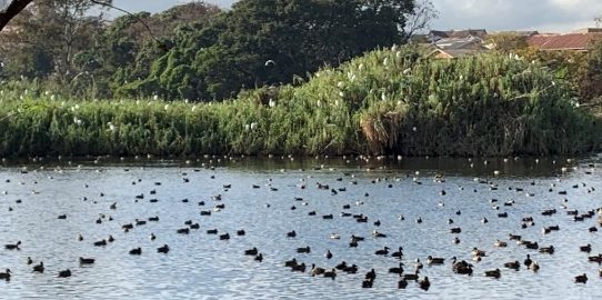

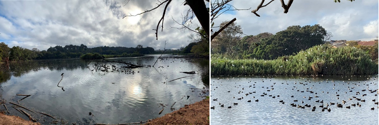

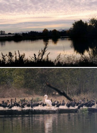
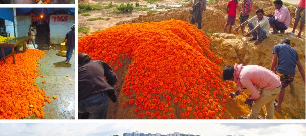
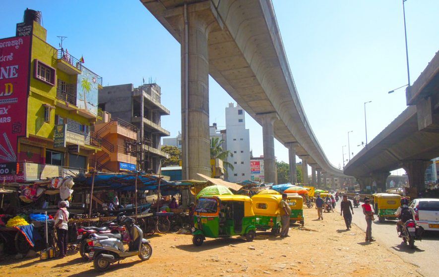
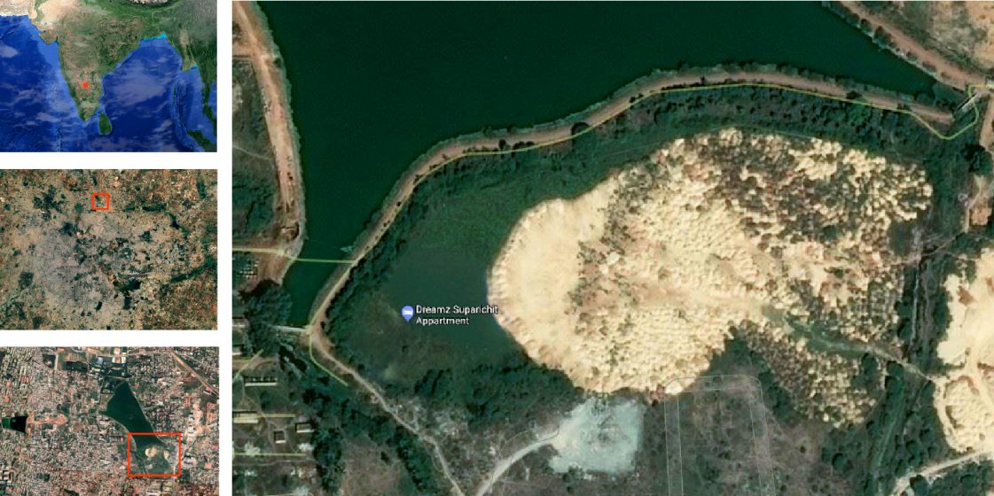
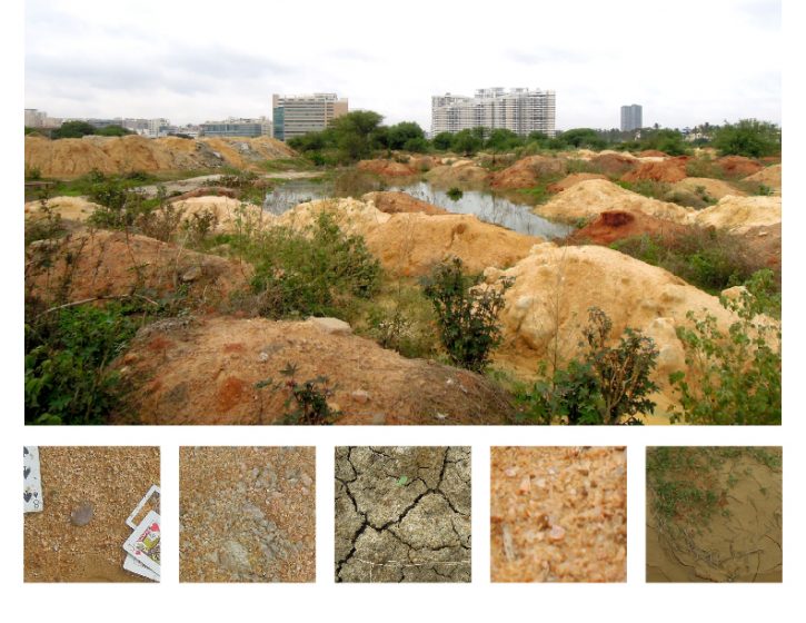
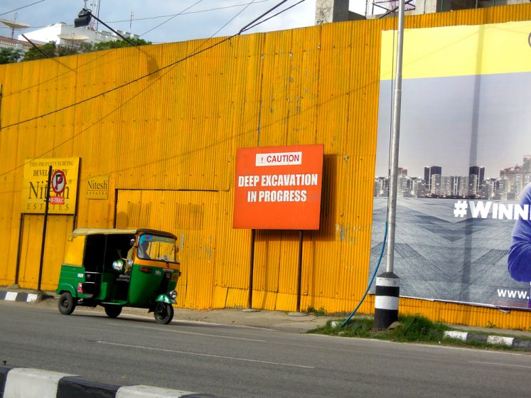
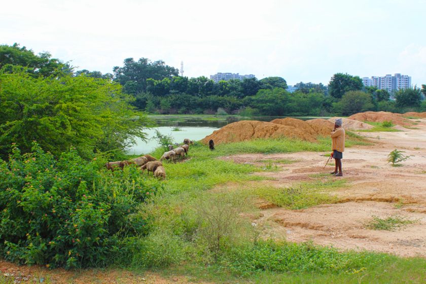
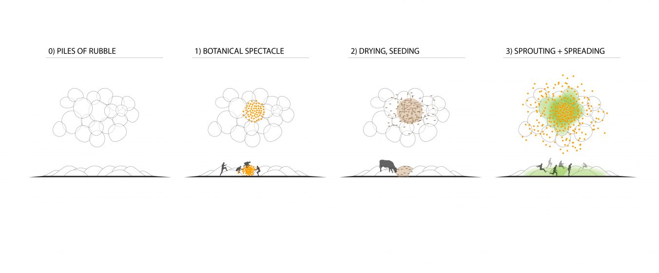
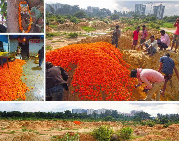
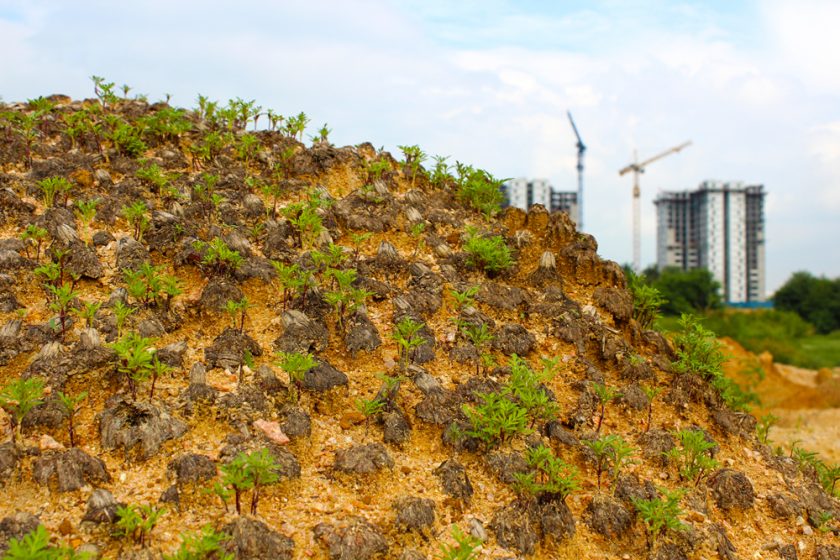
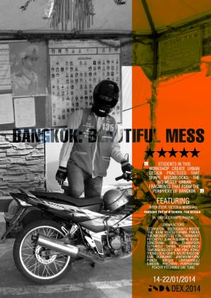
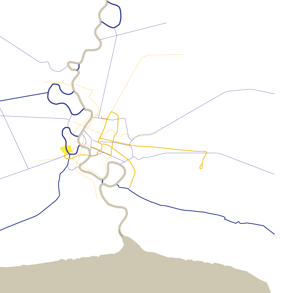
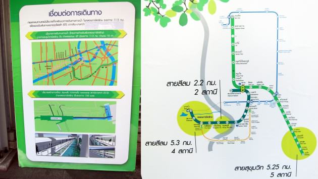
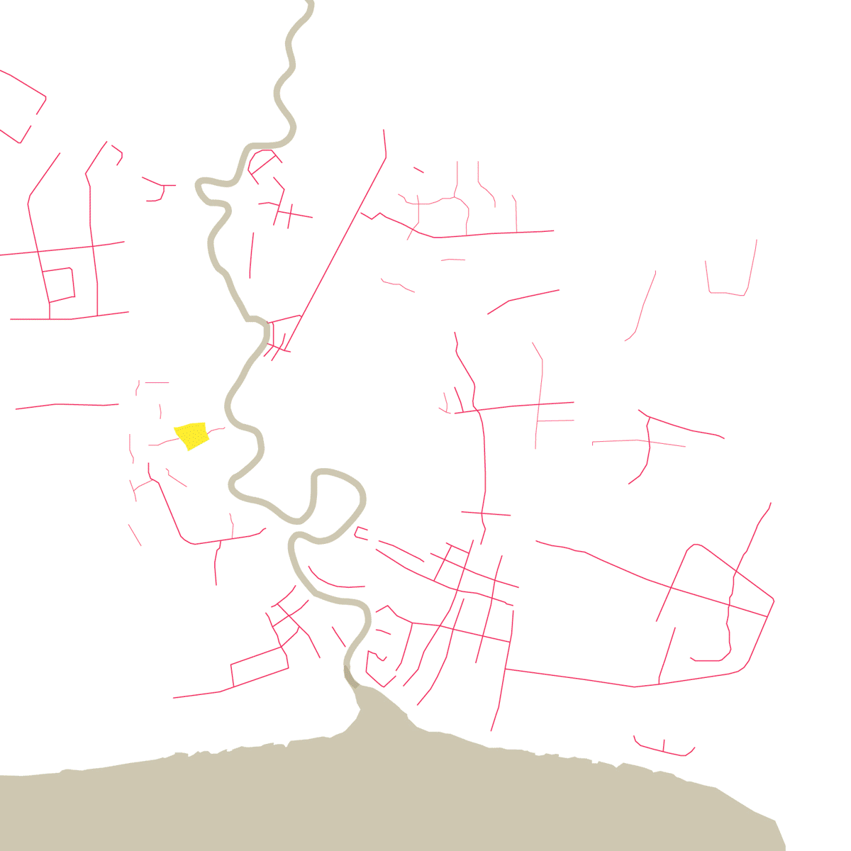
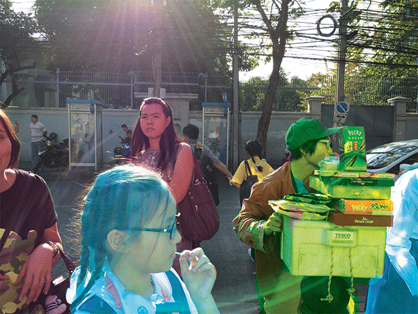
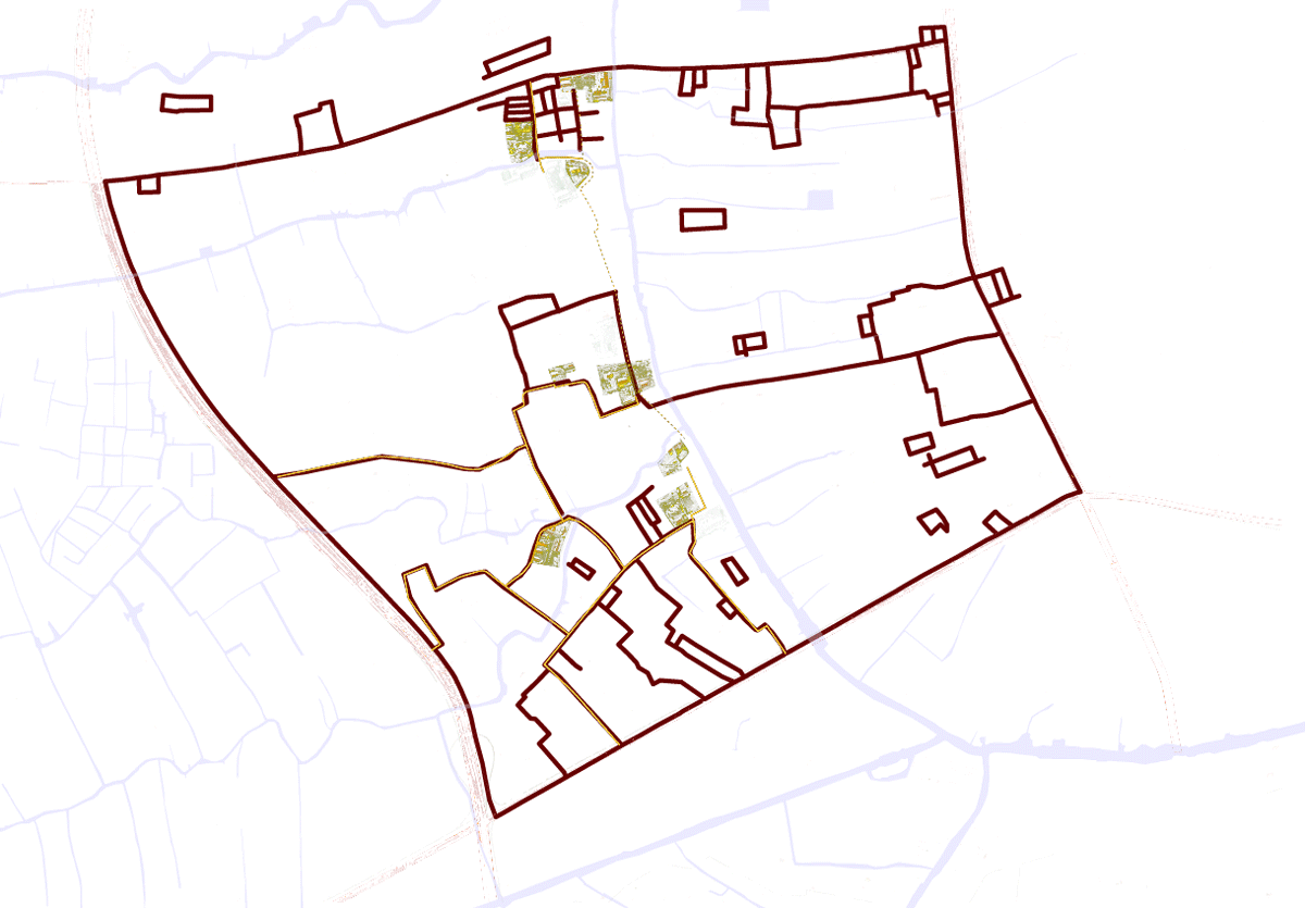
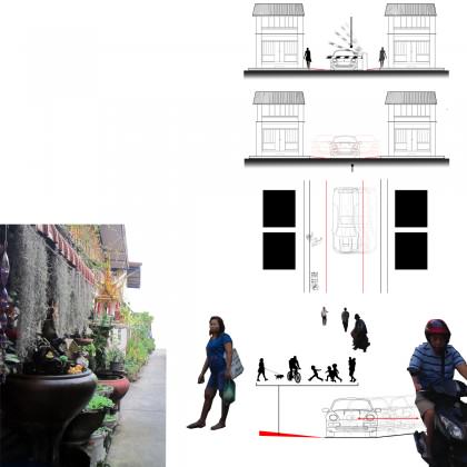
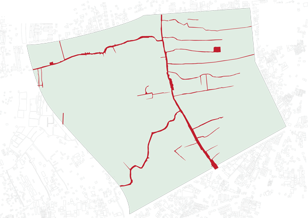
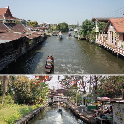
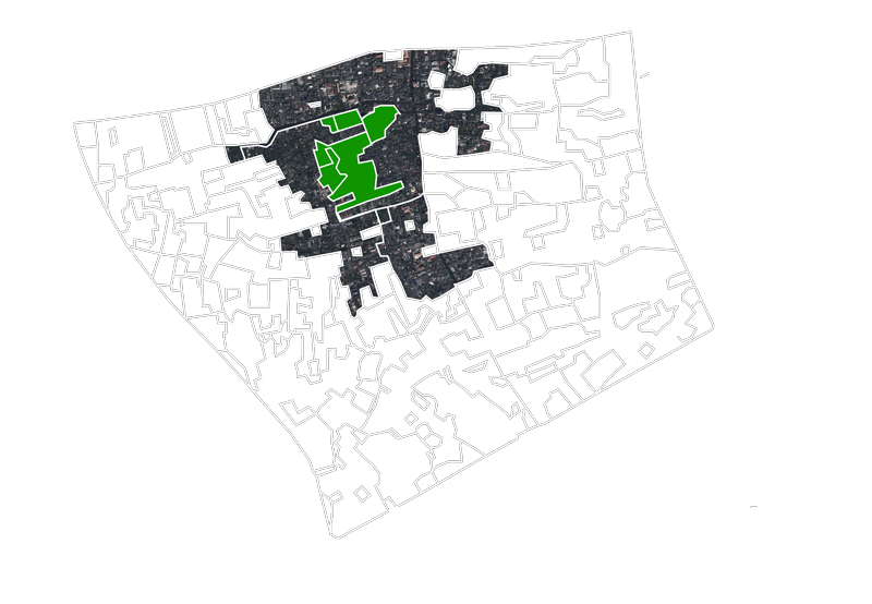
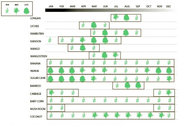

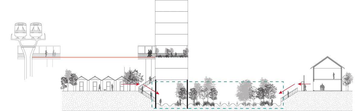
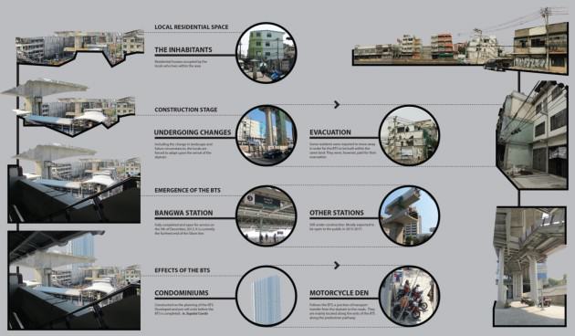
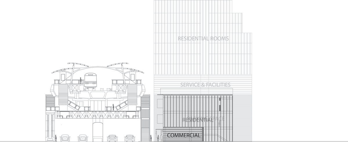
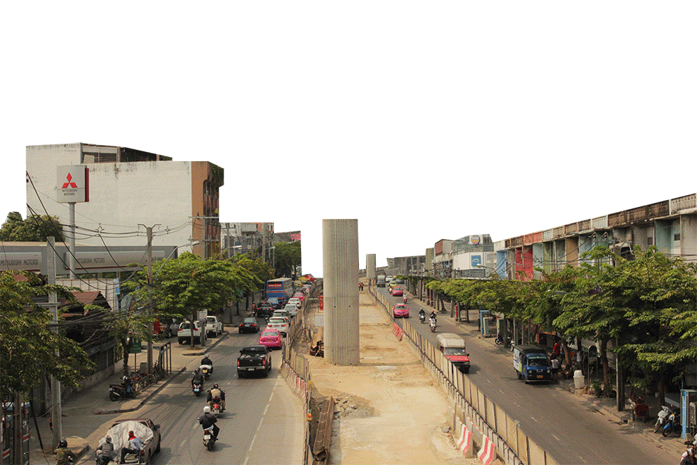
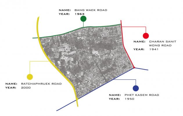
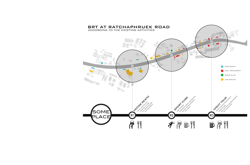

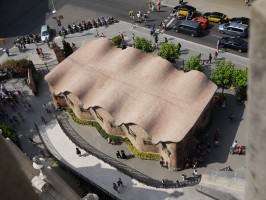


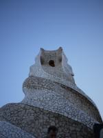


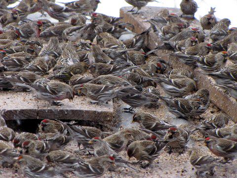


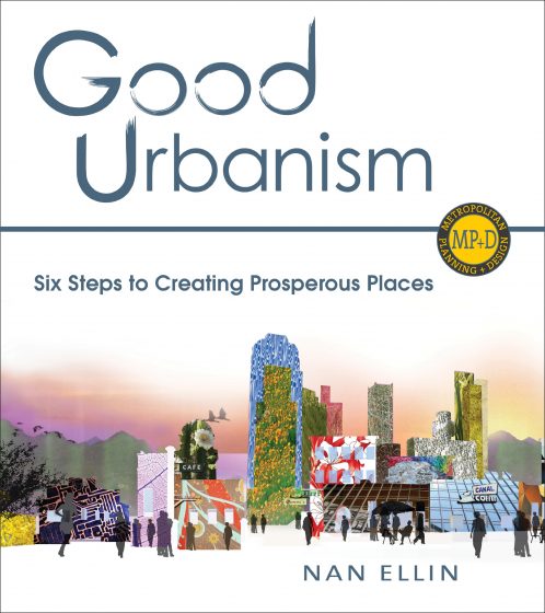
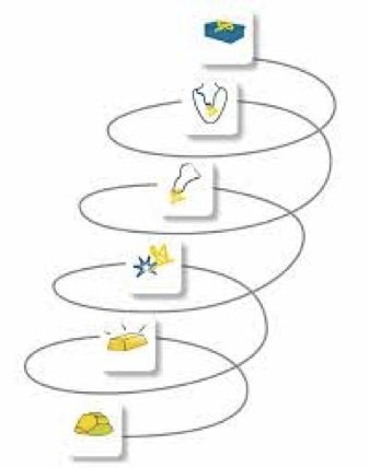

 a) City ranking producers
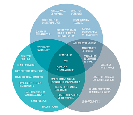
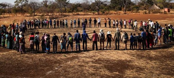
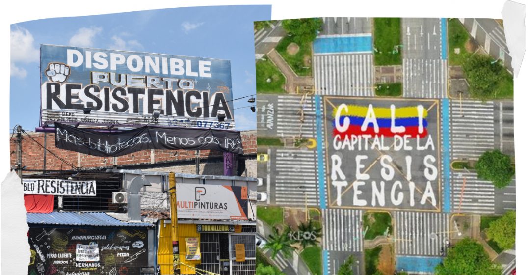
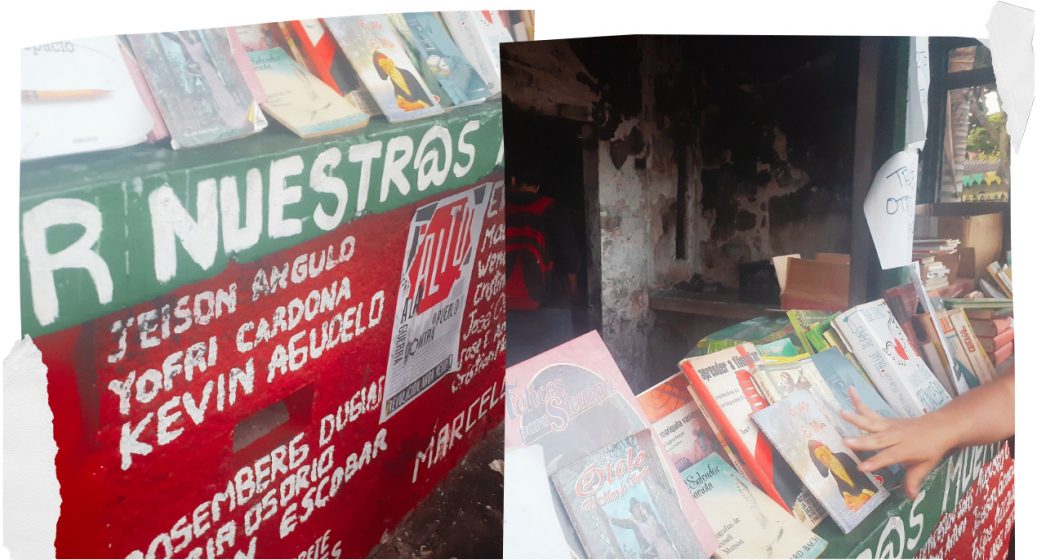
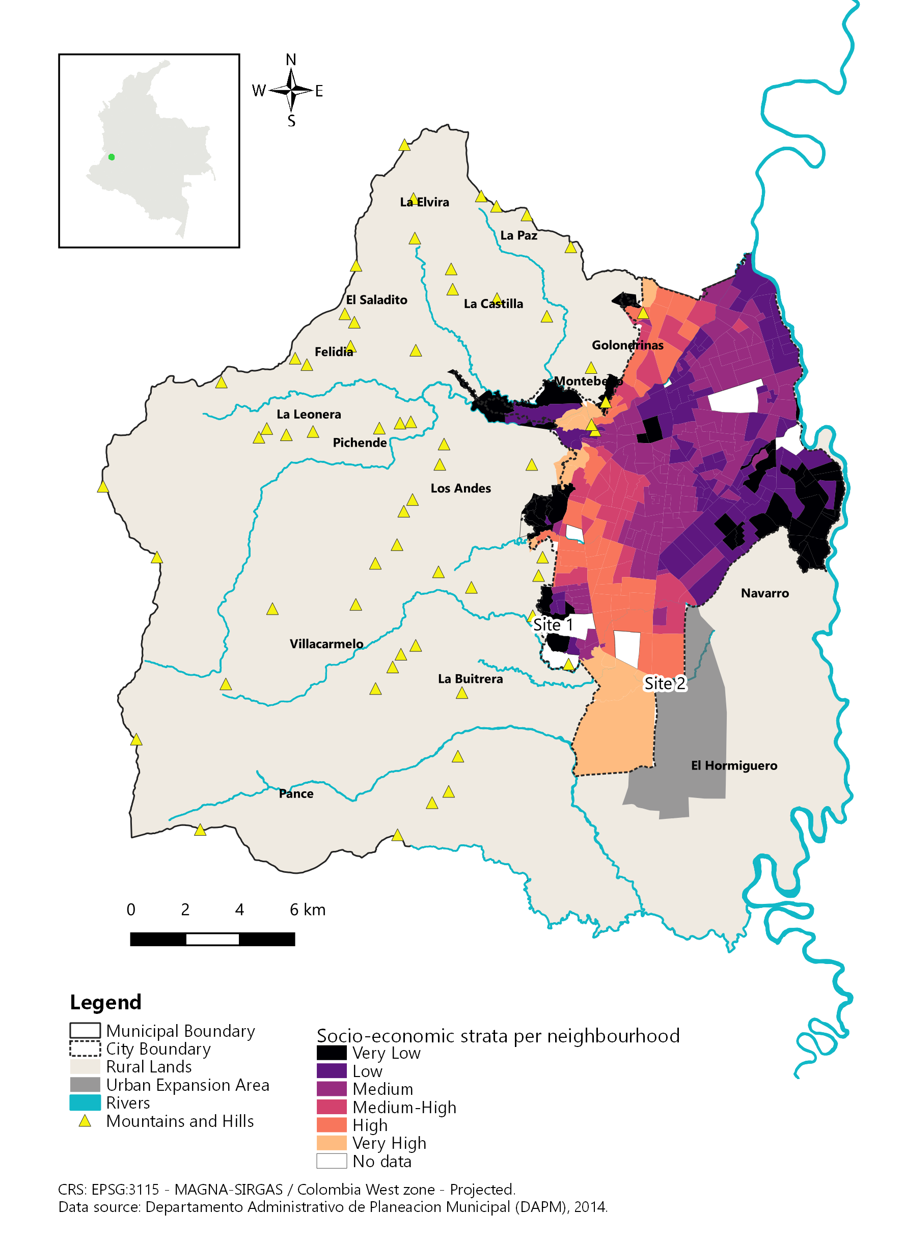
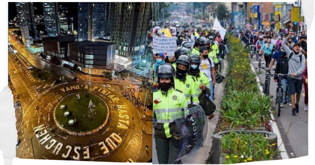
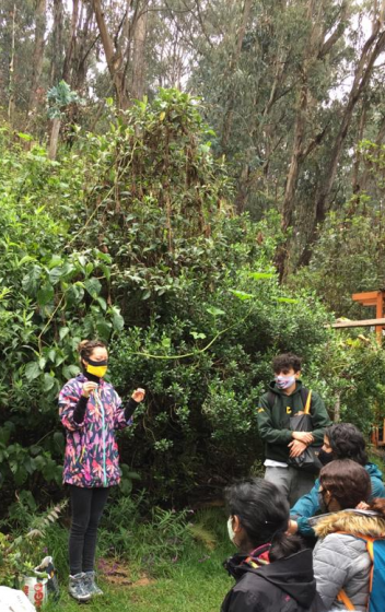
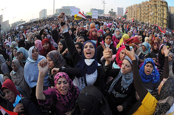
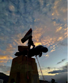

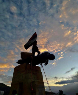

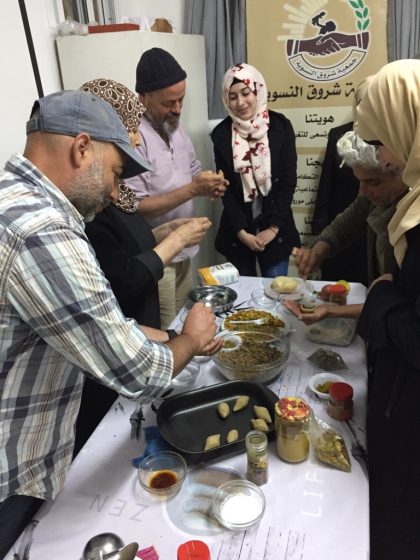
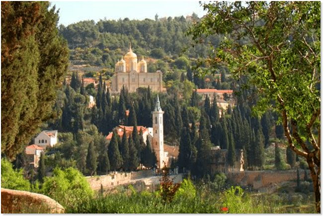

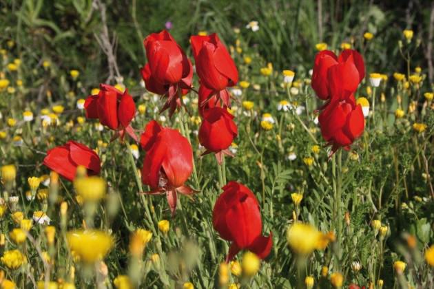
 Jerusalem is characterized topographically by the watershed that draws a clear divide between the eastern side, a desertscape of great beauty with many historic features, including the magnificent Kidron/Wadi El Nar Basin, running down to the Dead Sea, and the western side, with the green rolling Jerusalem Hills, abundant water sources and fertile valleys. The physical contrast between these two microclimates is dramatic, and very much an integral part of Jerusalem’s magic and majesty.
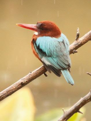
 In the 1990’s an attempt was made to convert the sixty acres of the park into a residential neighborhood with a business center, then considered worthy urban objectives. The land had previously been allocated to two collective farms that had been asked to grow fruit for Jerusalem under siege during Israel’s War of Independence. The orchards were planted already in the 1940’s and provided a source of fresh fruit for residents during the six-month siege in 1948. During those difficult months, Jerusalemites had a meager water supply thanks to the rainwater cisterns that have been part of life in Jerusalem for thousands of years.
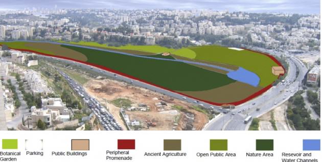
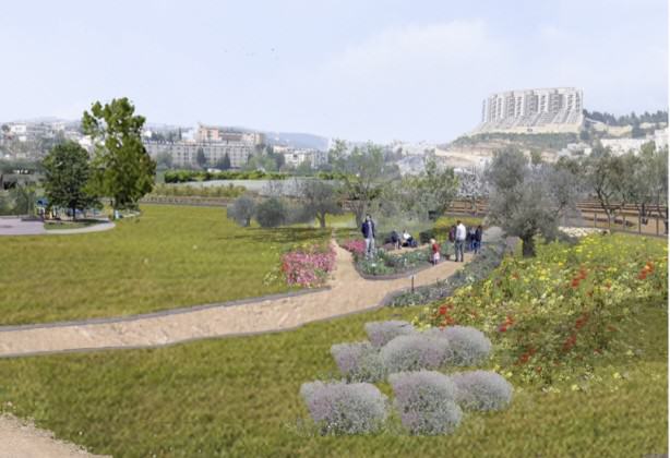 The Society for the Protection of Nature in Israel fought the battle for the Gazelle Valley in the planning committees and the courts, eventually winning the case by proving that percentage-wise, this space needed to be left open to enable intensive development in the surrounding neighborhoods. Without realizing, we were making the case for preservation of urban nature, and indeed for the multiple eco-system services it provides. Those that argued in favor of intensive residential development in the valley claimed that the pro urban nature camp was hypocritical, since by not developing the Gazelle Valley we would push urbanization further into suburbs on the west side of Jerusalem, where the really important natural resources are. So we were accused of conducting a NIMBY fight to prevent building in our back yards.
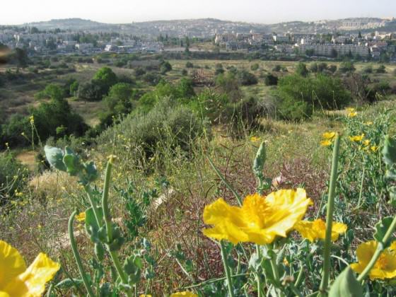
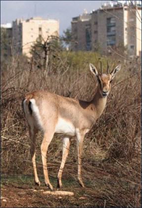

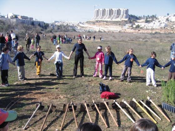 When it came to planning the park in preparation for the actual development, an additional element of great significance for Jerusalem was brought into the picture.
 As I submit this entry to the TNOC blog, the fence around the valley, which will provide protection for the gazelles from the heavy traffic all round, and from marauding wild dogs, is nearing completion, and so is the rainwater collection system I have described. The many ancient agricultural terraces around the valley will be restored, and a bike path will run round the entire park, as well as along the axis of lakes and streams. A Visitors’ Center will provide educational material and information for tourists. There will be no lighting in the park after 22:00, and the park will be closed to the public at night, with no entry fee during opening hours.

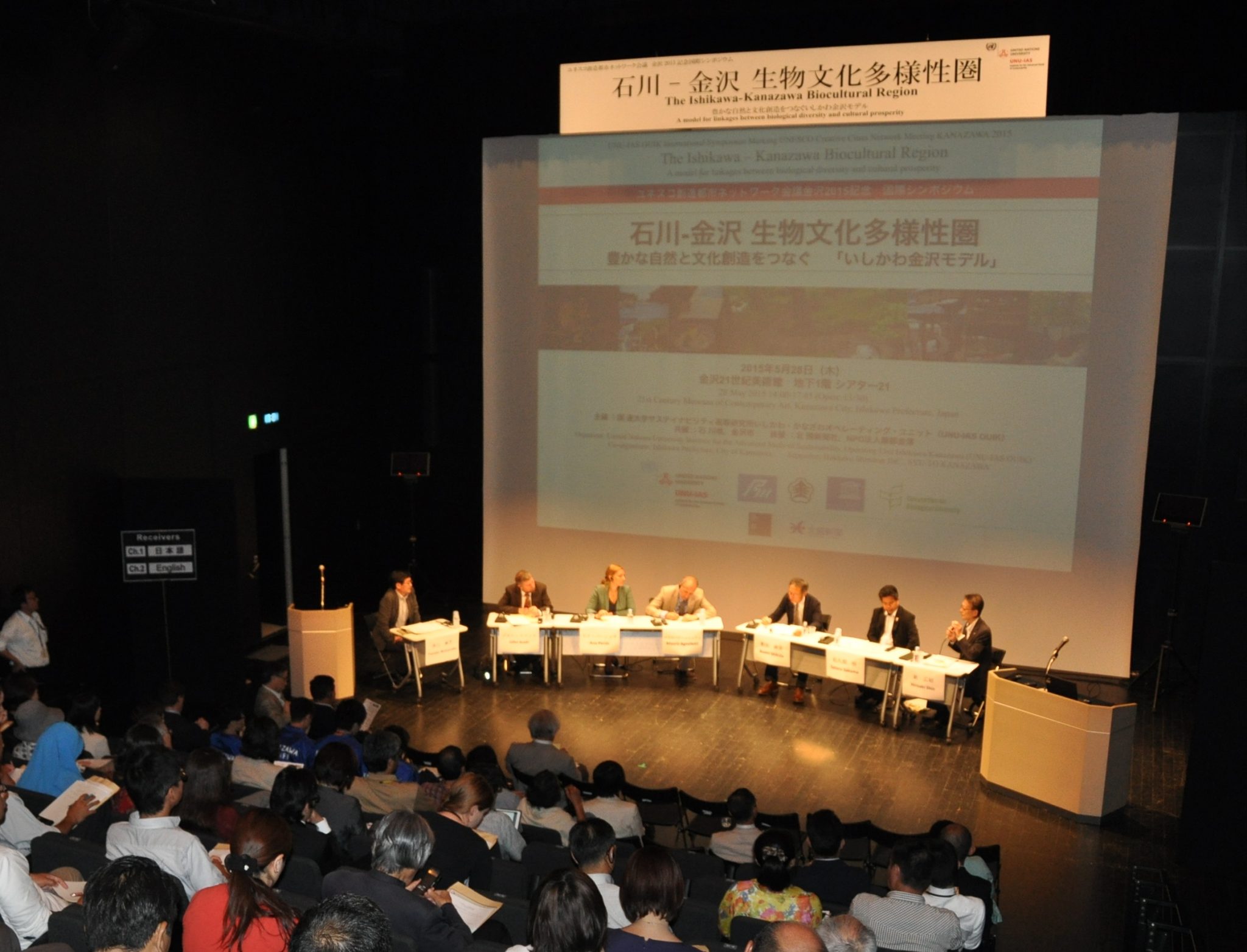
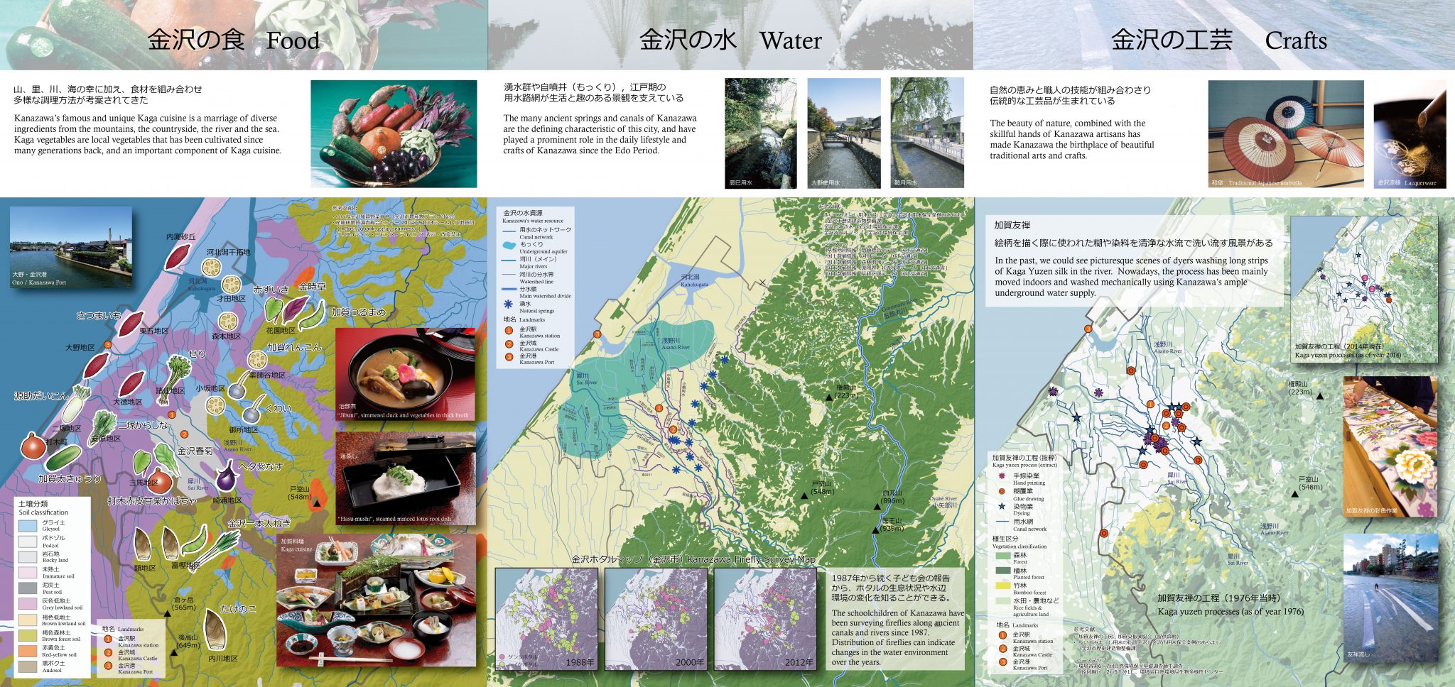
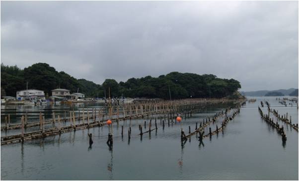
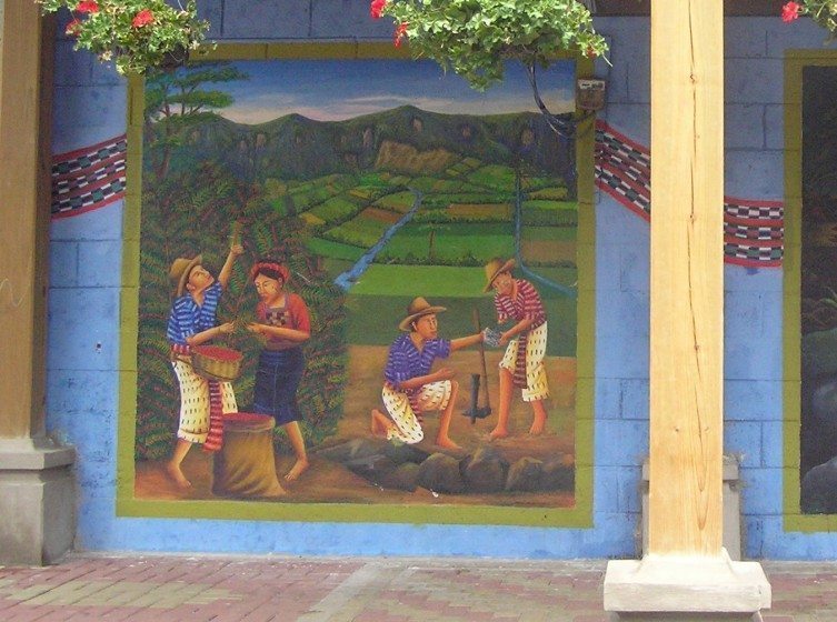
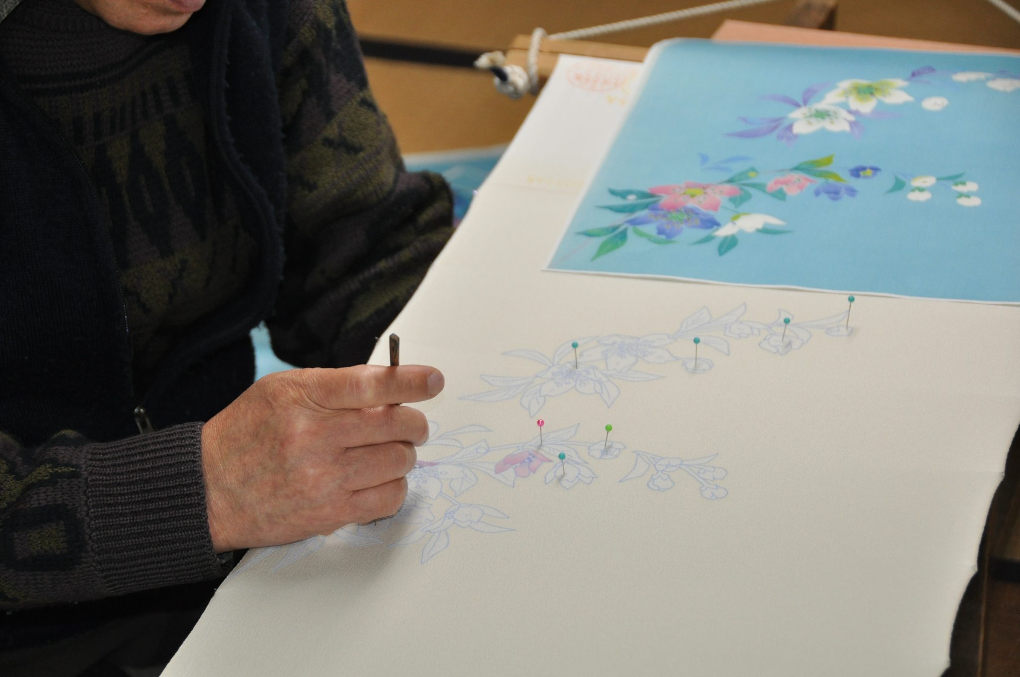


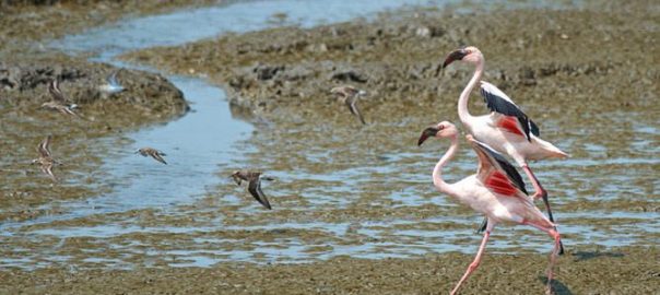
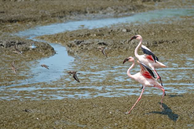

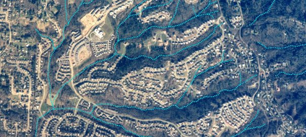
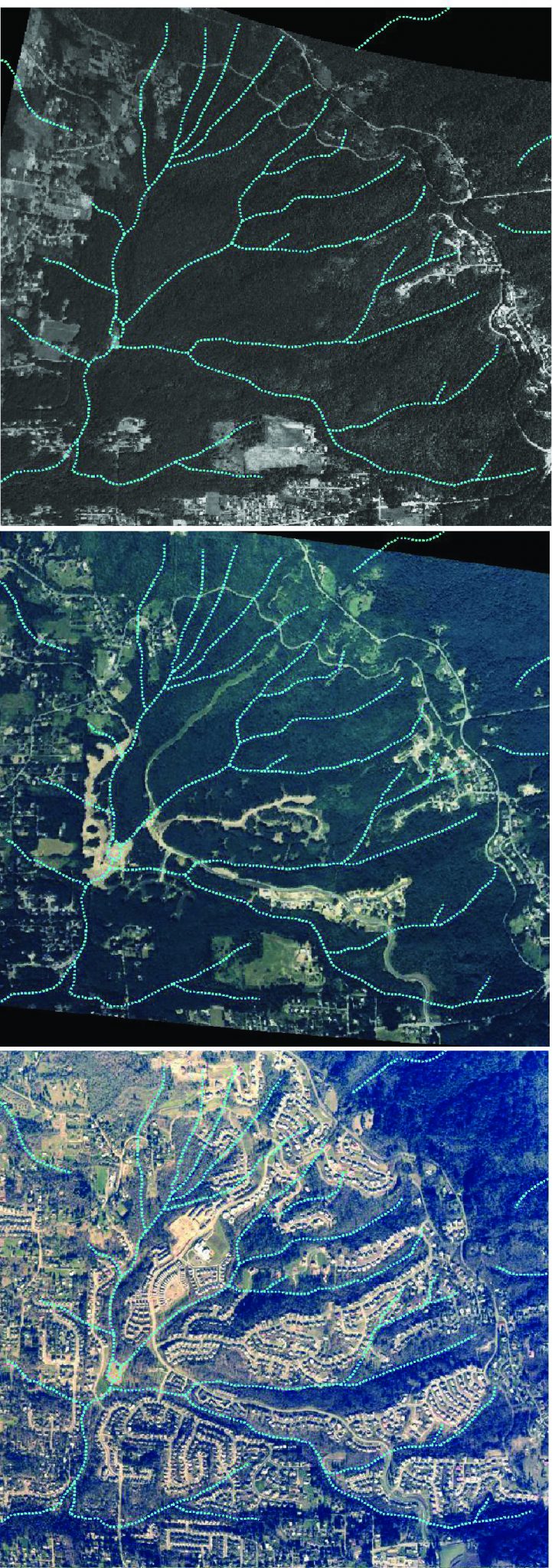
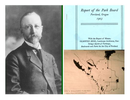
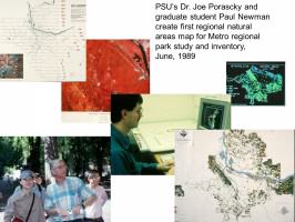 Three years later Metro adopted the
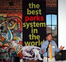
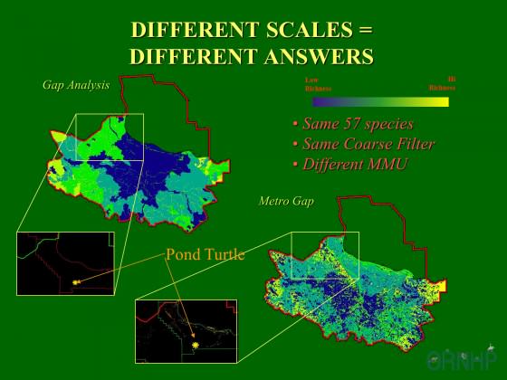

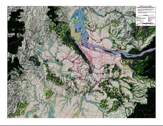
 In 2010 The Intertwine Alliance launched the
  In any mapping effort the issue of database size is a critical factor. In our region, while we have imagery at the one-half meter resolution most regional mapping efforts have been at 30-meters or larger resolution, which is fine if all your are interested in is characterizing an ecoregion. If, however, you are interested in both the ecoregion and urban core higher resolution is required.
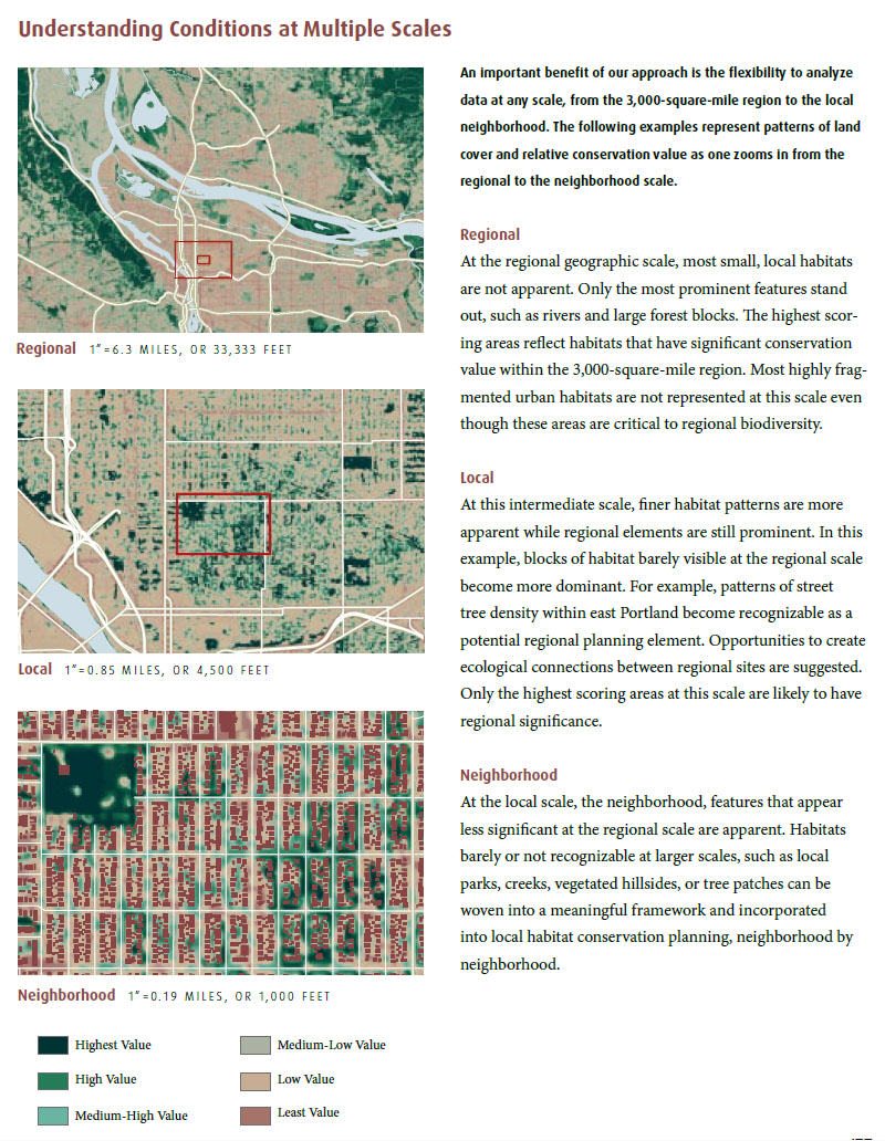
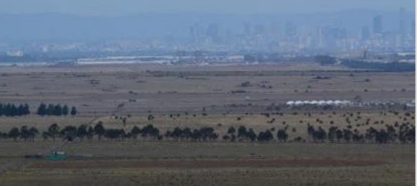
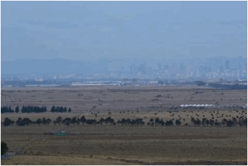
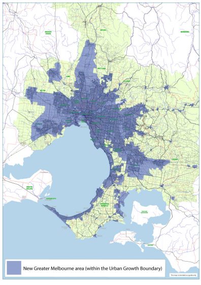
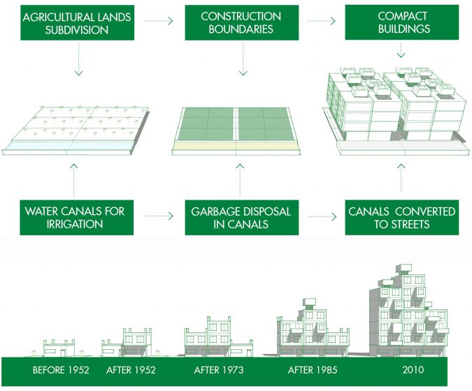
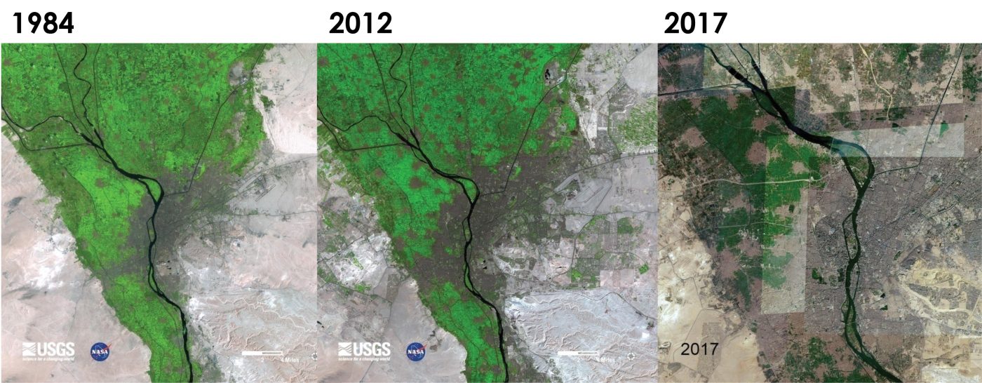
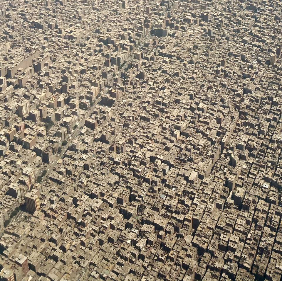
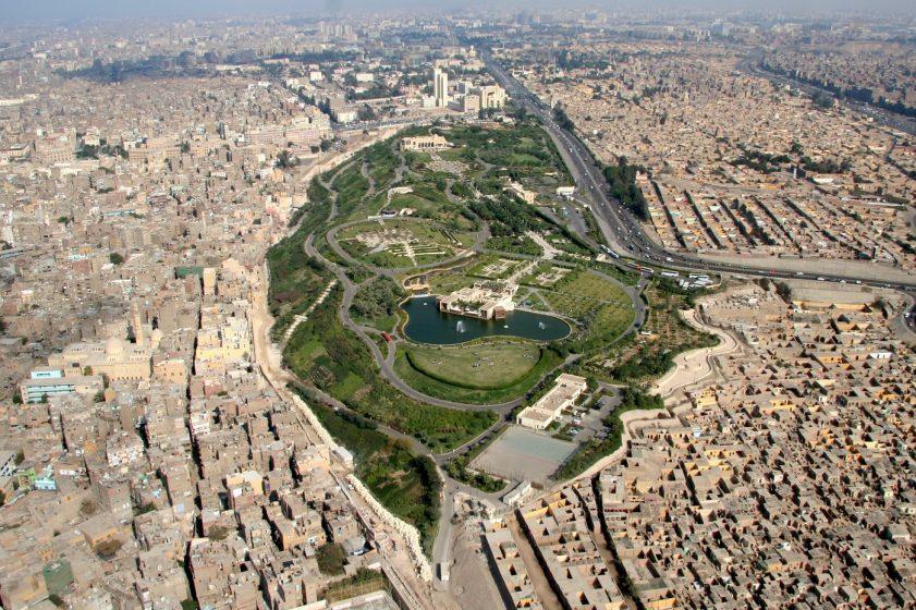
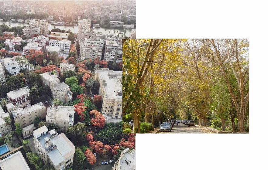
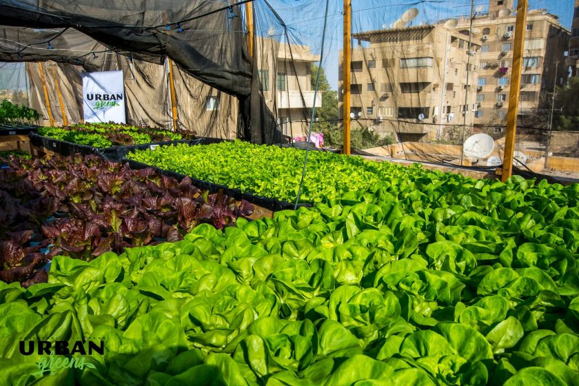
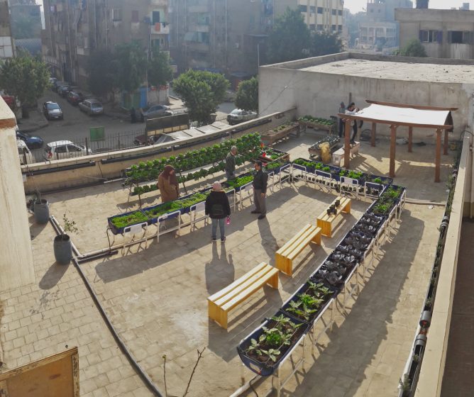
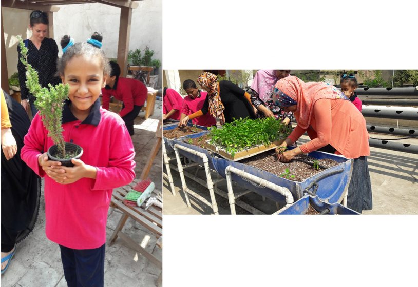
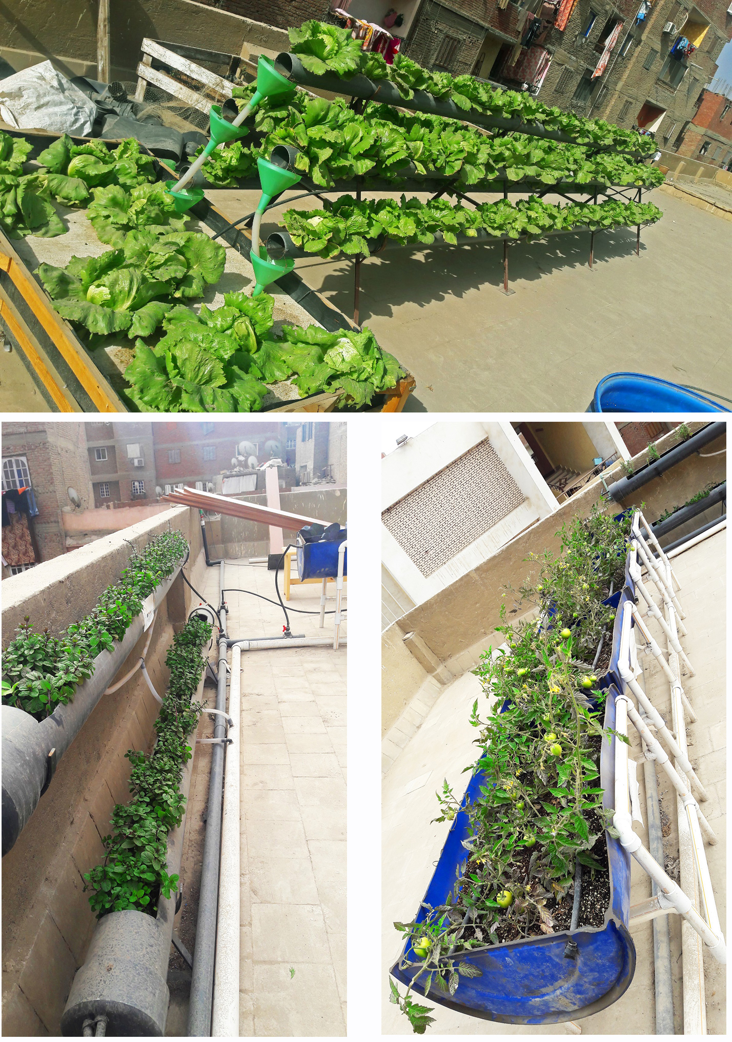
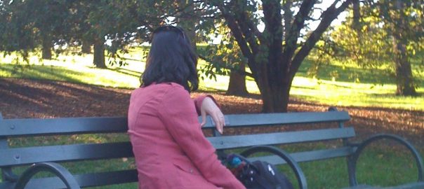
 Over the past decade, Professor Tim Beatley and his network of researchers and affiliates have continued to advance the biophilic design concept (previously applied by others to, for example, buildings, institutions, single gardens, and other features) up to the city scale. Tim Beatley has taught at the University of Virginia for over 30 years. He has had a long-term interest in the key issues of urban sustainability, resilience, human health, and well-being; therefore, he is appropriately prepared to map out the relationship between these issues and biophilic design in theory and practice.
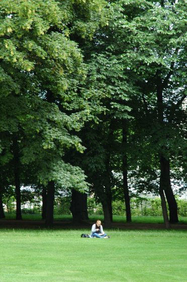
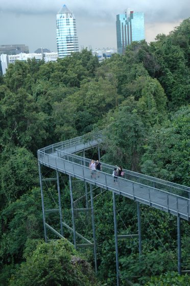

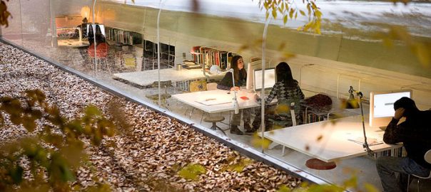
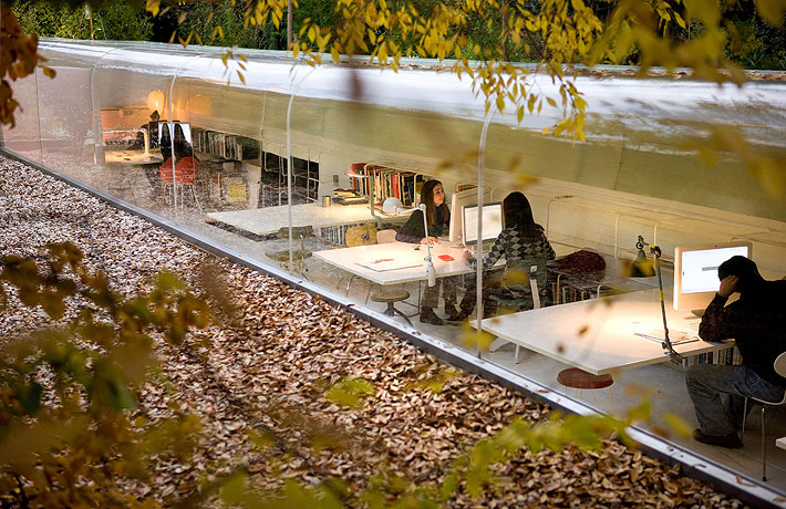
3 Comments
Join our conversation